Measuring:
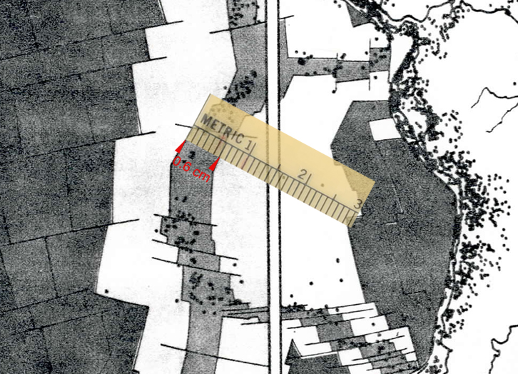
You're asked to measure the width of the zone less than 5 million years old, and to measure perpendicular to the ridge. Here's how that looks in an example along the EPR:
|
Here, the five-million-year-old-and-younger zone is 0.6 cm (6 mm) wide on the map.
To turn that into a spreading rate, you can do the following:
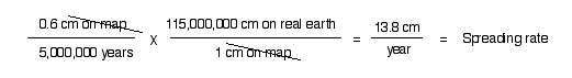 |
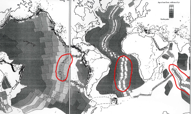
"13.8 cm/yr" would then be what you would write in the table at the bottom of the page as one of your three measurements for the EPR. Then you would pick two more spots and do the same to complete the EPR, and go on to the MAR and Indian Ridge from there. The map below helps you find the EPR, MAR, and Indian Ocean MOR:
 |
And away you go!
To the GEOL 3030 page.