This is the early stage of a website intended to provide a photographic tour of the Snake River. The Snake extends from its headwaters in northwest Wyoming across southern Idaho, along the Oregon-Idaho and Washington-Idaho borders, and across eastern Washington to its confluence with the Columbia River. Pages/photographs are listed here in order from upstream to downstream, except as noted.
< < < < < < < < IN WYOMING > > > > > > > >
Braids and meanders high on the Snake River.
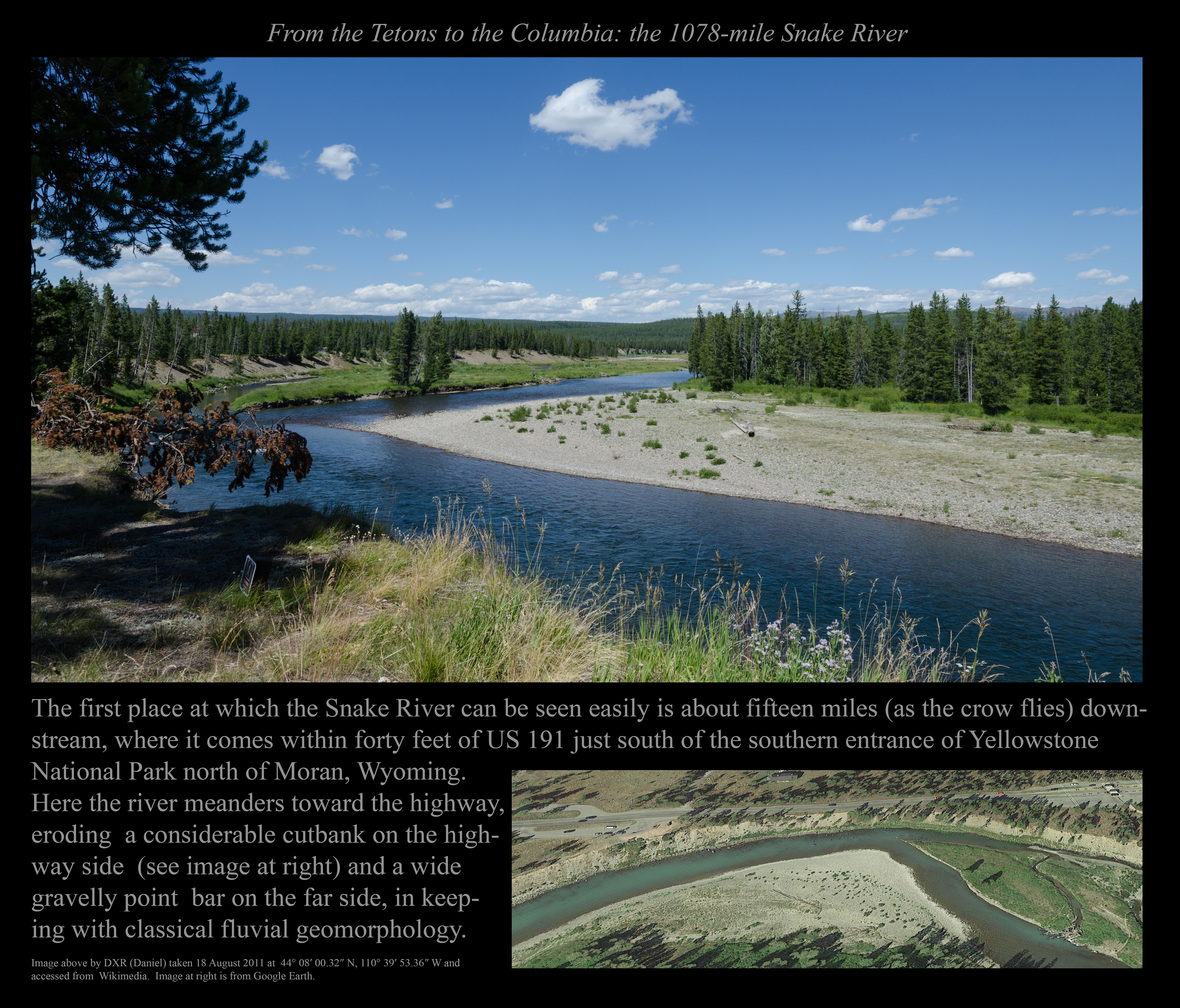
The Snake River at the southern margin of Yellowstone National Park.
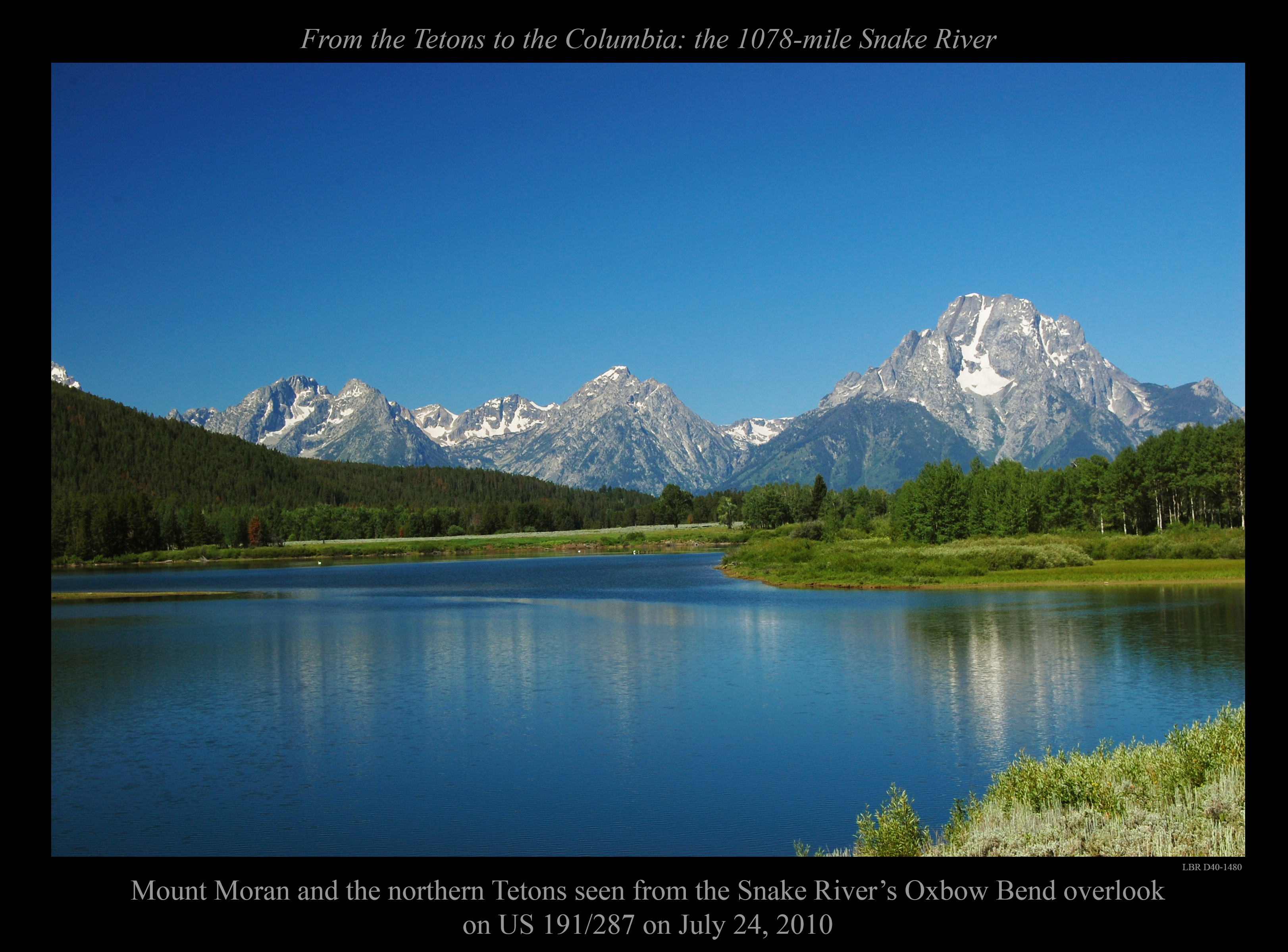
A 2010 view across the Snake River to Mount Moran in the northern Tetons.
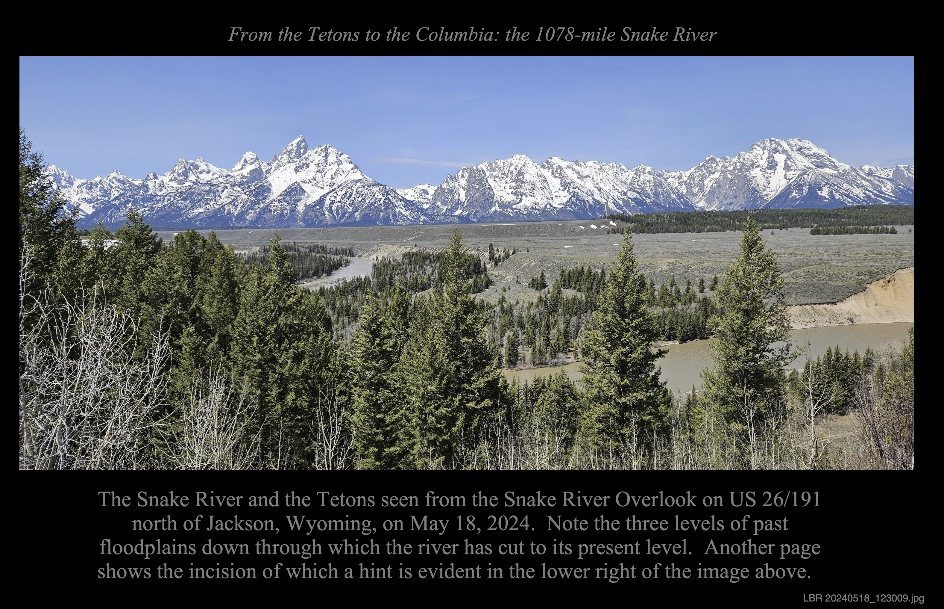
A 2024 view across the Snake River and its terraces to the Tetons, including the Grand Teton.
Just upstream from the above: A 2024 view of the Snake River in its modern channel.
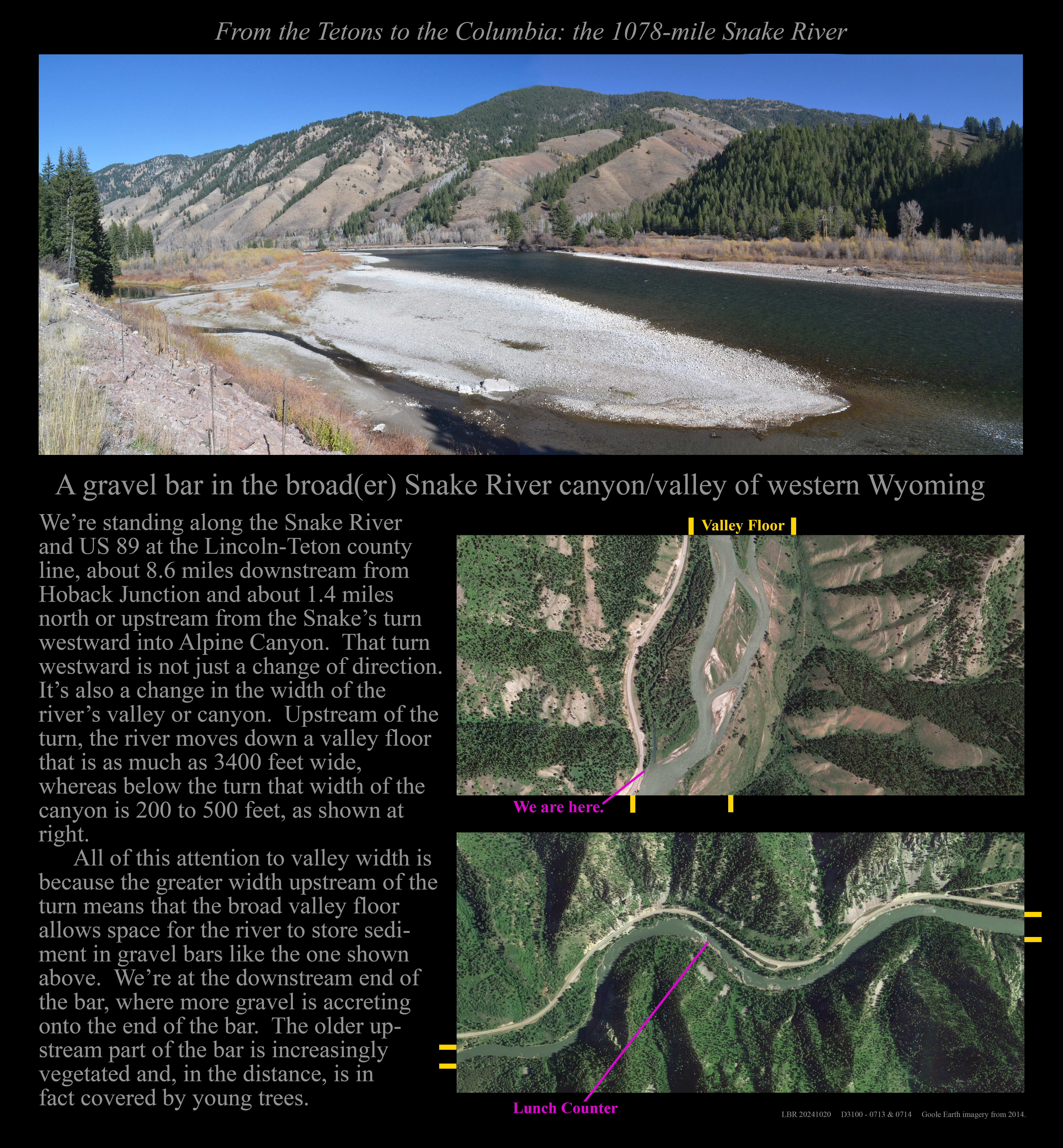
A gravel bar in the Snake below Hoback Junction.
The Snake at Alpine Canyon's East Table below a large landslide.
The Snake just above Taco Hole in Alpine Canyon.
The Snake between two hazards in Alpine Canyon.
The Snake at the Lunch Counter rapids above Alpine Junction, Wyoming.
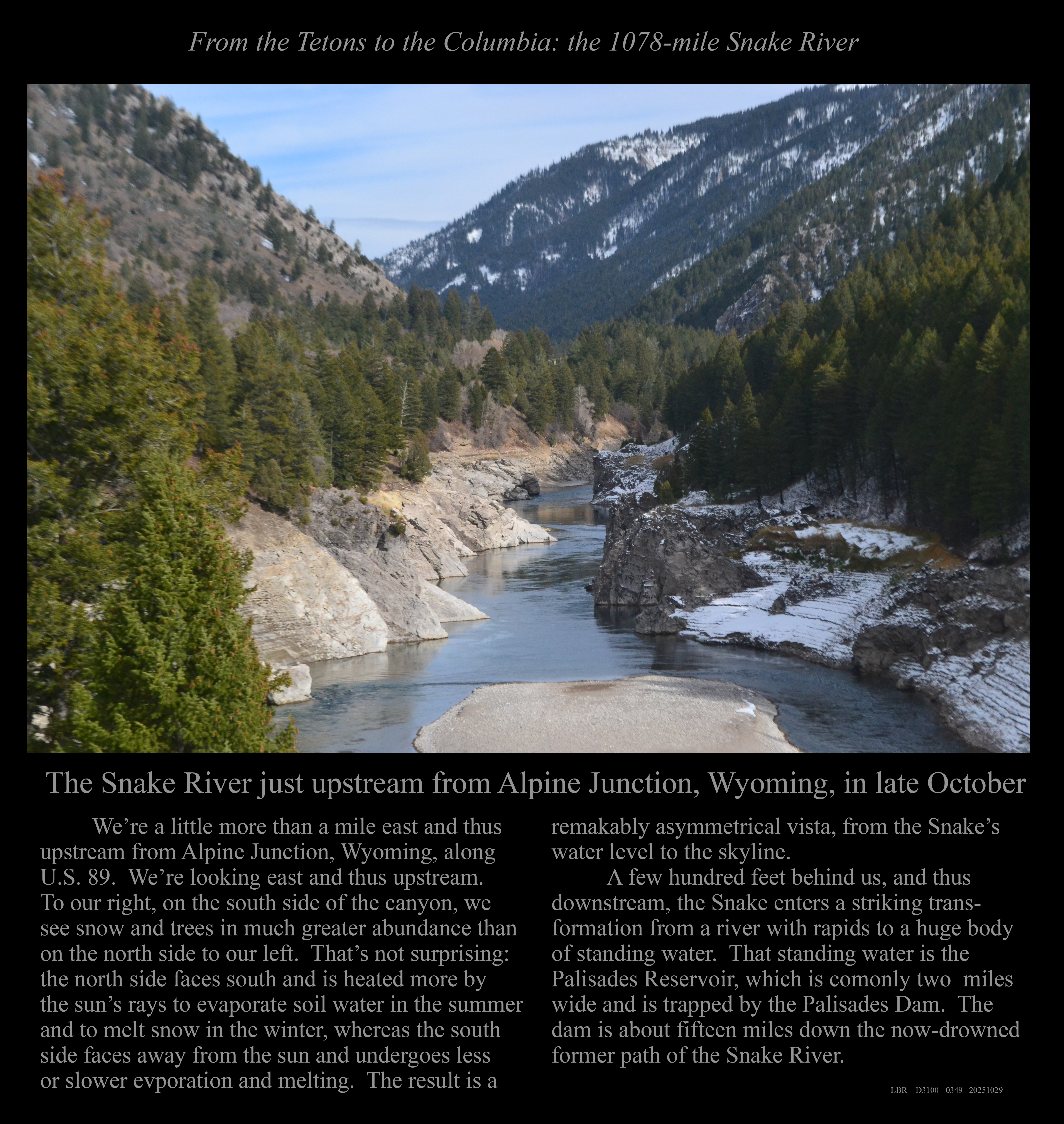
The Snake just a mile upstream from Alpine Junction, Wyoming.
< < < < < < < < IN IDAHO ABOVE TWIN FALLS > > > > > > > >
The Snake cutting through layered volcanic rocks near Clark Hill, Jefferson County, Idaho.
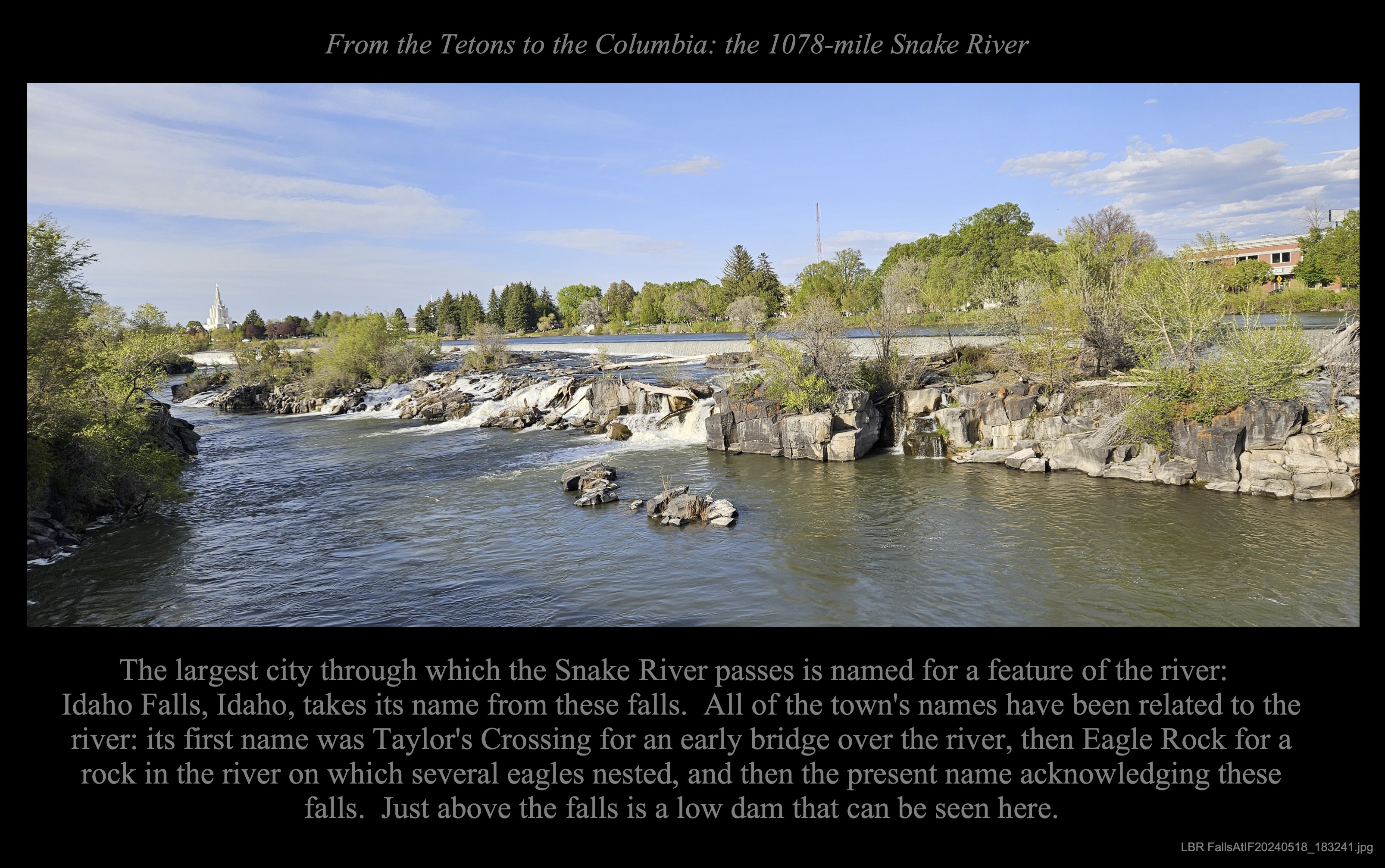
The falls of the Snake River in the city of Idaho Falls, Idaho.
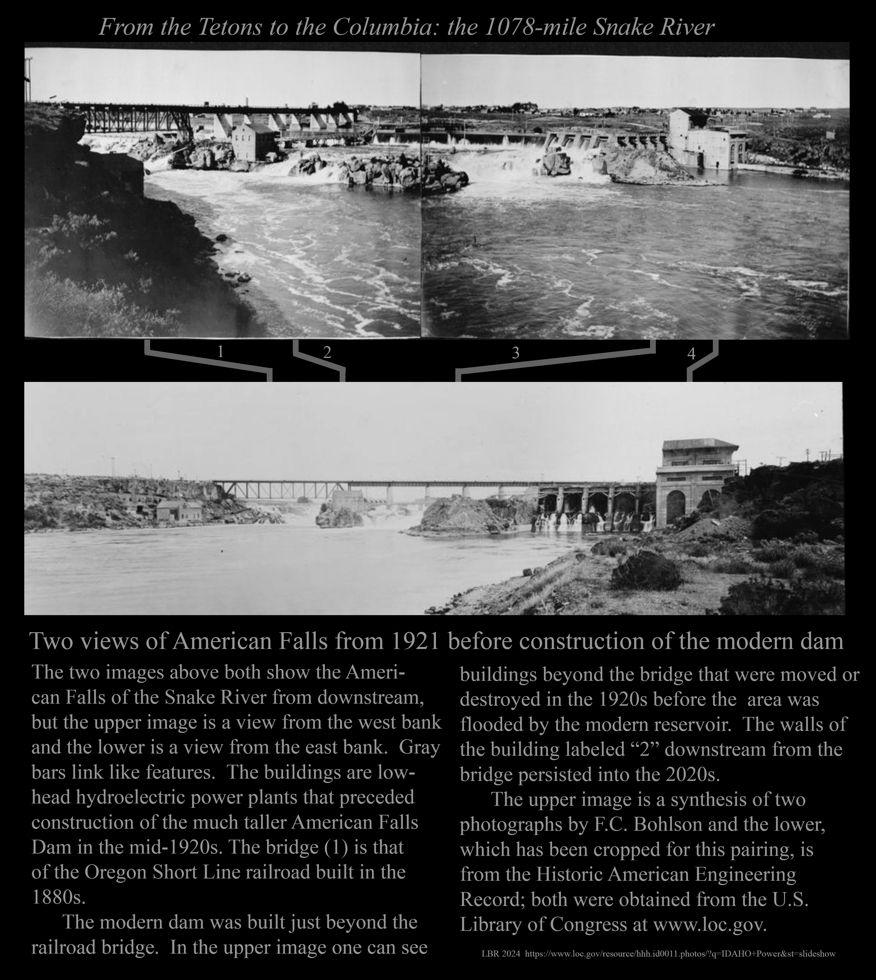
The Oregon Short Line Bridge and American Falls before the American Falls Dam.
The American Falls in 1921, before the modern dam.
Lake Walcott and the Minidoka Dam.
Milner Dam and a dry Snake River bed.
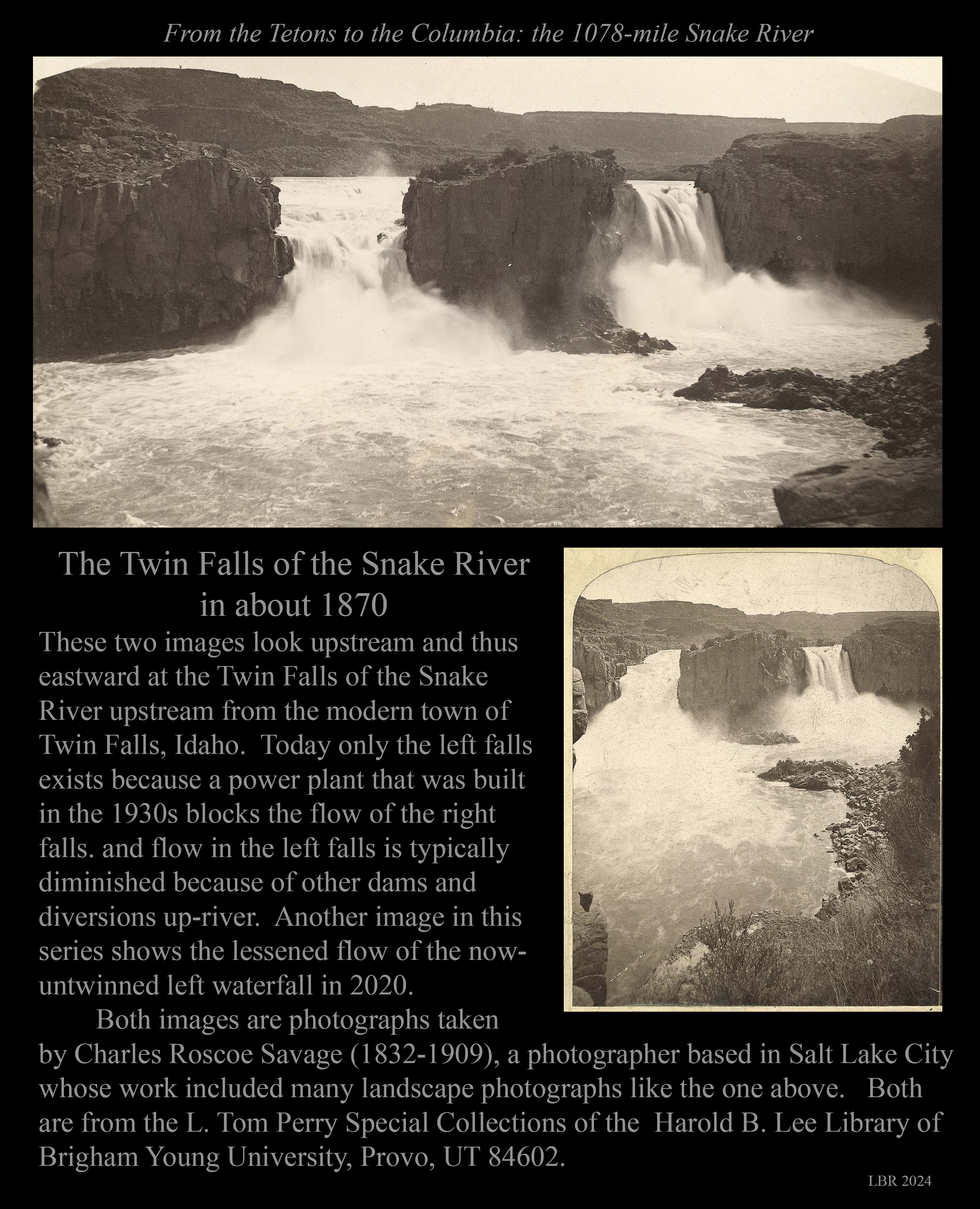
The Twin Falls in the 1870s, when there were two falls there.
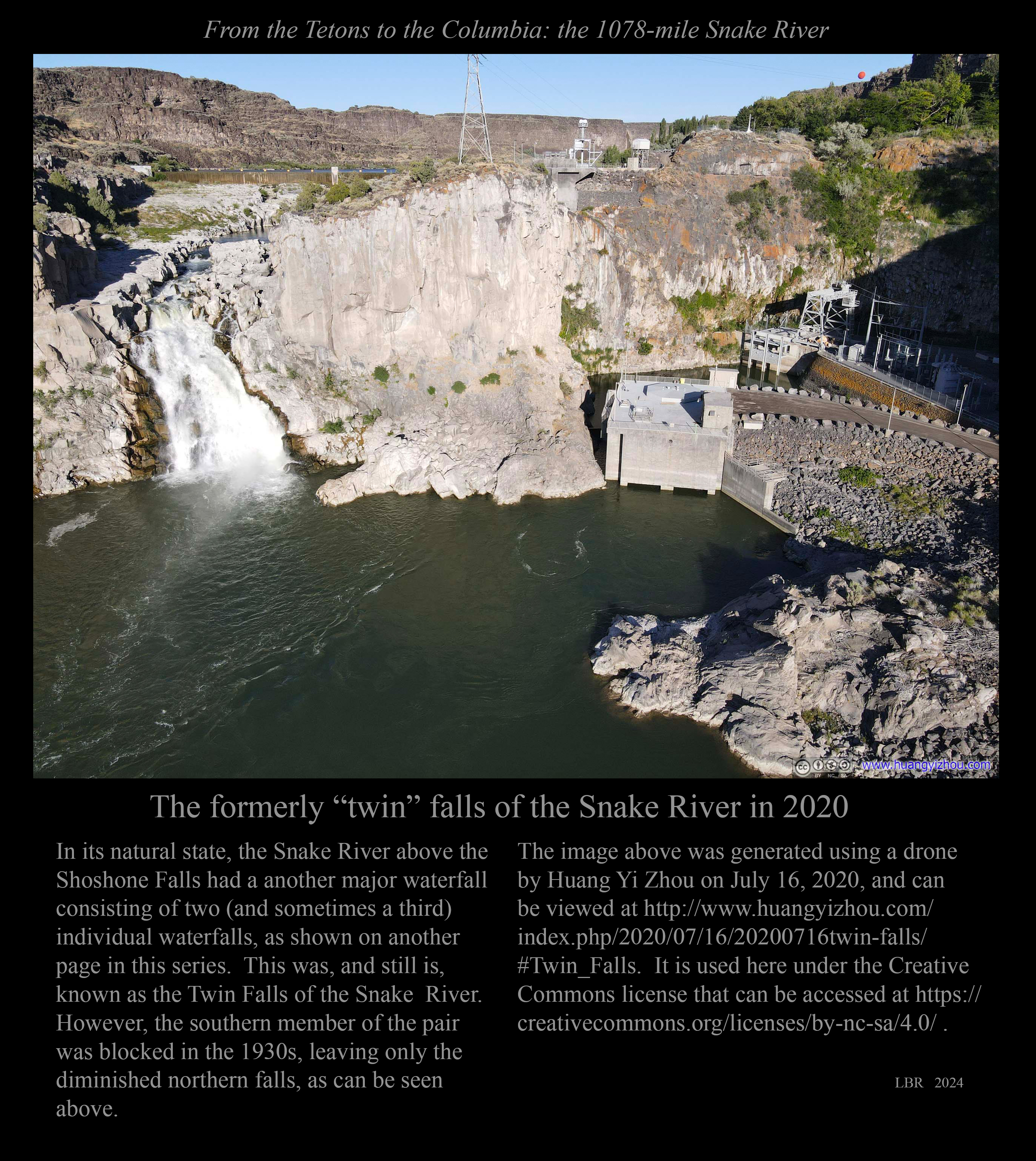
The surviving waterfall of the Twin Falls in 2020.
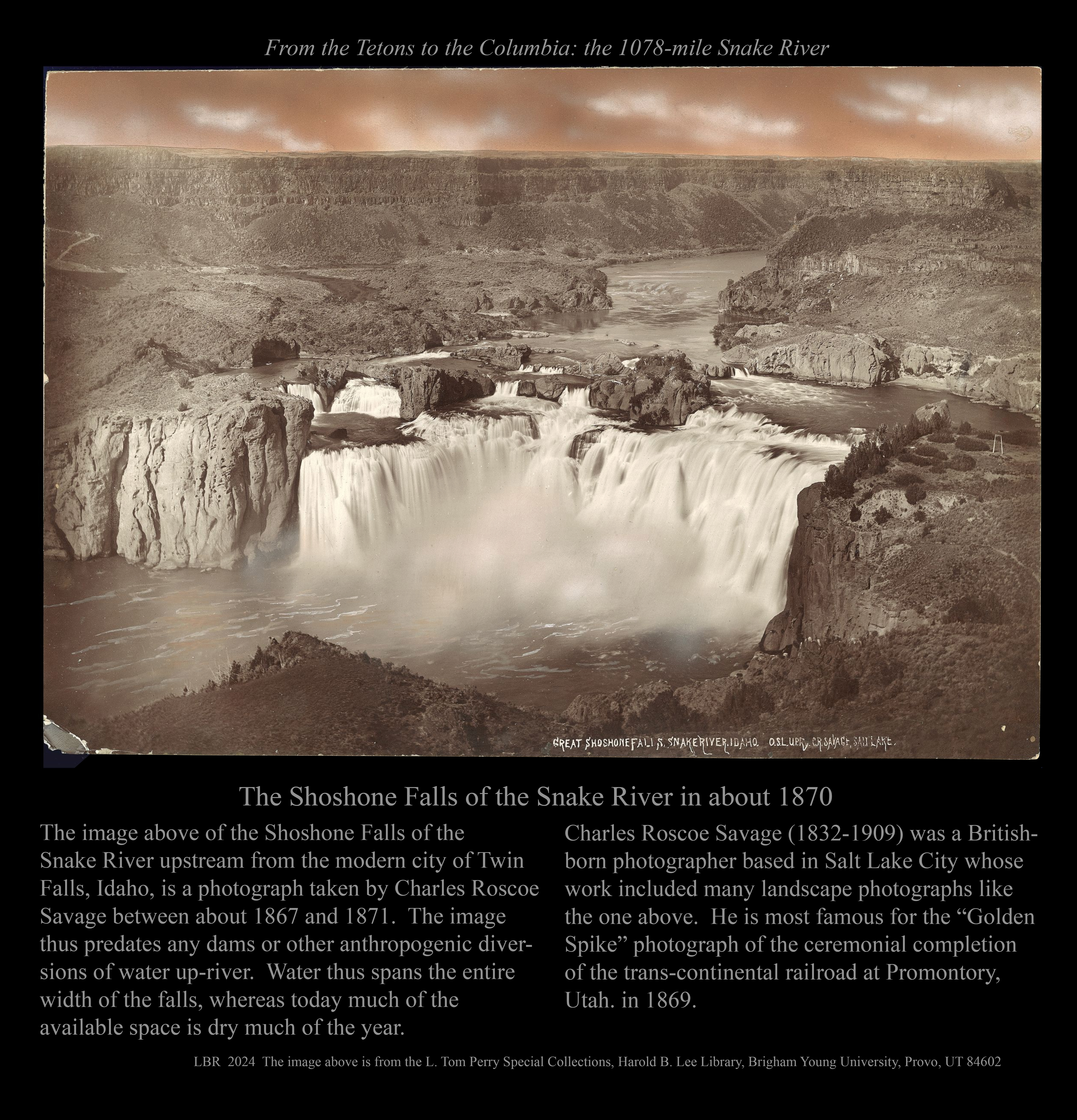
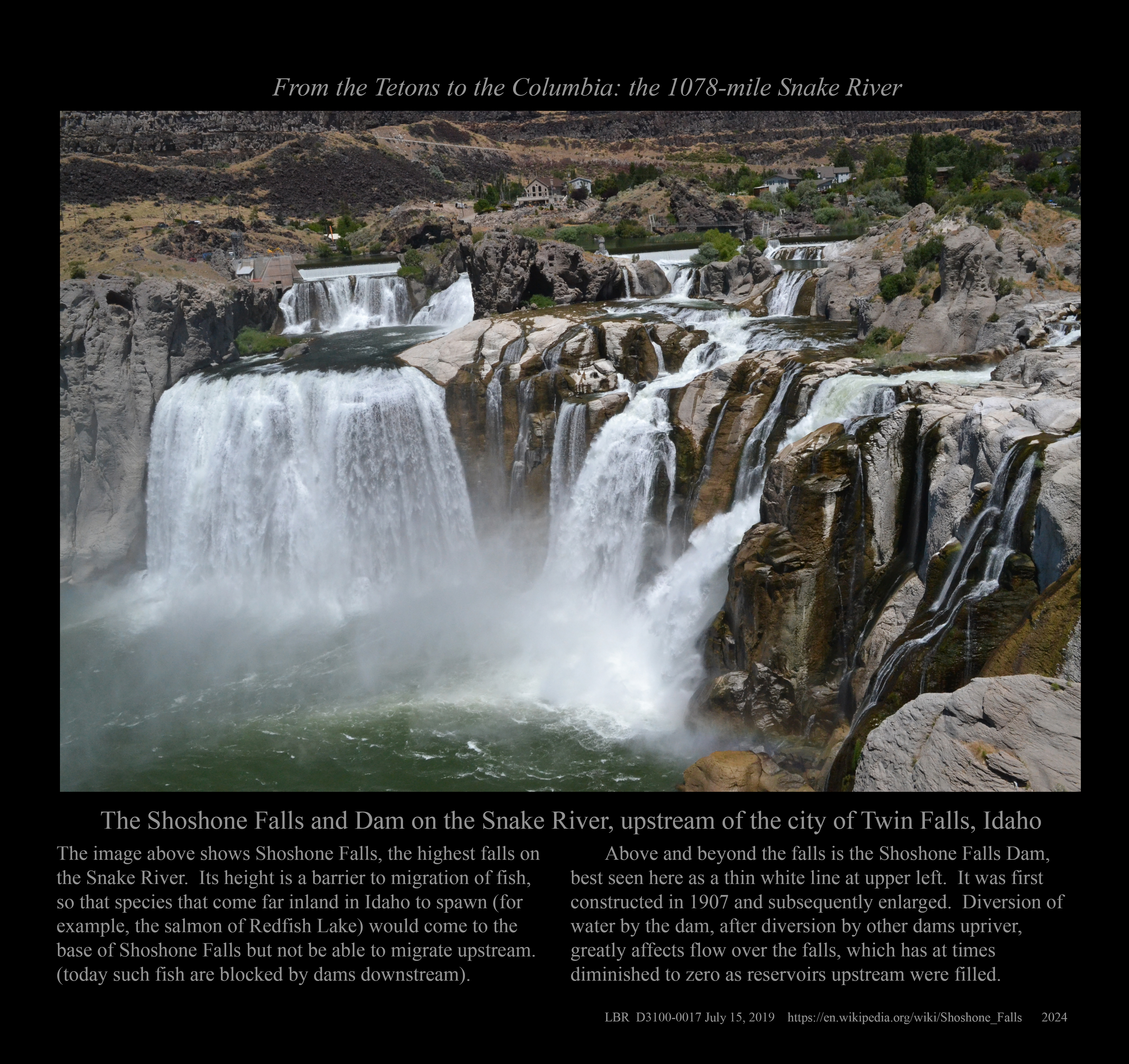
The Shoshone Falls in the 1870s.
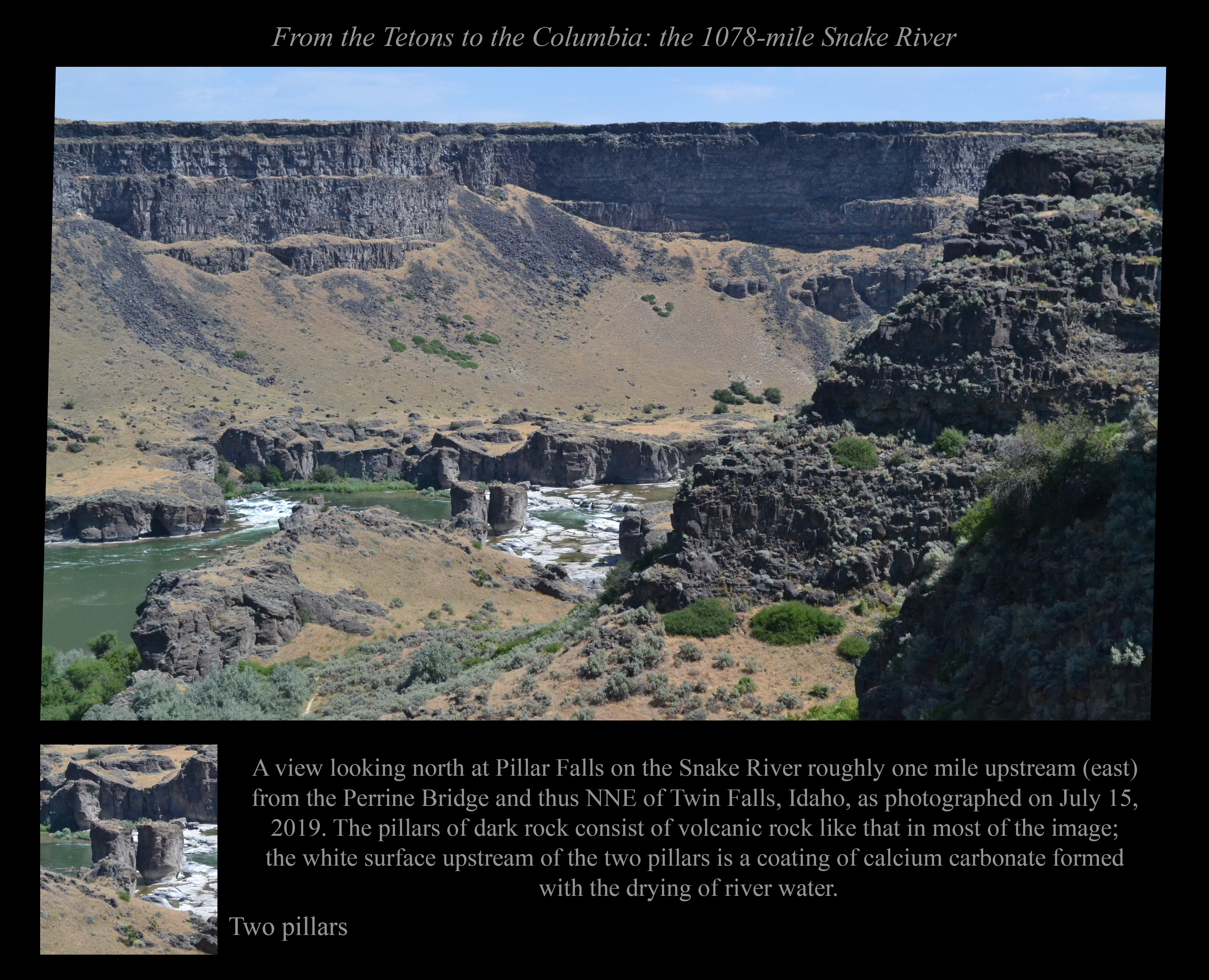
The Snake River at Pillar Falls northeast of Twin Falls, Idaho.
The Snake River flowing under the Perrine Bridge north of Twin Falls, Idaho.
Back in time: The Twin Falls - Jerome Intercounty Bridge.
< < < < < < < < BETWEEN TWIN FALLS AND HAMMET > > > > > > > >
The Snake River canyon west of the Perrine Bridge, as seen from the latter.
The Snake at Thousand Springs near Hagerman, Idaho.
The Owsley Bridge south of Hagerman, Idaho.
Boulders of the Melon Gravel deposited by the Snake near Hagerman, Idaho.
Bell Rapids (well, sort of) near Hagerman, Idaho .
Lava flows and landslides along the Snake near Bliss, Idaho.
Rapids in the Snake River below Bliss, Idaho.
The canyon of the Snake River below Bliss, Idaho.
Sugar Bowl near King Hill, Idaho.
Three Island Crossing near Glenn's Ferry, Idaho.
The Snake River Canyon as an avenue to all kinds of traffic near Glenn's Ferry, Idaho.
The Snake and its travelling companion, the Union Pacific Railroad.
The Snake below bluffs across the river from Hammet, Idaho.
< < < < < < < < BETWEEN HAMMET AND THE IDAHO-OREGON BORDER > > > > > > > >
Sparlin Island and the Snake River below Hammet, Idaho.
Sparlin Island and nearby bluffs from below.
Indian Cove Bridge downstream from Hammet, Idaho.
Loveridge Bridge between Hammet and Bruneau, Idaho.
The box canyon above Crane Falls.
Crane Falls Lake and the Snake River.
The view down the meandering Snake River from Grand View, Idaho.
The placid Snake River between Grand View and Jackass Butte.
Jackass Butte downstream from Grand View, Idaho.
The bend in the Snake River at Jackass Butte at River Mile 475.
Castle Butte, a volcanic vent downriver from Grand View, Idaho.
The Snake and its canyon upstream from the Swan Falls Dam.
Sinker Butte seen from across the Snake just above the Swan Falls Dam.
Swan Falls Dam and the view downriver.
The Melon Gravel downriver from Swan Falls.
Two views looking upstream, downstream from Swan Falls.
Three views looking downstream farther downstream from Swan Falls.
Two views looking downstream at Mile 454 well below Swan Falls.
< < < < < < < < ON THE OREGON-IDAHO BORDER > > > > > > > >
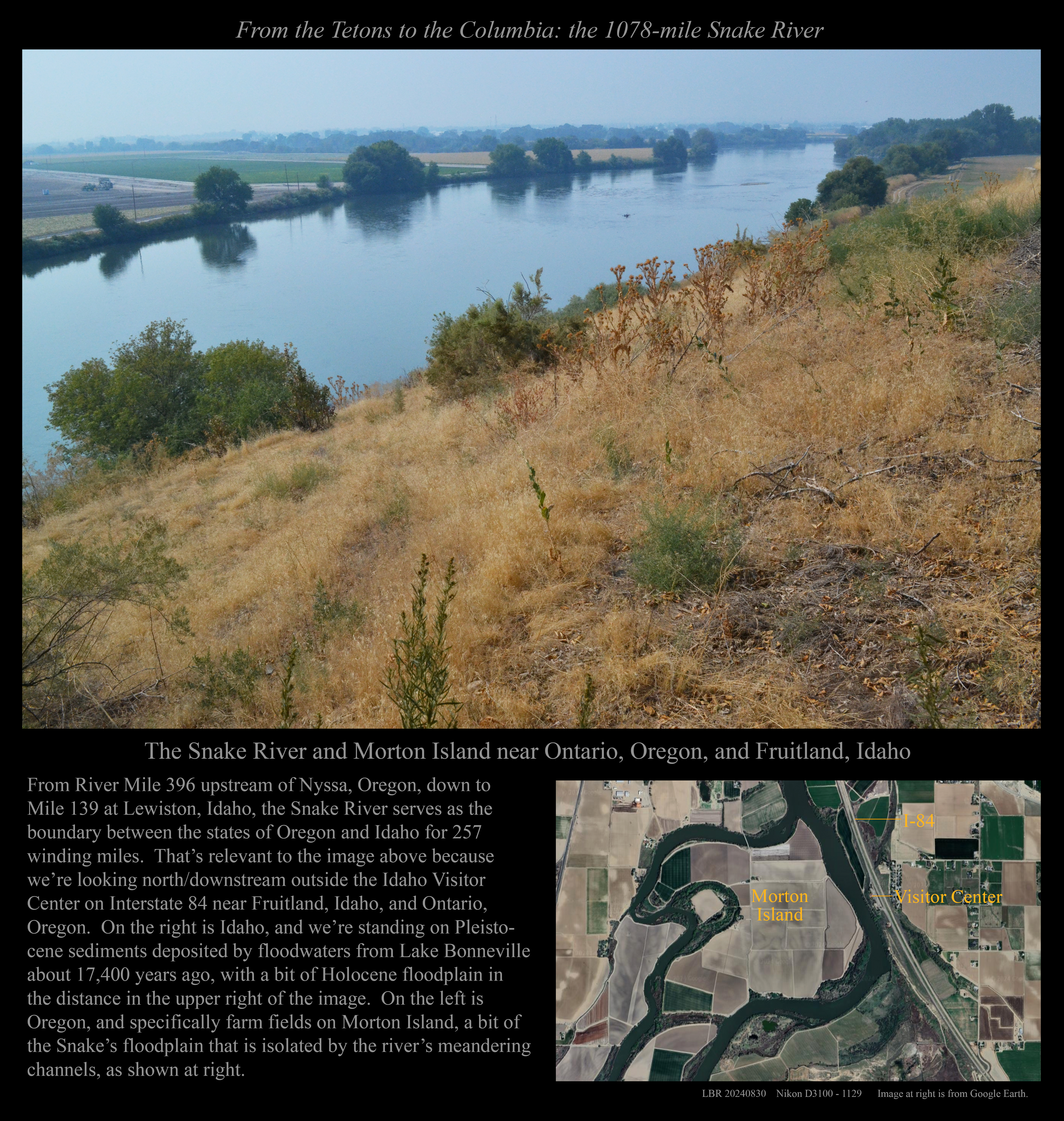
The Snake River's meanders downriver from Ontario, Oregon.
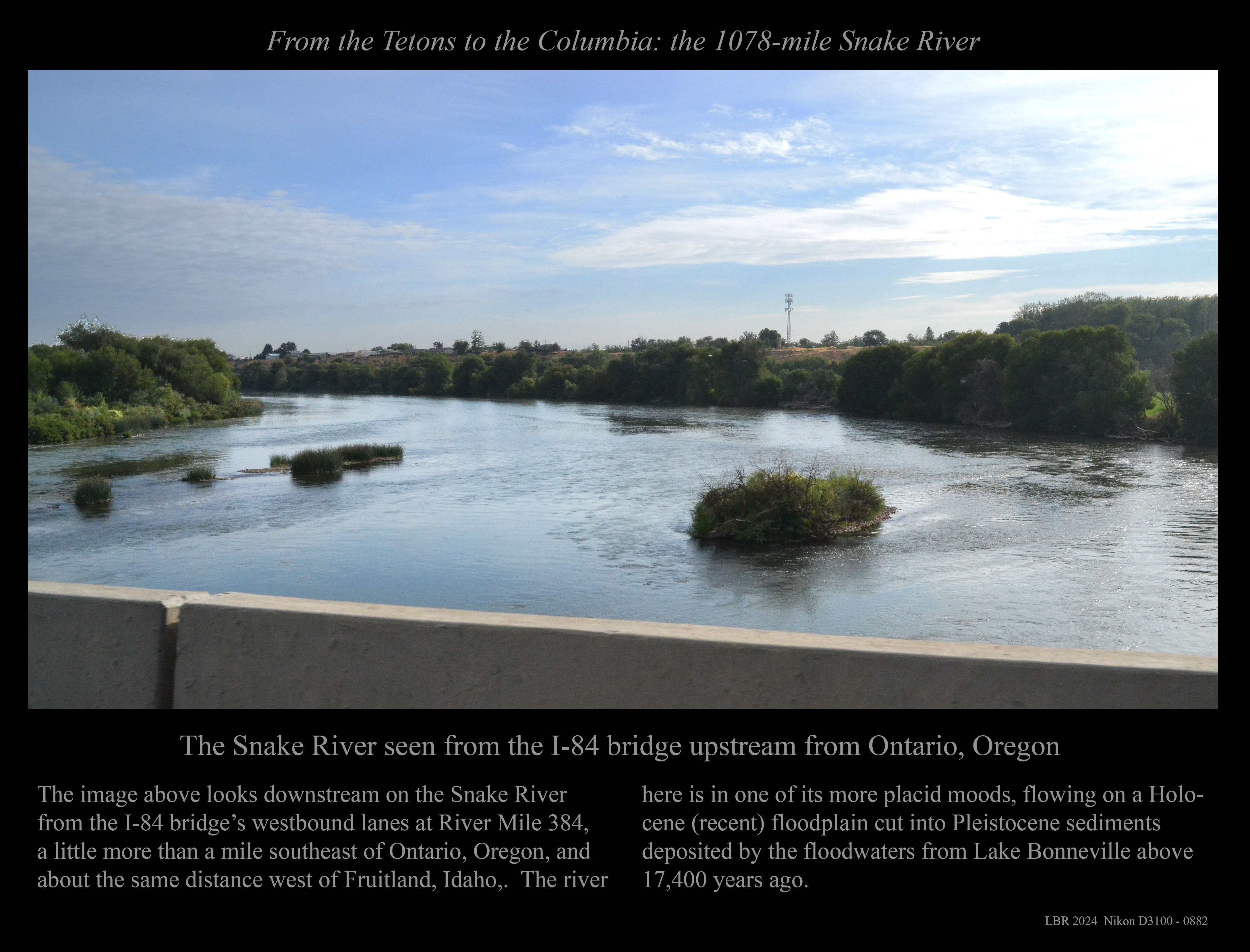
The Snake River from the westbound I-84 bridge.
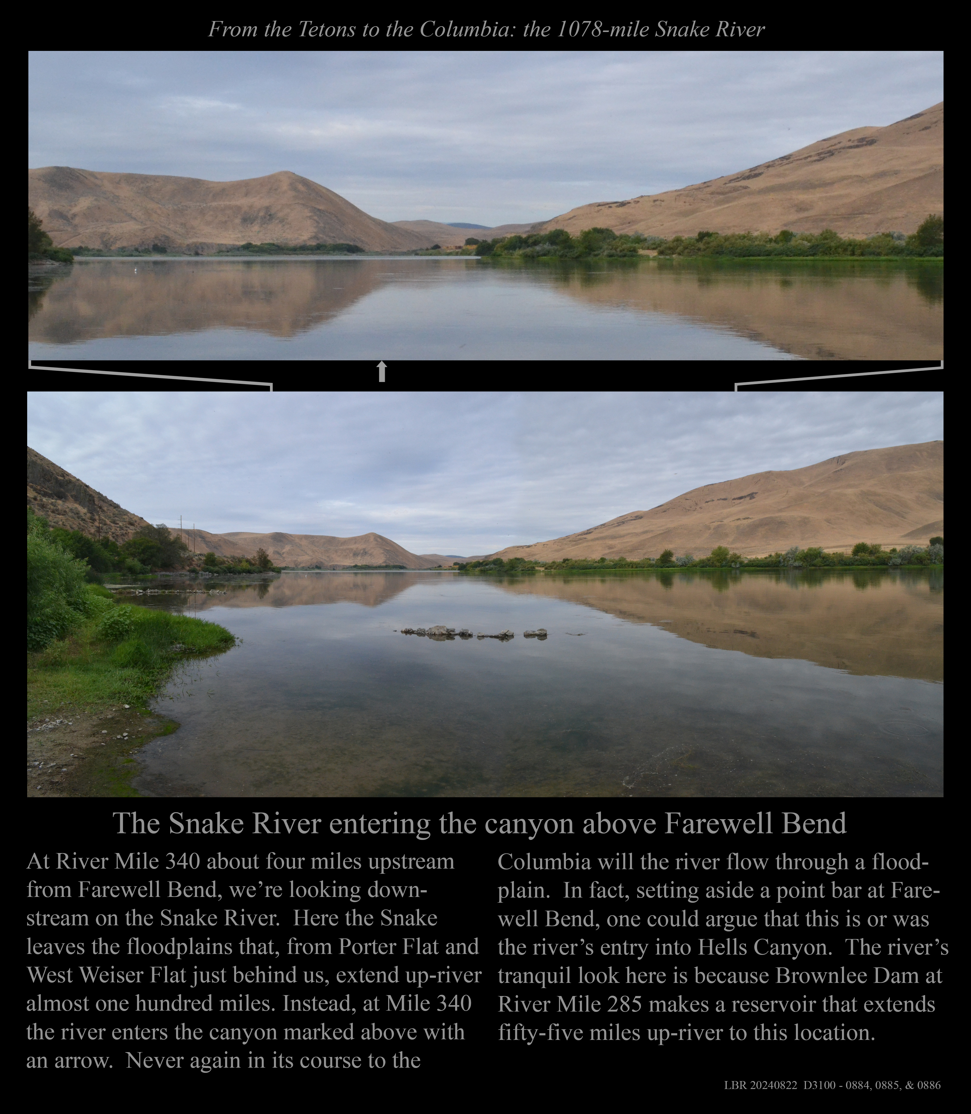
The Snake entering the canyon above Farewell Bend.
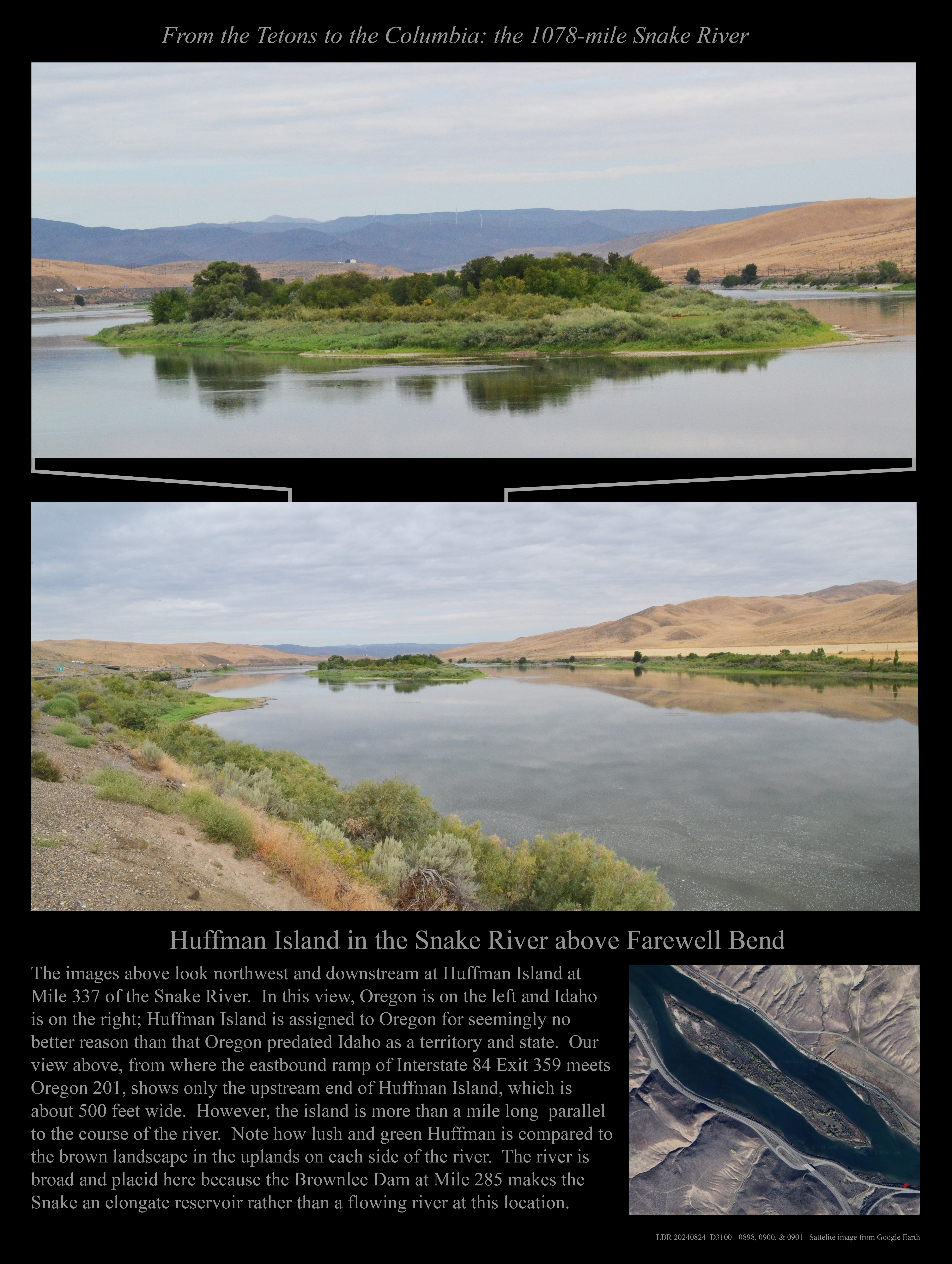
Huffman Island in the Snake River above Farewell Bend.
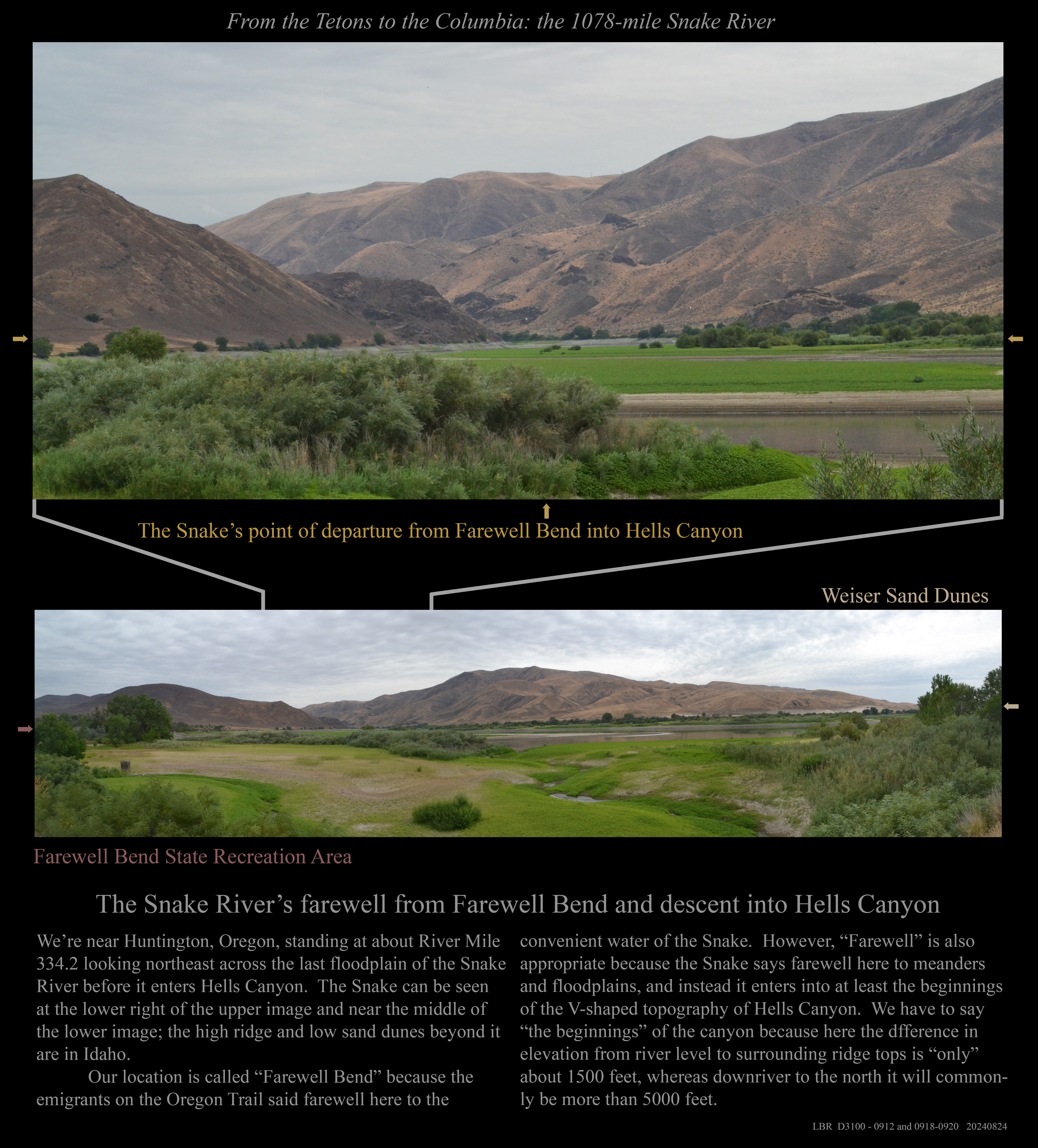
The Snake River at Farewell Bend
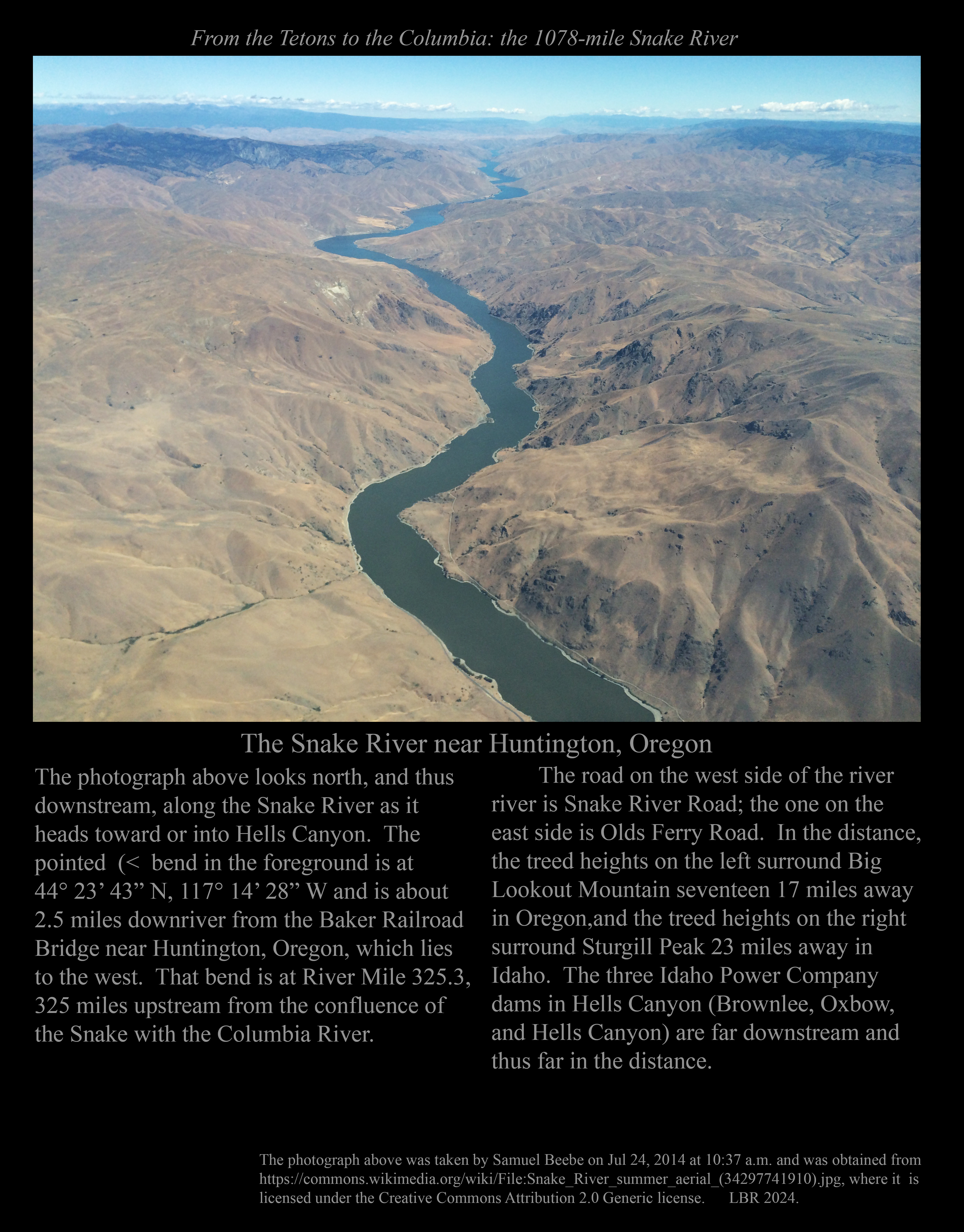
The Snake River near Huntington, Oregon.
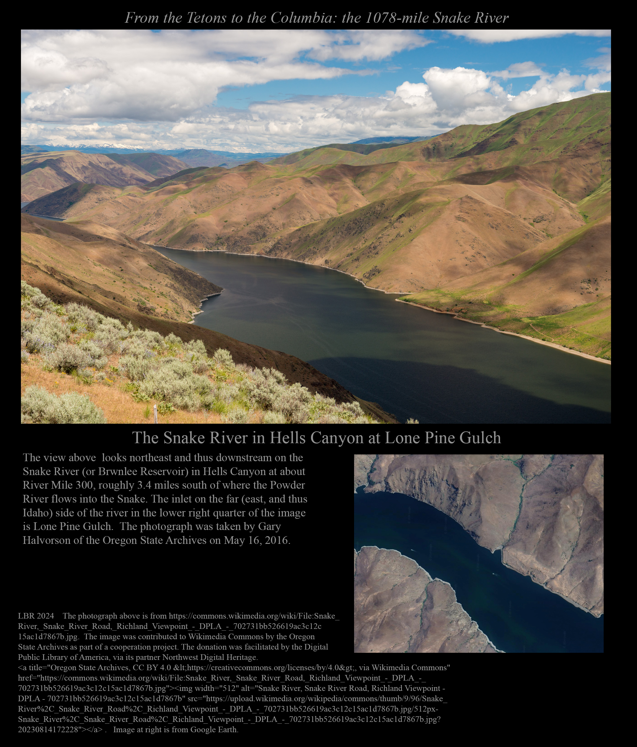
The canyon of the Snake River at Lone Pine Gulch.
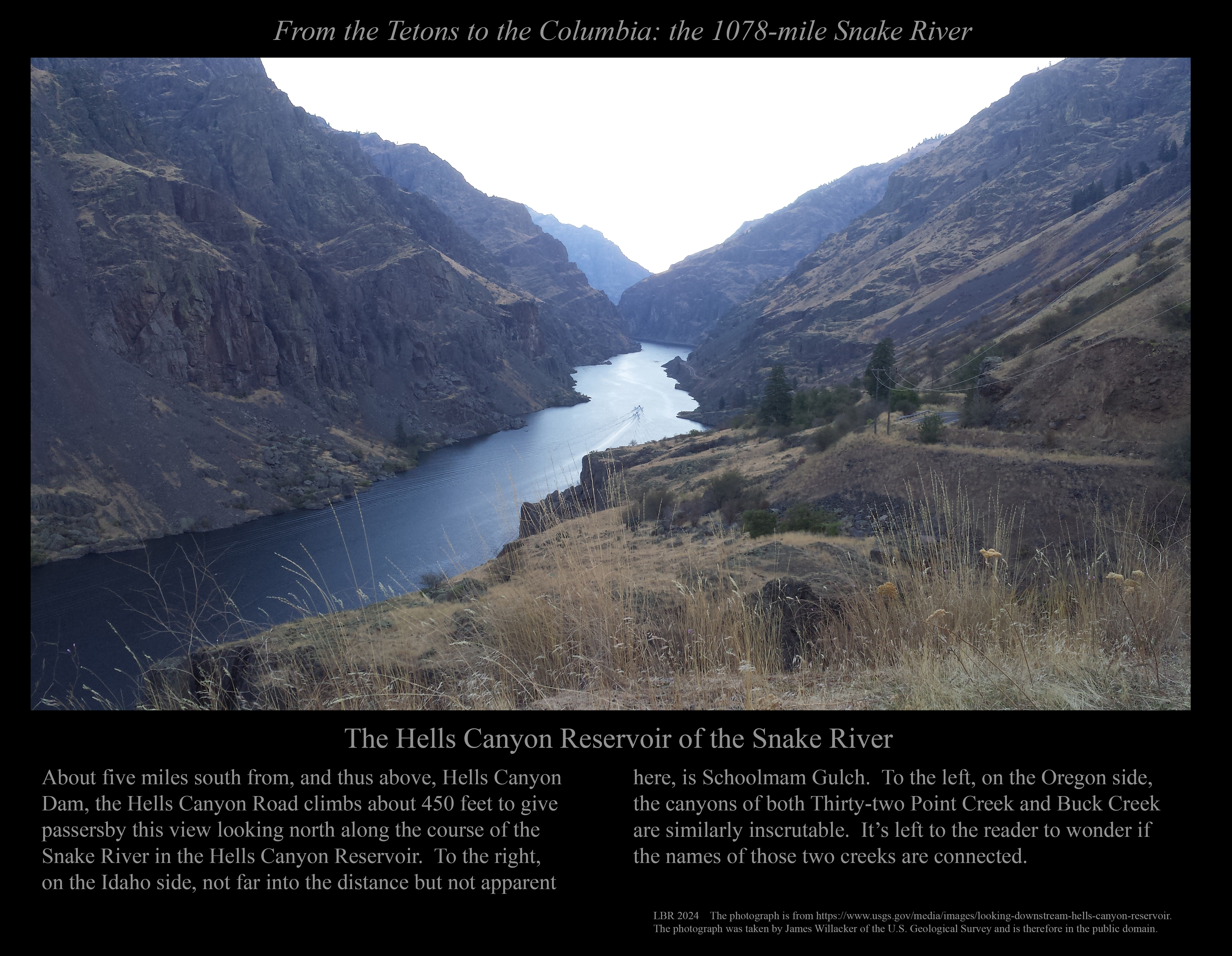
Hells Canyon on the Snake River seen from the Schoolmam Gulch viewpoint.
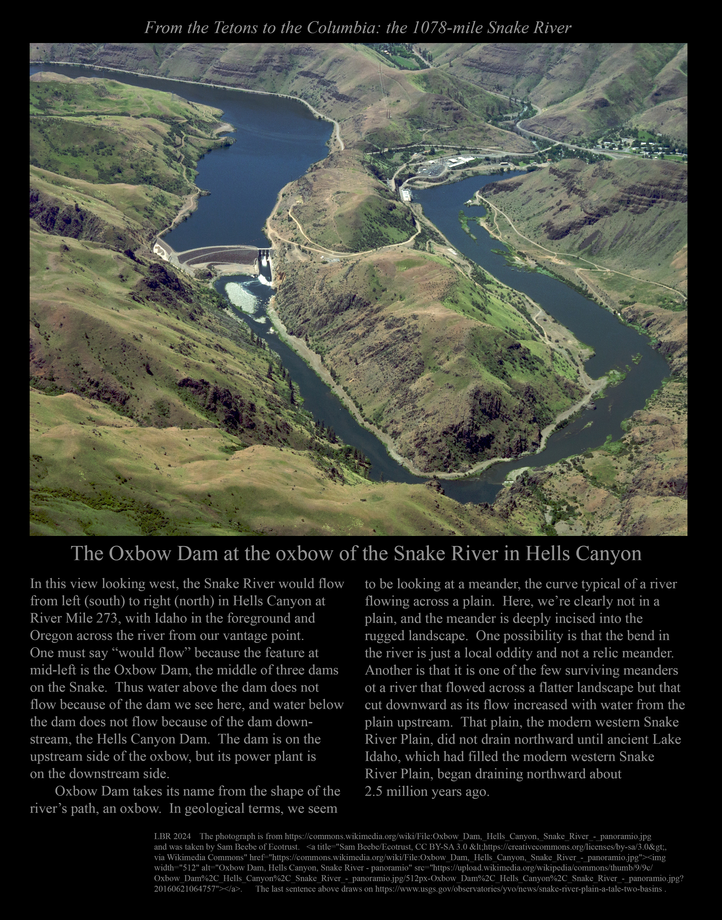
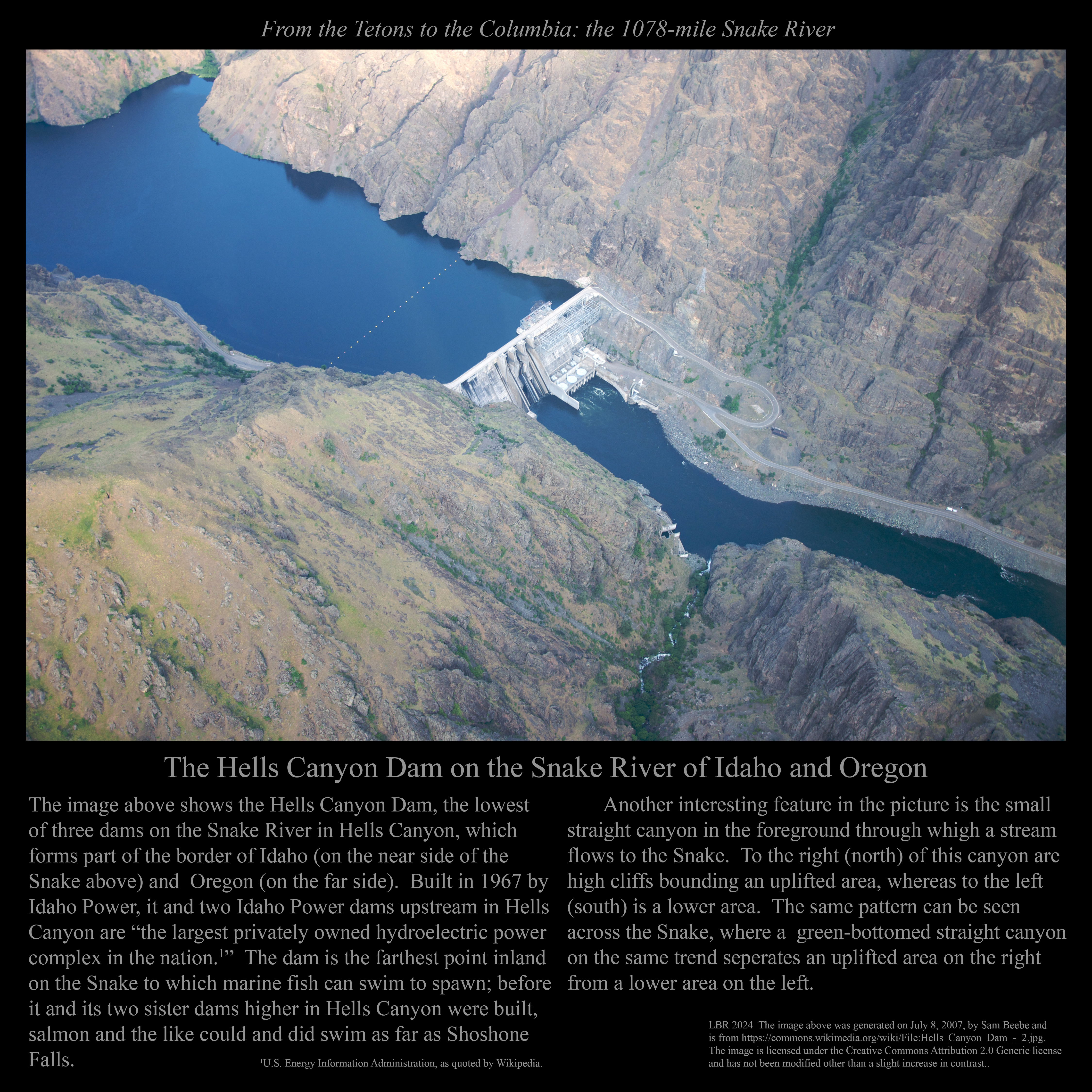
The Hells Canyon Dam from above.
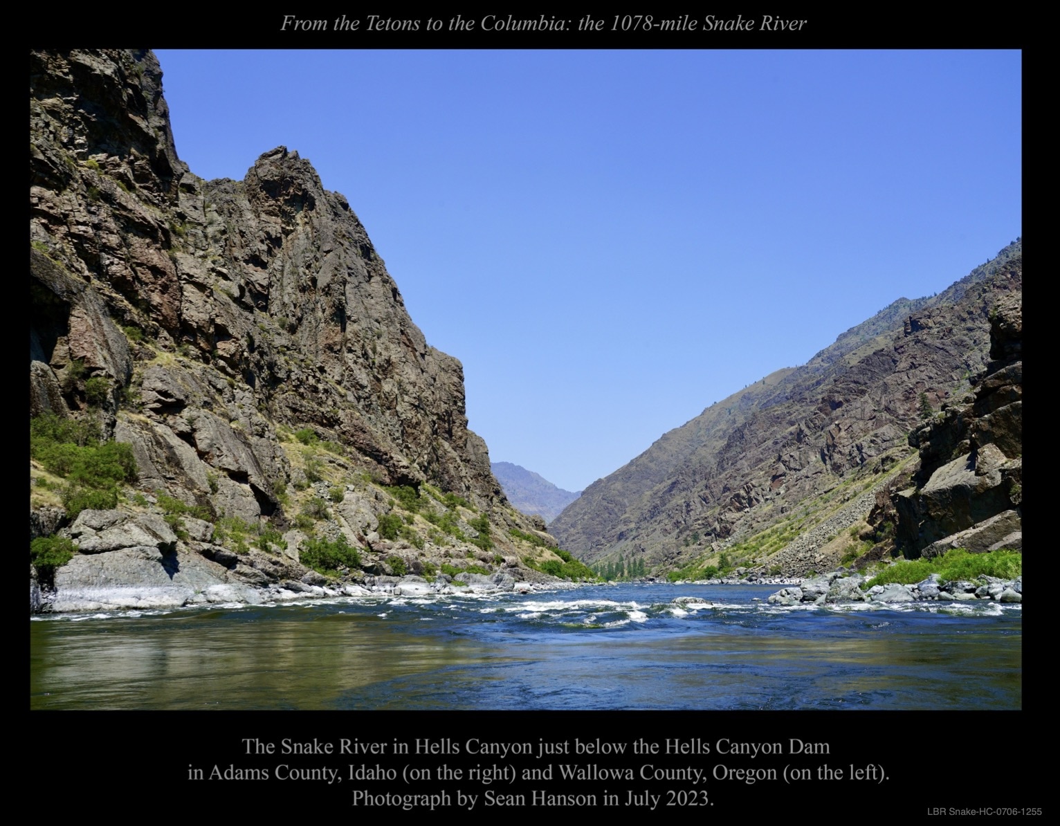
The Snake River in Hells Canyon just below the Hells Canyon dam .
The Snake River flowing freely below Wild Sheep Rapids.
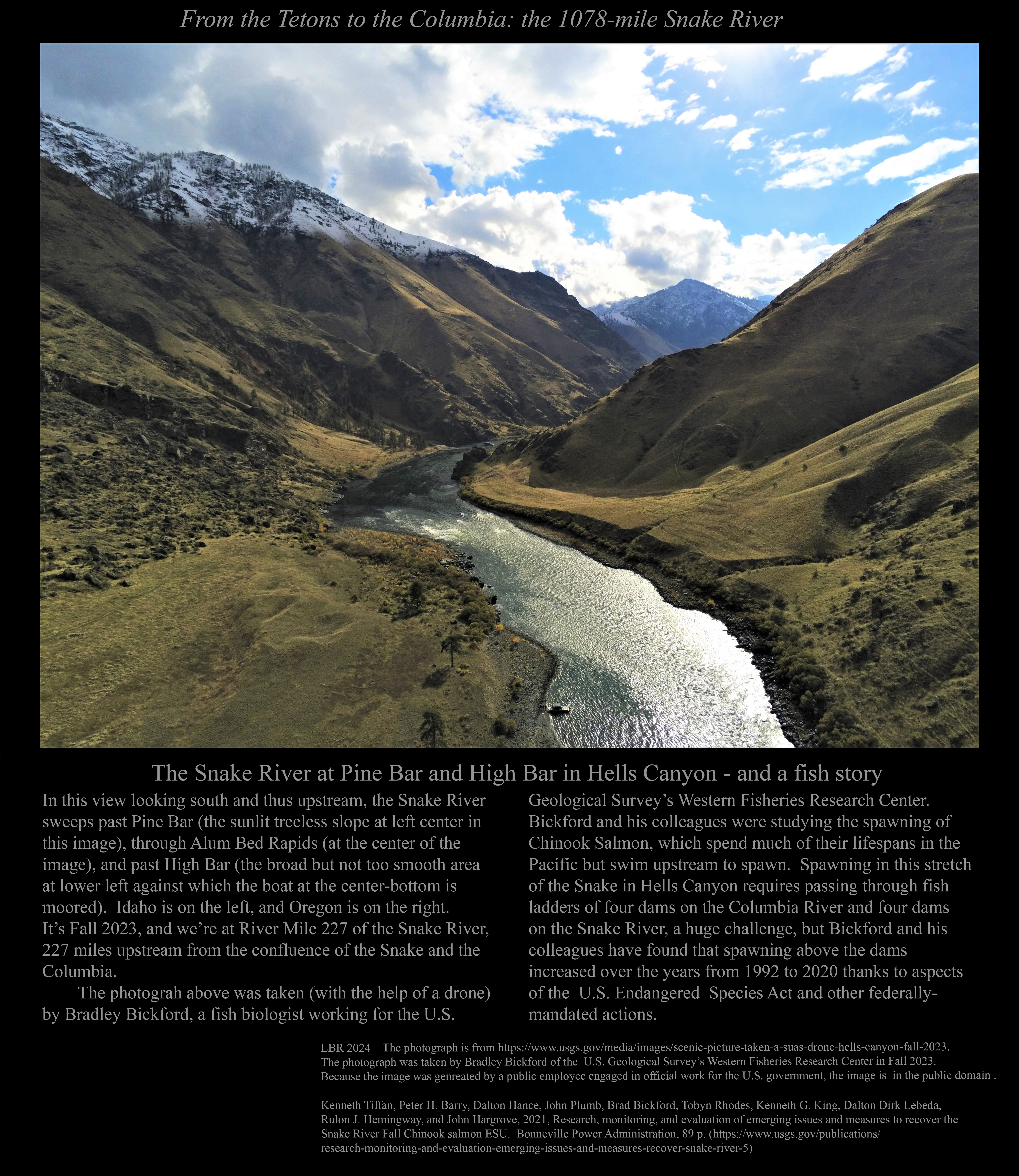
The Snake River at Pine Bar and High Bar.
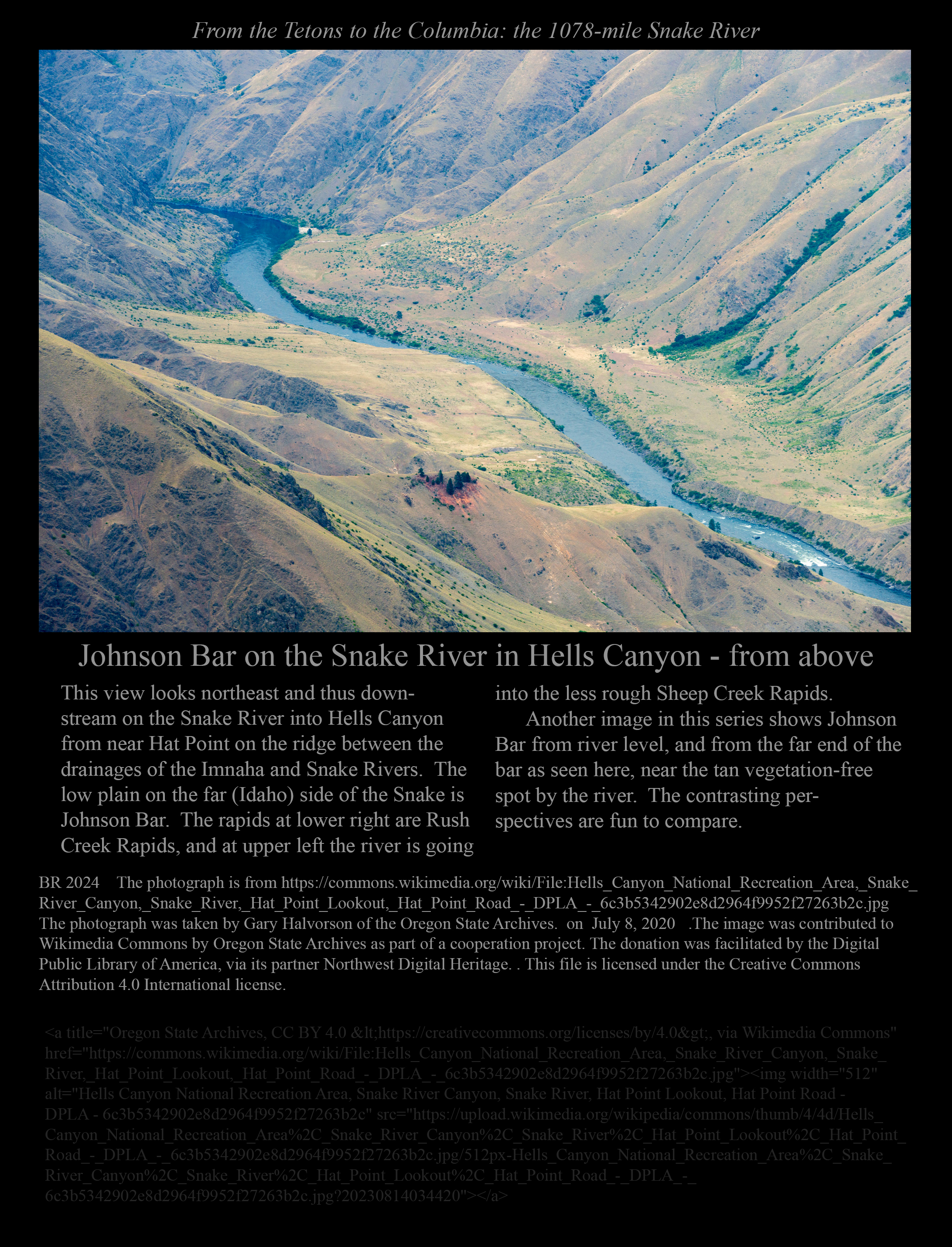
Johnson Bar in Hells Canyon seen from above, as opposed to . . . .
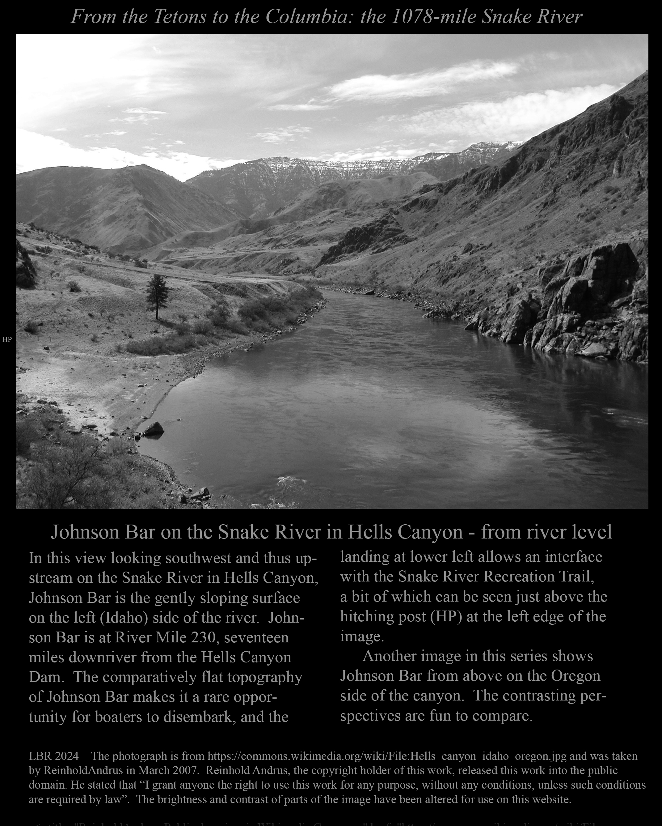
. . . Johnson Bar in Hells Canyon seen from river level.
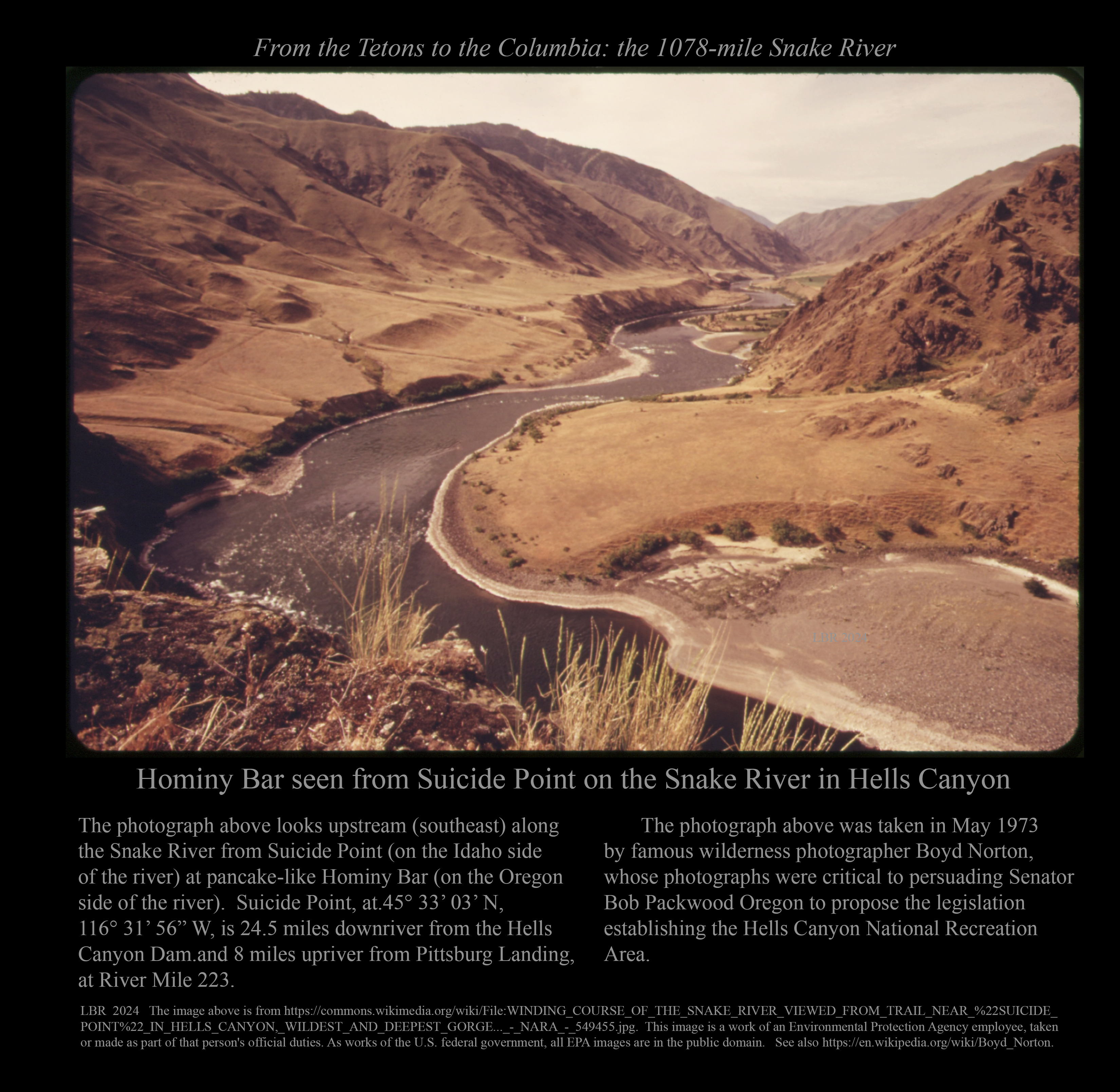
Hominy Bar and Suicide Point on the Snake River.
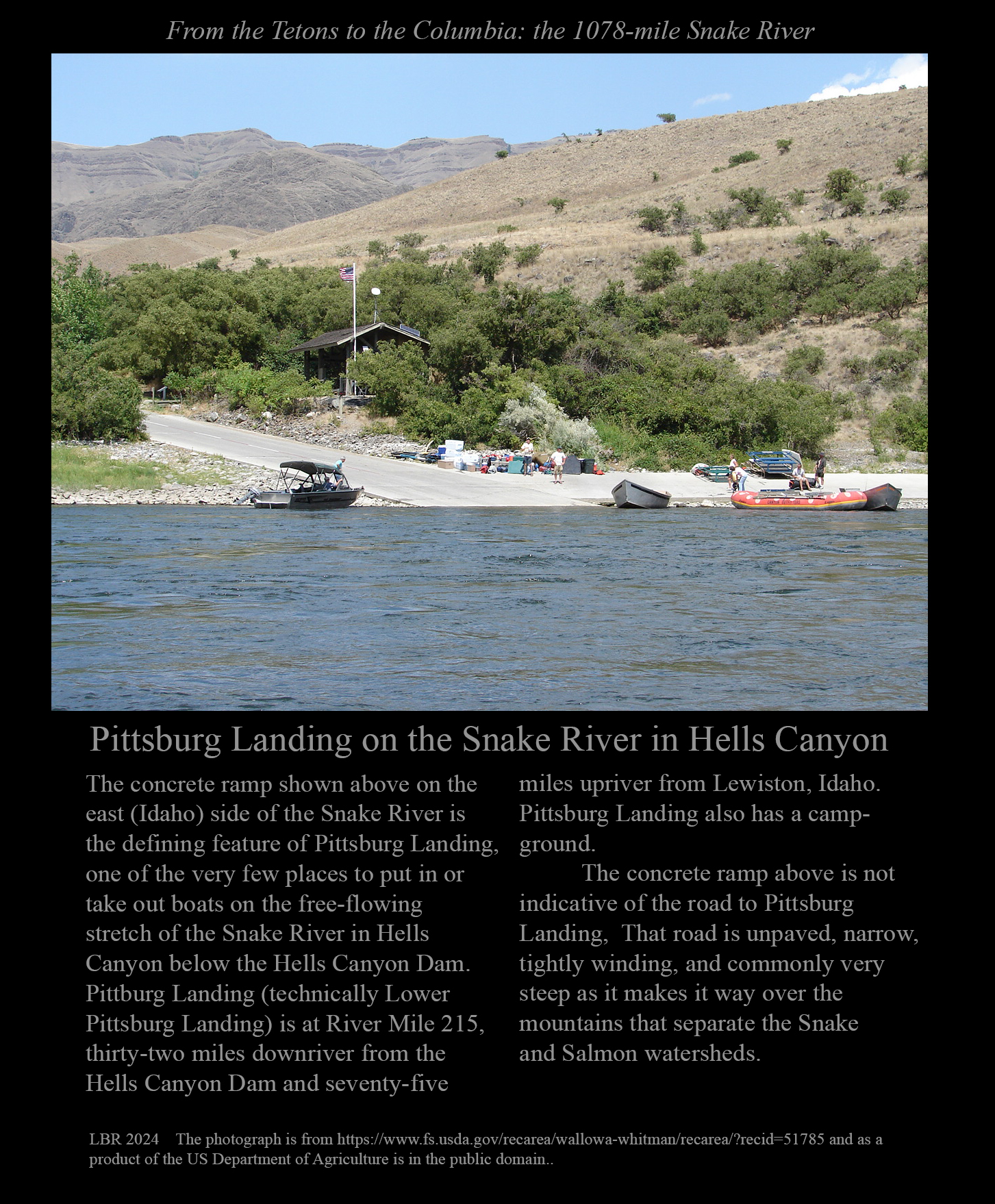
Pittsburg Landing, a common exit from Hells Canyon for river travellers.
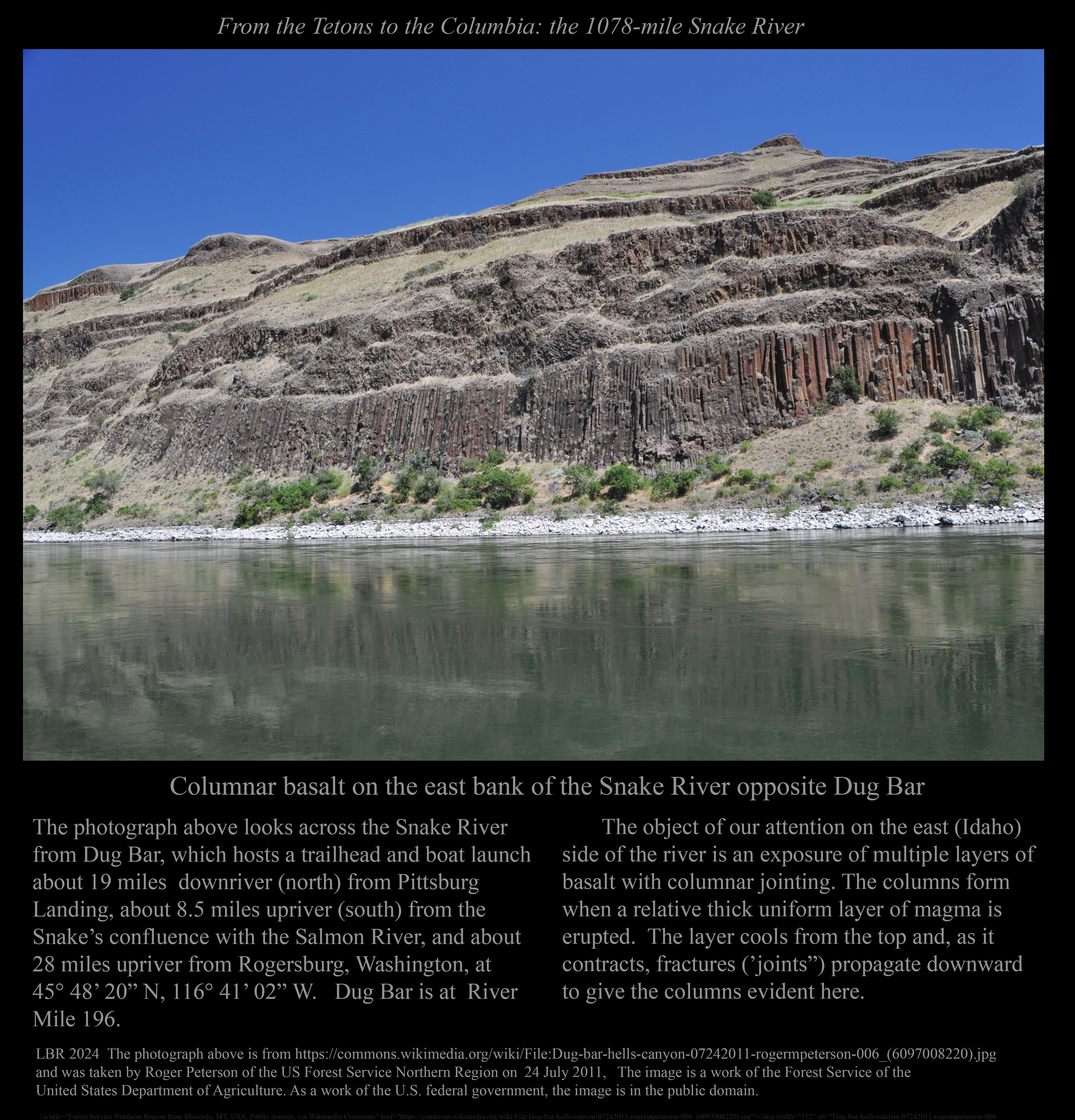
The Snake below columnar basalt at Dug Bar.
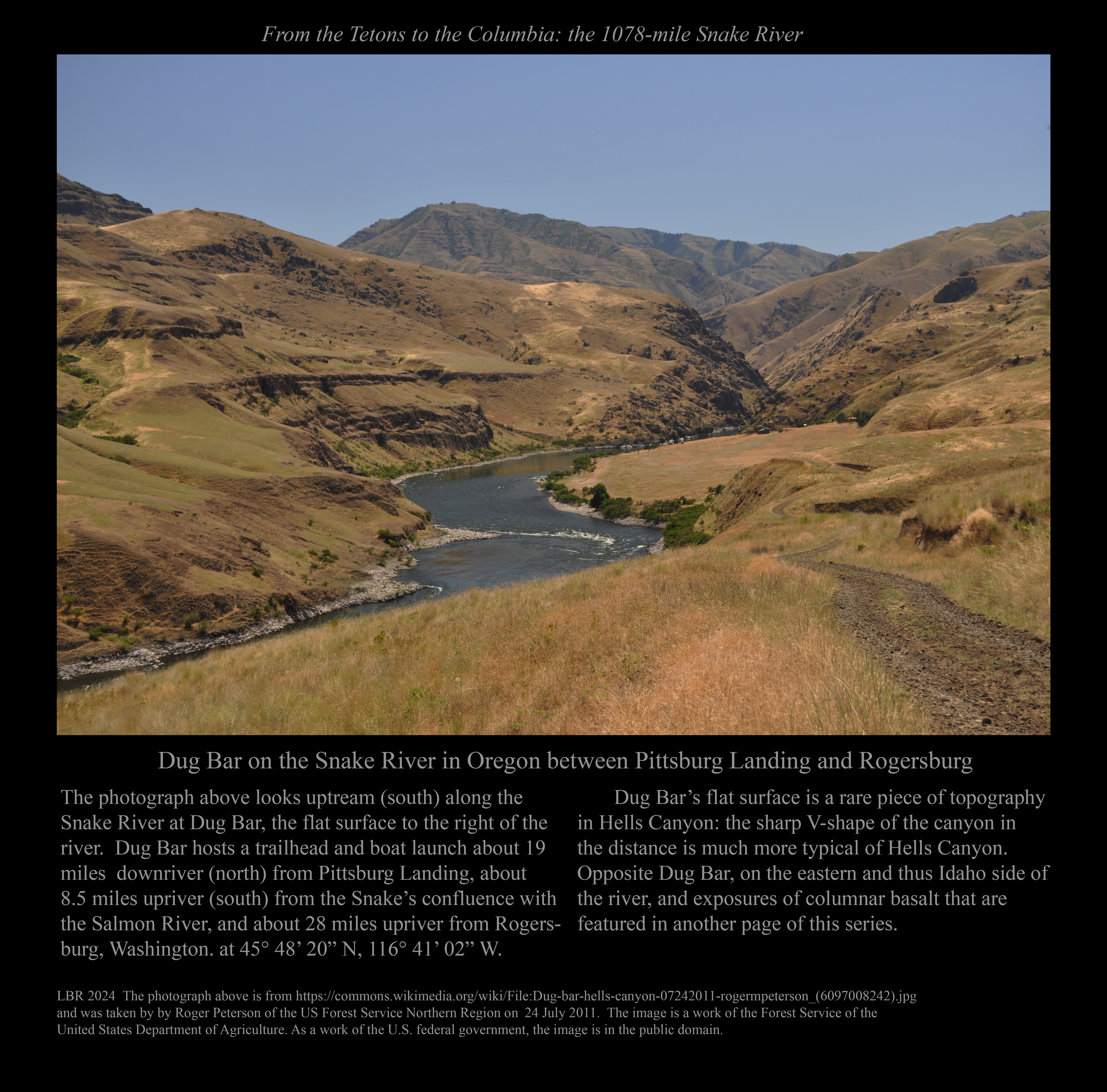
Dug Bar seen from downstream on the Snake River.
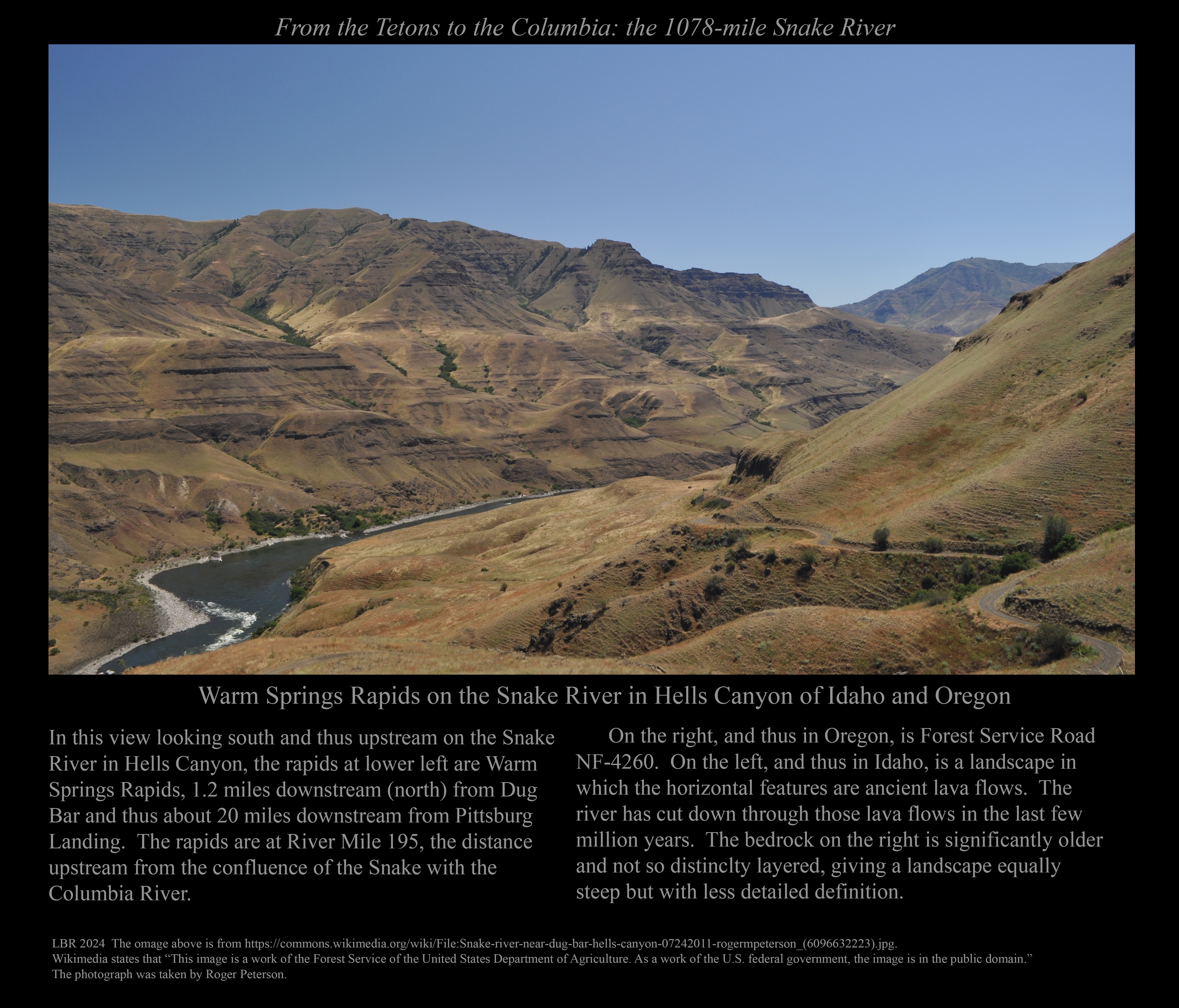
The Snake River below ancient lava flows at Warm Springs Rapids.
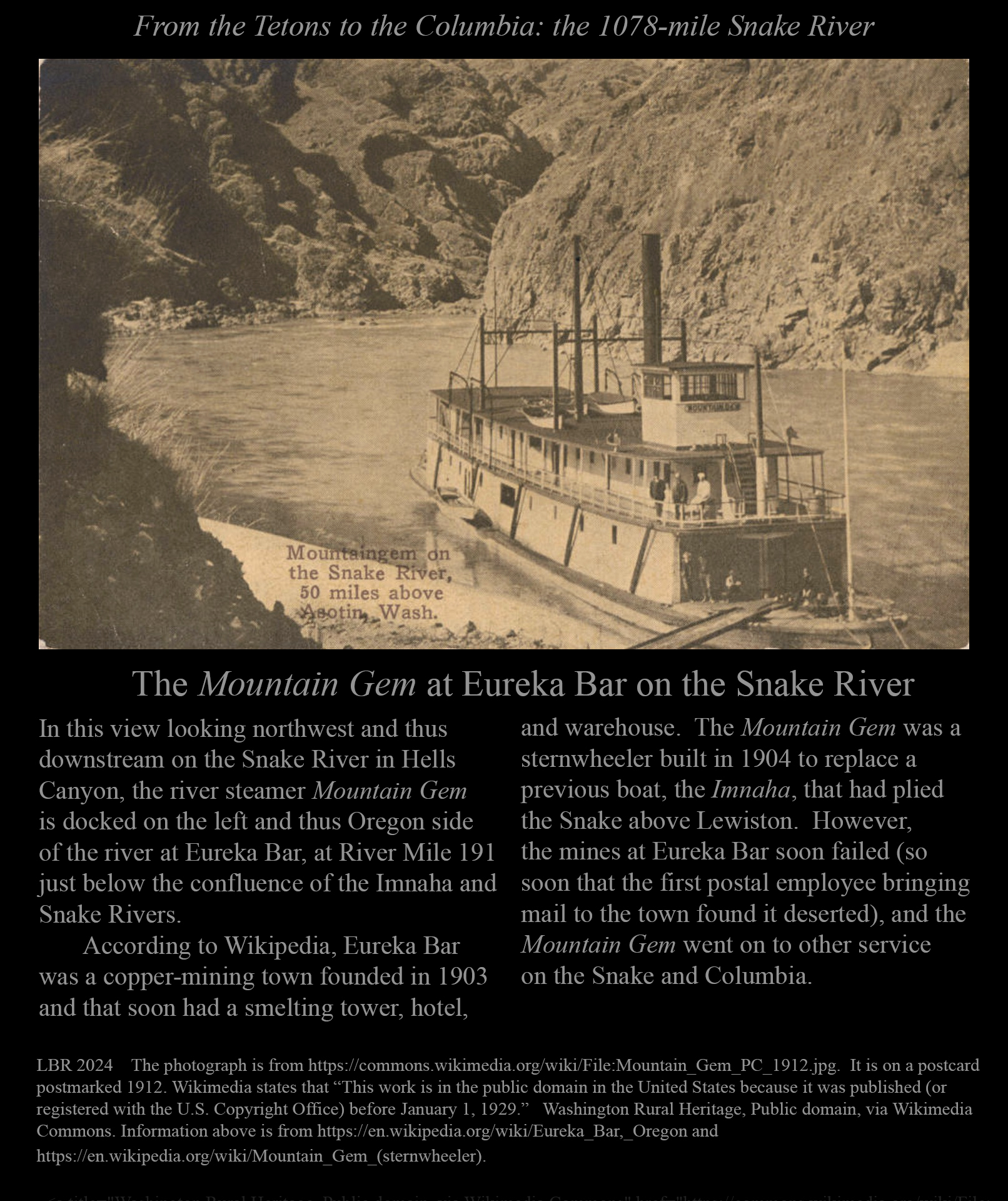
The Mountain Gem at Eureka Bar on the Snake River in the early 1900s.
< < < < < < < < ON THE WASHINGTON-IDAHO BORDER > > > > > > > >
The Snake River between Lewiston, Idaho, and Clarkston, Washington.
The Blue Bridge over the Snake at Lewiston, ID, and Clarkston, WA.
< < < < < < < < IN WASHINGTON > > > > > > > >
An overview of the dams on the Snake River in Washington.
A barge entering the lock at Ice Harbor Dam.
The railroad bridge over the Snake River between Pasco and Burbank, Washington.
Journey's end: the confluence of the Snake River with the Columbia River.
Errors and problems should be reported to rlsbk@uga.edu.
Back to railsback.org