|
This virtual field trip takes us to Canyonlands National Park just west of Moab, in east-central Utah. The point of the trip is to see how differences in bedrock influence the movement of groundwater.
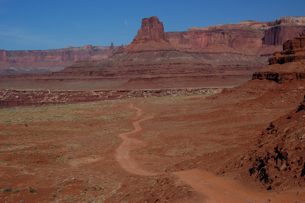
The first of our two stops will be in Lathrop Canyon, on the east side of the Island in the Sky unit of the park. Below is a view of Lathrop Canyon from the east, with Airport Tower on the other side of the canyon. As you take in this beautiful landscape, also note how little vegetation it has:
|
Image 1
|
|
|
Image 2
|
|
|
|
|
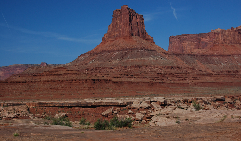
Let's move down to the rim of the inner canyon to say a few words about the stratigraphy. The relatively thin white layer in the midground of the image below will be a major player at this stop. It's the White Rim Sandstone, a Permian-age sandstone. Below it is the red Organ Rock member of the Cutler Formation; the Organ Rock consists of fine sandstones, siltstones, and mudstones. Not too important to us here, but above the White Rim and in the distance, are the strikingly layered Triassic Moenkopi Formation, the slope-making Jurassic Chinle Formation, the cliff-making Wingate Sandstone Formation, the Kayenta Sandstone, and (at upper right) the buff Navaho Sandstone capping it all:
|
|
Image 3
|
|
|
|
|
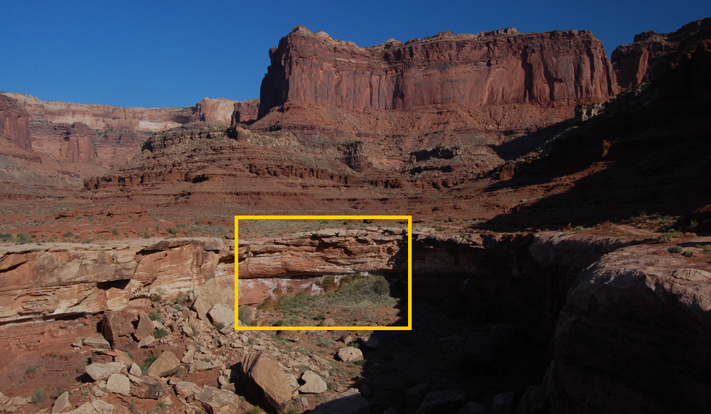
If we look to our right up the canyon, we see something a little unusual, outlined in the yellow rectangle:
|
|
Image 4
|
|
|
|
|
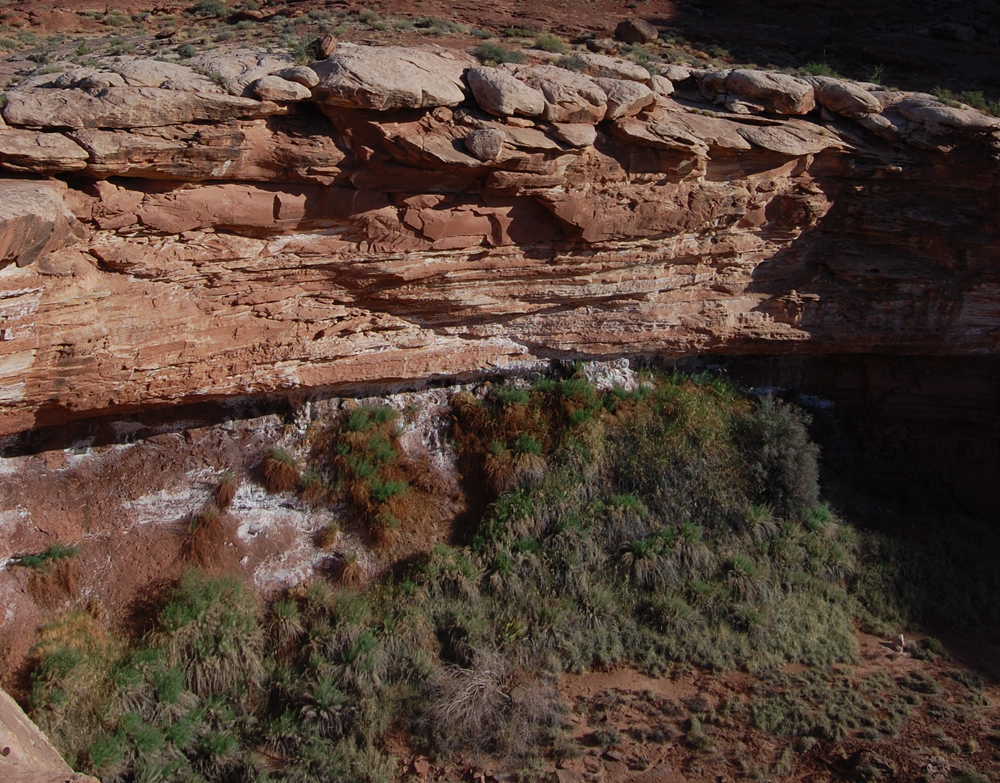
The area in the yellow rectangle, seen in image below, is distinctive for two reasons. One is that it has some lush vegetation, at least by the standards of central Utah. The second is the white staining of salt.
|
|
Image 5
|
|
|
|
|
So what is happening here to allow this lush vegetation and accumulation of salt? We'll pause while you ponder.
. . .
. . .
. . .
. . .
. . .
. . .
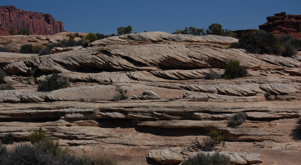
If you're still pondering, bear in mind that we're seeing this in the lower part of the White Rim sandstone and at the top of the Organ Rock's fine sandstones, siltstones, and shales. It may also be helpful to know that the White Rim is a sandstone with high-angle cross-bedding and is thought to have been deposited as shoreline dunes. For example, here's a picture of the White Rim from elsewhere in Canyonlands:
|
|
Image 6
|
|
|
|
|
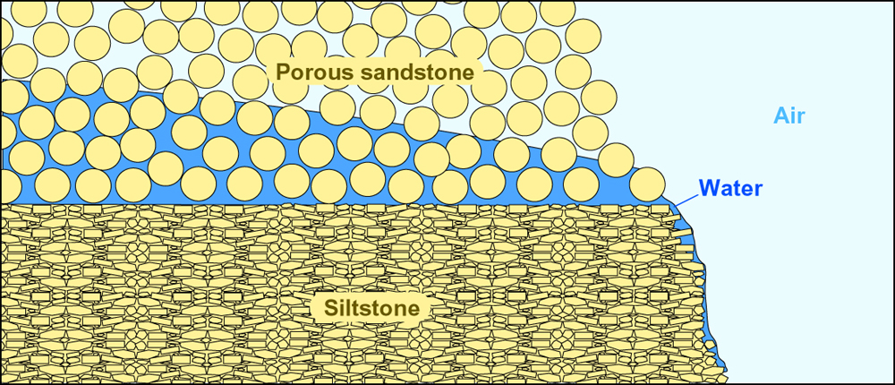
At this point, hopefully you've had a hydrologic insight. The White Rim Sandstone, as an aeolian and thus well-sorted sand, is sufficiently permeable that groundwater moves downward through it. It's thus an effective aquifer. The Organ Rock, as a finer-grained deposit, is a less permeable unit though which water passes much less readily. Thus water that has fallen as rain higher in Lathrop Canyon has moved down through the permeable White Rim but can't sink deeper into the Organ Rock, and so instead it emerges here as a subtle spring, as suggested by the very schematic cross-section below. The water of course is what lets plant life flourish here. It is also what precipitates salts, because it carries dissolved solids derived from chemical weathering of rock higher up in the canyon.
|
|
Image 7
|
|
|
|
|
The second stop of our trip takes us to Cave Springs in the Needles unit of Canyonlands National Park, and to a lower part of the stratigraphic section. In the image below, we're standing on the Cedar Mesa Member of the Pennsylvanian Cutler Formation, and in the distance are strata of the Cutler that overlie the Cedar Mesa.
|
|
Image 8
|
|
|
|
|
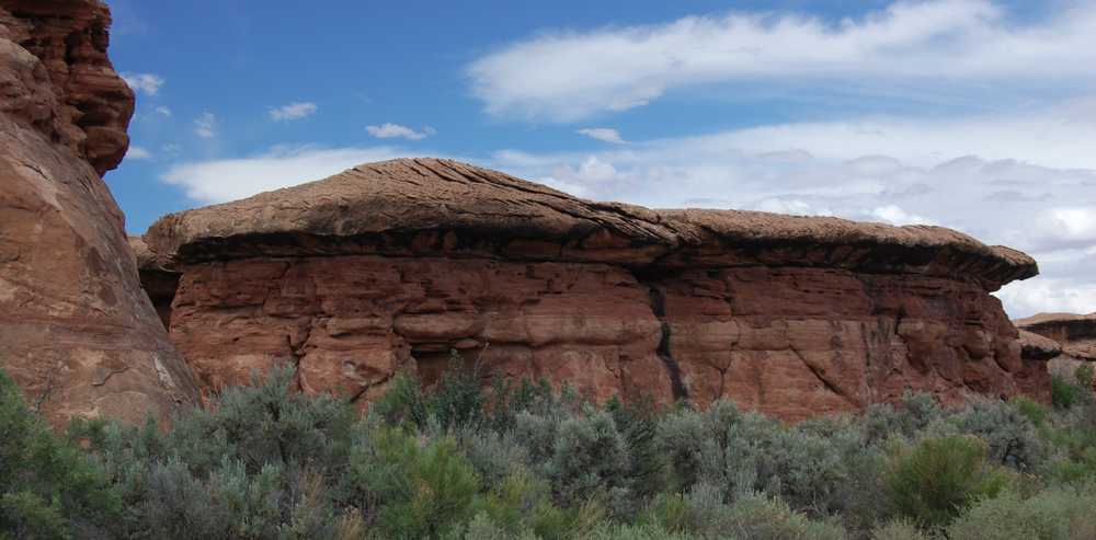
For a look at what happens under the Cedar Mesa, let's go down to these peculiar erosional features along the road to Cave Springs:
|
|
Image 9
|
|
|
|
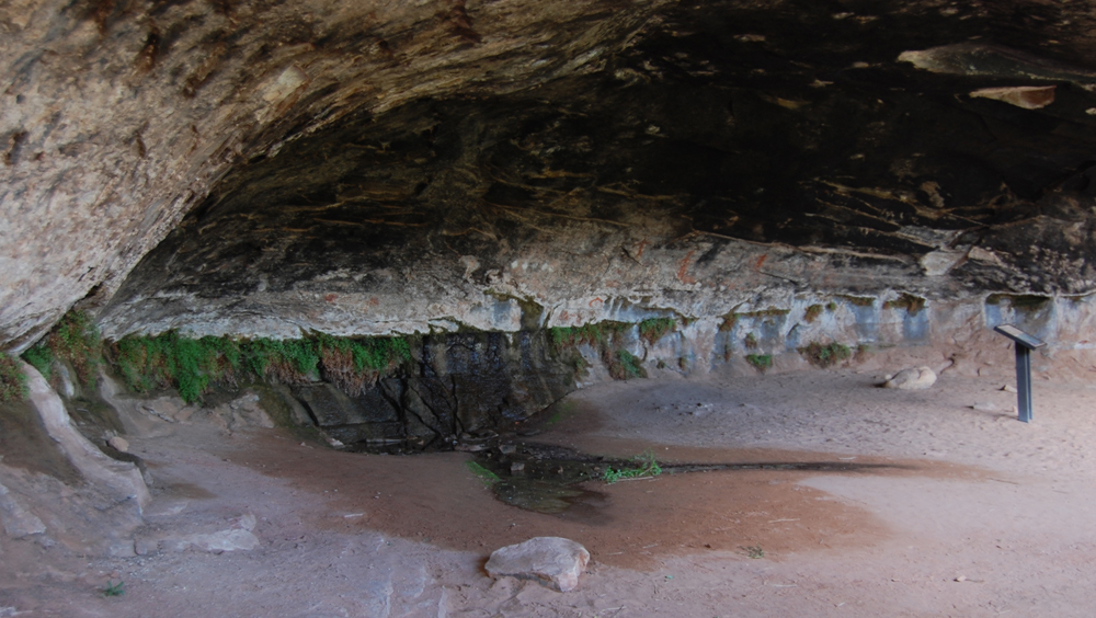
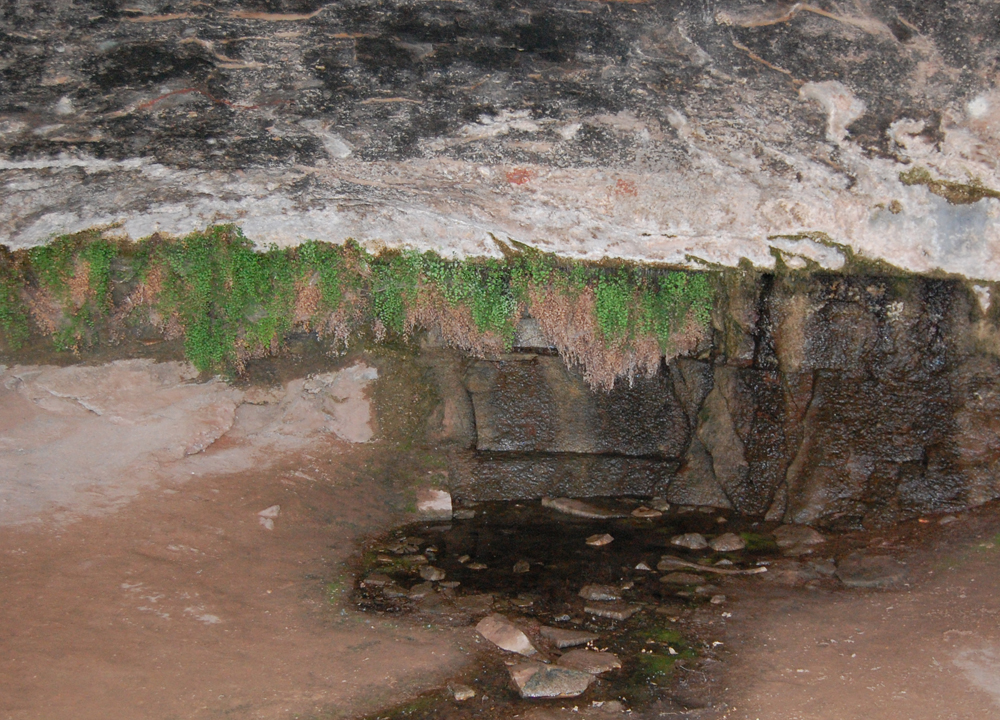
The image above shows mushroom-like erosional features that capped by a sandstone with high-angle cross-bedding and that have thick bases of fine-grained strata. In short, although we're now lower in the stratigraphic section, were seeing the same juxtaposition of well-sorted sand over finer-grained sediments. Thus you know what we're likely to find here: groundwater seeping at out the base of the sandstone. Indeed that's the case here at Cave Springs, where the "caves" are the areas under the overhanging sandstone. In the two images below, note
(a) the salt-encrusted base of the Cedar Mesa sandstone,
(b) the ferns growing at the contact between the Cedar Mesa and the underlying strata,
and (c) the pool of water.
|
|
Image 10
|
|
|
Image 11
|
|
|
|
|
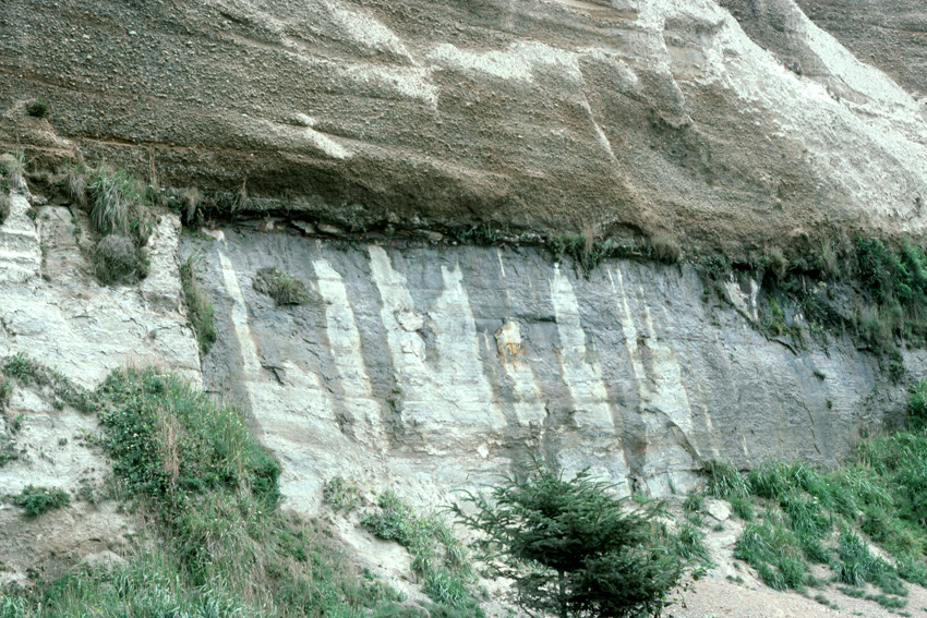
To summarize, in both cases we've seen groundwater that sank readily through a well-sorted and thus permeable sandstone flow out as a small spring at the contact with an underlying less permeable stratum. It's a phenomenon that's not unique to places like Canyonlands; for example, the image below shows the same process in sediments on the northern California coast:
|
|
Image 12
|
|
|
|
|
The only reason all this is so striking in Canyonlands is that we're in such a dry environment, so that even a little seepage creates a wetter microenvironment. Historically, Cave Springs was a water resource for Native Americans and then for Euro-American cowboys.
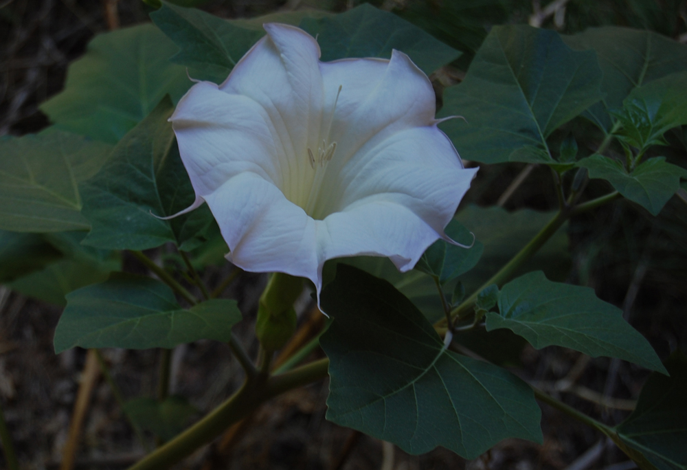
Of course, the springs are also a great resource for the plant life we've seen. With that in mind, we'll close with a visual treat that is rarely found in the Utah desert but that was present a few feet from the main Cave Springs seep in 2009. It's a Datura in bloom.
|
|
Image 13
|
|