This virtual field trip takes us to southern Russia to see Lake Baikal. Lake Baikal is the world's deepest lake, with a depth of more than 1,600 meters or 5250 feet. As a USGS fact sheet points out, Lake Baikal's depth and size make it the world's largest freshwater lake, with about one fifth of the world's total surface fresh water. That means Lake Baikal contains as much water as the five Great Lakes put together.
Overview of the images:
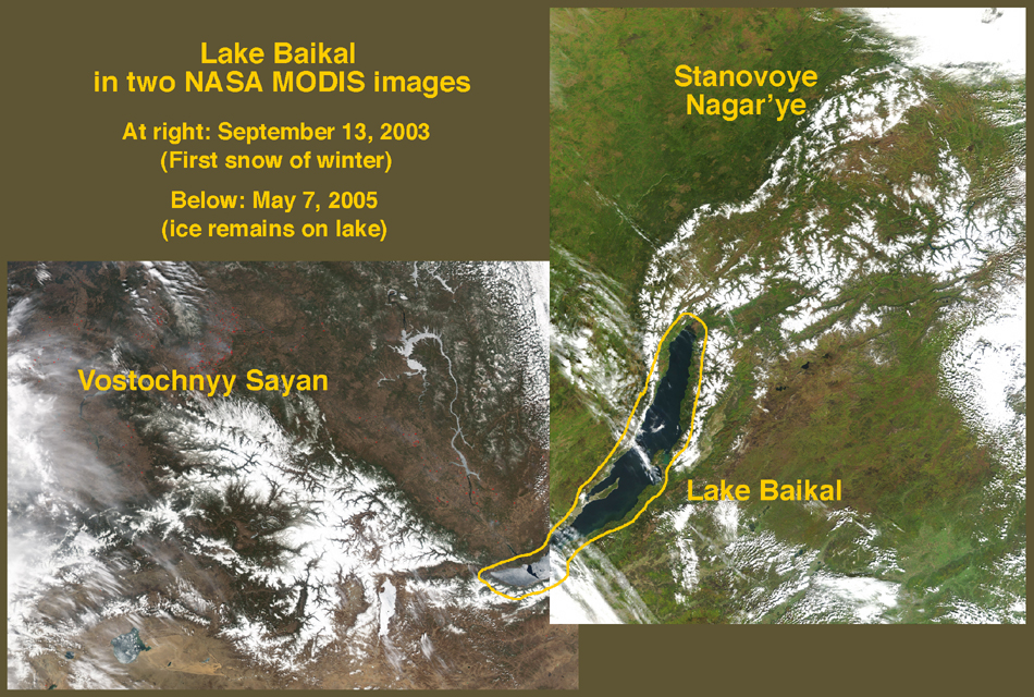
This virtual field trip uses two NASA MODIS satellite images. The two images combine to show Lake Baikal and two mountain regions to the southwest and northeast. The images are true-color images, and so green in the northeast image shows late-summer vegetation, and brown in the southwest image shows late winter barrenness. White is snow or clouds, with the clouds usually whispy or blurry. The images are a product of
NASA's MODIS program. One of the goals of the MODIS program is to detect fires, which are marked with small red rectangles on the images. Ignore them.
The mountains to the southwest, and a major fault:
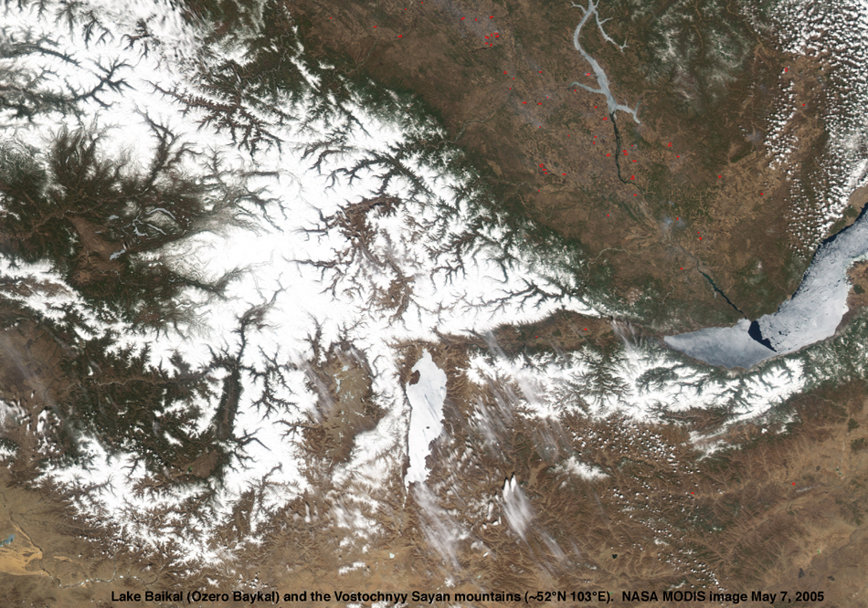
We begin with the image that captures the southestern end of Lake Baikal and the Vostochnyy Sayan mountains to the southwest. The Lake is at the east side of the image and looks gray because most of it was ice-covered when the image was acquired. The mountains are recognizable because they are covered with snow; the green and brown areas within them are river valleys.
One of the things for which interpreters of these images look is exceptionally straight valleys. Valleys often form where there is a crack or fault in the uderlying bedrock, because the break allows rocks to be eroded more readily. A straight valley is thus likely to be the surface expression of a fault that cuts across the landscape. A series of valleys lined up end-to-end is even more persuasive evidence of a major fault.
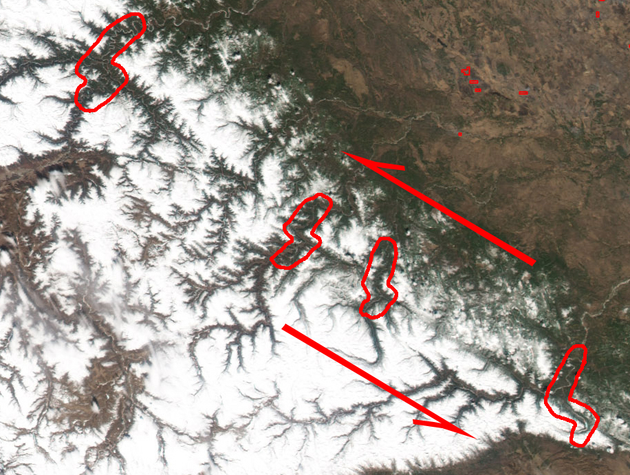
With that in mind, look at a more detailed image of the Vostochnyy Sayan mountains. Do you see a series of valleys that combine to define a line across the landscape?
If you're not having any luck, start in the southeast (lower right) corner of the image and look diagonally across the image, and thus across the northeast part of mountainous area. Do you see a southeast-to-northwest line defined by several valleys, each of which run southeast-northwest?
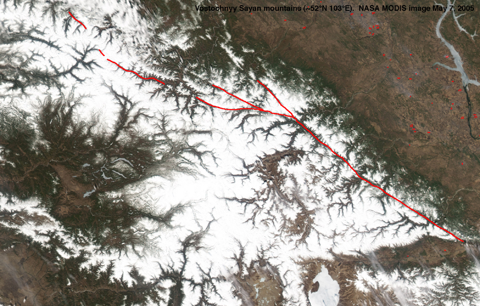
Next you can look at an image with the major fault marked in red. (If you hadn't found it, compare the marked image with the unmarked image.) The fault bifurcates into at least three faults at its northwest end, for reasons to which we'll return later.
Direction of movement along the fault:
A fault is a break in bedrock along which the two now-separated rock masses or blocks have moved relative to each other. That movement can be horizontal (one blocks moves sideways relative to the other) or vertical (one block moves up or down relative to the other). If you like, you can look at some sketches of simple faults.
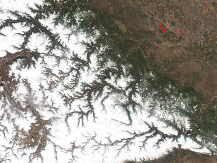
With that in mind, we can look at the images to see if we can tell which way motion has occurred along the fault we've found. In the case of faults with horizontal motion, one thing for which to look is offset of streams and rivers across the fault. Can you see any offset rivers along the fault in this more detailed image?
A marked version of the previous image shows southwest-to-northest valleys that are offset where they cross our major fault. The offset is consistently a jog to the left.
So what's the sense of movement along the fault? The offset river valleys answer the question. The area to the northeast (the upper right) has moved leftward relative to the area to the southwest (the lower left), as shown on this further marked detailed image.
Other features in the mountains:
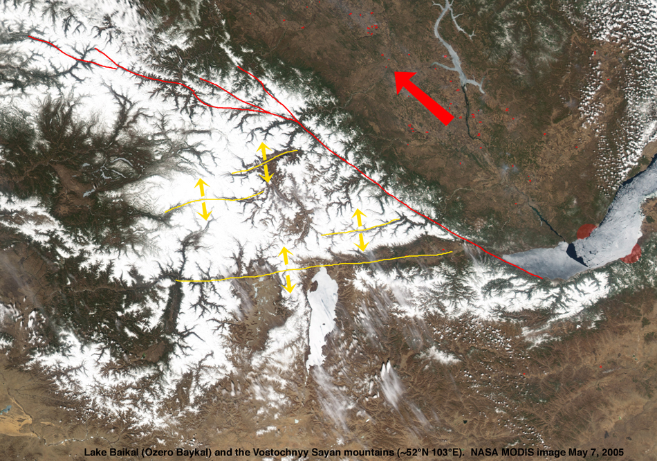
When we were looking for faults, you may have noticed other relatively straight valleys parallel to each other. These valleys run southwest to northeast (almost opposite our major fault). Take a look for them in our unmarked image of the Vostochnyy Sayan mountains.
These valleys are marked in yellow in another marked copy of the image. In light of what we now know about motion on the red fault, I've put yellow arrows around the yellow valleys to suggest that they have been pulled apart as a product of the drag along the red fault. As the block to the northeast moves northwest, drag on the block to the southwest pulls it apart a little bit, cracking the crust to make valleys. This is most evident in the longest and southernmost yellow-marked valley.
The origin of Lake Baikal - a first look
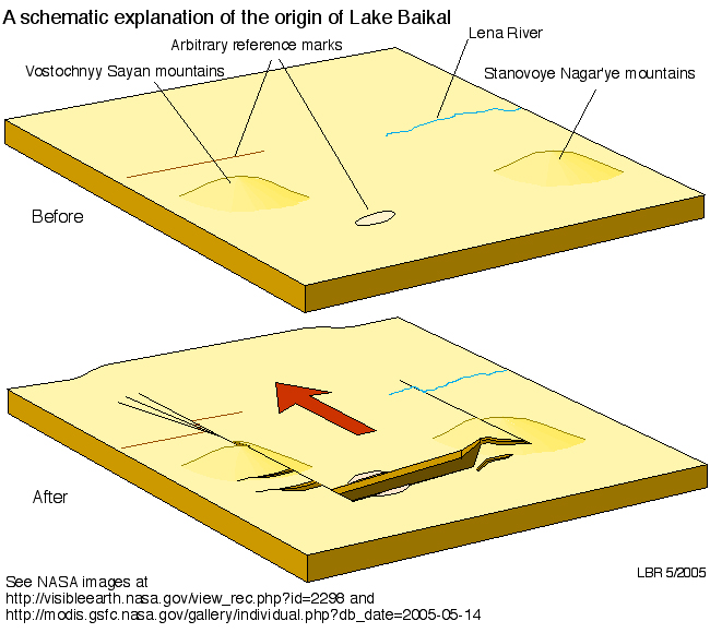
Notice that our red fault in the marked image does not extend beyond the south end of Lake Baikal. If the area with the big red arrow is moving northwest, but the area southeast of Lake Baikal isn't moving, Lake Baikal has to have pulled apart. We now see the origin of Lake Baikal: as the region with the red arrow moves northwest, Lake Baikal is the crack in the earth surface pulled open. That's why Lake Baikal is so long and deep. If that doesn't make sense, you can now look at a schematic sketch of the process, or you can wait until you've worked on the other end of the lake and seen the whole show.
The situation to the north:
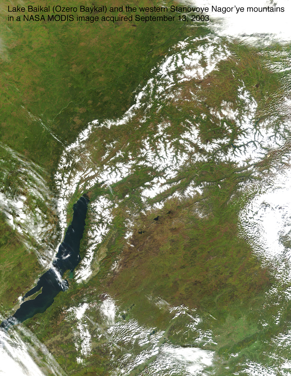
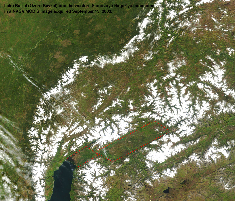
We now turn to the other of our two images and thus to the north end of Lake Baikal. Lake Baikal extends northeastward toward and into the Stanovoye Nagar'ye mountains, as you can see in the most general image.
A closer look shows that the lake ends - that is, the water-filled basin ends - but the valley extends farther northeast. The valley is a broad flat depression with the shape of a rhombus extending northweast from the northern shore of the lake, as should be evident in a more detailed unmarked image. If it's not evident, there's a marked image too.
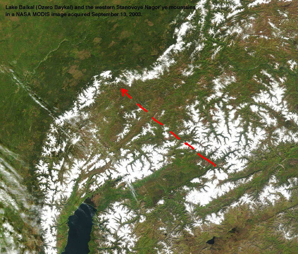
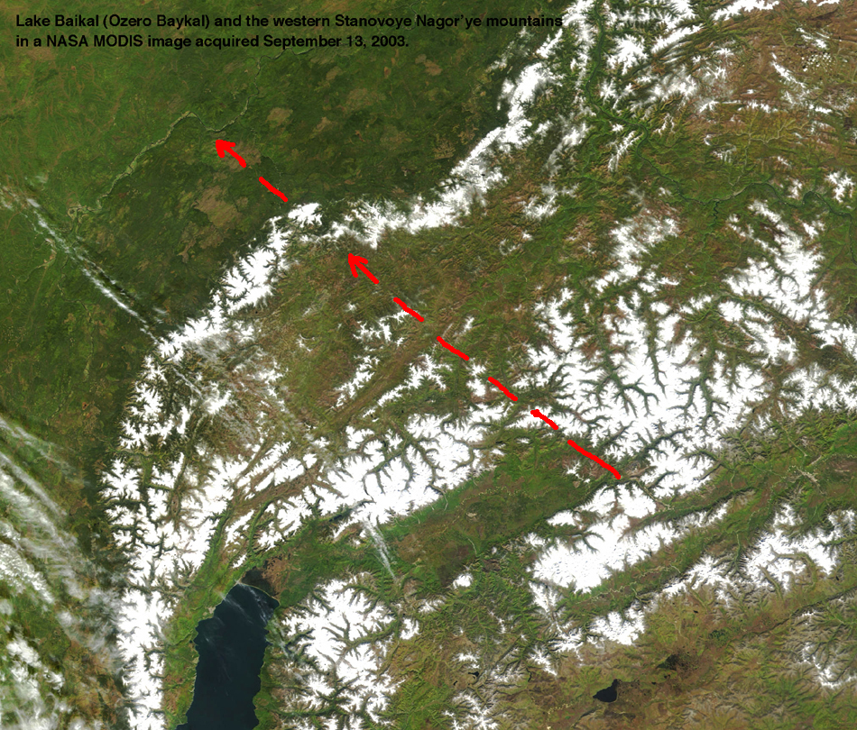
If we look at the north end of that rhombic plain, the end is straight and defined by a valley, as you can see in this marked image. What does a straight valley mean? A good first hypothesis would be that it is a fault.
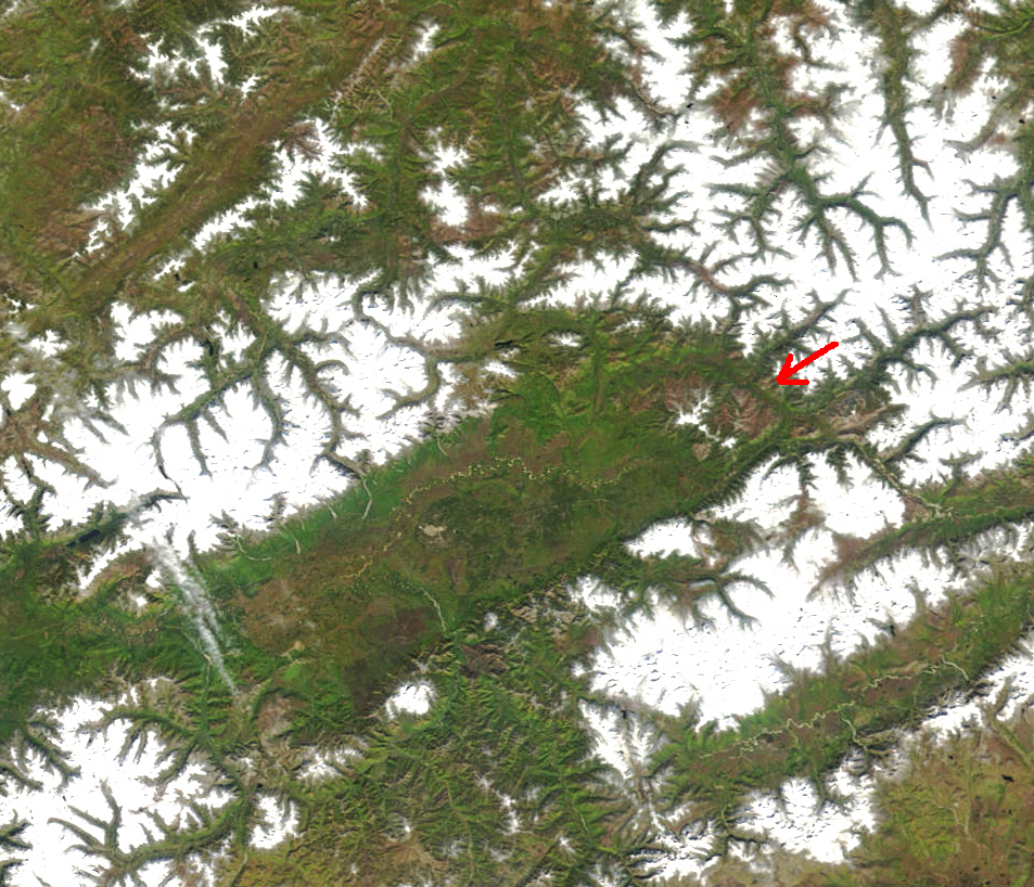
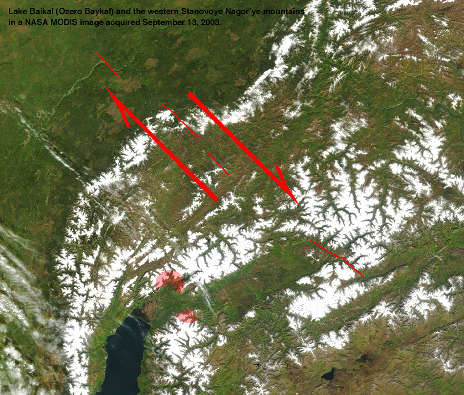
With that hypothesis in mind, let's extend the trend of the fault out to the northwest. If we do, we come to an interesting jog in the northwest margin of the mountains, as seen in this marked image. While you're there, take a look even farther northwest.
If we extend the trend even farther, we come to a very sharp jog in the Lena River, as seen in this image or at the arrows in this more detailed image.
So what can we conclude? Our hypothesized fault at the north end of the lake plain does indeed seem to be a fault - it cuts across other landscape features. So what is the sense of motion along the fault? If we use the same rules we used in Part I, we look at the jog in the margin of the mountains and in the Lena River and conclude that the block southwest of the fault has moved northwest and the block northeast of the fault has moved southeast. That makes it a right-lateral fault (the far side moves to the right) as shown in this marked image.
So what's this got to do with Lake Baikal? The rhomb-shaped basin extending northeast from the lake proper appears to have been pulled apart behind the northwest-moving block, just as we inferred for Lake Baikal. In fact, the romb-shaped basin is just an extension of the Lake Basin, but one with a much shallower floor.
The Origin of Lake Baikal - the inferred big picture:
At this point, we've seen that each end of greater Lake Baikal - the lake plus the rhombic basin - is bounded by a fault along which there has been horizontal motion (a strike-slip fault). At each end, we've seen the lake basin pulled open behaind a block moving the northwest. Put that together and you've got a model for the opening of Lake Baikal like this explanatory sketch. The area under the large red arrow has moved northwest, leaving a gap behind it that it Lake Baikal. Smaller and more shallow elongate basins have been pulled open too.
Final details:
In the sketch, notice how the bifurcating faults in the Vostochnyy Sayan mountains allow the cumulative motion along the main fault to be distributed onto smaller faults, each with less motion, so that the whole fault system dies out to the northwest.
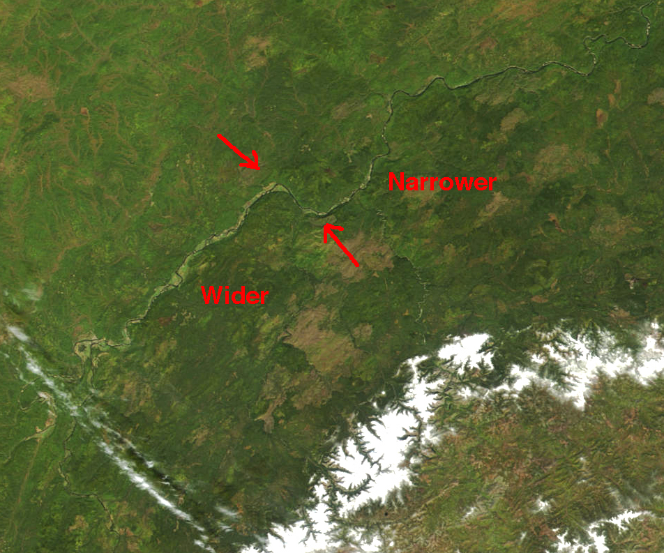
Notice how the width of the Lena River valley changes across the northern fault, as seen in the detailed image. The river valley is wider southwest of the fault, suggesting that the valley is being widened a little by the same pull that has widened Lake Baikal a lot.
Comparison with geologic maps:
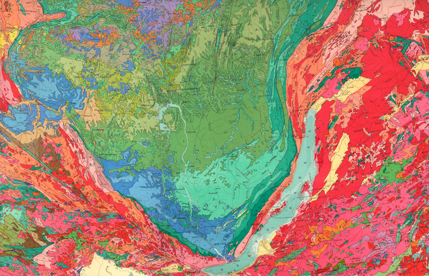
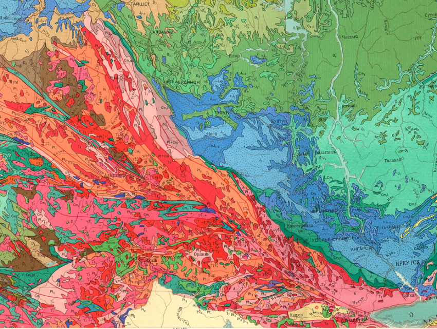
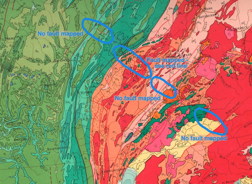
Thus far, we've interpreted these images as if we were looking at the surface of a planet from which we had no information from the surface. Clearly that's not the case: for example, this 1965 Geologic Map of the USSR produced at 1:2,500,000 scale provides an oppoortunity to compare our analysis from the sky with ground-based observations around Lake Baikal.
Our observations to the southwest of Lake Baikal are supported by geologic mapping. Faults are shown on this detailed view of the map as red lines, and we can see diverging red lines cutting SE-NW through the Vostochnyy Sayan mountains. We may not have seen all of these faults, but we certainly had the right general idea.
Our observations to the northwest of Lake Baikal don't fare so well in light of the geologic mapping. A detailed view of the map shows no fault where we inferred one at the jog in the Lena River. It does have a NW-SE trending fault at the offset in the western margin of Stanovoye Nagar'ye mountains. However, it shows no fault farther to the southeast where we inferred one, and no fault at the northeast end of the broad rhombus-shaped valley northeast of Lake Baikal.
What should we infer from the disagreement between our interpretation of the satellite images and the mapping by geologists on the ground? There are at least three possibilities. Explanation #1 is that our field trip leader was overly imaginative and flat-out wrong (certainly a possibility). Explanation #2 is that the field geologists missed a lot of clues about faults (far less likely). Explanation #3 is that examination of satellite images can provide hypotheses (in this case, the existence of a long NW-SE fault system) that can then be tested on the ground with an eye now inspired by the view from the air. Explanation #3 may be the best. What we need now is a real field trip!
The point of all this is that you can infer a lot about a region by looking at the landscape, either from the ground or, in this case, from the air. In your future travels, keep your eyes open for such things, and you'll be rewarded with insights and ideas about the land over which you're traveling.
Back to The main page for Railsback's virtual field trips
Back to Railsback's main page
Back to the UGA Geology Home Page