|
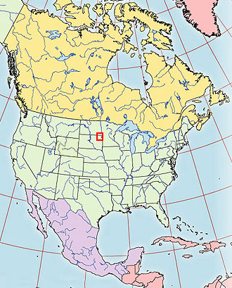
This virtual field trip takes us to an unusual landform in northeastern South Dakota (with a bit in North Dakota and at least a flank in Minnesota). It's the Coteau des Prairies, a flatiron-shaped plateau left between the paths of two streams of glacial ice during the Wisconsinan glaciation of North America.
|
|
|
|
|
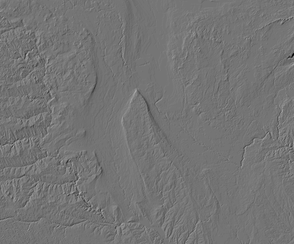
Let's begin with the best view of the Coteau des Prairies, the view from above. On the U.S. Geological Survey's digital shaded relief image, the Coteau des Prairies is a striking feature, living up to its name as the "Slope of the Prairies".
|
|
|
|
|
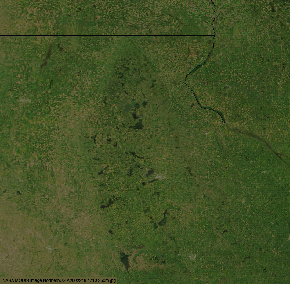
The Coteau des Prairies is a little less striking in the NASA MODIS true-color image, which is at slightly higher resolution. The northern tip of the Coteau des Prairies just reaches the east-west border between North Dakota and South Dakota. The dark spots atop the Coteau des Prairies are ponds and lakes.
|
|
|
|
|
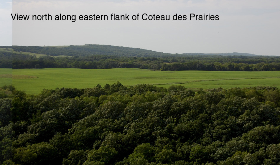
With that introduction from above, we can approach from the east with the morning sun behind us:
|
|
|
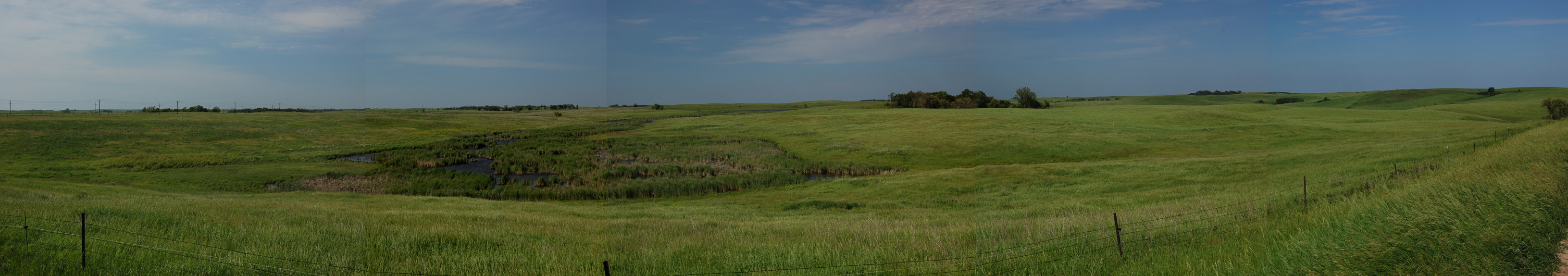
Of course, the view above is just a little of the length of the Coteau des Prairies. Here's a longer view, with links to larger versions:
|

|
| 2000 x 171 panorama 7680 x 658 panorama |
|
|
|
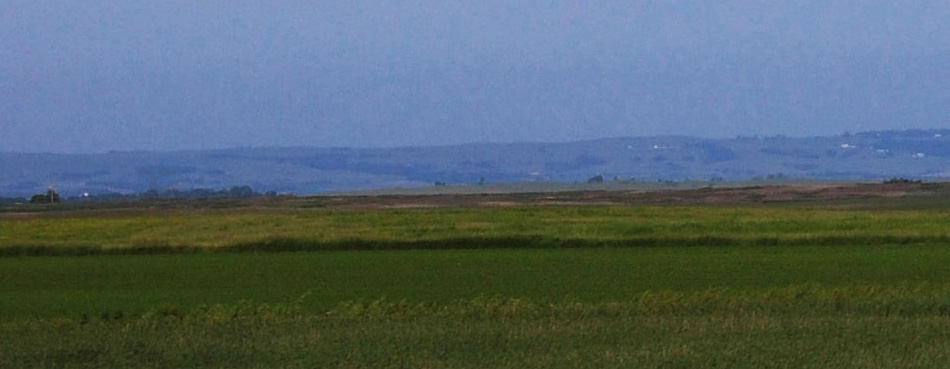
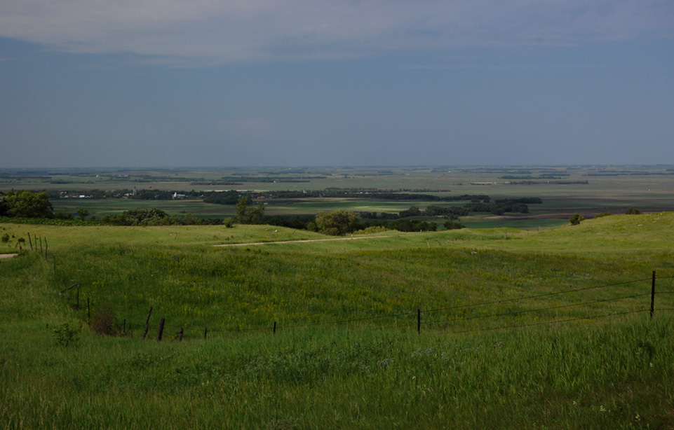
At this point, you may have been squinting enough to wonder if this Coteau des Prairies is much of a feature - after all, the eastern Dakotas are hardly known for topographic prominences. To answer that question, here's a view from an observation tower along South Dakota Highway 10 on the side of the Coteau des Prairies:
|
|
|
|
|
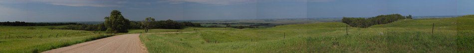
That's just a little bit of a 360-degree panaroma from the observation tower on the side of the Coteau des Prairies, which is available as the large, larger, and huge images linked below:
|

|
| 2000 x 143 panorama 9000 x 642 panorama 16,782 x 1198 panorama |
|
|
|
Let's move up onto the crest of the Coteau des Prairies, at a location a little farther north, for the view off the Coteau des Prairies to the east:
|
|
|
|
|
That's just a little bit of a panaroma from the same spot. Below this somewhat cropped sample of the panorama is a link to a larger version of the cropped image and the link for the large uncropped panorama:
|
|
| 2000 x 228 cropped panorama Full 7680 x 672 panorama |
|
|
|
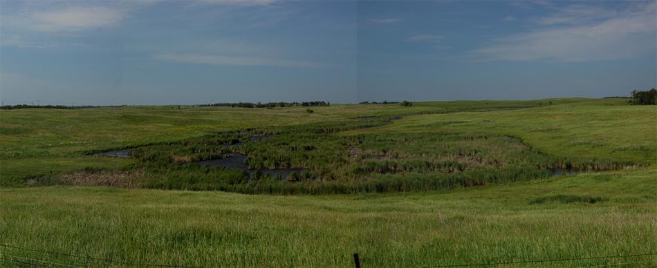
Finally, let's look around on top of the Coteau des Prairies. This cropped image shows that the top is indeed pocked with ponds; the links below it are to a broader panorama.
|
|
| 2000 x 352 panorama Full 3262 x 574 panorama |
|
|
|
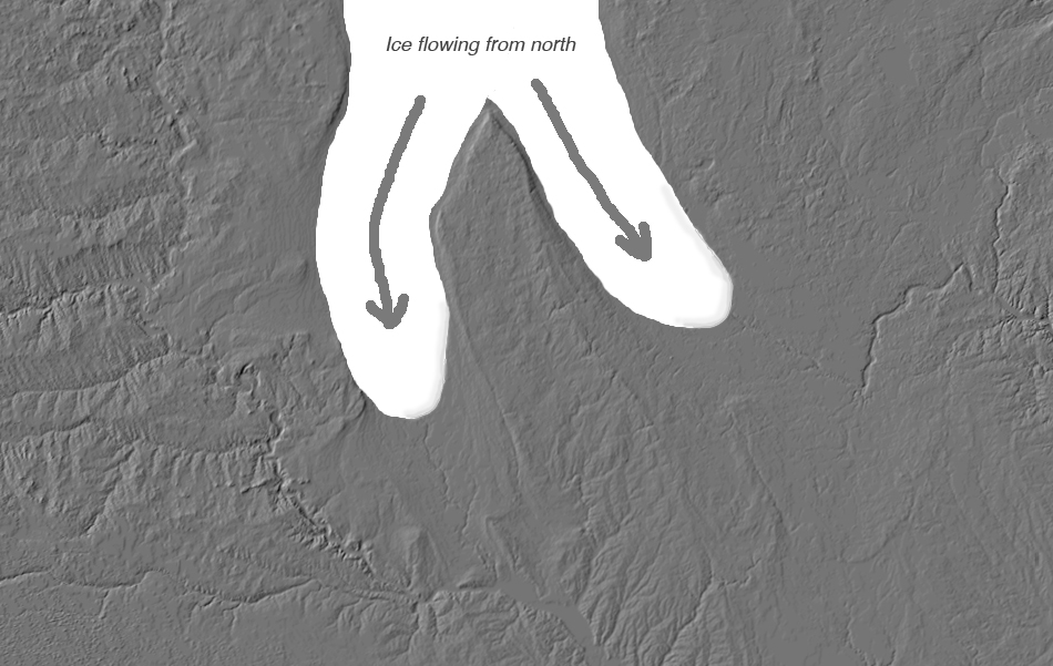
So what is this thing again? It's the Coteau des Prairies, the divide between the paths of two streams of glacial ice during the Wisconsinan glaciation of North America. The modified image below tries to envision the flow of the ice. Note the arcs of moraines on the modern landscape to the south of each of the lobes of ice envisioned here. Most noticeable is the arc to the southeast, which defines the limit of the Des Moines Lobe.
|
|
|
|
|
All that ice is a cool thought on a hot South Dakota summer's day. Hope you enjoyed the trip!
|
Back to The main page for Railsback's virtual field trips
Back to Railsback's main page
Back to the UGA Geology Home Page