|
In our continuing investigation of mountain streams and the valleys through which they flow, we're going up the East Fork of the San Juan River in southwestern Colorado. We're just east of Pagosa Springs, Colorado, and just west of the Continental Divide.
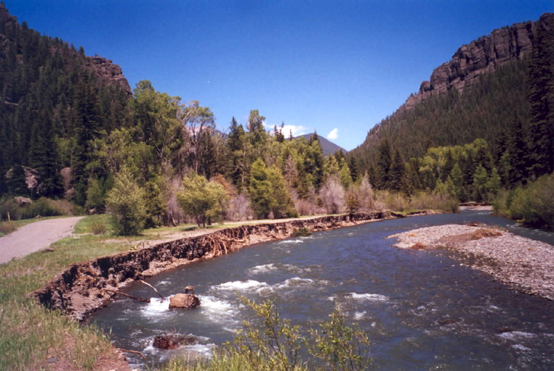
In our first view, we're looking upstream at a rapidly flowing mountain stream. To the left, the stream has cut a bank to expose some sediments that it deposited in the past. It's also presently depositing or reworking a gravel to our right.
|
|
|
|
|
|
|
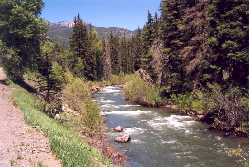
At our next stop upstream, we now see a classic rushing mountain stream. Here the valley is narrow, and its "V" shape allows for no floodplain.
|
|
|
|
|
|
|
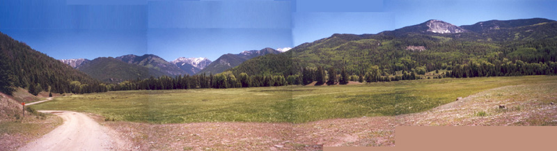
As we progress upstream to higher elevation, we might expect the narrow cayon to persist as we move up into smaller and smaller valleys.
Actually, we find just the opposite: the valley widens into a beautiful broad floodplain, as seen in this panorama. The stream is now off to our right in the trees across this flat floodplain from us. Click on the image to access a larger view.
|
|
|
|
|
|
|
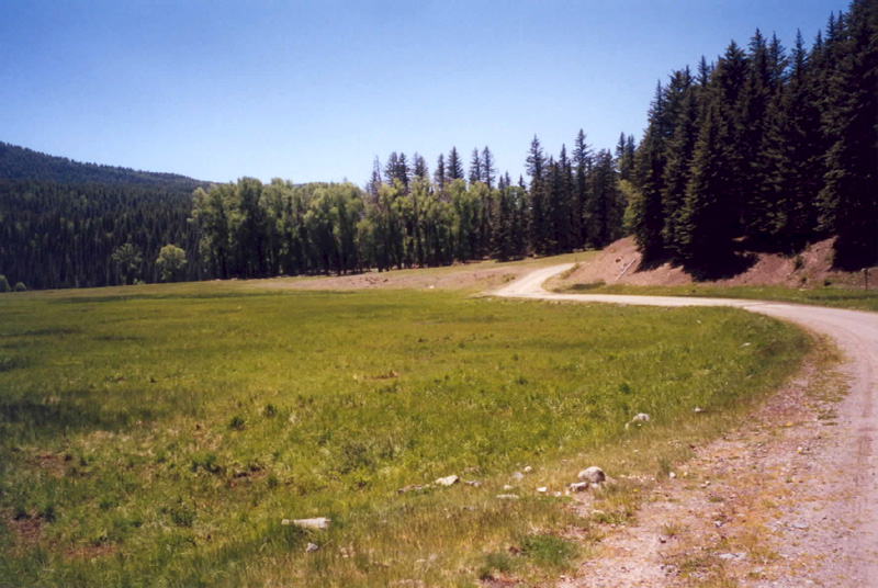
So why is there a flat-bottomed valley so high up? After, we're at an elevation of about 8300' (2530 m), and we're only about four miles from the continental divide. The answer emerges if we go along the road to the left where it just goes into the trees, turn around, and look back.
|
|
|
|
|
|
|
As we look back, the viewpoint for our panorama is at the point where the road disappears, which we see was on a bit of higher ground. In fact, the brown area on which we were standing slopes out into the floodplain, and it consists of loose rocks and finer material. It's an old landslide. It's what has dammed up this valley, making the floodplain upstream from it.
So who cares? Even if you're not interested in the origin of this beautiful alpine plain, you might consider that the porous sediments in this plain hold a lot of groundwater. In times of drought, water drains from this plain, keeping water flowing in the stream, so that it doesn't go dry. On the other hand, during heavy rains or during spring snowmelt, the sediments act as a sponge to store the rainwater or meltwater, so that the stream doesn't flood so much. The sediments act to moderate the flow of the East Fork downstream, maintaining flow in dry seasons but lessening flow in floods.
|
