|
This virtual field trip takes us to the eastern margin of the Front Range, the eastern boundary of the Rocky Mountains in Colorado. We'll also see Colorado's famous hogbacks, which are ridges of upturned sedimentary rock.
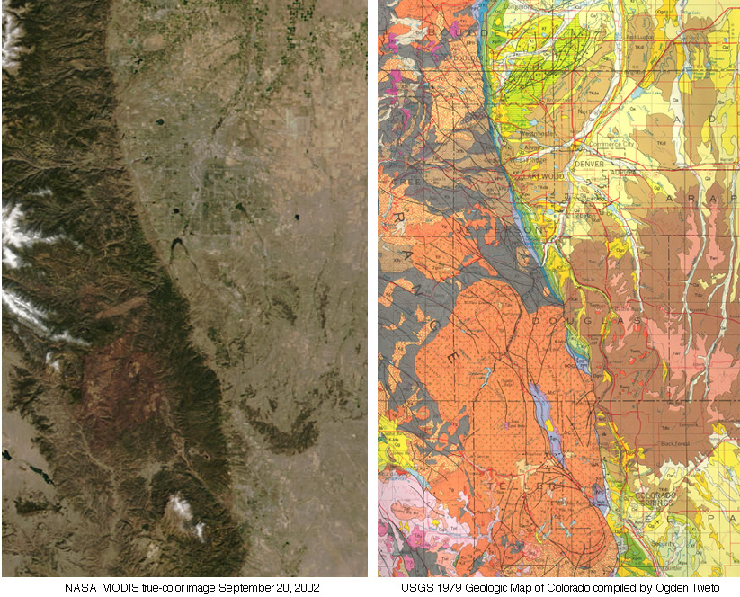
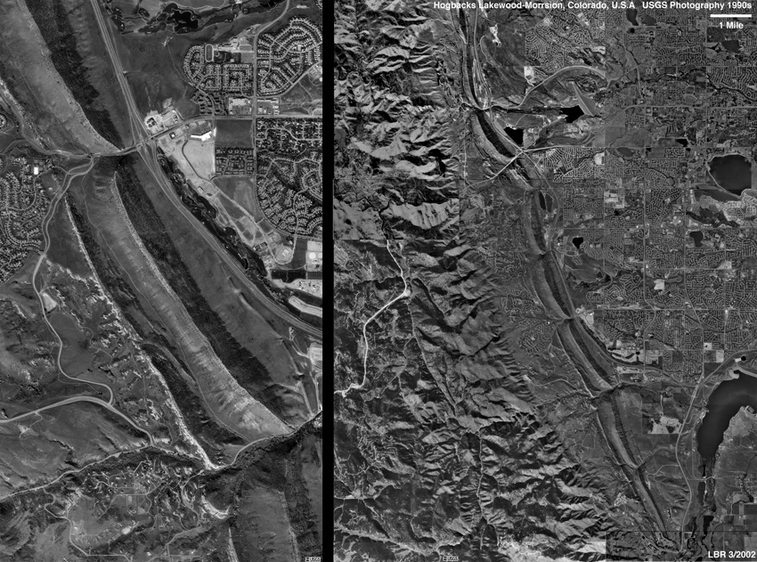
The transition from the Great Plains to the mountains of the Front Range is obvious on any satellite image or geologic map. Here are both, with Denver a little above center and Colorado Springs toward the bottom:
|
|
|
|
|
|
|
|
|
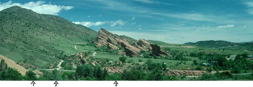
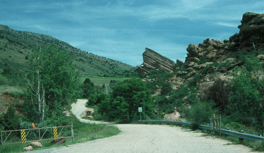
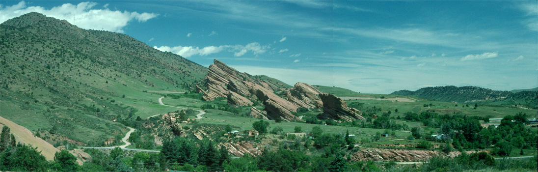
Our trip takes us to two localities, one west of Denver and one west of Colorado Springs. Let's begin by going to Morrison, Colorado, the site west of Denver. Here's the view from Red Rocks Vista, looking north. Bear Creek and Colorado Highway 74 run left-to-right in the foreground and Red Rocks Park, among other things, is in the background. Admire the view, and then ask yourself: Do you see a geological transition?
|
|
|
|
|
1096 x 350 version 2192 x 700 version
|
|
|
|
Do you see a fault? An experienced geological observer would see a high ridge to the left with at most a few scattered ragged exposures of rock, whereas a prominent ridge of sedimentary rock juts up in the middle image but is nowhere to be seen to the left. The road that we see going away from us on the left side of the image seems to separate two rather different areas. That observation provides us with a hypothesis: maybe there's a fault between two different kinds of rock.
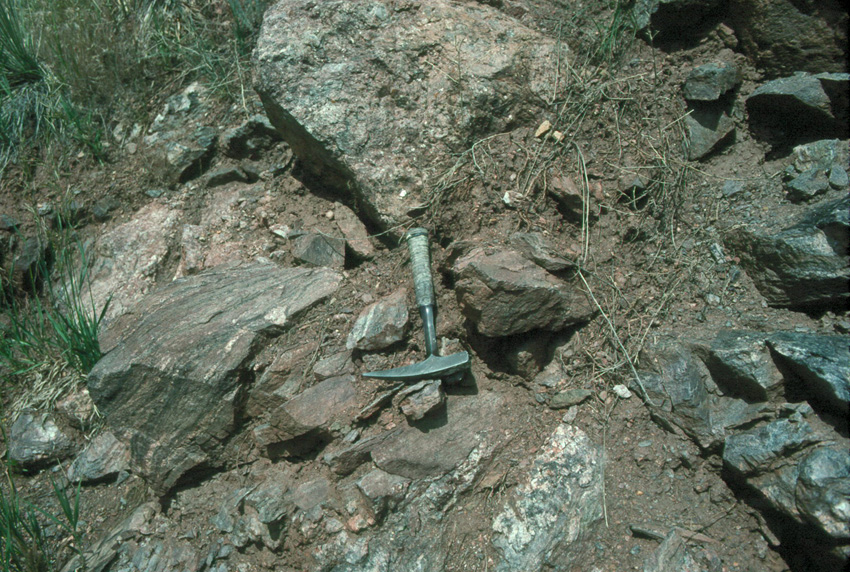
We can go down along Highway 74 to test that hypothesis. We'll go to Locations 1, 2, and 3 and see what we find. Here's the rock that we encounter at Location 1. Can you identify it?
|
|
|
|
|
|
|
At right and top center you can see some of the shininess of foliated rock, and at center and left you can see layering. These are pieces of gneiss, a high-grade metamorphic rock. If we go on up Highway 74
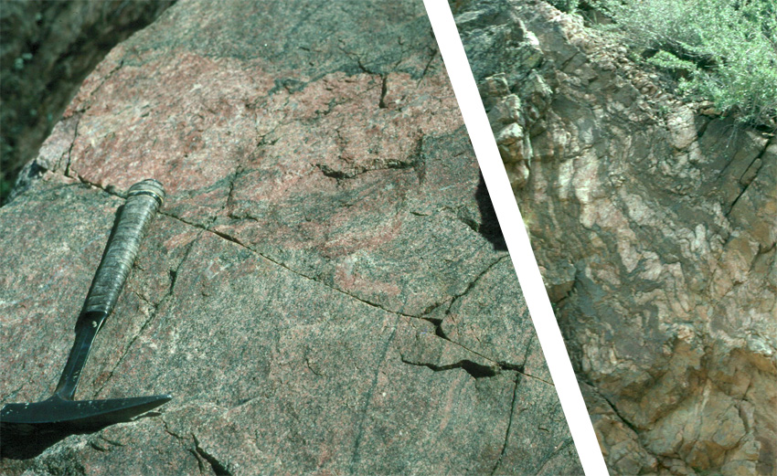
to the left out of our panorama above, we find more gneiss with its squiggly layers, and bits of granite:
|
|
|
|
|
|
|
From our observations of gneiss and granite along the road, it appears that the high ridge consists rocks from deep in the crust. Let's move along to Location 2:
|
|
|
|
|
|
|
The image above looks up the road for Entrance 4 of Red Rocks Park, and again we see the sharp contrast between the high slope to the left and the dipping rocks to the right. In fact, the road seems to coincide with the geologic boundary.
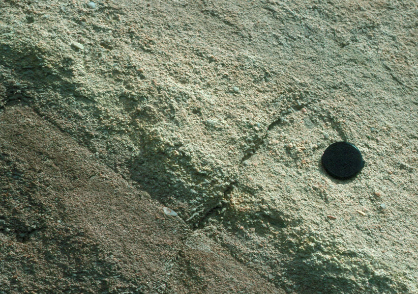
Let's move along to Location 3. What kind of rock do we have here?
|
|
|
|
|
|
|
We can see sand grains and even pebbles - it's a coarse sandstone. It has certainly not been exposed to the high temperatures and pressures that produced the granite and gneiss that we saw earlier.
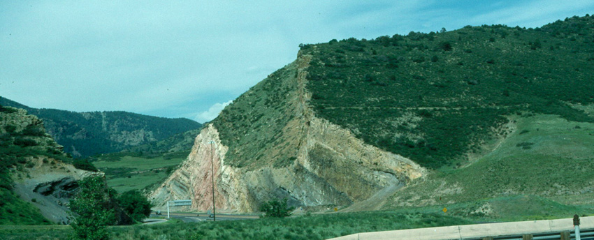
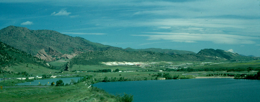
Let's move farther to the right in our original panorama (i.e, to the east), so far that we reach the ridge at the far right. Here's what that ridge looks like:
|
|
|
|
|
|
|
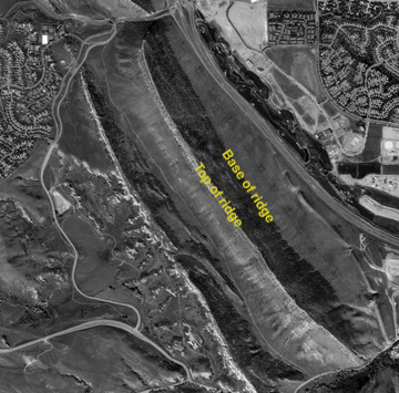
That ridge consists of distinctly layered sedimentary rock too. Note in the image above how the layer nearest us, the uppermost layer, gives a planar surface to the east side of the ridge. That shape of the ridge extends for miles, and the ridge is called a "hogback". In the next image, let's step back and look along the ridge. If you have trouble seeing the hogback ridge, you can look at a marked image too.
|
|
|
|
|
Alternate marked image
|
|
|
|
The Hogbacks extend along the east side of the Front Range, as you can see in the aerial photographs below. The image on the left is a small part of the one on the right. The illumination is from the lower left, and the dominant feature to the left of the highway should be the dark shaded planar surface of the hogback sloping to the northeast. If you have trouble getting three-dimensional aspect right, there's another marked image too.
|
|
|
|
|
|
|
In the right-hand image above, you should see several hogbacks, strung along like sausages. The layer noted above that defines their planar eastern slope is the Dakota Sandstone, and so these are the Dakota Hogbacks. The breaks between them are where streams flowing from west to east have broken through the ridge. To the west are the mountains of the Front Range.
So how did all of this come to be?
----------------------------------------------
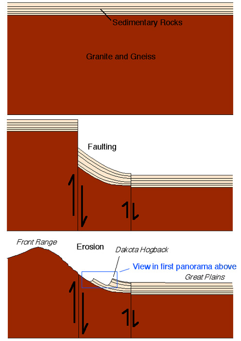
The conventional explanation of the geology that we've seen is that the Front Range has been uplifted along a major fault, or a series of faults. That uplift has exhumed granites and gneisses from deep in the crust, and any sedimentary layers on top of them have been removed by erosion. East of the fault systems, those layers survived, and they have been upturned by "fault drag", as shown below. That's why we have our hogbacks. Here's a very simplified three-step sketch:
|
|
|
|
|
|
|
That ends the part of the trip west of Denver. You can stop here, or you can go on to the much more brief treatment of our second major stop, which is west of Colorado Springs.
|
|
|
|
|
|
|
| ----------------------------
Acknowledgements and sources: The account provided above is based in part on Weimer, R.J., and LeRoy, L.W., 1986, Paleozoic-Mesozoic section: Red-Rocks Park, I-70 road cut, and Rooney Road, Morrison area, Jefferson County, Colorado, in Beus, S.S., ed., Centennial Field Guide Volume 2 - Rocky Mountain Section of the Geological Society of America, p. 335-338.
|