|
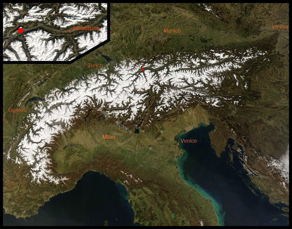
This virtual field trip takes us to a landslide in the Kalkalpen (the Calcareous Alps or Limestone Alps). We'll be near the town of Haiming in the north side the Inntal (the valley of the Inn River) in Tirol, a land (state) in western Austria. The image below, a NASA MODIS true-color image, shows with a red dot the location of the Haiming landslide west of Innsbruck.
|
|
|
|
|
|
|
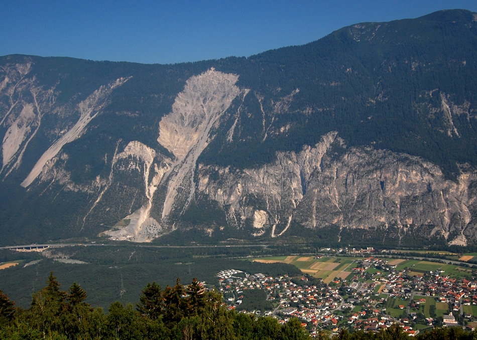
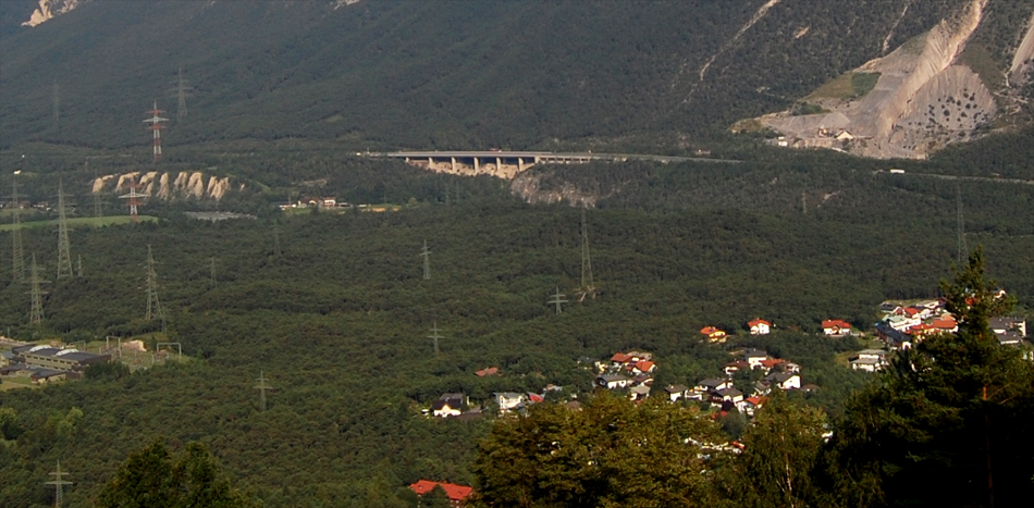
We'll begin with our most distal and highest view, from atop the south side of the Inn Valley. The main thing to see is the huge landslide scar on the side of the Tschirgant, the ridge of limestone on the north side of the Inn Valley. At lower right is the village of Haiming, with its pink church at the very lowest right. The east-west autobahn runs below the Tschirgant ridge. The Inn does likewise, just a bit closer to us.
|
|
|
|
|
|
|
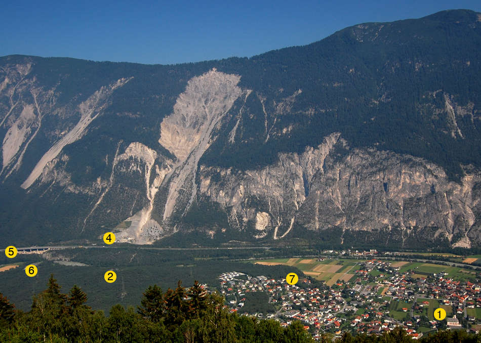
We'll look at the landslide from several perspectives. The image below is the same as the one above, but with some of our viewpoints labeled.
|
|
|
|
|
|
|
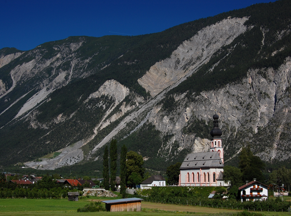
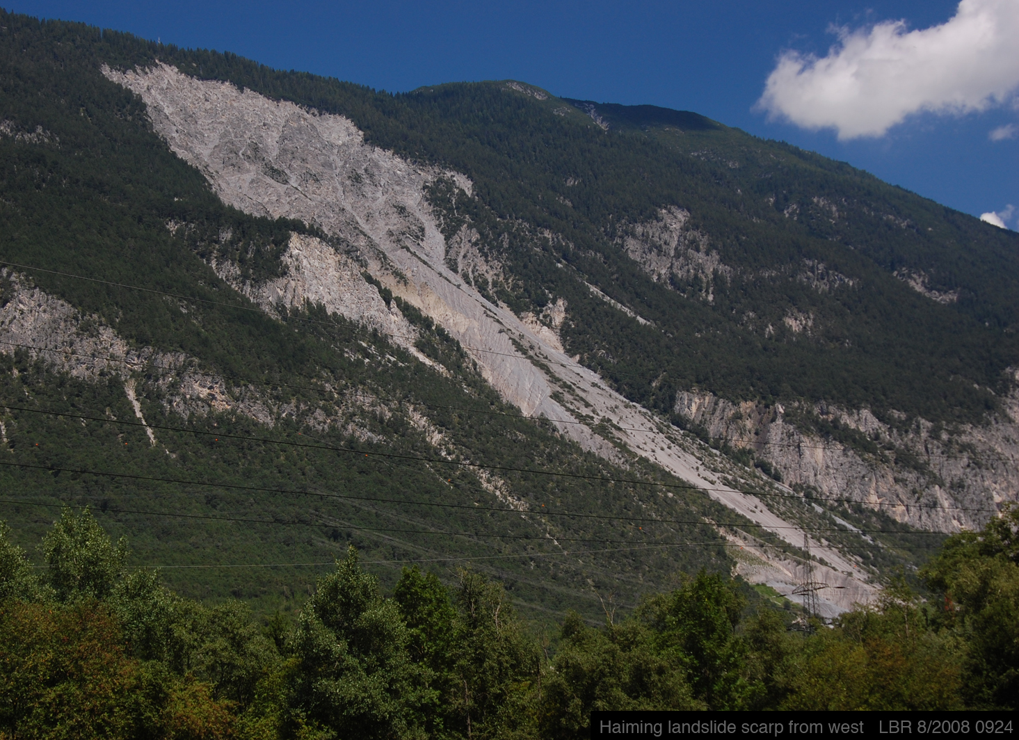
So let's go down to the valley floor to look at the lanslide's scar. Our first view is from the east, from Point 1 in the image above, and thus from near the church in Haiming:
|
|
|
|
|
|
|
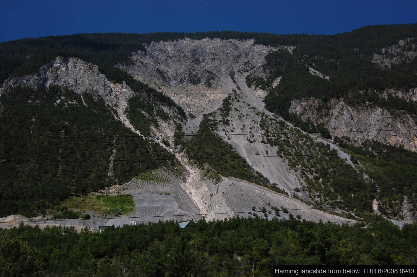
Our second view is from below the scar, from Point 2 on the image above:
|
|
|
|
|
|
|
Our third view is from the west, near the suspension bridge between Ötztal Bahnhof and Schlierenzau, which is a Point 3 too far west to be on the image above:
|
|
|
|
|
|
|
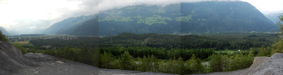
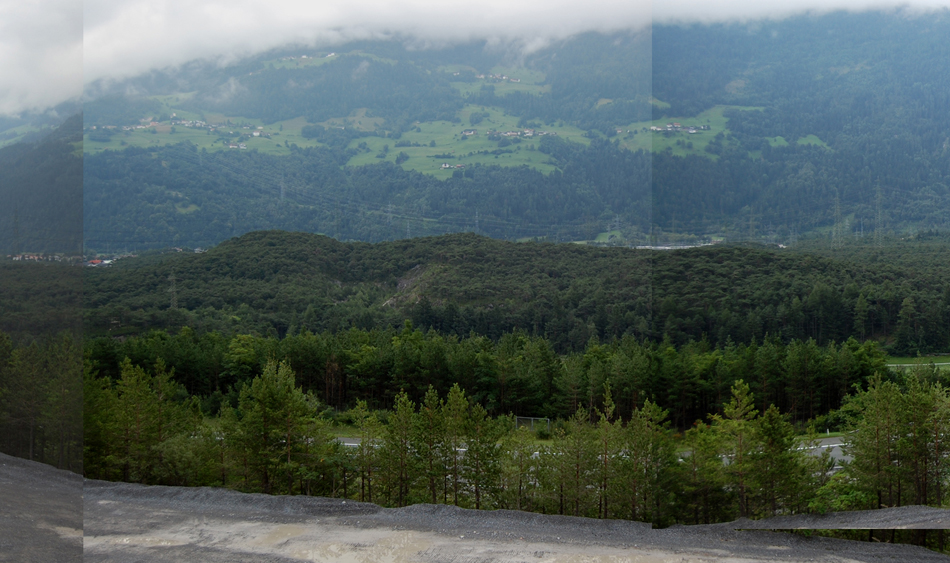
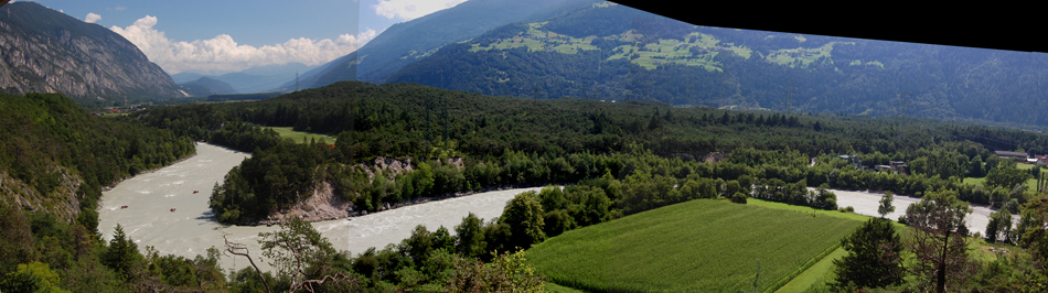
Hopefully we've persuaded you that it's a very large and very fresh-looking scar of a landscape. We'll now look at the valley floor below the scar, and thus at the landslide deposits. We'll begin with a a view from the toe of the scar, or at Point 4 in the image above. Of the two images below, the first is a panorama, and the second the central part of that panorama:
|
|
|
|
|
|
|
|
|
|
The thing to note in the image above is the hummocky landscape of the landslide deposits. You can see the same in the image below, which looks east from Point 5. Compare the hummocky topography of the landslide deposits at center-left with the flat floodplain of the Inn at lower right.
|
|
|
|
|
|
|
We can also go back to the south side of the valley to get a view of this hummocky landscape:
|
|
|
|
|
|
|
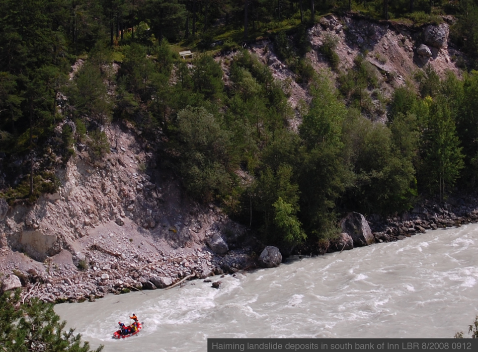
Now we can start looking at the landslide deposits themselves. In the image below, looking from Point 5, you can see the rubbly nature of the sediment exposed in the cliff cut by the river (with rafters for scale below and a park bench for scale above):
|
|
|
|
|
|
|
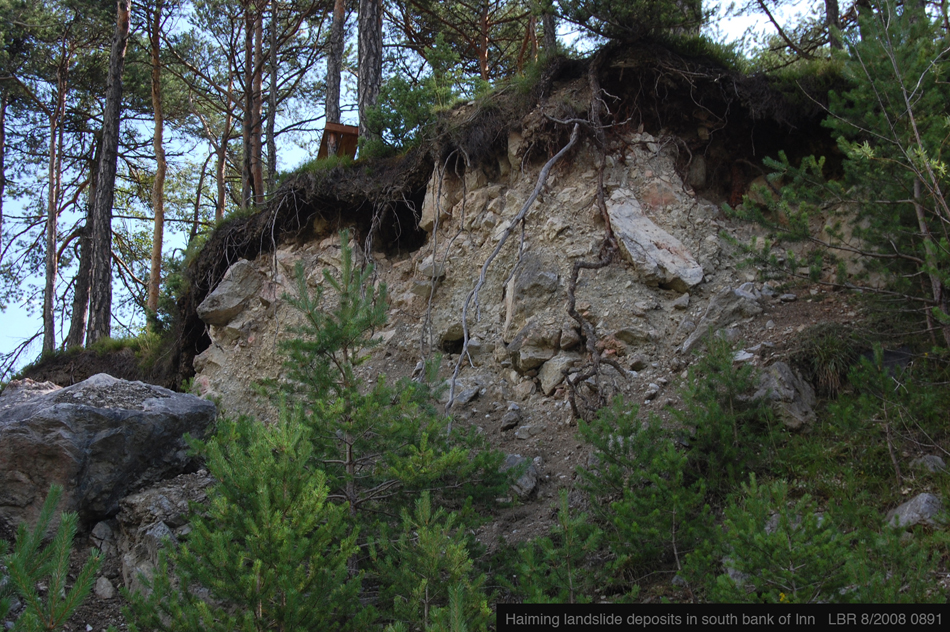
If we go down to Point 6, next to the river, we can see this close view of the landslide deposits, which prove to be a jumble of rocks of all sizes:
|
|
|
|
|
|
|
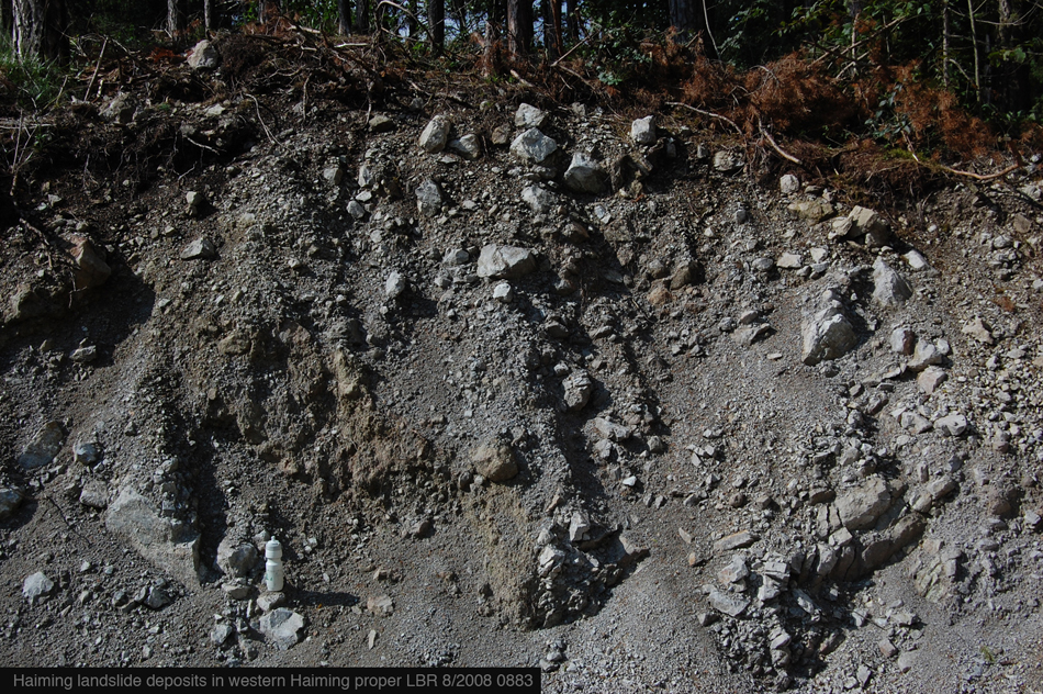
For another view of these deposits, let's go back to Haiming, to Point 7. There's a water-bottle for scale:
|
|
|
|
|
|
|
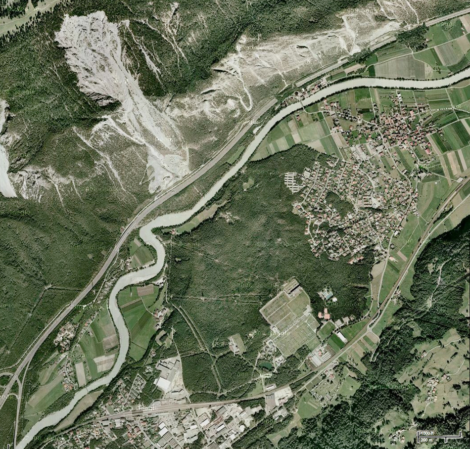
Finally, let's get the truly big picture. The image below is a true-color satellite image swiped from Google Maps. Haiming is to the upper right (you can see the gray-roofed church, the largest building), Ötztal Bahnhof is at the lower left, the landslide scar is to the upper left, and the landslide deposit is in the dark green area in the lower middle. Things to note include . . .
The hummocky surface of the landslide deposit, which is typical of landslide deposits
The extent to which the western, and newer, part of Haiming has encroached on the landslide deposit. In contrast, the old-timers who knew their landscape and were not pressed for real estate did not build there.
The path of the Autobahn (the gray strip to the left of the river) directly under the landslide scar. In contrast, the railway built much earlier swoops through the lower right of image, in a much less vulnerable part of the valley.
The subtle meanders of the Inn just up-river (to the lower left) of where the landslide deposit blocked the river's course. The Inn above Hall typically runs straight, without meanders, but the local effect of the landslide slowed the river's descent enough that it meanders a bit here.
|
|
|
|
|
|
|
|
|
. . . and with that we'll end our visit to Haiming. Wiederschauen!
|
|
|