|
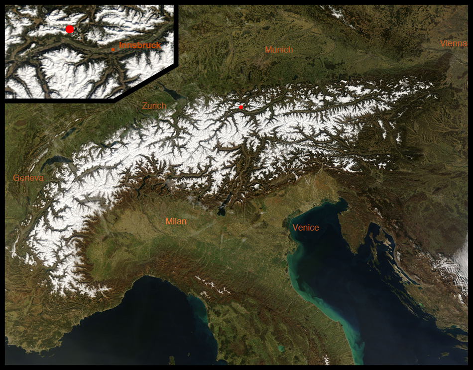
This field trip takes us to a striking mountain in the Alps that has lost half its top to a huge landslide. The mountain is Hohe Munde ("High Mouth"), a peak in the Kalkalpen (the Calcareous Alps or Limestone Alps) above the town of Telfs on the north side the Inntal (the valley of the Inn River) in Tirol, a land (state) in western Austria. The image below, a NASA MODIS true-color image, shows with a red dot the location of Hohe Munde west of Innsbruck.
|
|
|
|
|
|
|
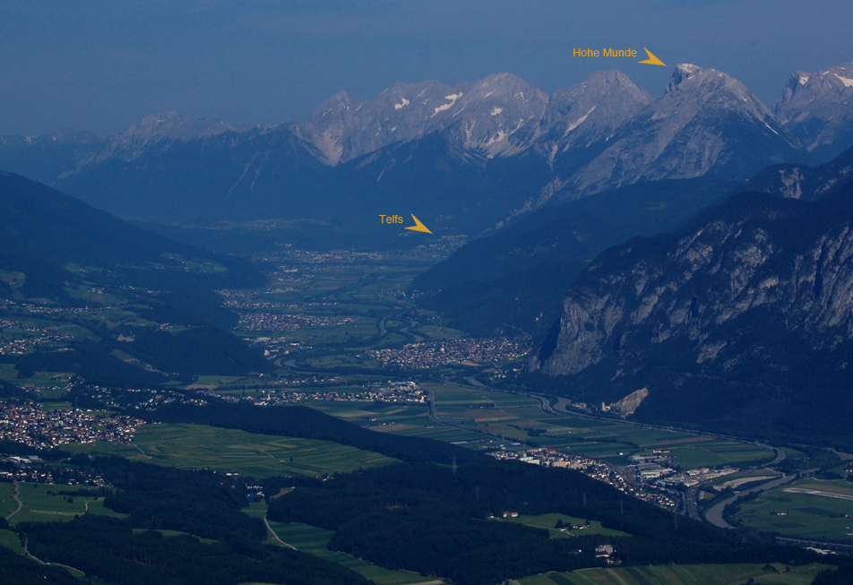
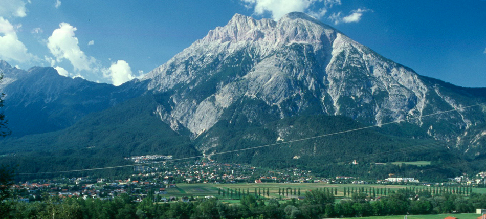
We begin our trip from afar, with the image below. We're standing south of Innsbruck, on the rounded mountaintop called the Patscherkofel, and we're looking west up the Inn Valley. The gray peaks on the right-hand side of the Inn Valley are mountains of the Calcareous Alps. If it seems that half of Hohe Munde is missing, that's the point of this trip.
|
|
|
|
|
|
|
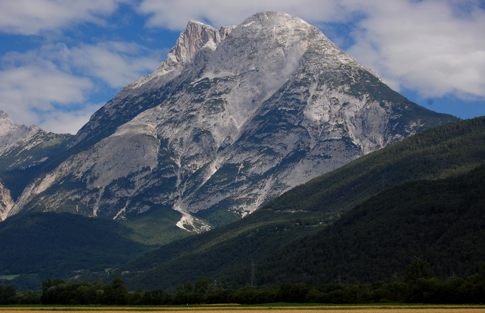
With the next few images, we'll approach Hohe Munde and swing around to see it from the southwest side. We'll begin that approach by going down on the valley floor for the view shown below, from near Hatting, a village west of Innsbruck.
|
|
|
|
|
|
|
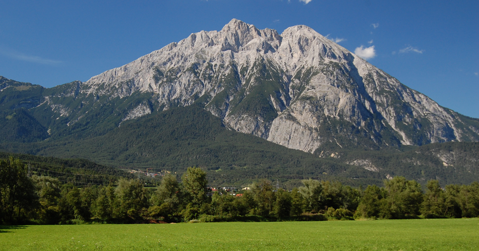
We move westward, and thus up the Inn Valley, and so begin to see more of the southwest face of the mountain in this image from just east of Oberhofen:
|
|
|
|
|
|
|
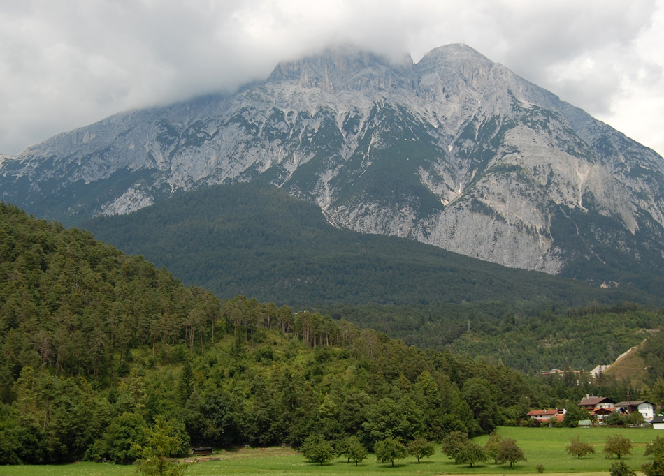
We'll go up a bit on the south side of the valley, into the village of Pfaffenhofen, for this view, which now includes the town of Telfs:
|
|
|
|
|
|
|
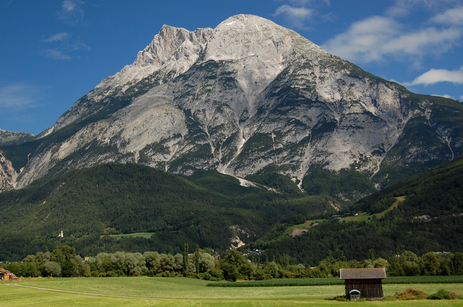
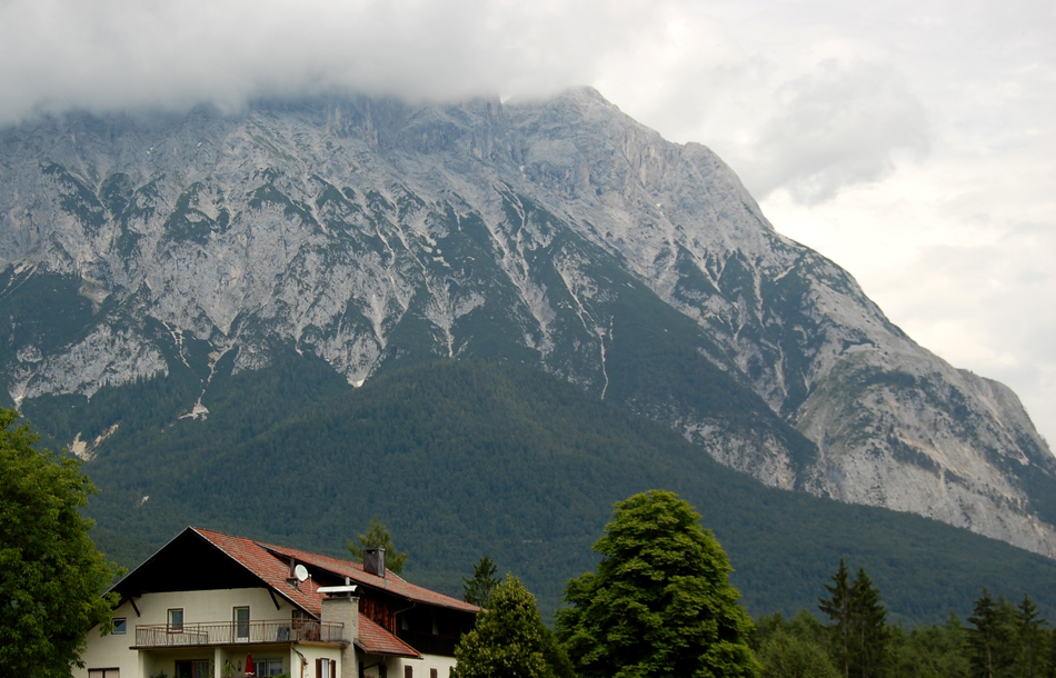
We now get around to the southwest side of Hohe Munde and see what happened to that missing half of the mountain that we noticed from afar. It's now the green triangular slope below the gray barren limestones - and it's a huge landslide deposit. The image below is from the Inn floodplain west of Telfs:
|
|
|
|
|
|
|
The next two images continue to swing around to the west of Hohe Munde. The first below is from along Highway 169 west of Telfs, and the second looks over the Gerhardhof guesthouse a bit farther north and higher up.
|
|
|
|
|
|
|
|
|
|
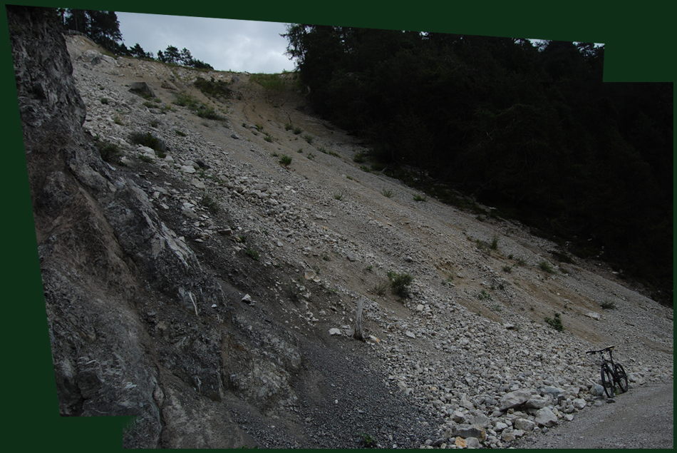
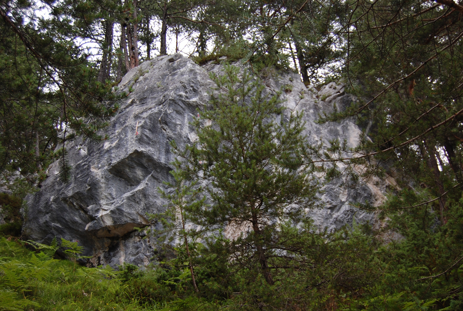
So, having circled our quarry (which is a bit of a pun here), it's time to go look at it in detail. We'll make our way up above the Griesbach, and north of the Gasthaus Lehen, to some exposures on a nearly abandoned road. Let's begin at a large exposure resulting from construction of the road, with our field vehicle for scale:
|
|
|
|
|
|
|
It's a huge jumble of limestone blocks and smaller debris, as this closer look below confirms:
|
|
|
|
|
|
|
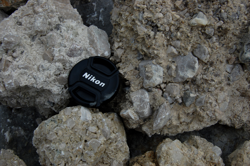
Included in this material are chunks of limestone breccia, probably landslide breccia lithified and then remobilized:
|
|
|
|
|
|
|
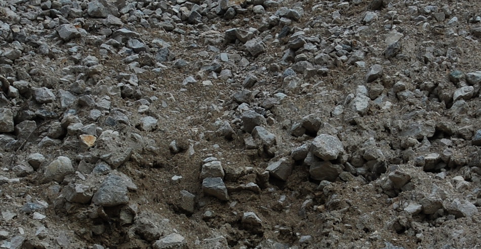
Now let's walk along the road to examine some smaller but instructive exposures. Here's an exposure showing a range on particle sizes in the landslide substrate, with our field vehicle again for scale. Note the brown soil developed on the whiter chemically unaltered limestone:
|
|
|
|
|
|
|
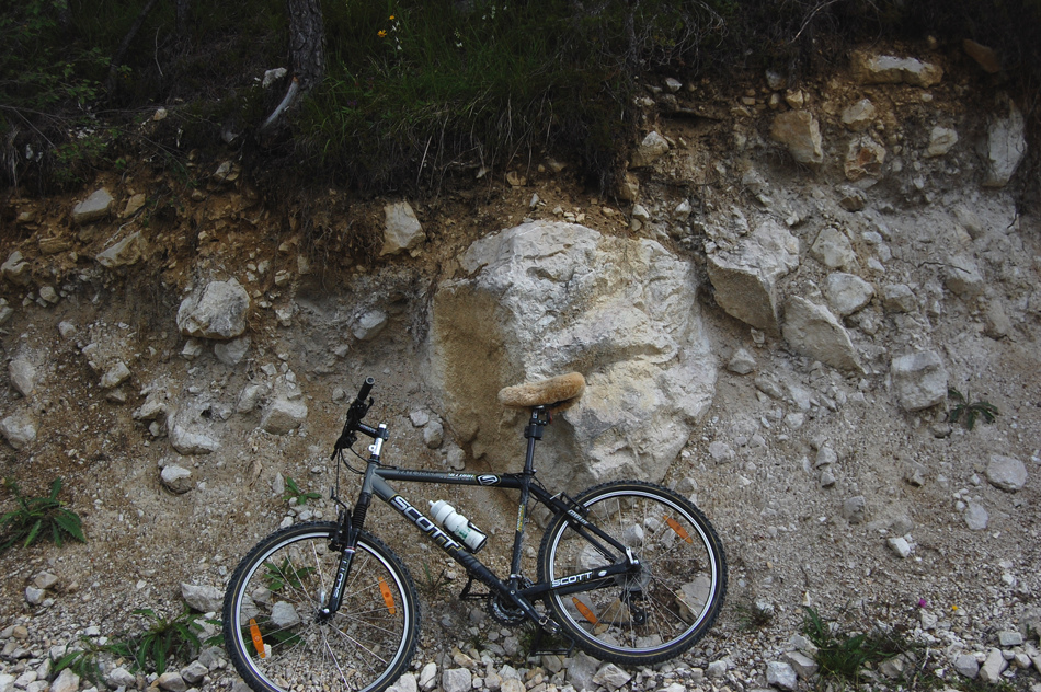
Our next view shows a larger clast:
|
|
|
|
|
|
|
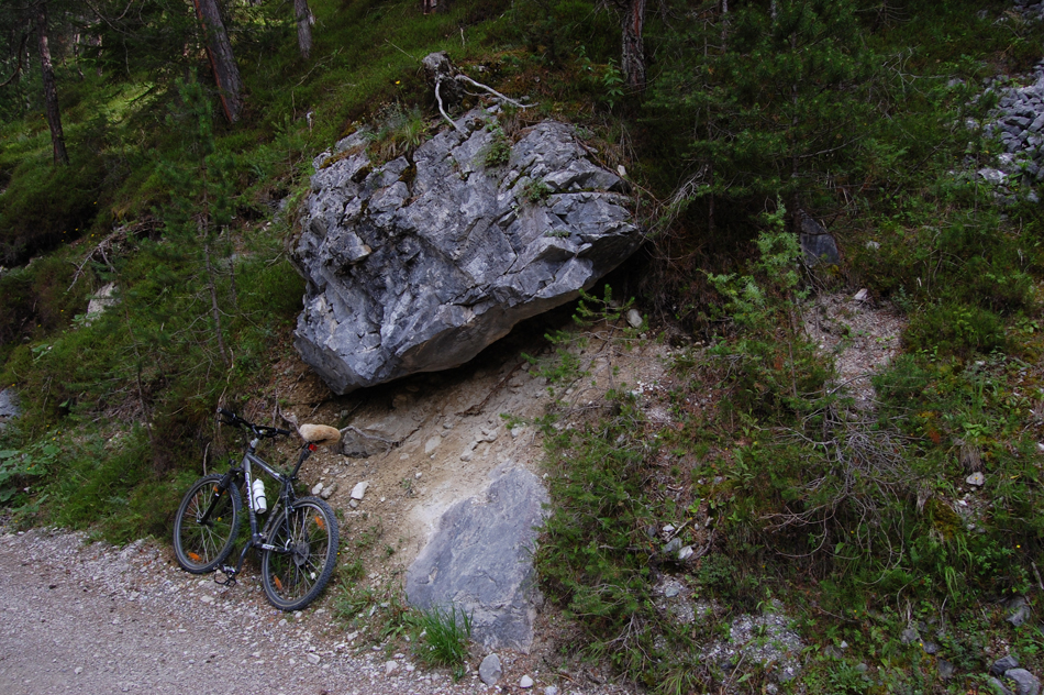
. . . and our last view shows a house-sized clast, large enough that rock climbers use it as a training site and leave their caribiners have from it:
|
|
|
|
|
|
|
The size of the clast shown above illustrates a problem for geologists working in areas of landslides: one could easily mistake such a large clast for an outcrop of bedrock. More than one geologist has measured the strike and dip, or orientation, of bedding in a large rock mass in order to map the bedrock and only later realized that he or she had measured the orientation of a boulder that had rolled to its present position.
. . . and here's one last thought. If you've hiked in mountains and, in looking at these pictures, thought to yourself "these exposures with the bike for scale look like a lot of the mountainsides I've walked over - I don't see anything unusual here", you're absolutely right. One of the realizations to which one comes in looking a mountain landscapes is that much of the landscape, especially on the flanks of mountains, consists of landslides. This trip just happens to have visited a large and obvious landslide below the mountain from which it so obviously descended.
|
|
|
|
|
|
|
|
Wiederschauen!
|
|
|