
Hypothesis 4: Some other origin that we haven't thought of yet.
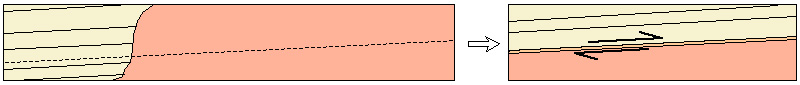
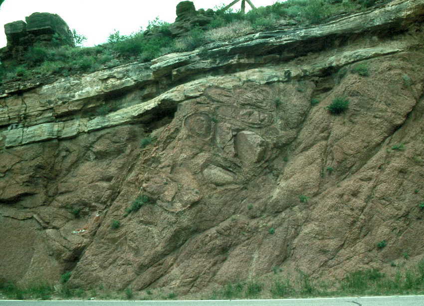
Our job now is to see what evidence supports or disproves these hypotheses, so that we can eliminate some or all and perhaps gain greater confidence in one of them. For example, we can go right up to the contact and look at the underside of the sandstone. If Hypothesis 1 were correct, we might expect to see that the sandstone had been baked by the heat from the granitic magma, and perhaps recrystallized. If Hypothesis 2 were correct, we might expect to see ground-up or pulverized rock (called "fault gouge") and linear tracks of deformation showing the direction of fault movement (called "slickensides"). If Hypothesis 3 were true, we might expect to see pebbles of granite in the basal sandstone. If Hypothesis 4 were true, we might see none of these but instead something new and expected. So let's strain our necks a bit and look up under the ledge of sandstone:
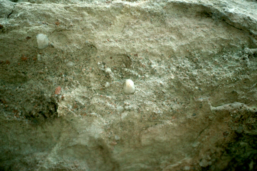
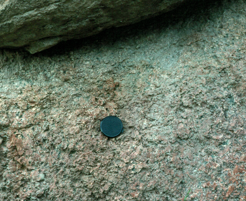
We can also look at the uppermost granite below the contact. As we think about Hypothesis 1, we might expect to see chunks of sandstone that sank into the magma that made the granite, and we might expect to see dikes of granite that went up into fractures in the sandstone. Hypothesis 2 would again lead us to look for fault gouge and slickensides. Hypothesis 3 sugests that we might find weathered granite just below the contact. Here's a look:
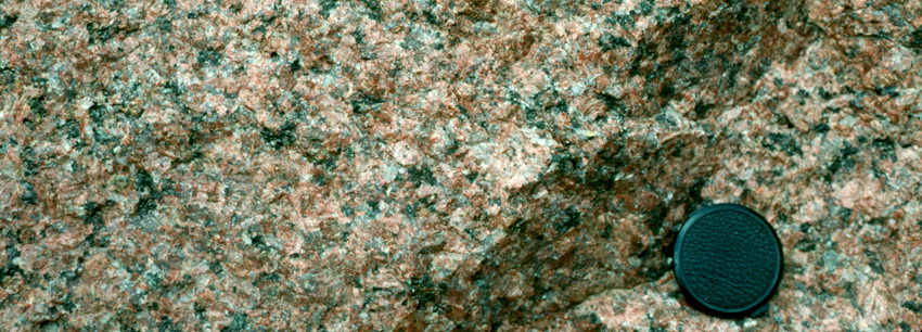
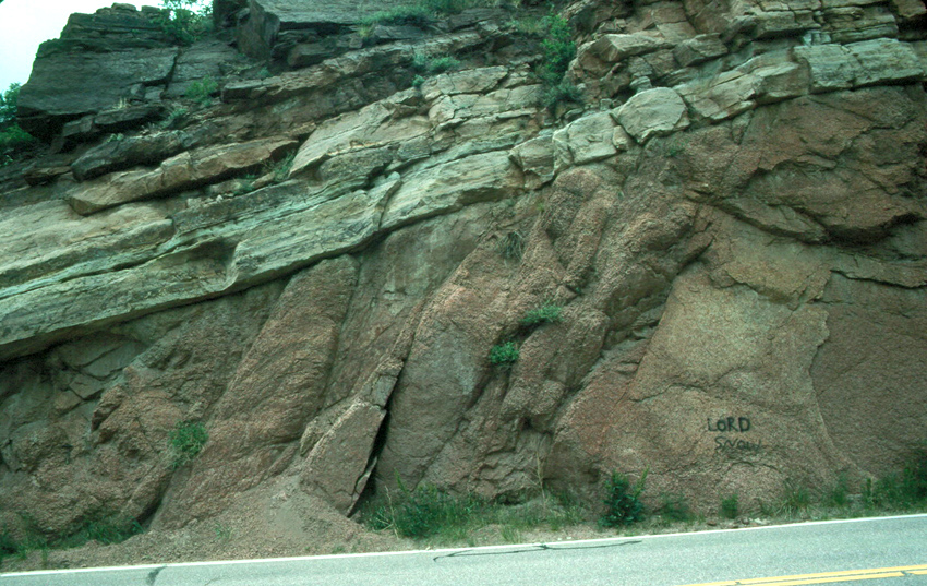
We can also back up and look at the granite for a little more distance. See anything relevant to our investigations?
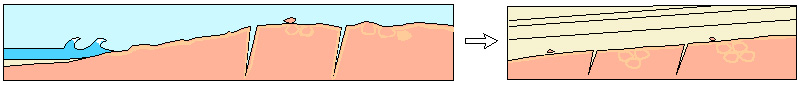
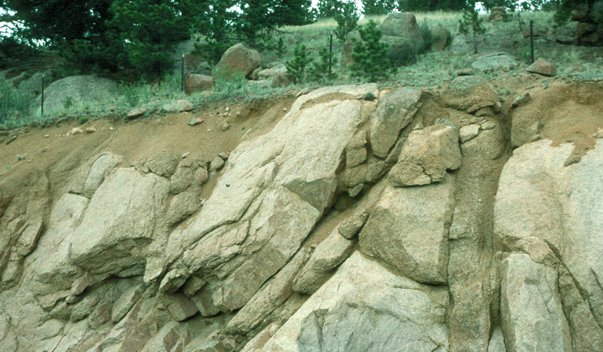
Secondly, note the round structures in the granite in the middle of the image. Weathering often works along cracks to isolate chunks of rock, and preferential attack on the corners of such chunks will round them to produce what are called "corestones". For example, let's jump a few miles to the west to look at the example of modern weathering of granite shown below. The round rocks on the land surface and at the top of the road cut are corestones, and weathering has expanded some of the sub-vertical fractures.
So where does all this leave us? We've found no evidence to support Hypotheses 1 or 2, but lots of evidence for Hypothesis 3. The granitic pebbles in the sandstone, the alteration of the uppermost granite, the expansion of the fractures upward, and the paleocorestones all support the contention that the granite was subjected to weathering and erosion, and then layers of sand were deposited on top of it to form the sandstone. This certainly appears to be an unconformity.
However, that's just the beginning of the story. For our magma to cool "deep within the earth's crust", there would have to have been a lot of rock on top. All that rock had to be eroded away to get our weathered granite up to the zone of weathering. If "deep in the crust" was 20 kilometers down, and erosion worked at something like a kilometer per million years, a number derived from modern studies of erosion, then at least twenty million years would be required to get the granite to the surface to be weathered - before the sand was deposited on top of it.
That's still not the entire story. The sand had to become sandstone, which requires that deep groundwater percolate through the pores of the sand and precipitate minerals to hold the sand grains together. Calculations of rates of flow of water and precipitation of cementing minerals in sandstones yields times on the order of ten to fifty million years.
Finally, there had to be some erosion to get our buried sandstone back to the land surface. That would add a few million years to our tally. Add it all up, and we get a minimum amount of time represented at this outcrop of something like thirty million years. Without doing any radiometric dating, we have to conclude that the Earth is far older than 6000 years.
Of course, you probably already knew that. Radiometric dating and stratigraphic correlation in fact show that the granite here is a little over one billion years old, and the sandstone is about 500 million years old. Somewhere about 550 million years ago, the granite was eroded, and soil developed at its surface. Only when the granite's weathered and eroded surface subsided, and when a shallow sea deposited the sand of our sandstone, was that land surface eliminated. We can nonetheless stand at this roadcut today, infer all these events of the past, and enjoy the vision of that ancient land.
Acknowledgements and sources: The ages of rocks reported above are from Noblett, J.B., et al., The Garden of the Gods and basal Phanerozoic nonconfomrity in and near Colorado Springs, Colorado, in Beus, S.S., ed., Centennial Field Guide Volume 2 - Rocky Mountain Section of the Geological Society of America, p. 335-338.