|
This field trip takes us to the valley of Trout Creek in the Rocky Mountains central Colorado. We're in eastern Chaffee County, mostly along US 285 east of Buena Vista and west of Hartsel.
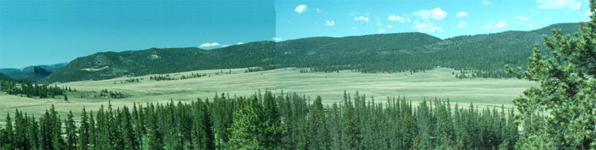
Our first view looks southward down into the valley from near Trout Creek Pass. We're looking into a relatively broad flat valley. Trout Creek flows out of the valley near the pinnacles at the far left side of this image. Much of the treeless area in the valley's plain in front of us is at an elevation of about 9200 feet (2800 m).
|
|
|
 |
|
a 2470 x 621 version of the same image
|
|
|
|
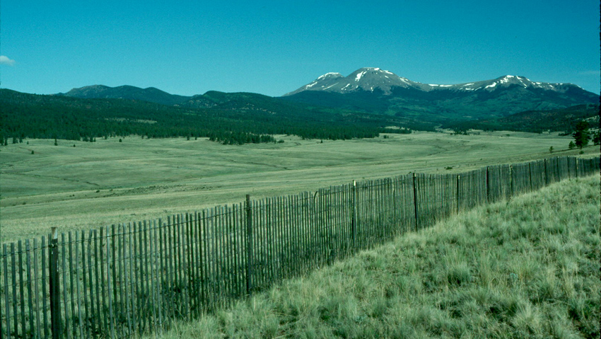
So why is the such a broad plain at such a high elevation, especially if erosion has produced that pinnacle downstream in the distance? The next two images move us down valley to see it from left (east) side. They won't answer the question, but they'll move us in the right direction.
|
|
|
 |
|
|
|
|
In the lower of the two images, the answer is beginning to emerge: the valley narrows downstream as a ridge blocks the end of the valley. Let's move onward a bit.
|
|
|
 |
|
|
|
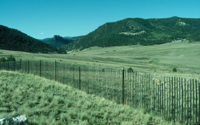
Indeed the ridge on the right above, which is Limestone Ridge, forces Trout Creek to exit the valley through a narrow slot. The rocks on each side of the ridge go under the stream as well, and they slow more downward erosion, so that Trout Creek doesn't erode the plain across which we've come. Let's move on down to the slot through which the stream passes.
|
|
|
 |
|
|
|
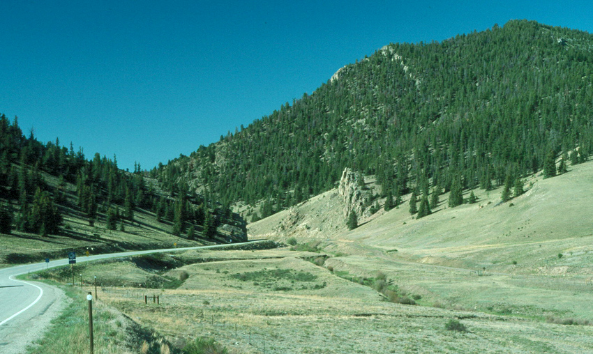
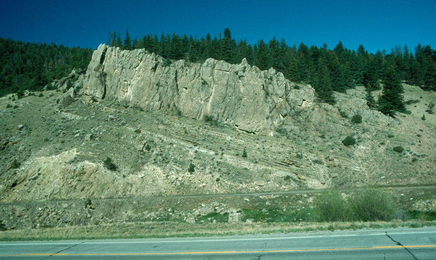
Here are the layers of limestone (and sandstone) in Limestone Ridge that have resisted erosion and maintained the downstream end of Trout Creek Valley. This is one example of what we're calling "dammed mountain valleys". In this case, the dam (these hard rock layers) existed before the stream cut down to make the valley.
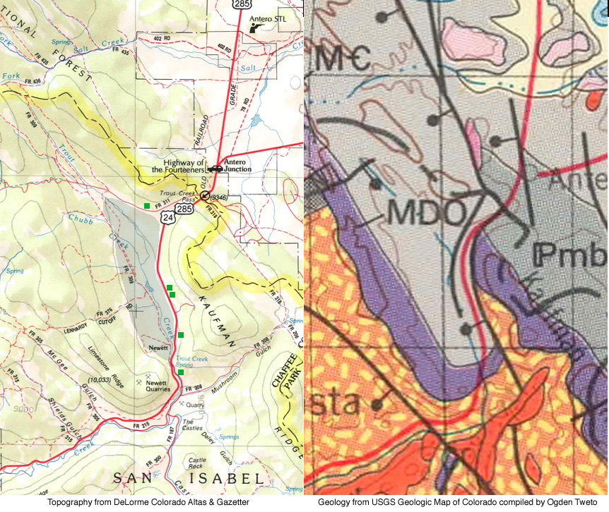
In fact, the rocks of Limestone Ridge wrap around the south end of the Trout Creek Plain. On the geologic map at right below, they're shown in purple and labelled "MDO" for Mississippian-Devonian-Ordovician. The map on the left side shows the topography, with our plain shaded in gray-green and with light green squares to show the locations from which the pictures above were taken:
|
 |
|
|
|
|
|
So who cares why these flat-bottomed alpine valleys exist? For other examples we'll give other reasons, but in this case the answers are evident in the images above. These valleys often provide passage for major highways, because they're broad enough to allow a wide right-of-way. They also provide pathways for railways: an old railroad bed is evident on the opposite side of Trout Creek in the image above. From an engineering and transportation standpoint, as well as from perspectives we'll discuss on other trips, understanding these valleys can be useful, and it helps us appreciate some very pretty places too.
|