|
|
|
|
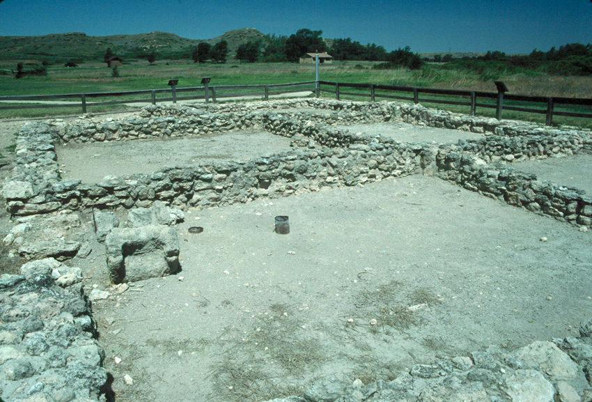
The image above shows not a building but just a foundation, and in fact it's only a modern reconstruction of the foundation. However, the reconstructed foundation is of a pueblo in western Kansas and thus presents an interesting story. The reason it's only a ruin is interesting too.
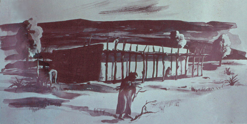
In 1664, a band of Taos Indians who were fleeing from Spanish rule in the Southwest came northeast into Kansas and settled along Ladder Creek, one of the tributaries of the Smoky Hill River. They built at least one pueblo here, the northernmost pueblo in North America. They built a stone structure that they covered with adobe inside and out, as seen in the artist's reconstruction below. A lack of windows and doors, combined with apparent holes for ladders suggests that the dwellers came and went through openings in the roof. They also built a system of irrigation canals to tap nearby springs.
|
|
|
|
|
|
|
The Taos band stayed in the peublo(es) for about twenty years before returning to the Southwest. A group of Picurie Indians took up residence in 1701 and stayed for a couple of years. Juan Urribarri (a.k.a. Jean Iturbi), famous for leading the French explorer La Salle into the 1687 ambush in which the latter died, opened a trading post on the site in 1717. The last known reference to the site dates from 1727, and the pueblo quickly degraded. Its collapse was so complete that the ruins were only discovered in the 1890s by farmer Herbert Steele after he had lived near them a few years. The ruins were excavated soon thereafter by a team from the University of Kansas. In 1970, a re-excavation found little and put together the reconstruction seen here. The reconstruction is based largely on information from the 1899 excavation.
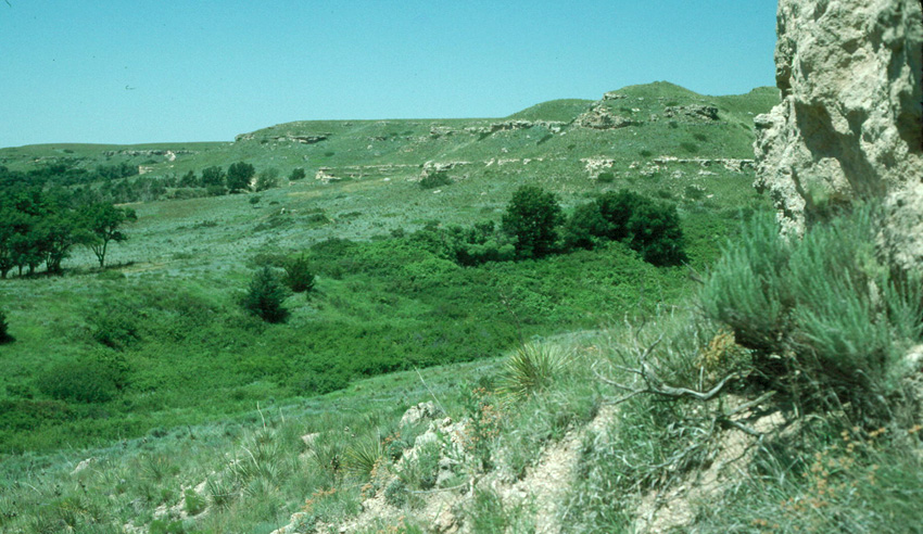
So why did a group of pueblo-builders settle here? The answers are largely visible in the images above and just below: Ladder Creek has cut a valley into the very flat plain of western Kansas. It thereby provides access to water, some protection from wind, and access to layers of building stone.
|
|
|
|
|
|
|
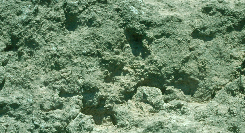
With that said, one might ask why the pueblo fell apart so quickly, and why so little survived that even the foundation had to be reconstructed to provide the present sight for tourists. The answer is in the "stone": it's not really stone at all. It's calcrete, a mass of calcium carbonate precipitated from soil water or groundwater into soil and shallow sediment. "Caliche" might be another another named used, but the sandy and massive nature of the material exposed along Ladder Creek probably makes "calcrete" a better name. The "stone" of the hillside appears layered like limestone, but the layers are featureless and massive (see image below), and they're not as hard as limestone.
|
|
|
|
|
|
|
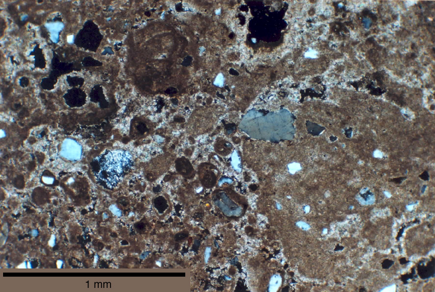
Thin sections of the material further reveal its non-limestone-like nature. The "rock" consists of sand and silt grains (the white to gray spots in the image below) surrounded by fine-grained calcium carbonate (the brown background). Note how dark brown calcium carbonate forms rings around some sand grains to make concretions or has formed nodules on its own - such textures are typical of caliche. Also note the black patches, which are holes and promote distintegration of the entire mass.
|
|
|
|
|
|
|
As a building material, the calcrete here is much softer than almost any limestone or calcite-cemented sandstone. Its softness almost certainly contributed to the collapse of the pueblo by the time farmers arrived in the late 1800s, and to the disintegration of the foundations. It was the first stone the Taos found in Kansas, and it was conveniently at hand by the desirable wetlands of Ladder Creek, but its failure across a few decades illustrates why caliche or calcrete is almost never used as a building stone when any other material is available.
Today, El Cuartelejo is in the Lake Scott State Park and Wildlife Area northwest of Scott City, Kansas. You can go on a virtual field trip to see more about the calcrete there.
_________________________
Acknowledgements: The information above is largely from the Park's brochure; the artist's reconstruction is from a plaque at the site, where it is presented with no attribution.
|