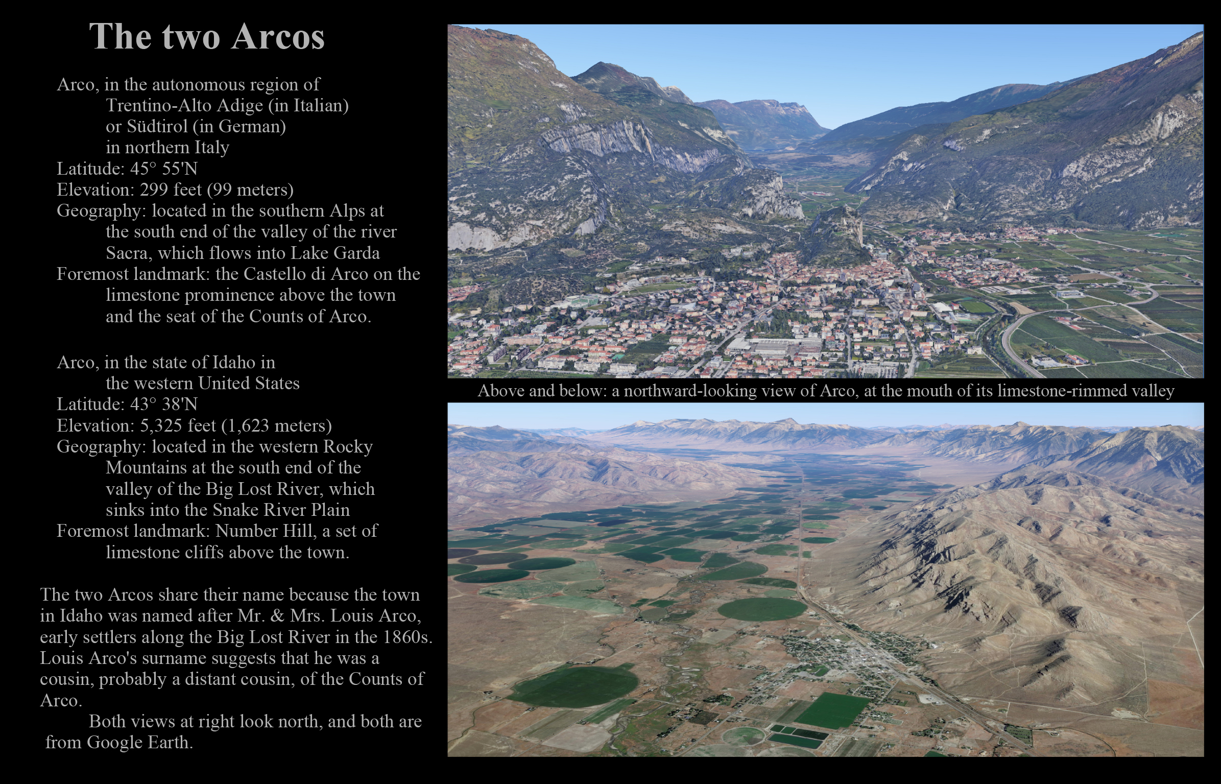
This page offers
more than 350 photographs of the landscape,
from the Big Lost River's headwaters
to its valley including Pass Creek and Antelope,
to Arco and east to the Little Lost and
to the desert southeast (including the Box Canyon),
and southwest, (including Craters of the Moon, and
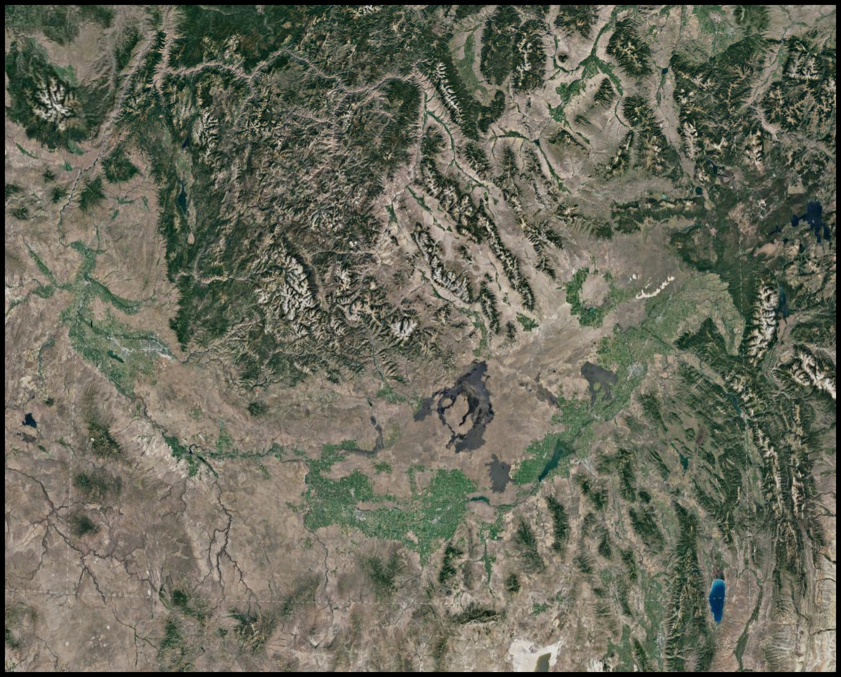
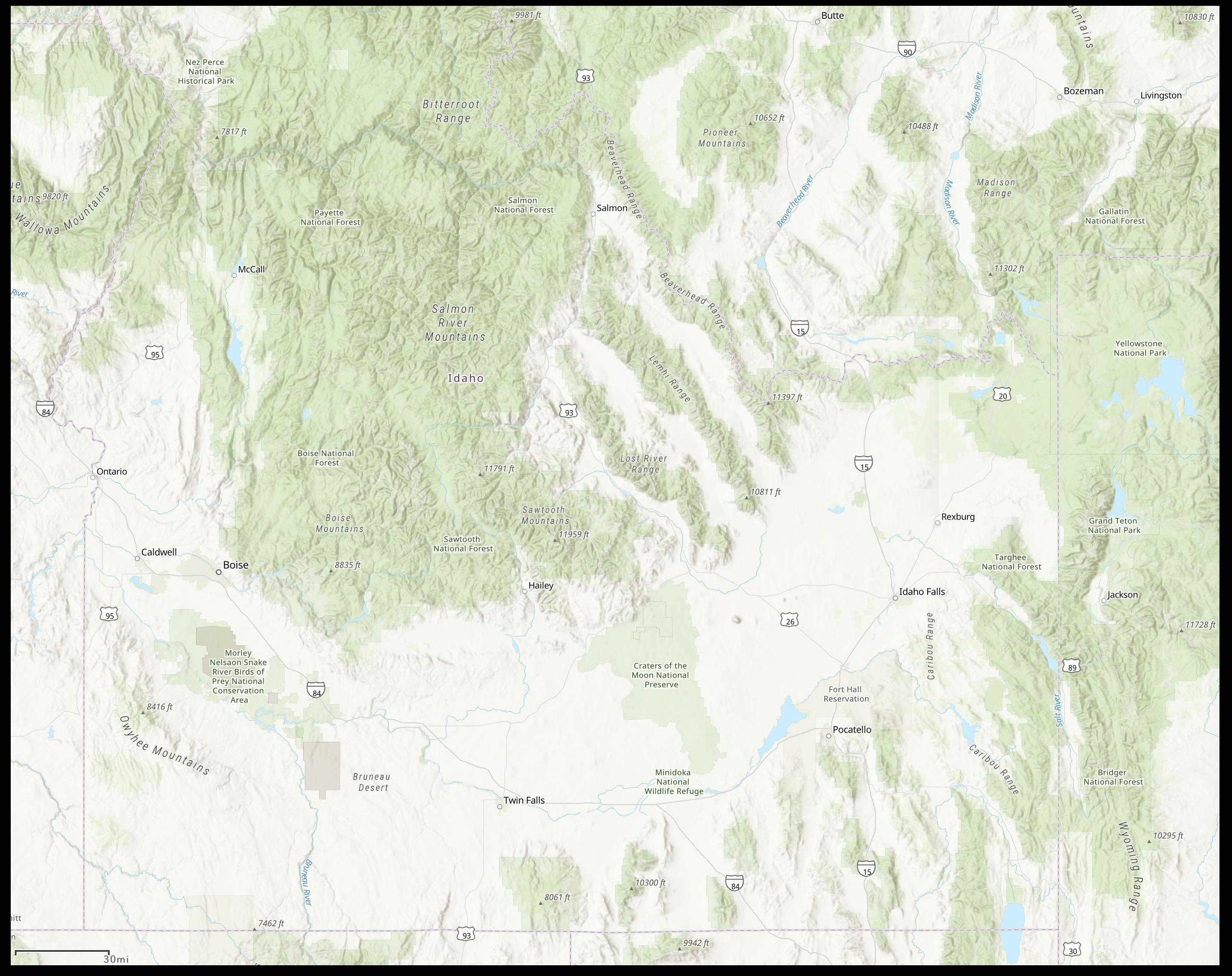
an overview of the region in three satellite images, labeled and unlabeled, and
a composite of four photographs highlighting the landscapes of the region, and
a quick tour of the Big Lost River itself, and
the railway that went up the valley of the Big Lost River, and
eight drafted posters about the landscape and its geology, and
photographs of rocks and geologic features, and
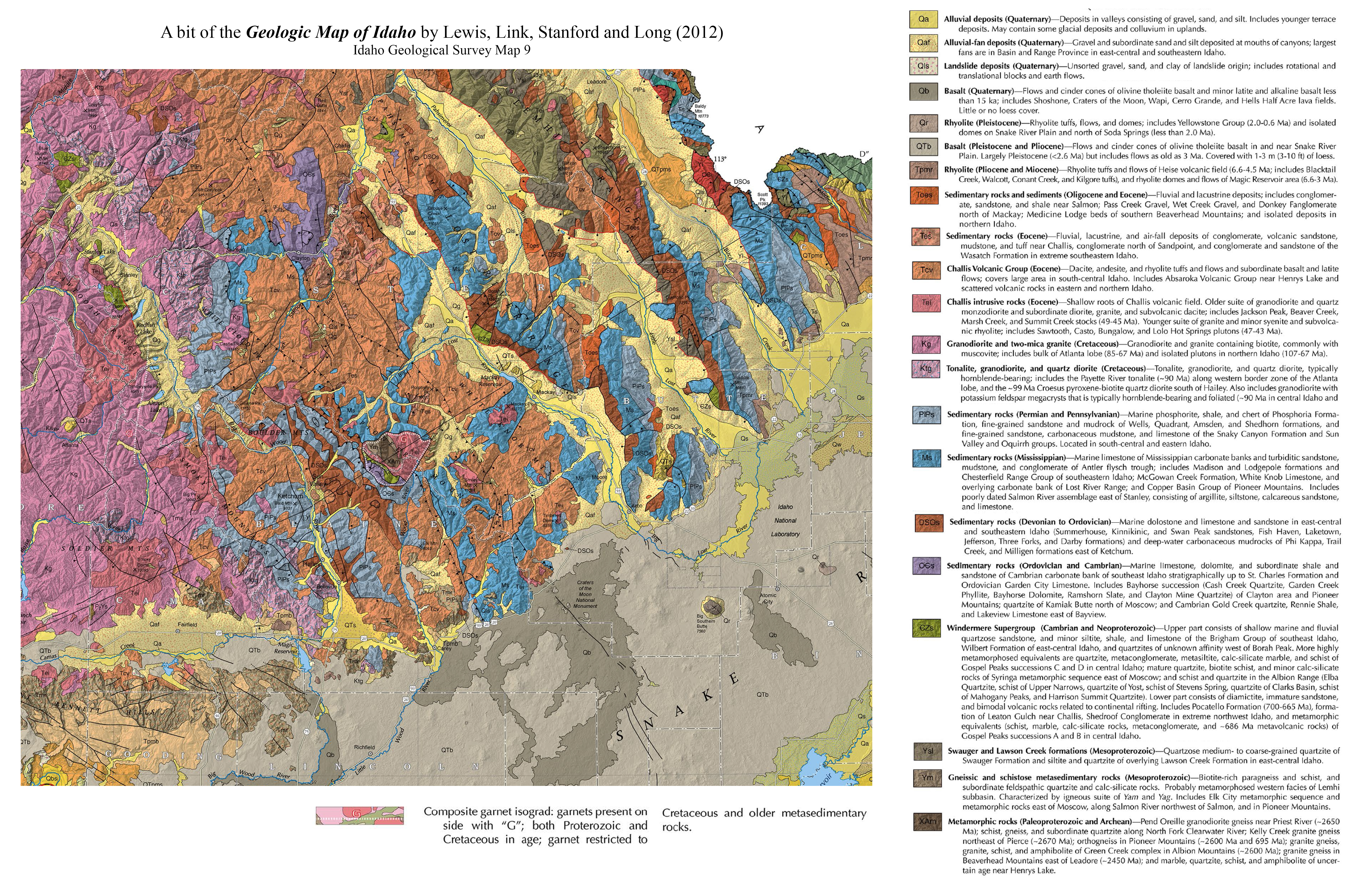
thematic maps of southern Idaho, and
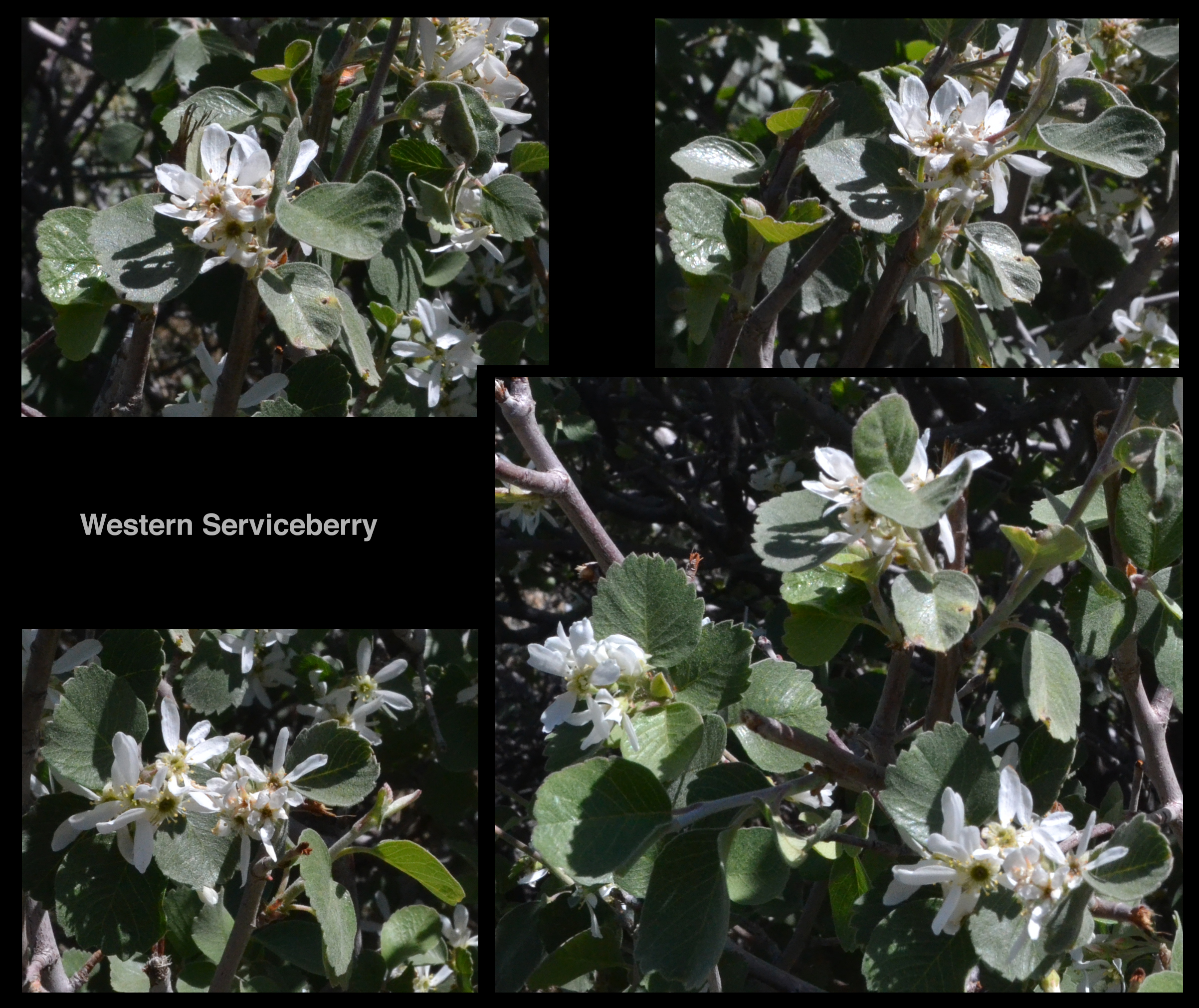
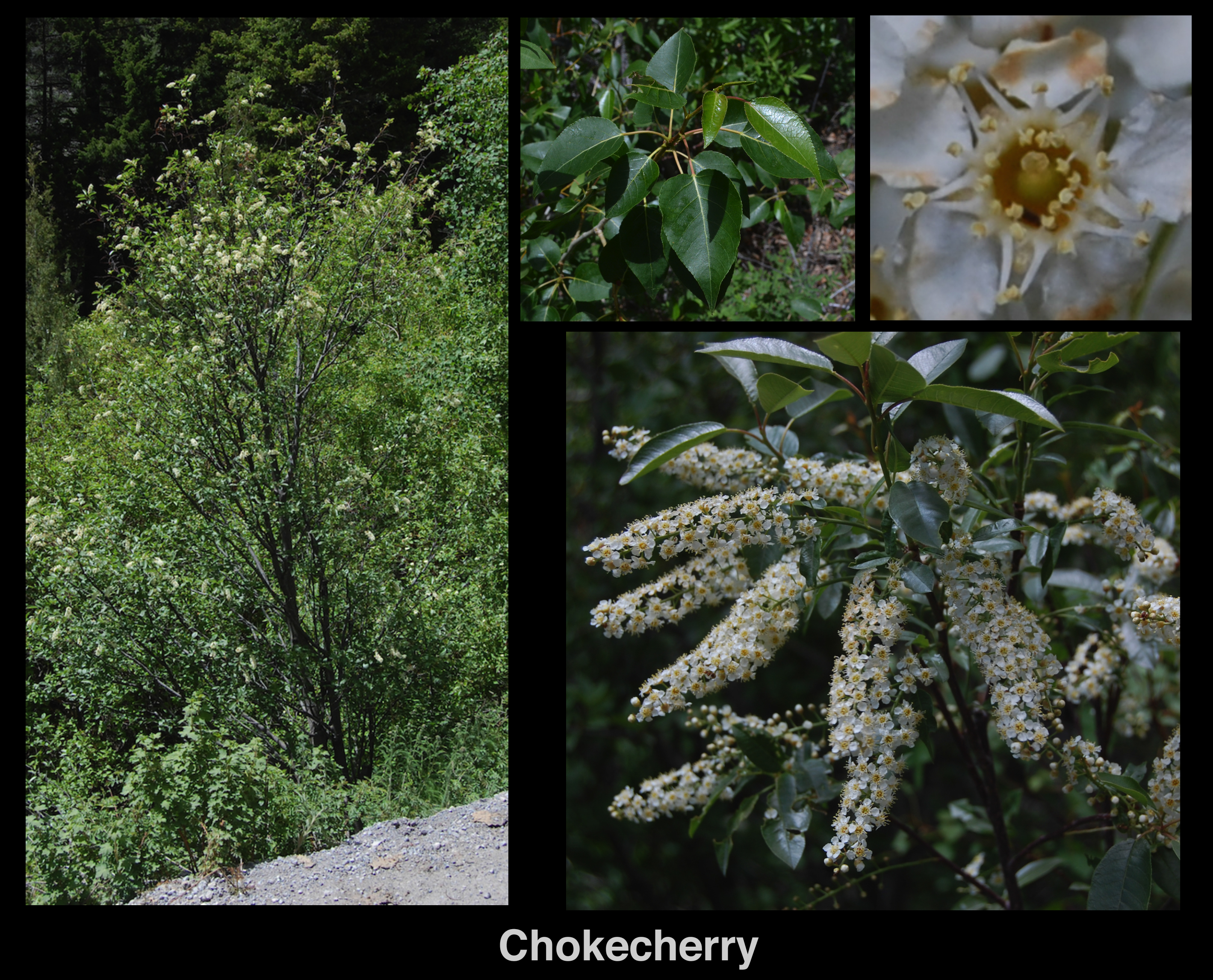
photographs of the brush on the landscape, and
photographs of wildflowers, and
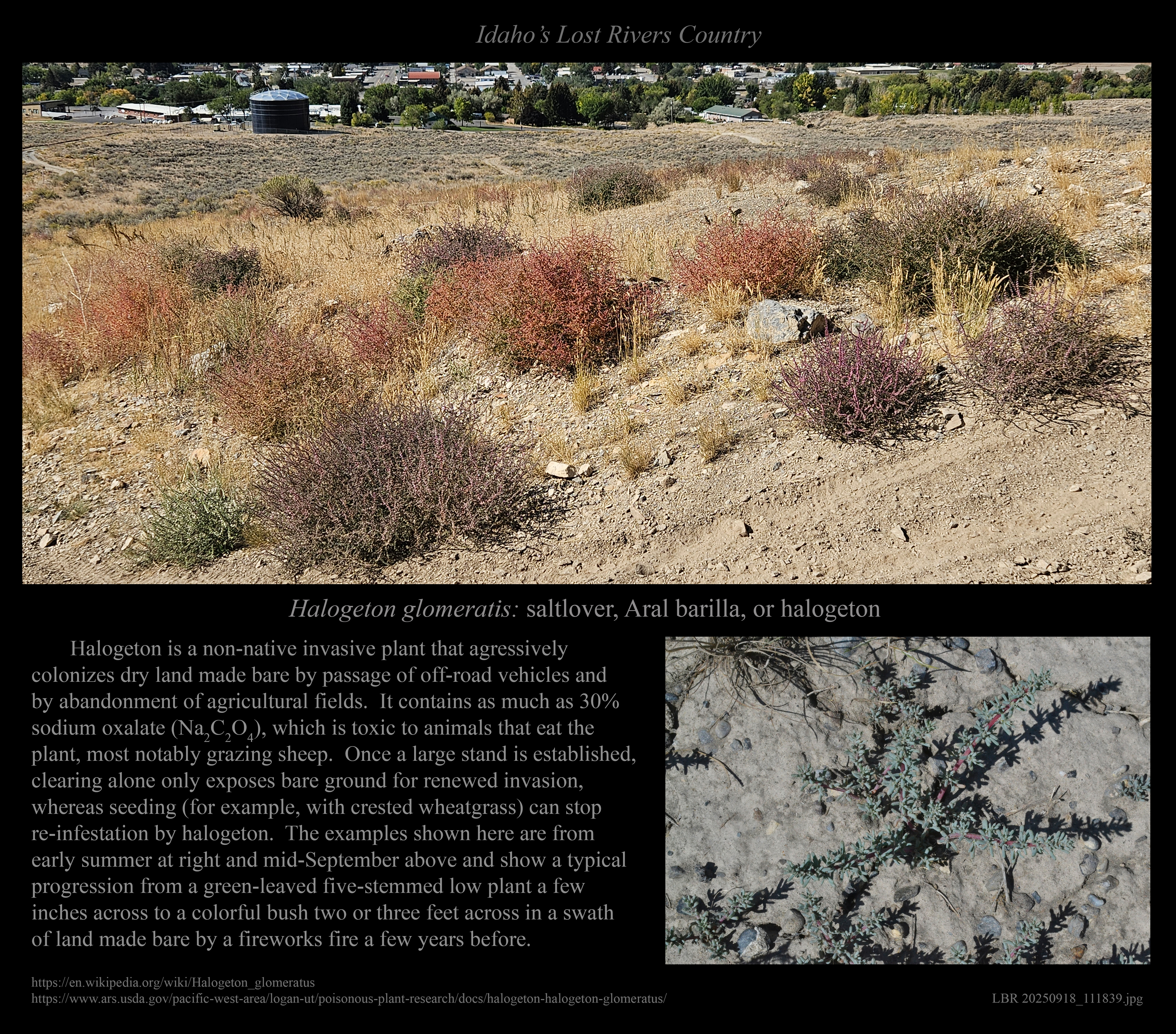
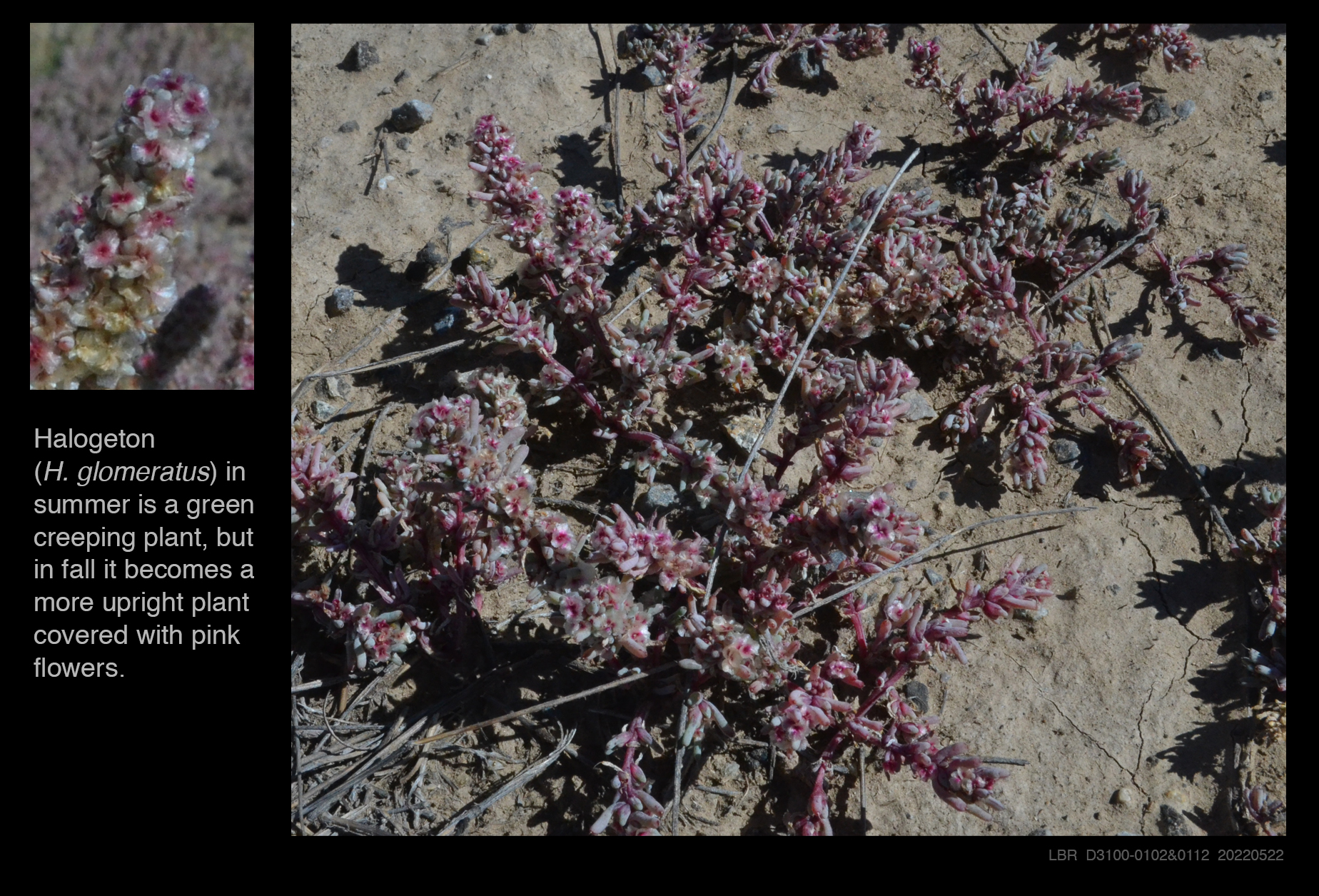
information about invasive plants in the area, and
essays about the area's natural and cultural history, and
historic documents (old texts, photographs, maps, etc.).
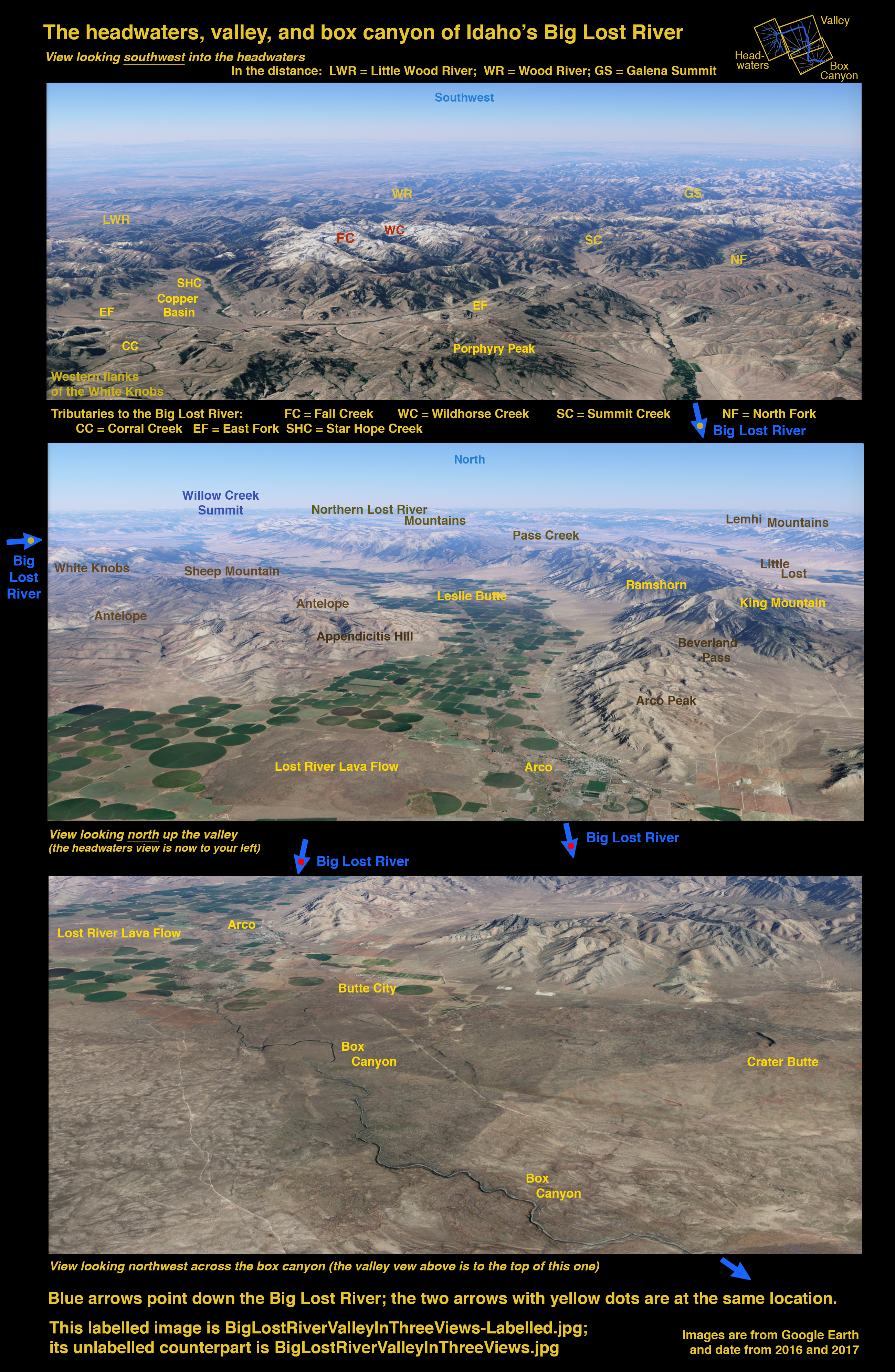
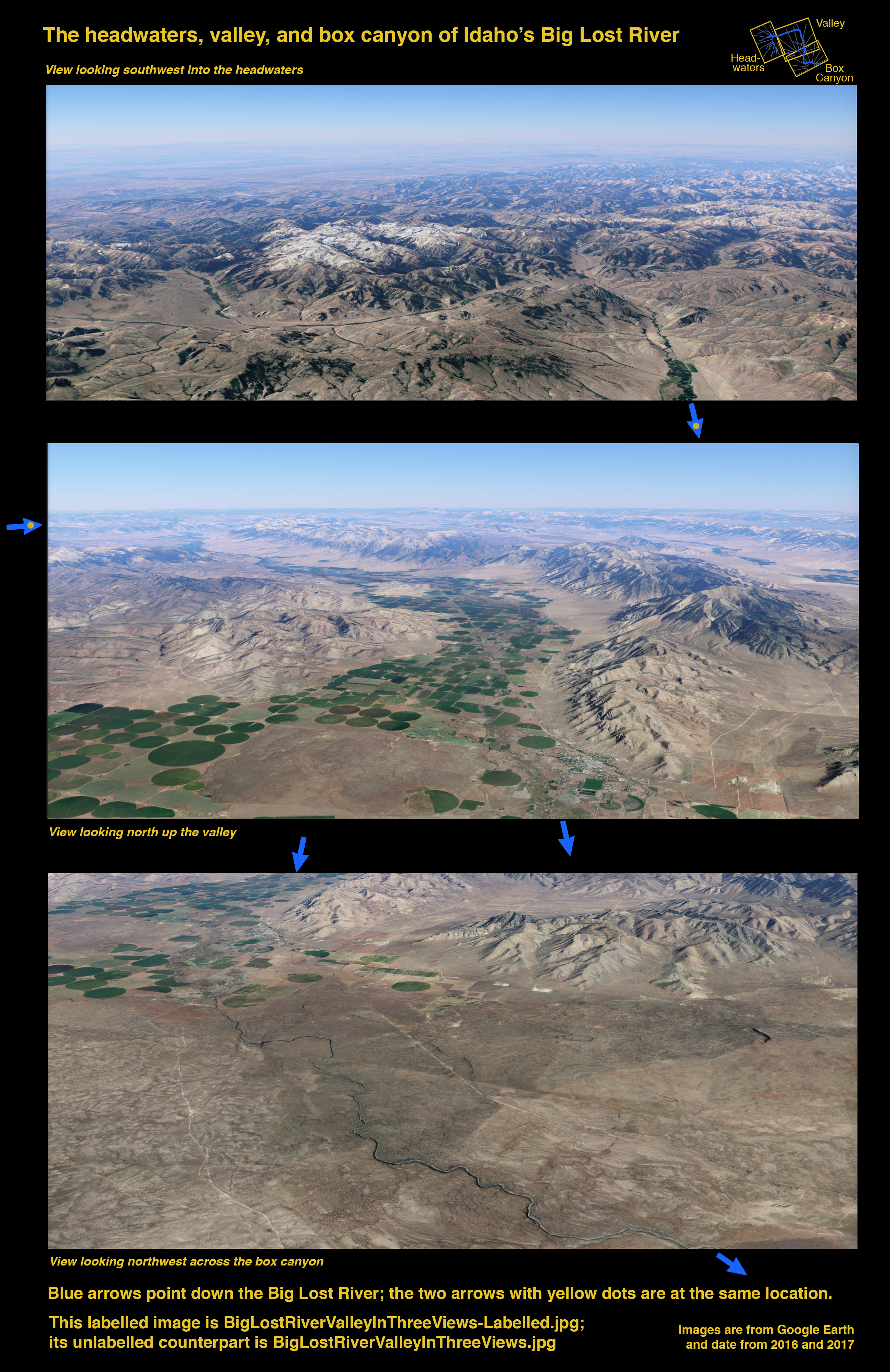
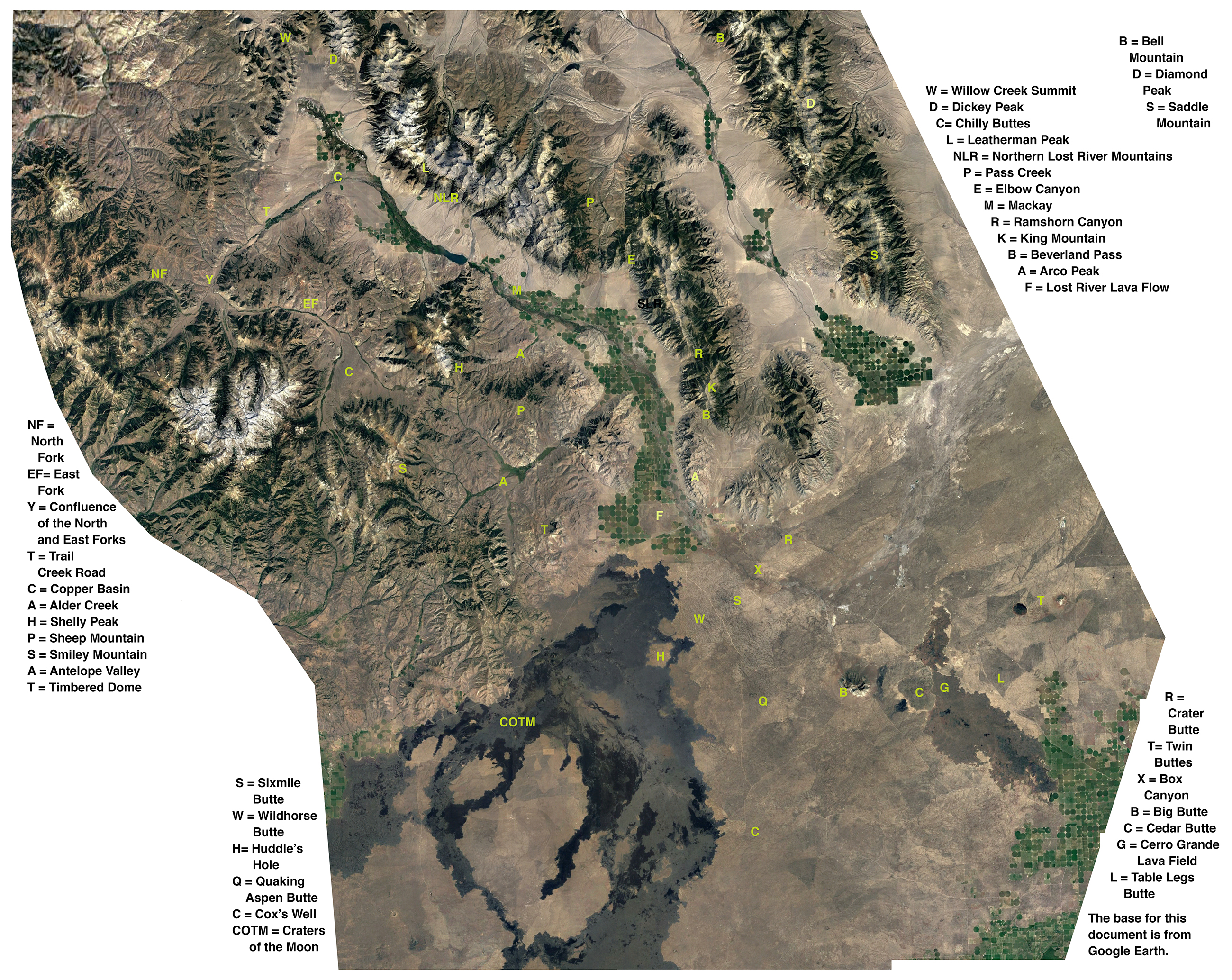
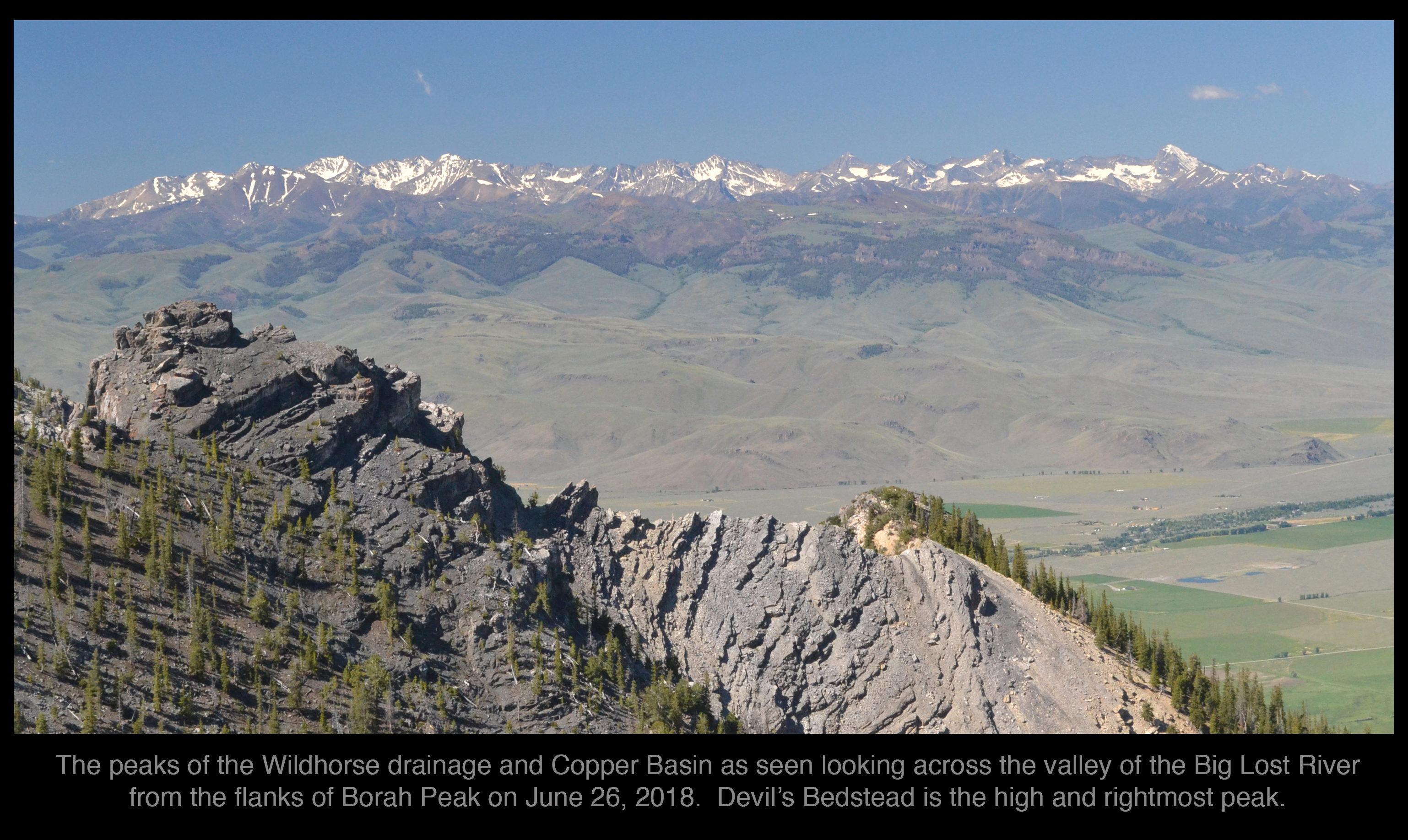
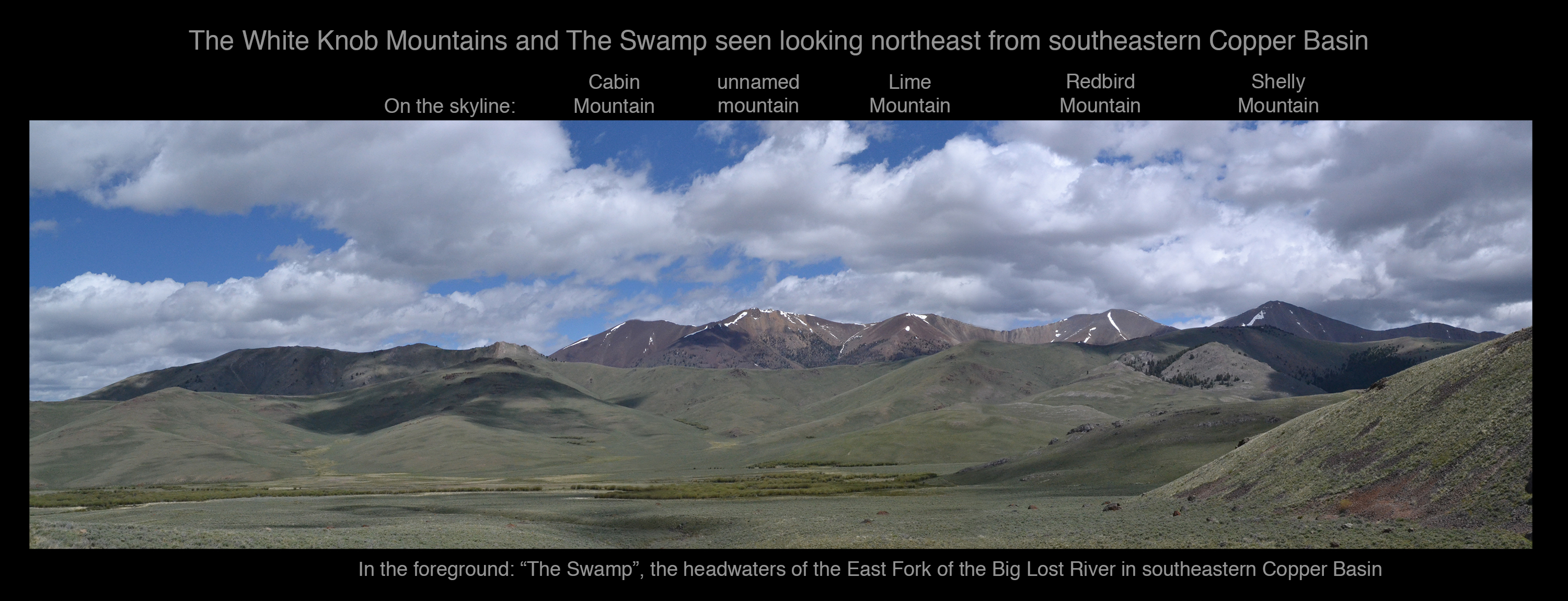
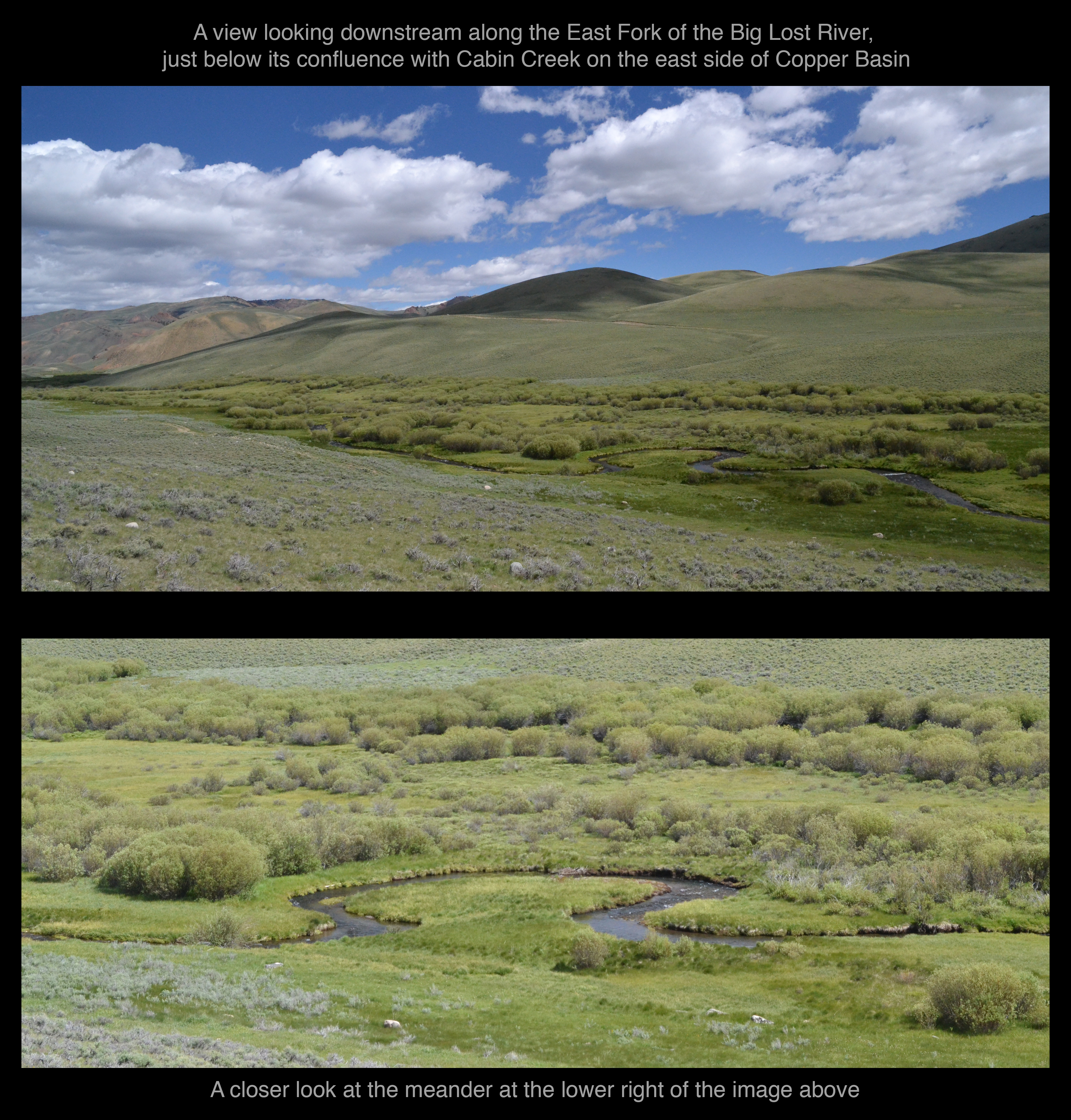
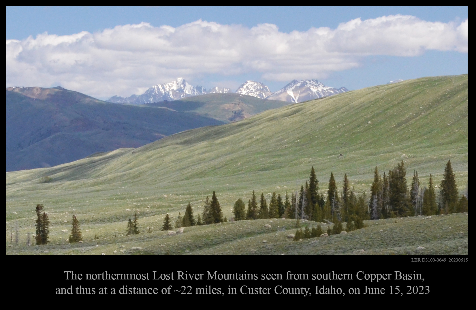
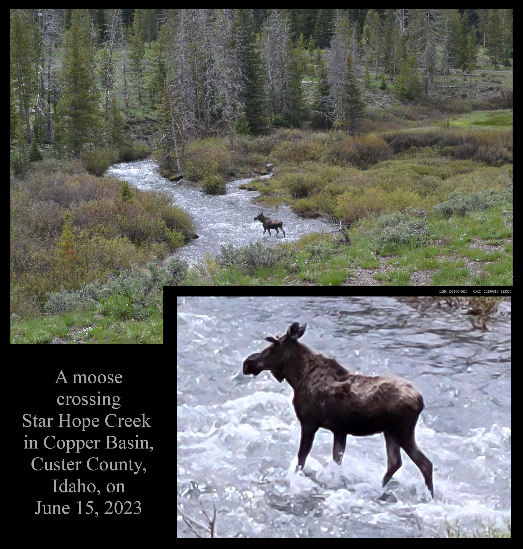
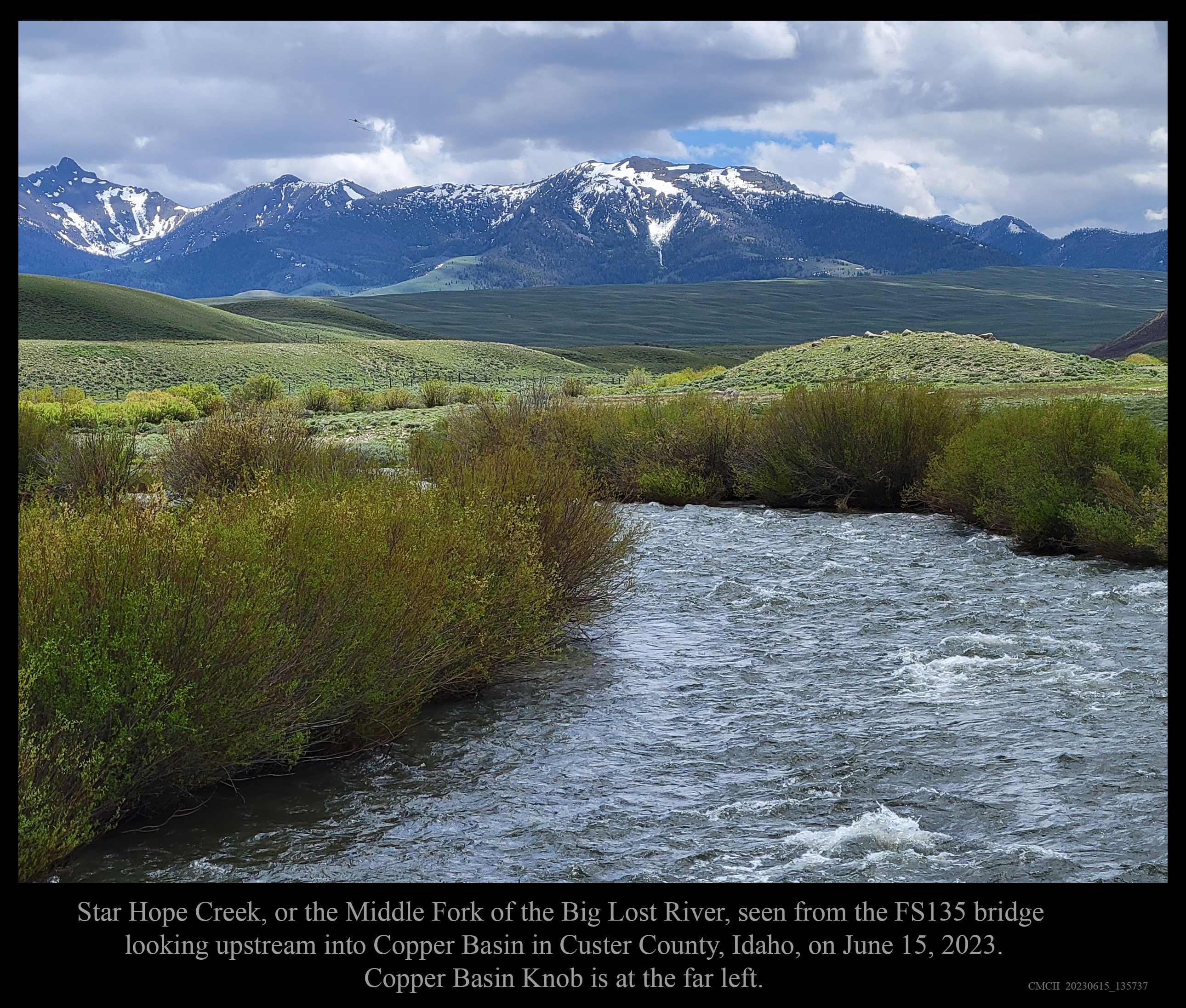
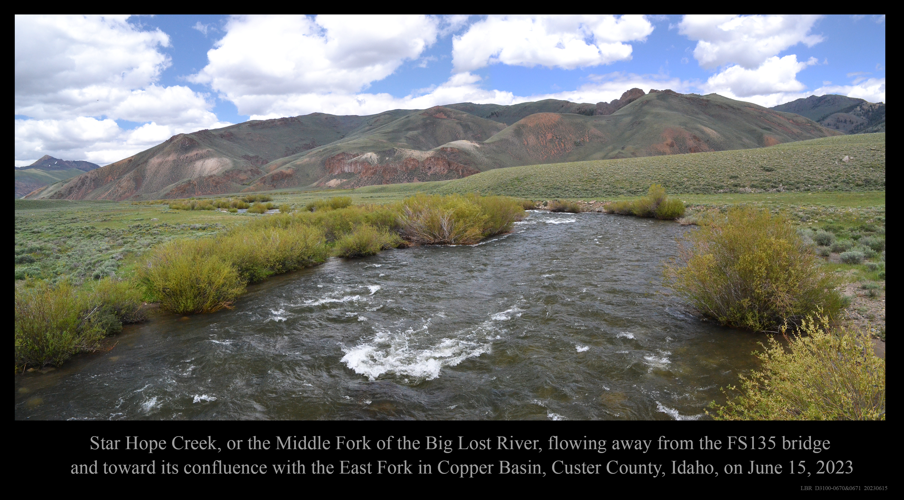
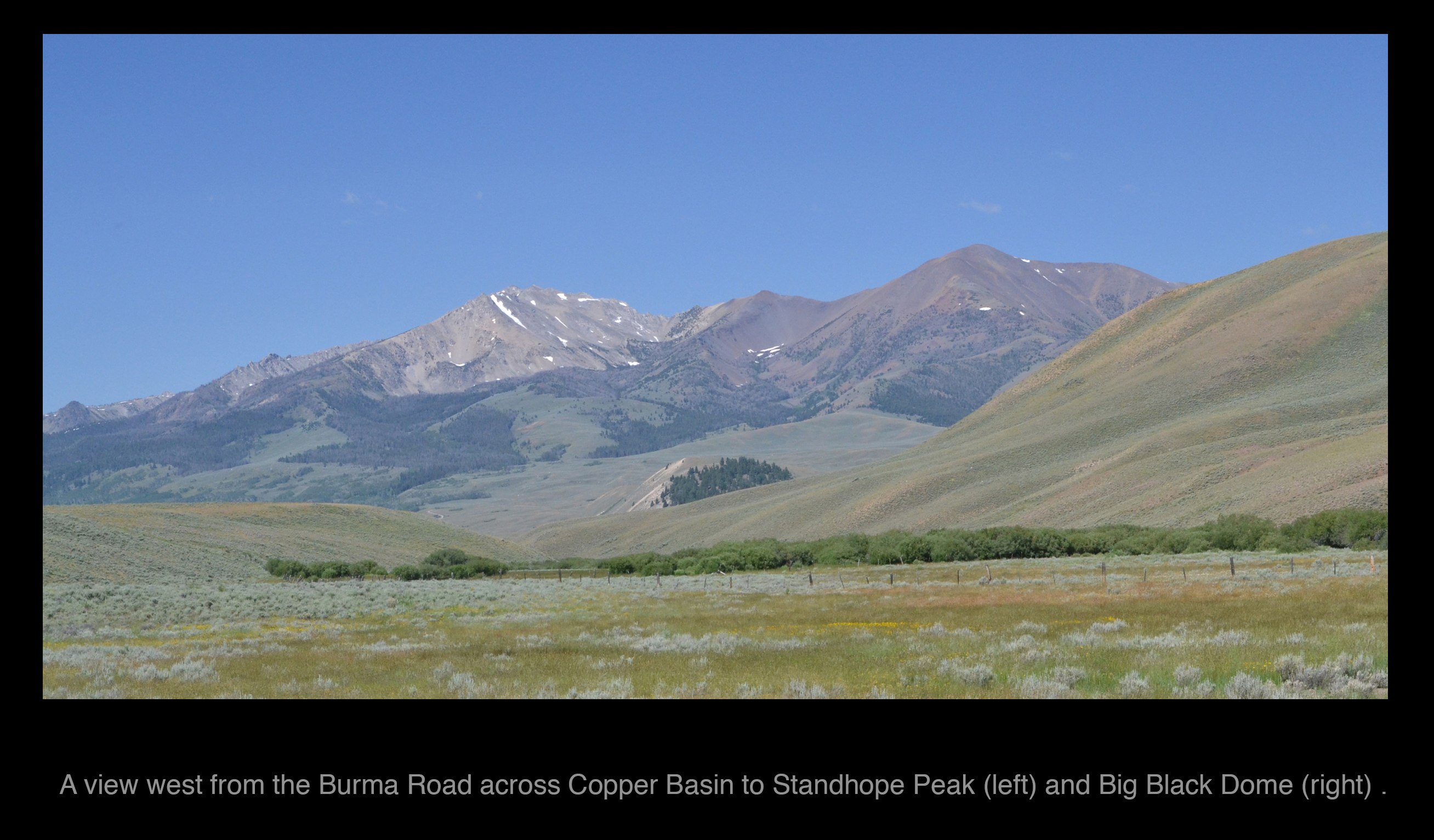
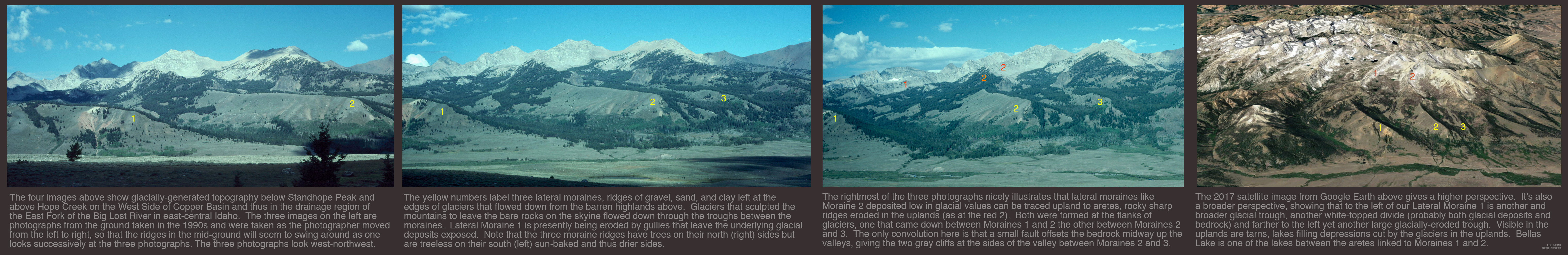
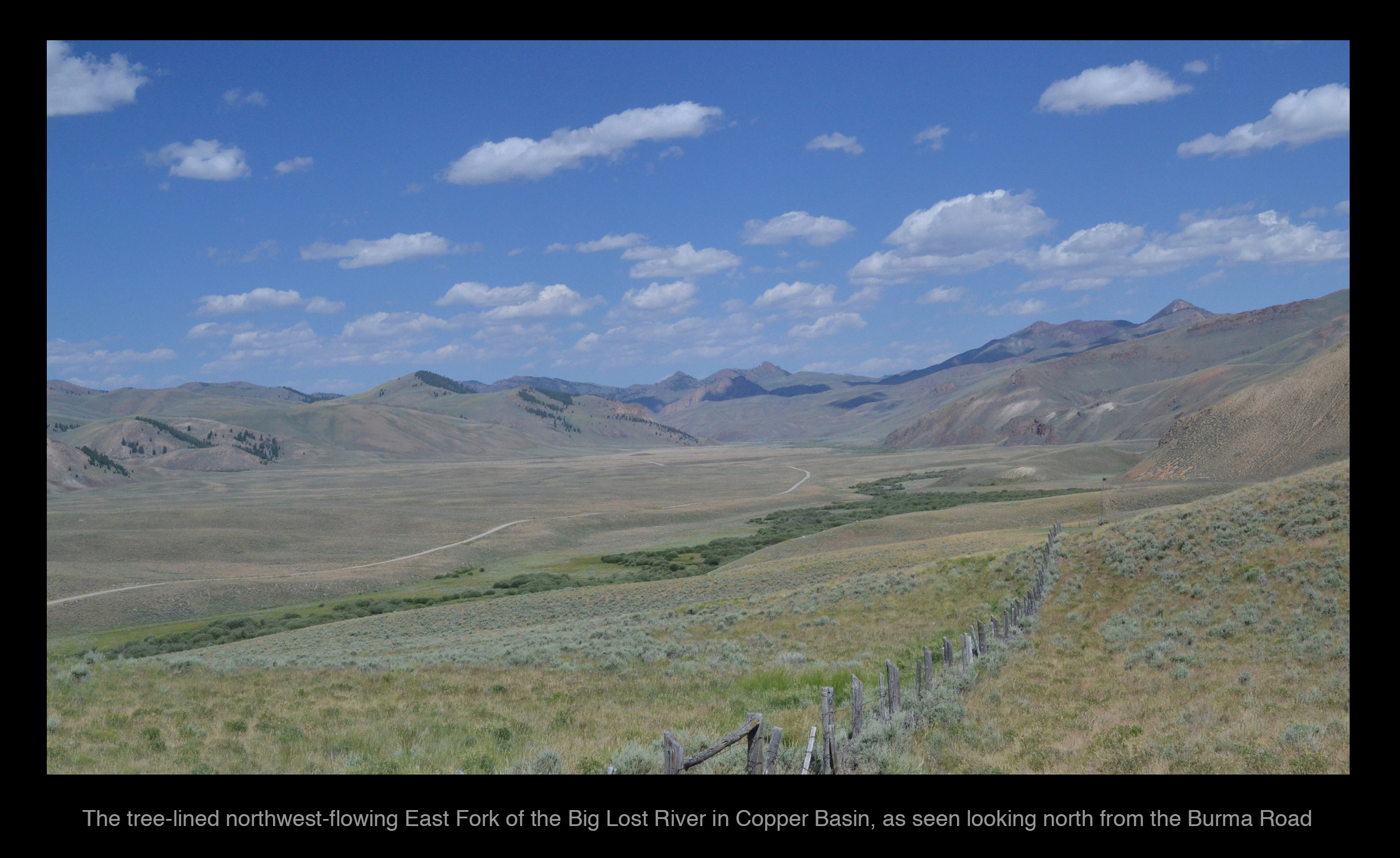
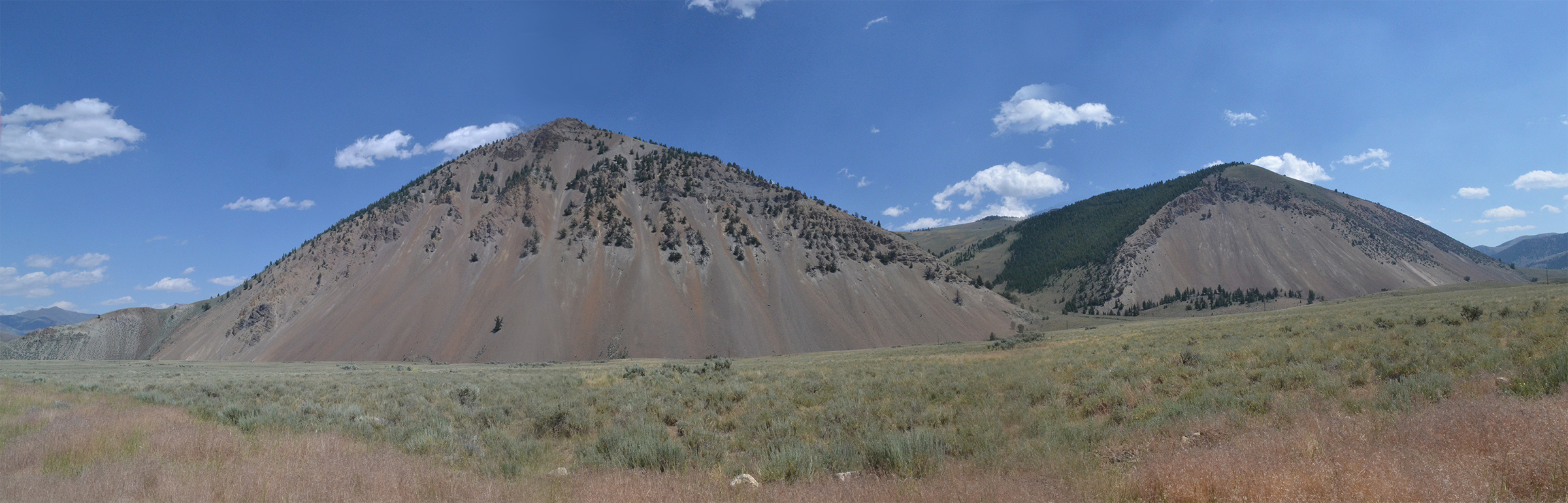
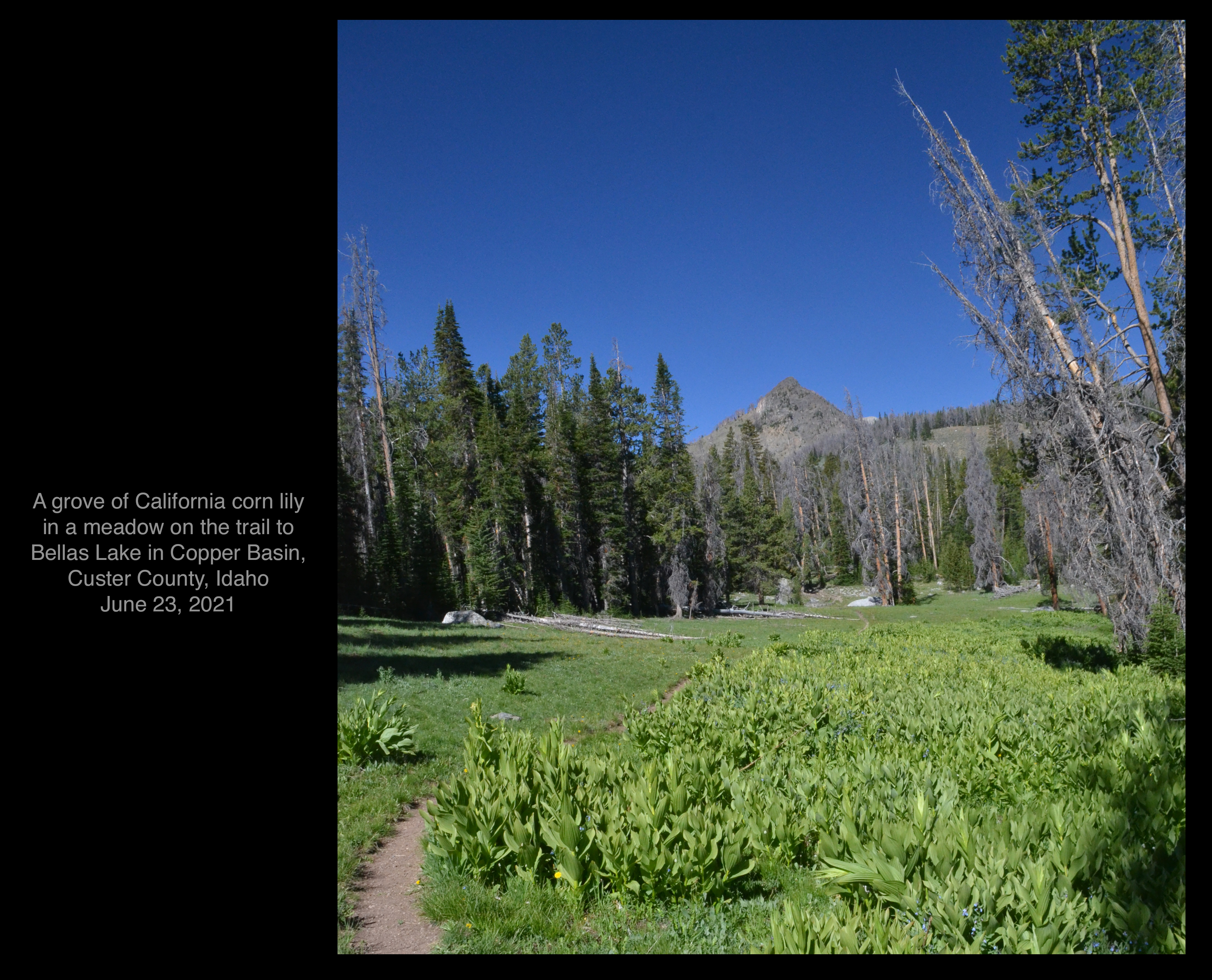
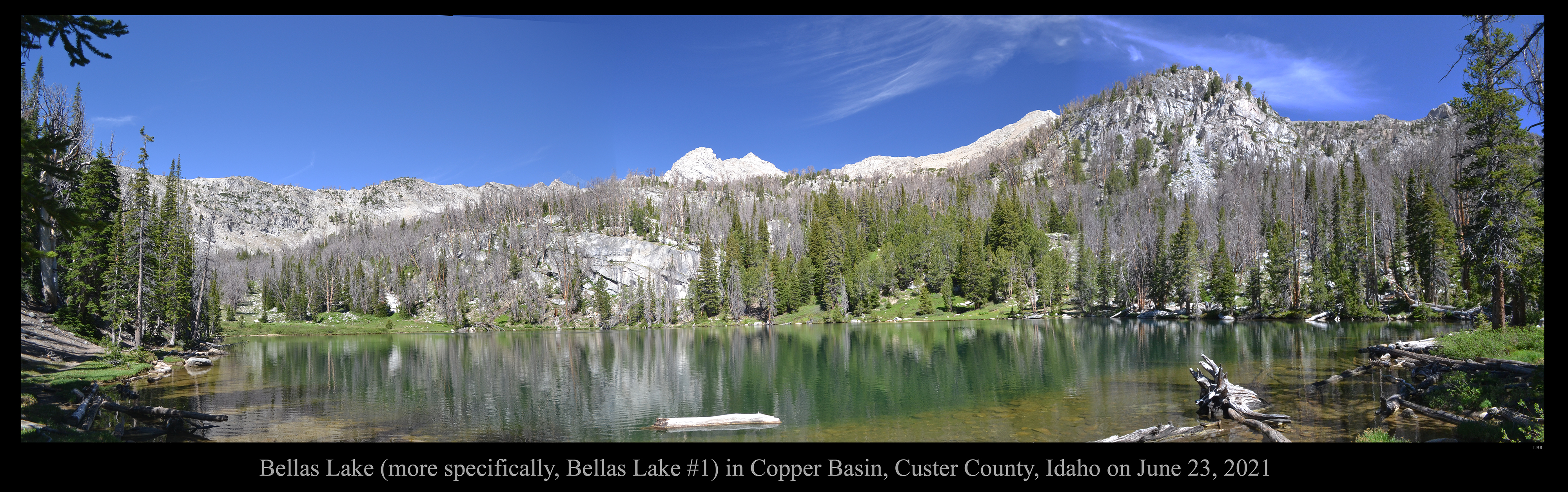
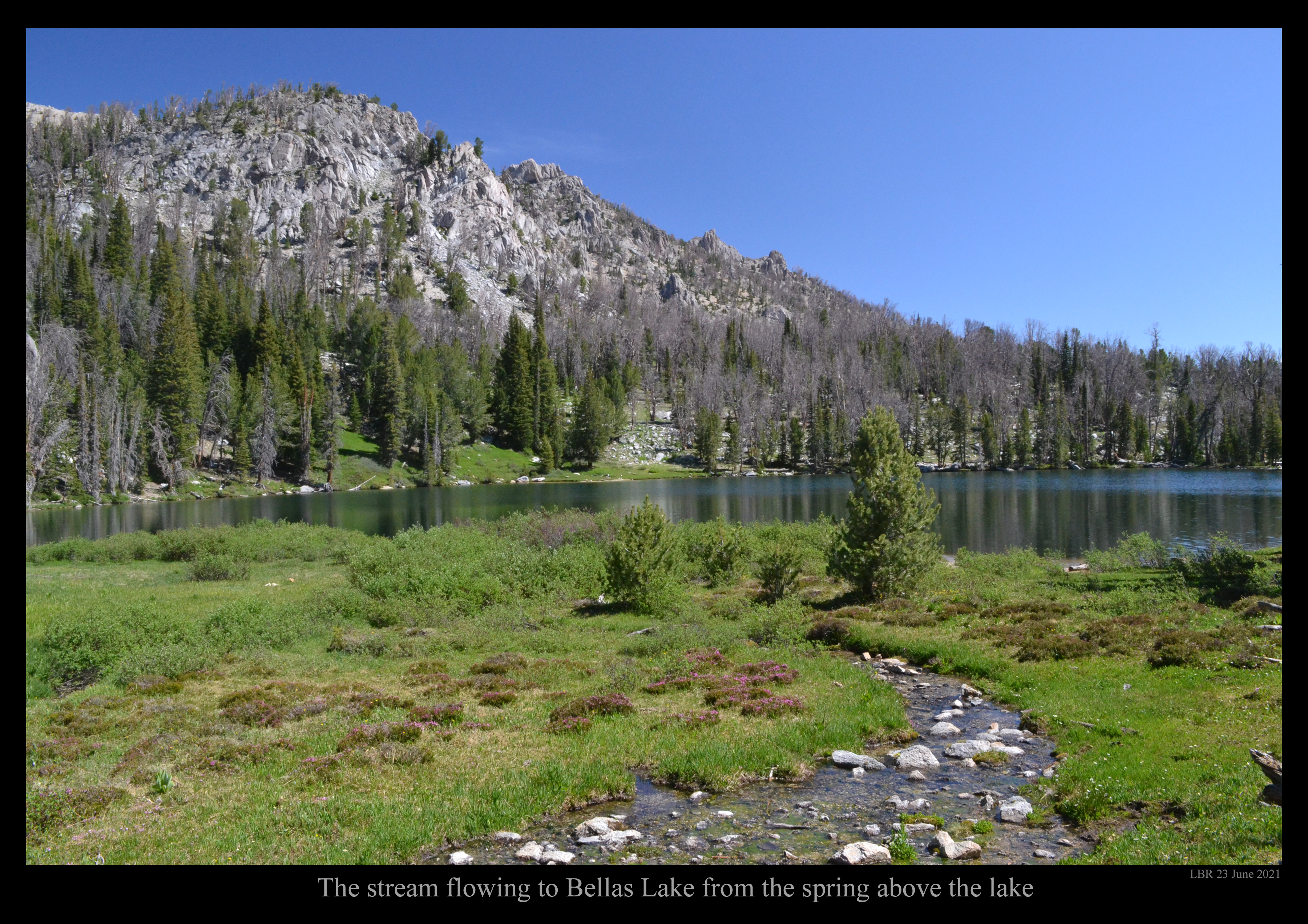
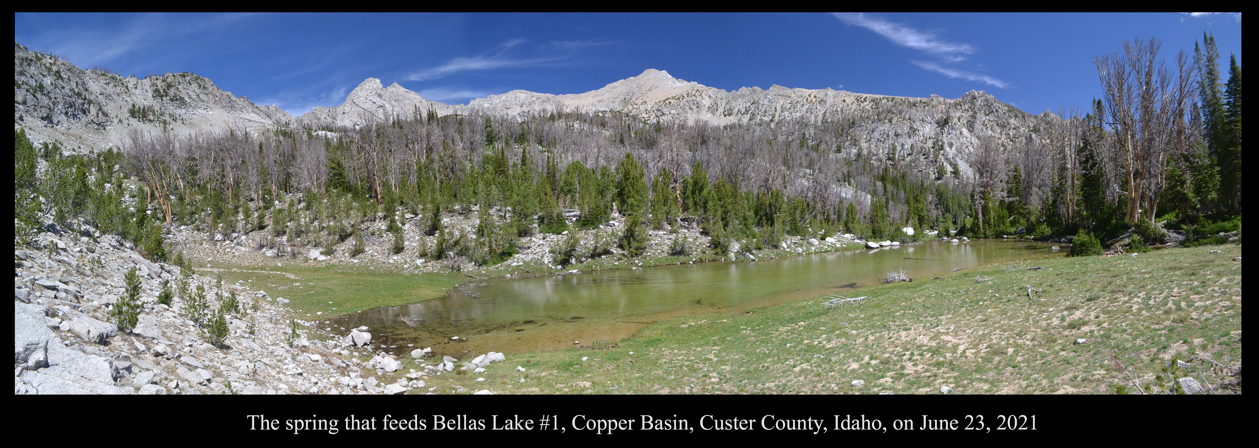
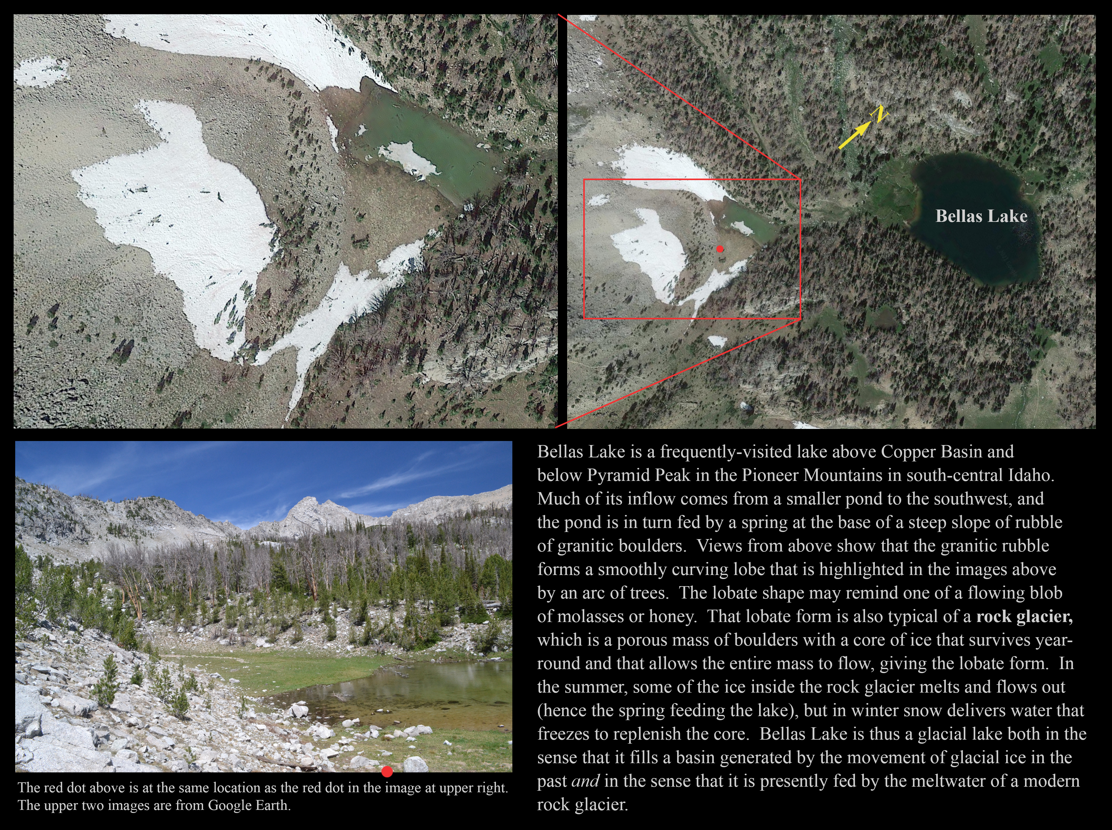
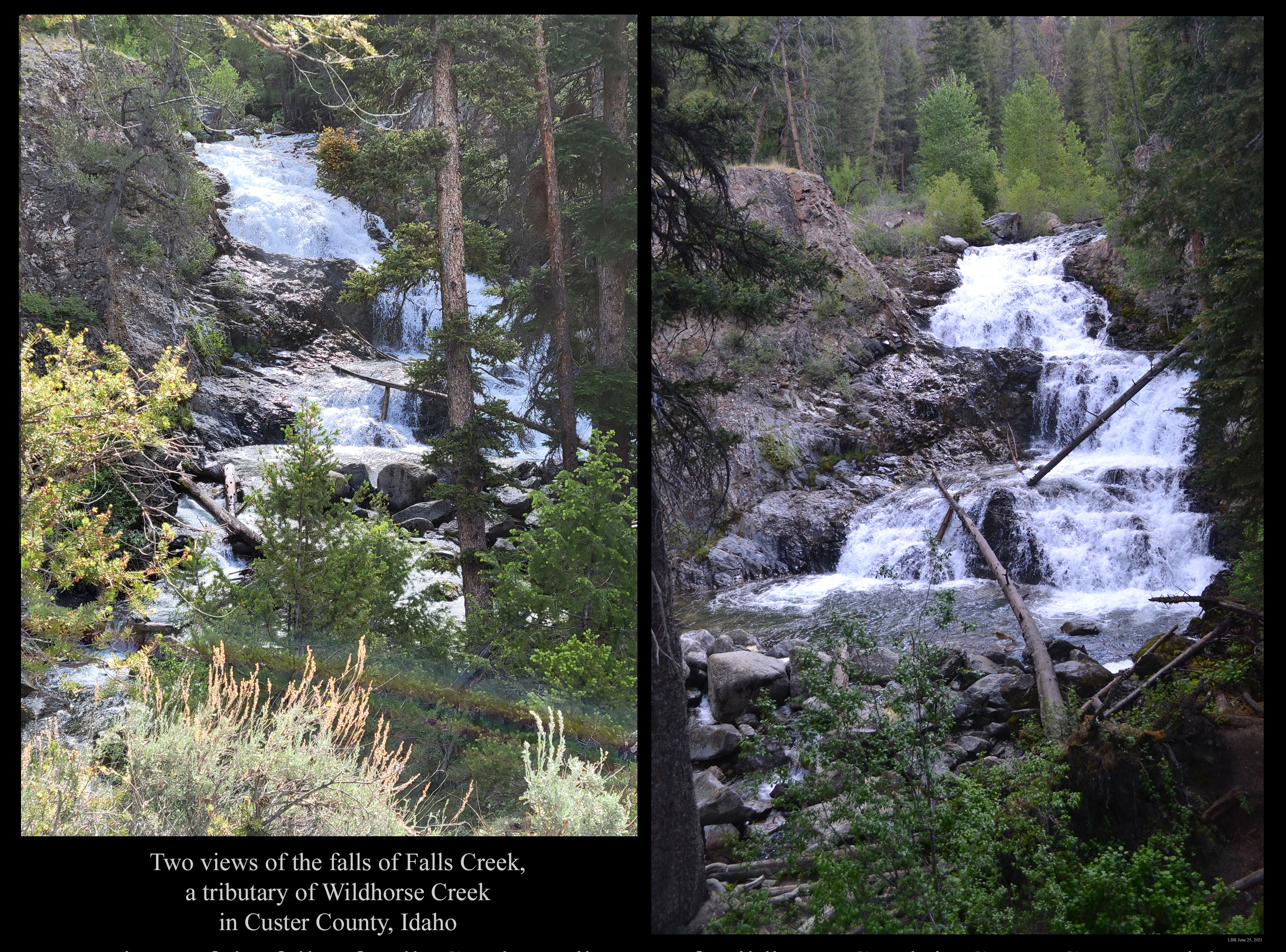
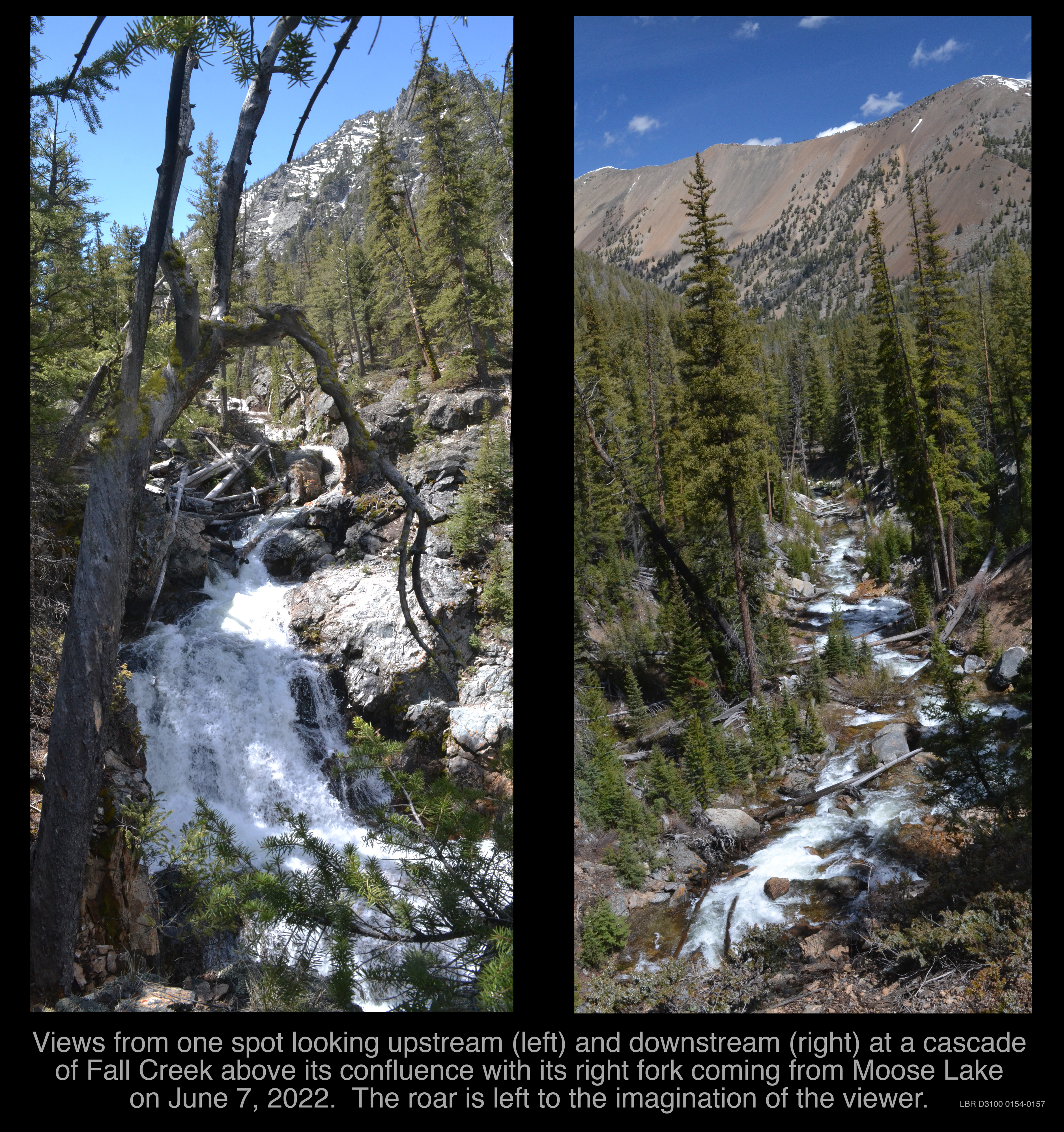
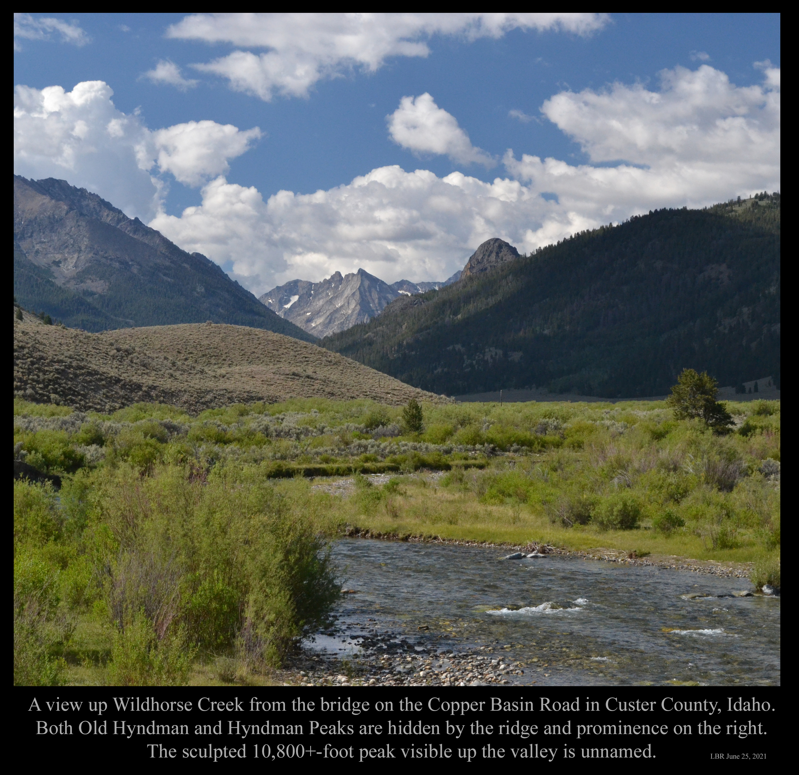
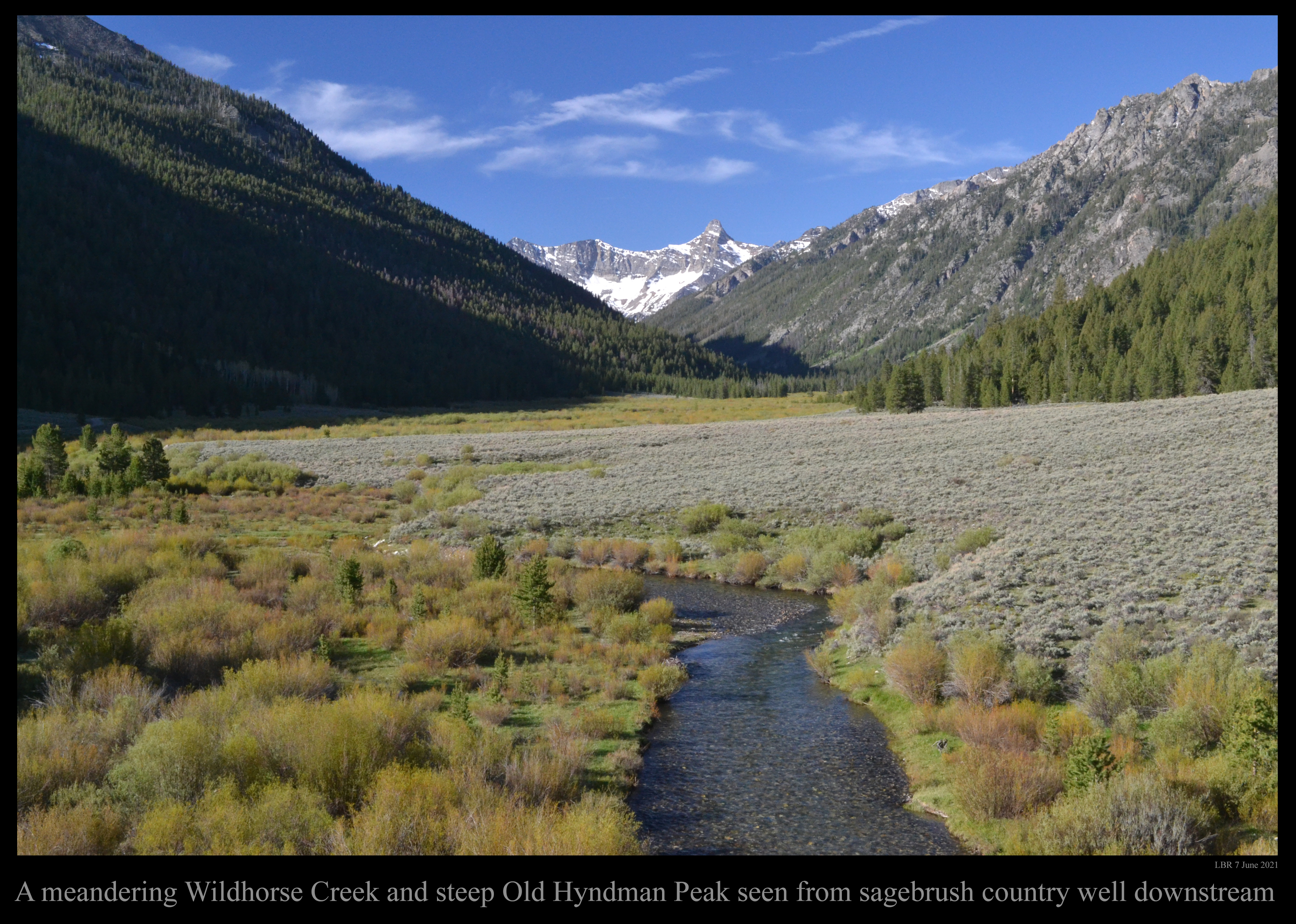
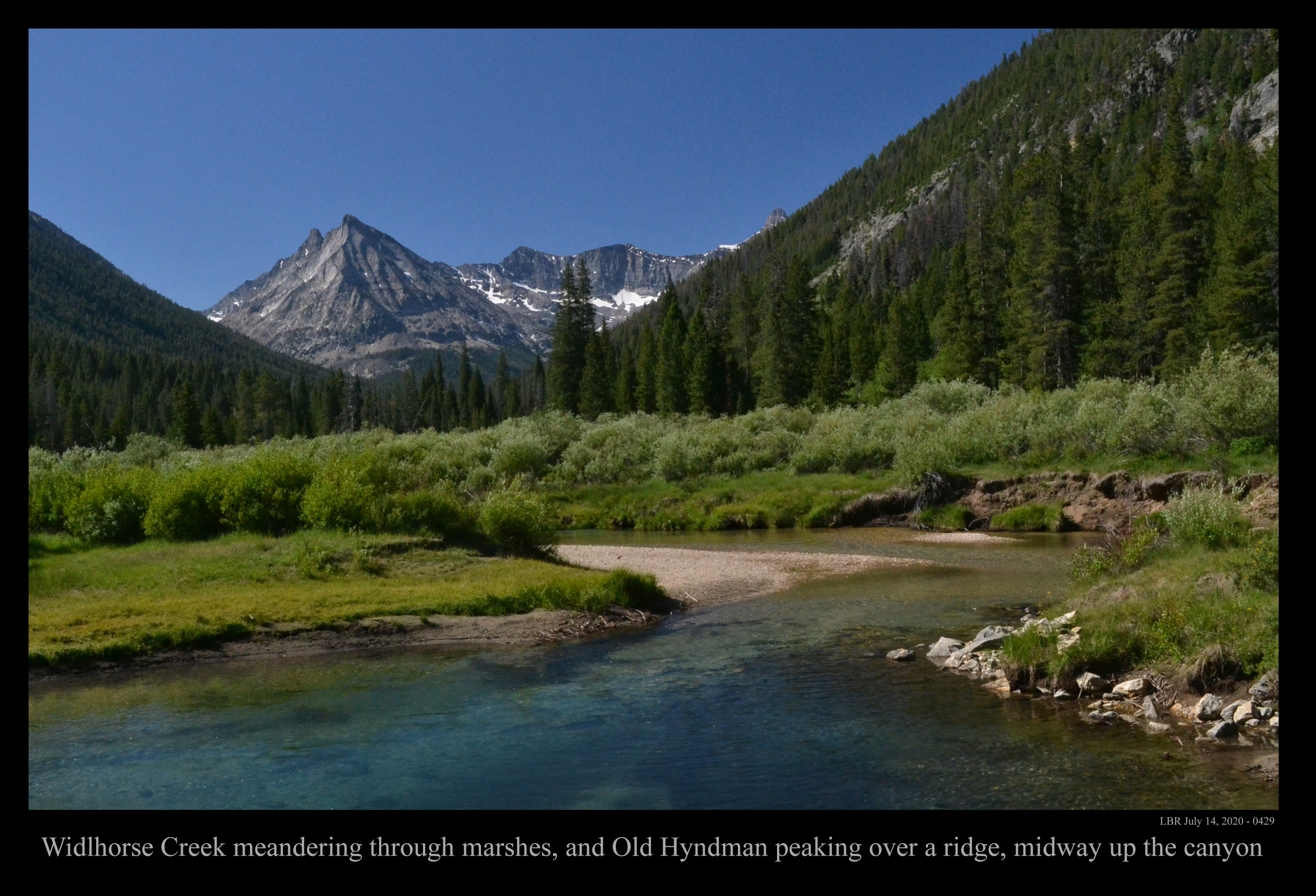
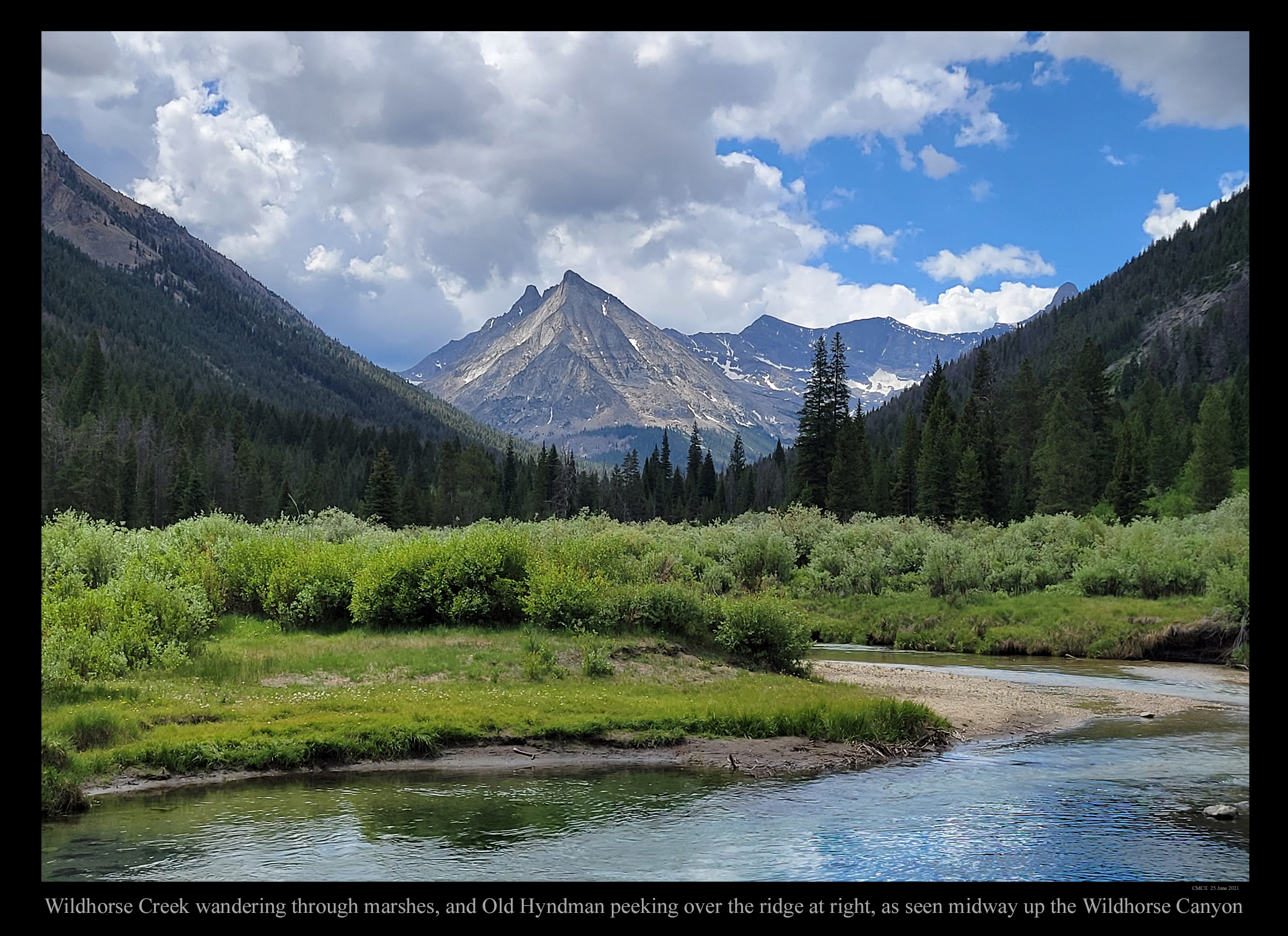
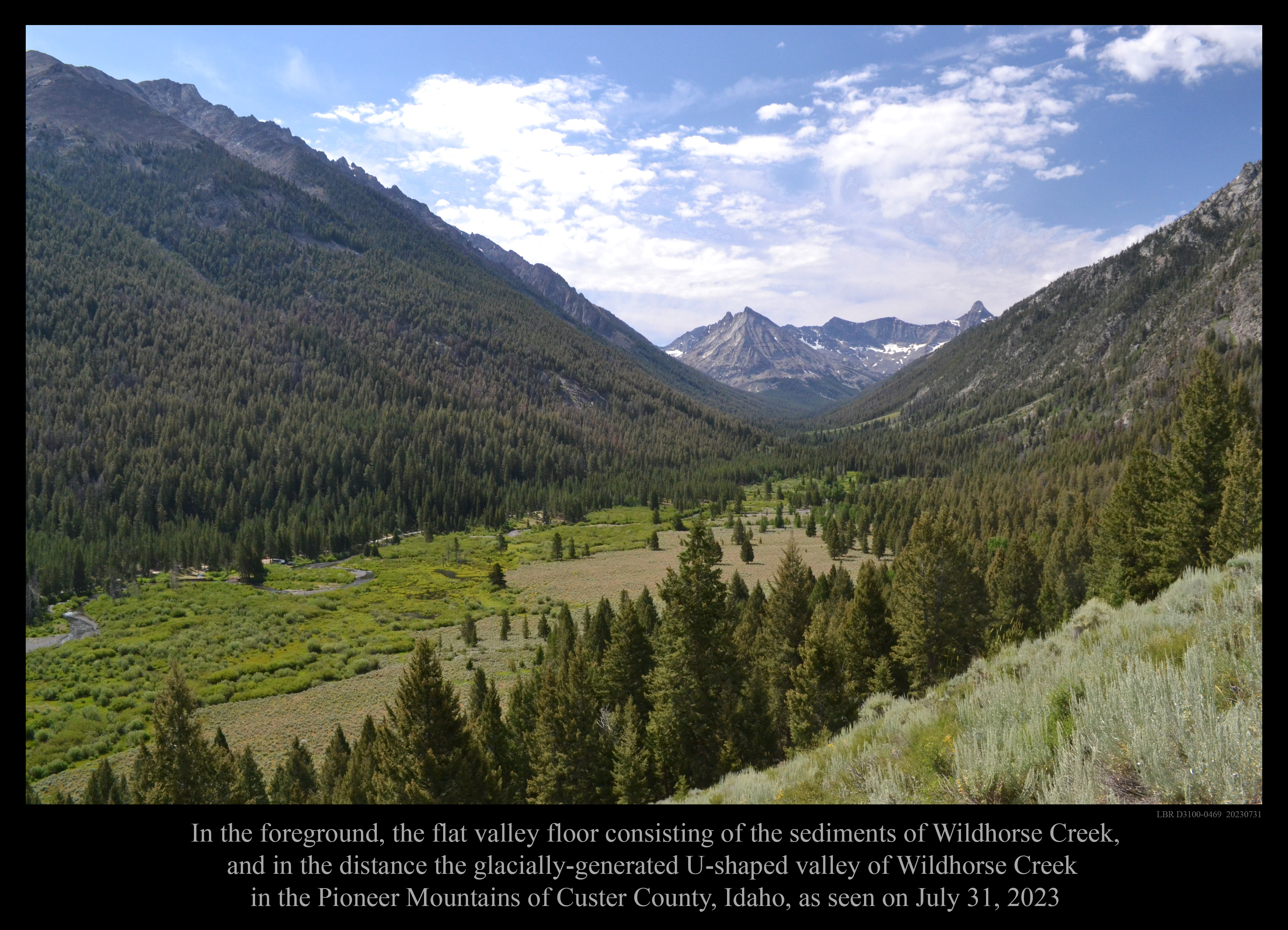
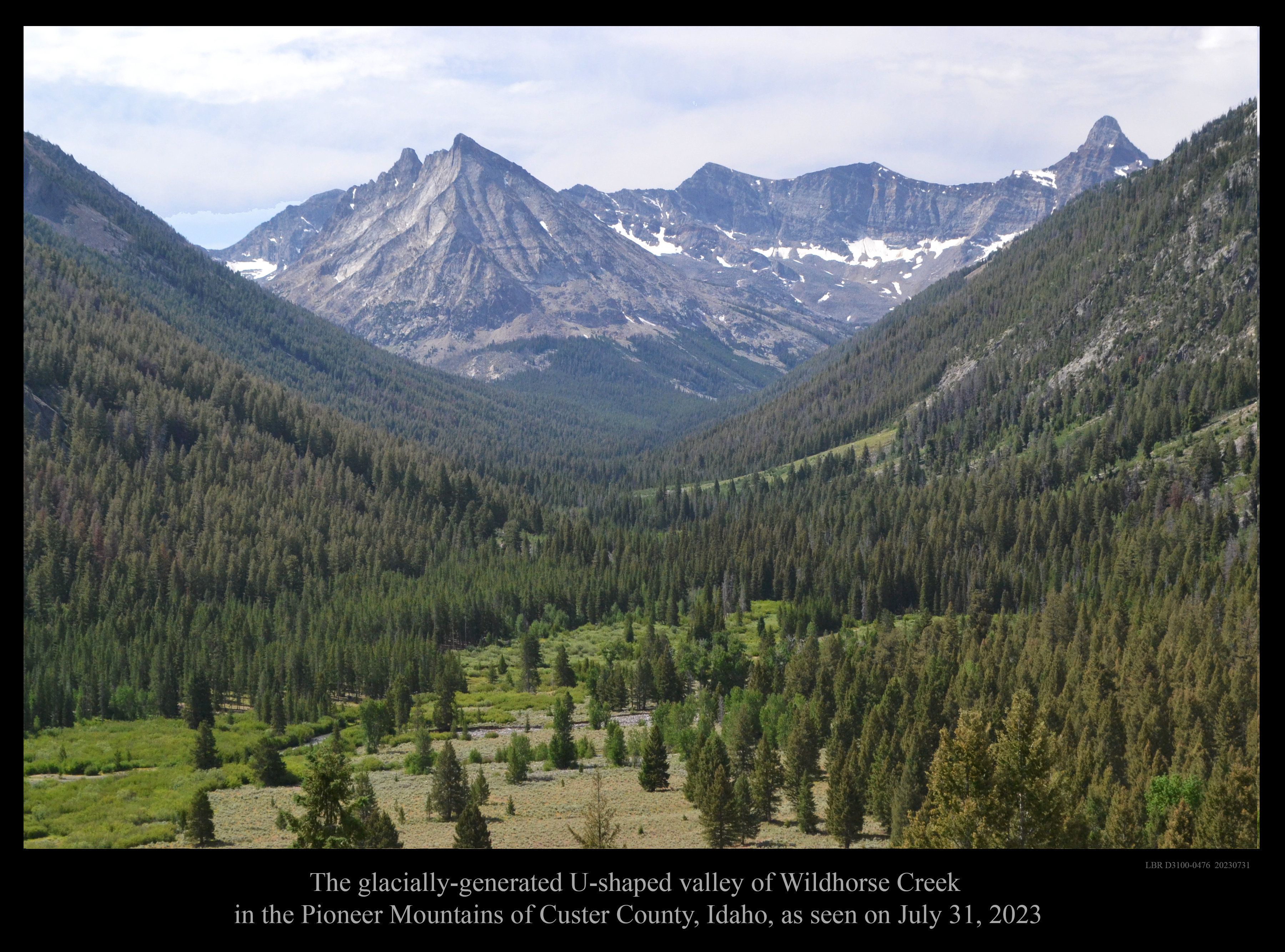
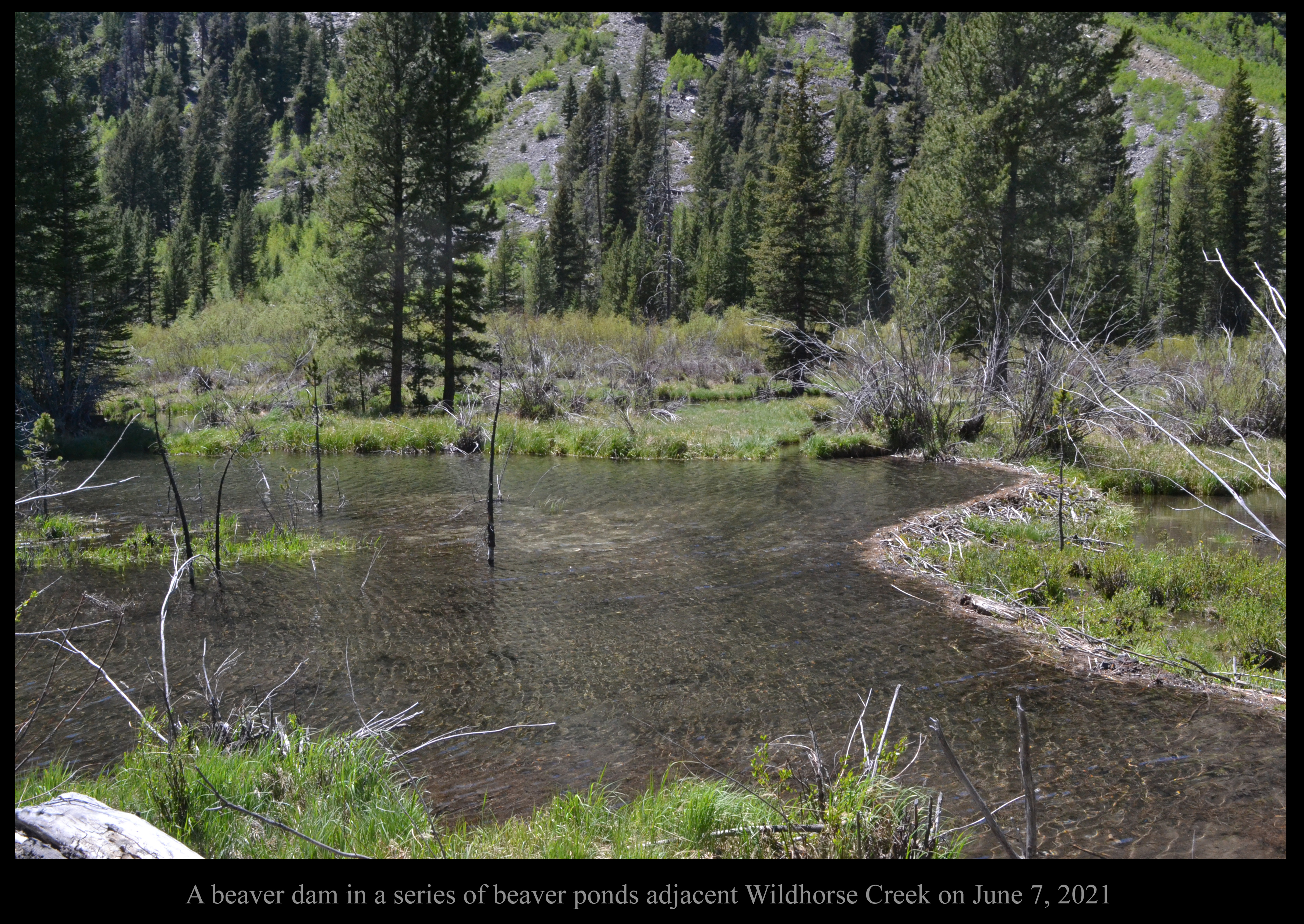
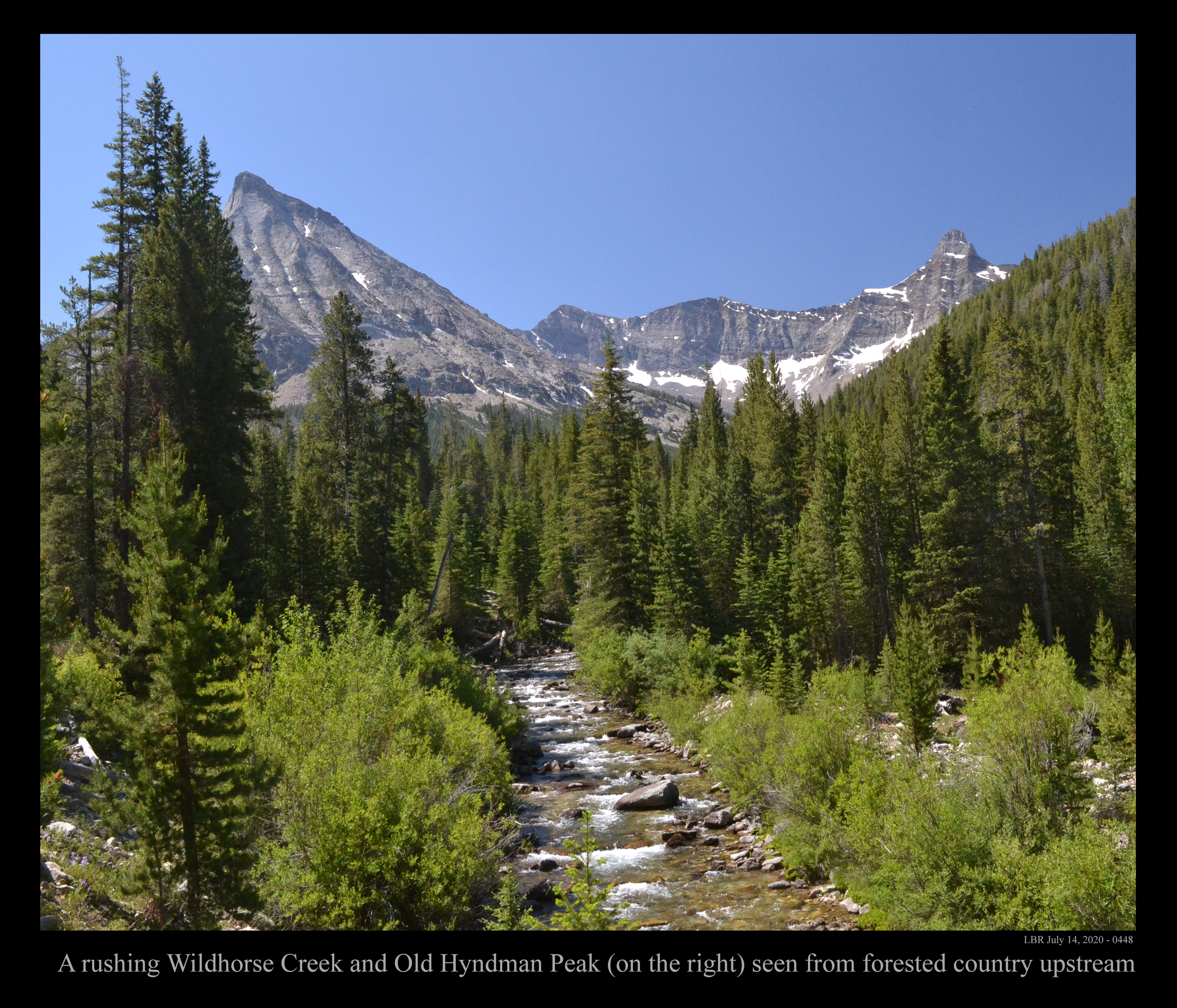
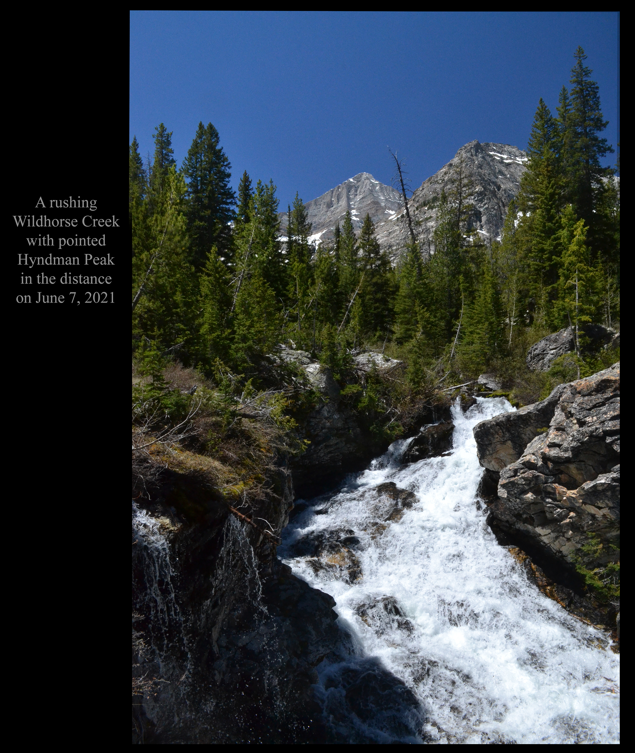
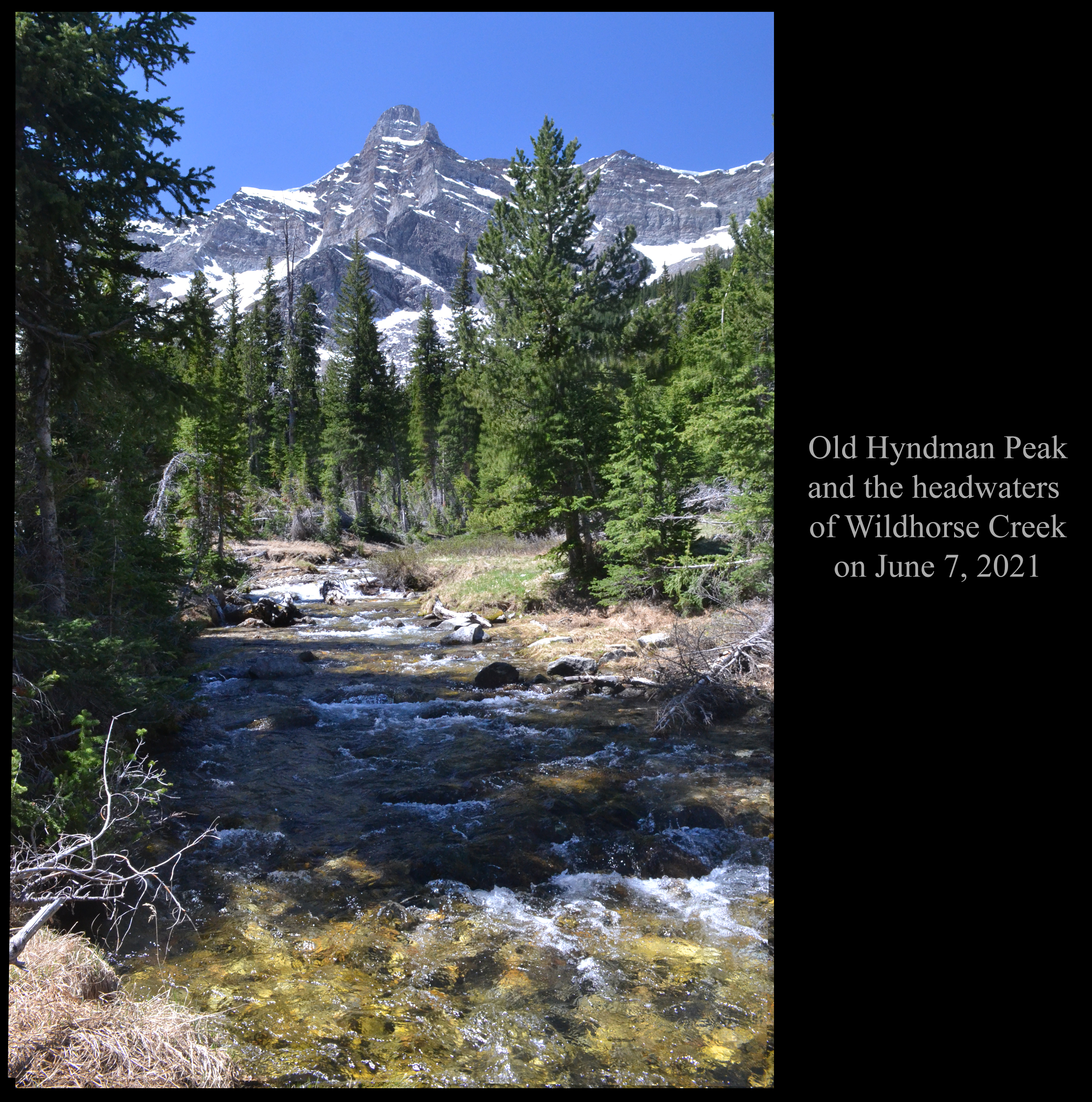
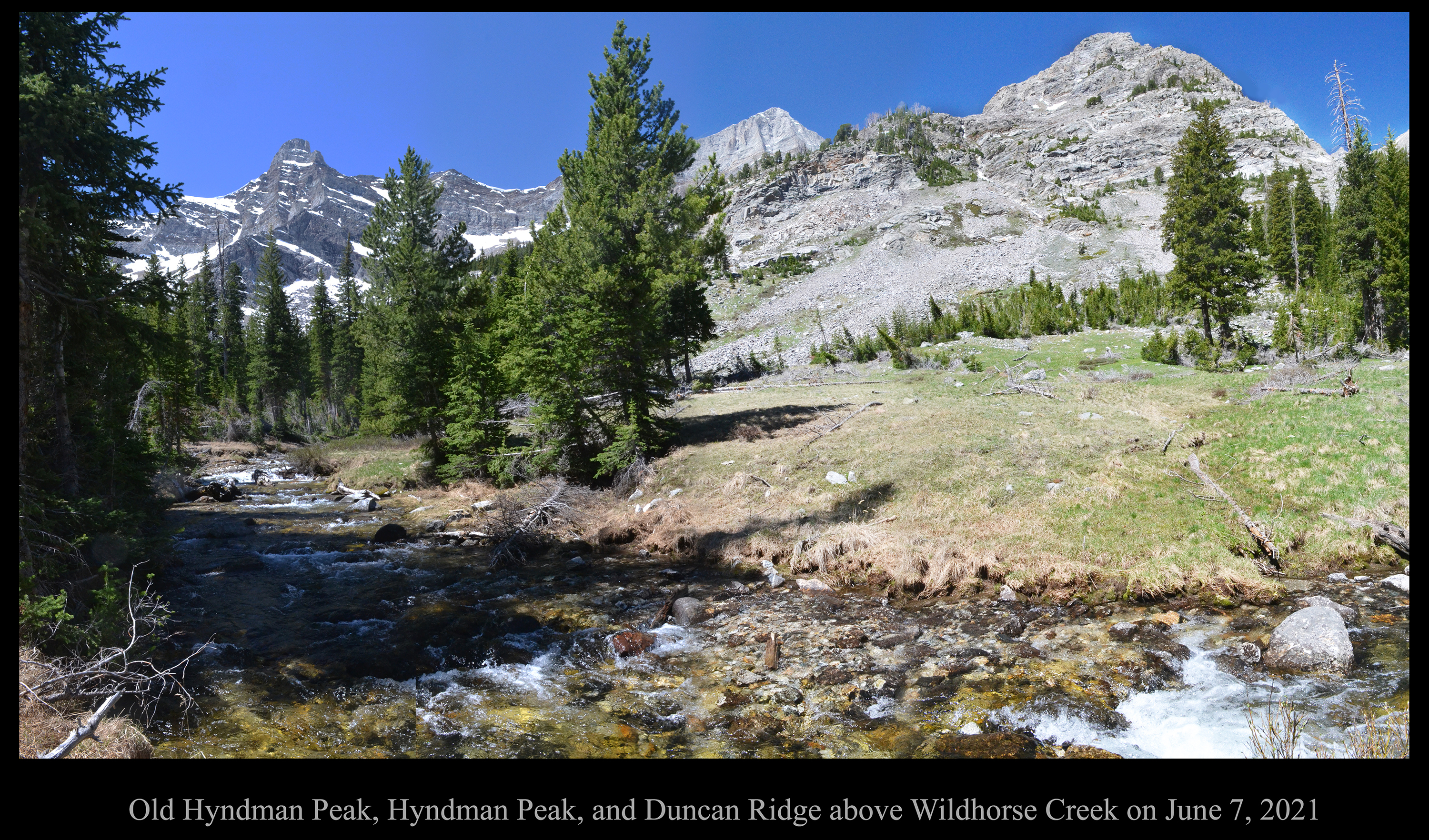
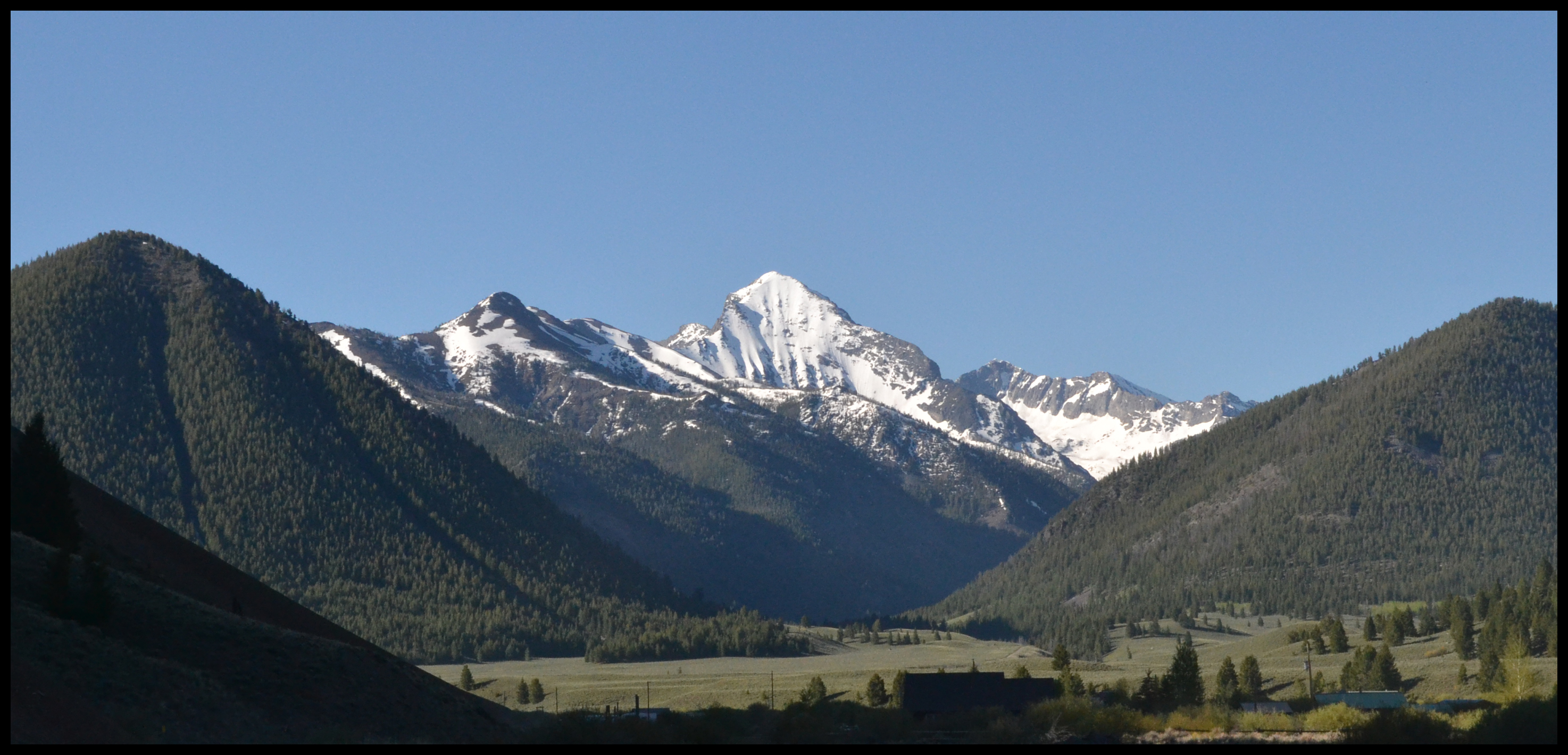
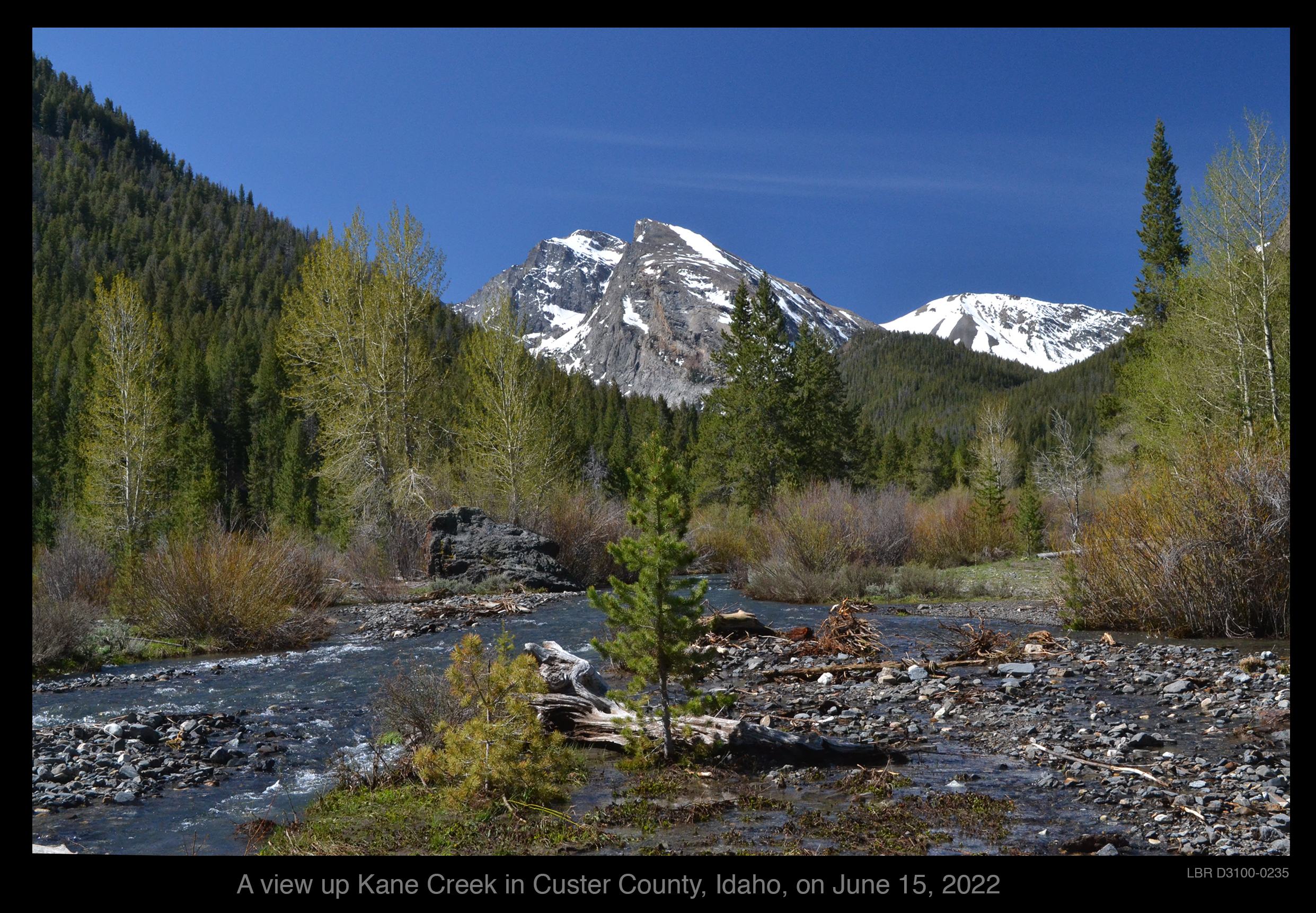
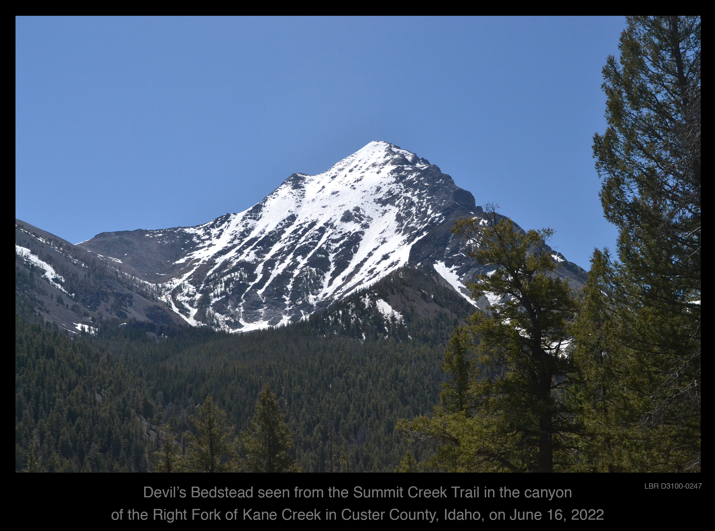
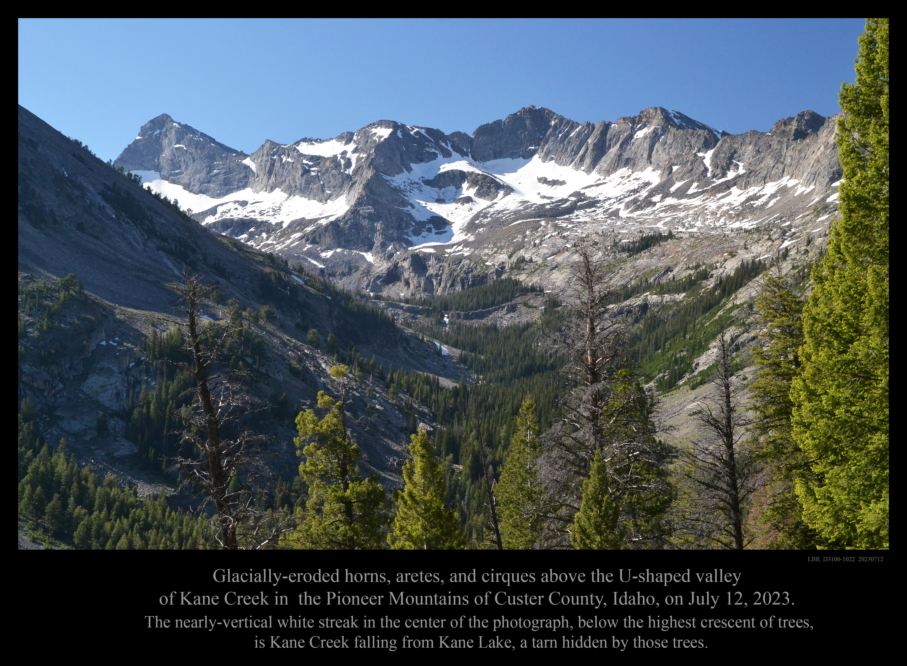
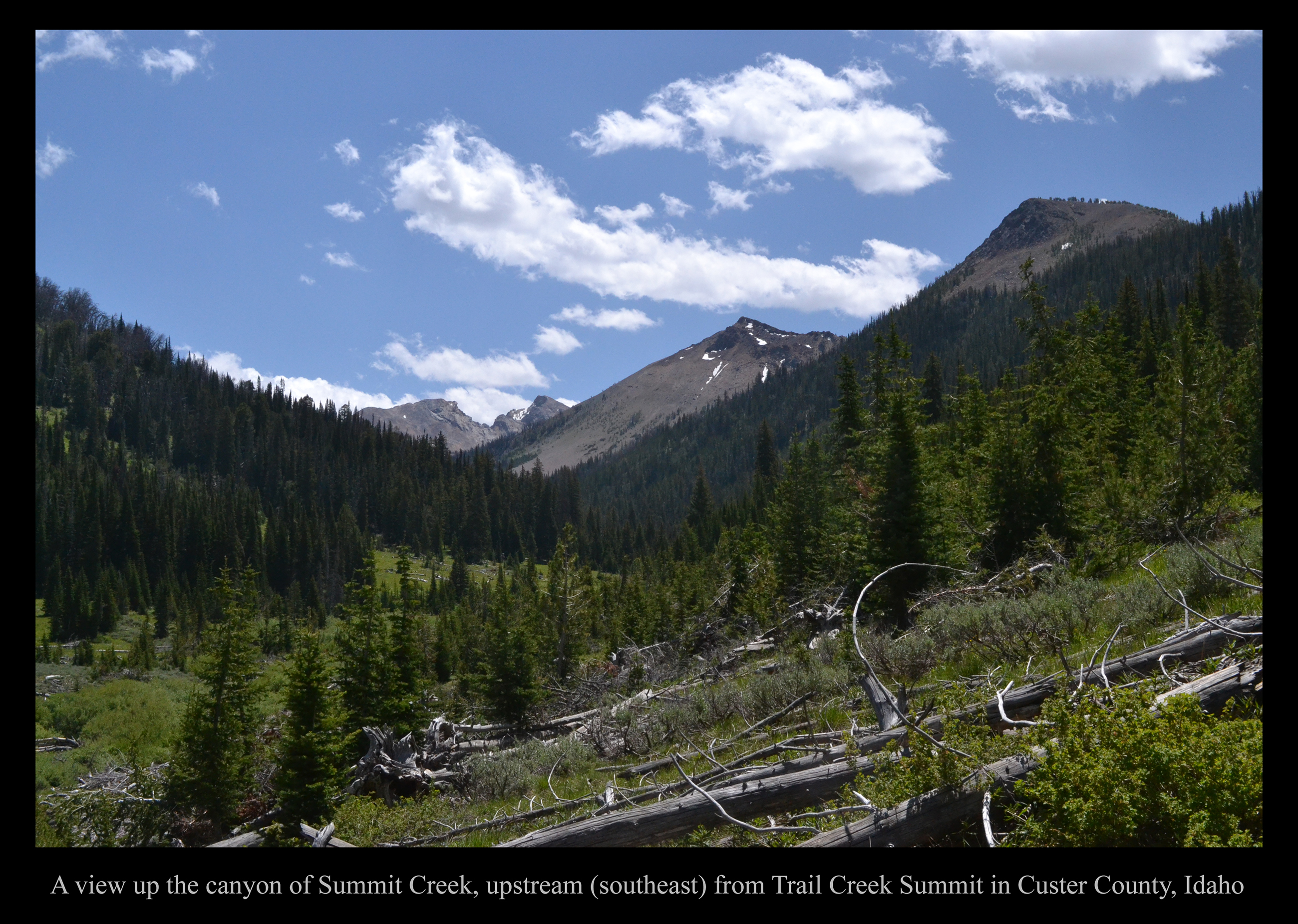
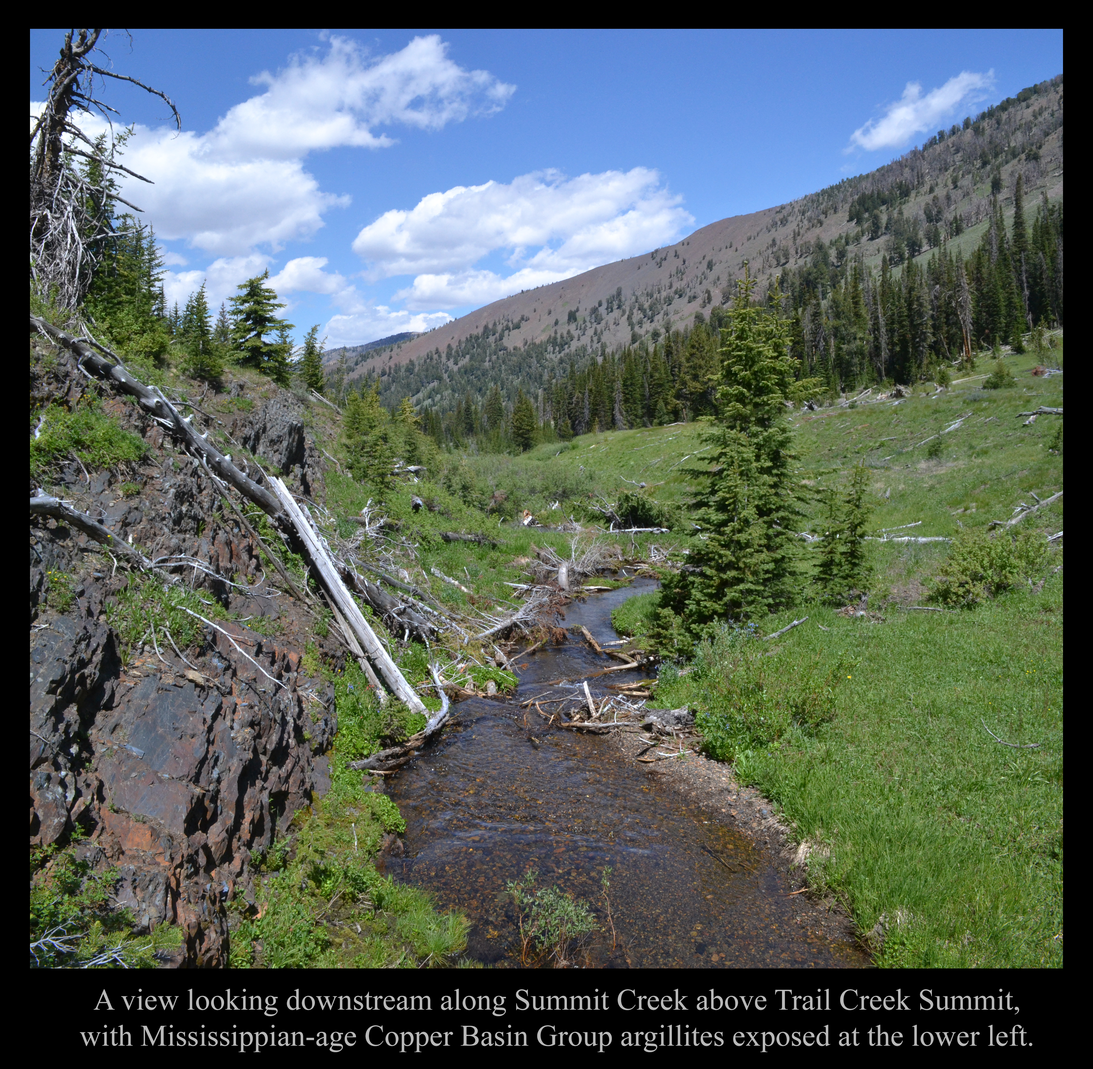
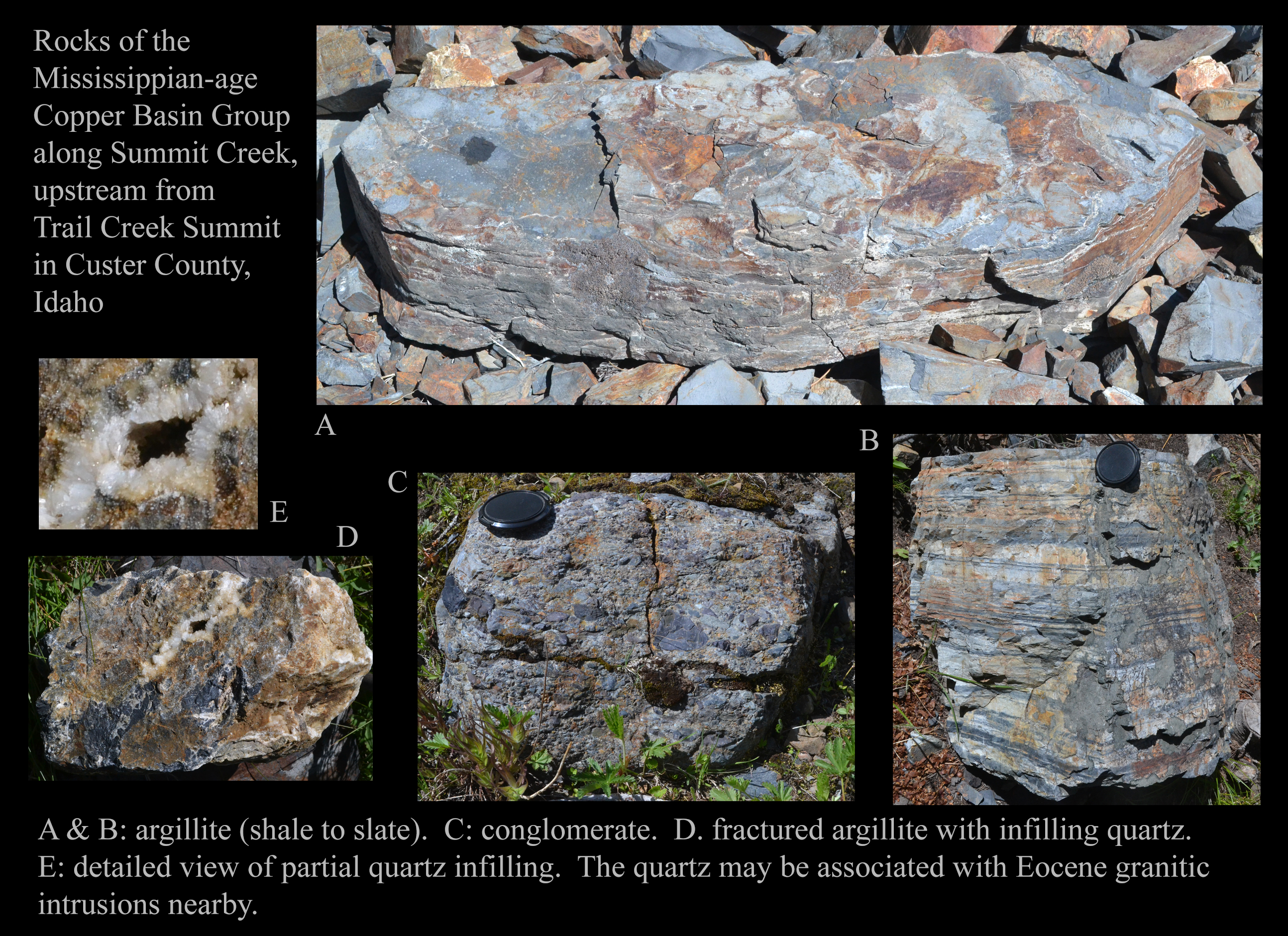
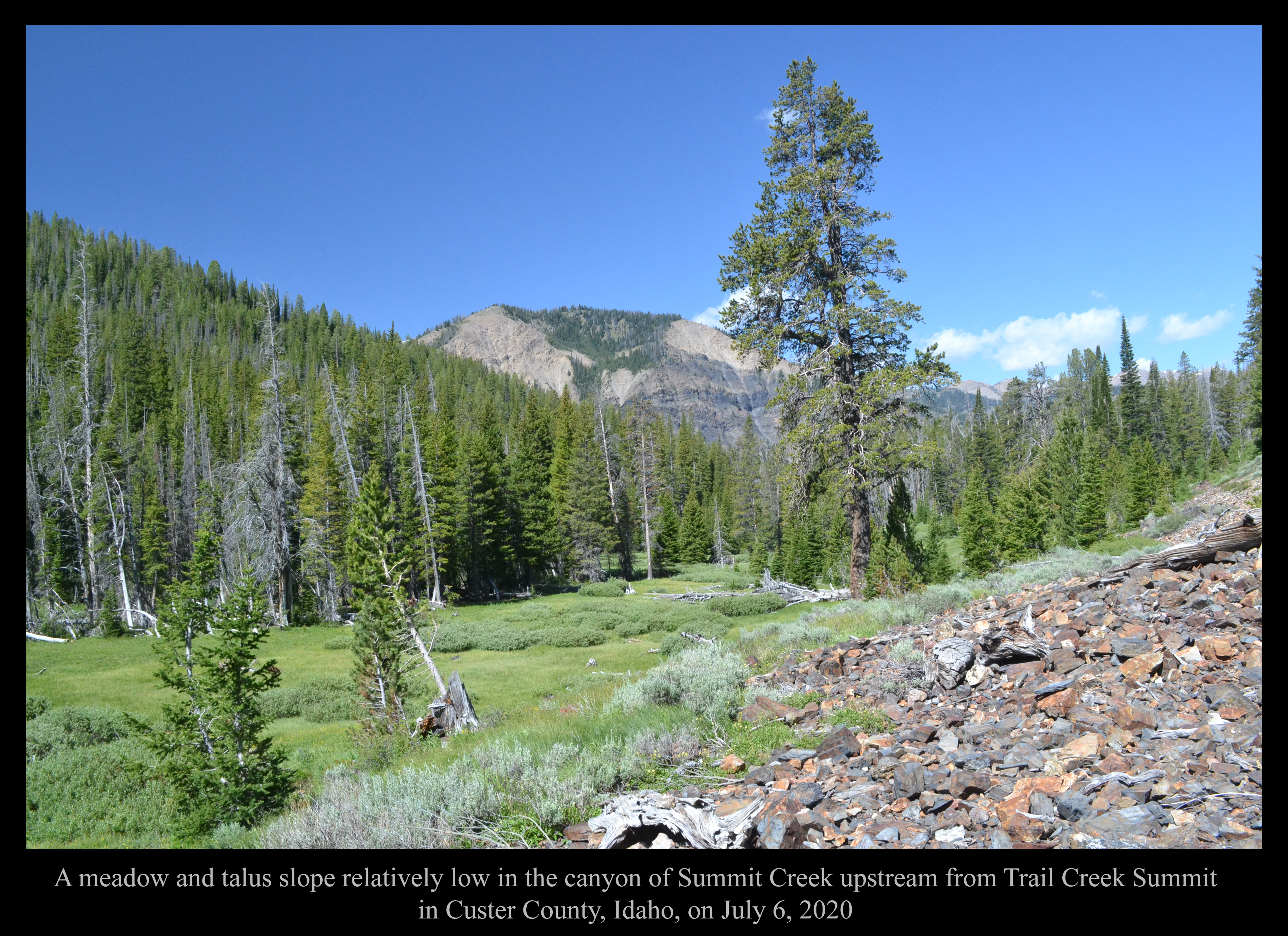
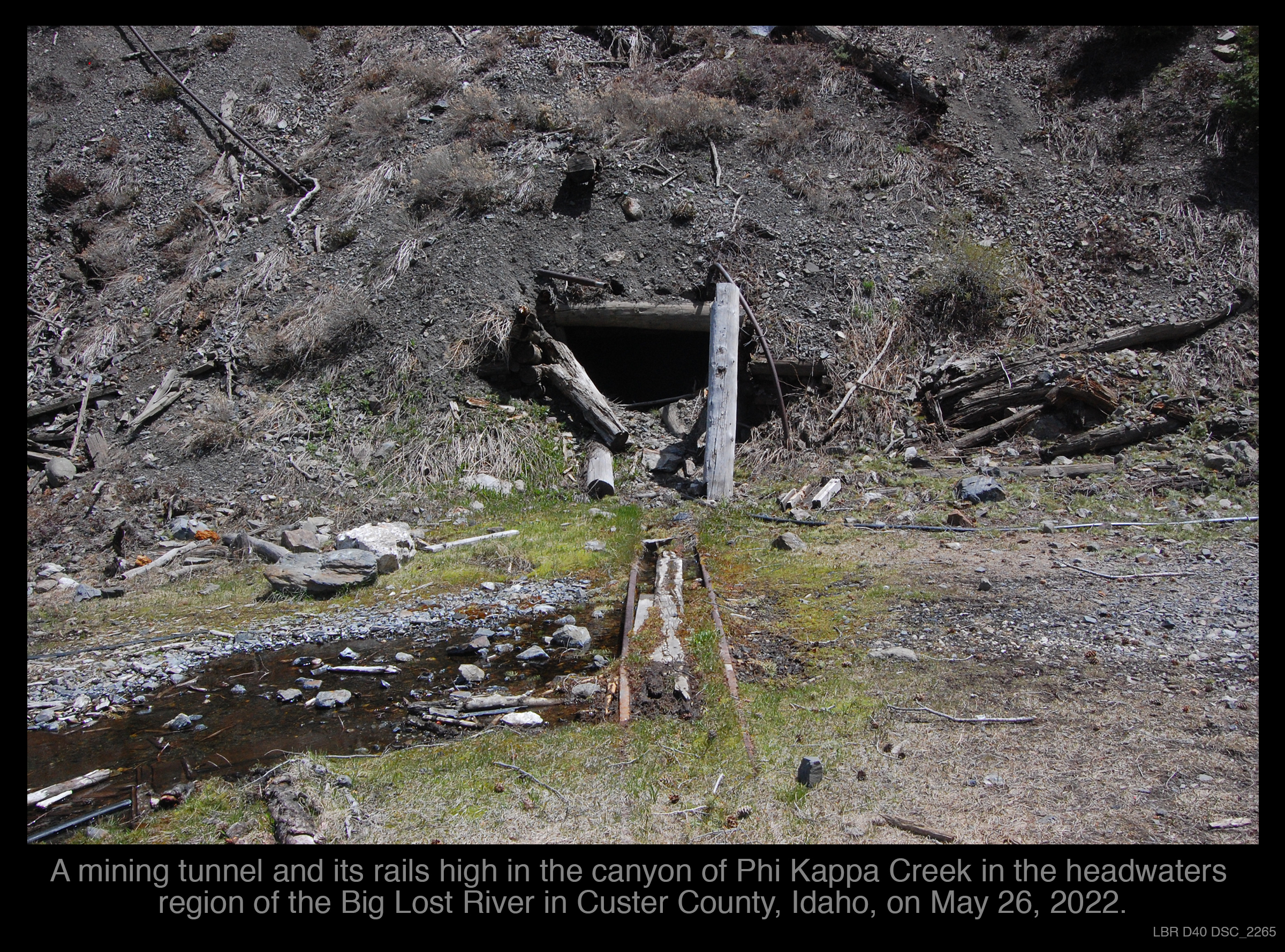
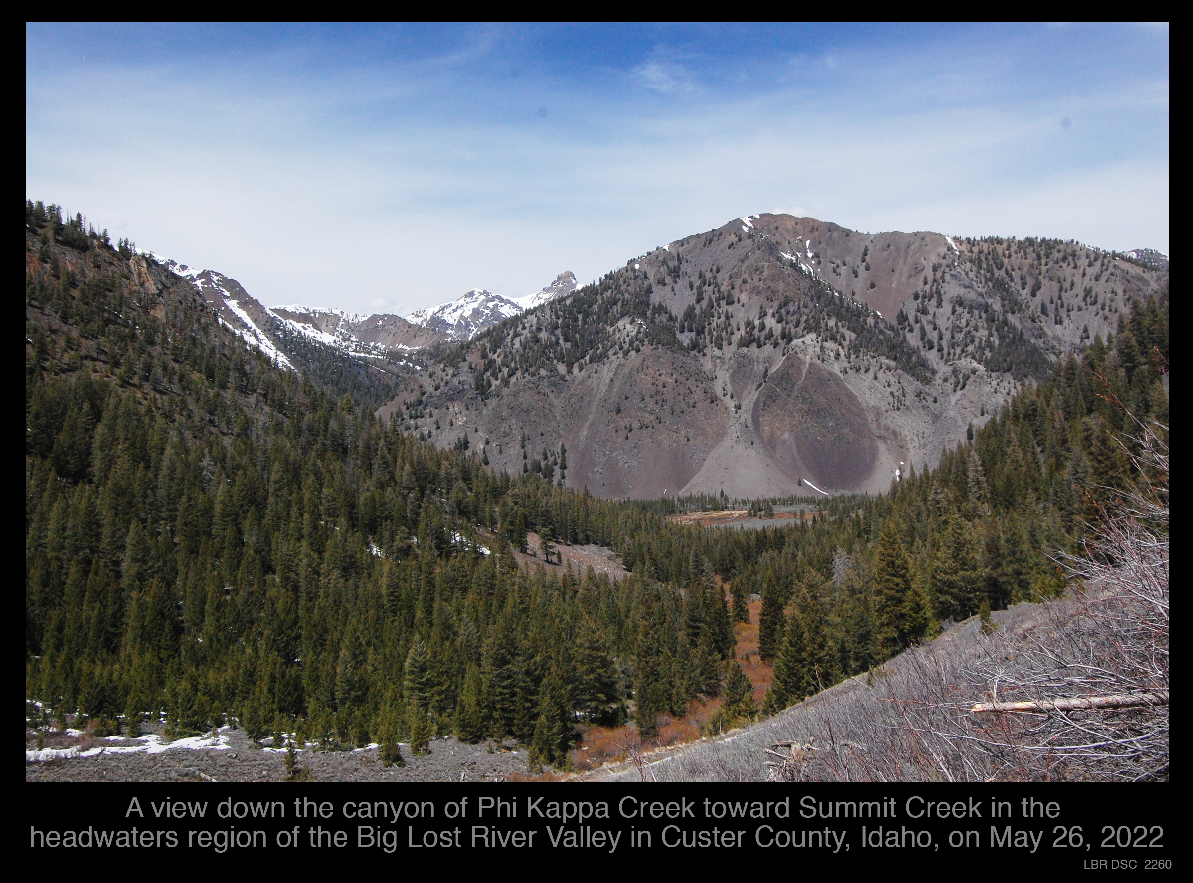
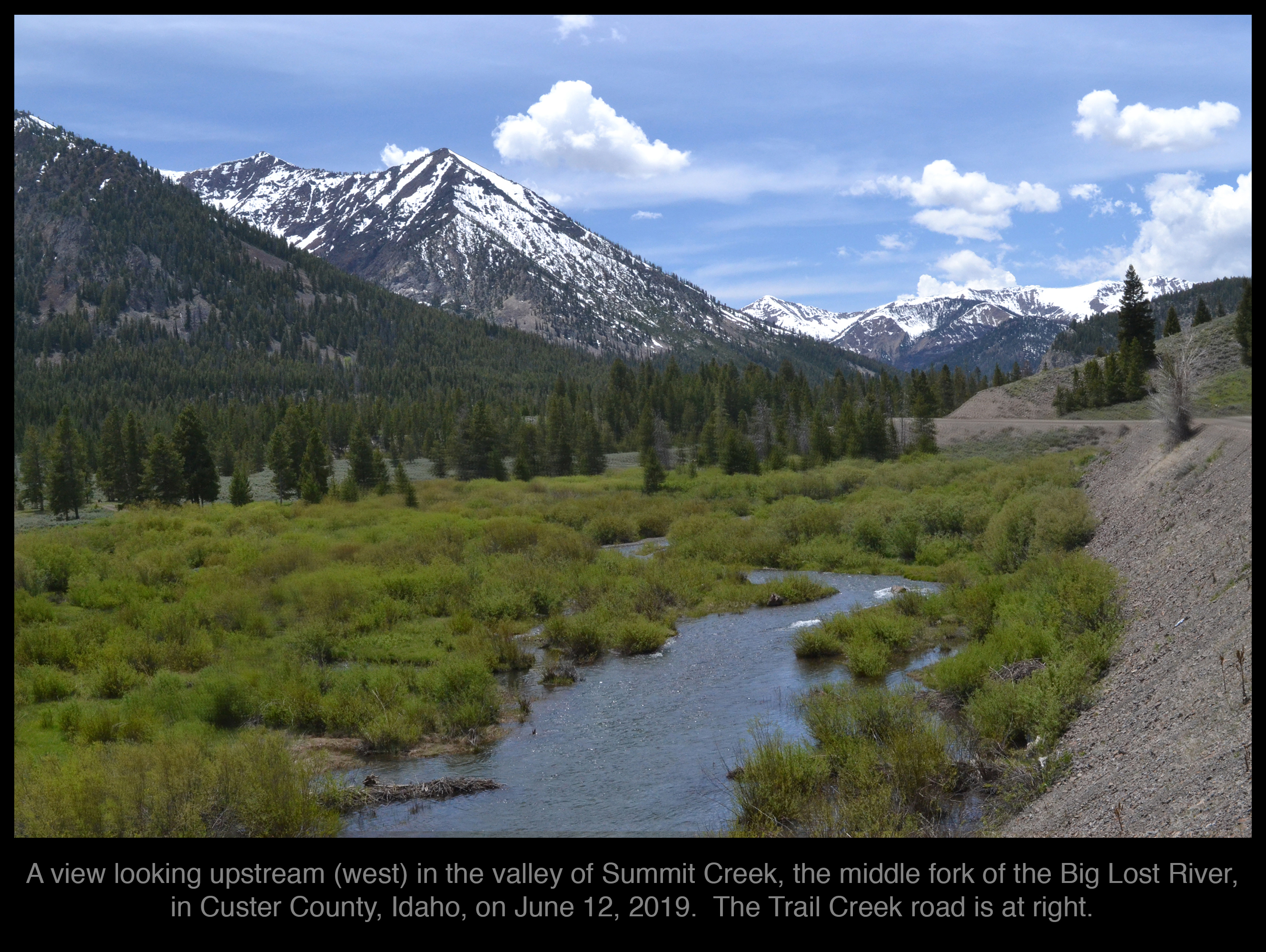
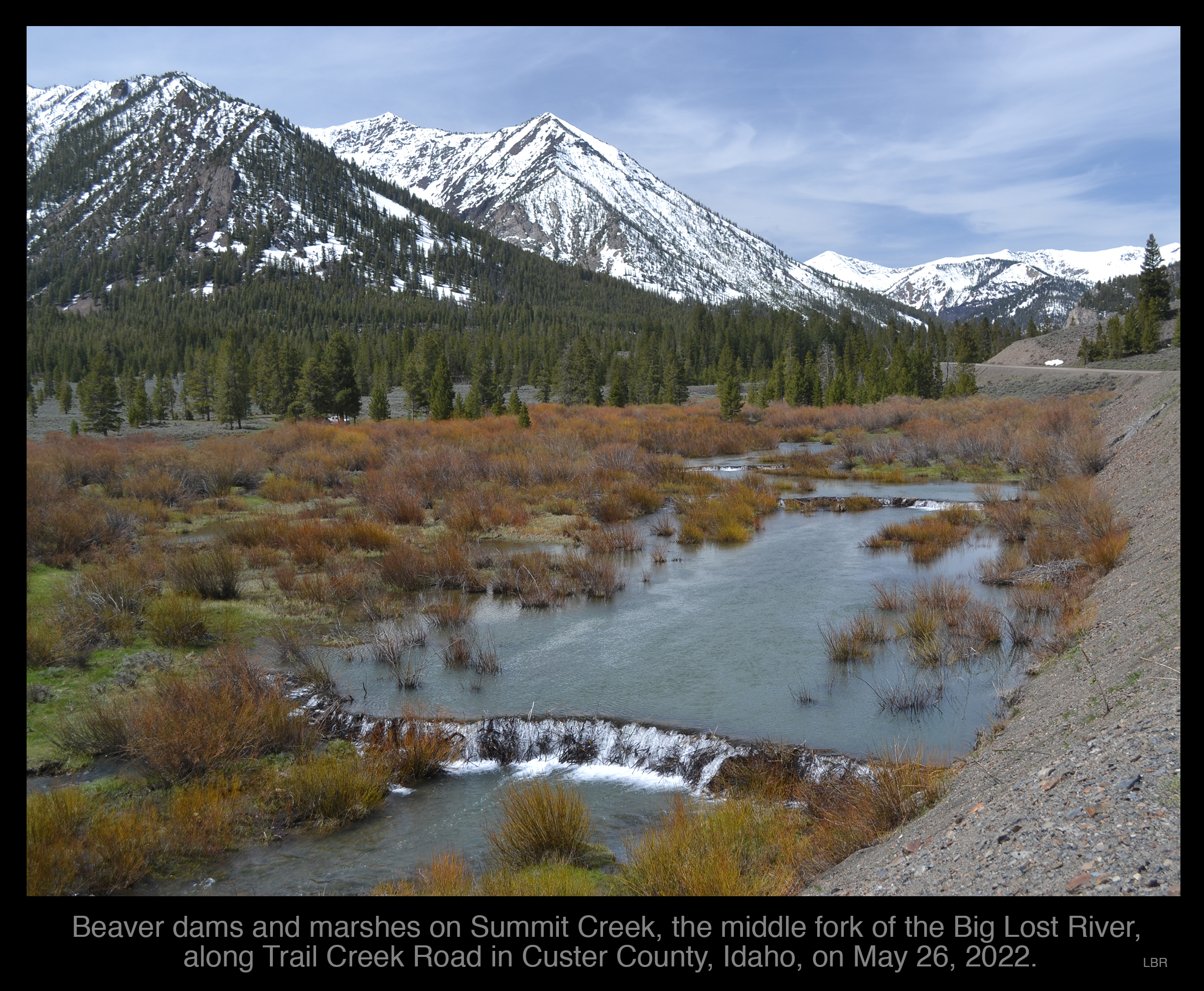
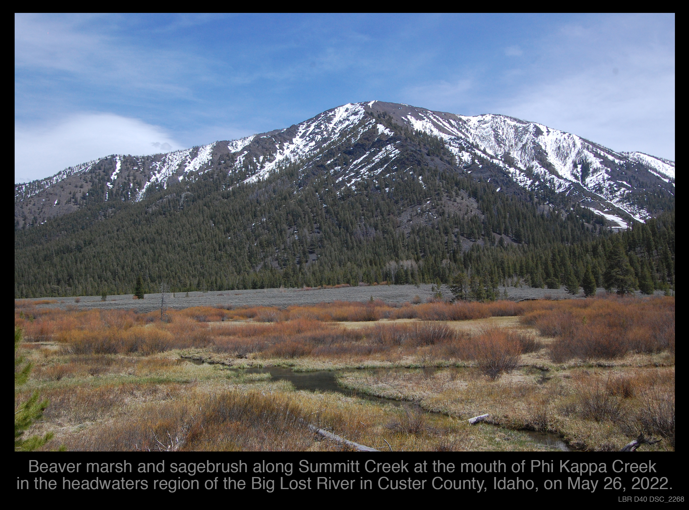
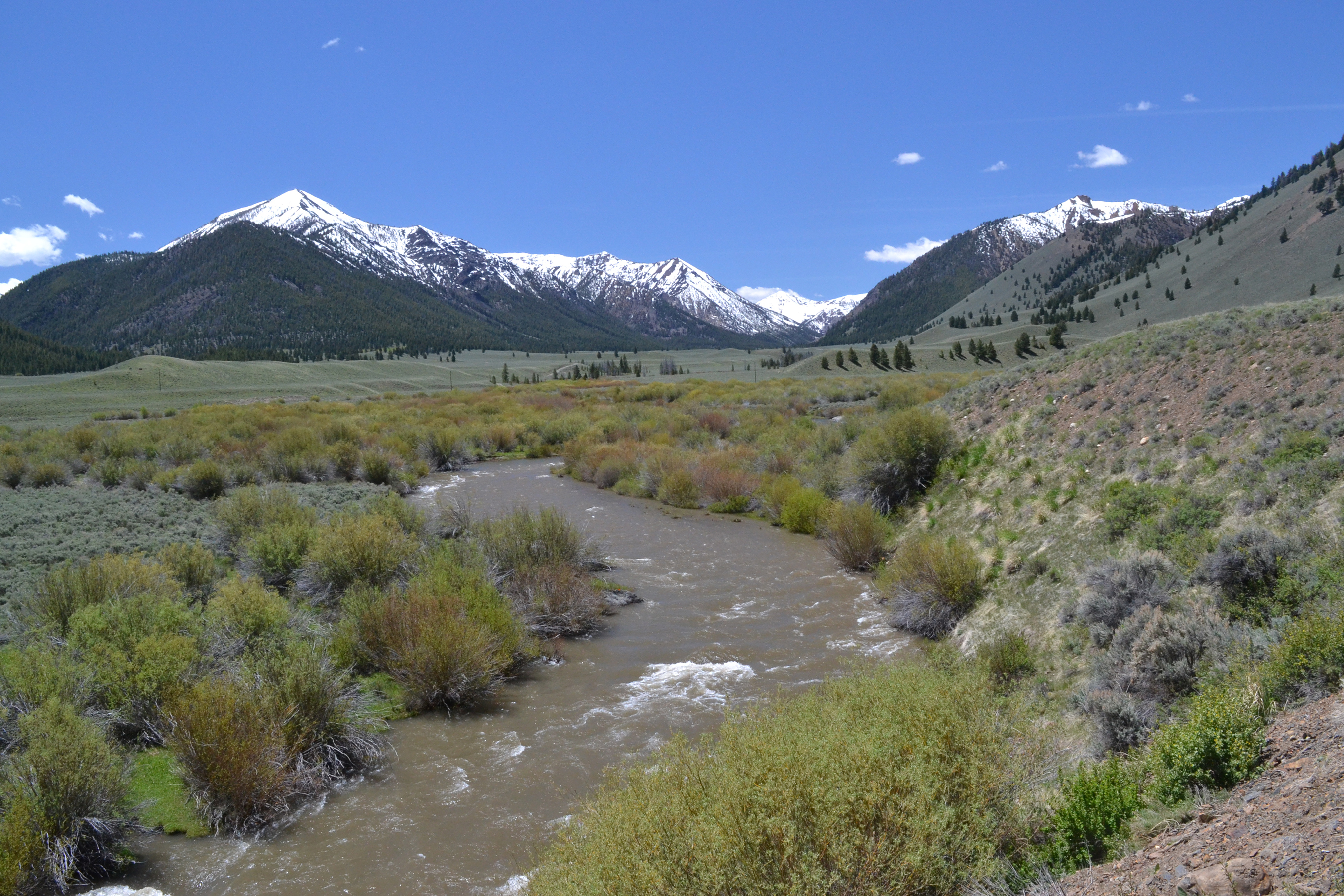
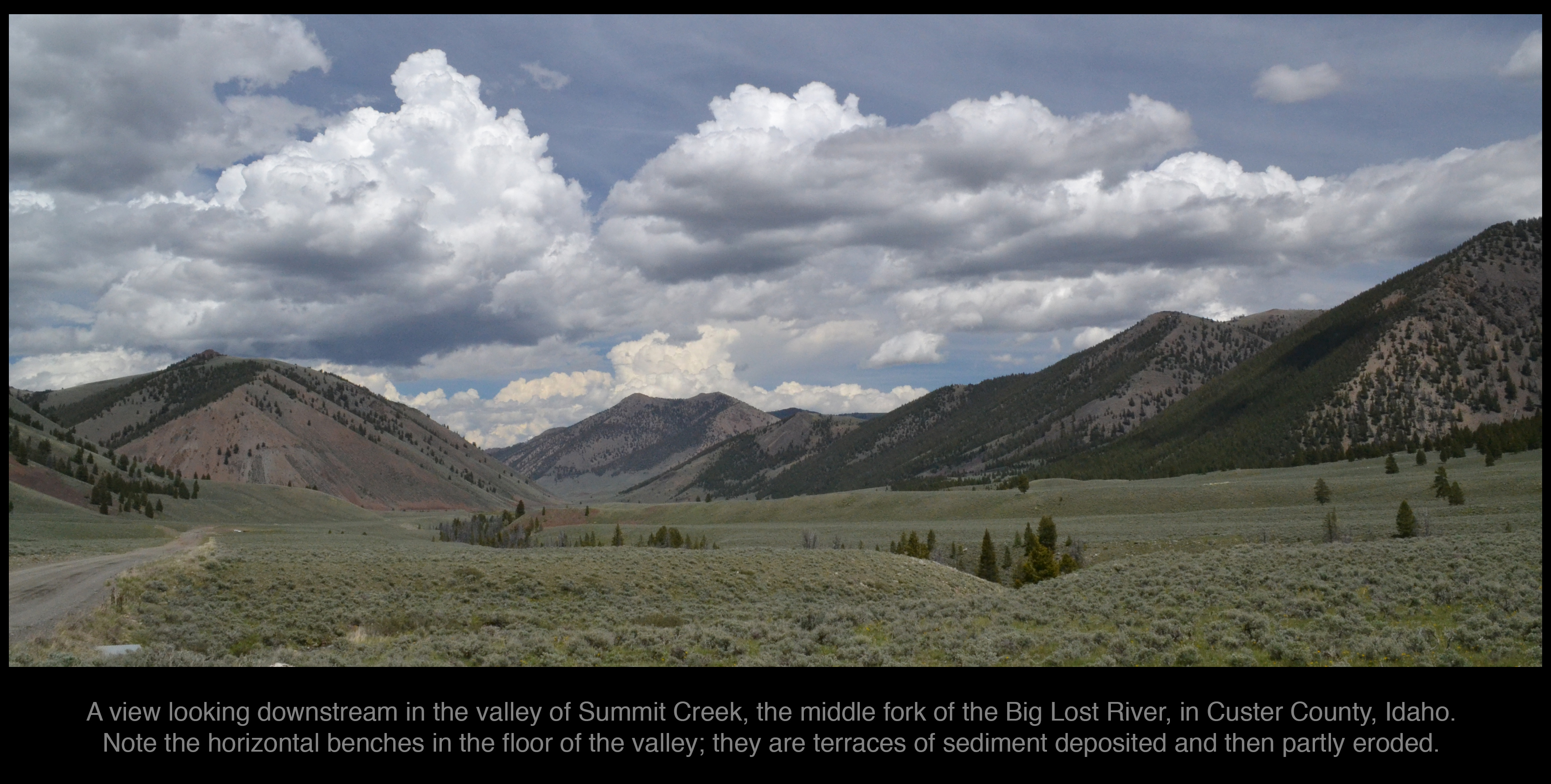
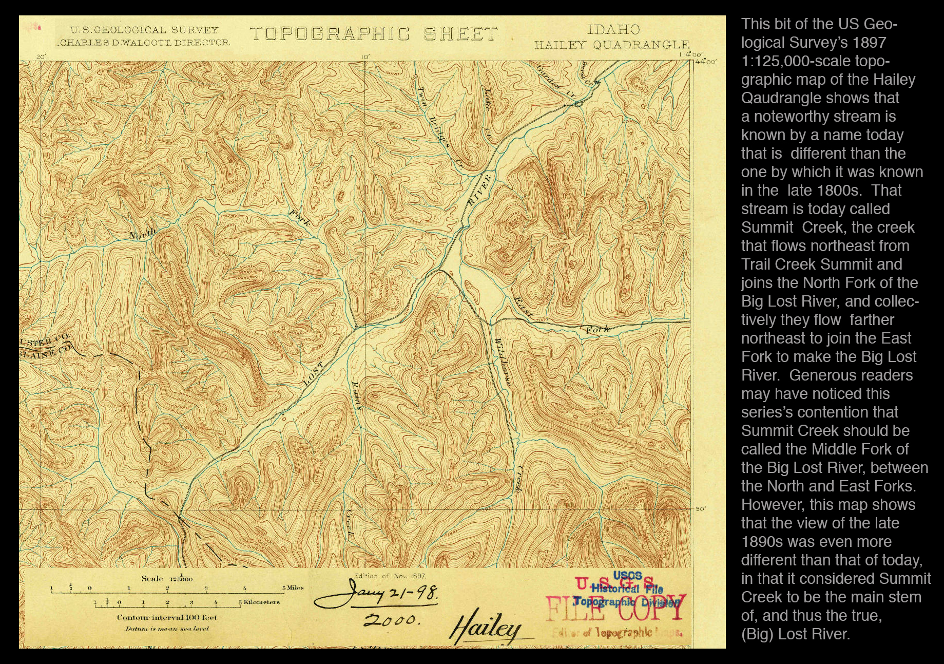
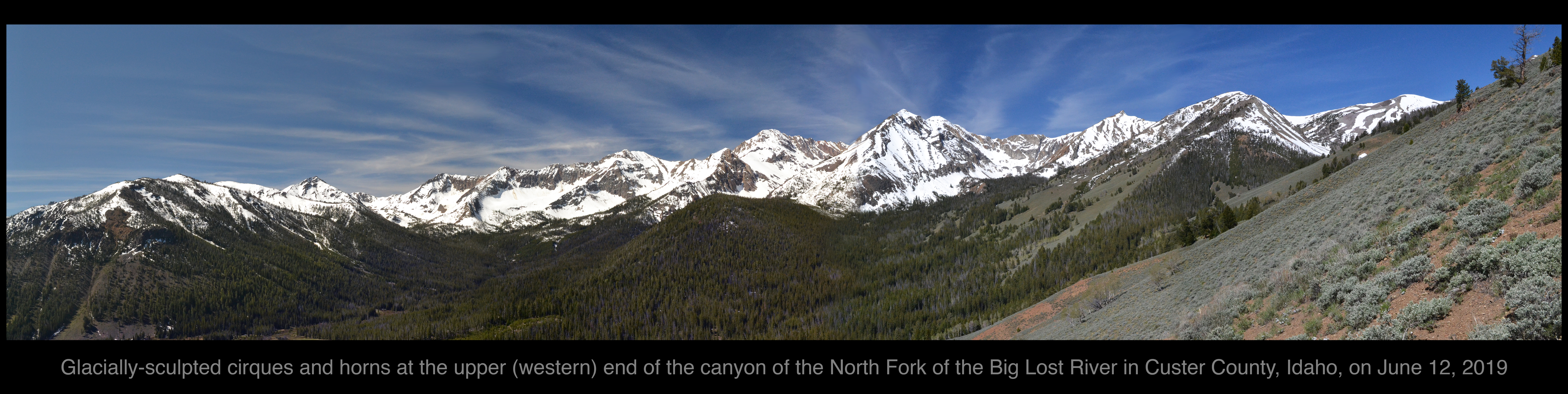
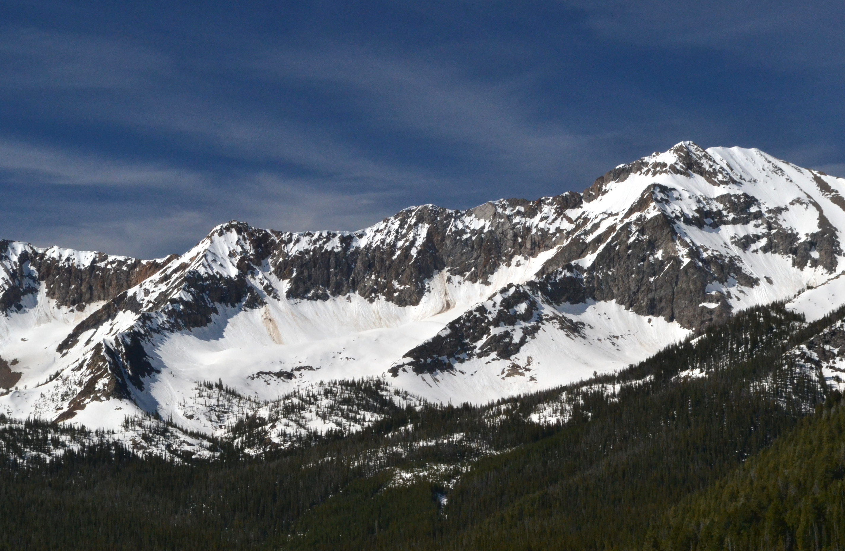
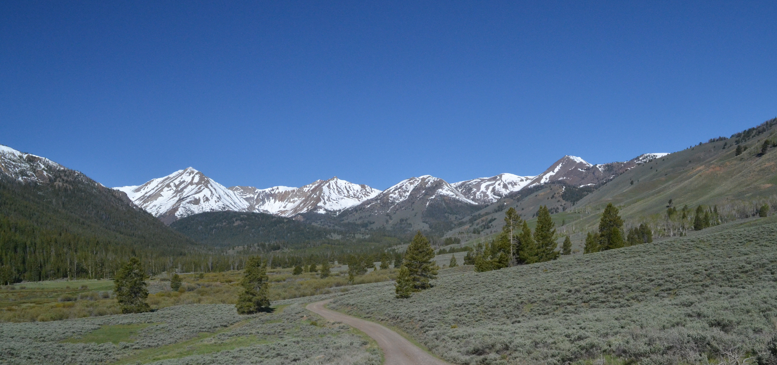
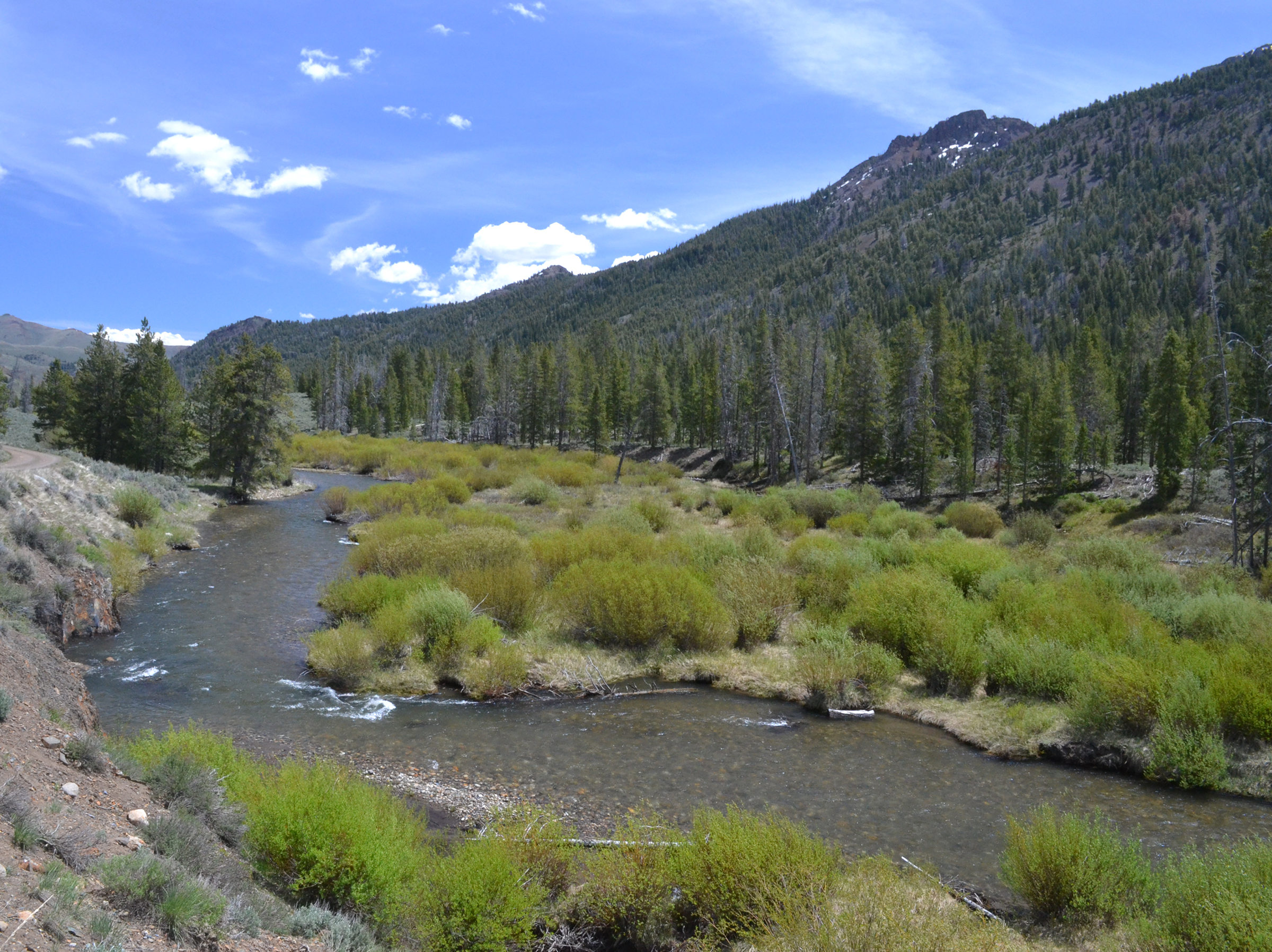
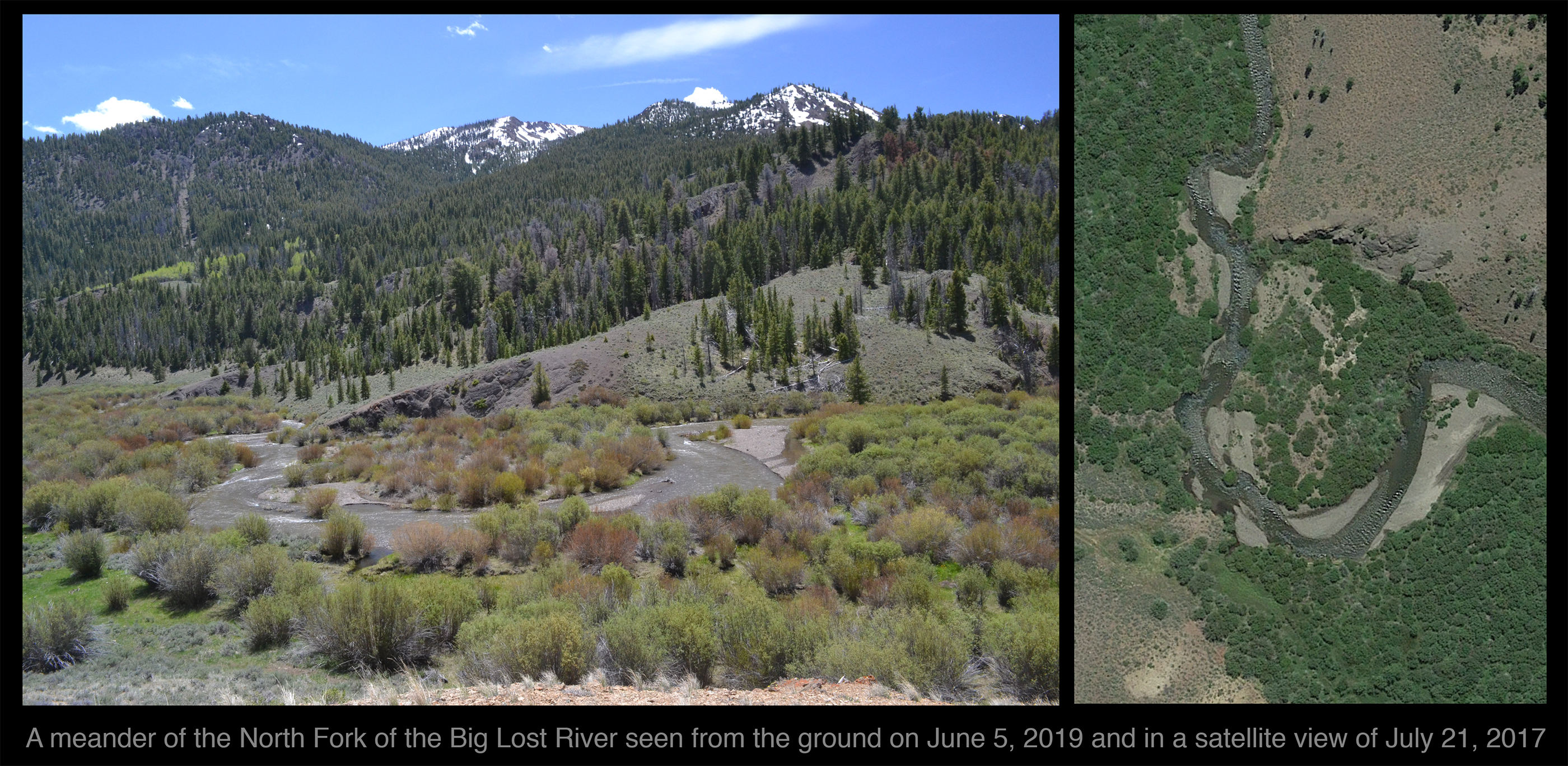
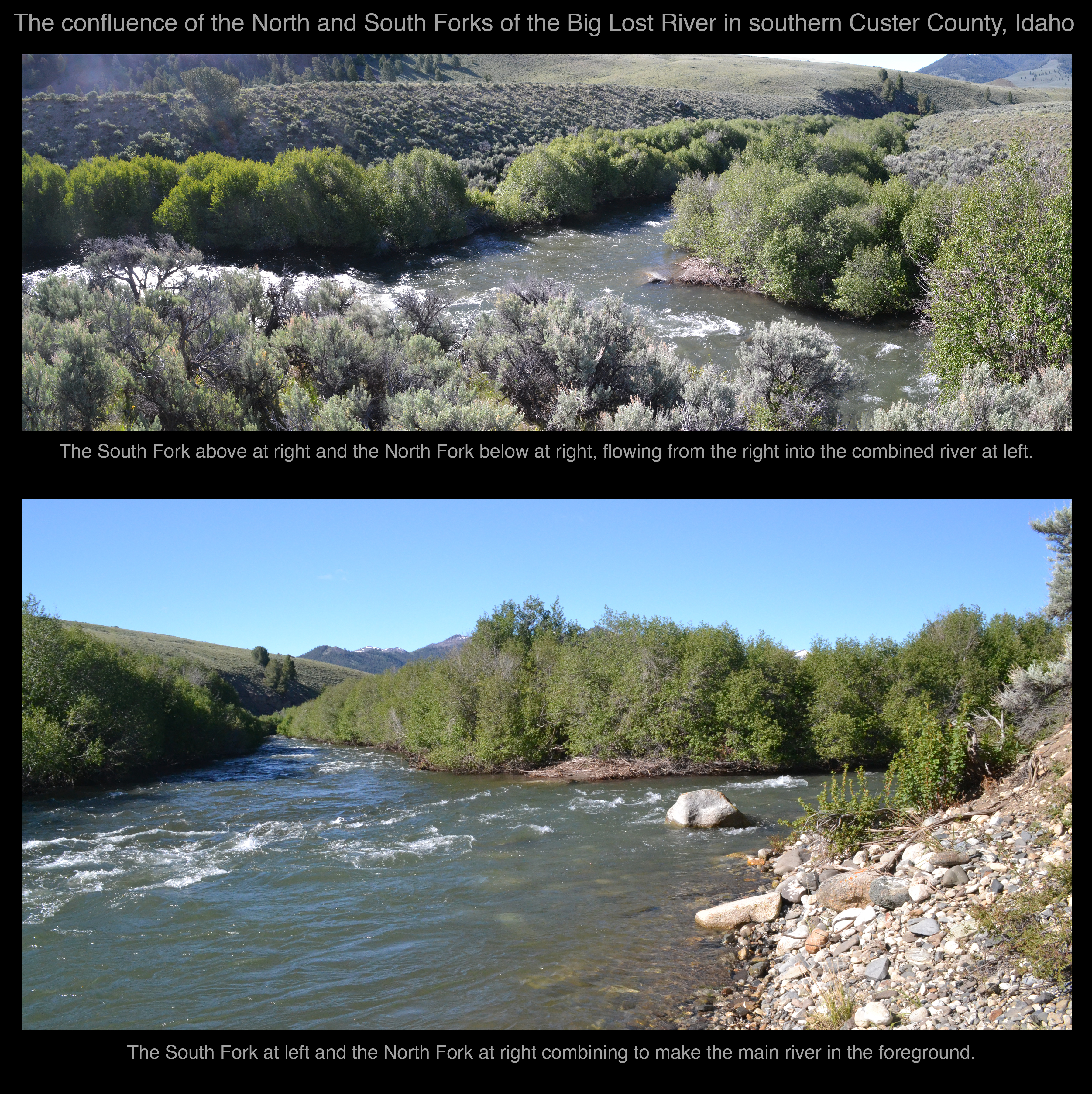
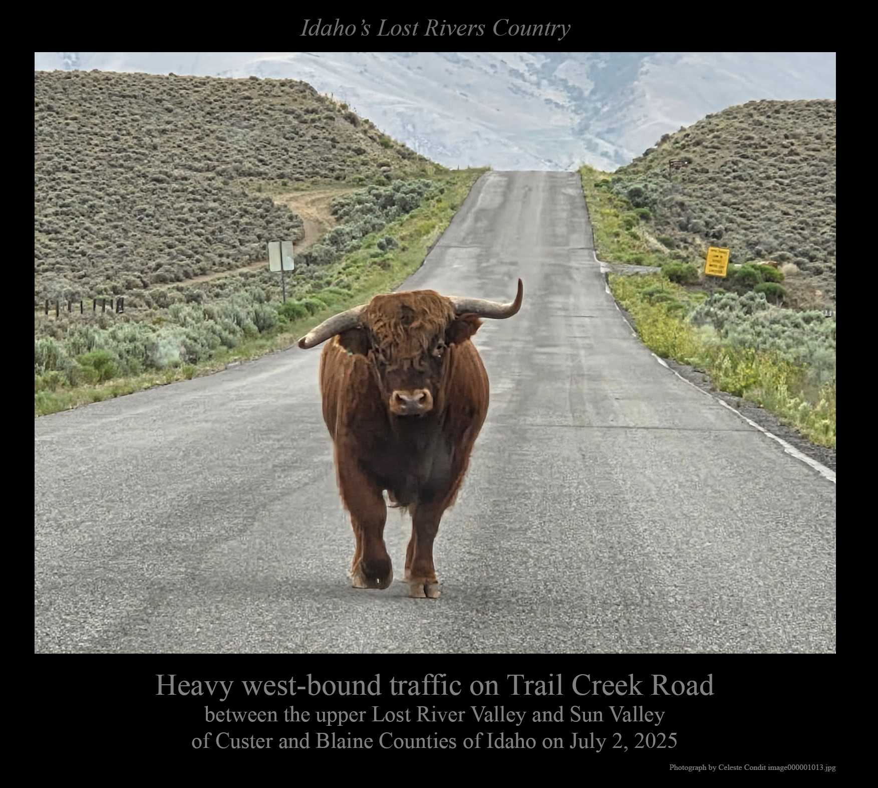
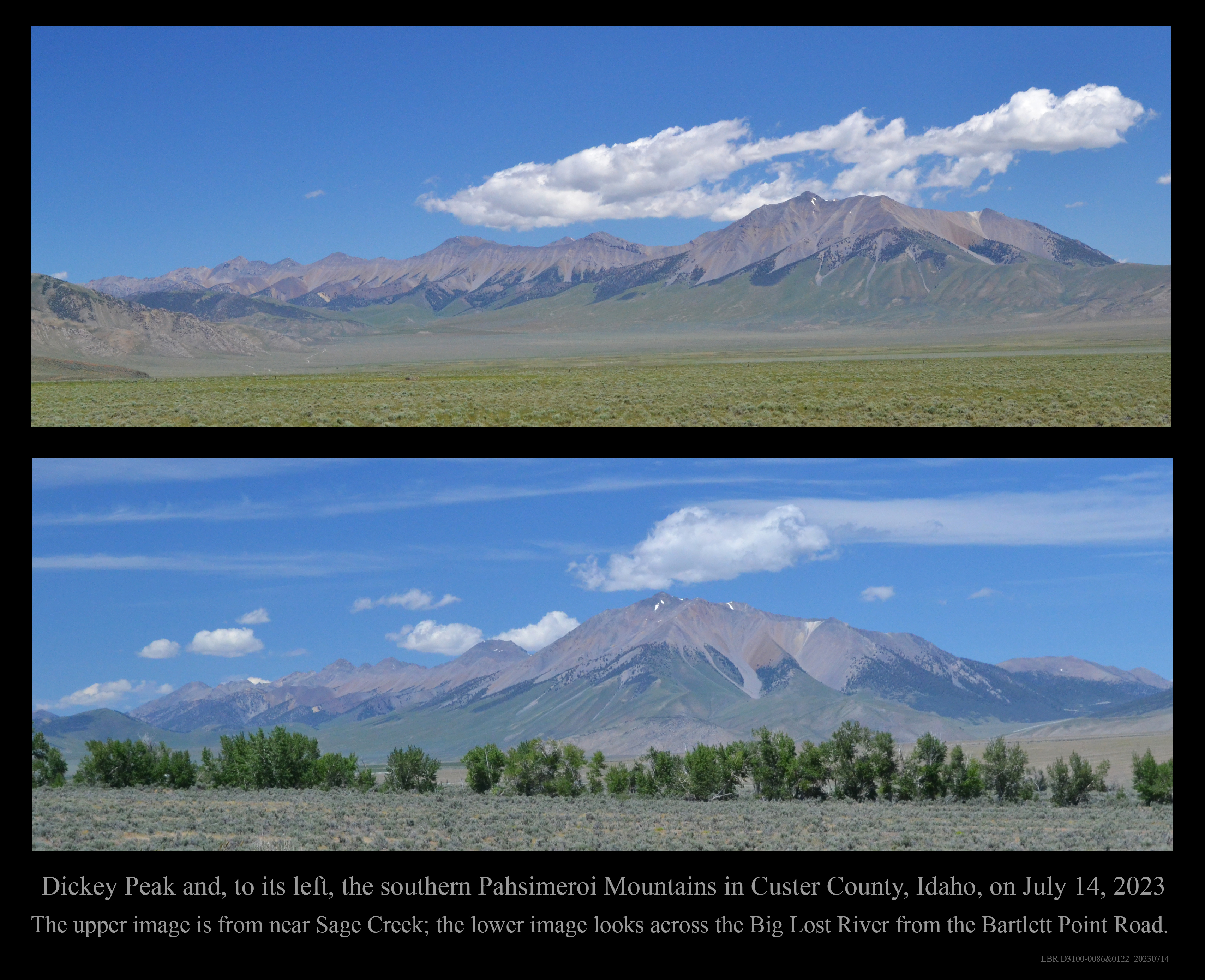
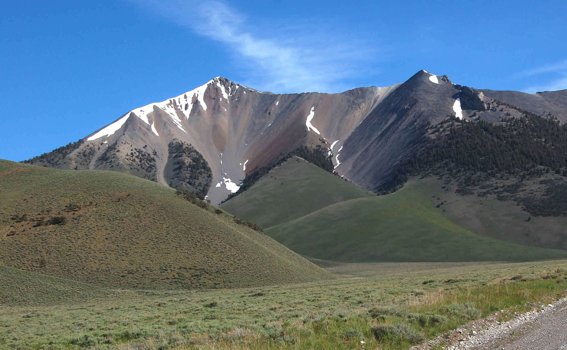
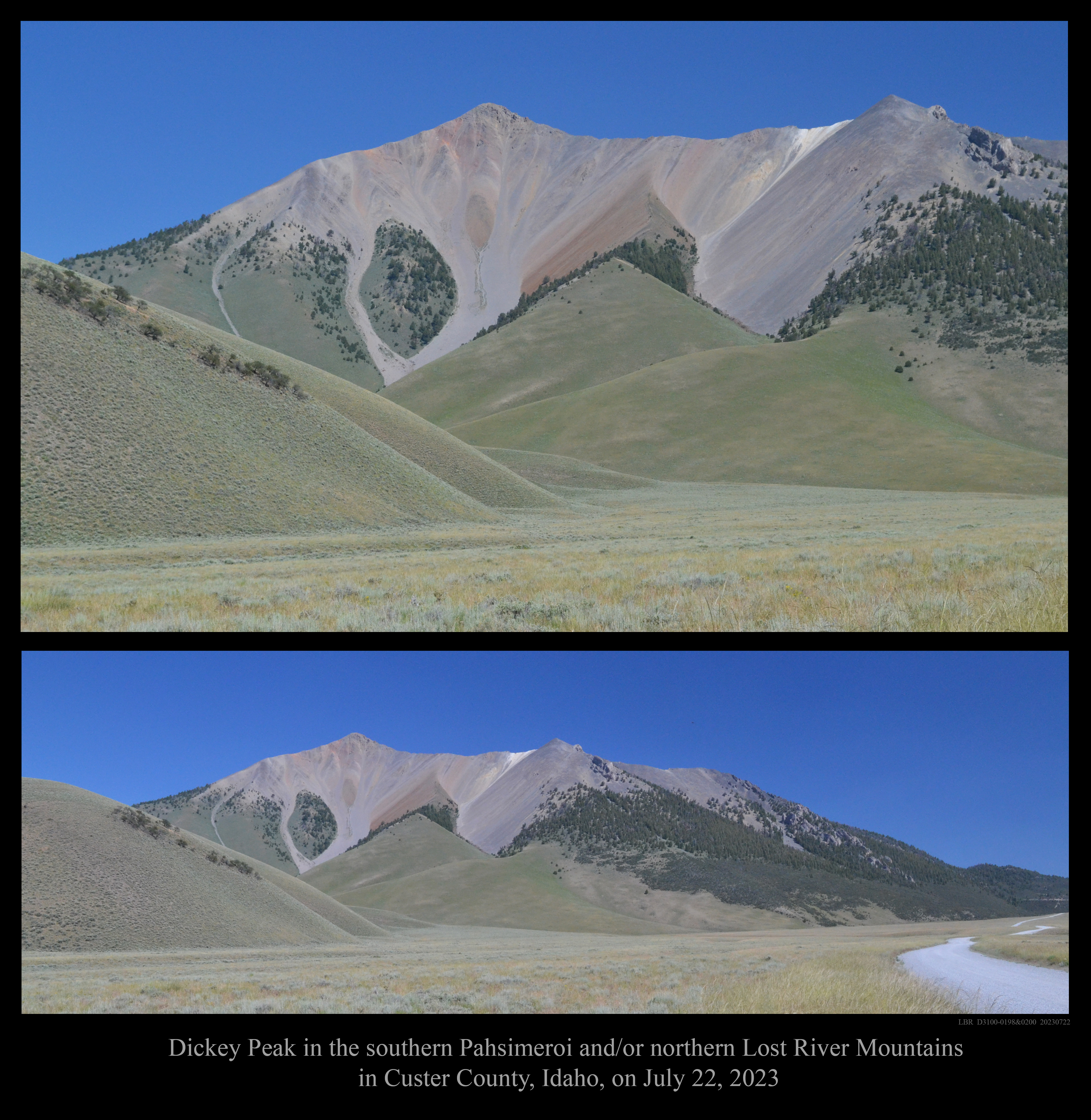
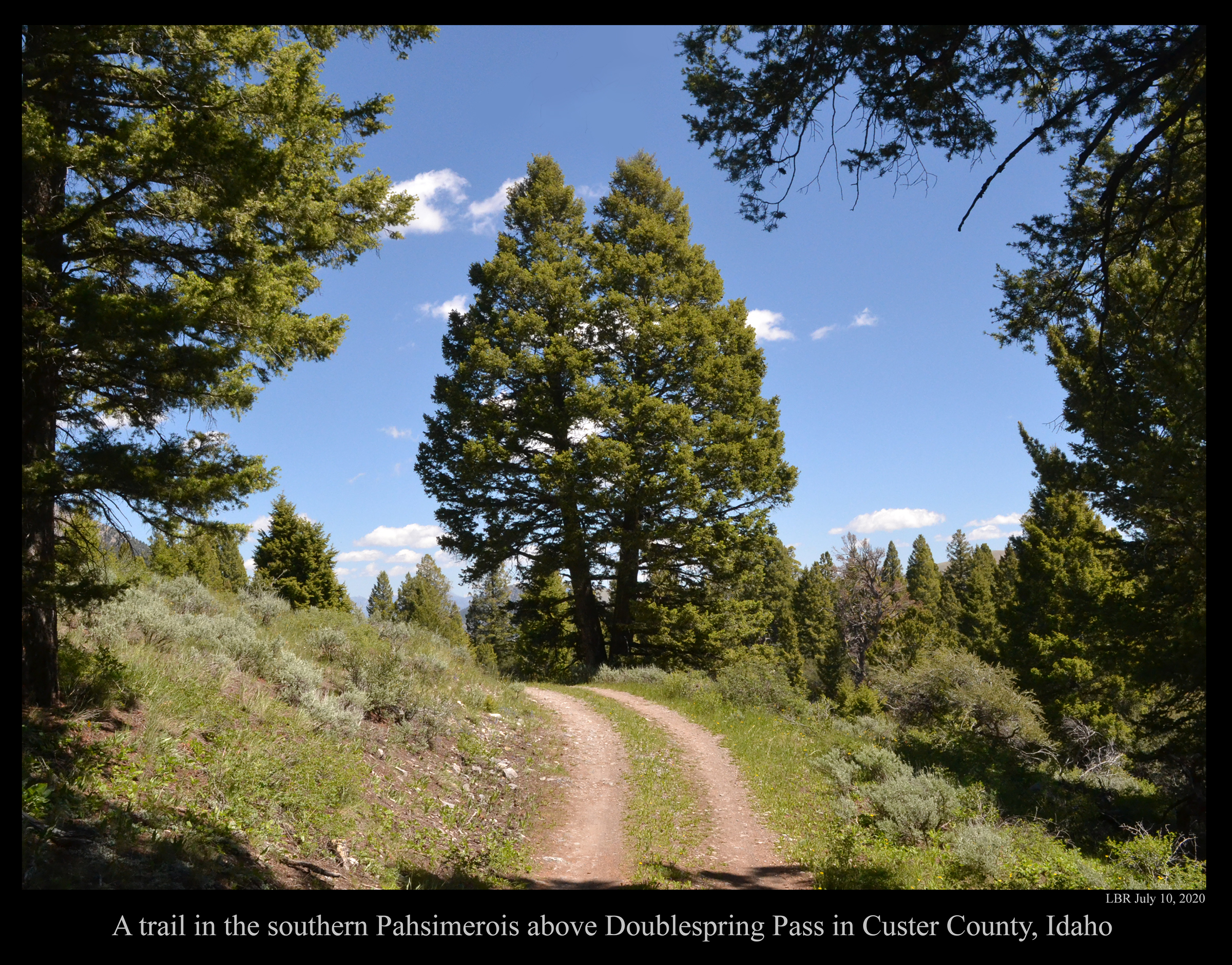
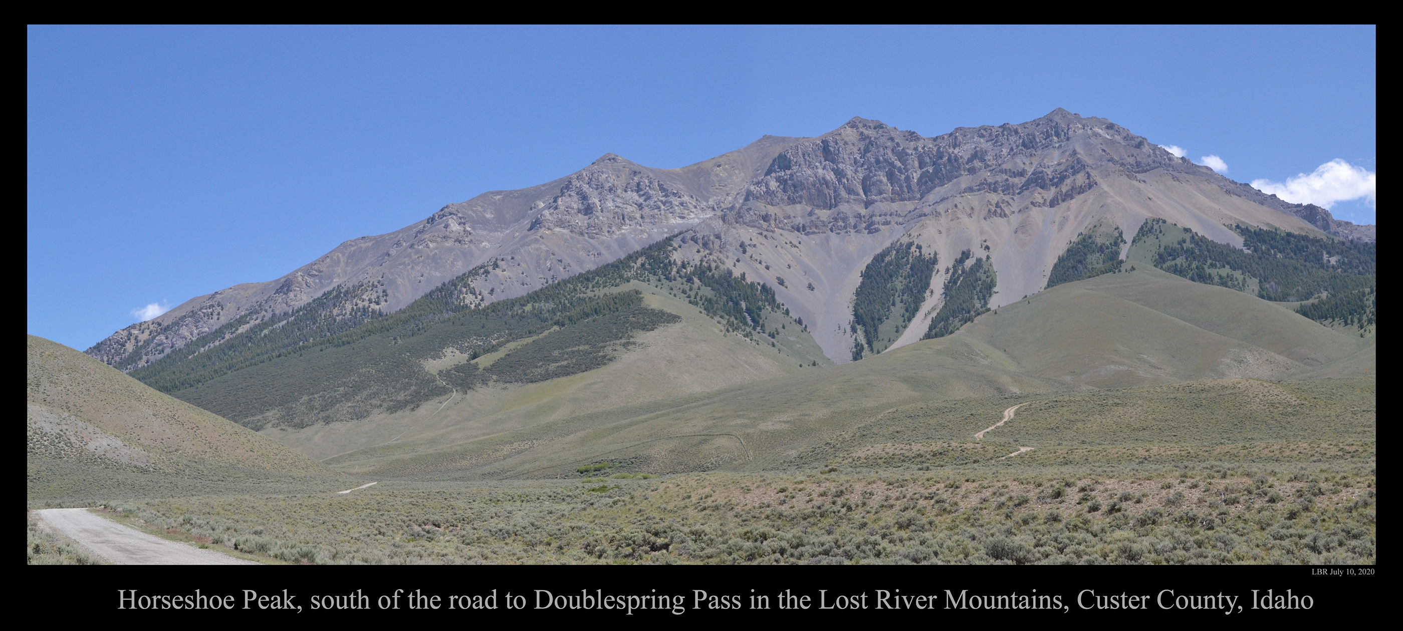
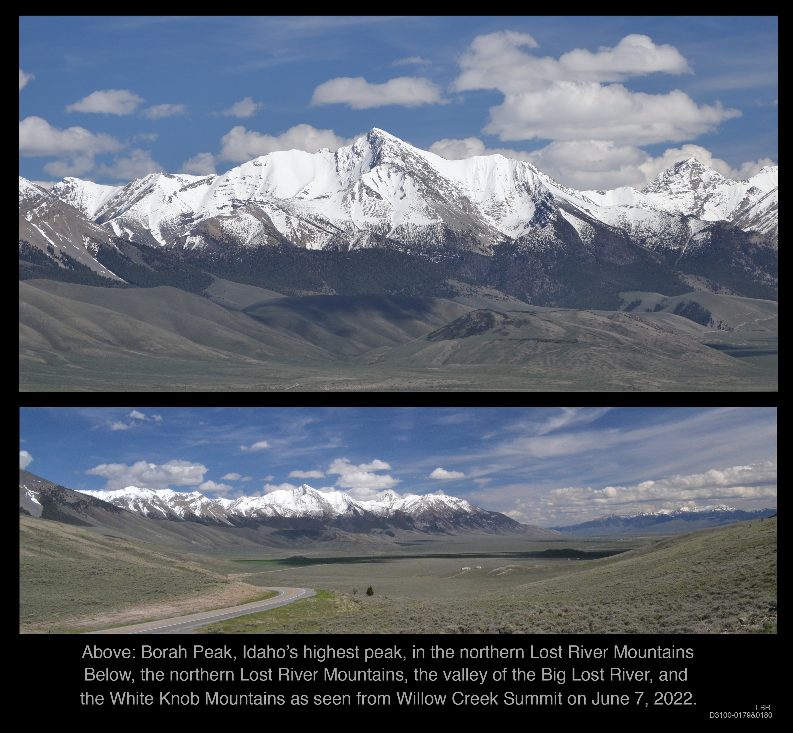
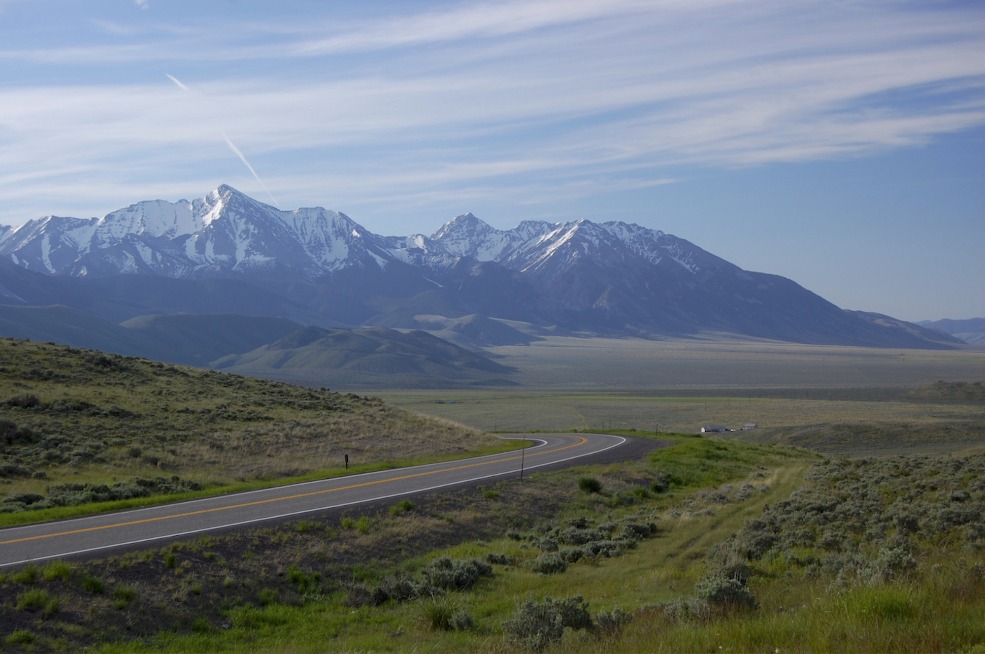
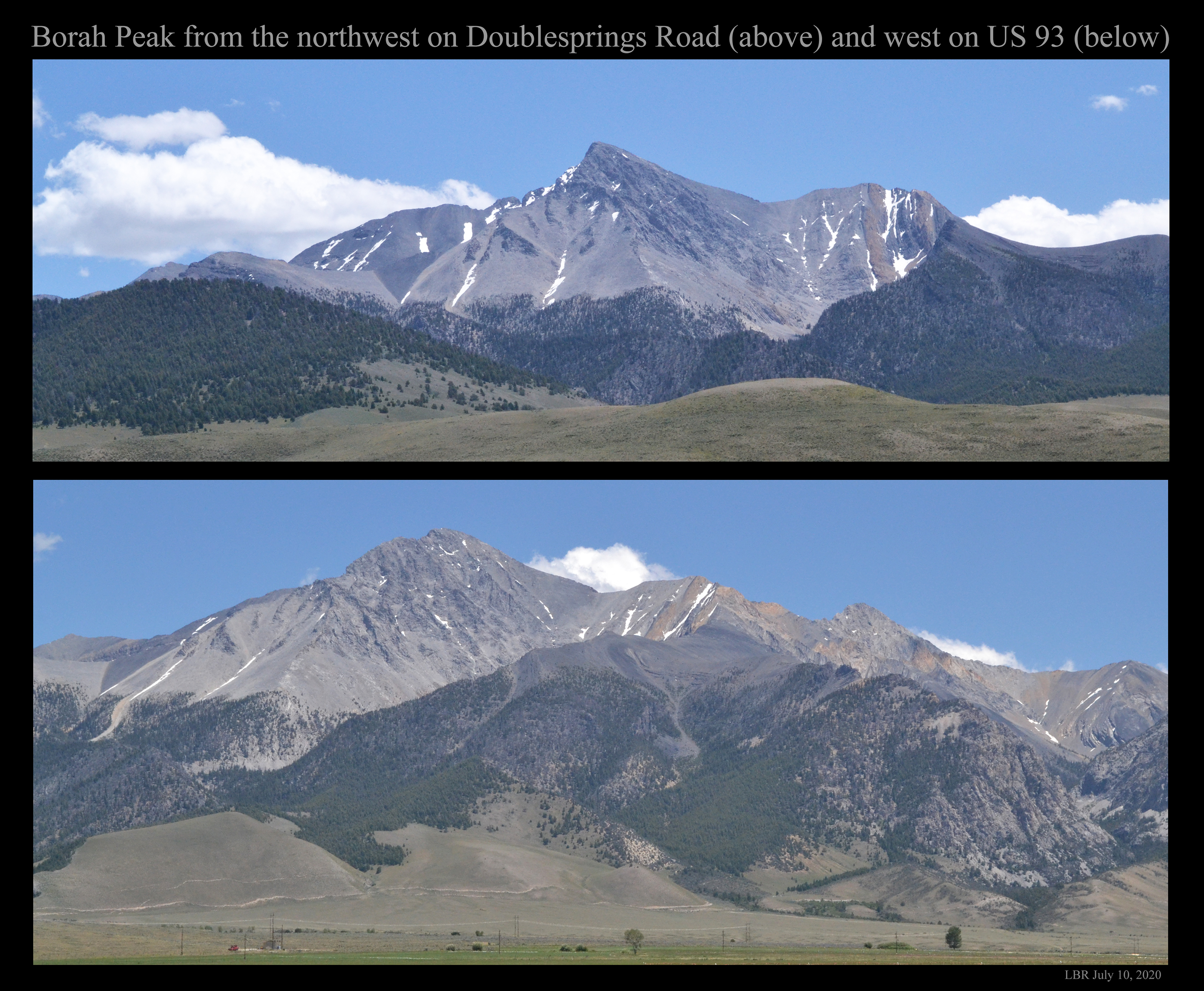
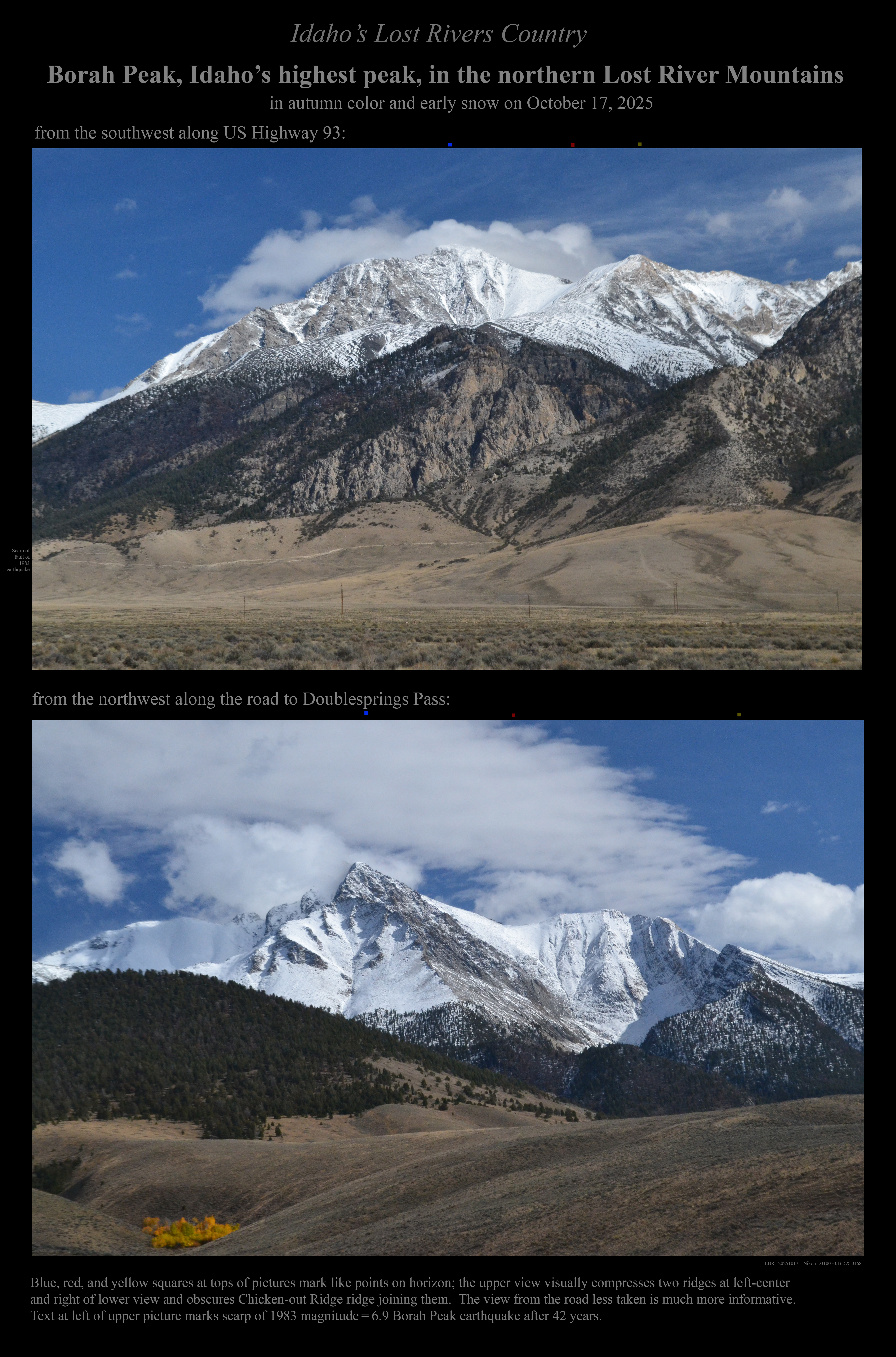
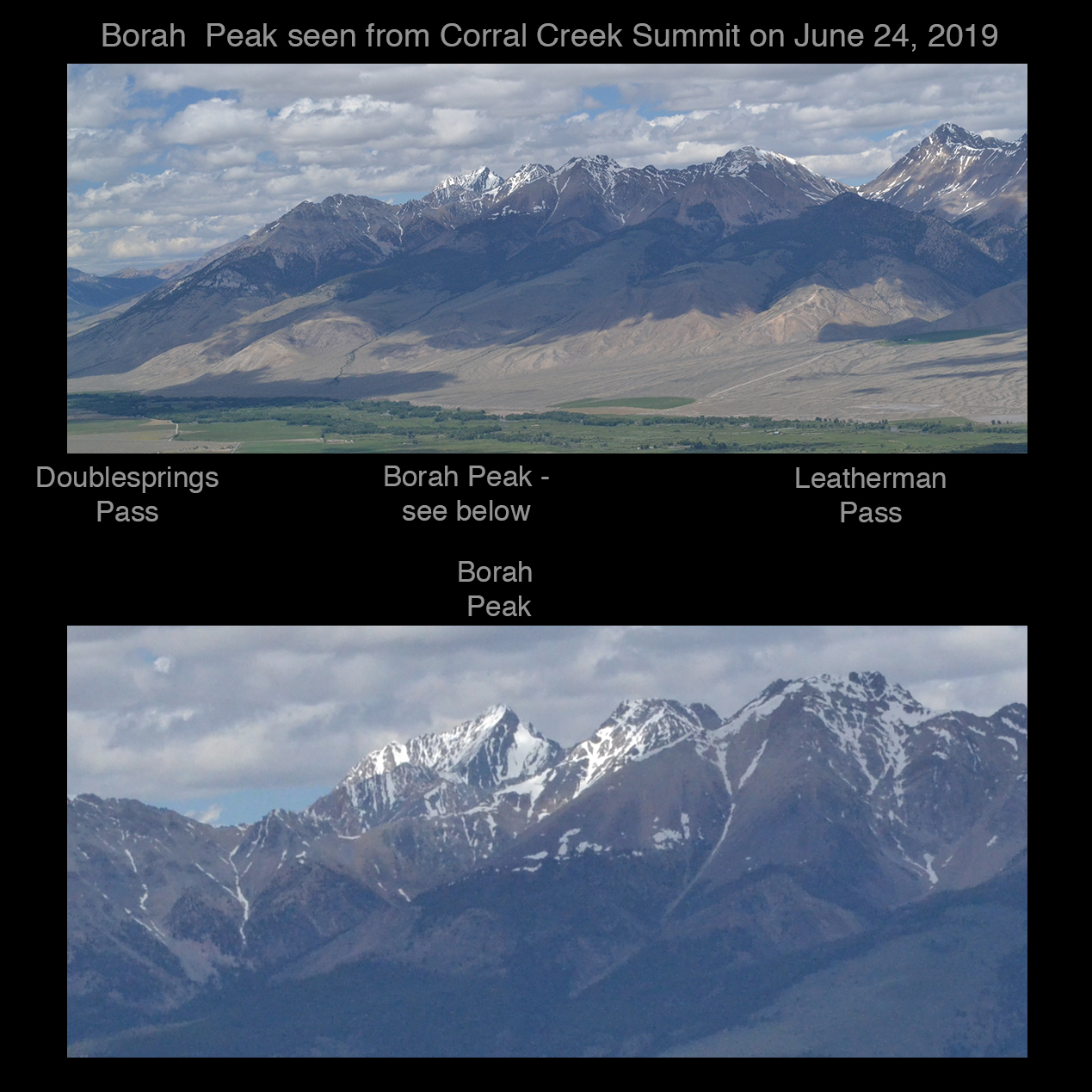
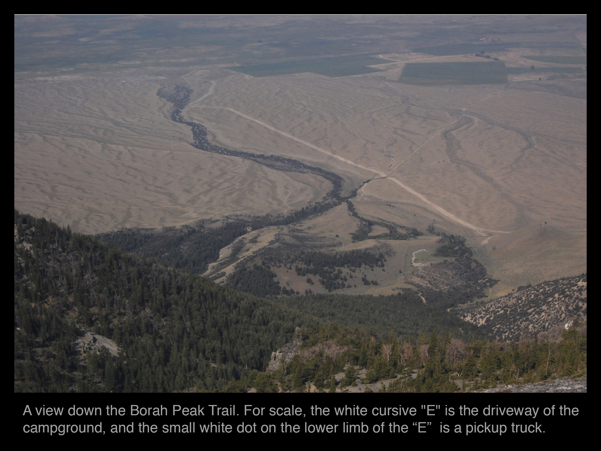
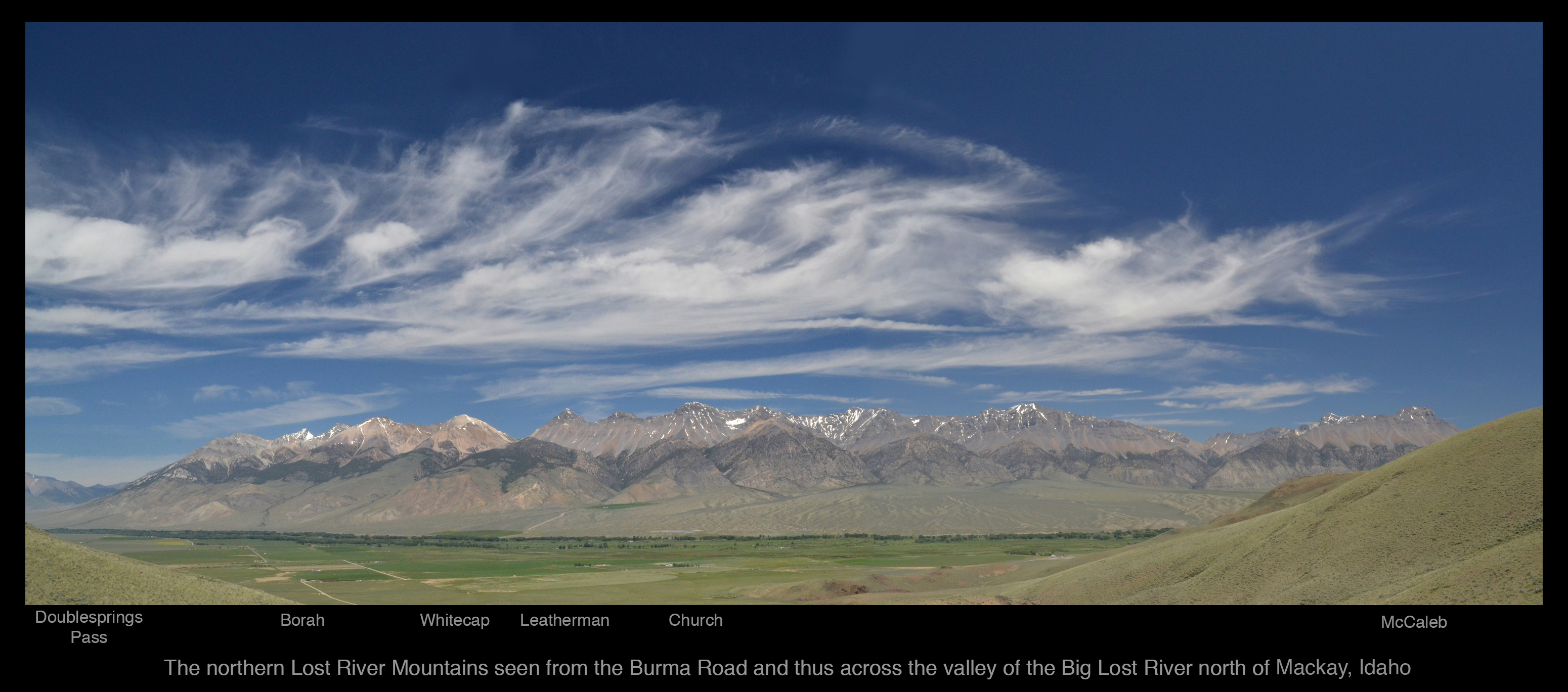
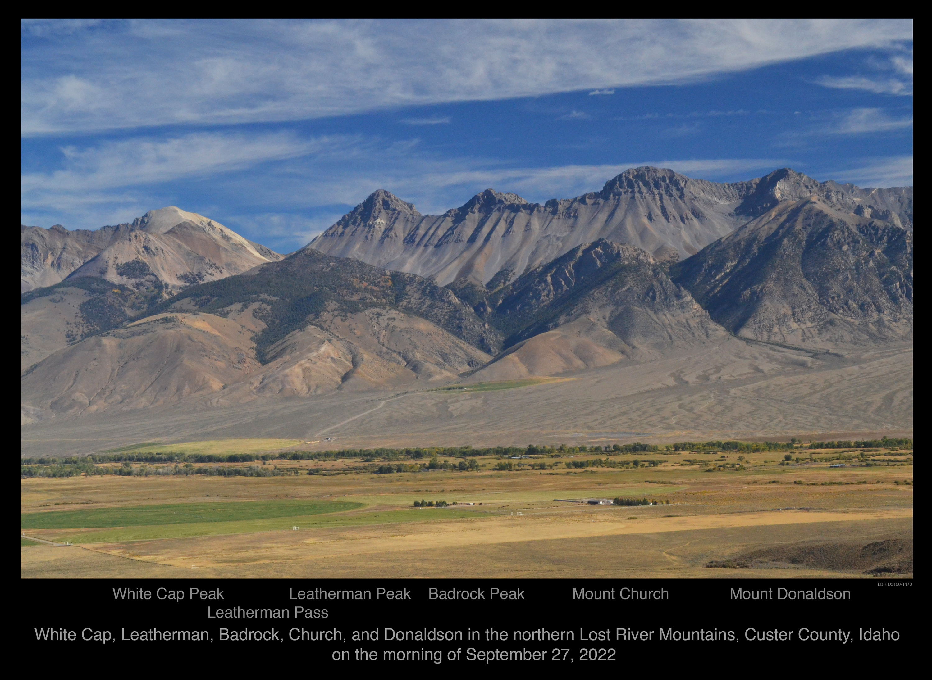
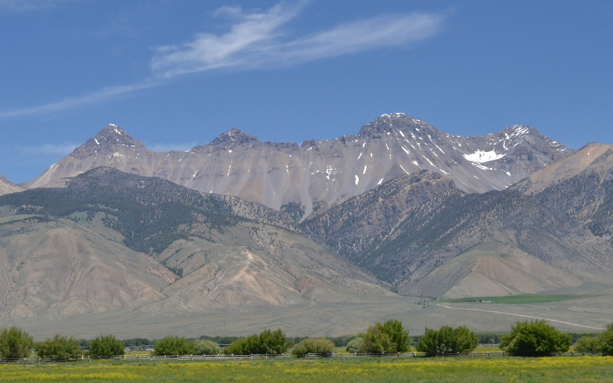
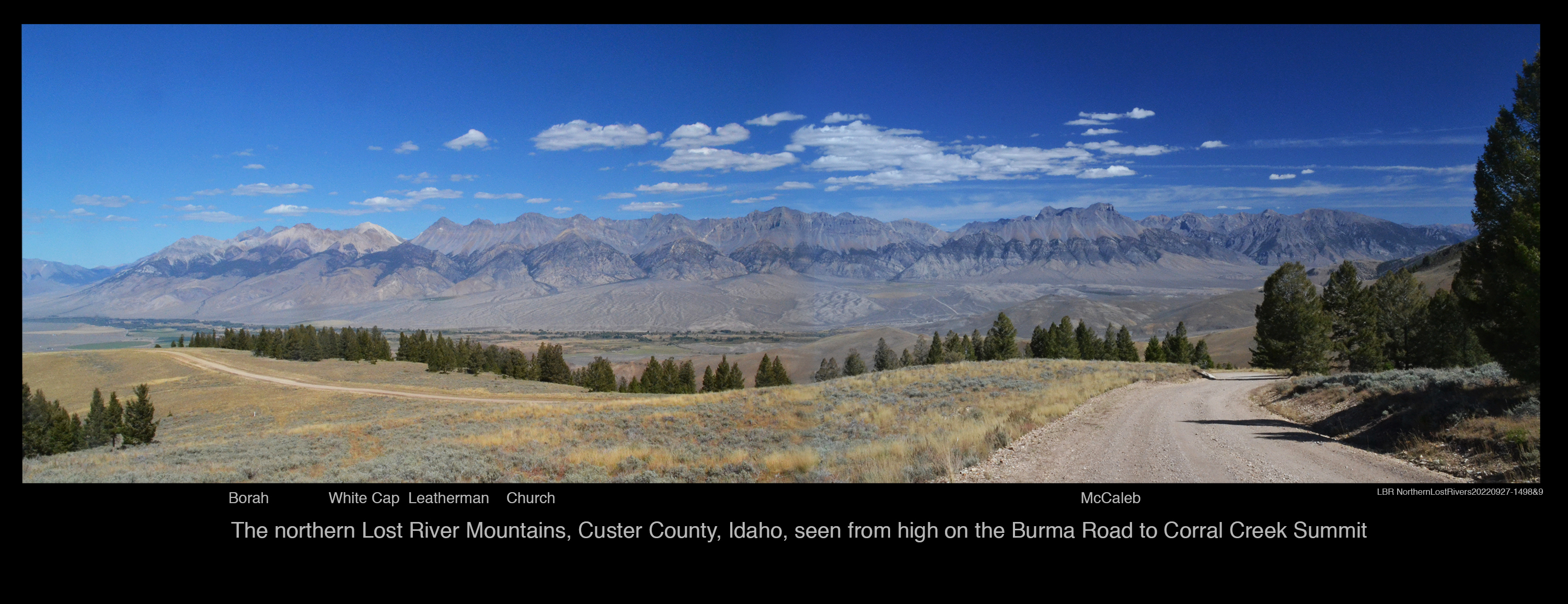
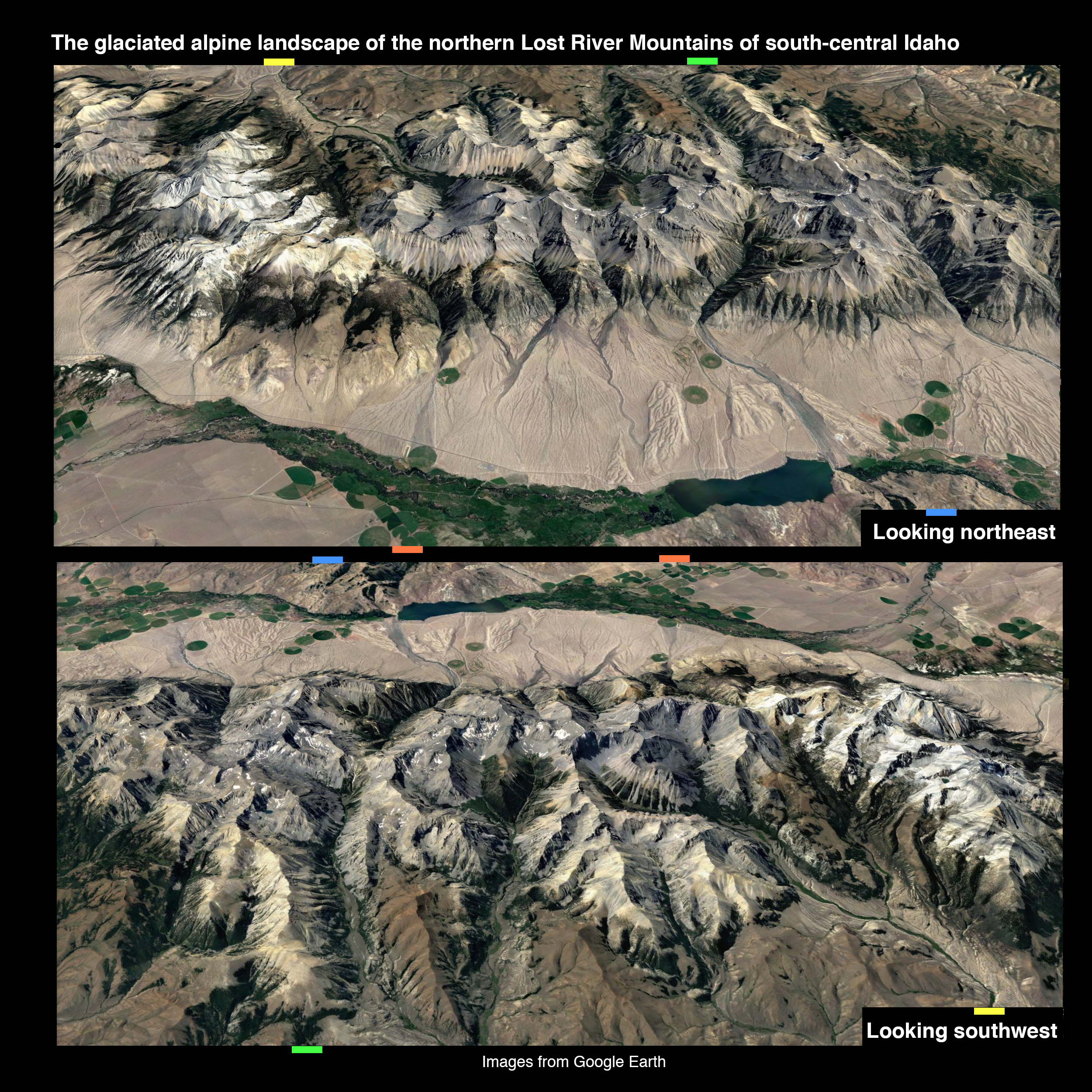
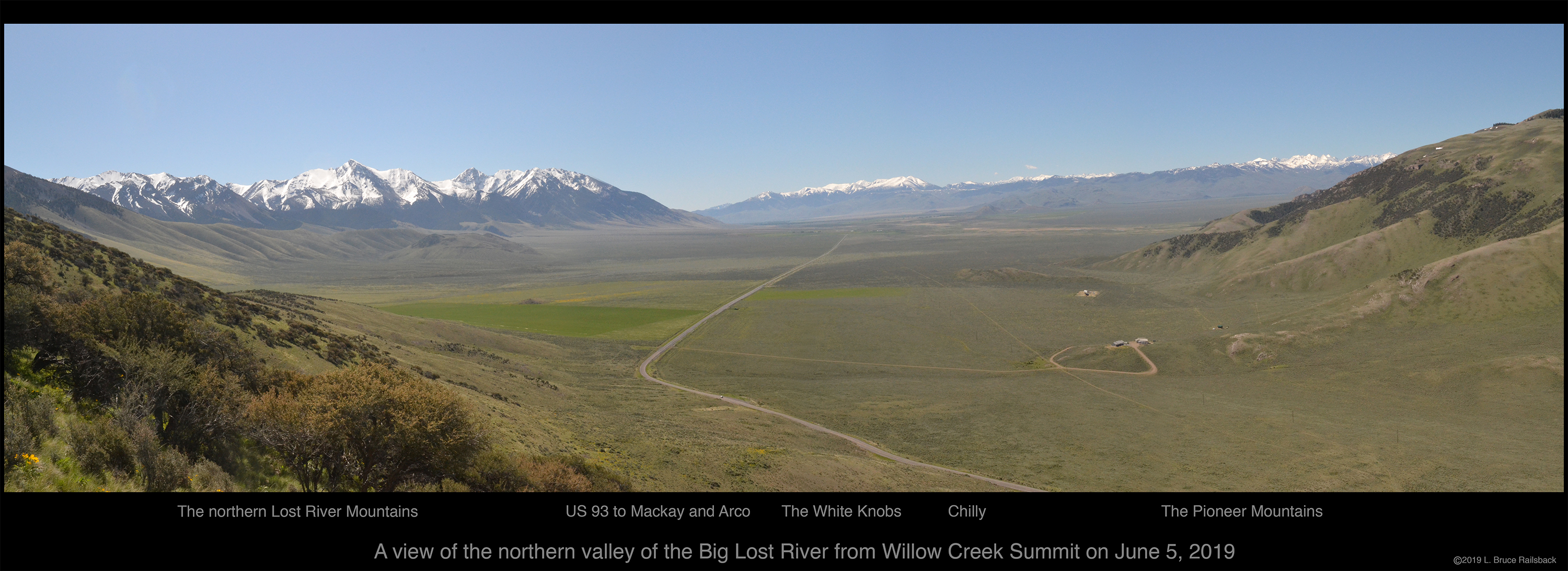
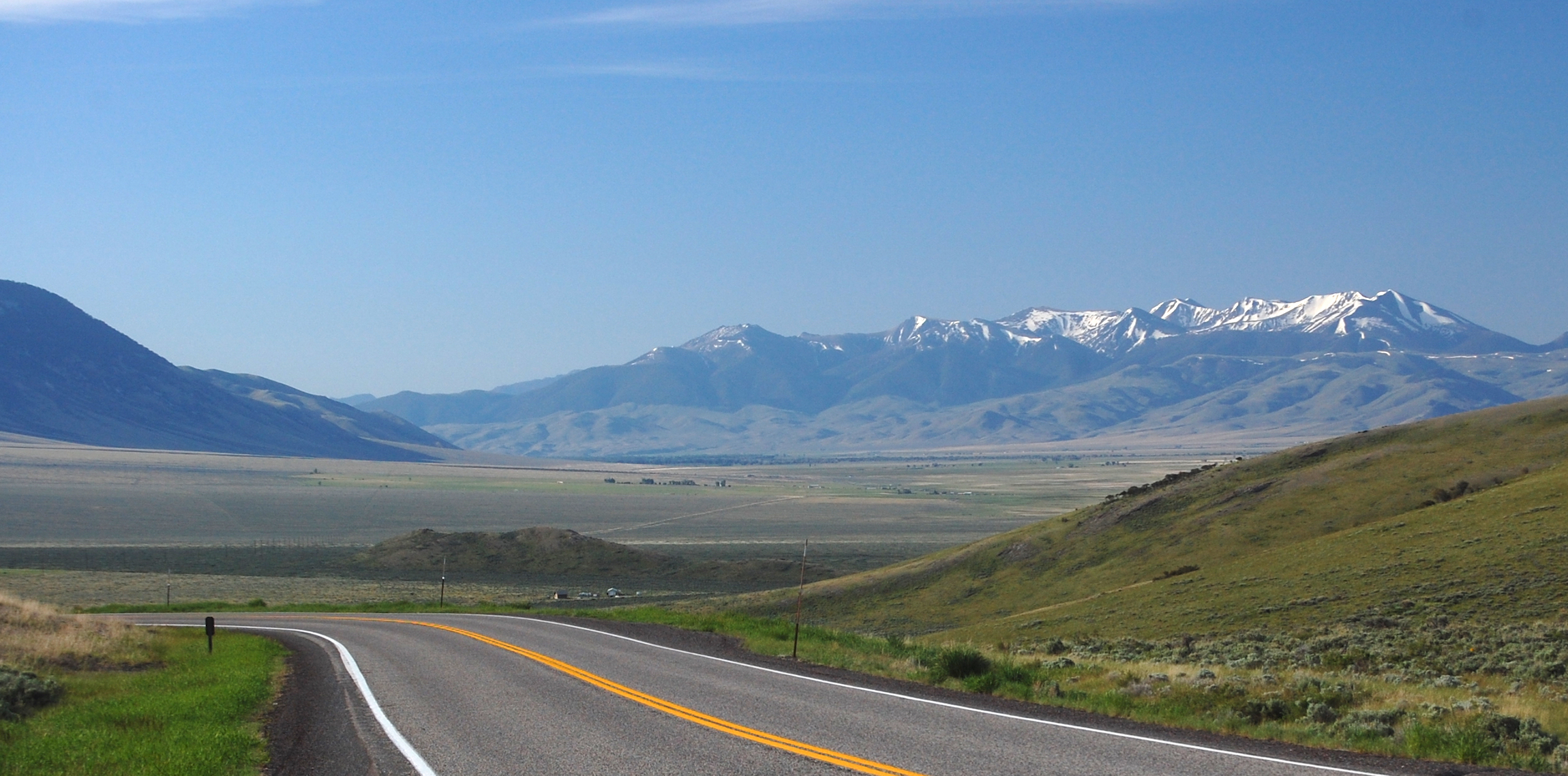
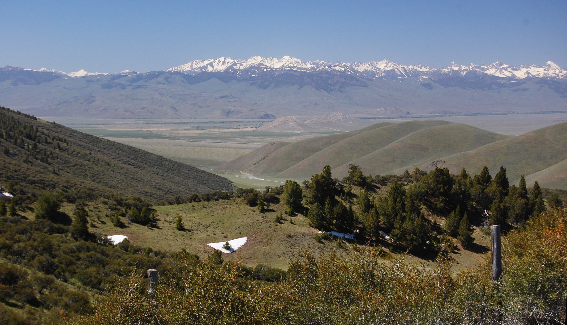
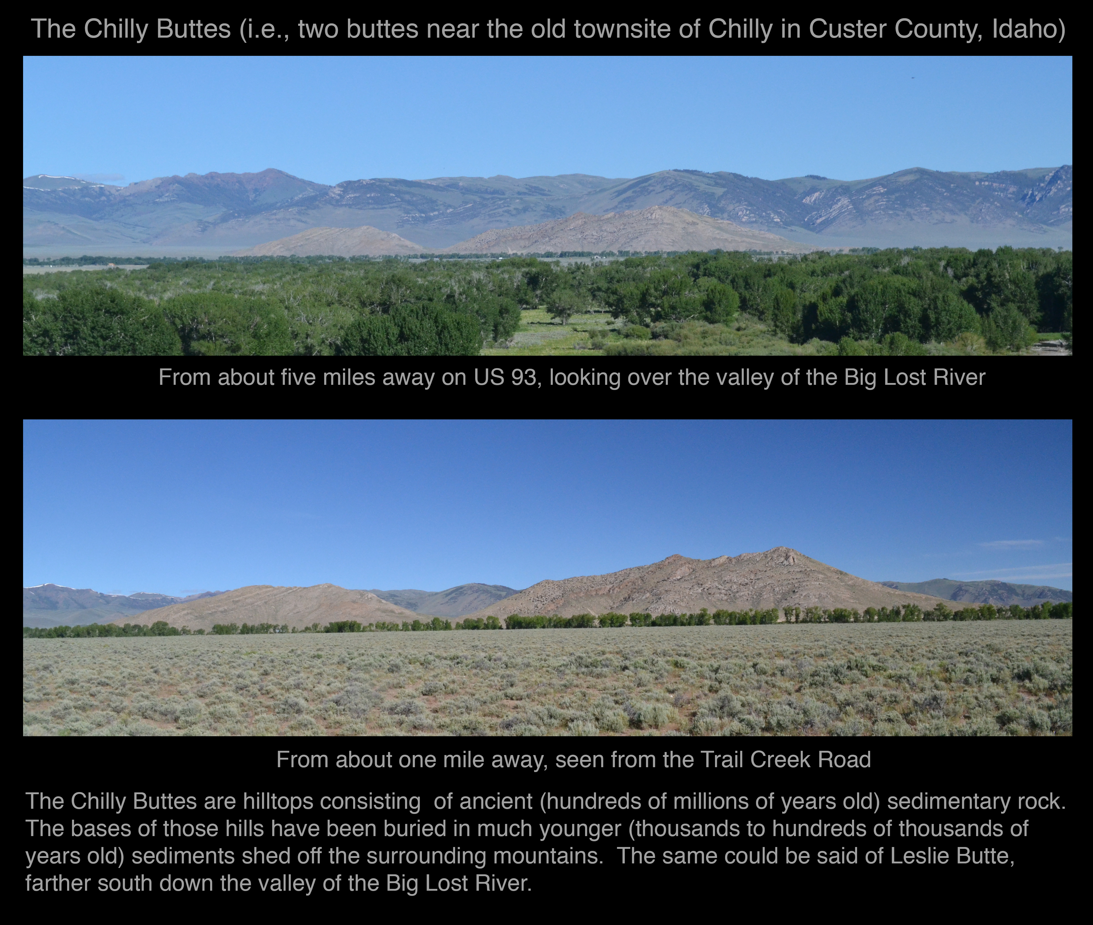
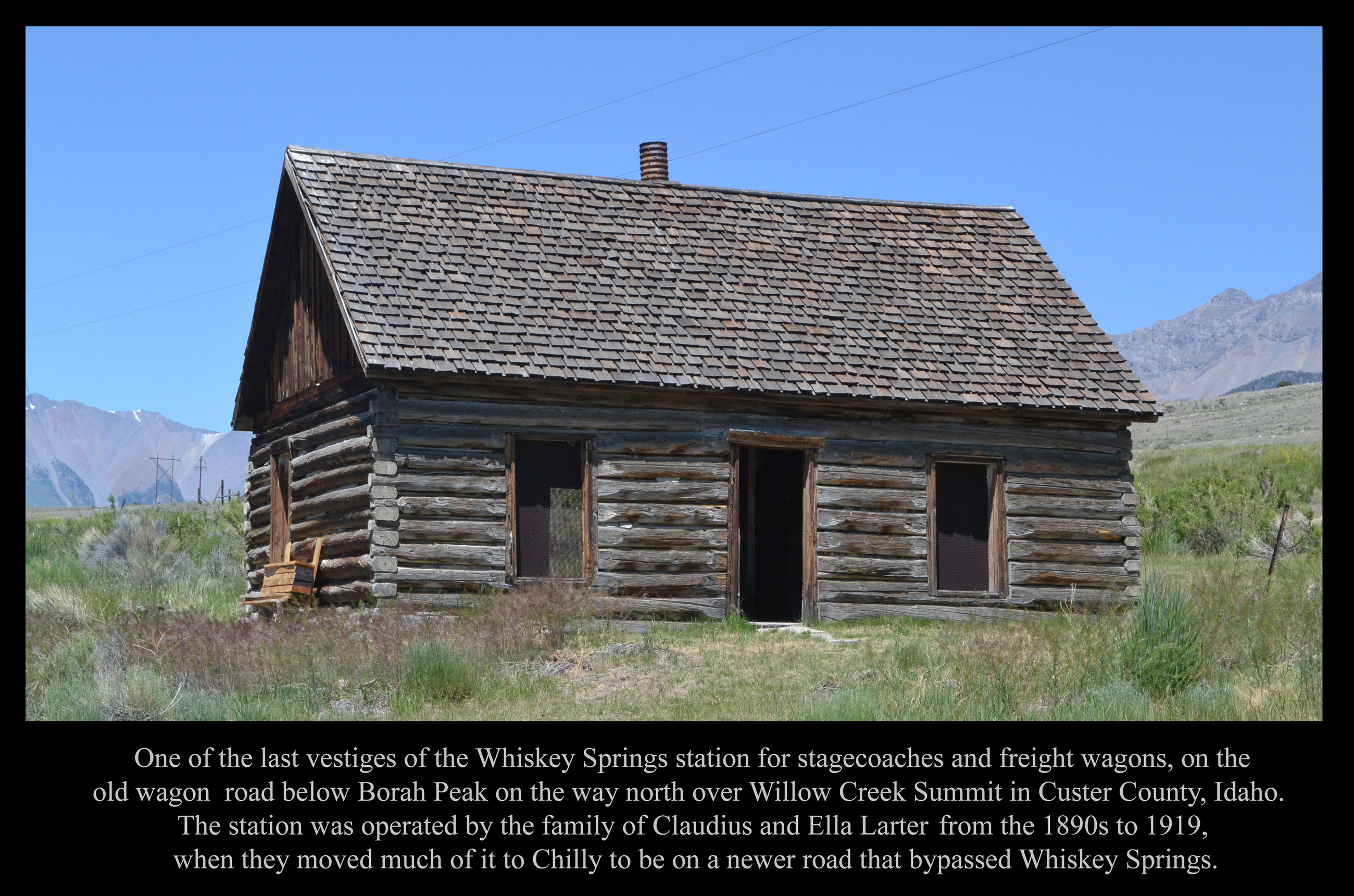
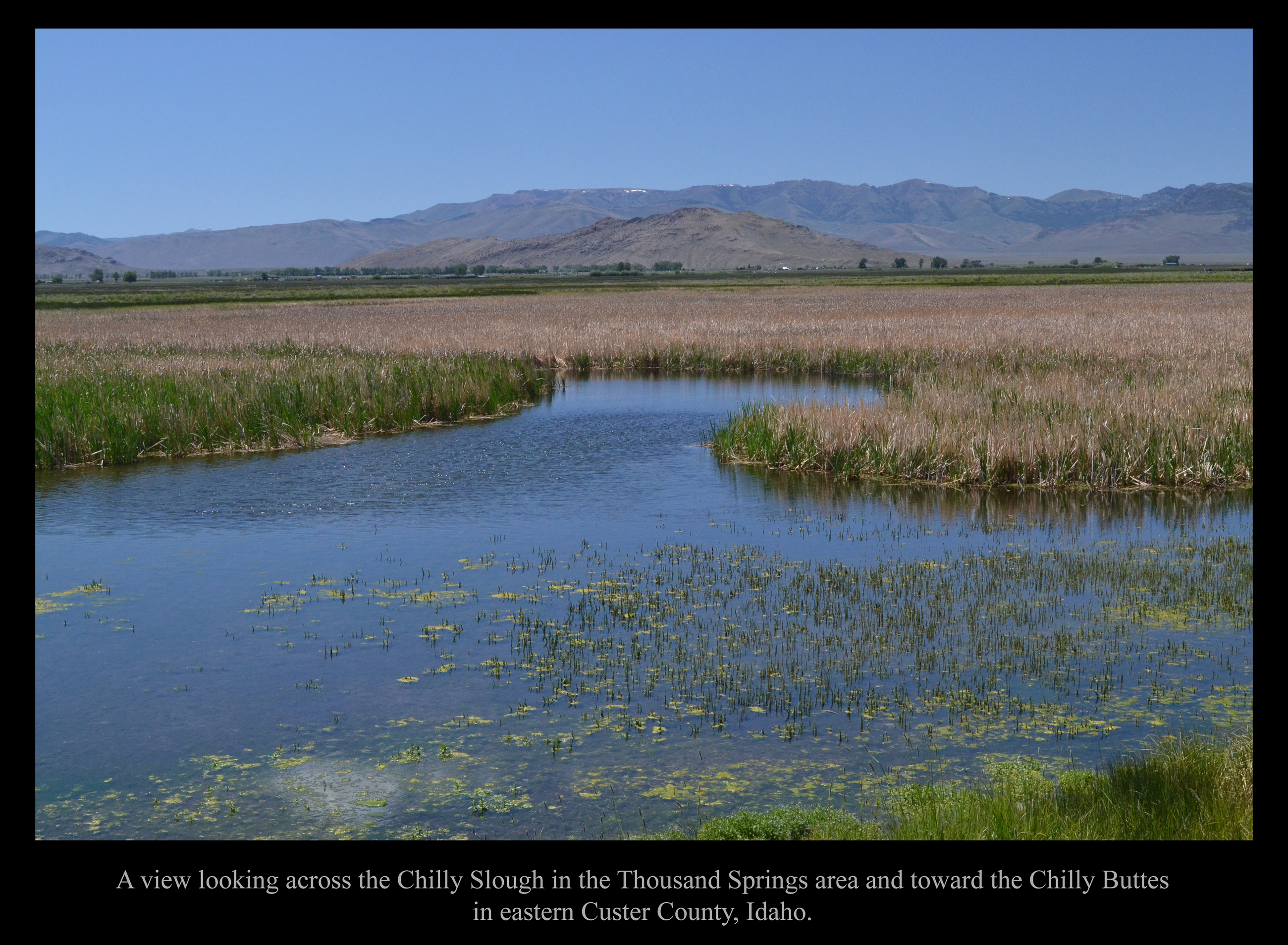
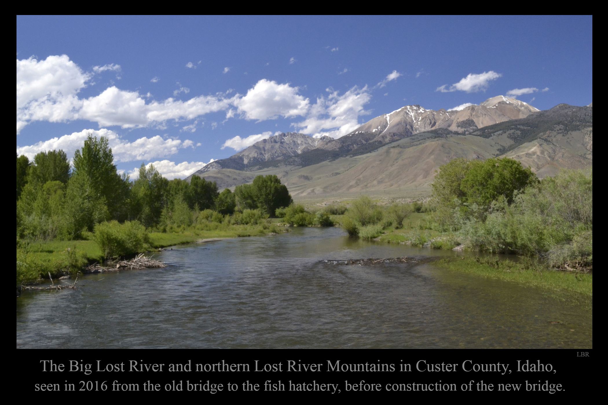
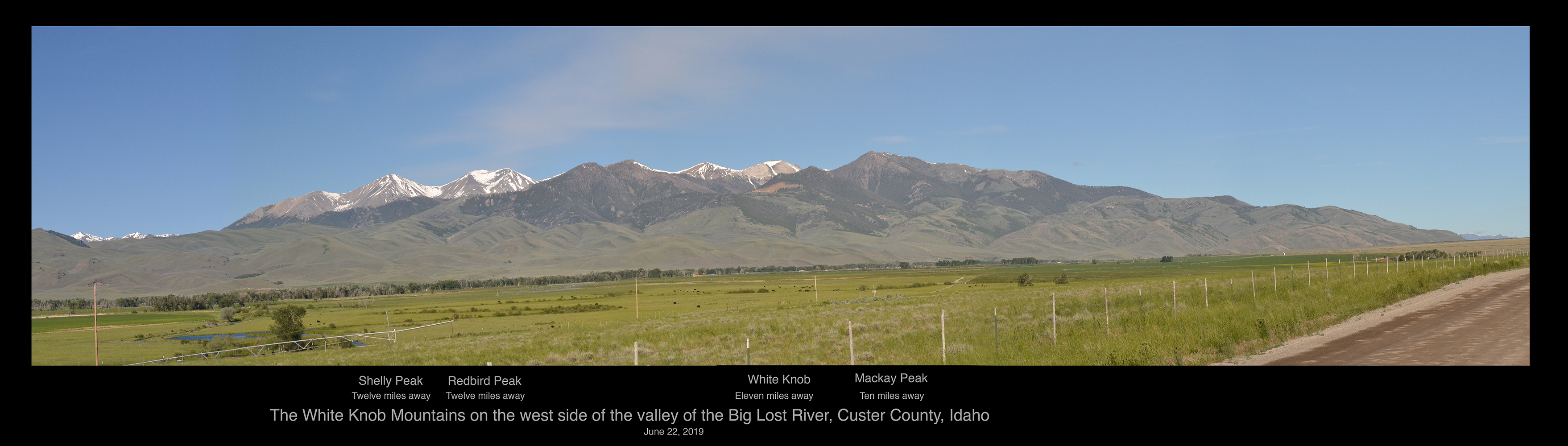
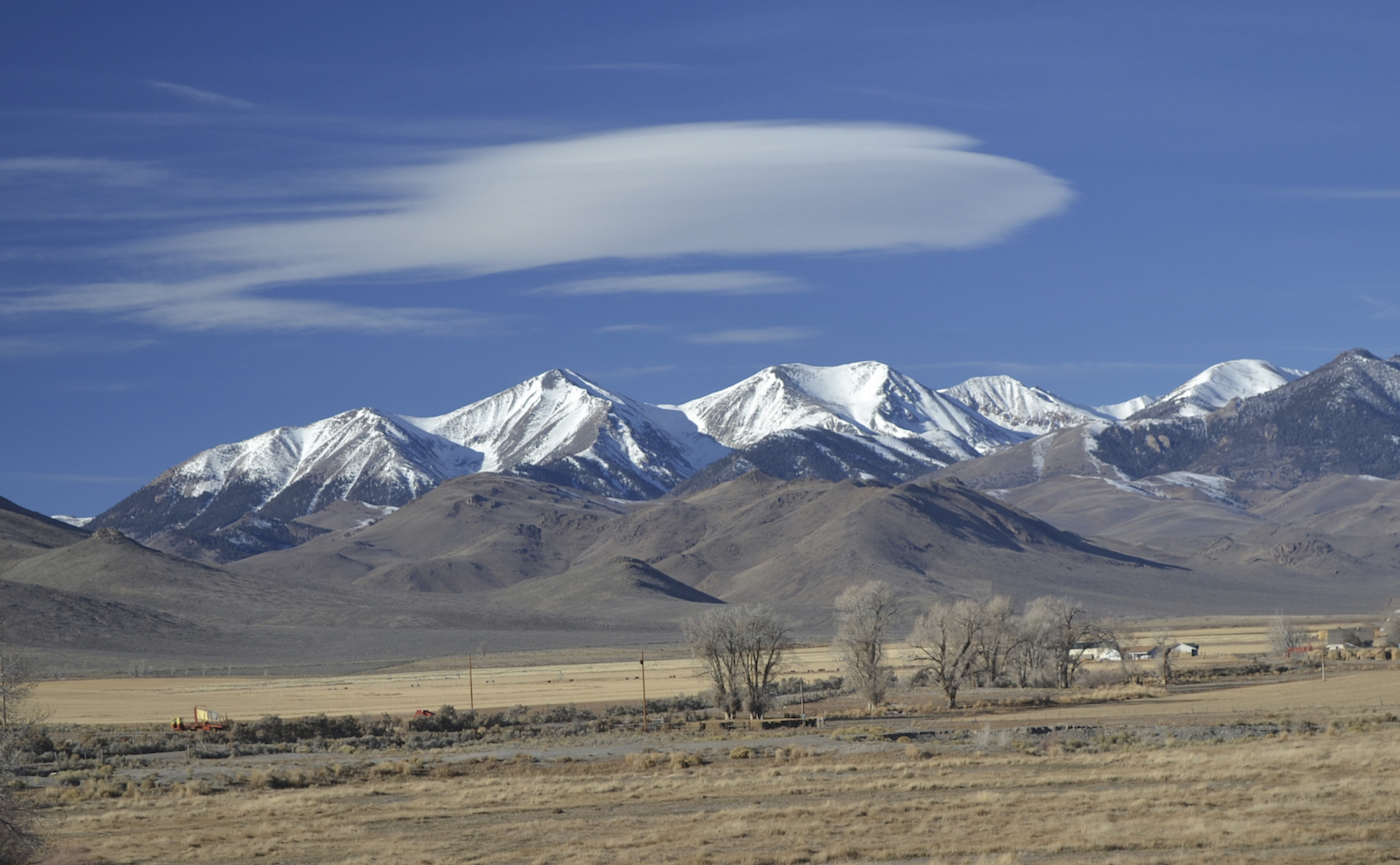
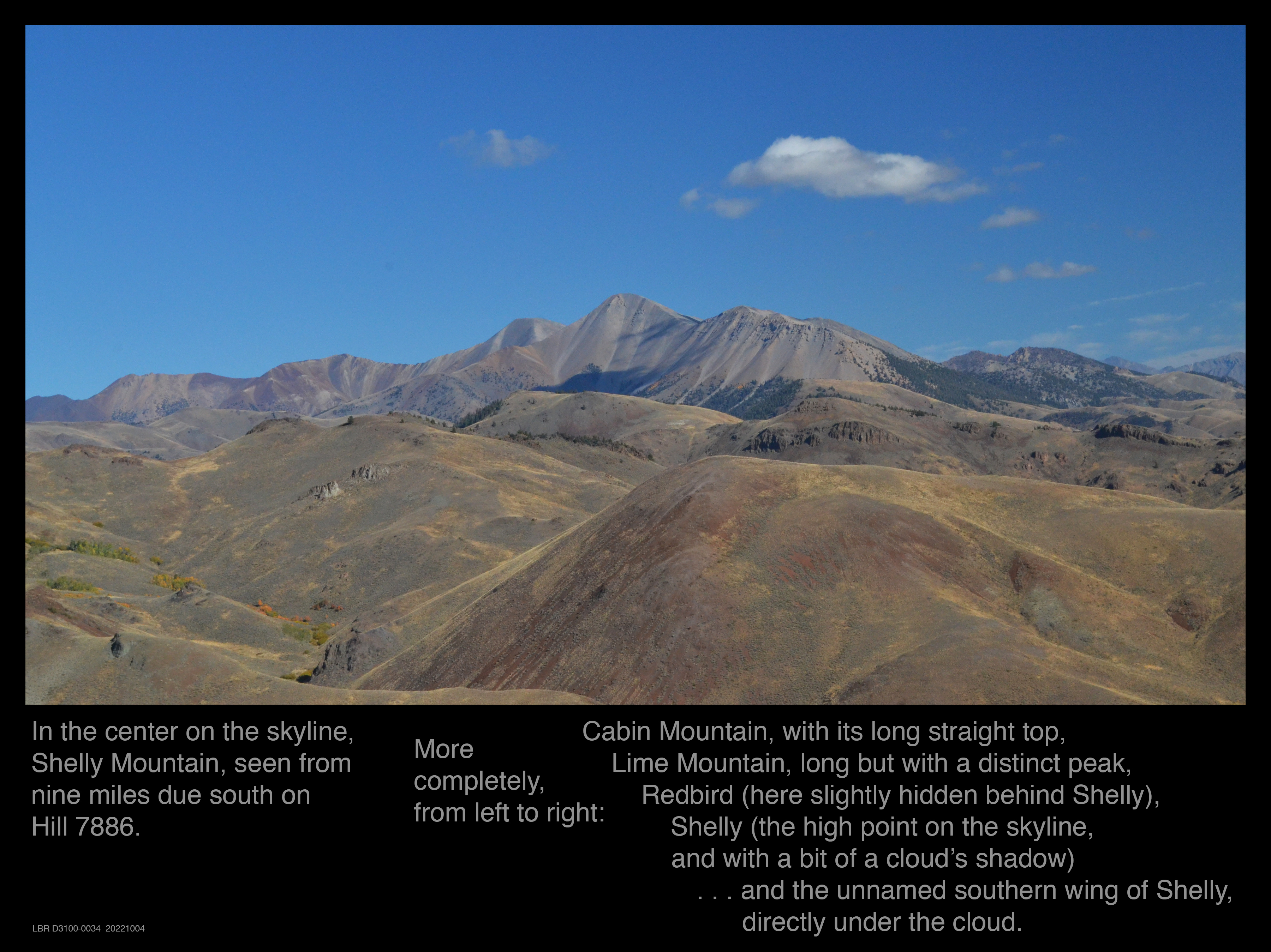
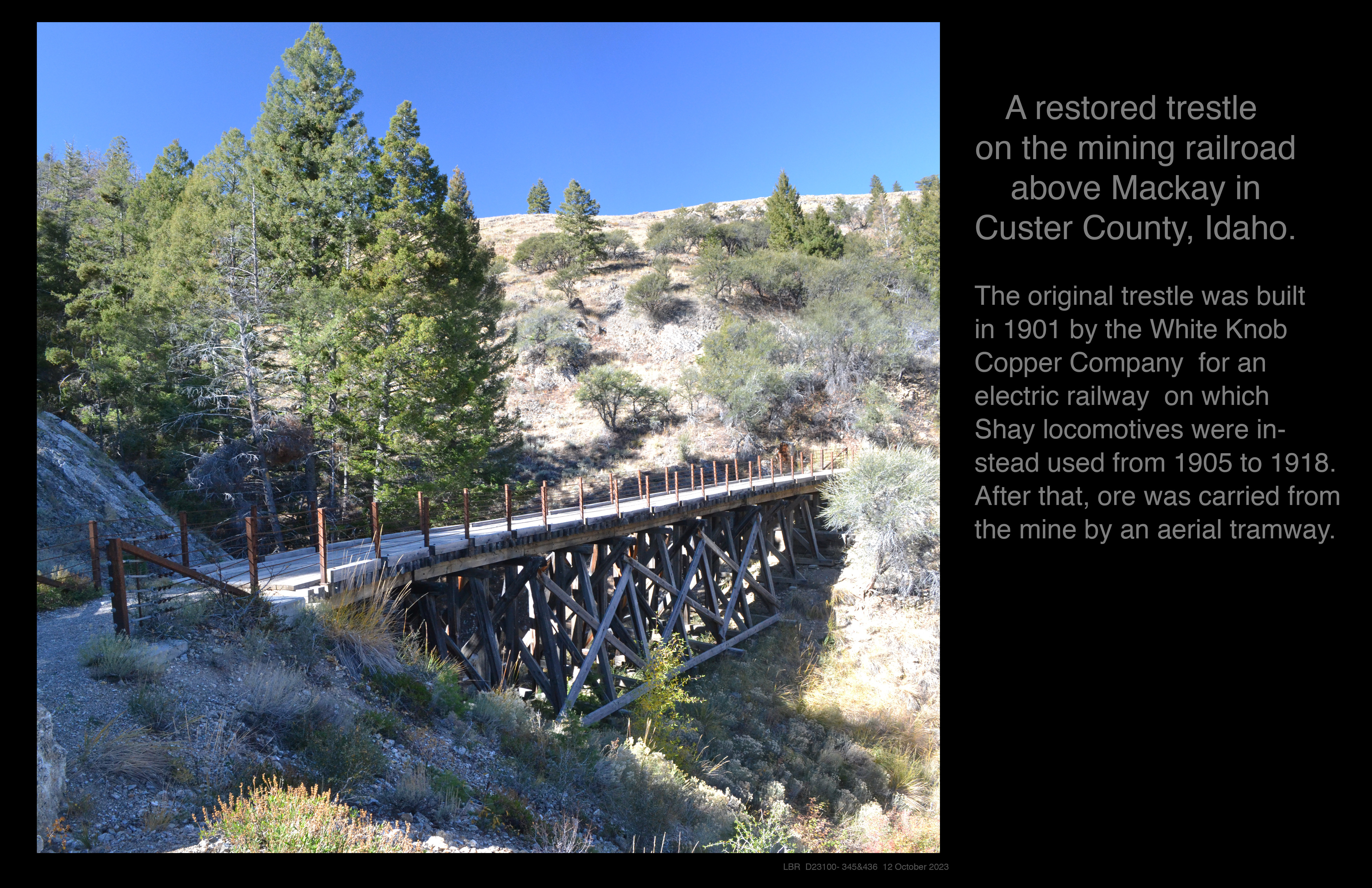
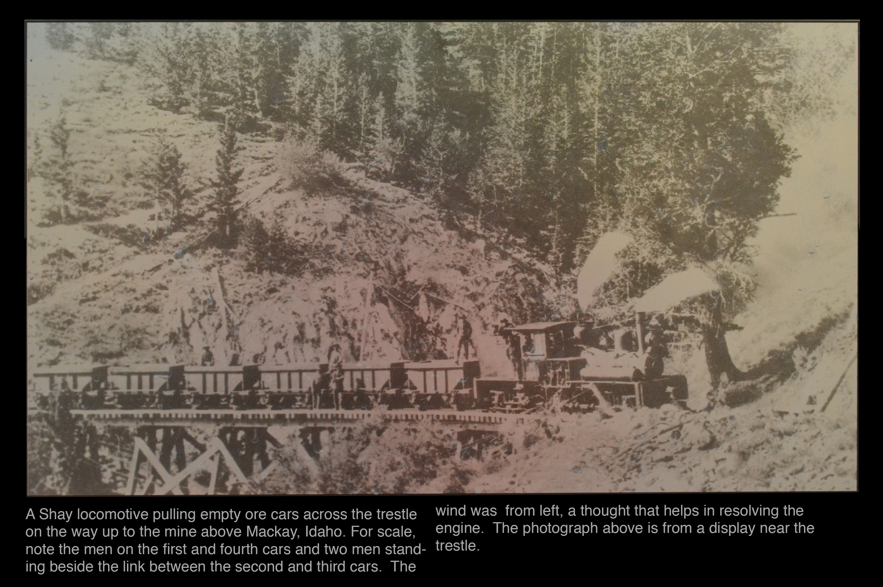
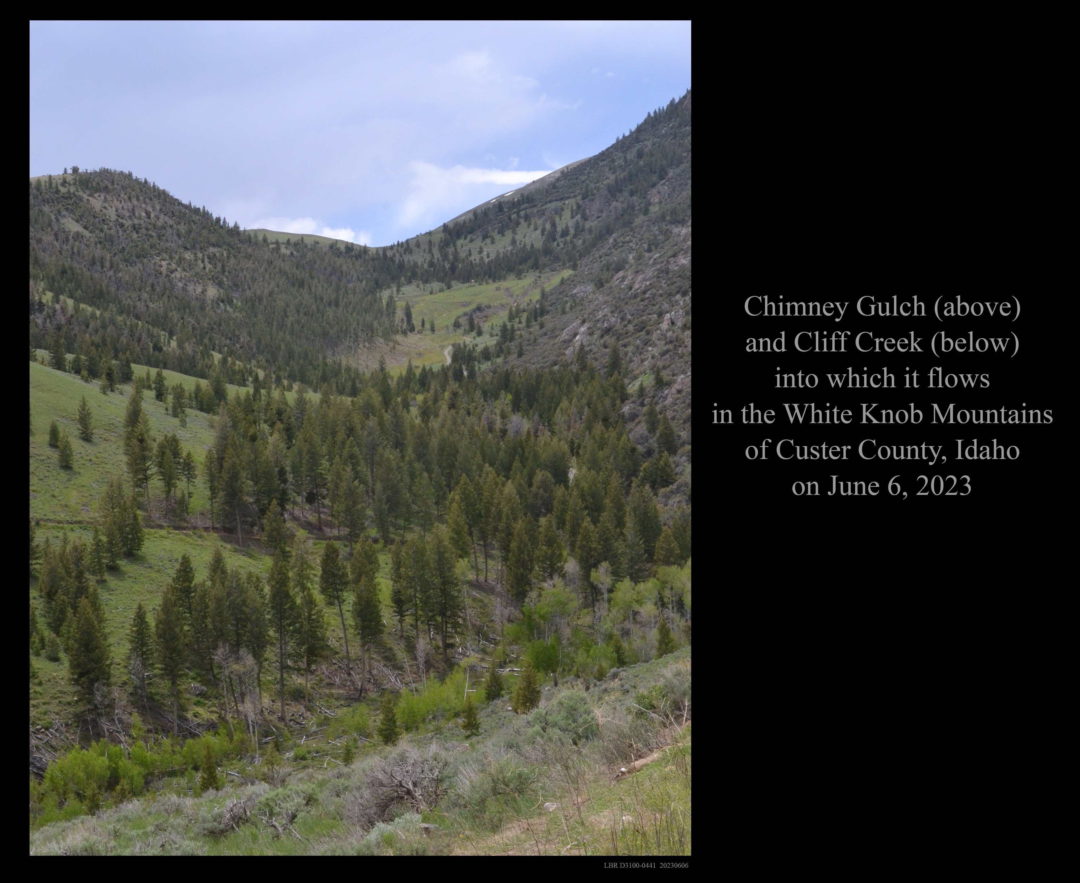
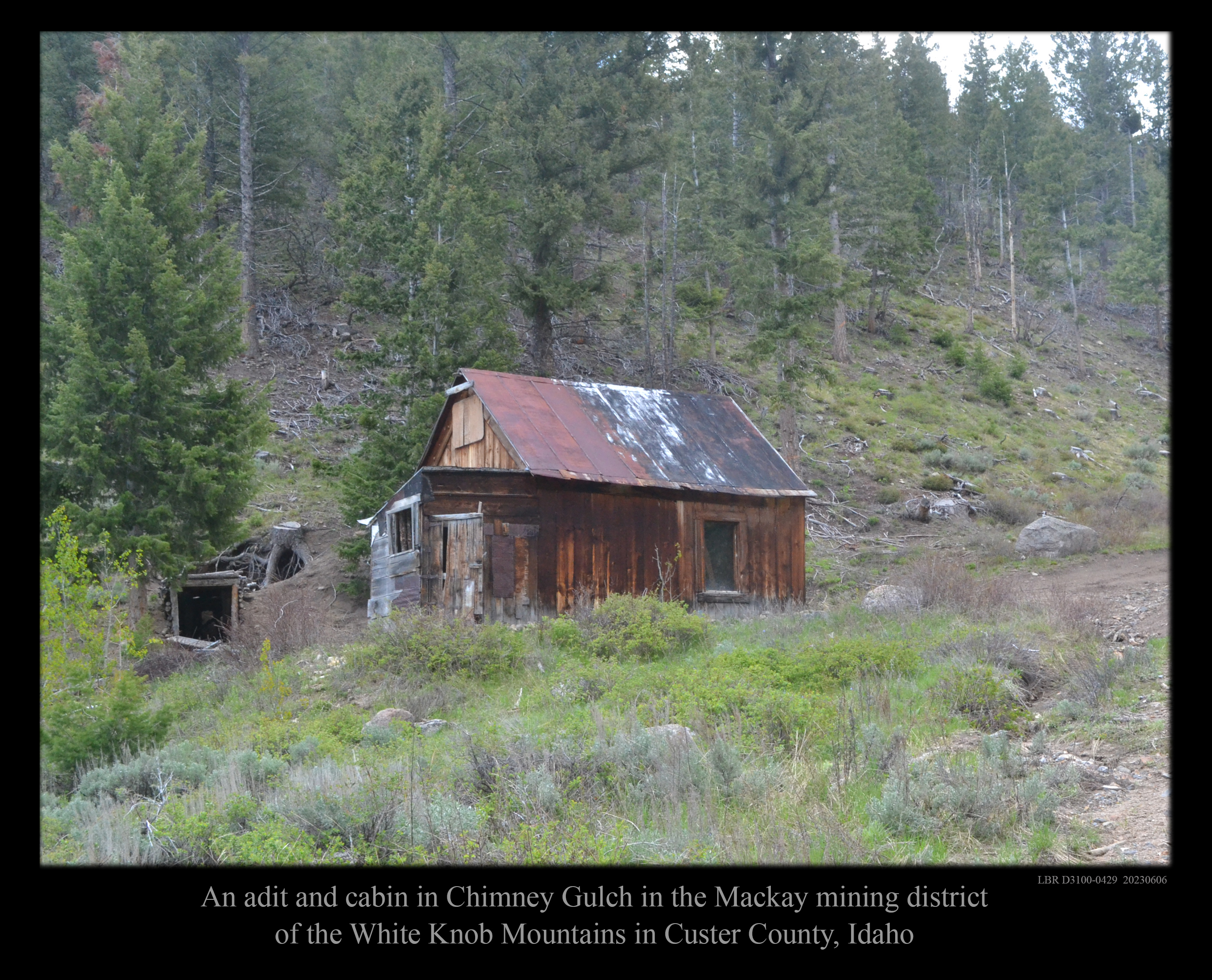
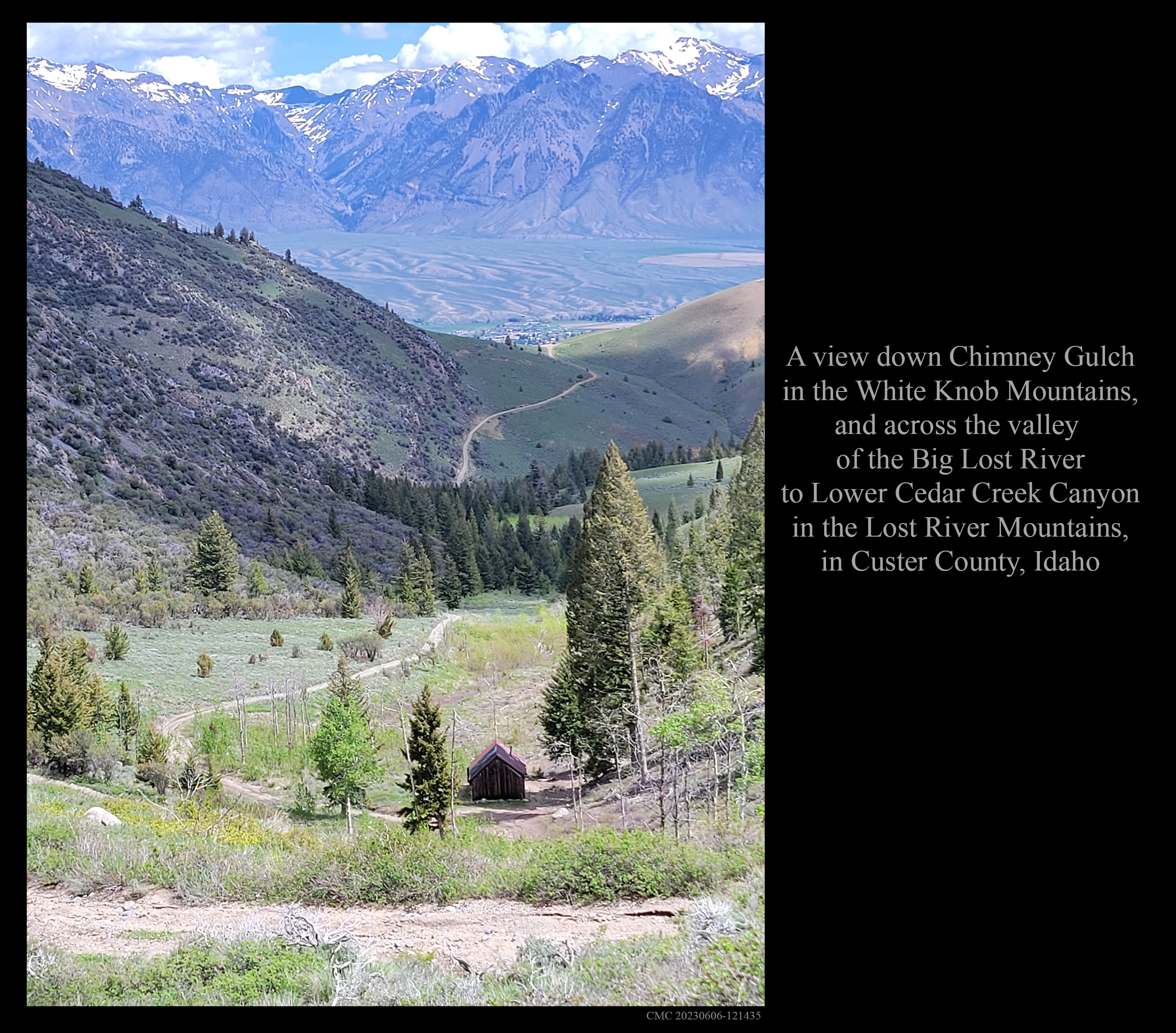
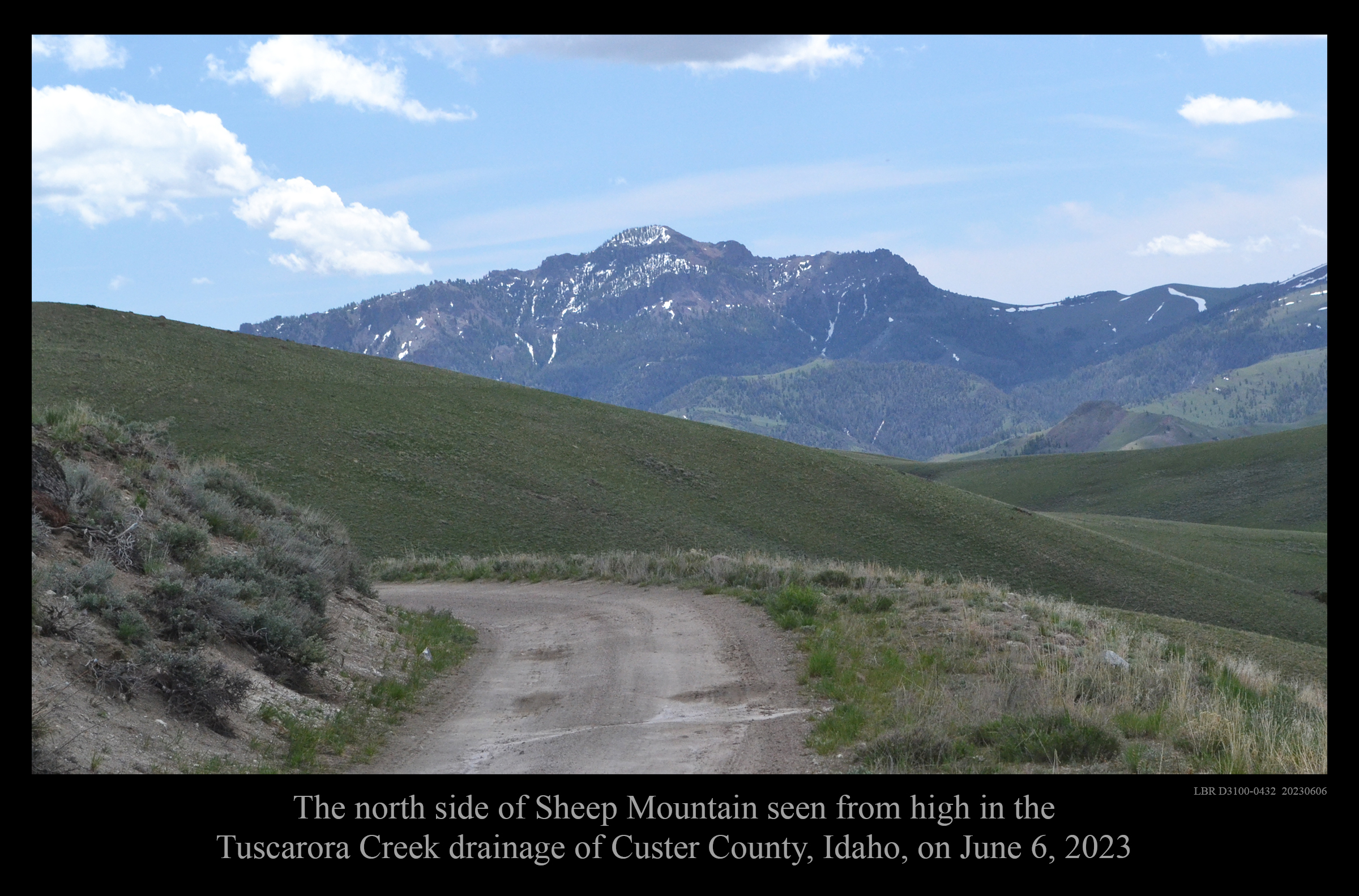
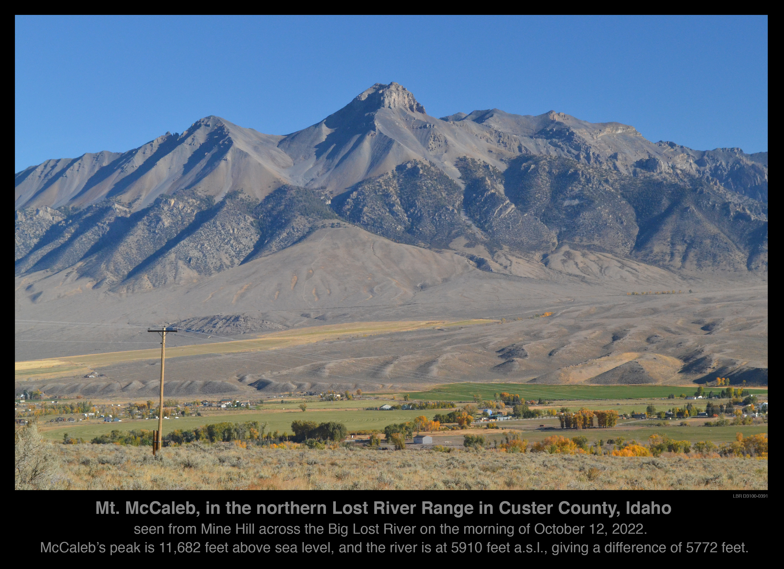
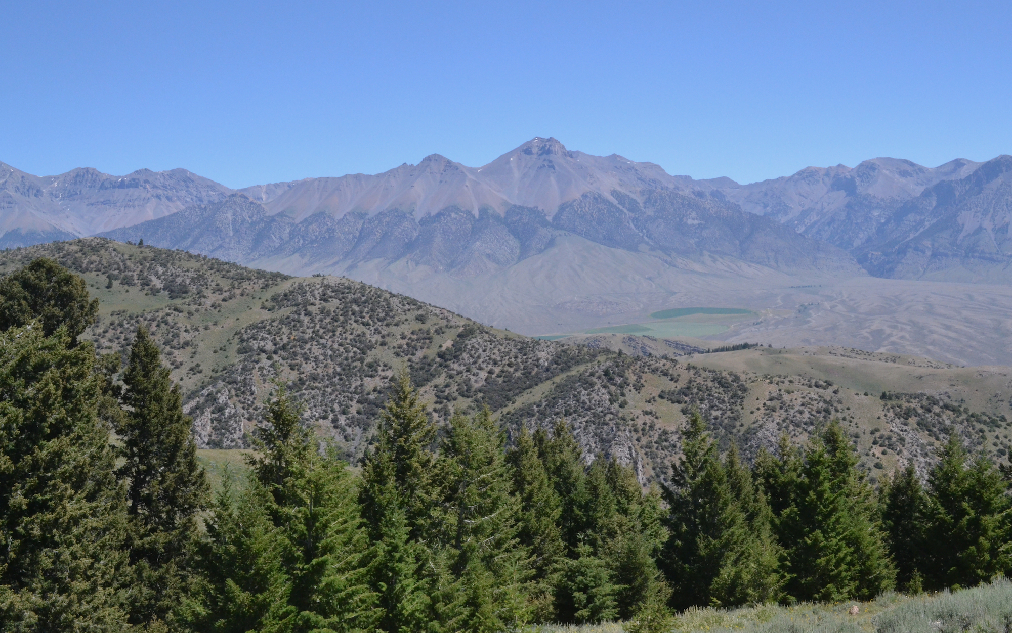
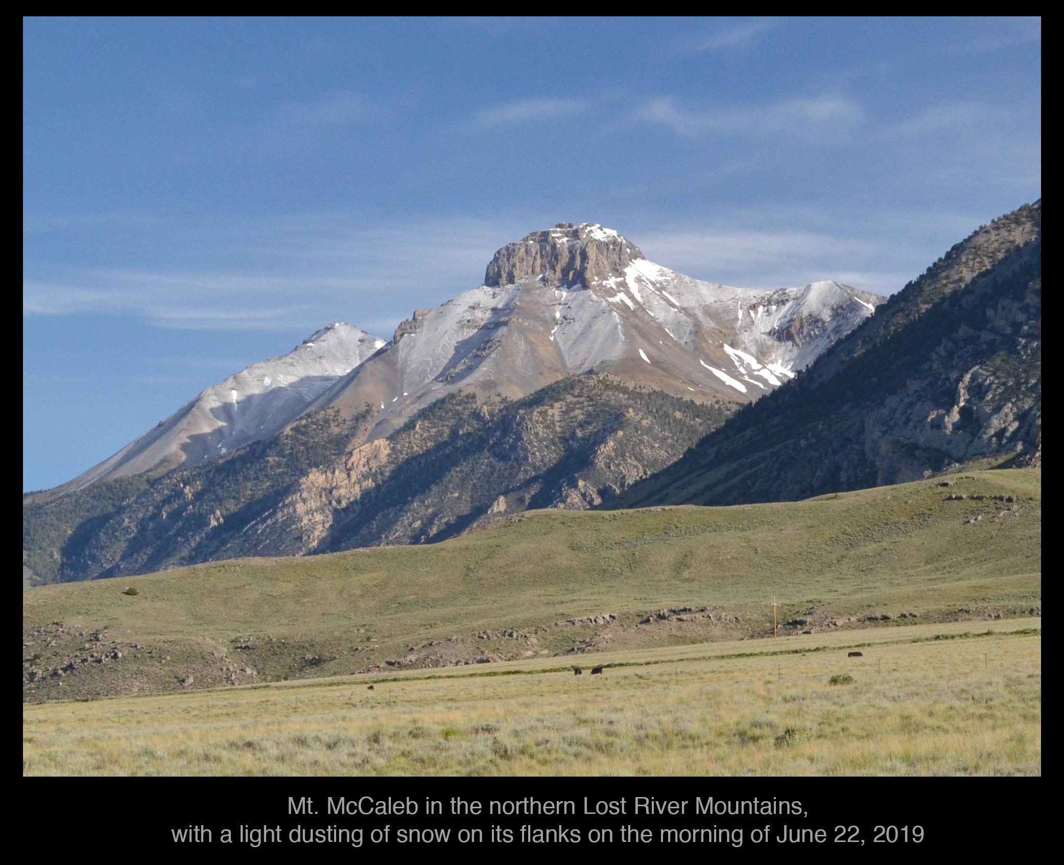
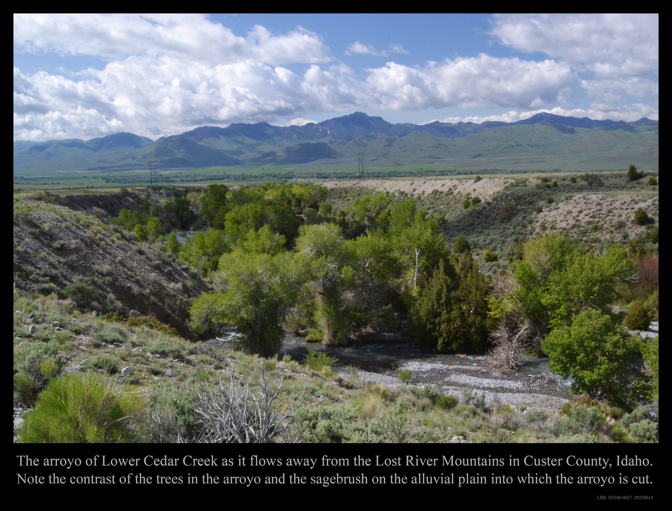
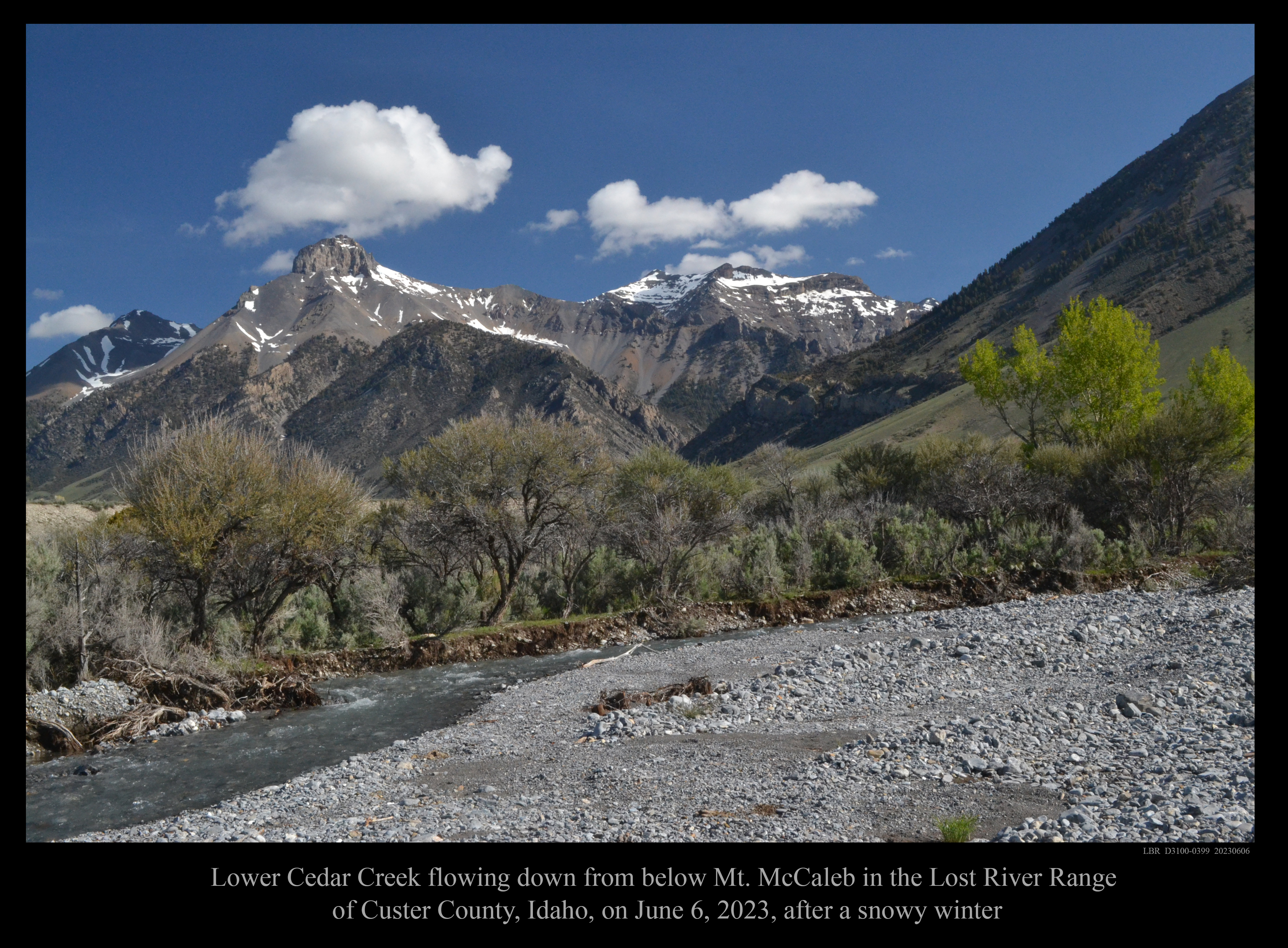
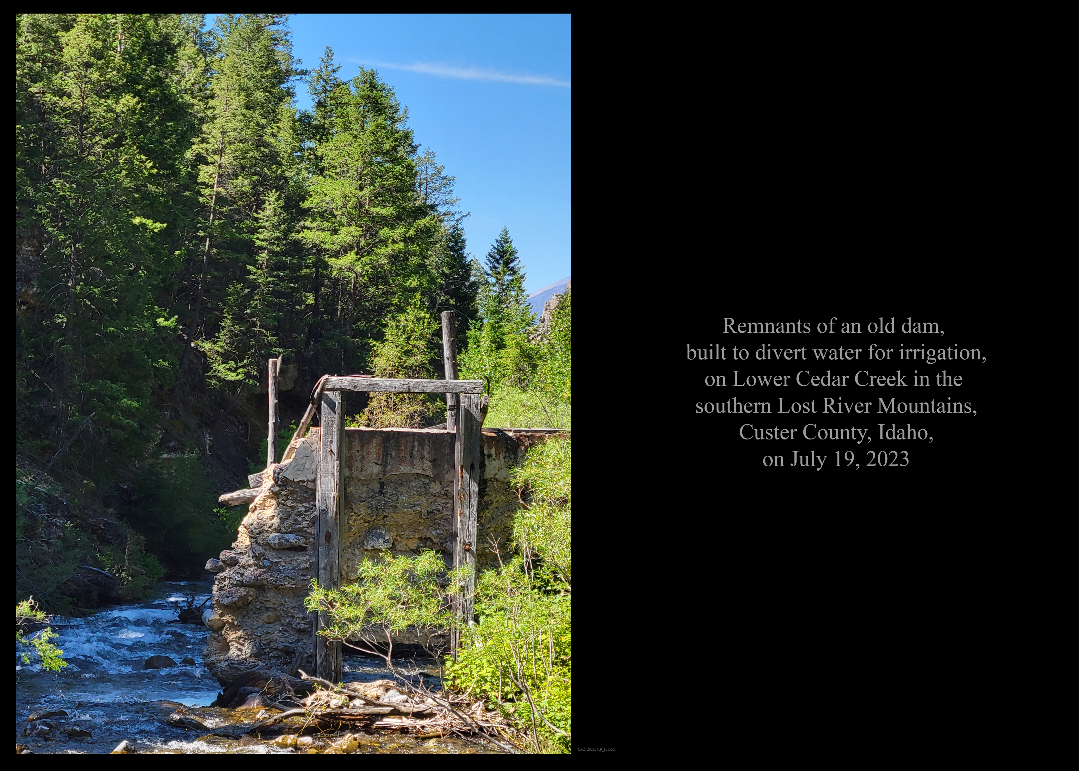
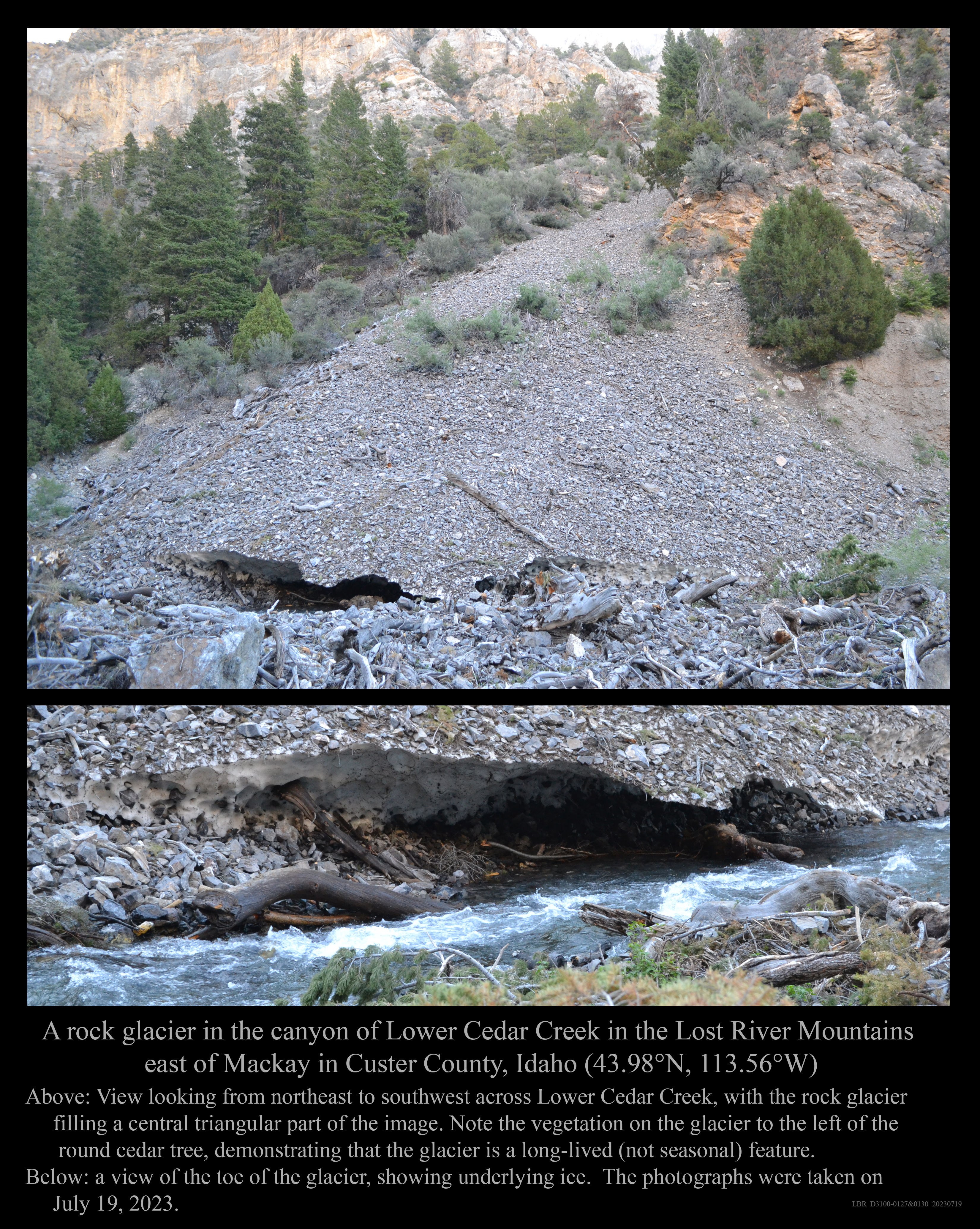
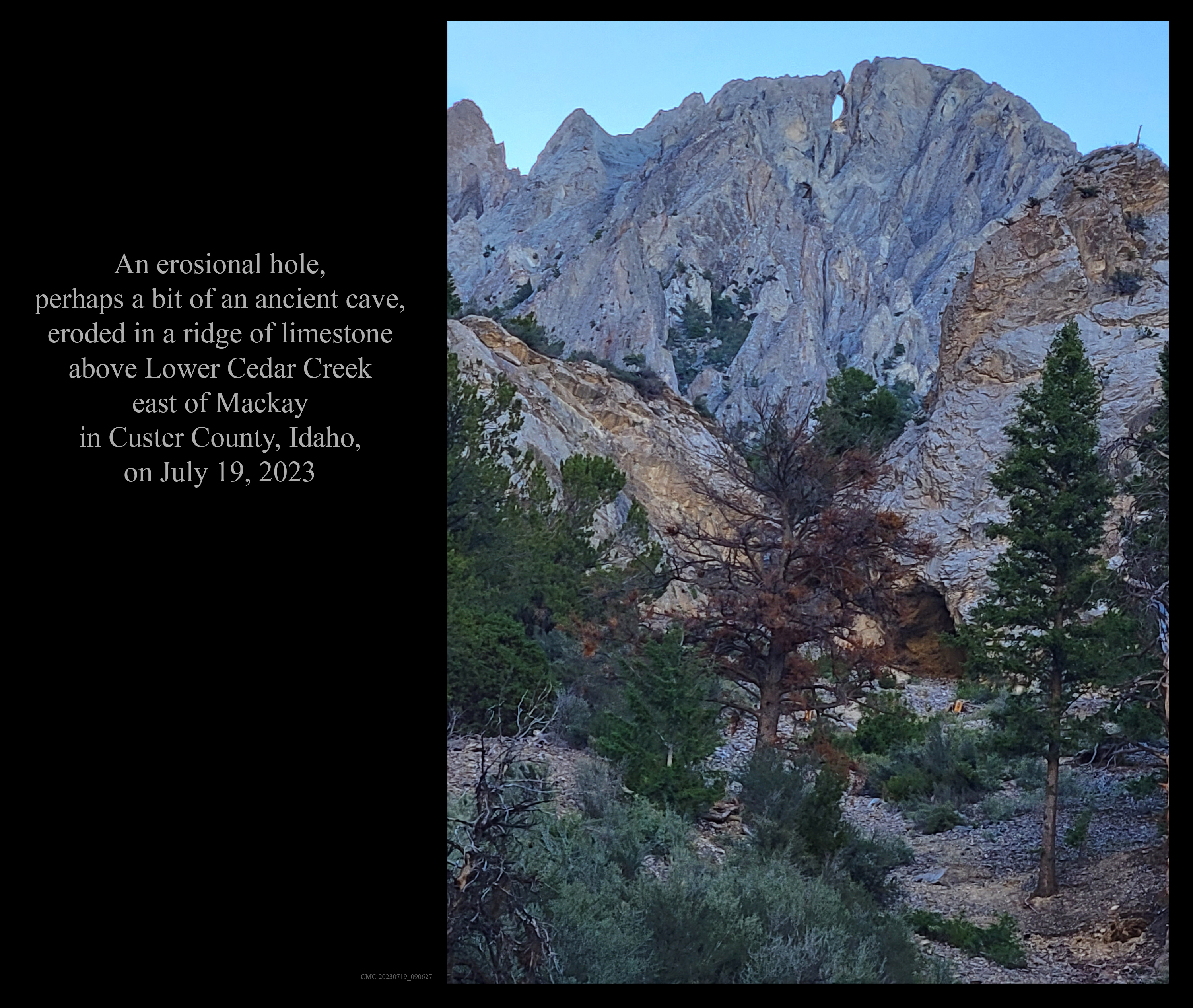
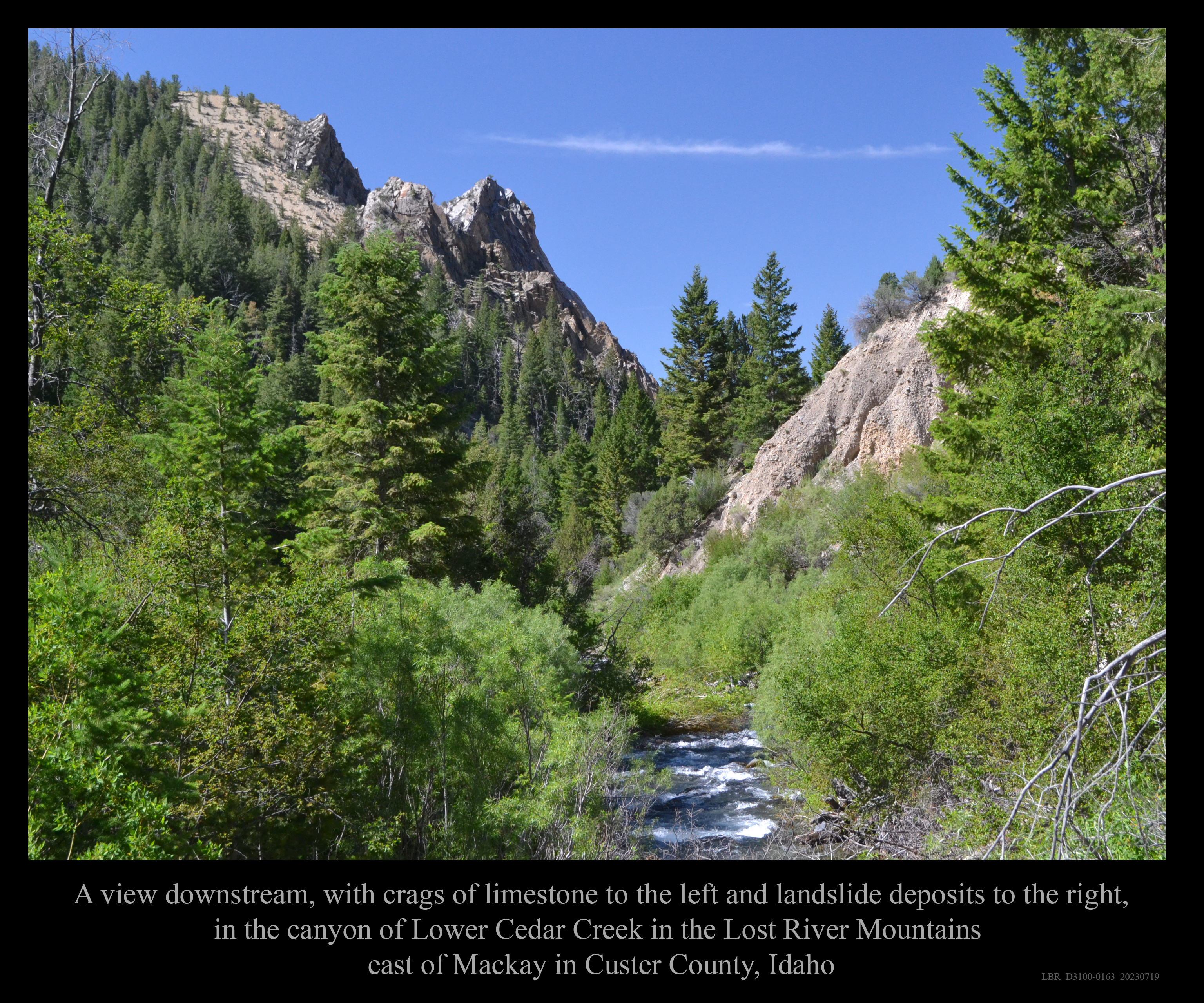
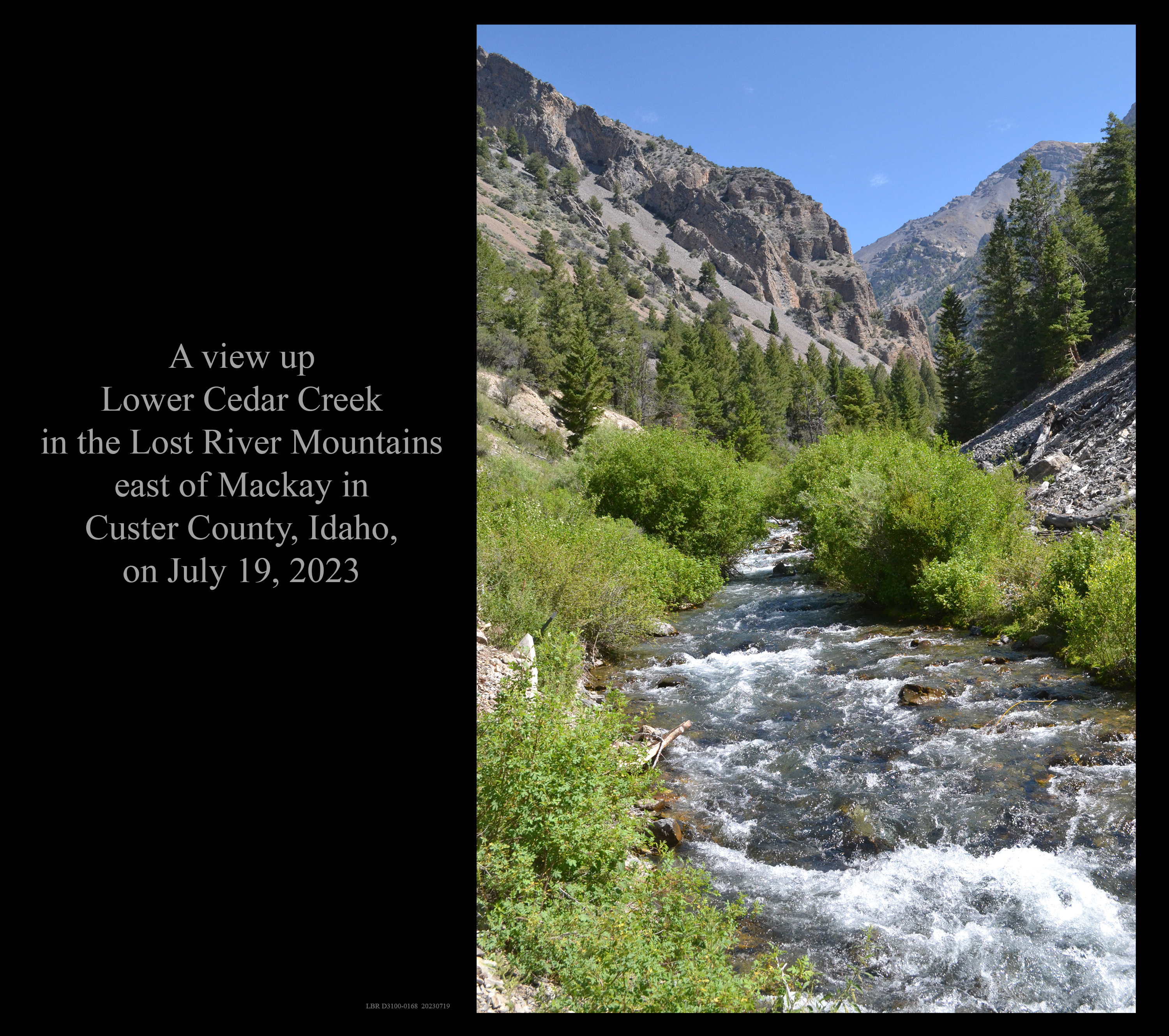
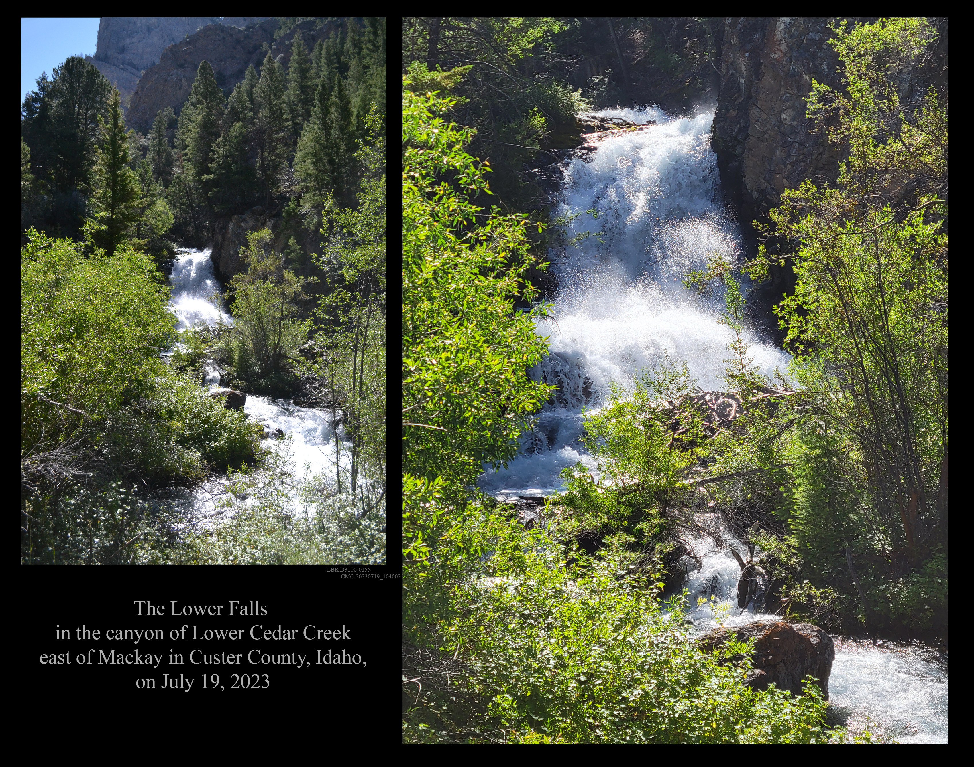
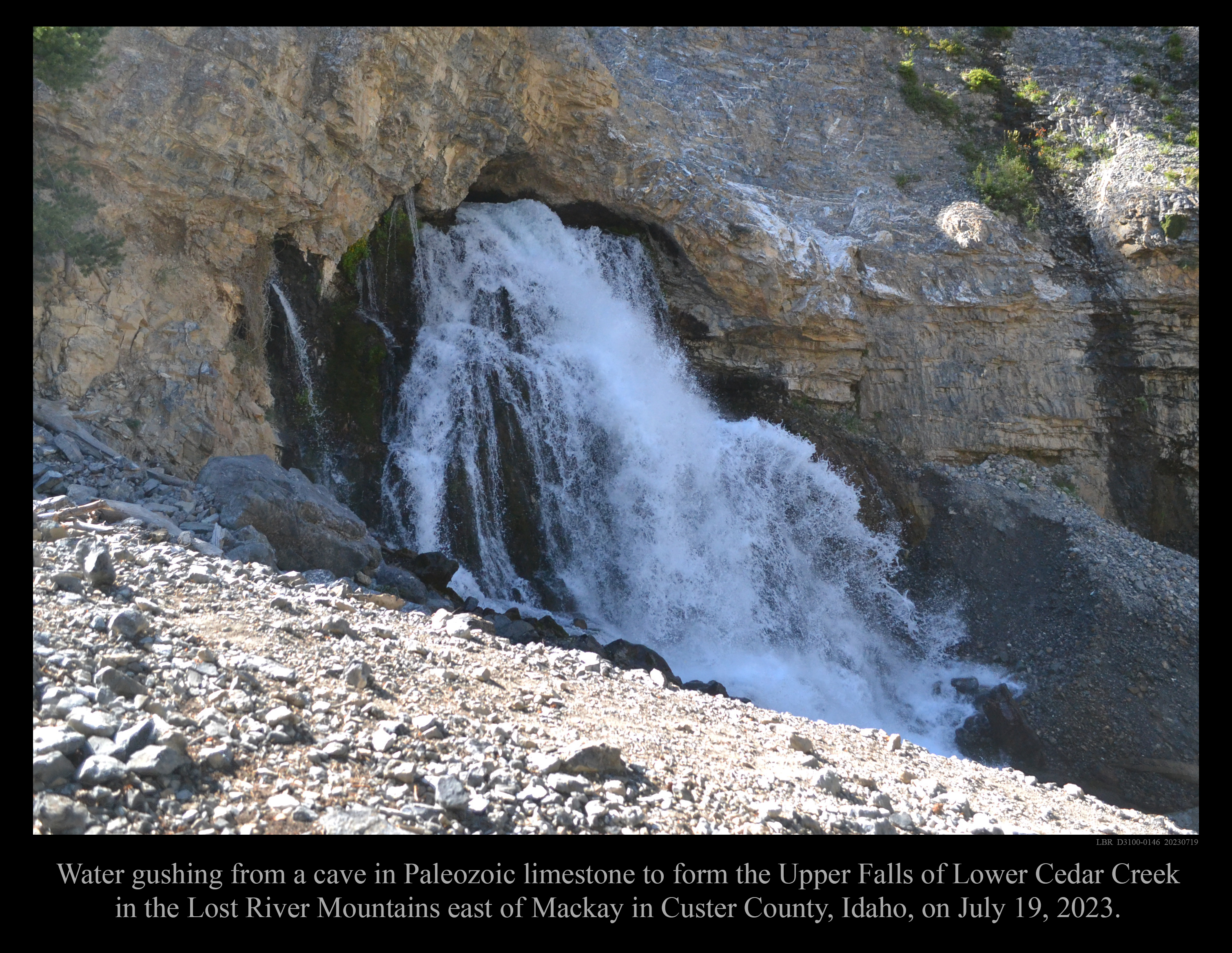
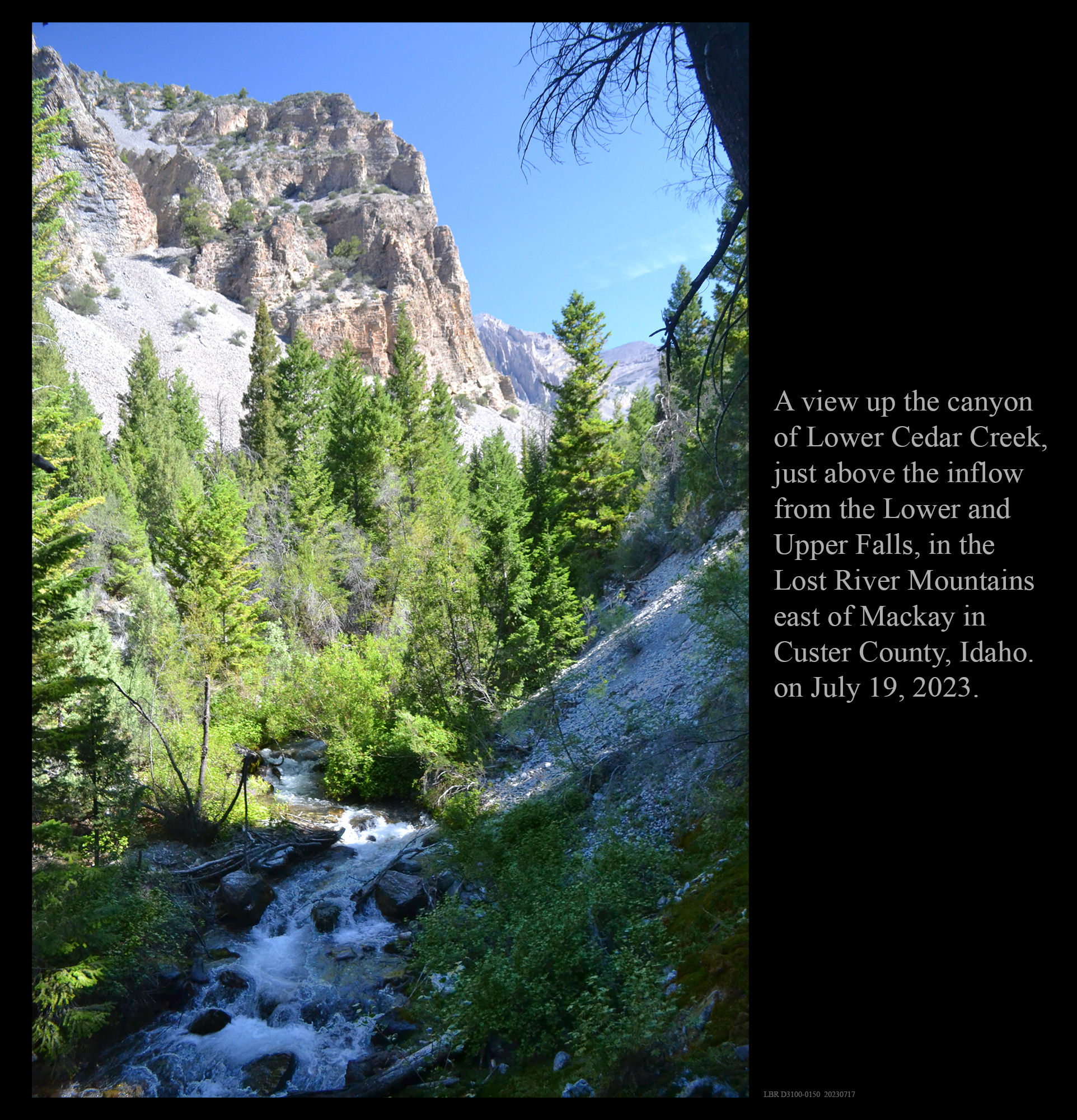
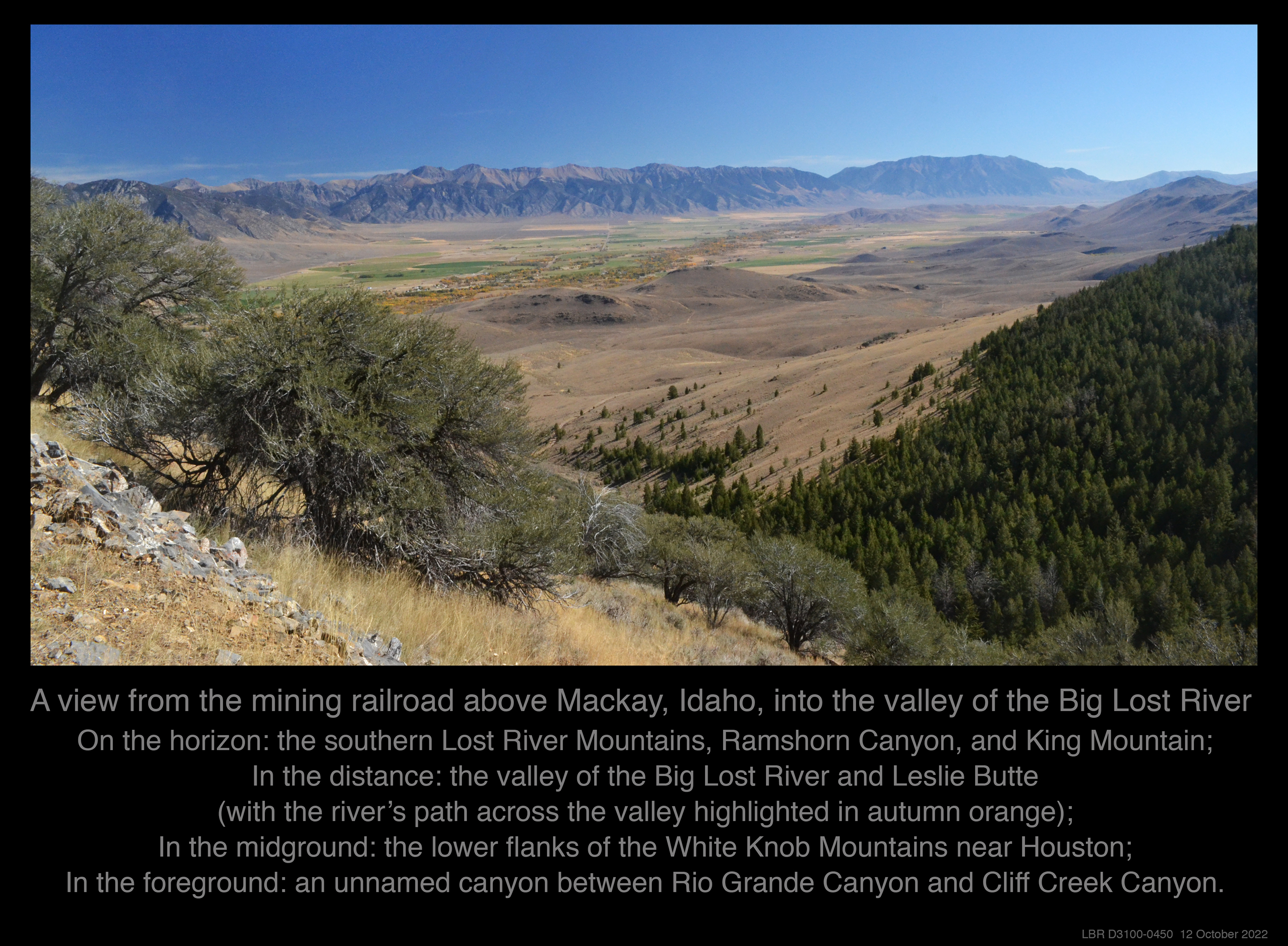
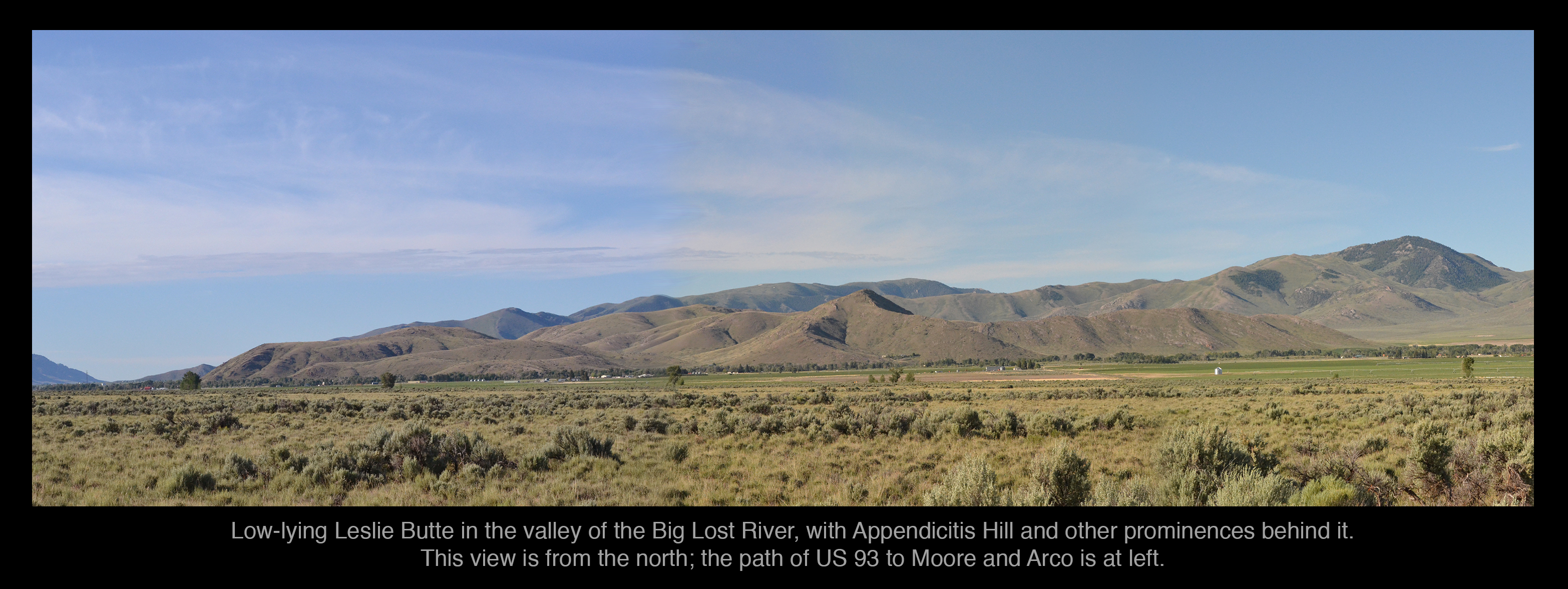
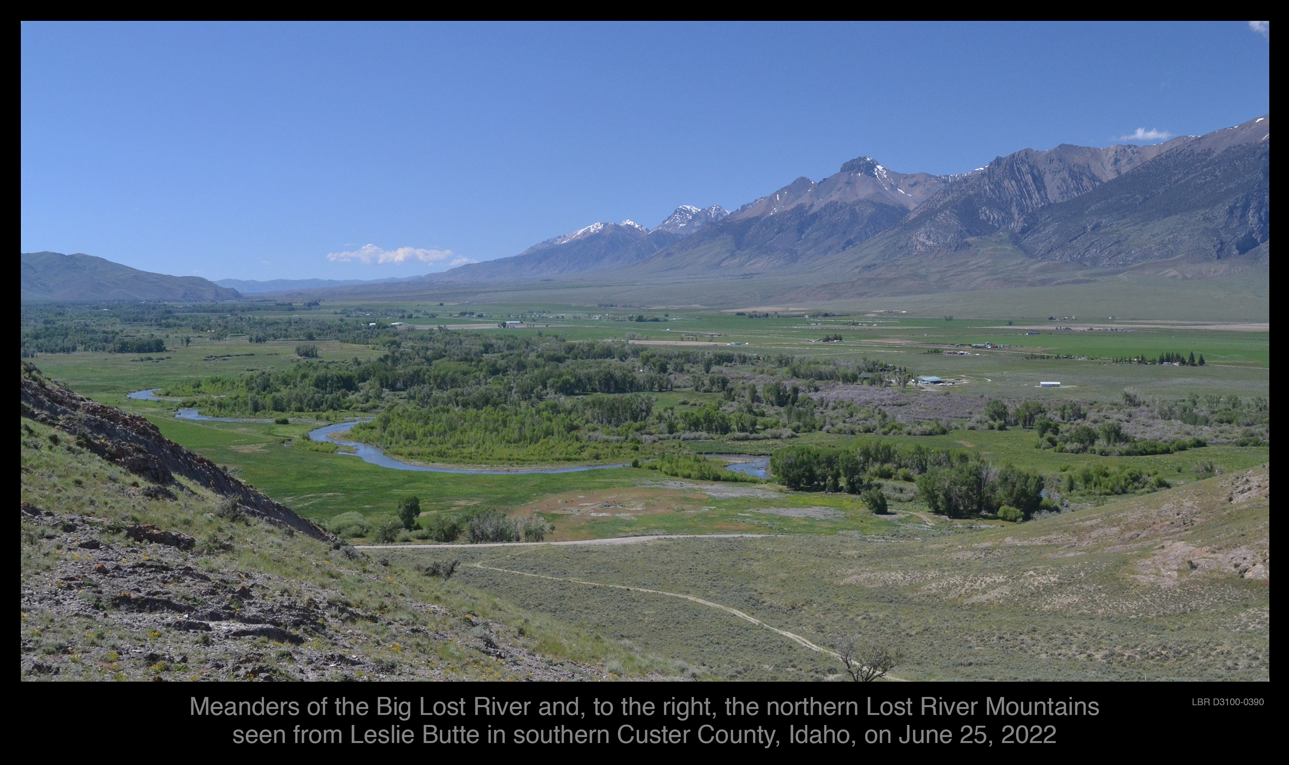
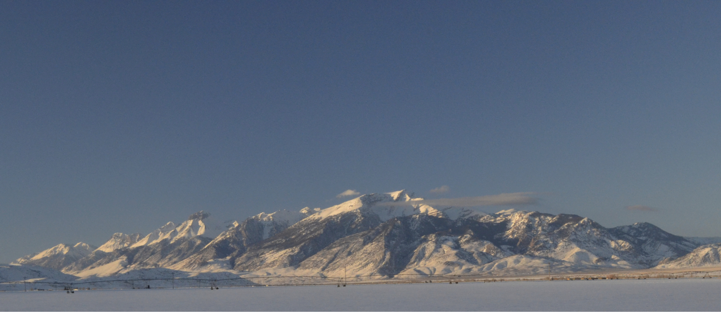
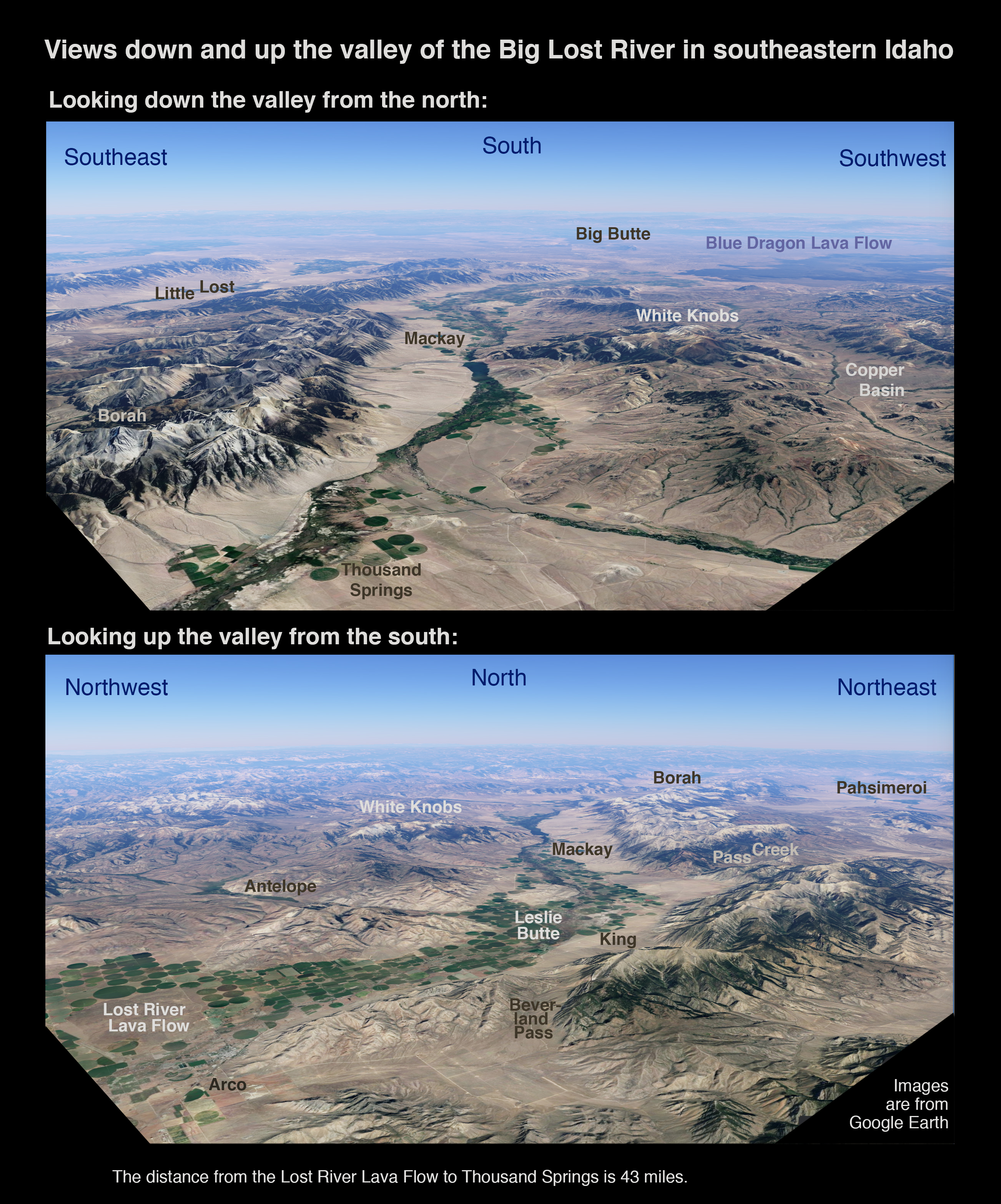
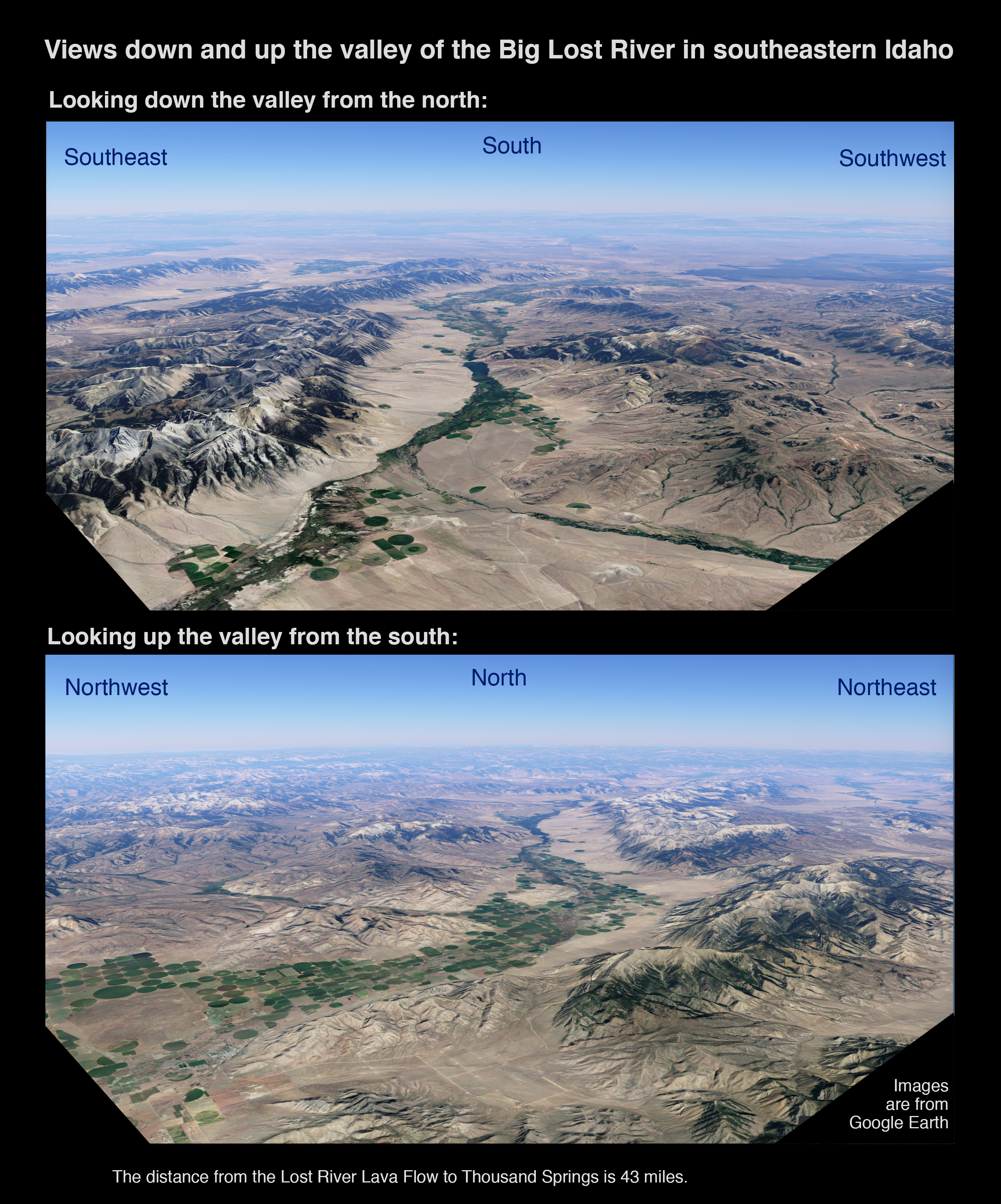
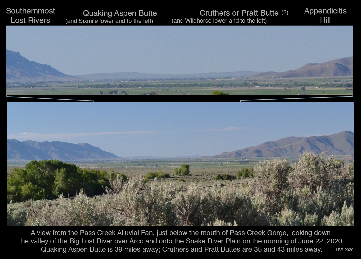
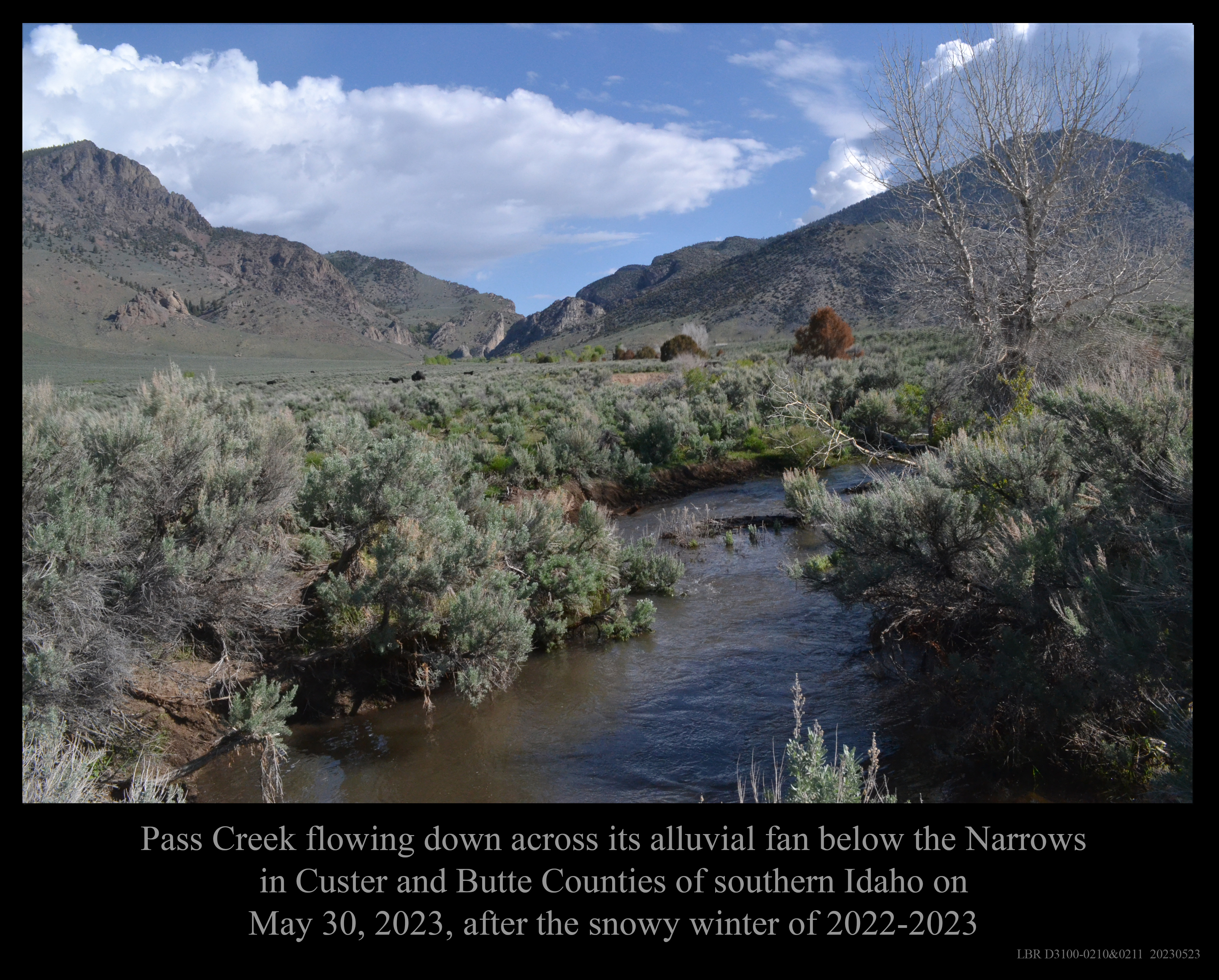
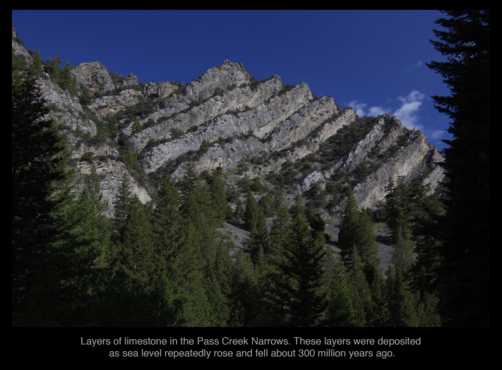
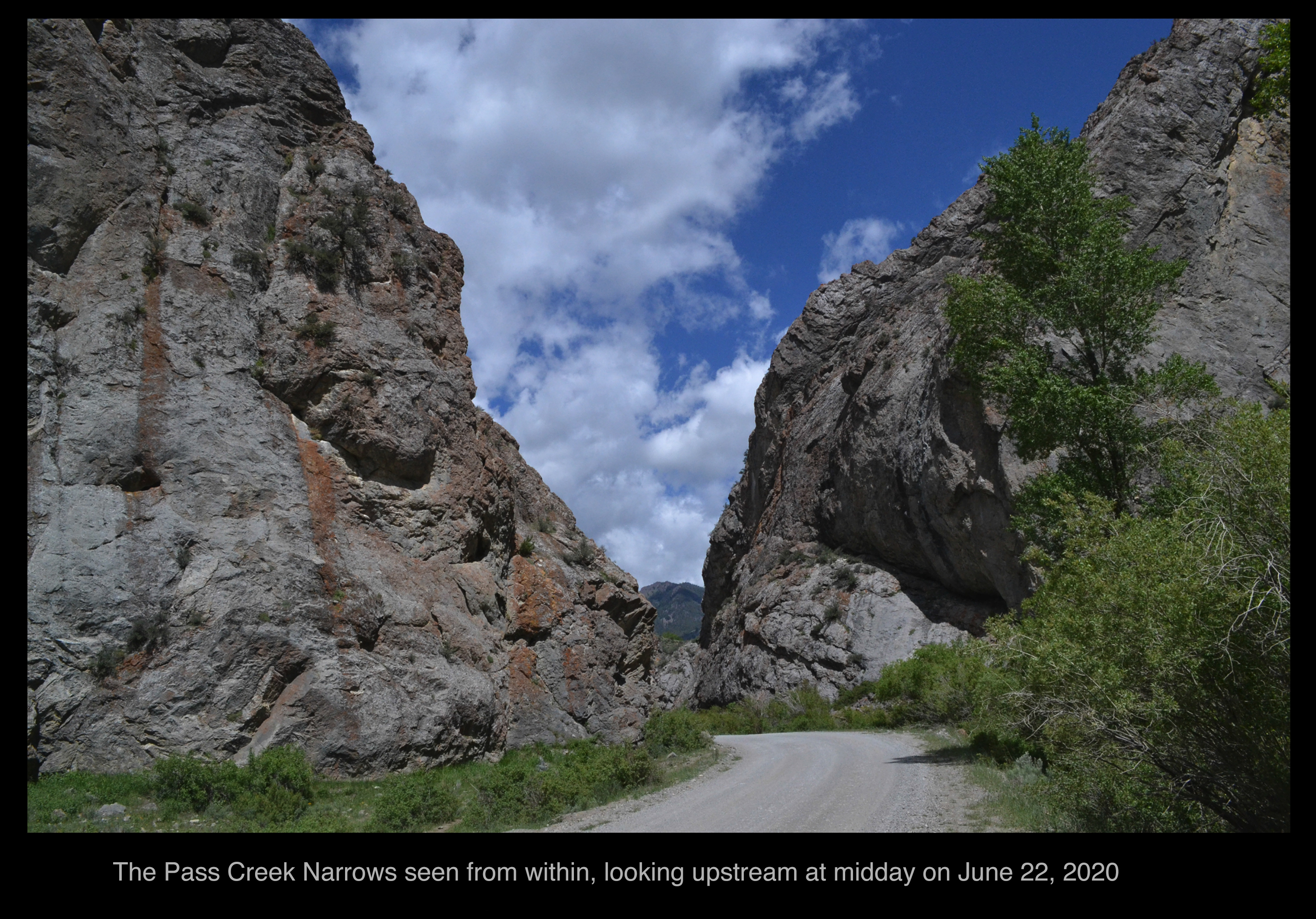
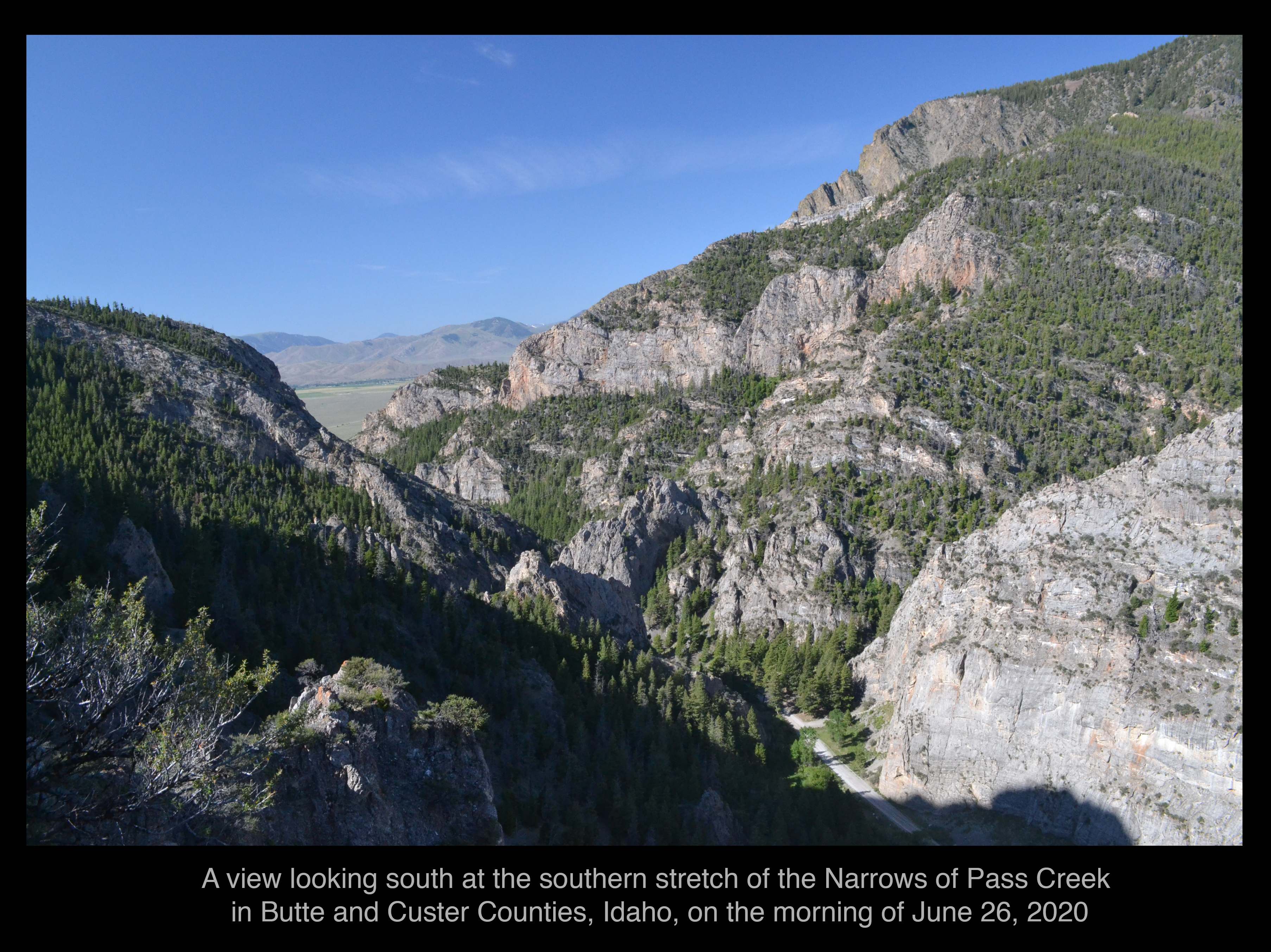
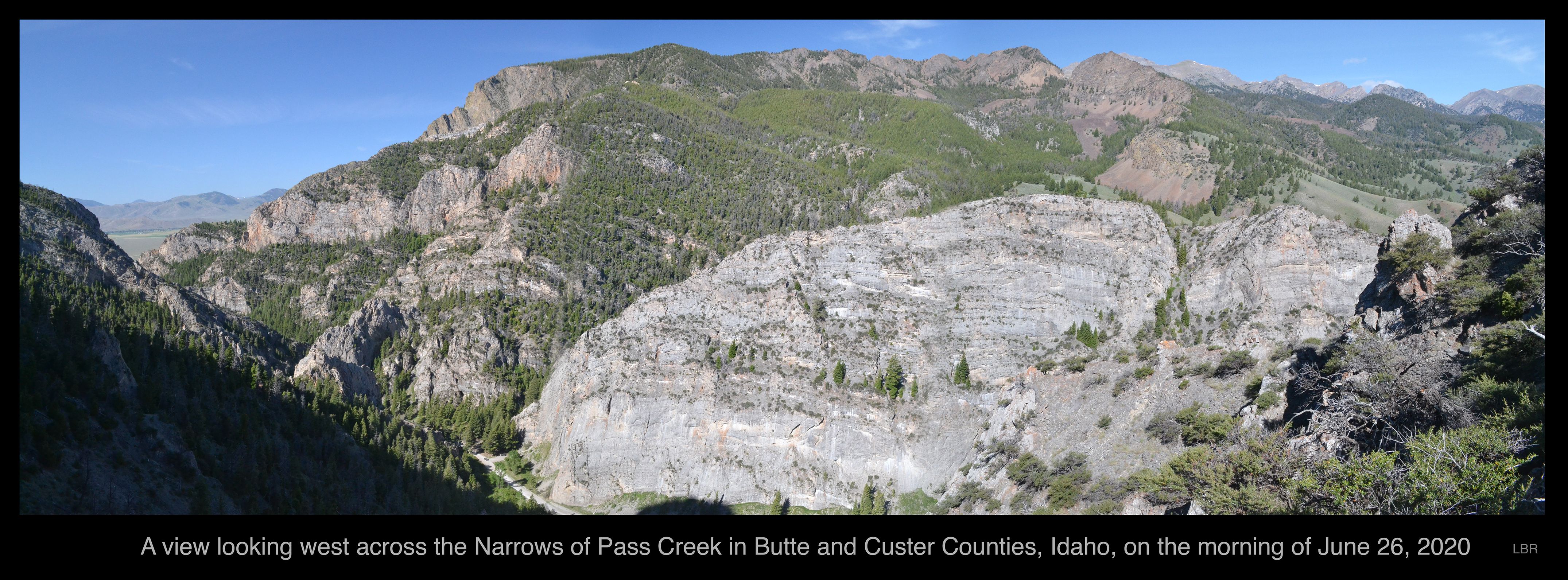
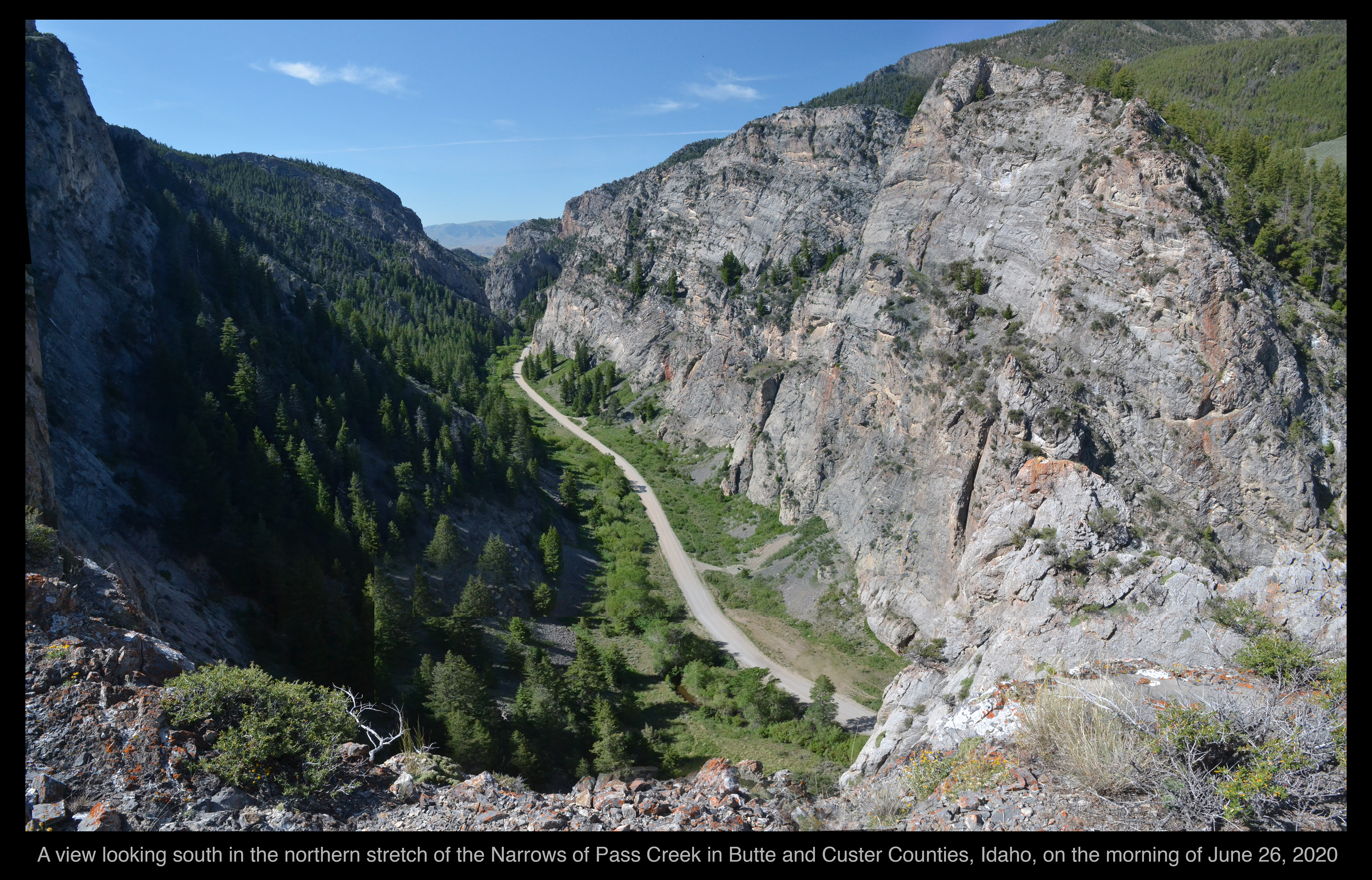
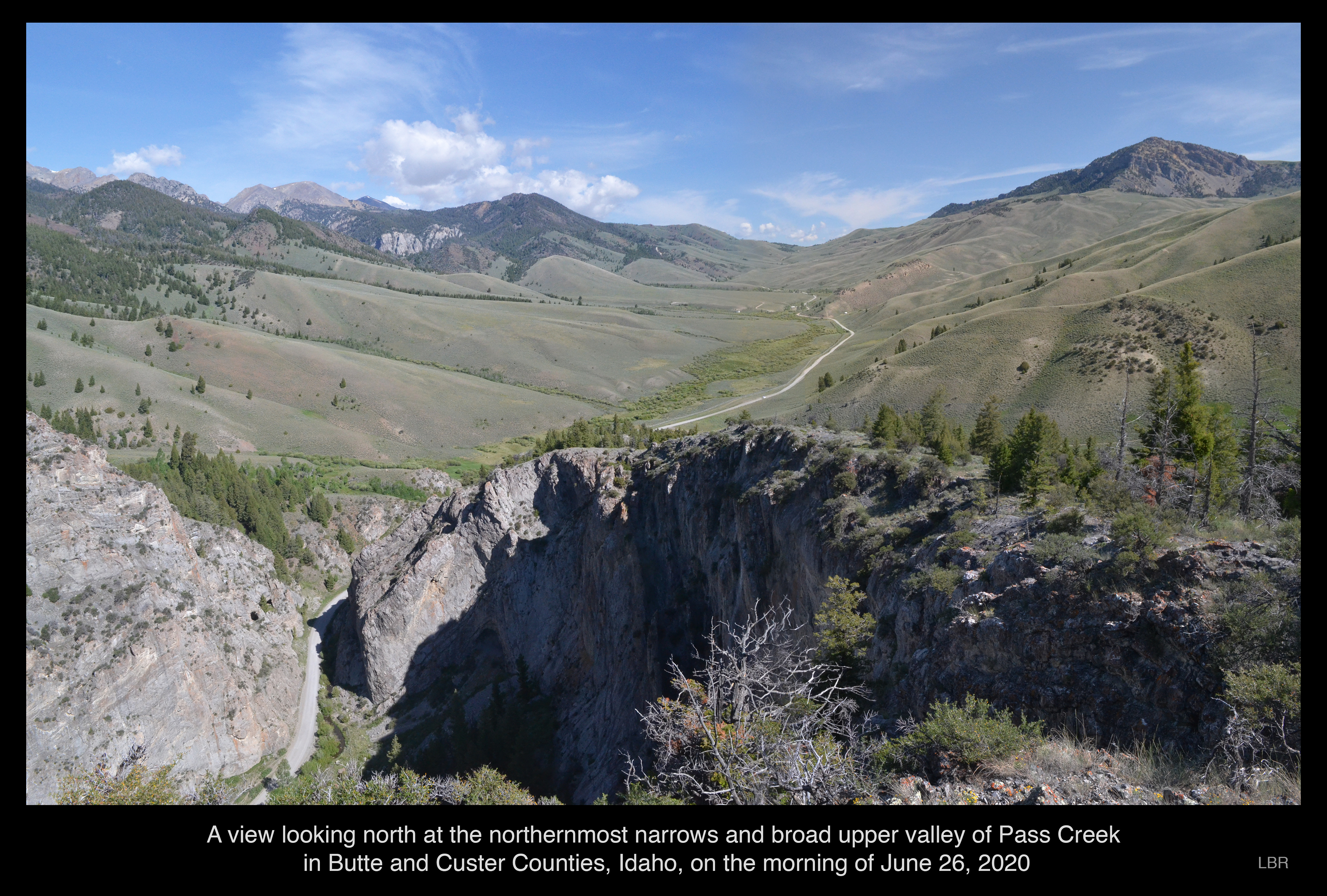
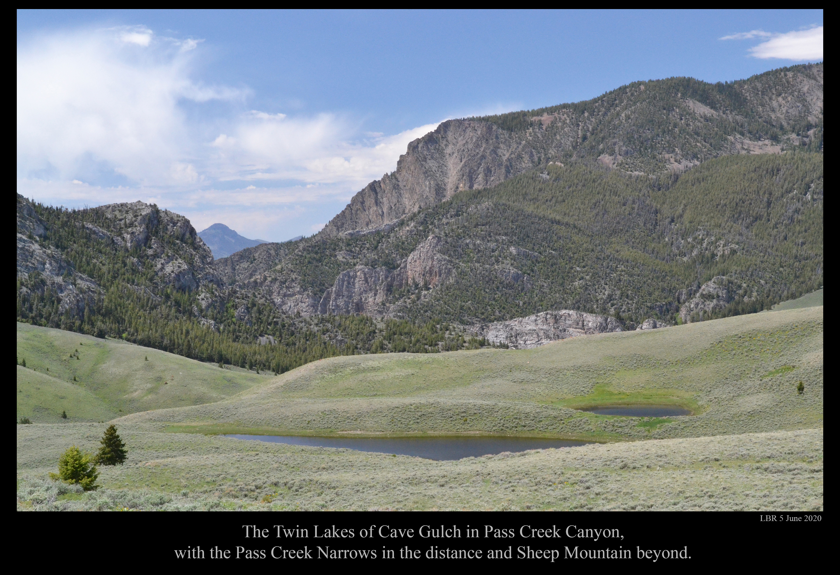
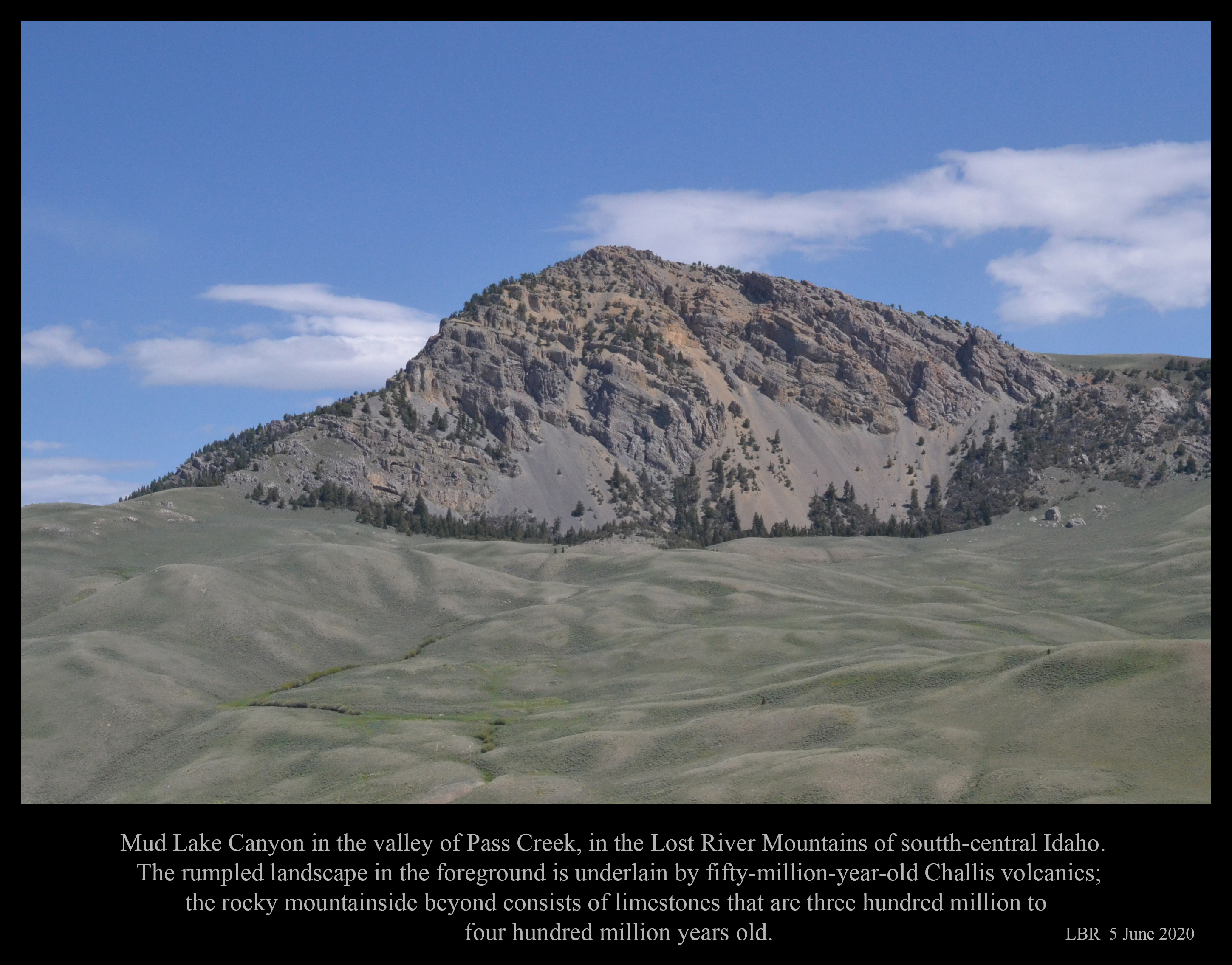
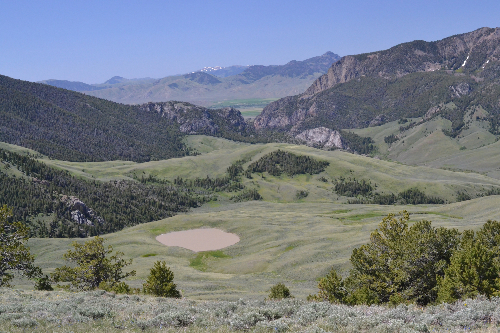
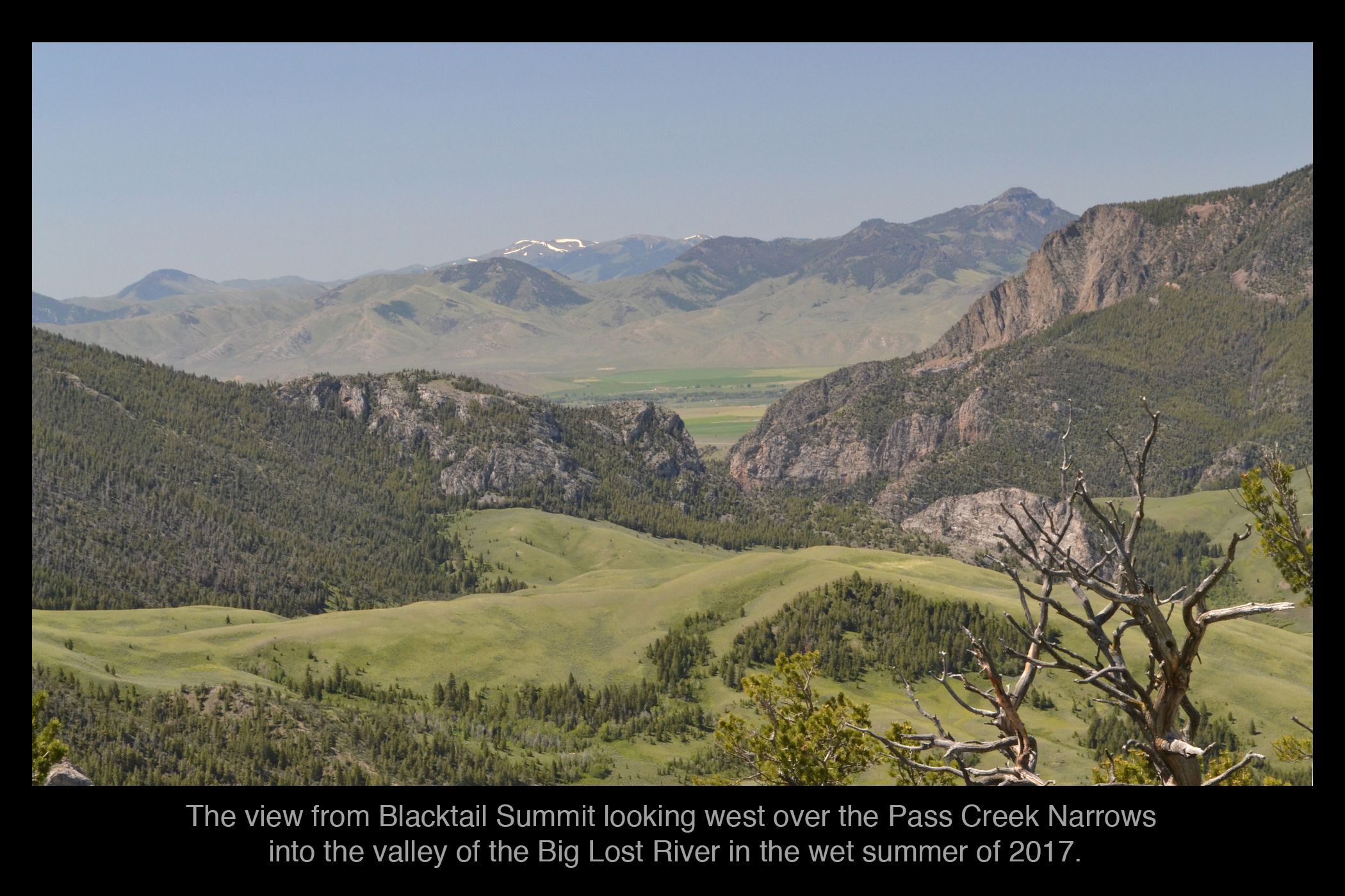
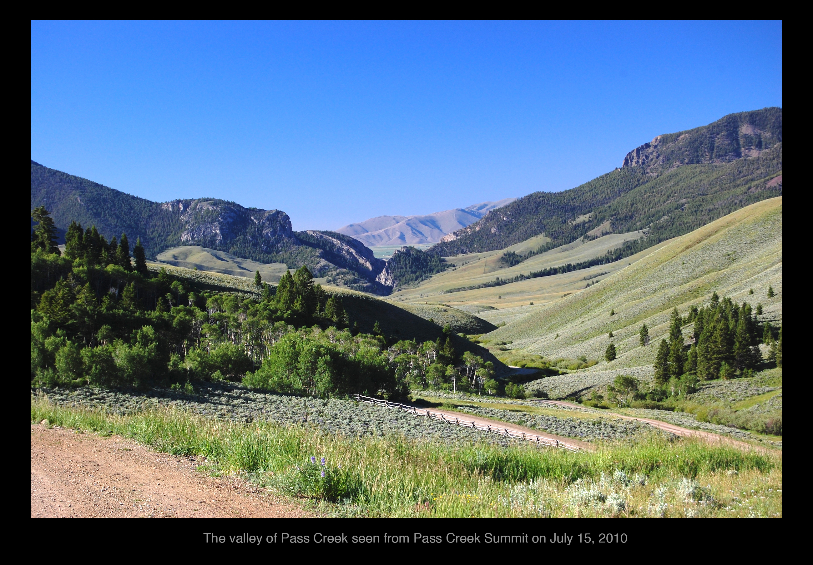
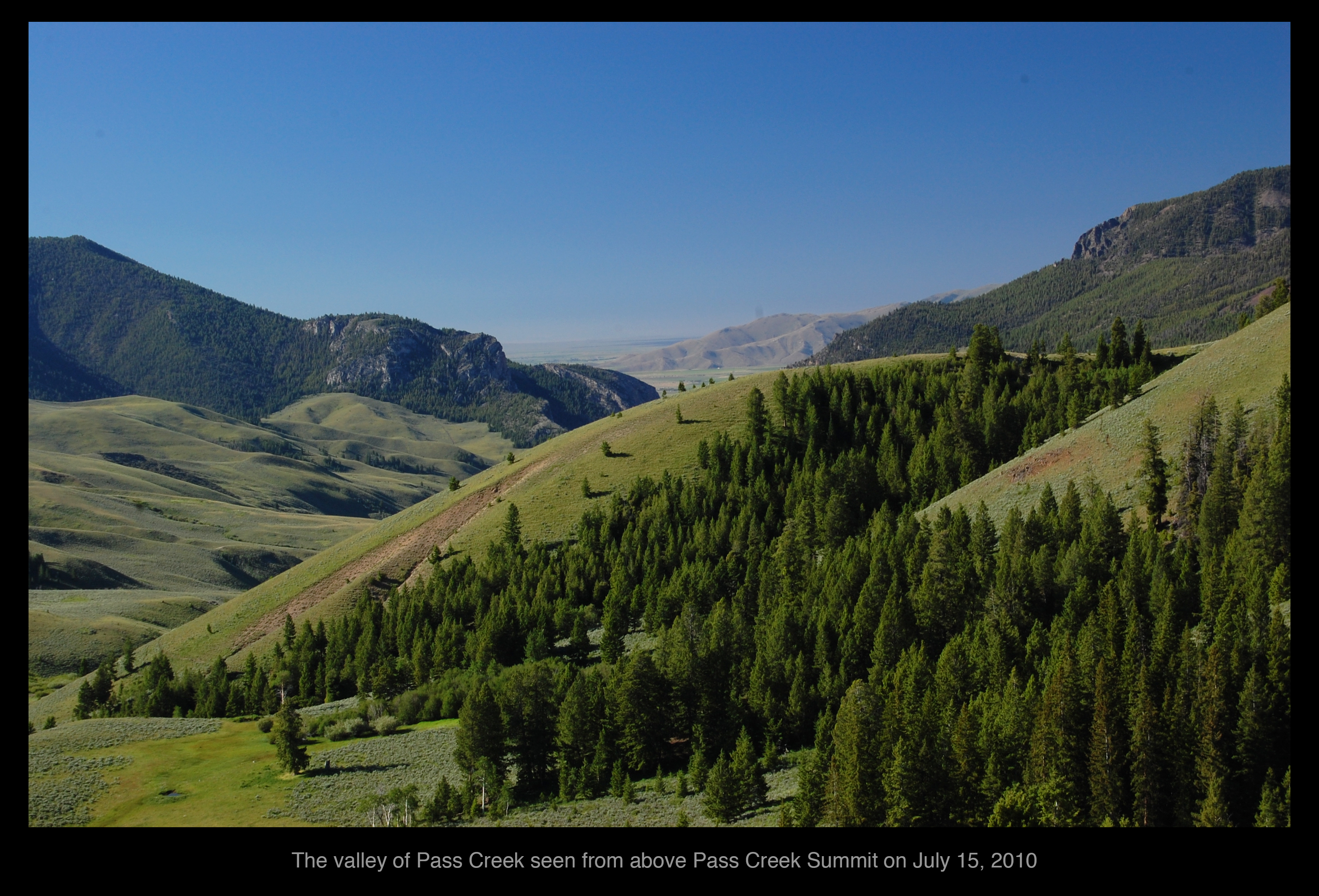
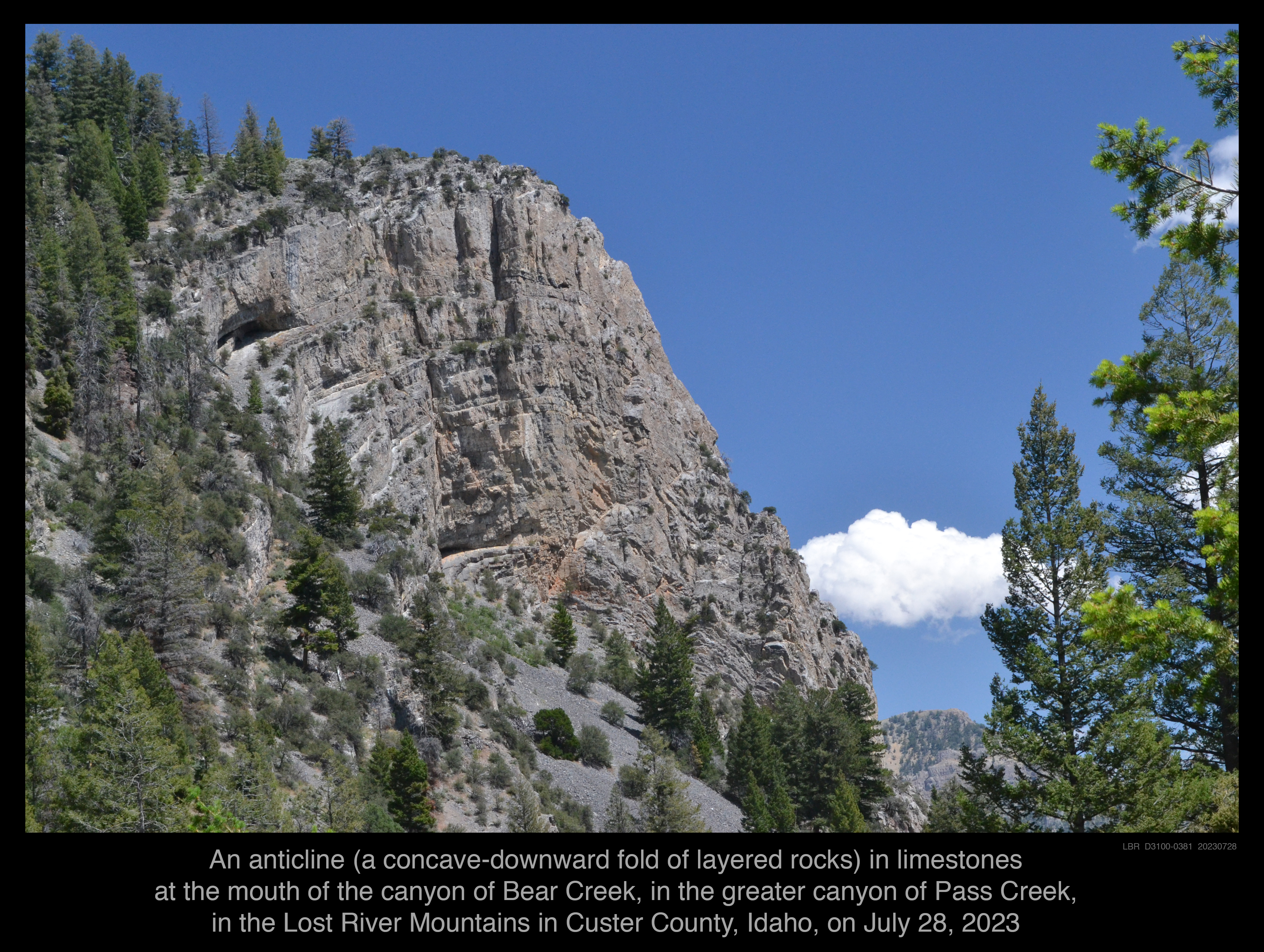
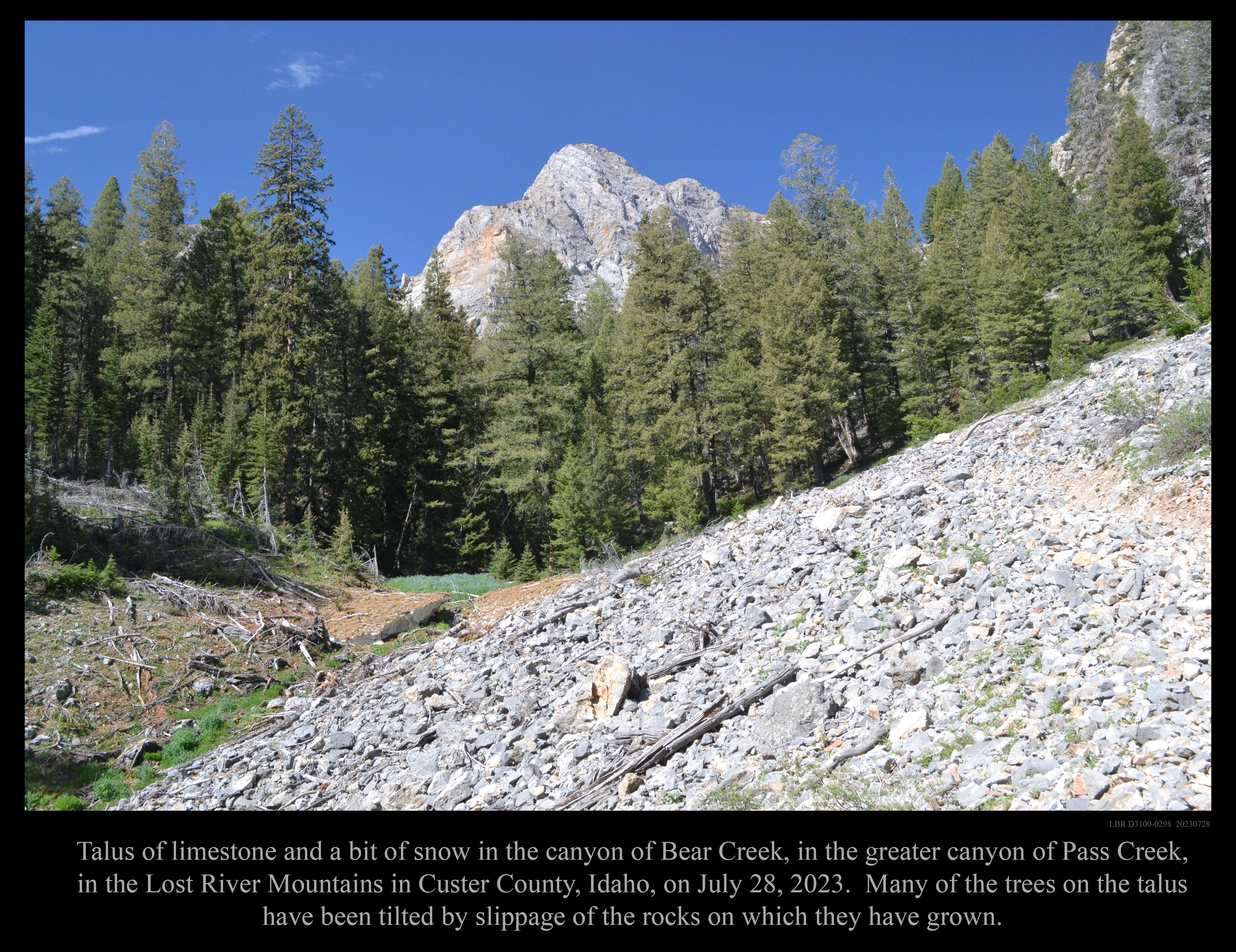
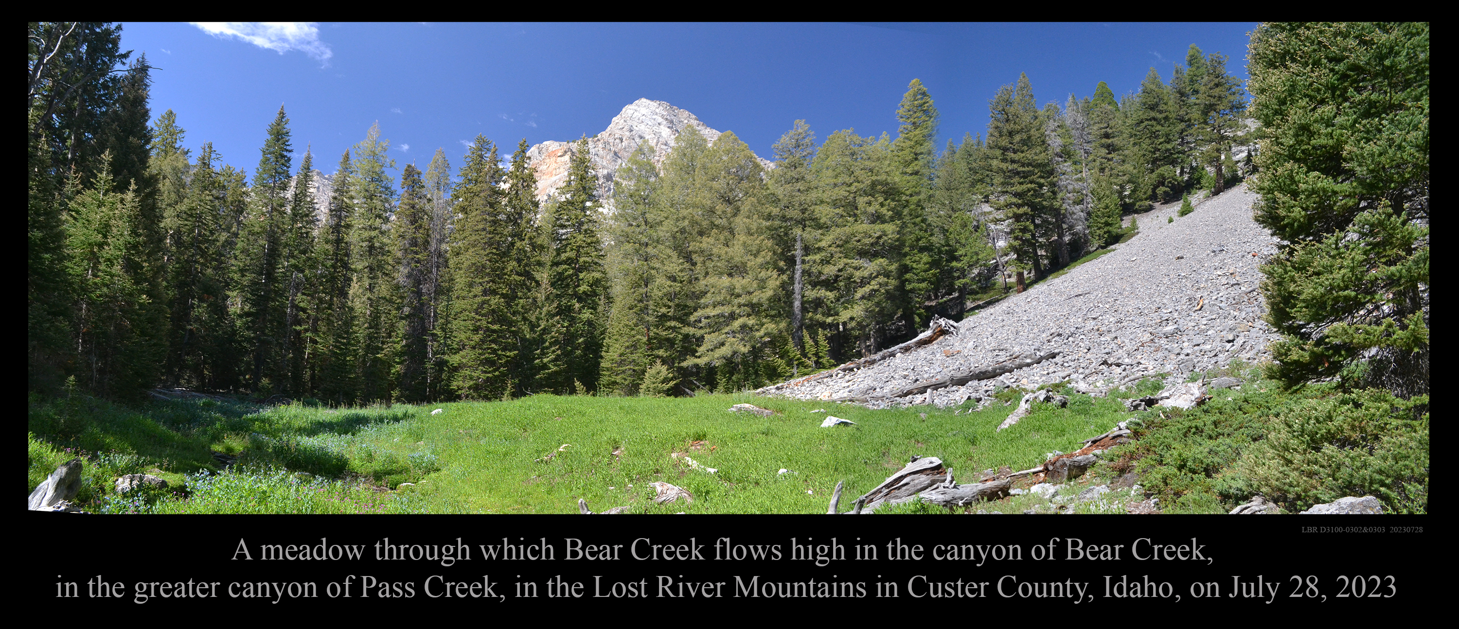
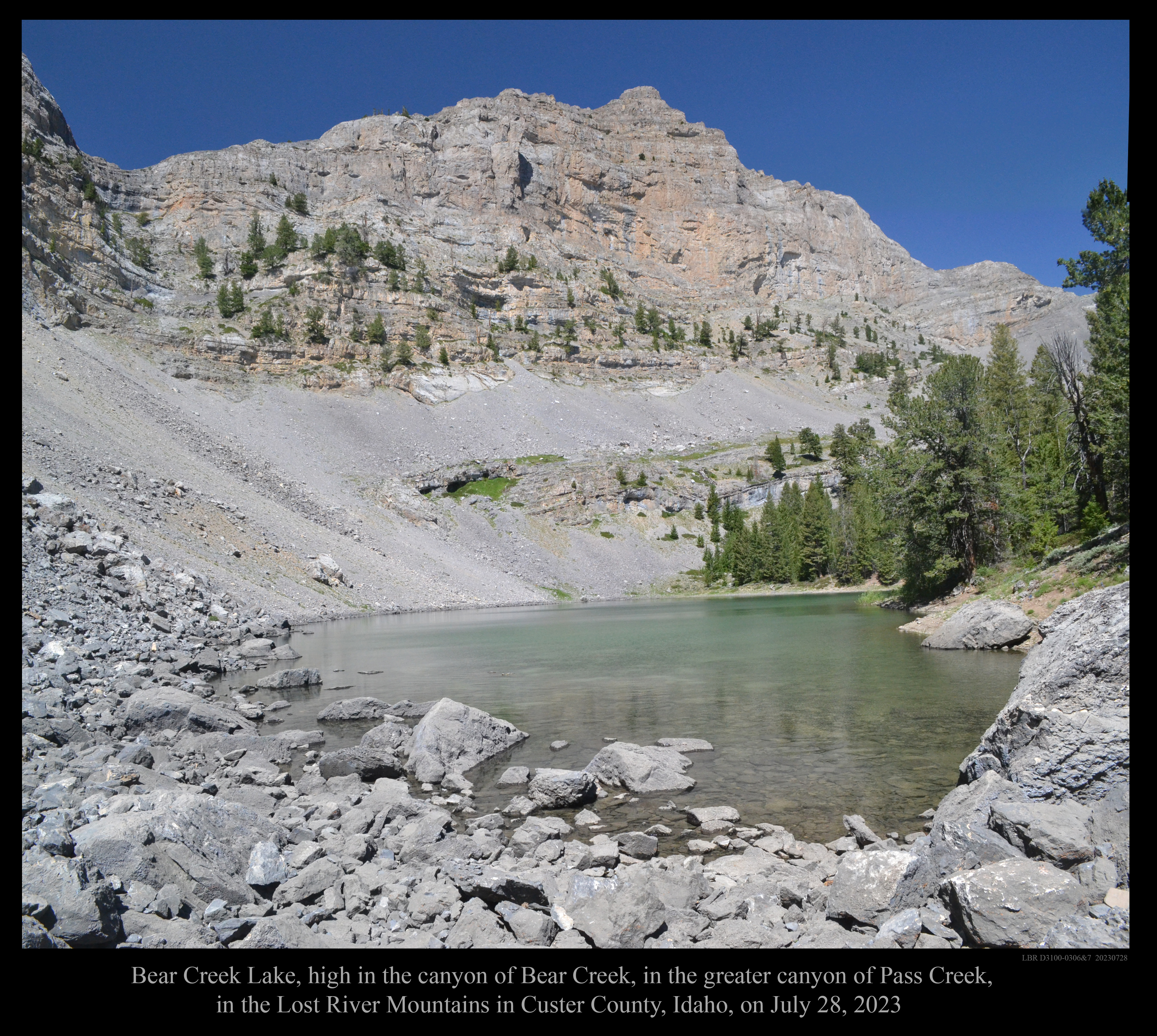
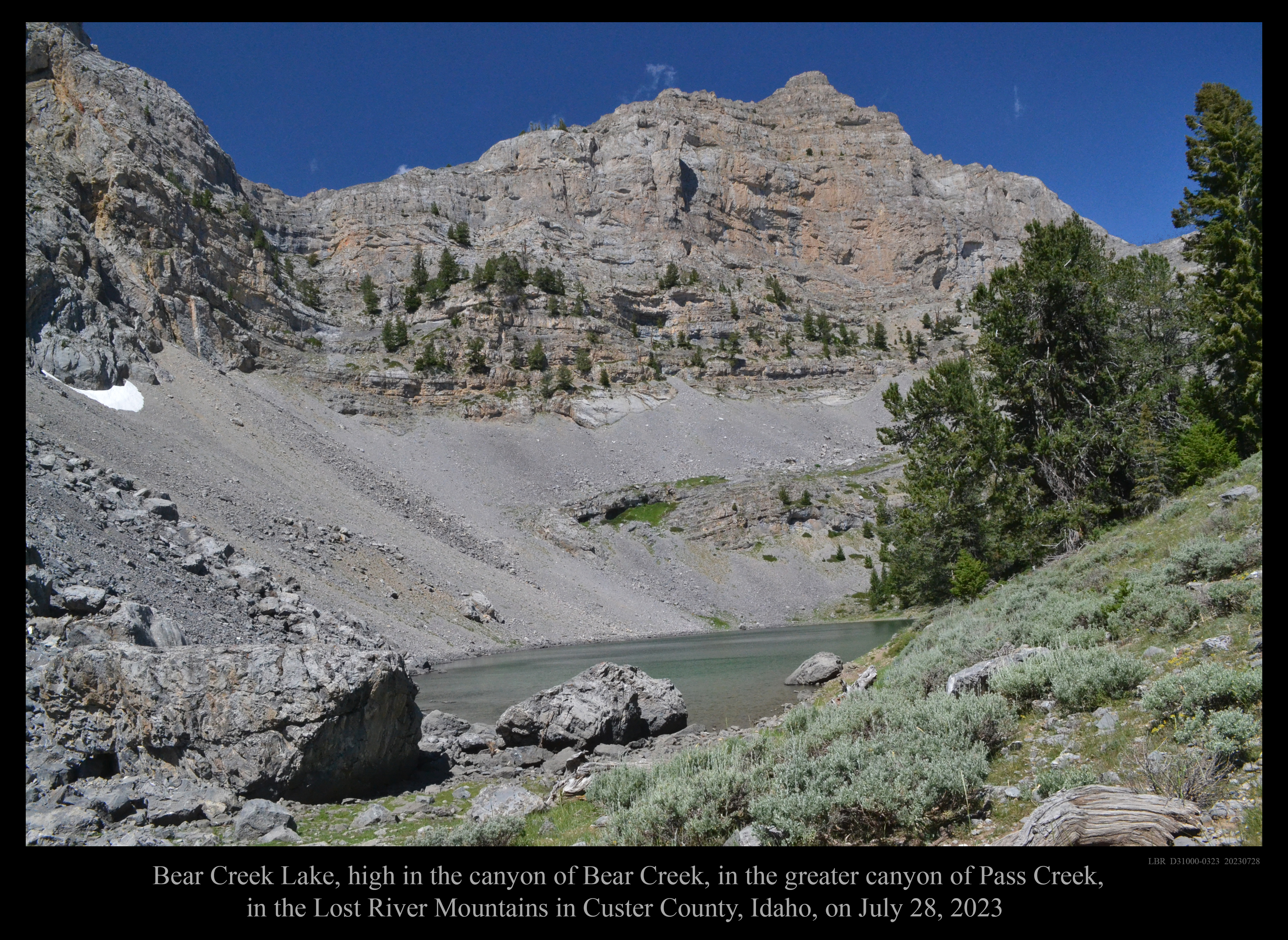
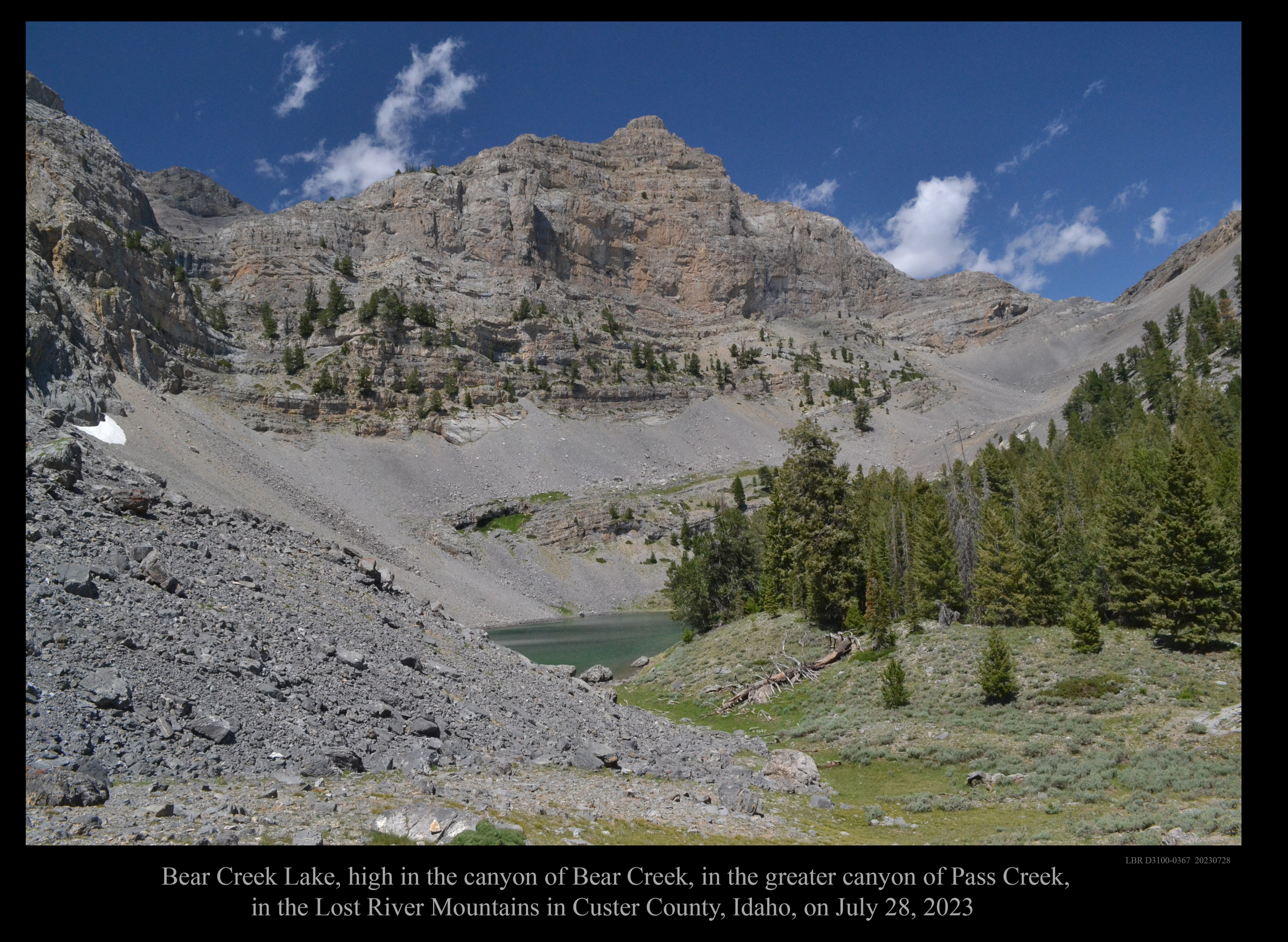
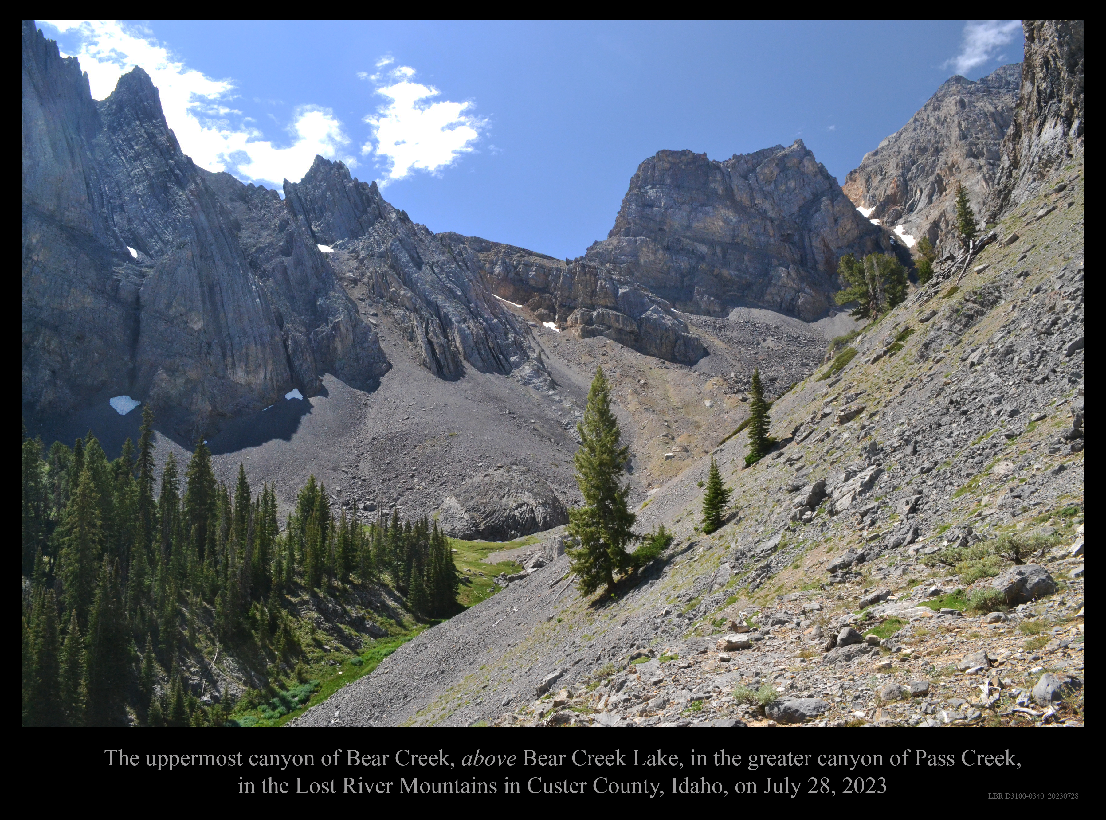
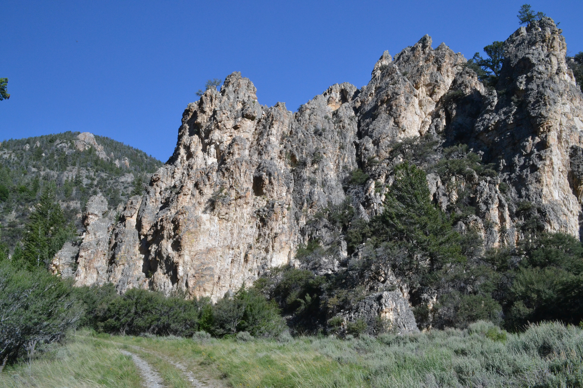
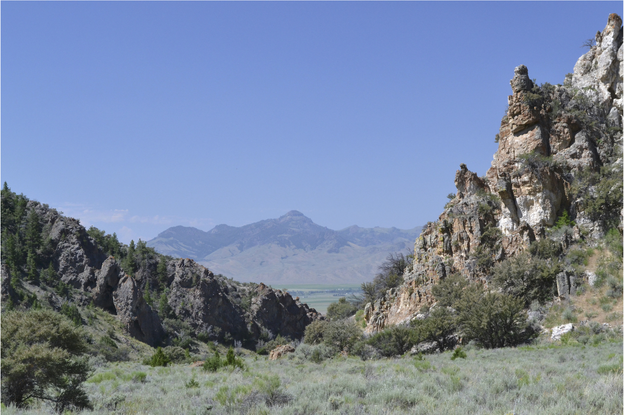
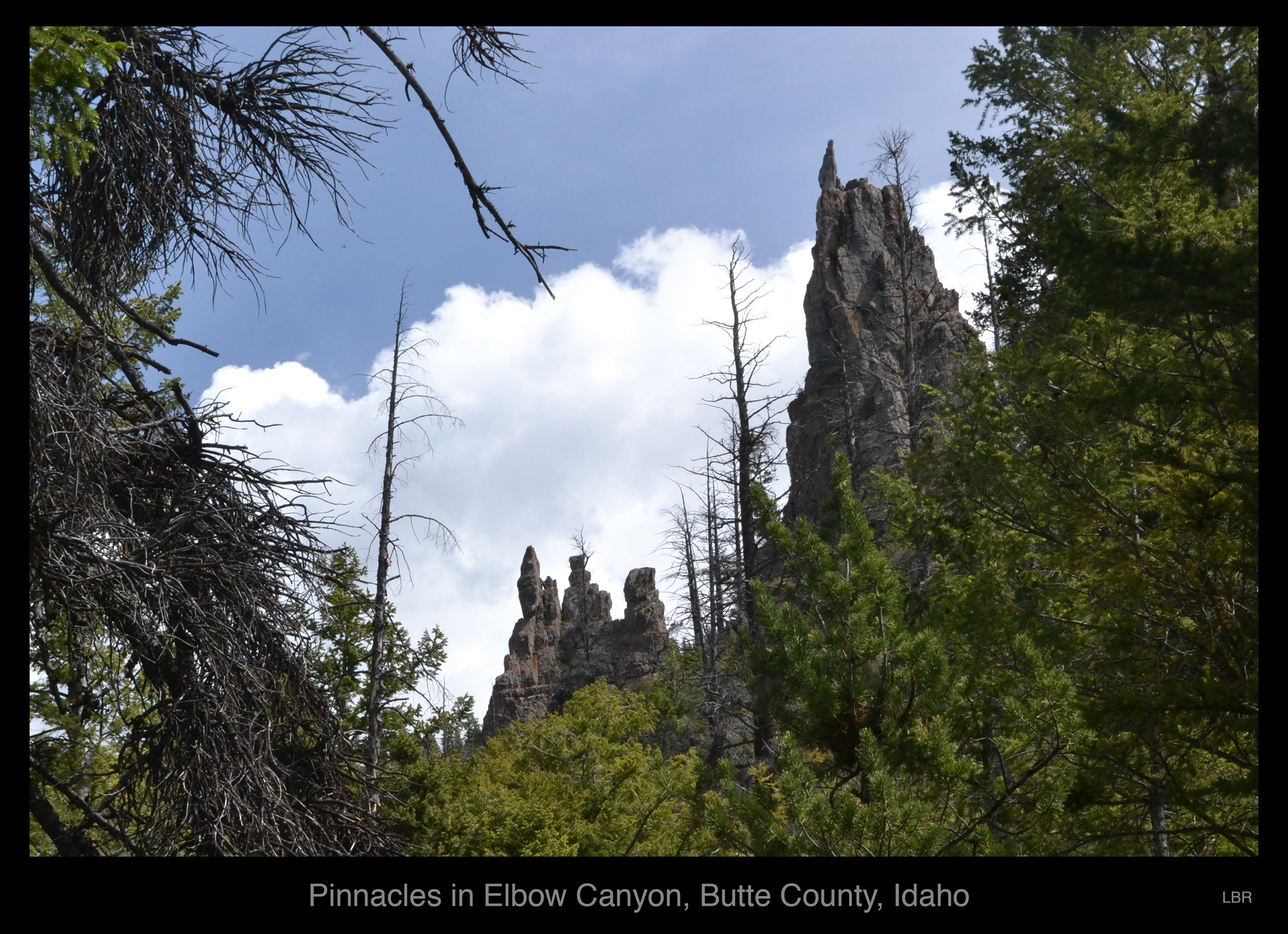
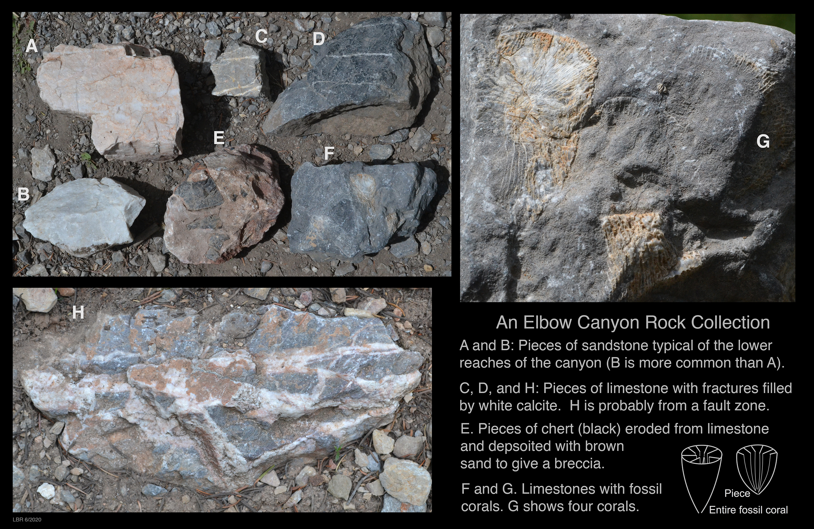
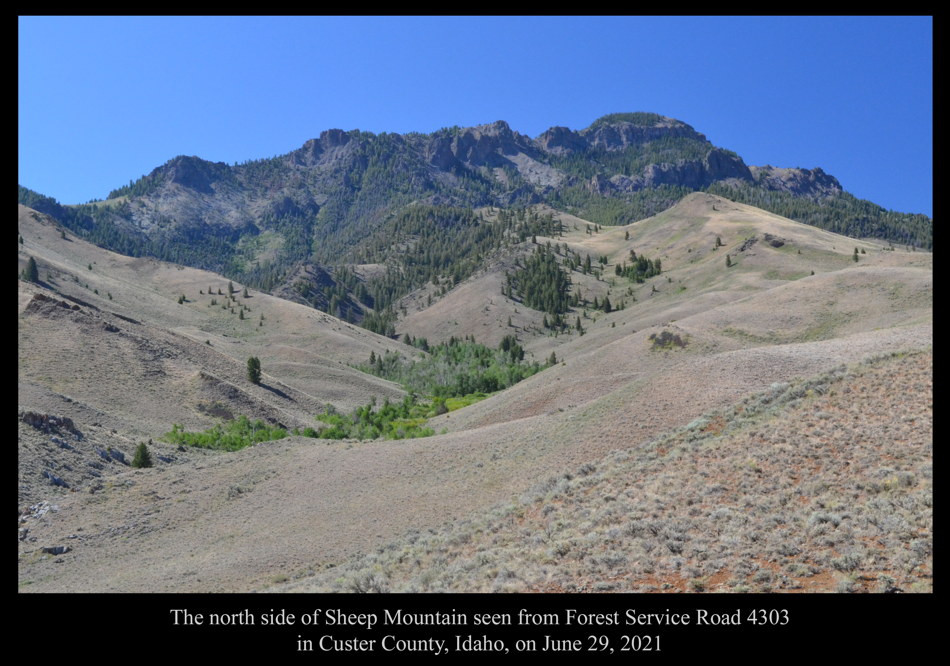
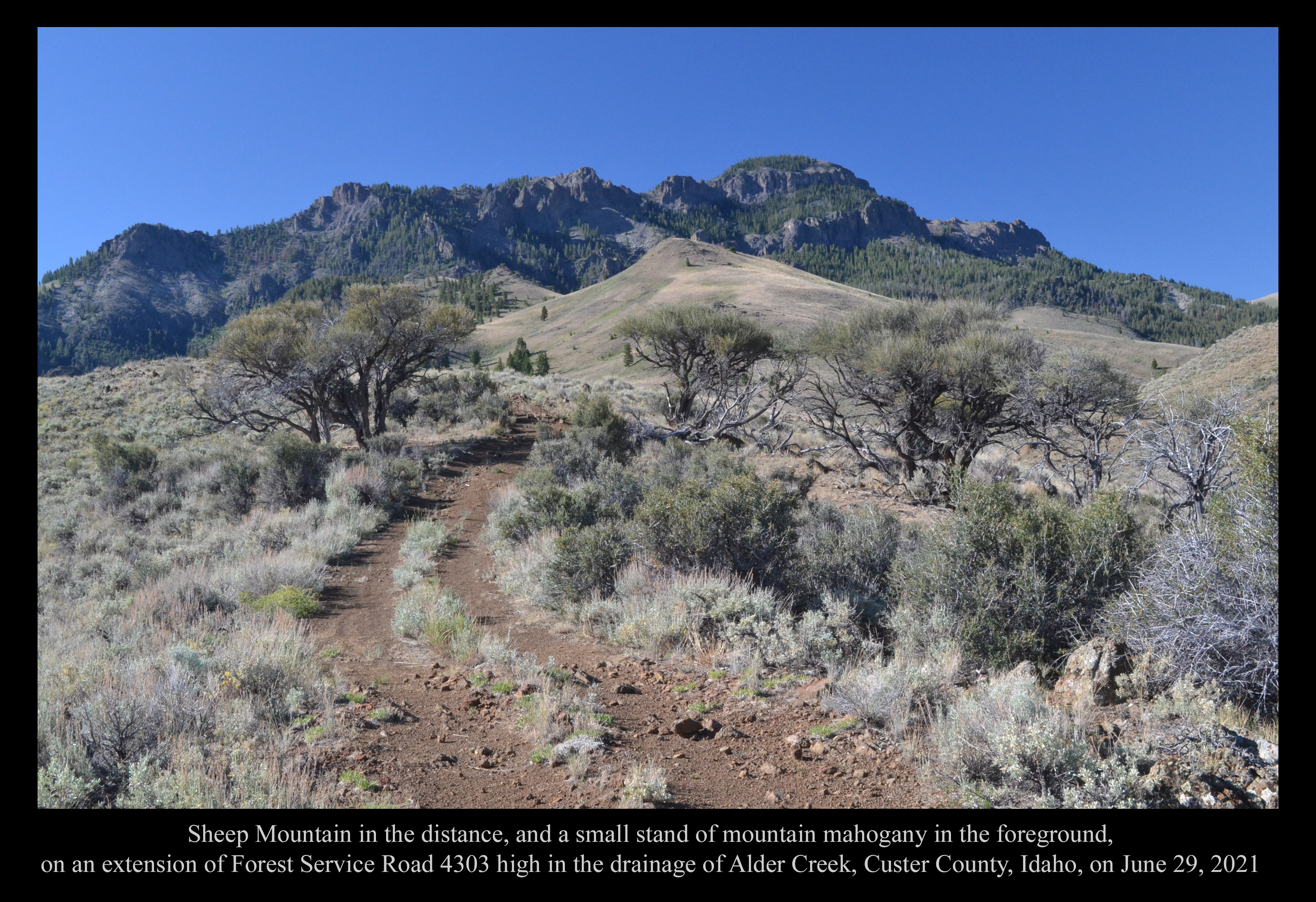
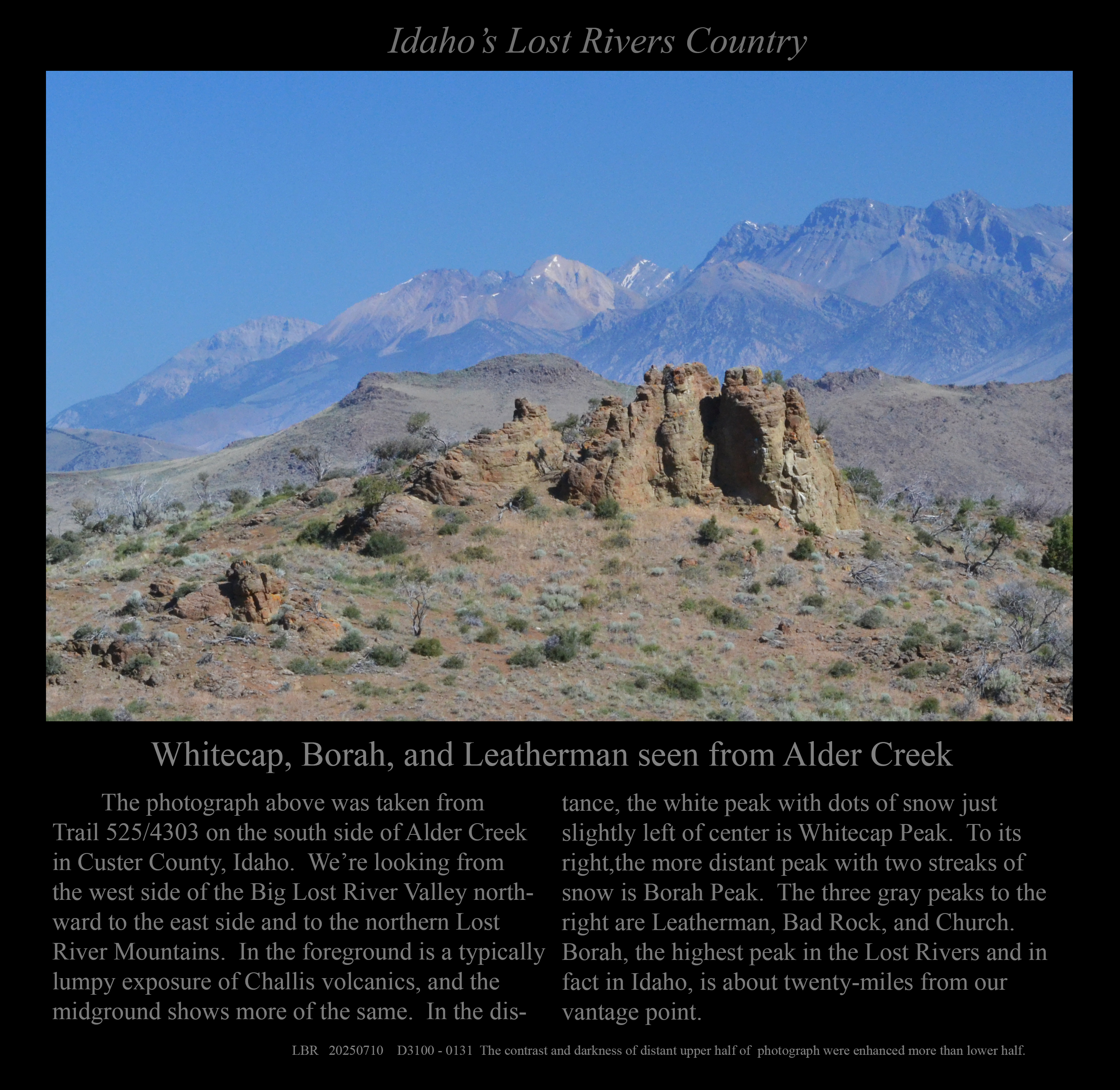
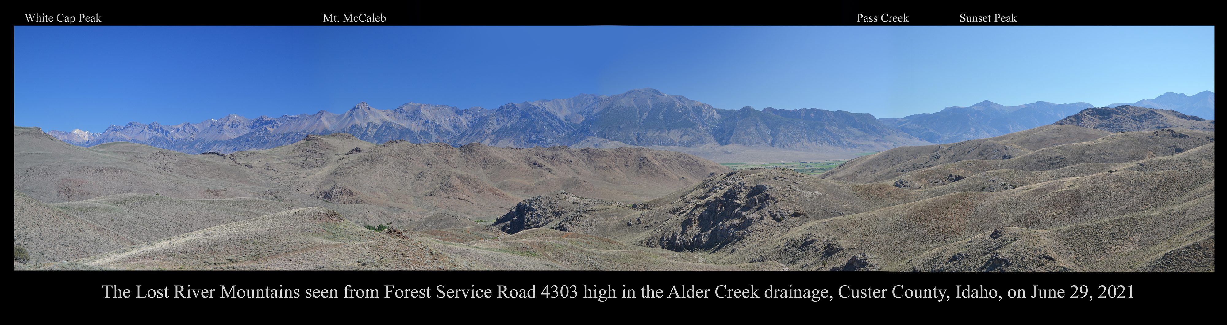
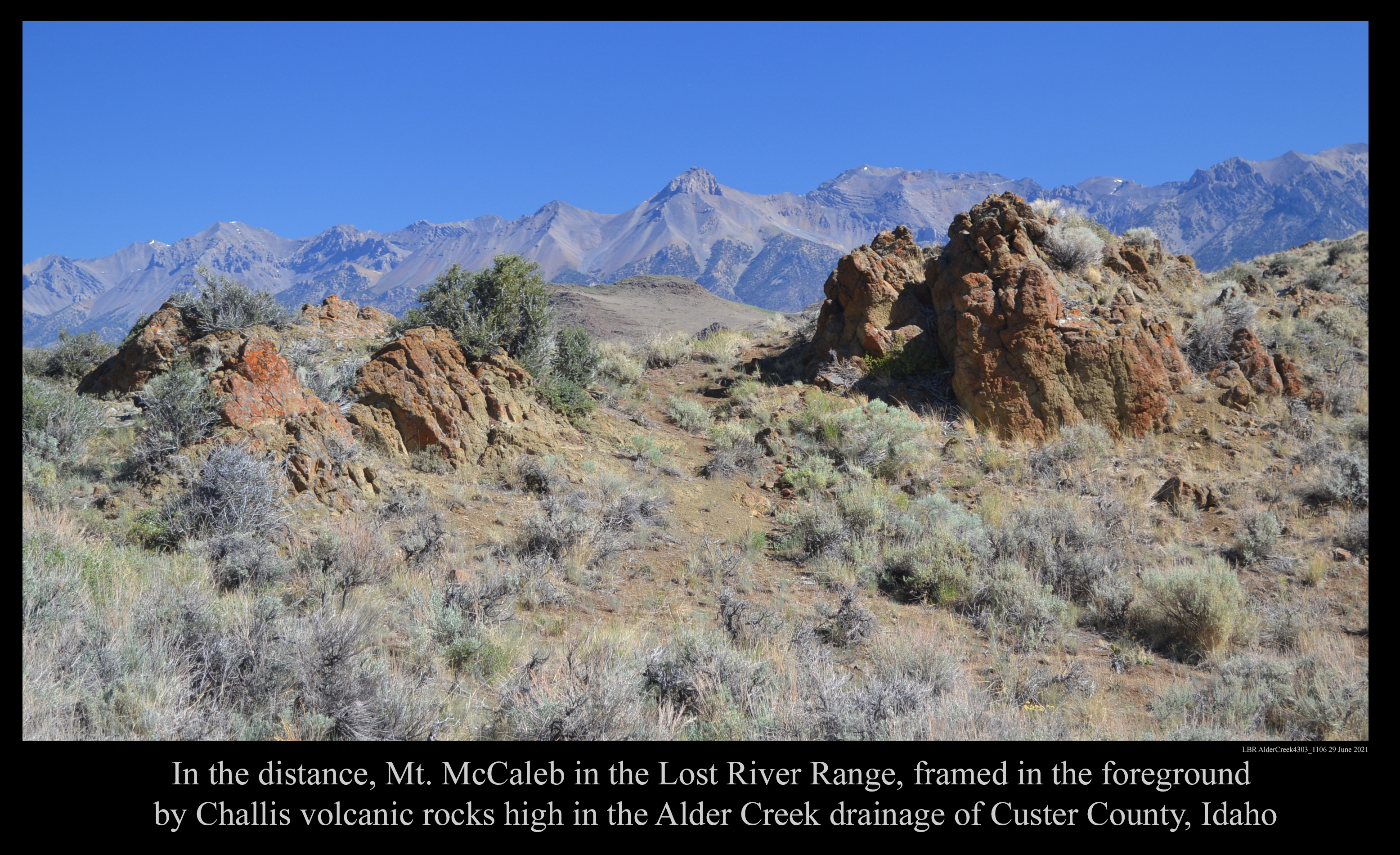
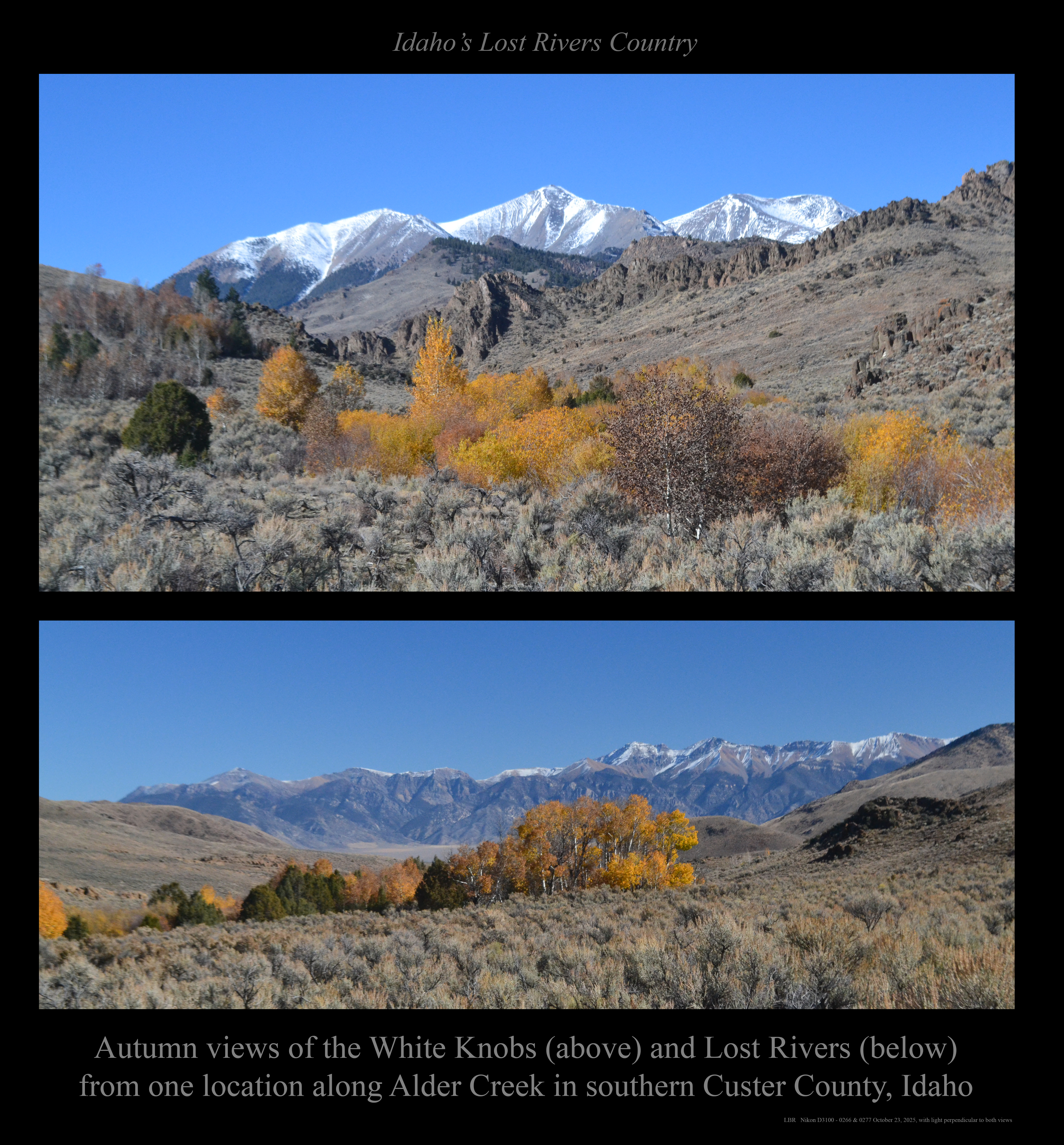
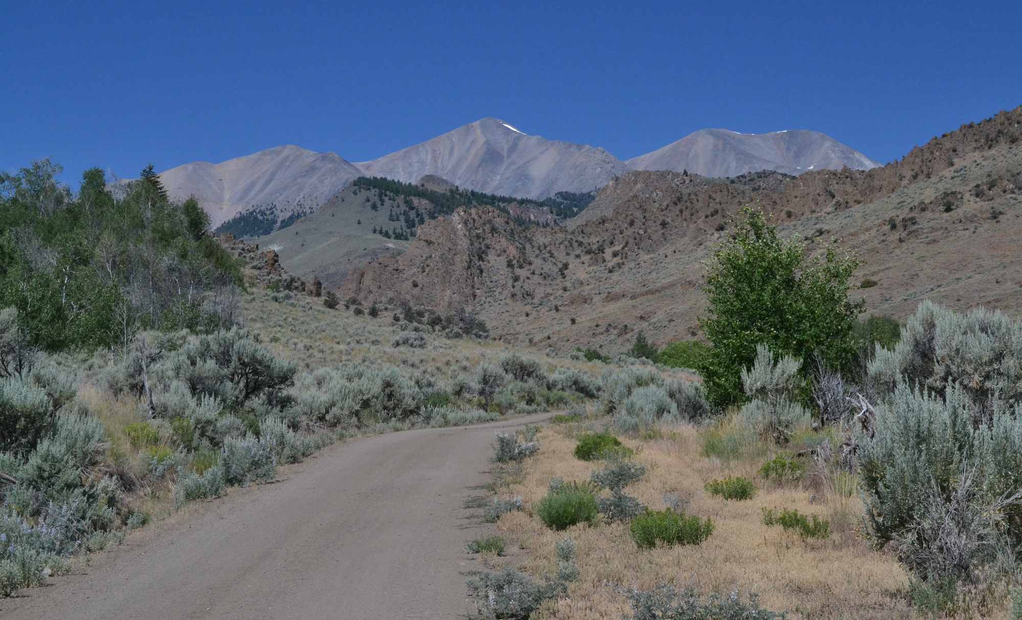
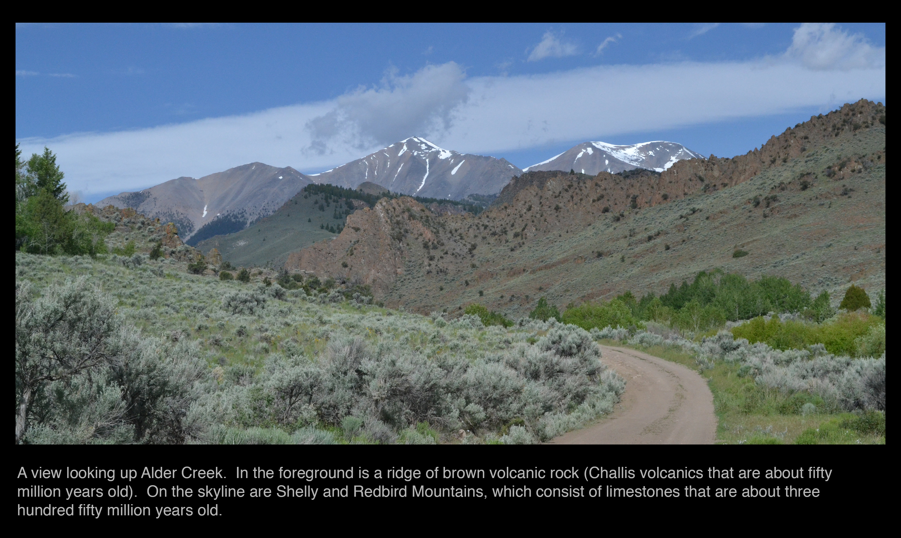
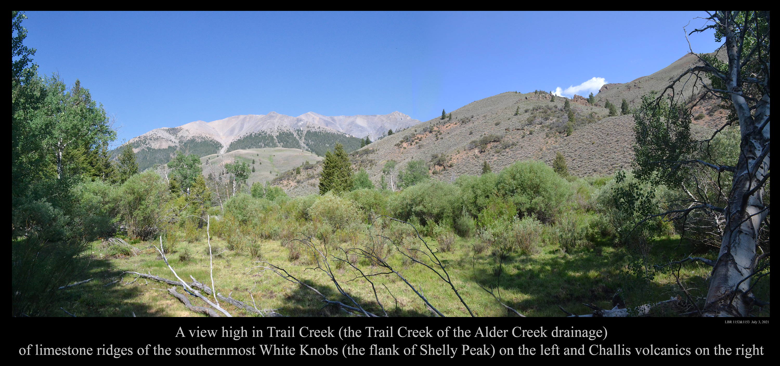
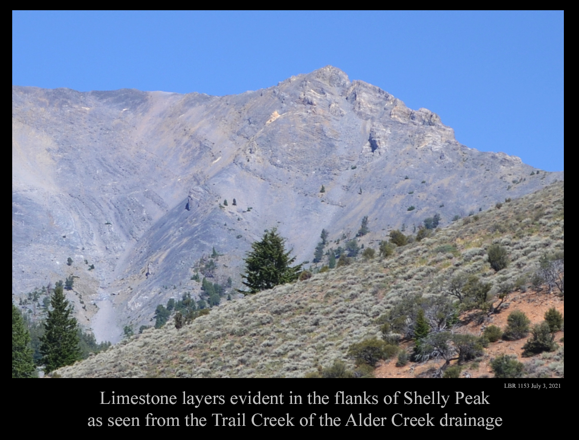
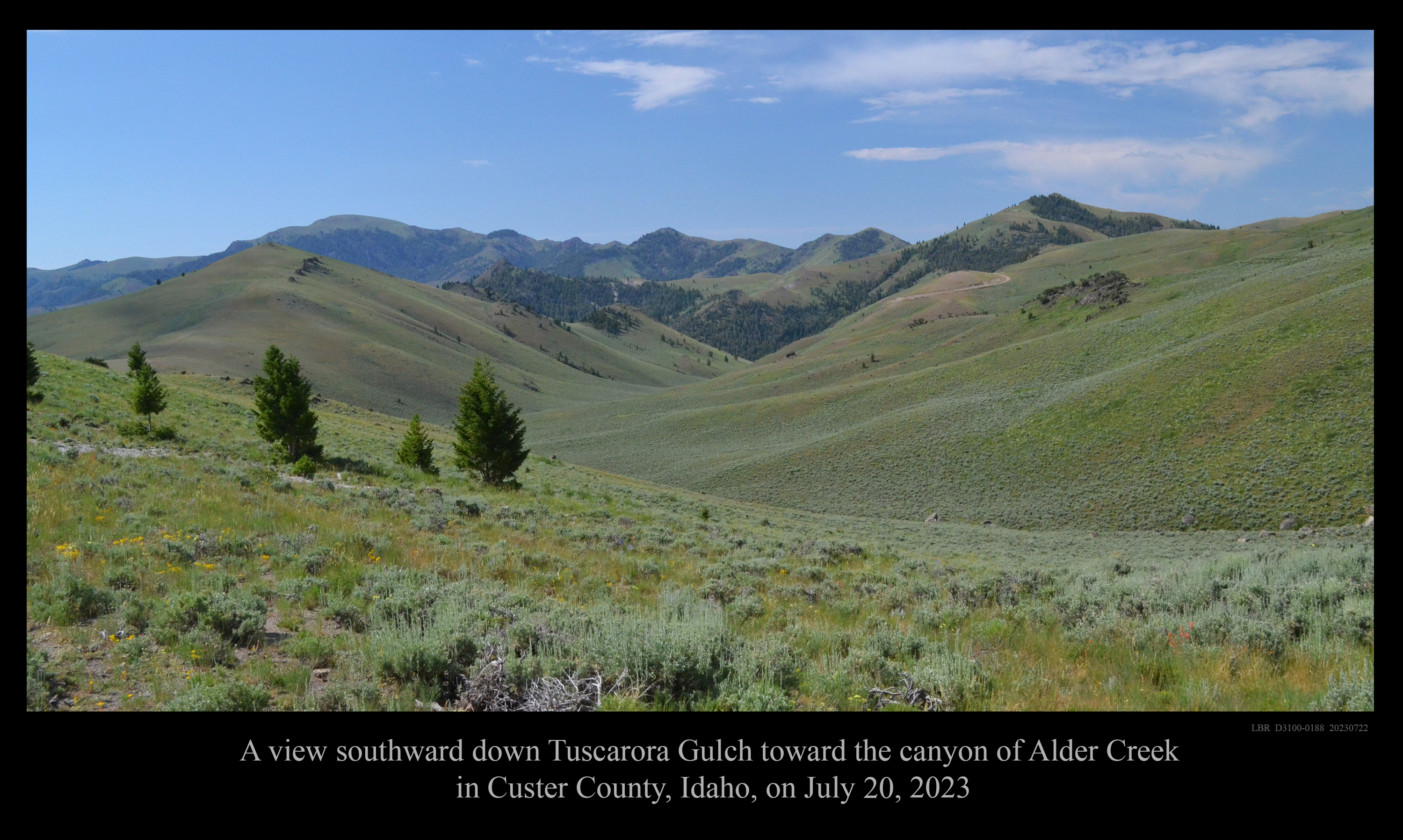
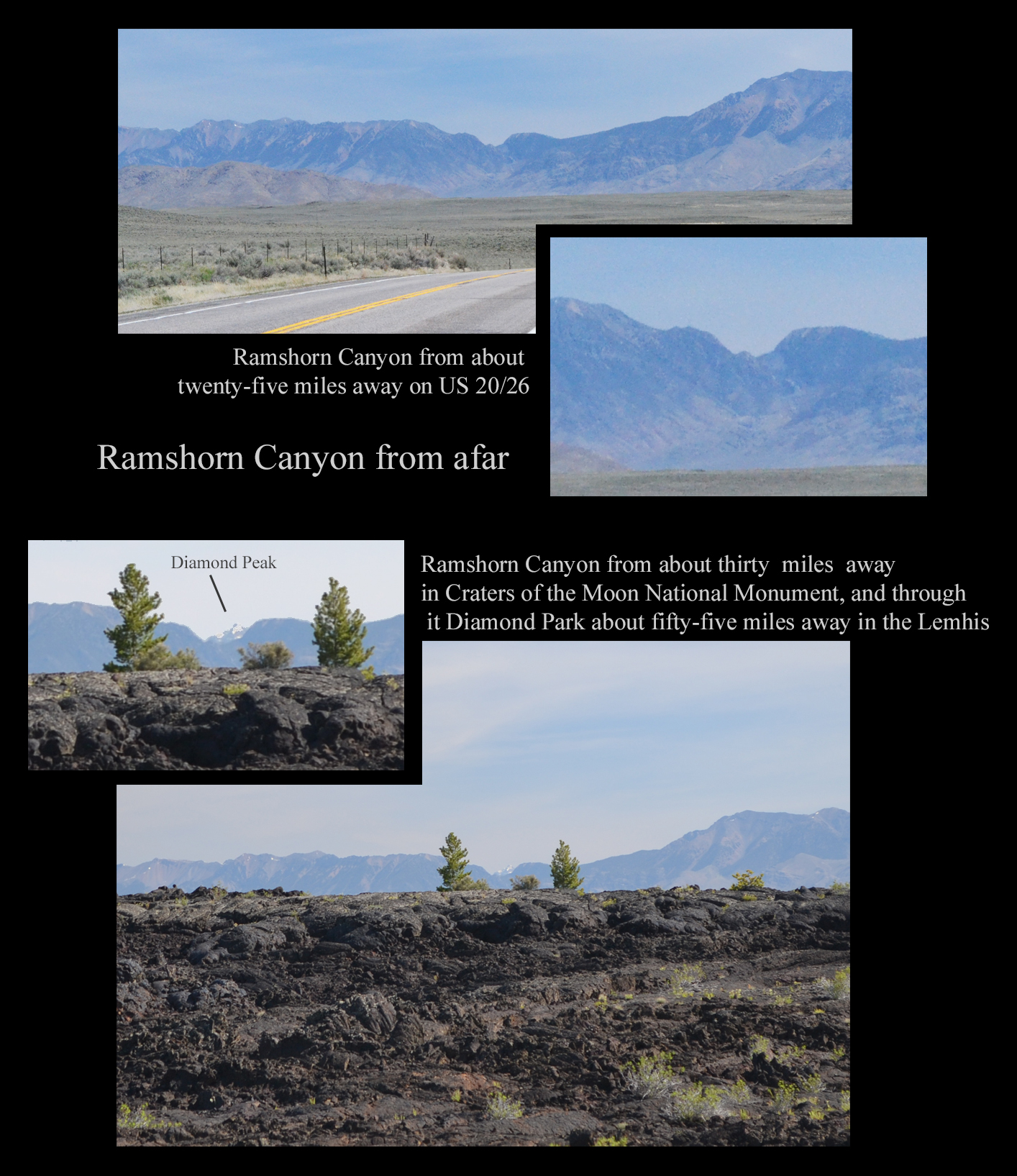
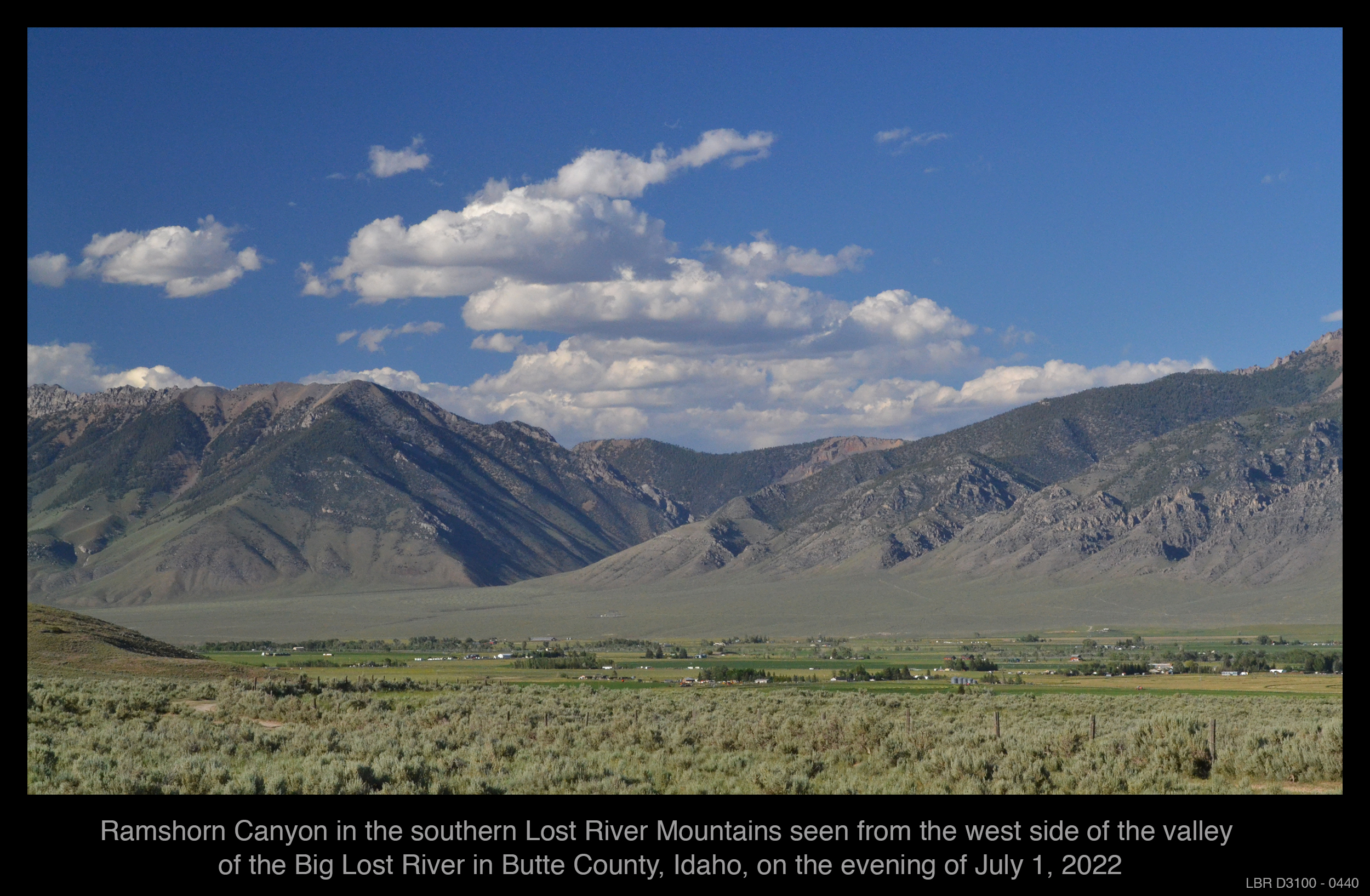
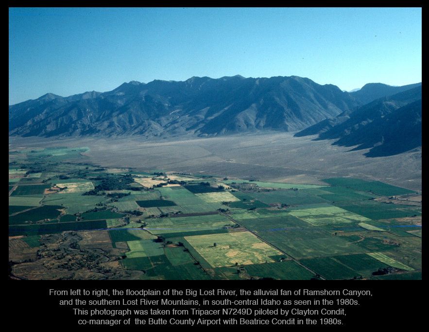
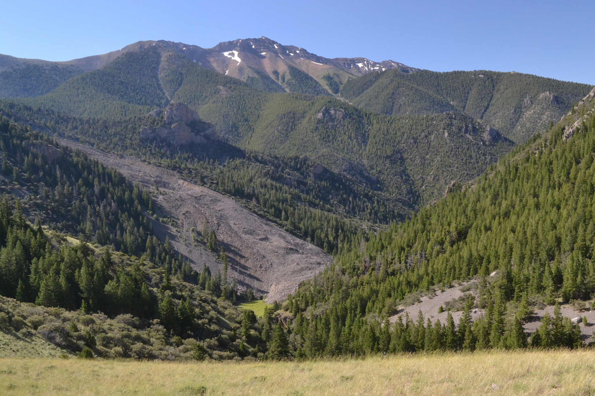
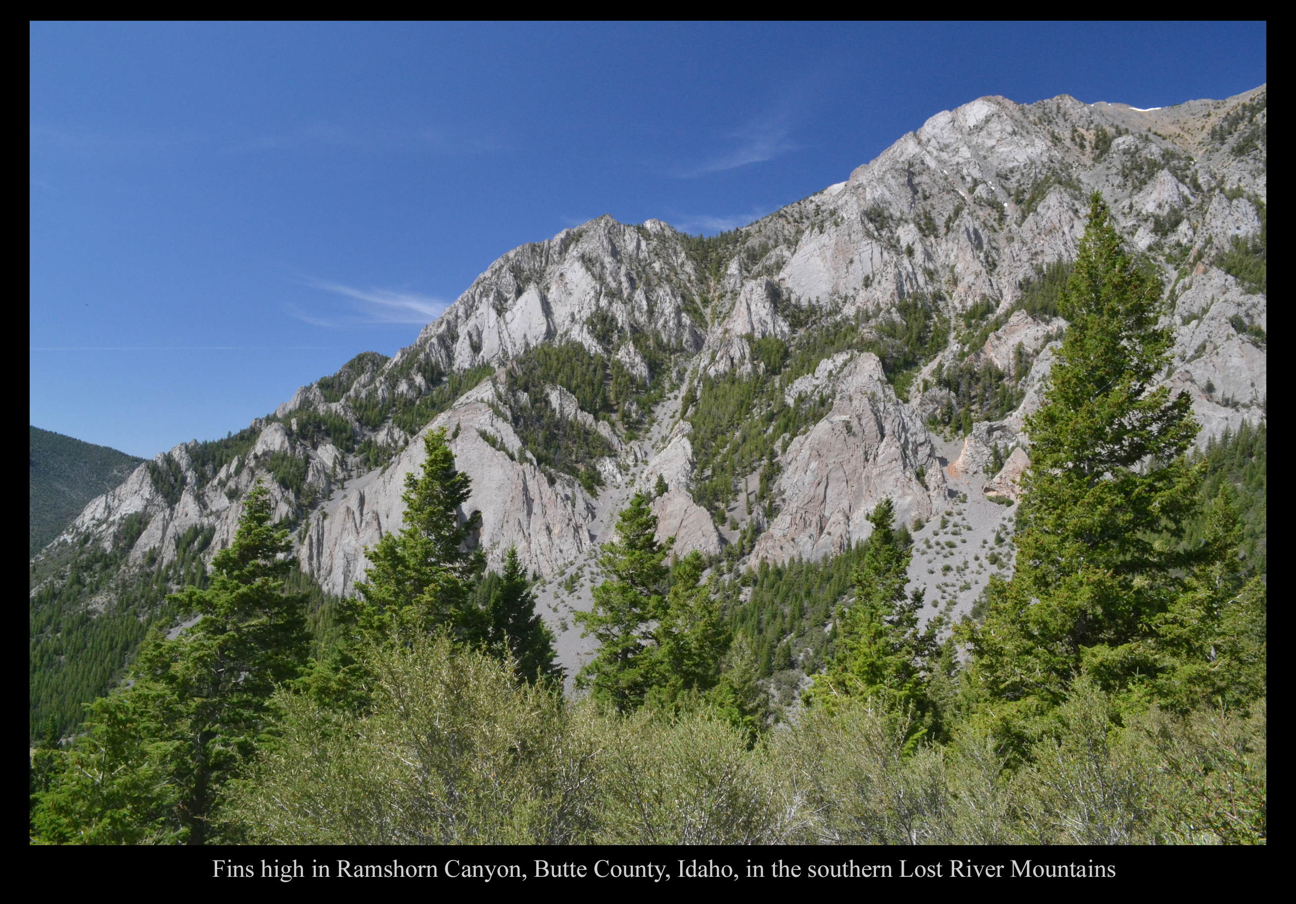
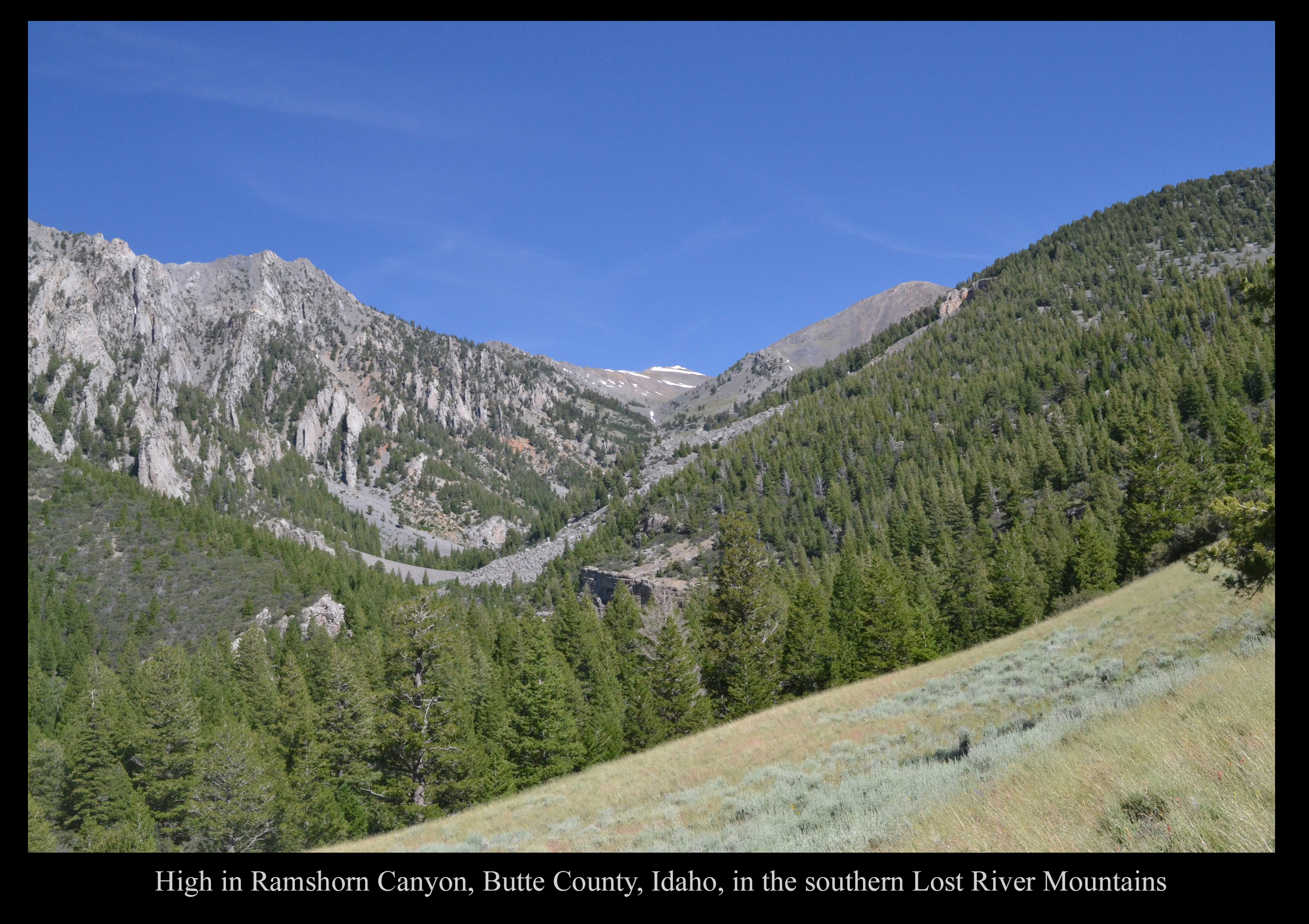
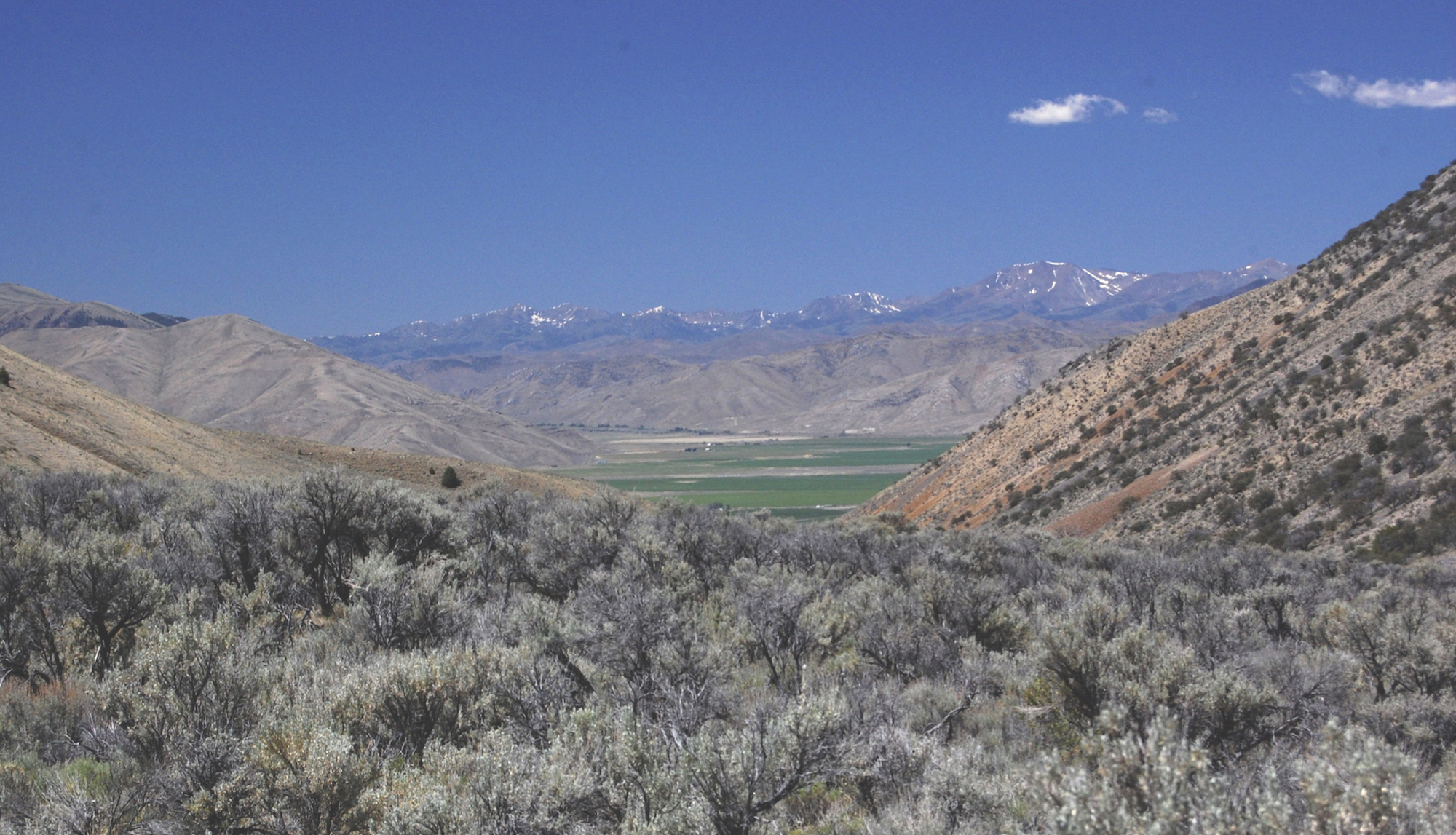
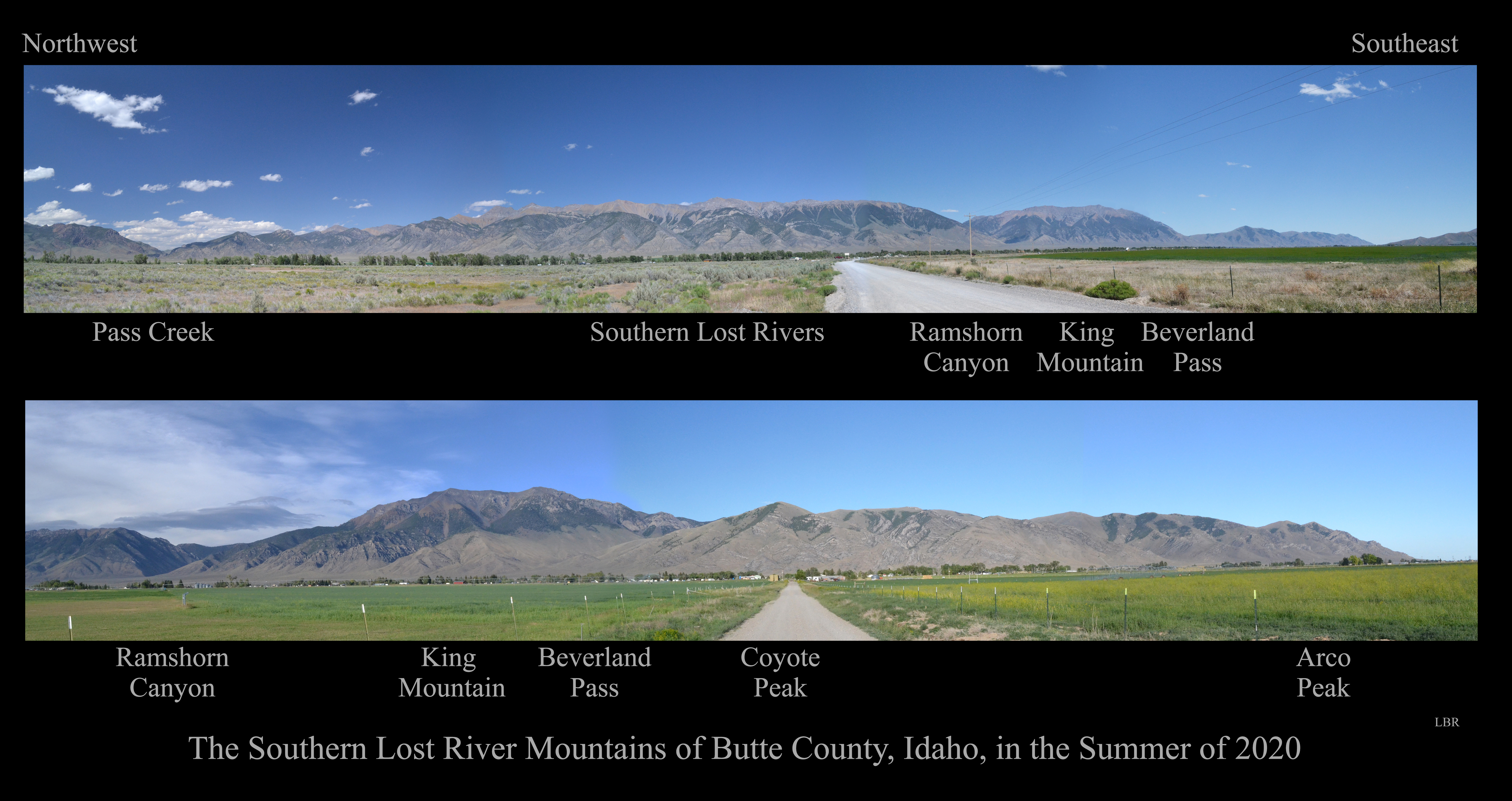
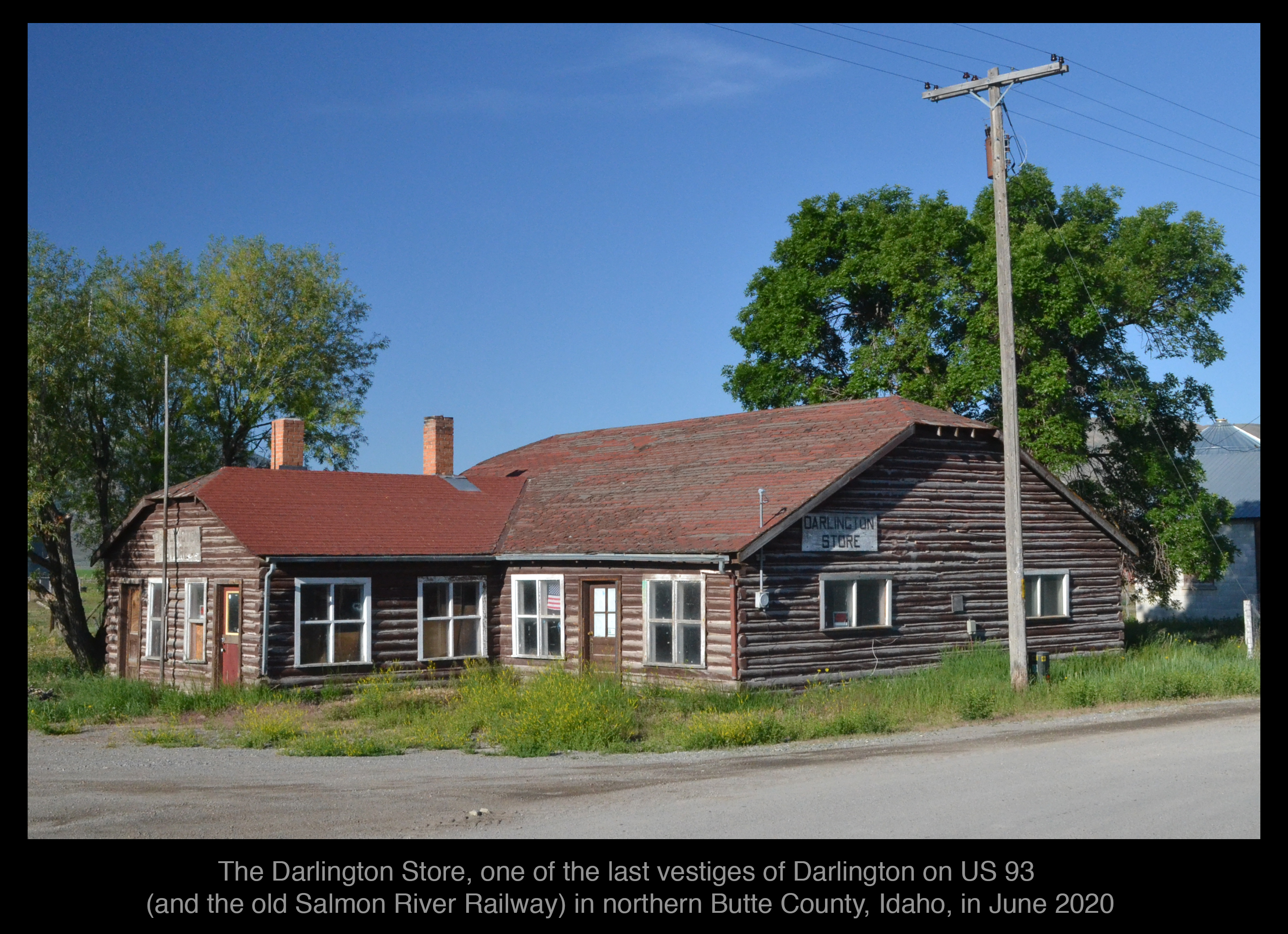
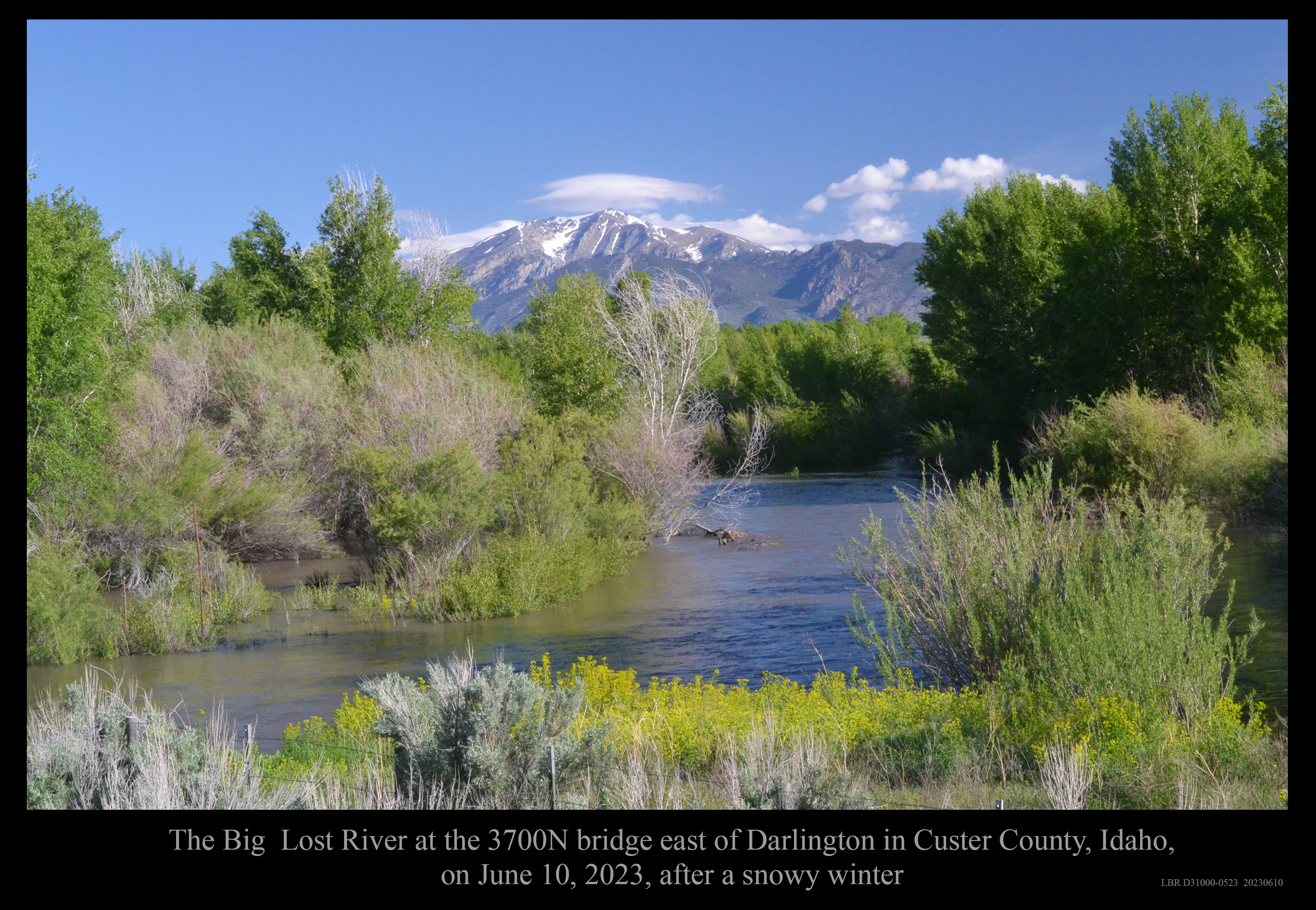
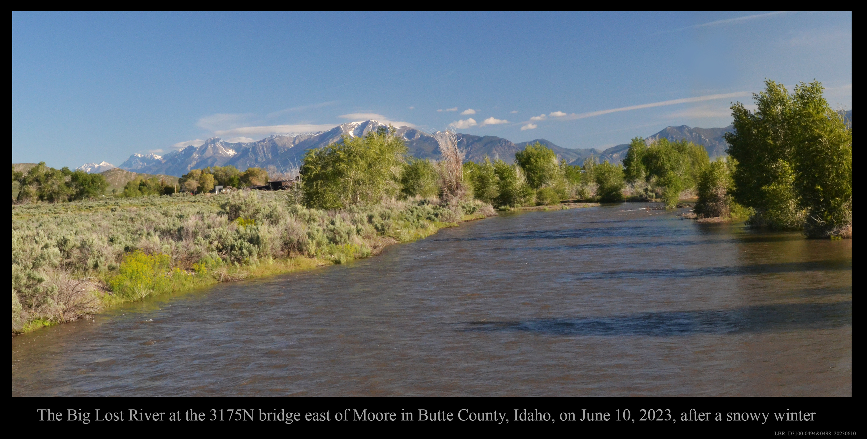
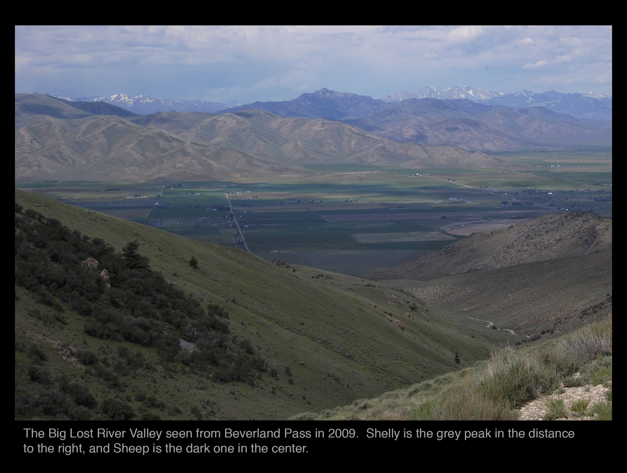
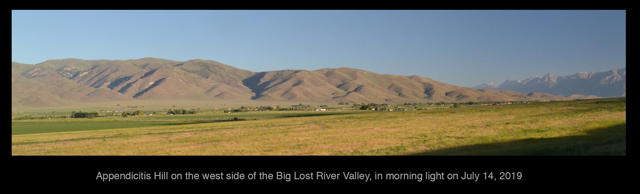
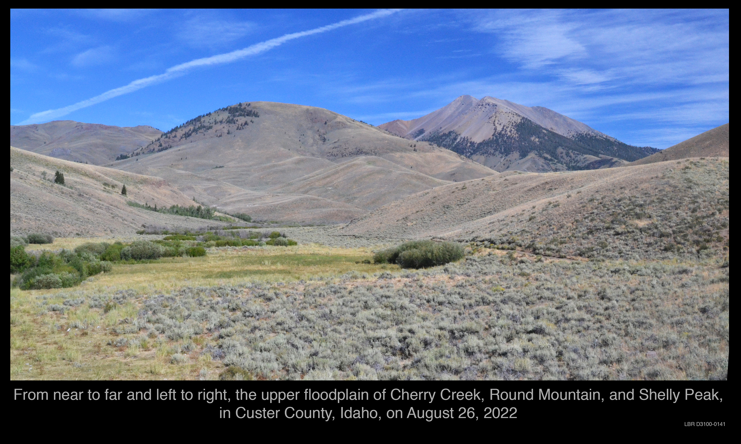
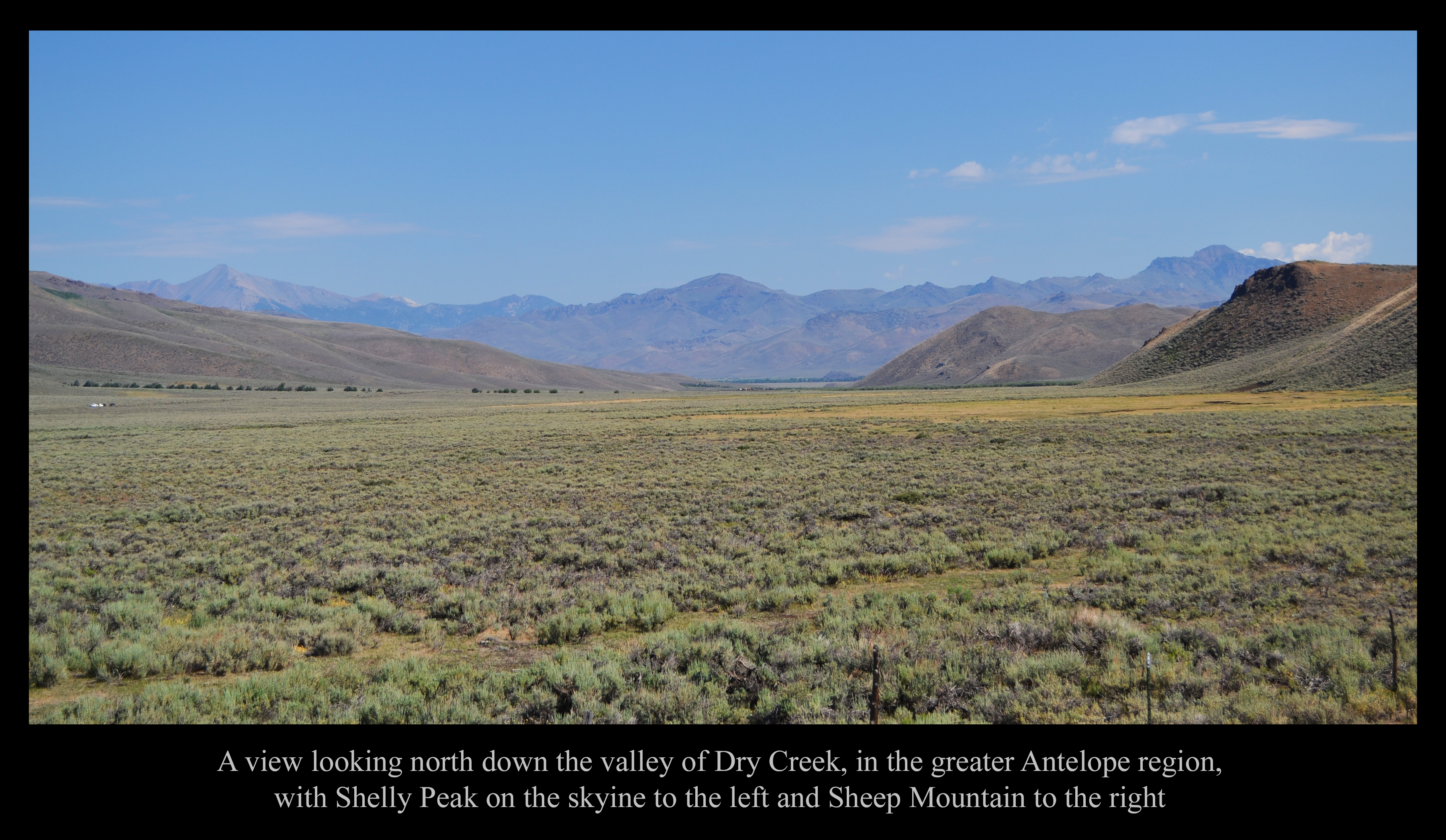
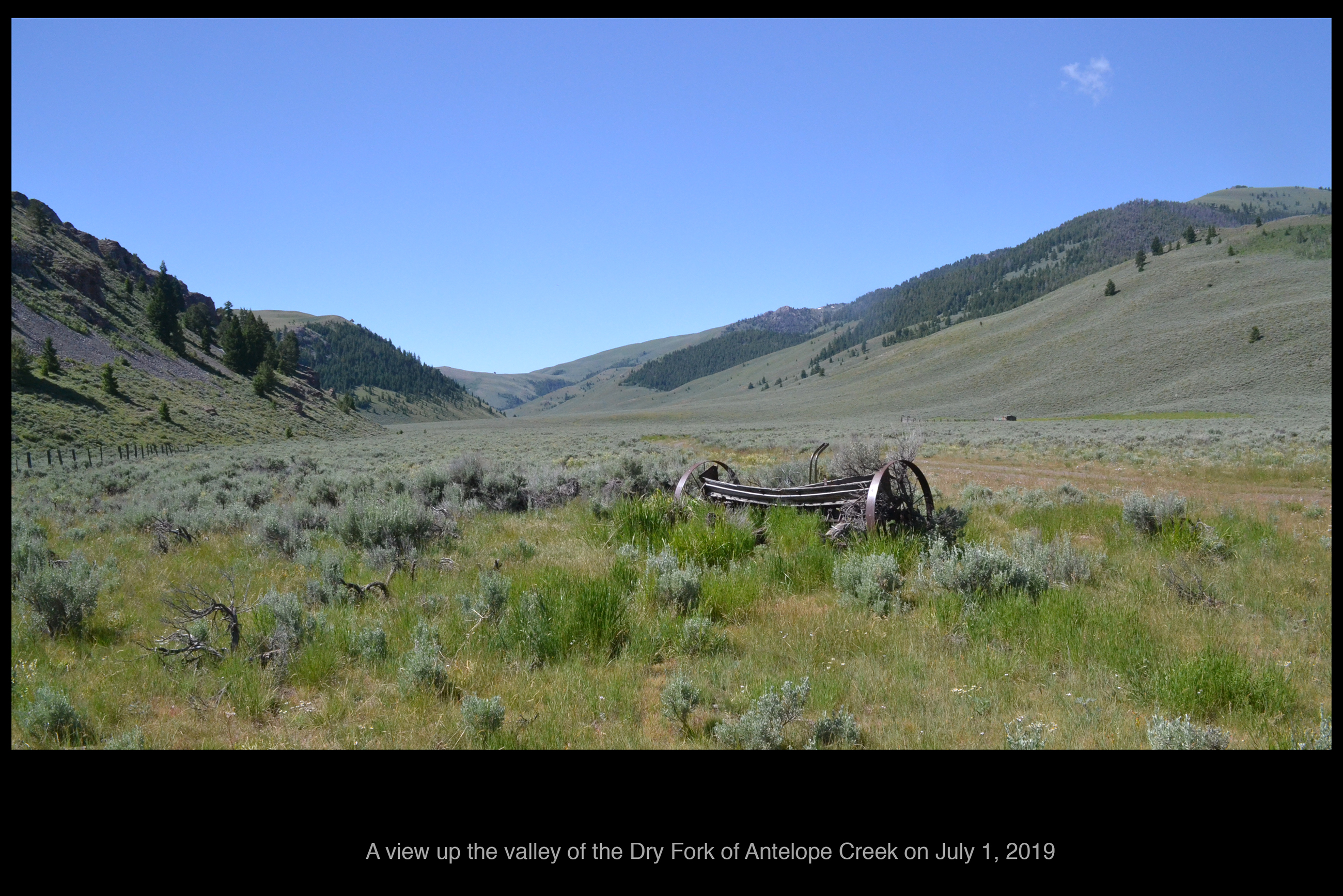
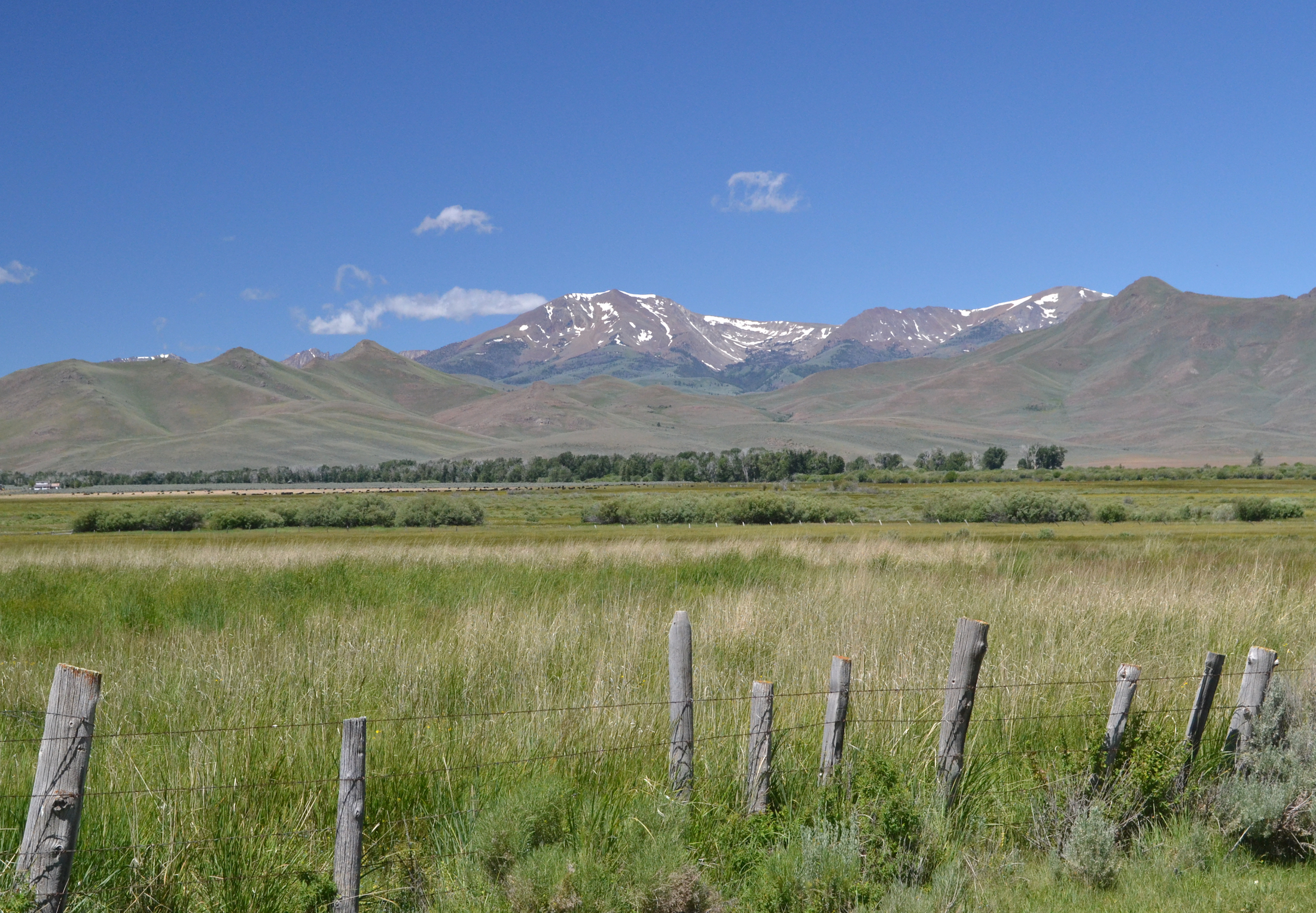
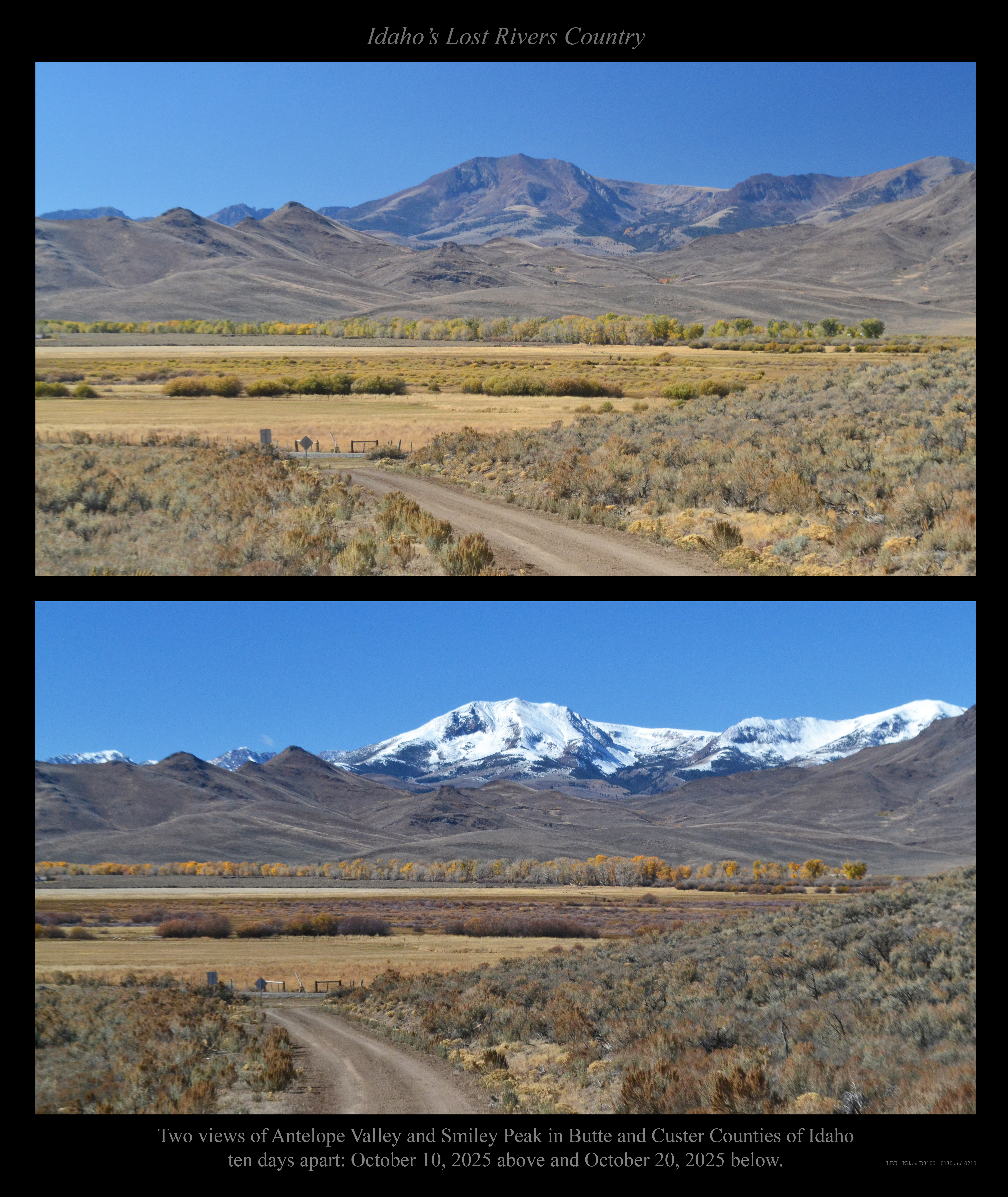
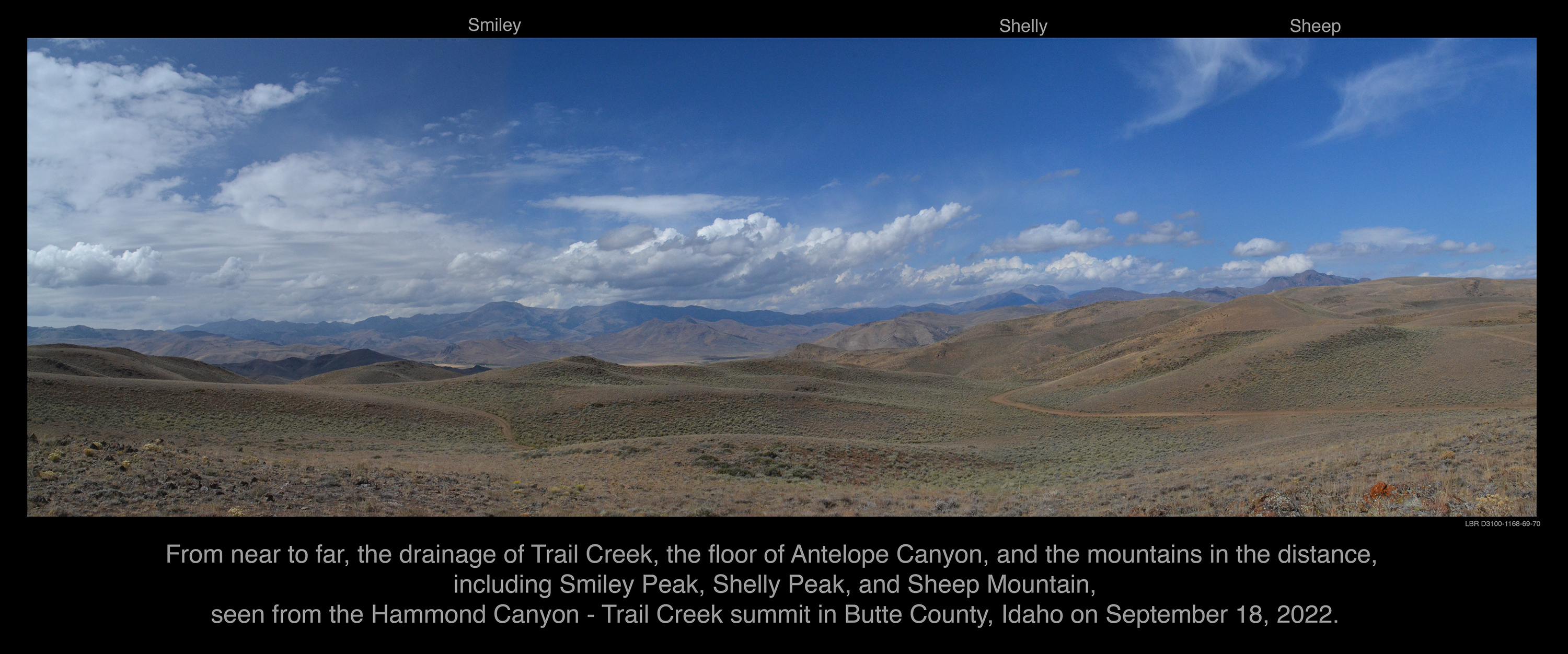
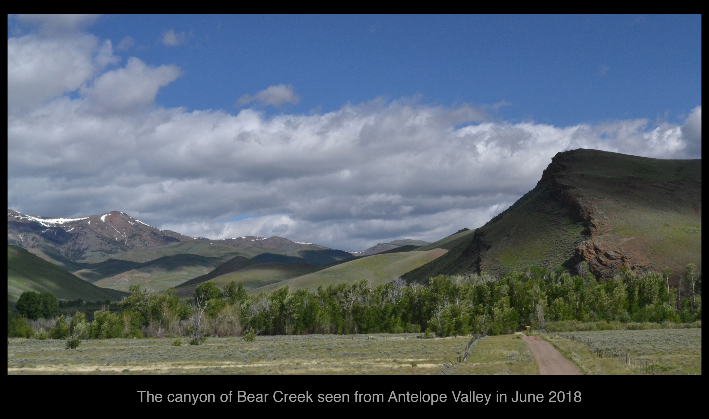
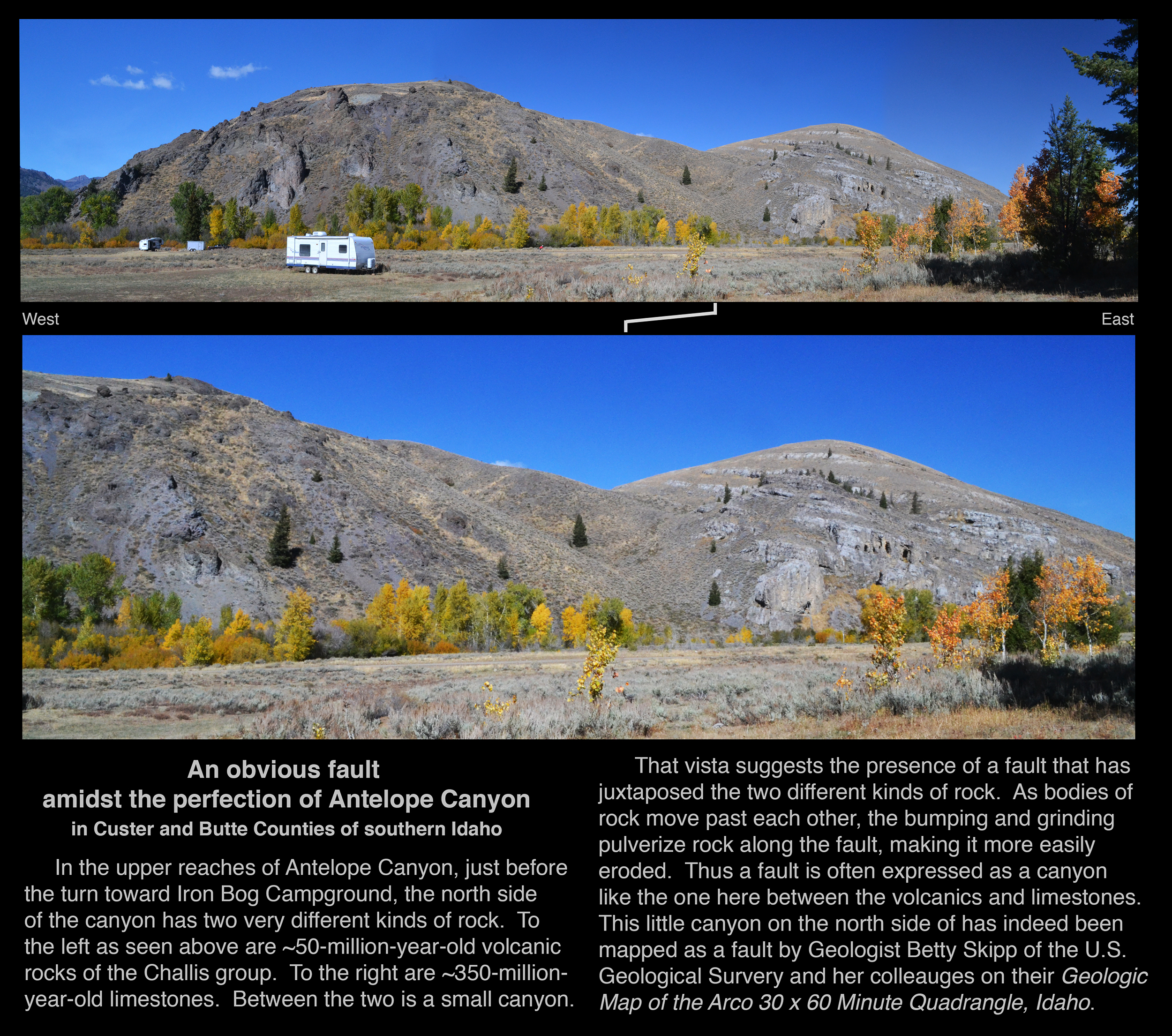
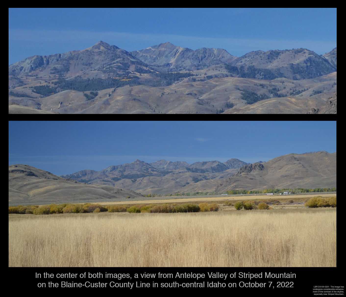
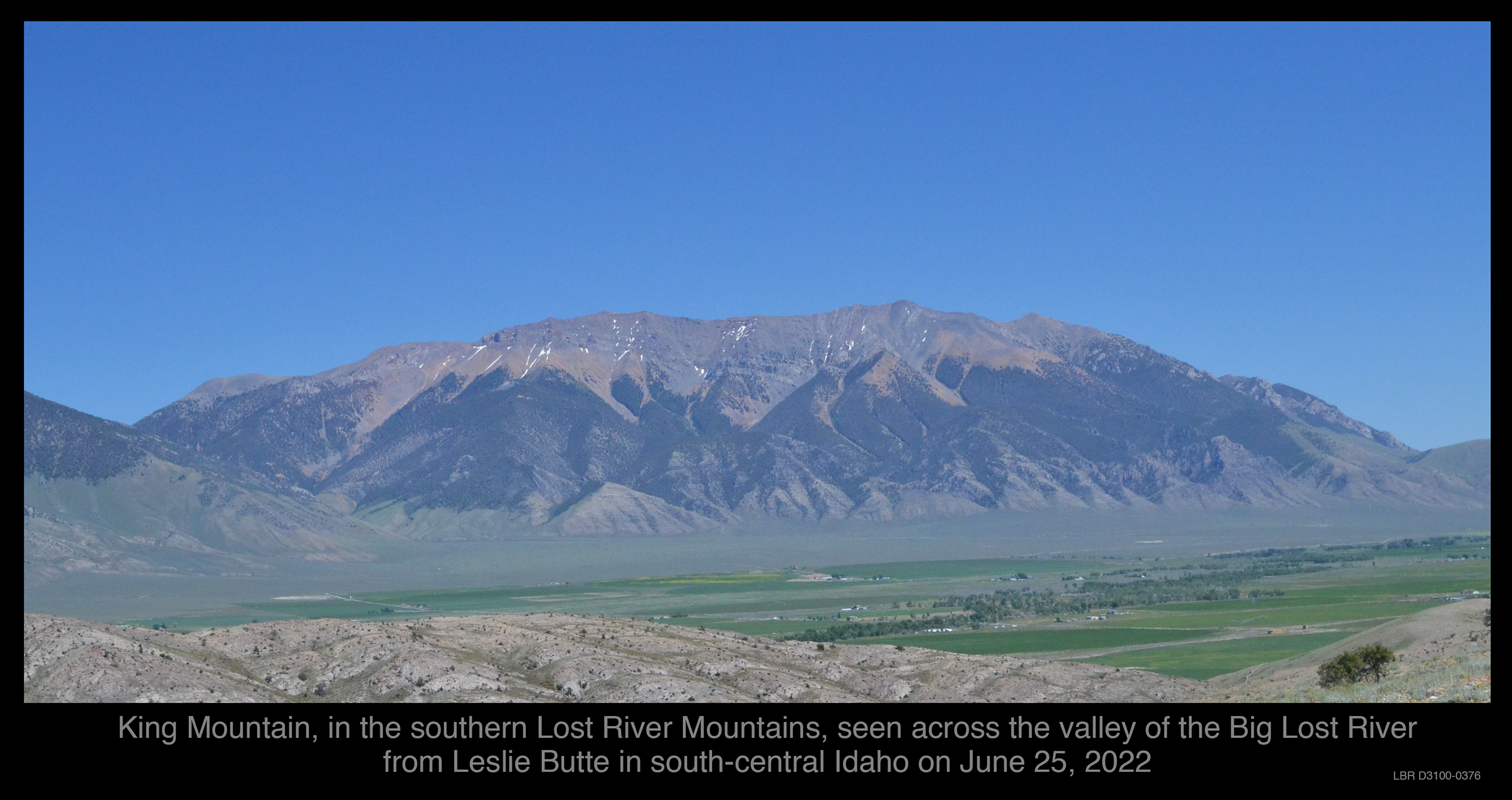
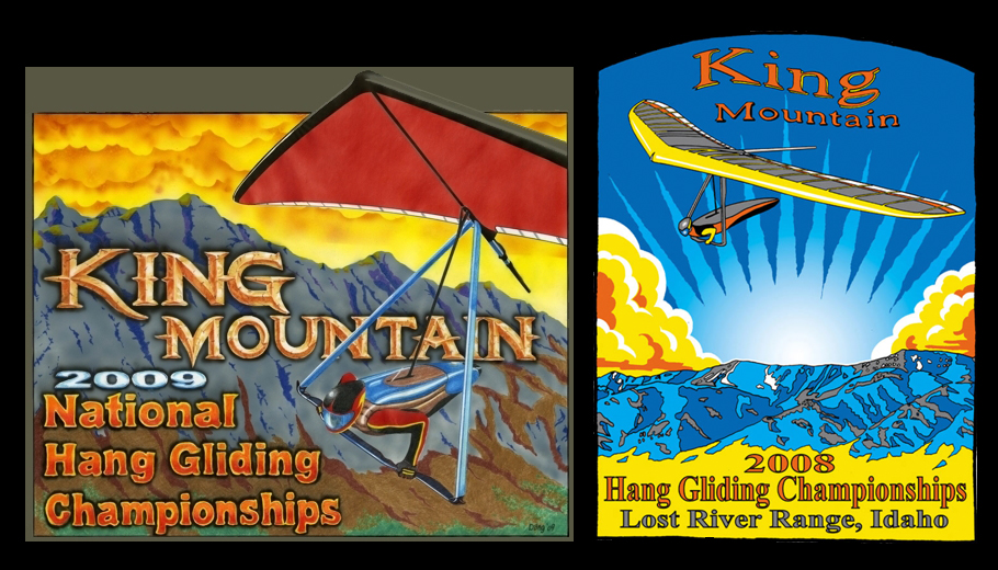
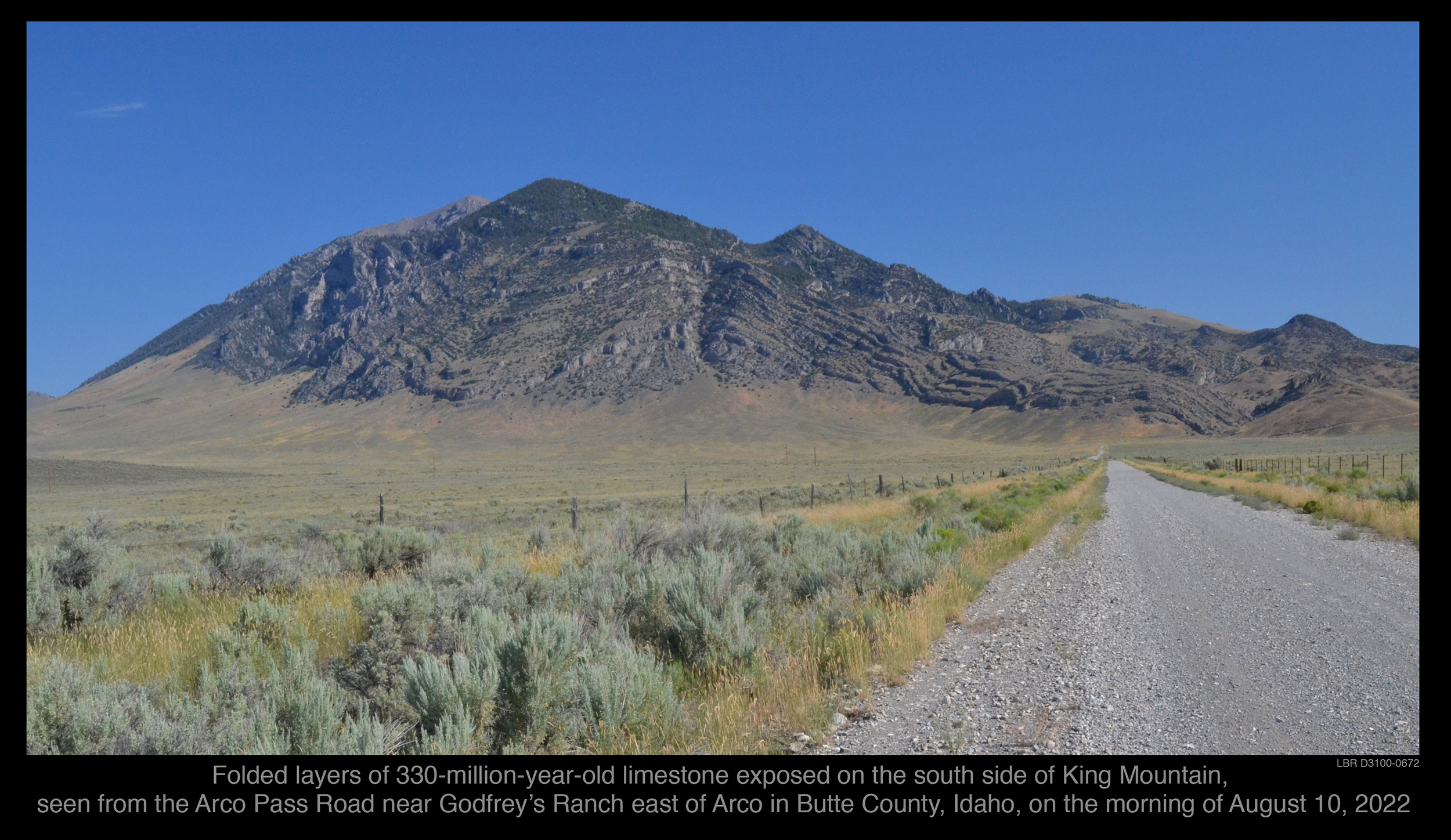
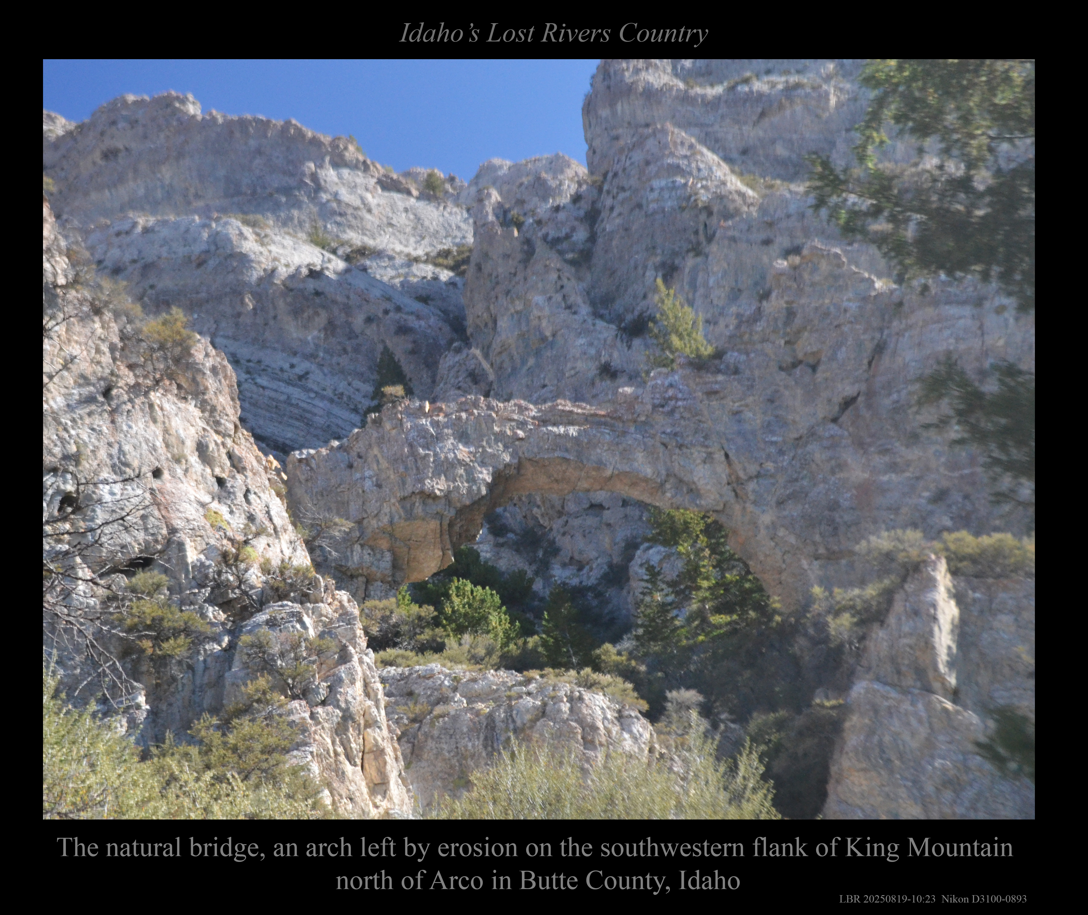
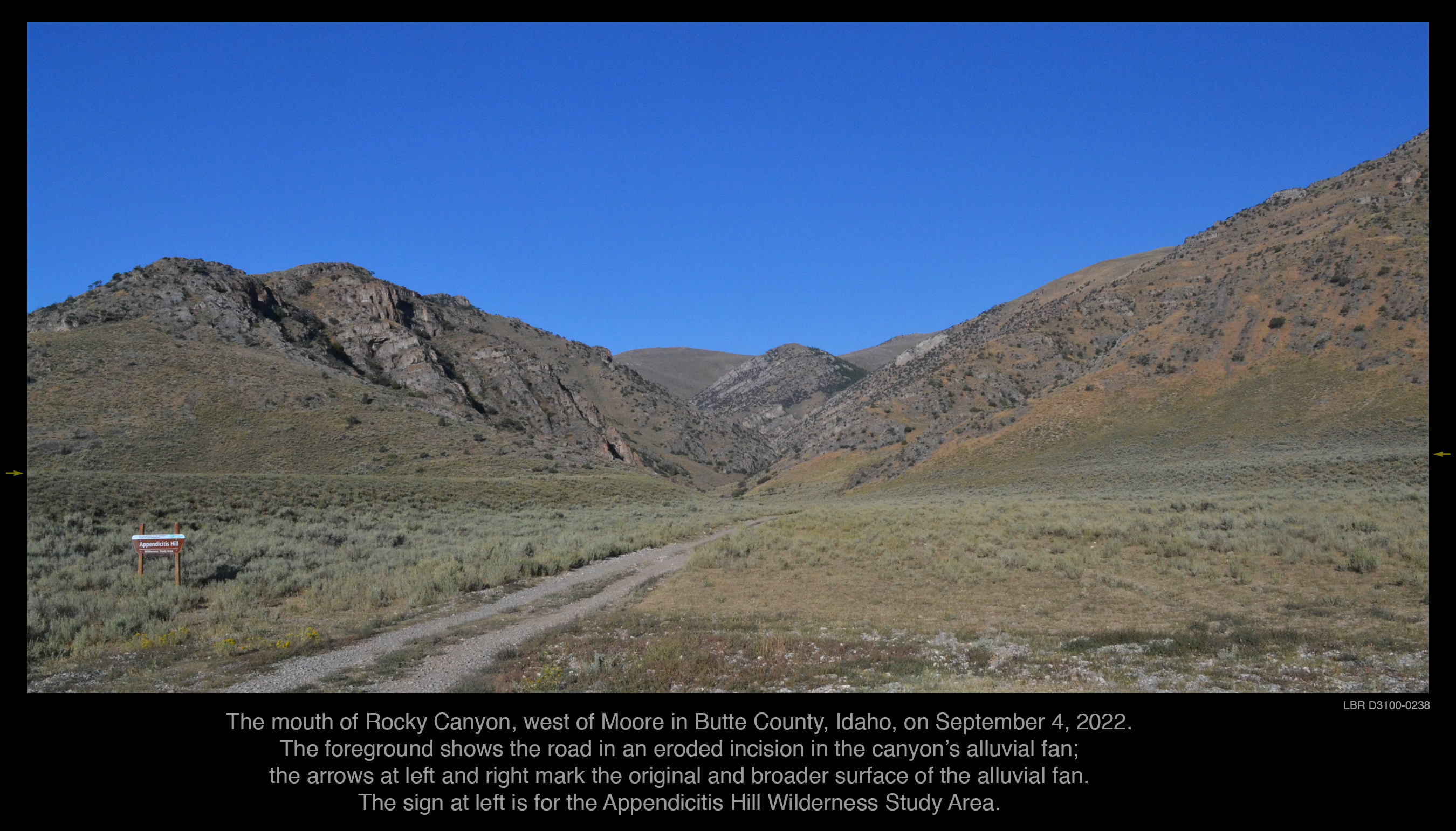
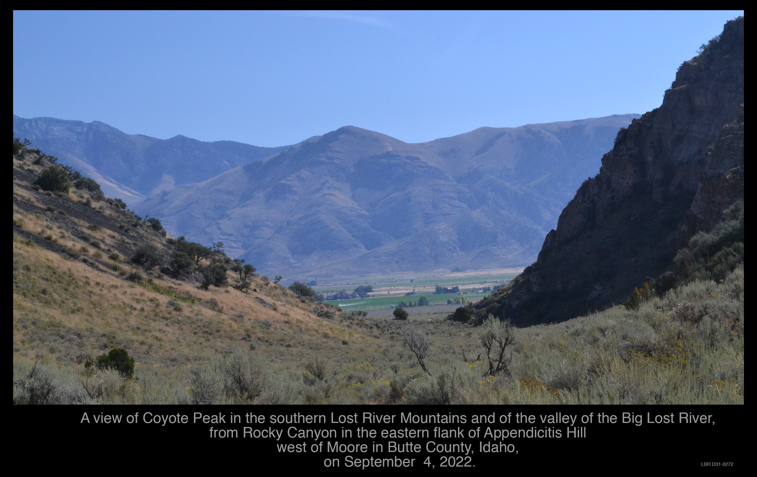
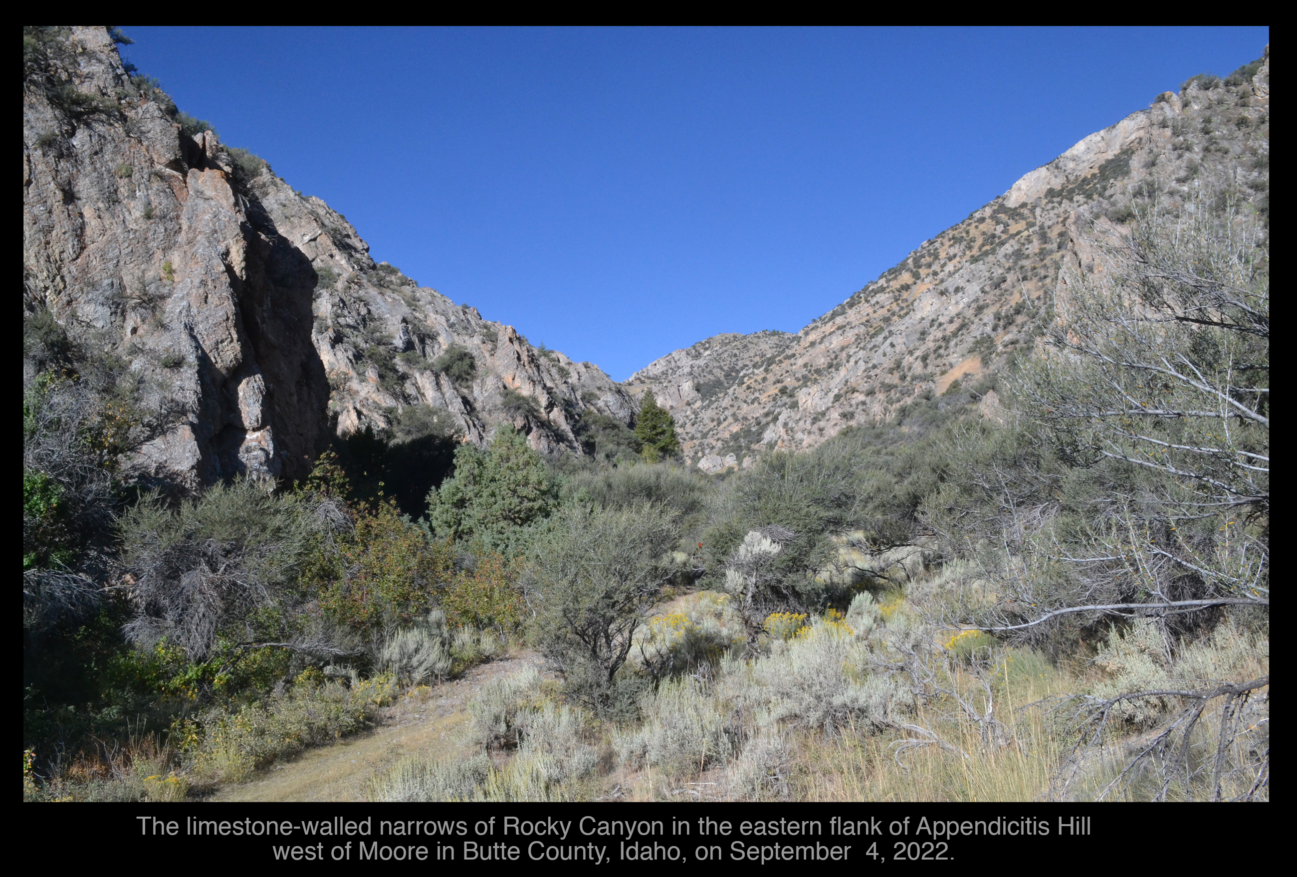
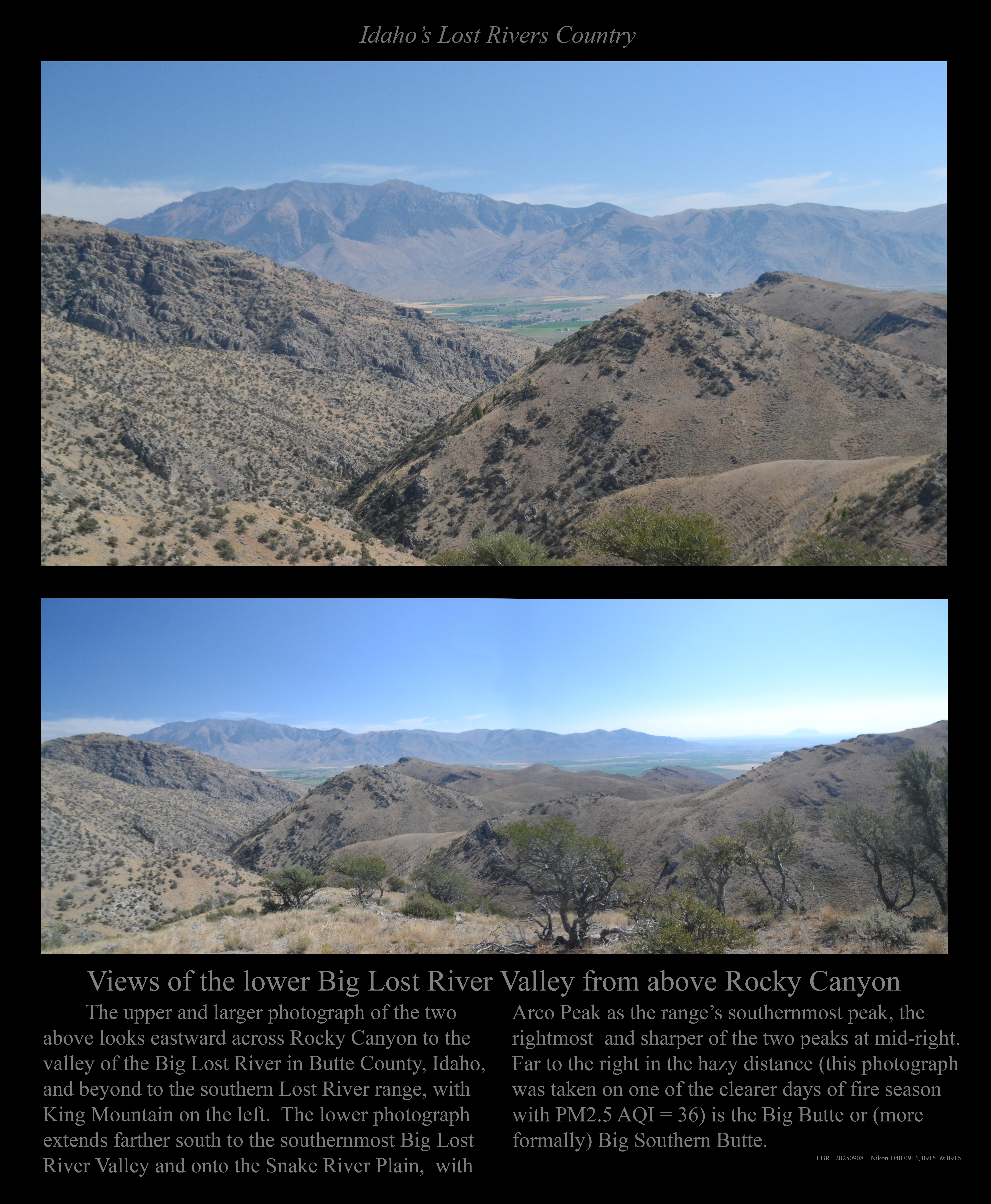
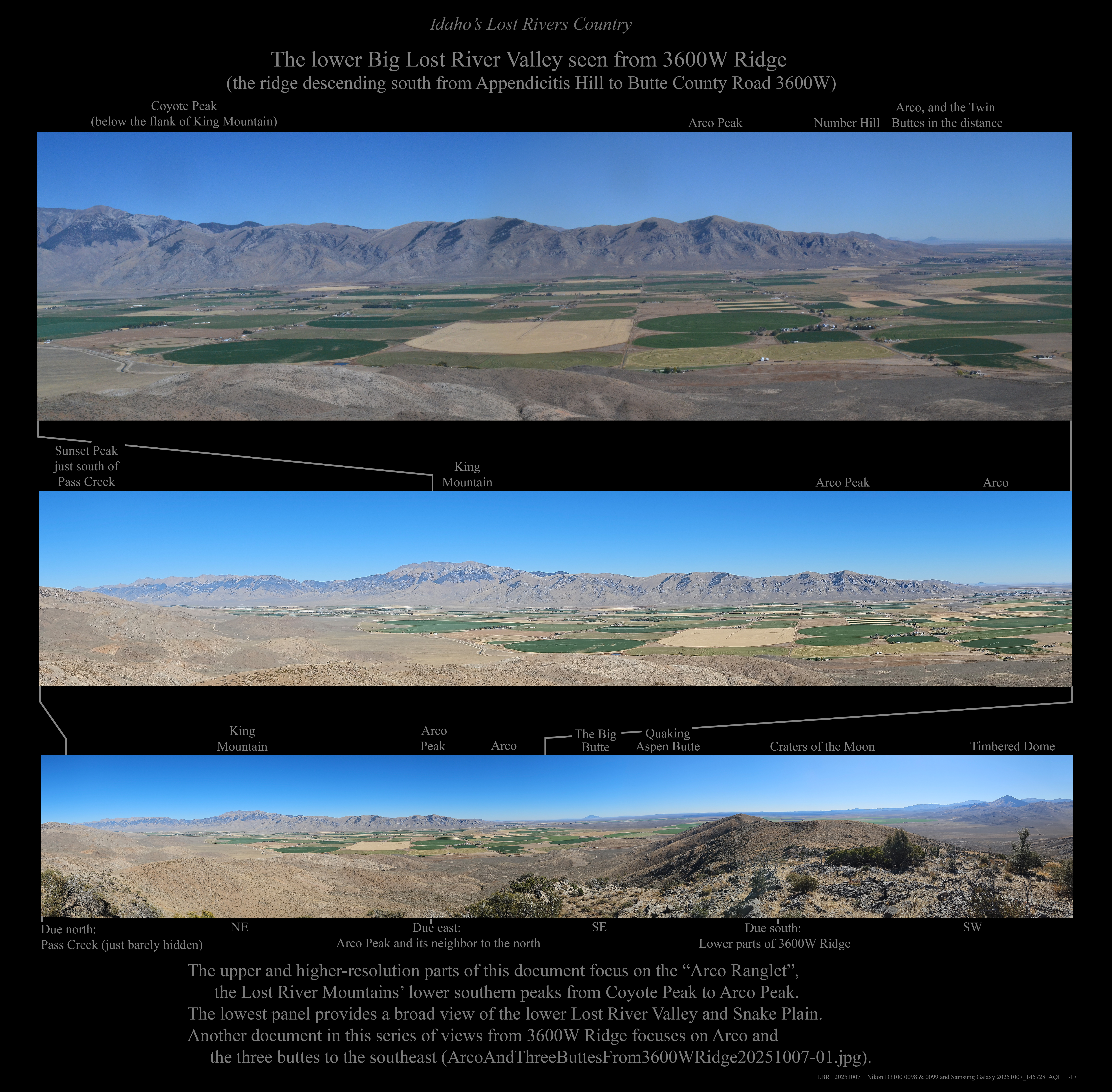
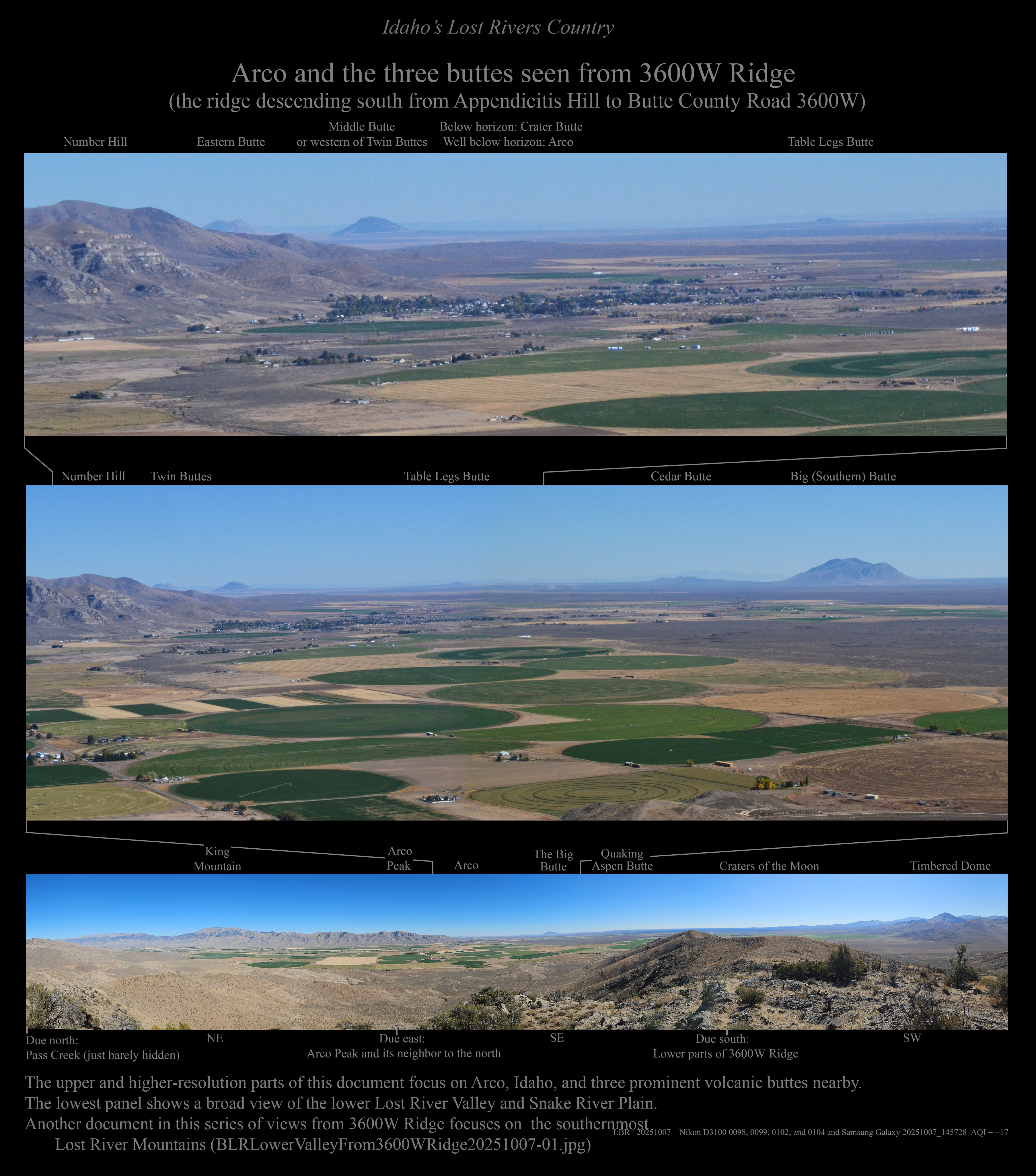
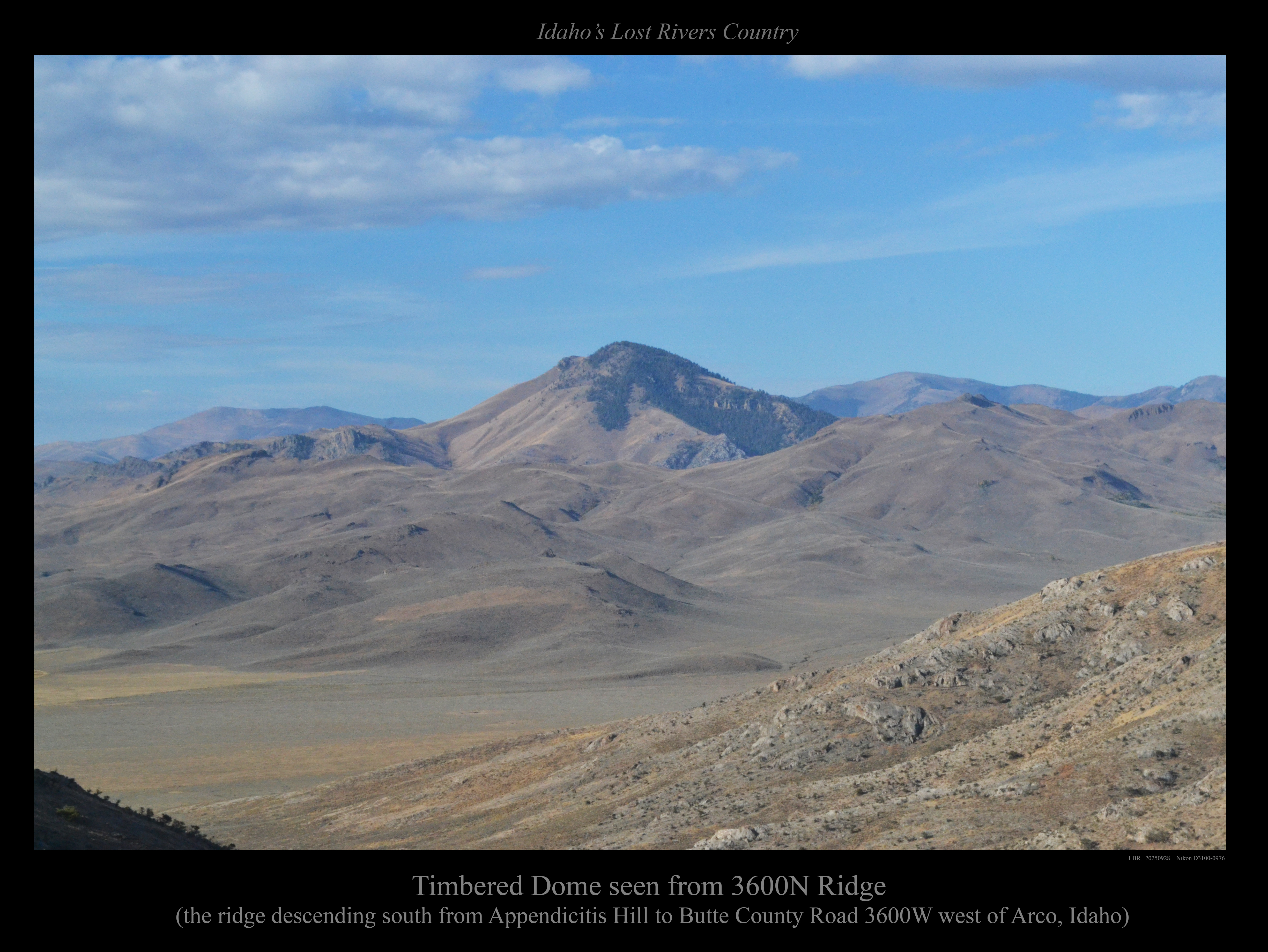
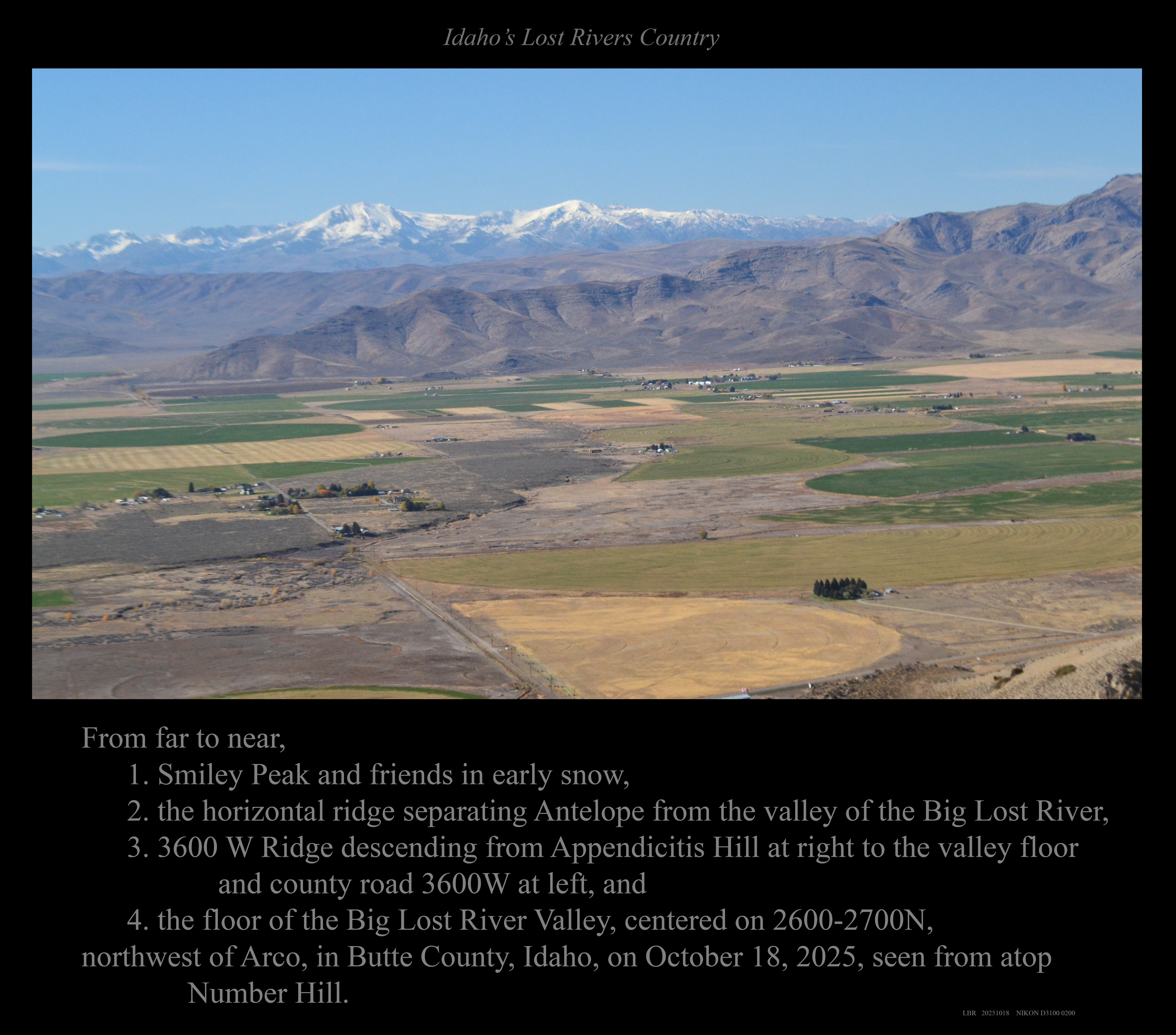
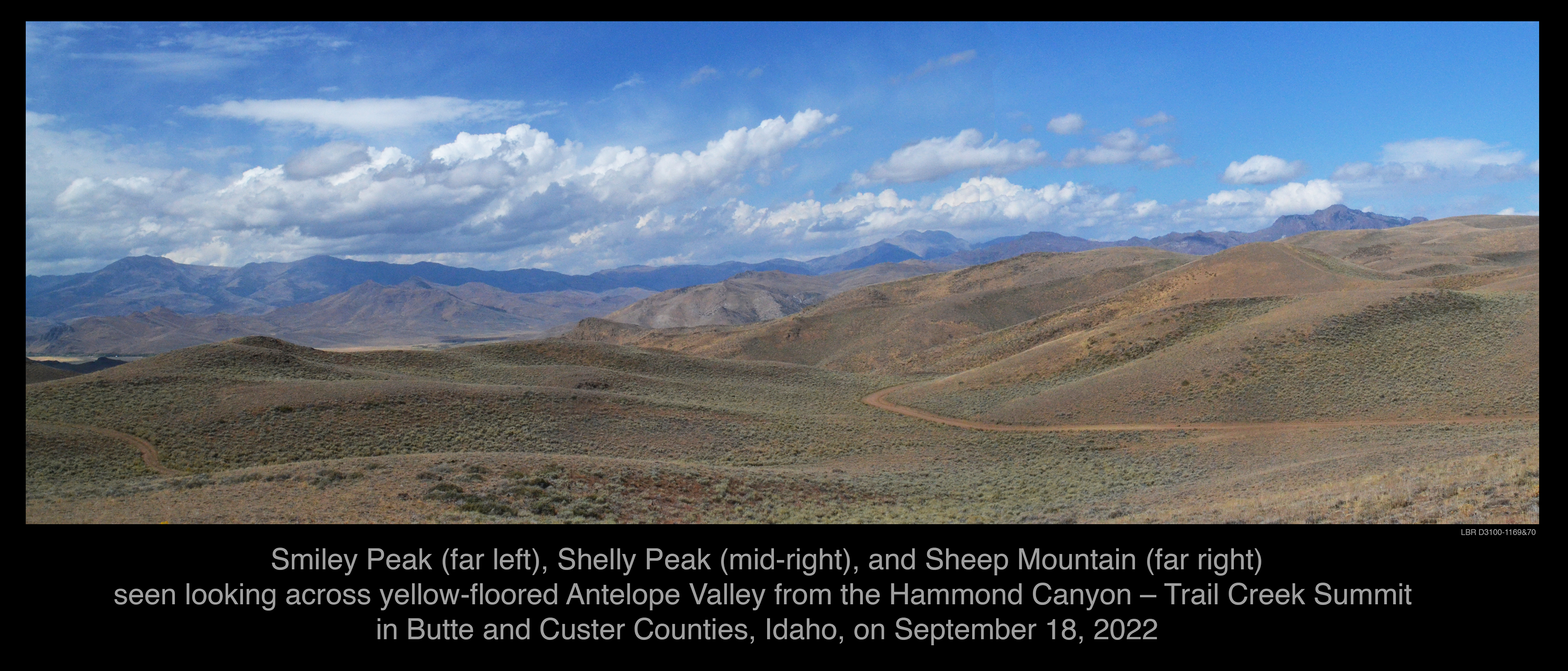
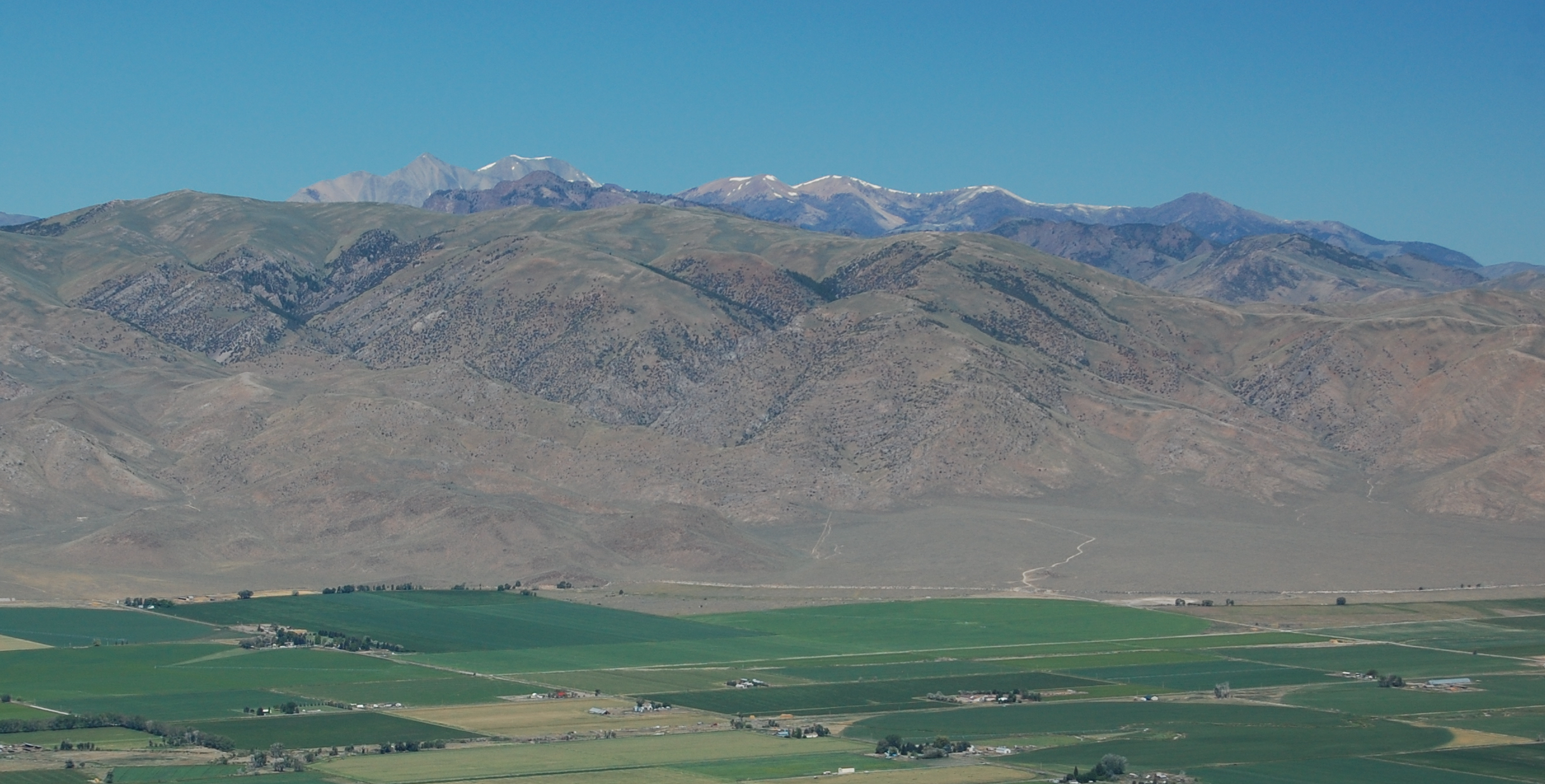
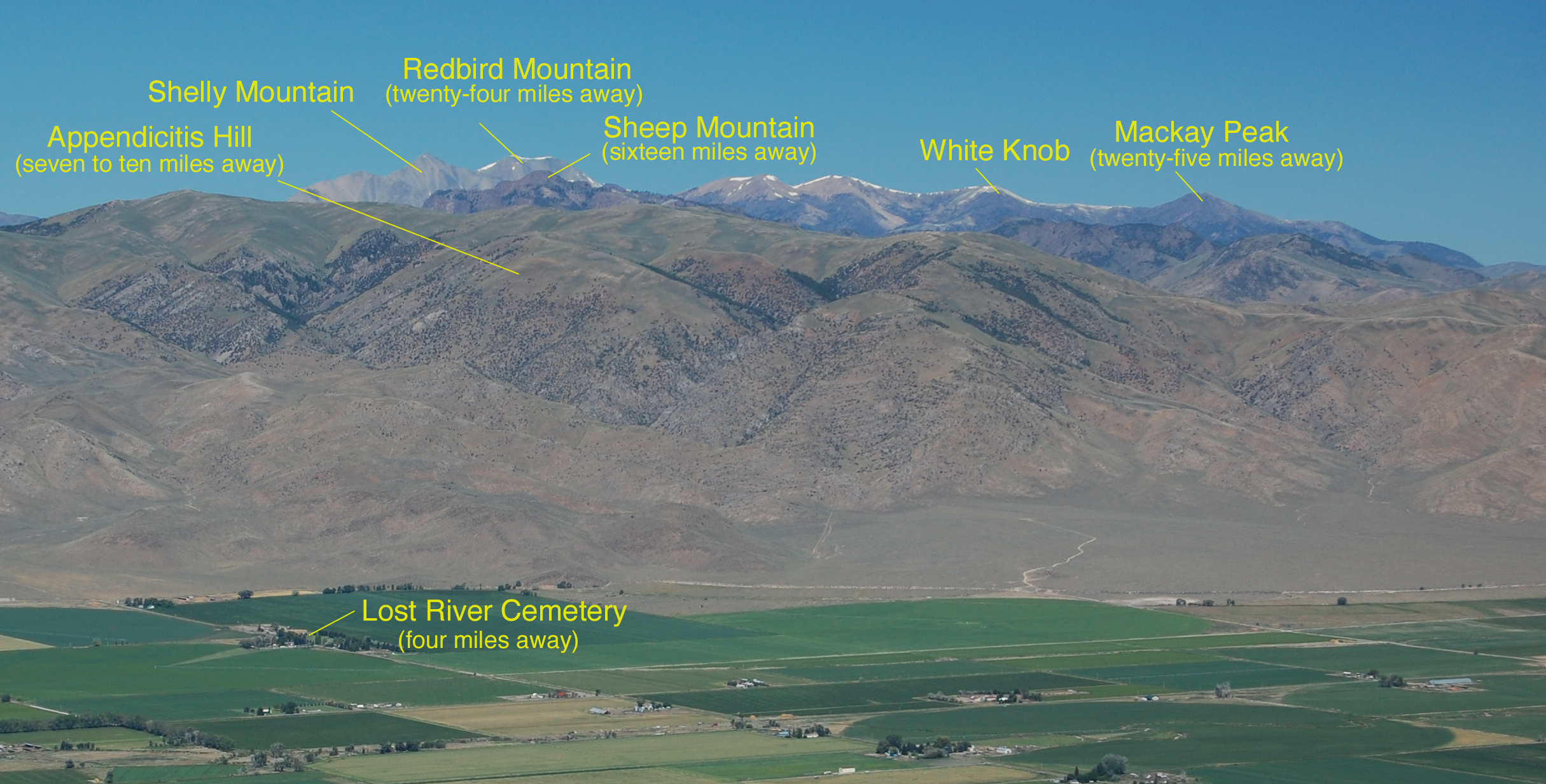
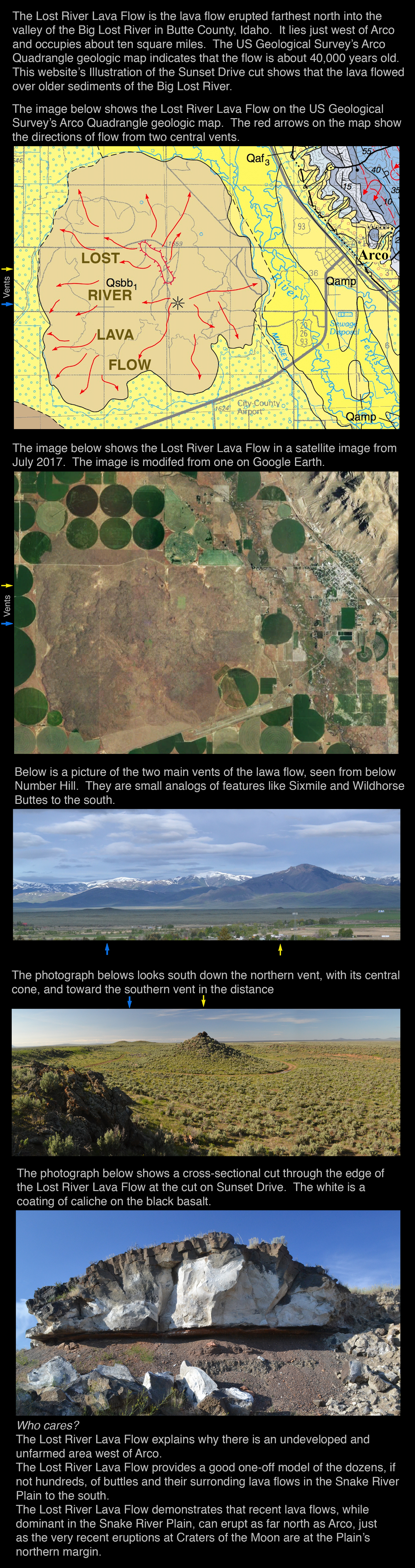
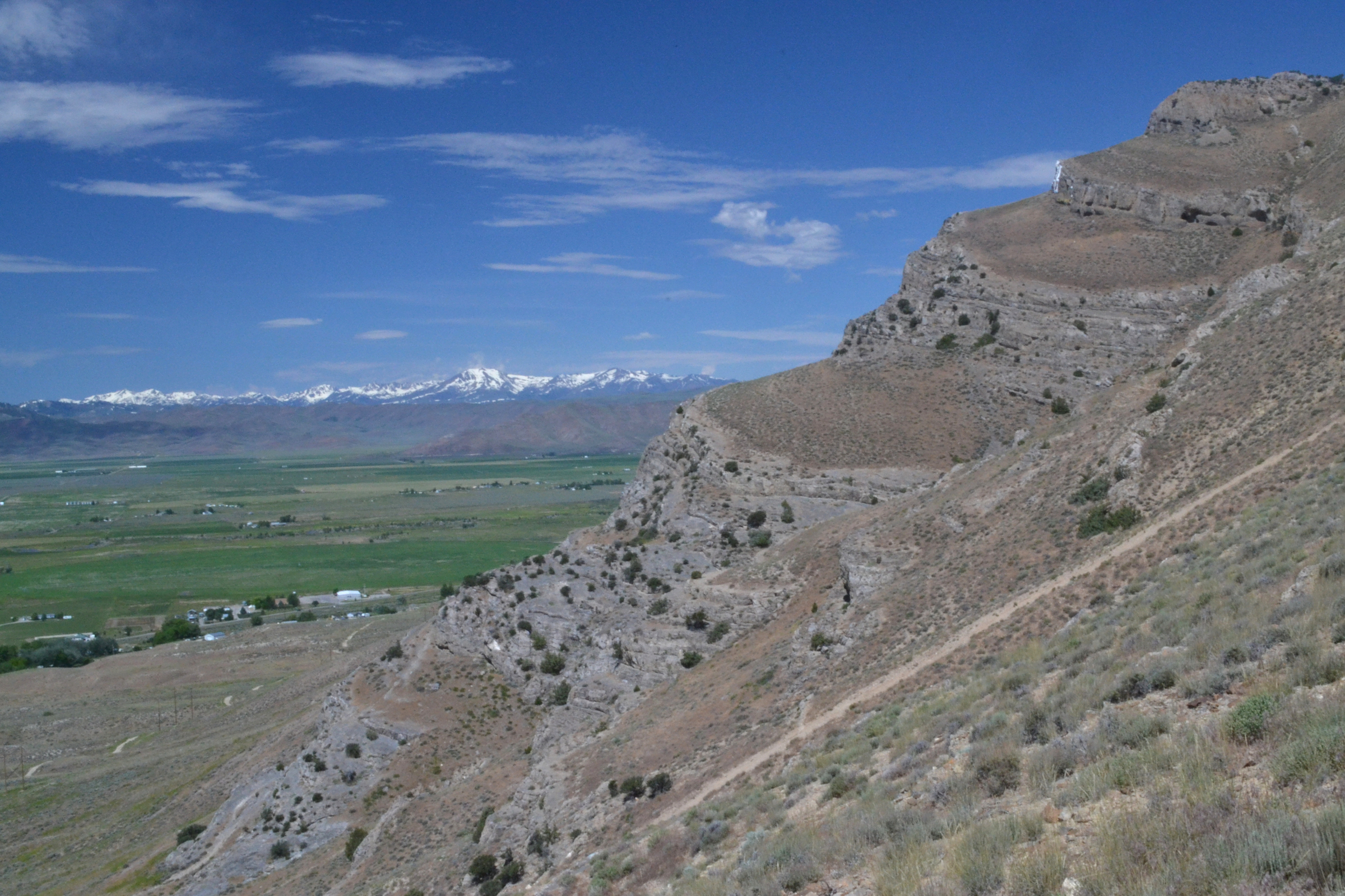
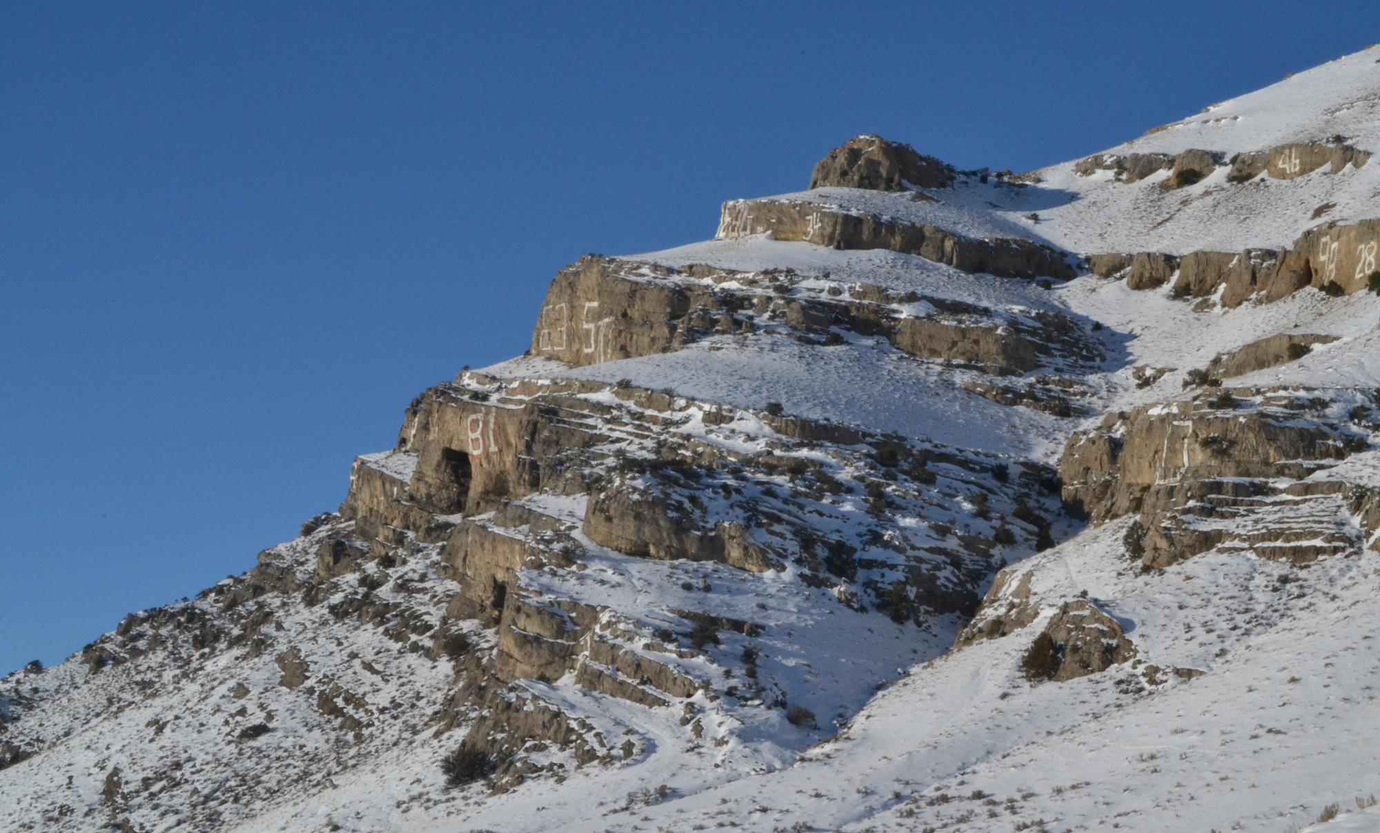
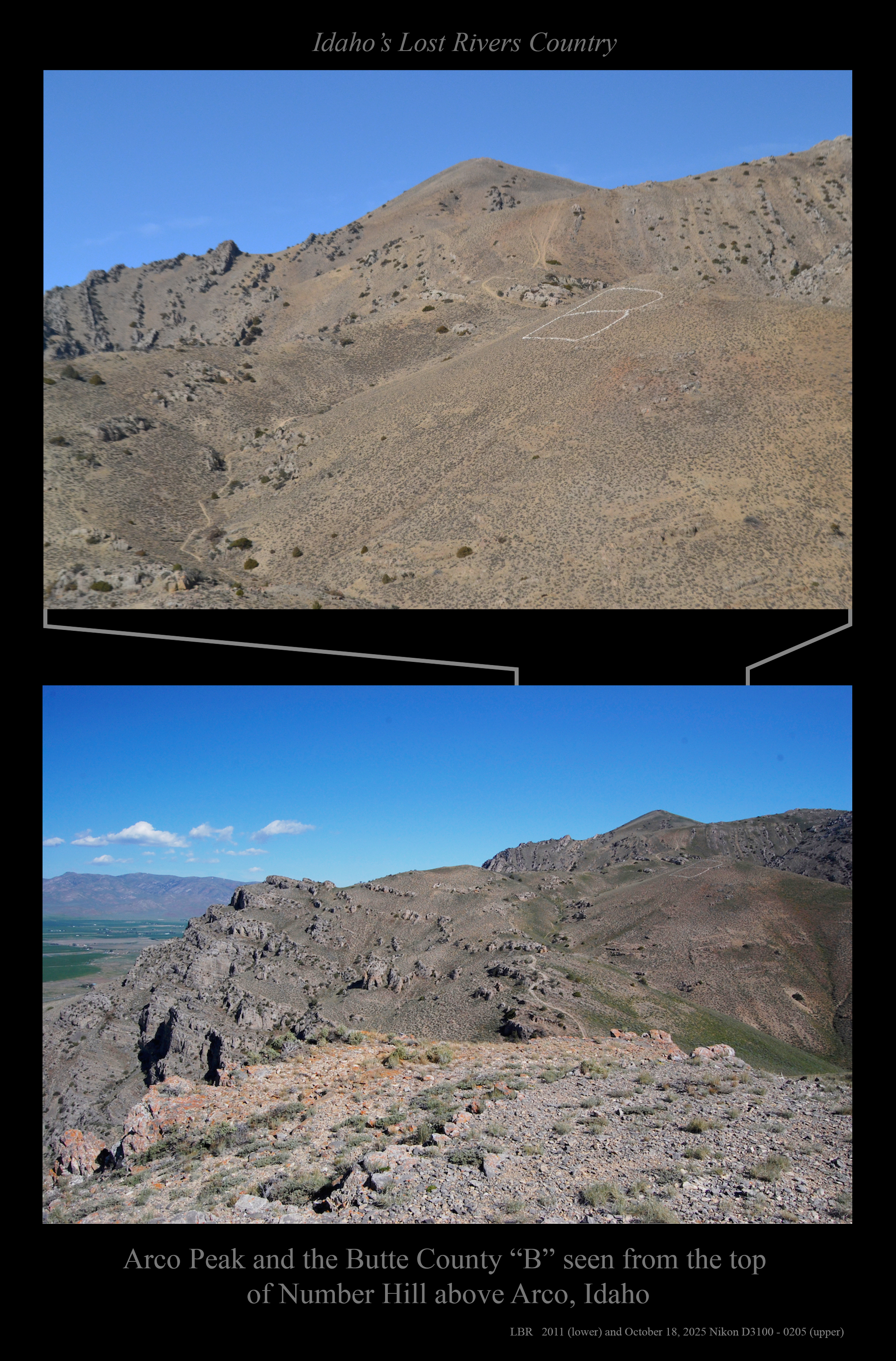
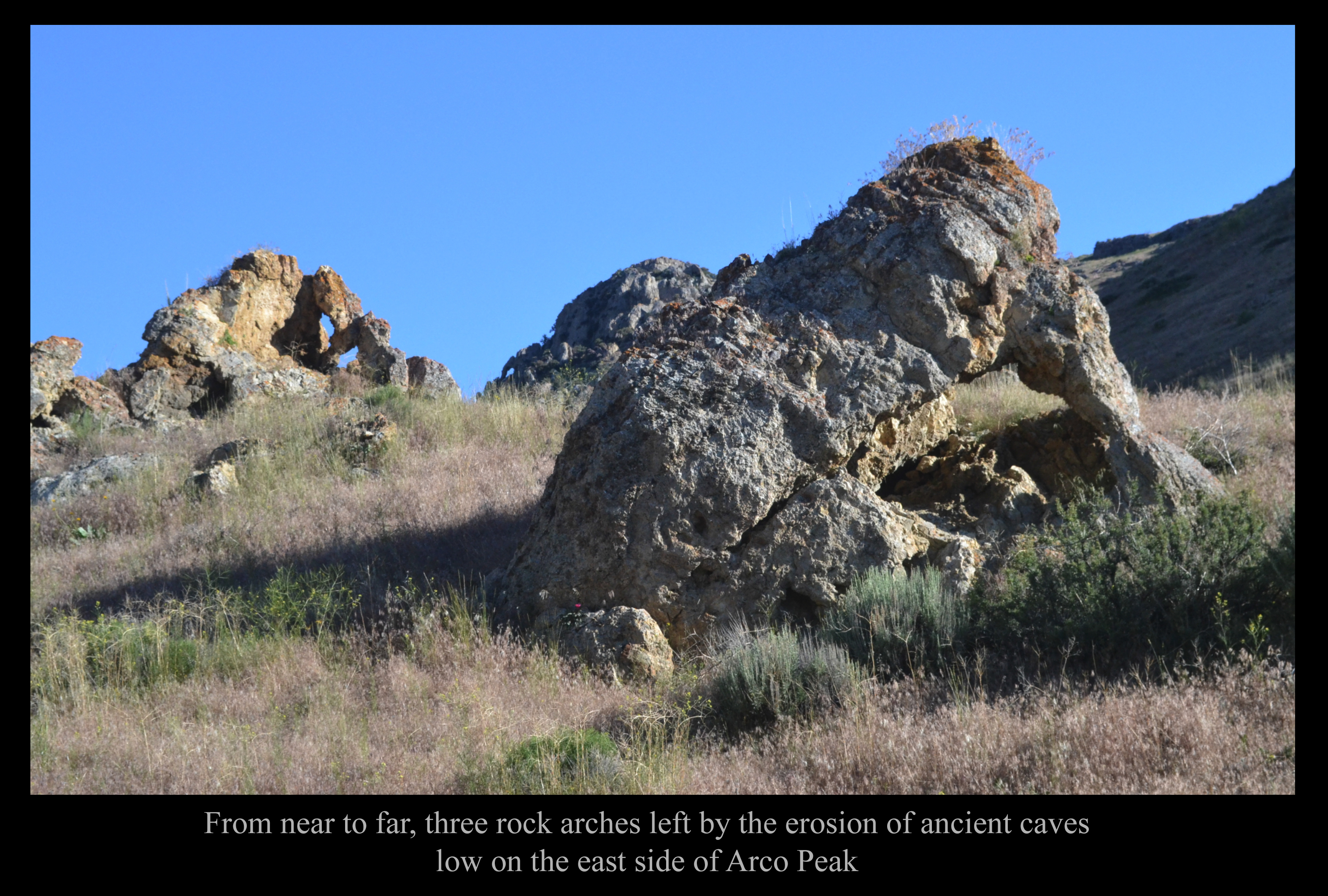
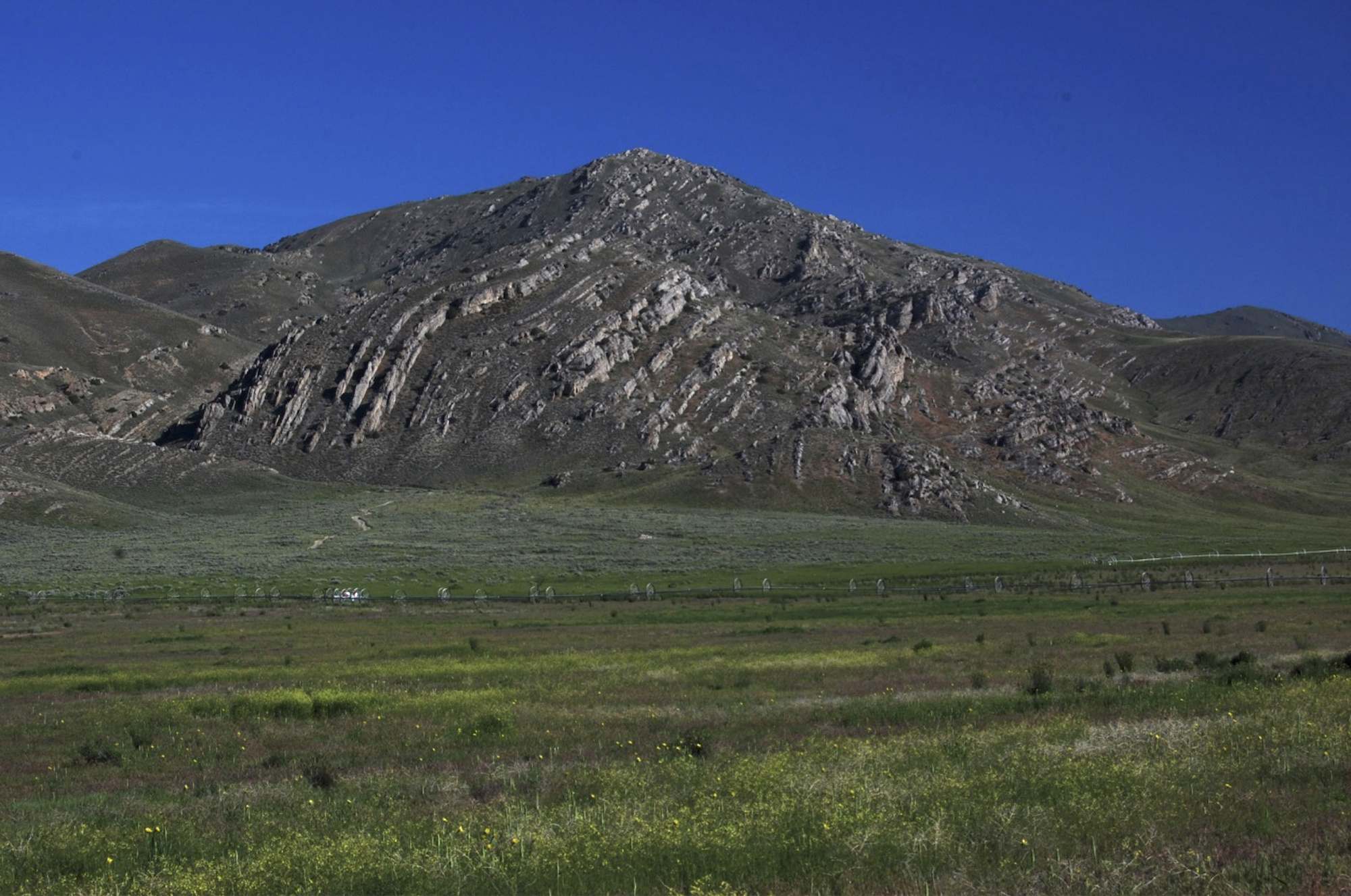
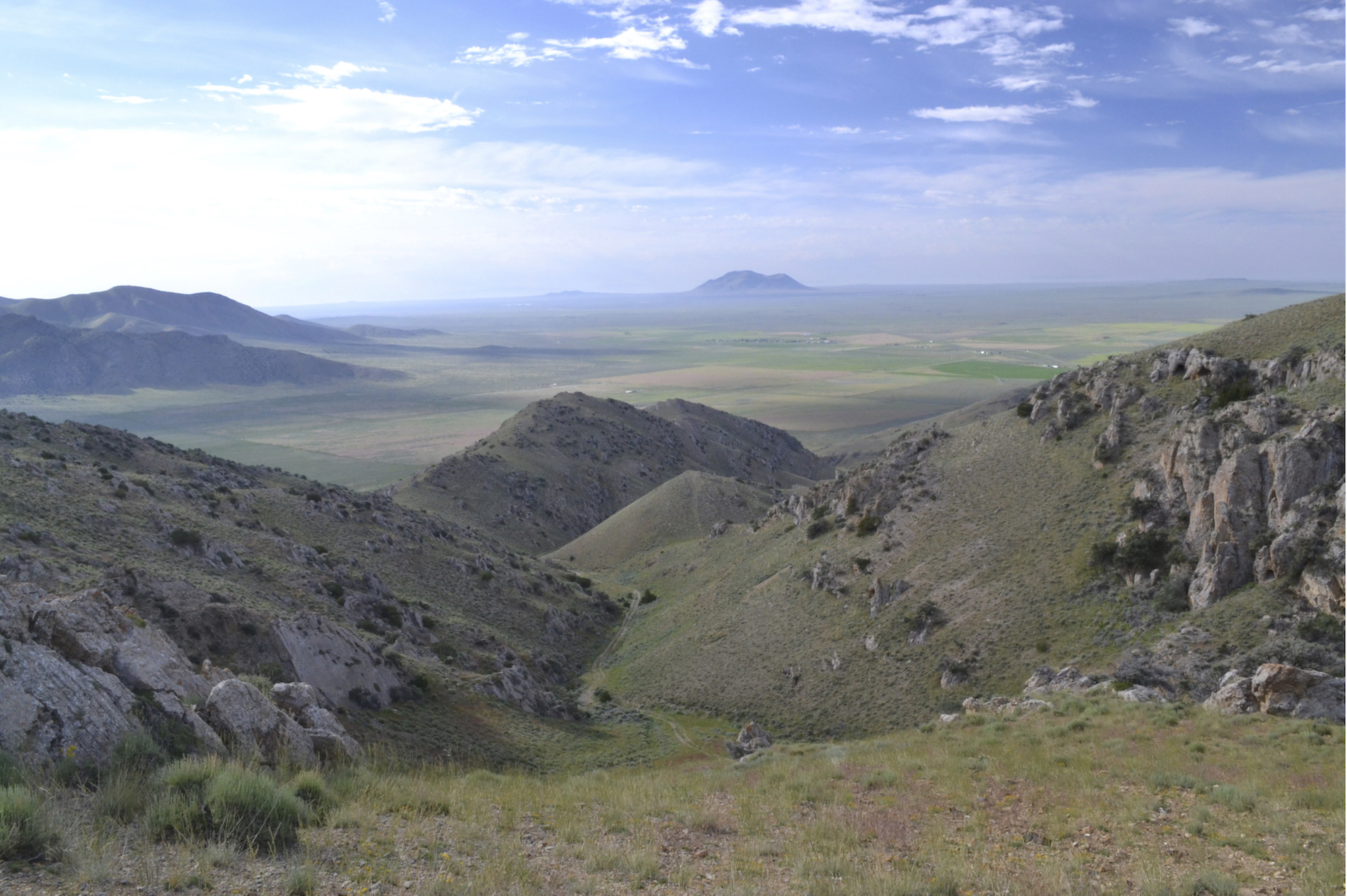
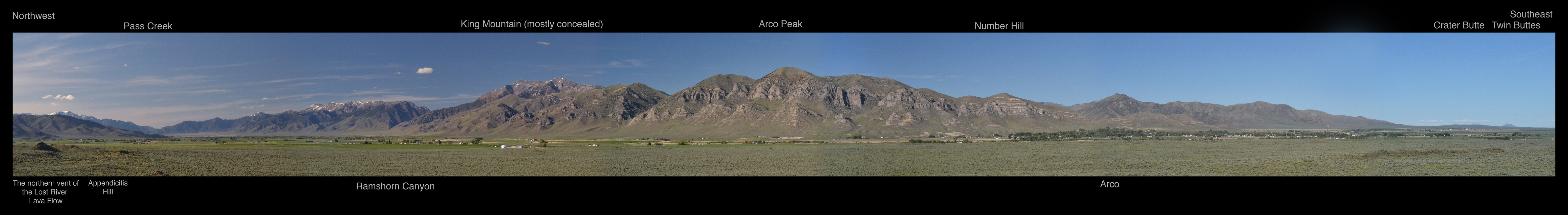
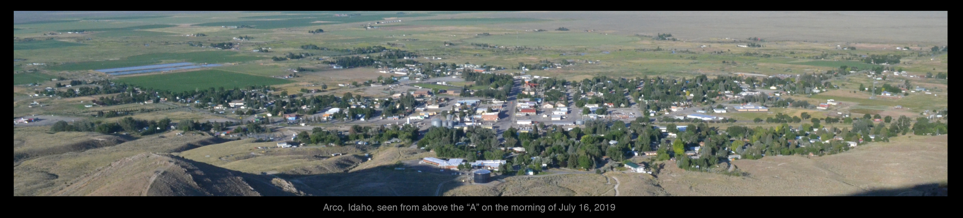
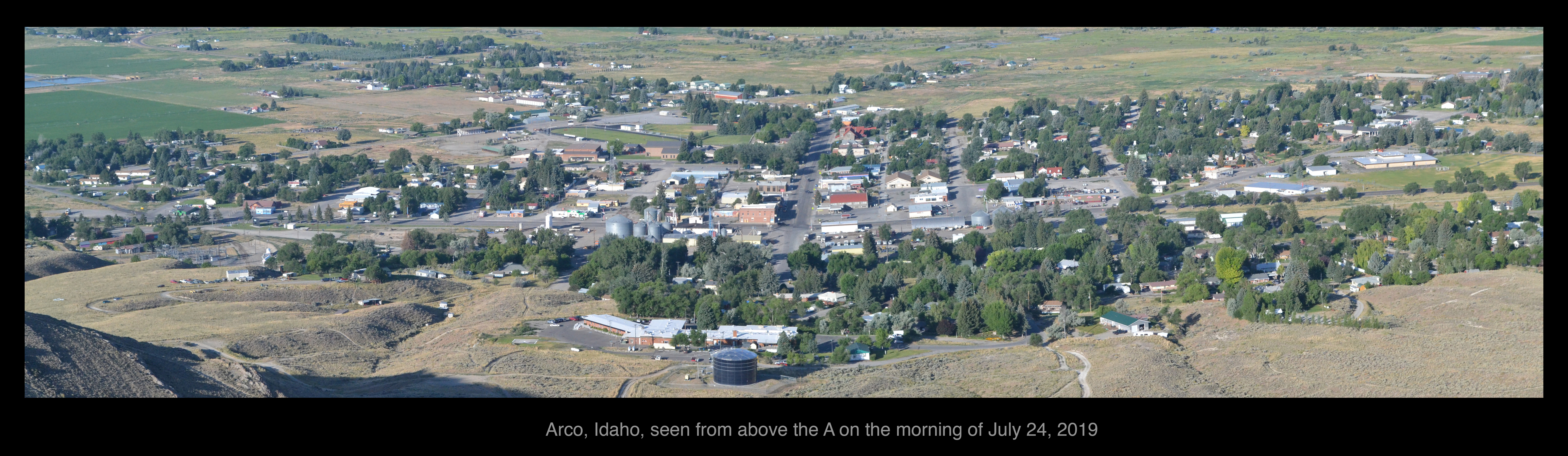
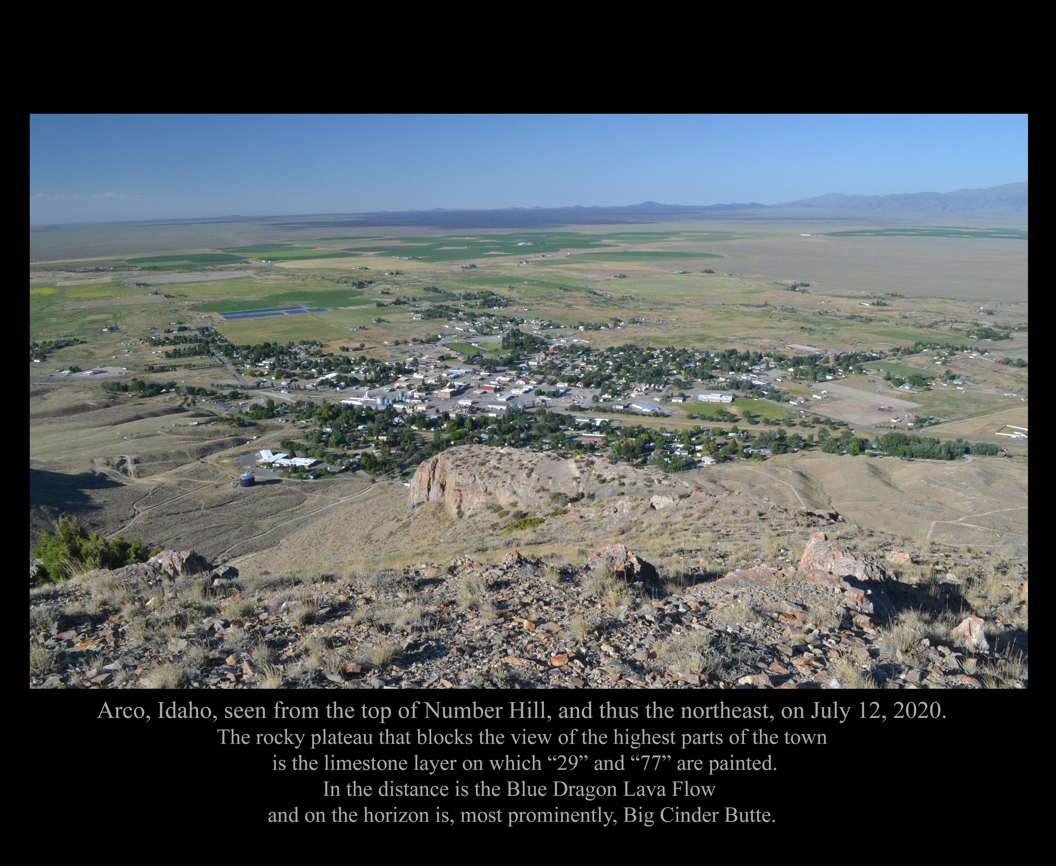
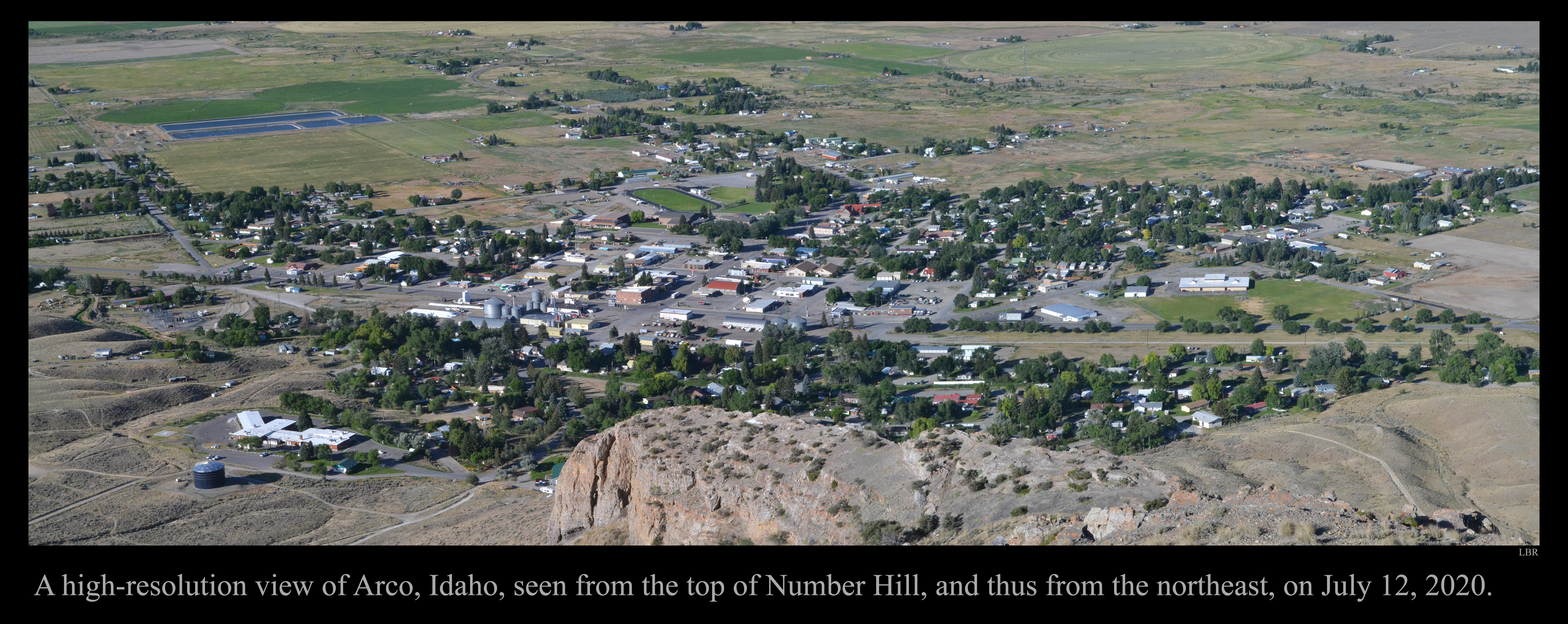
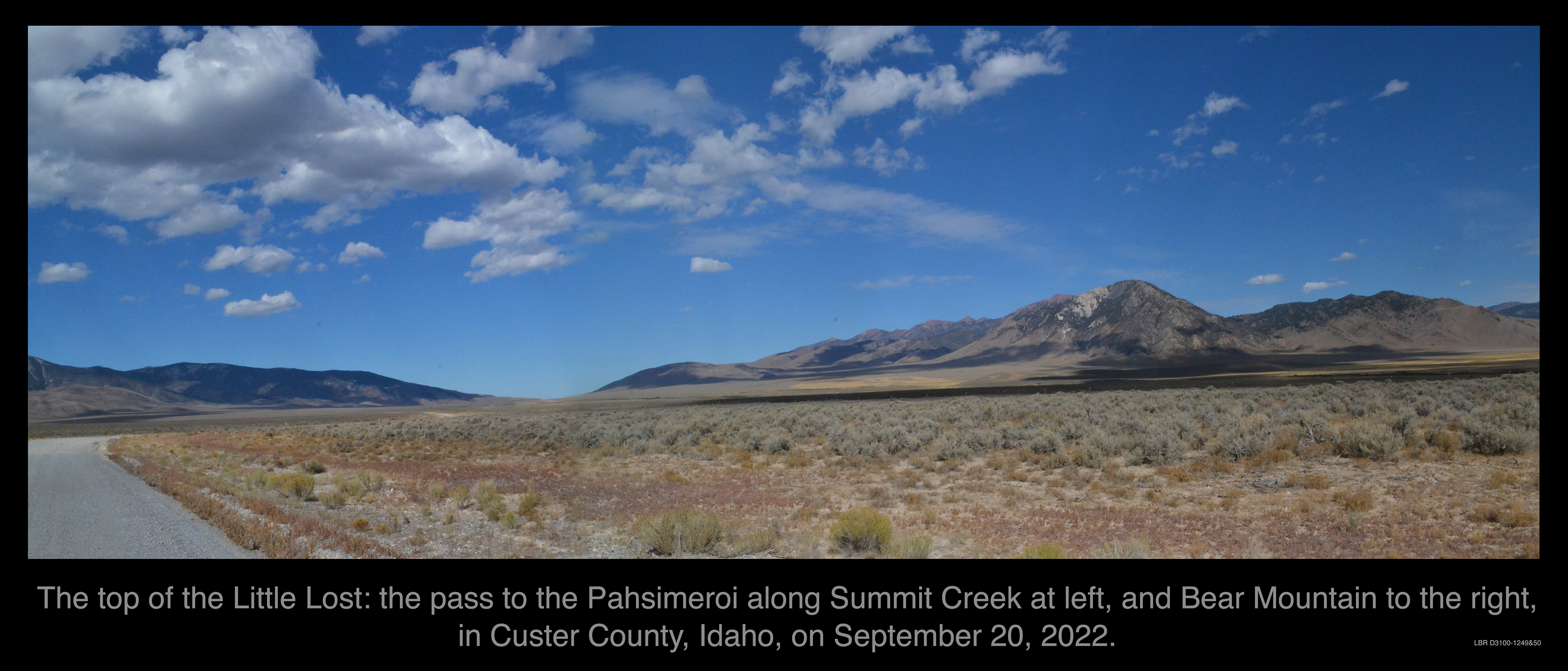
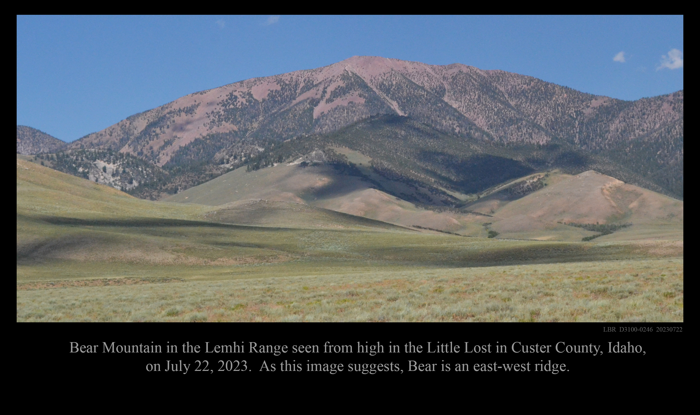
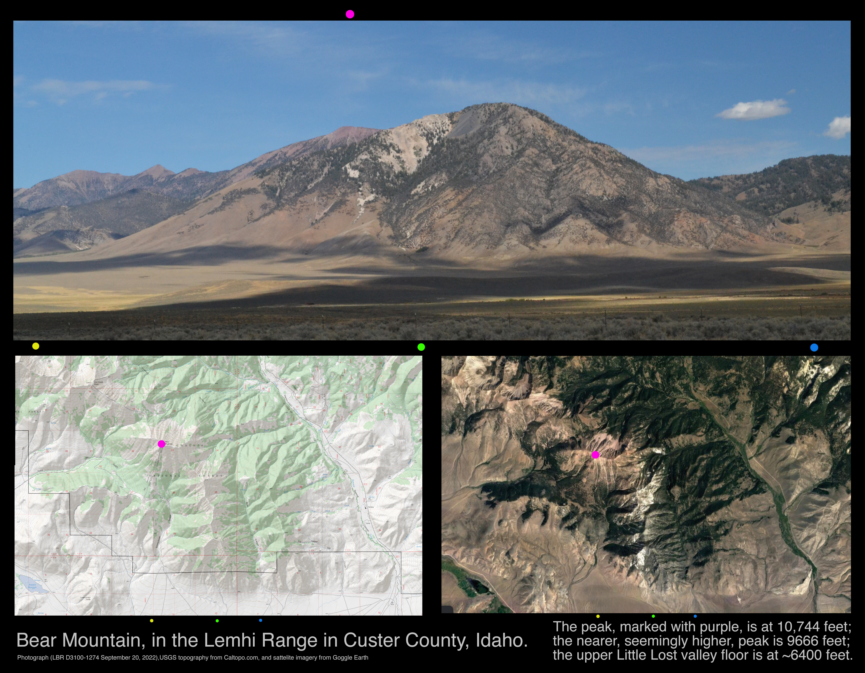
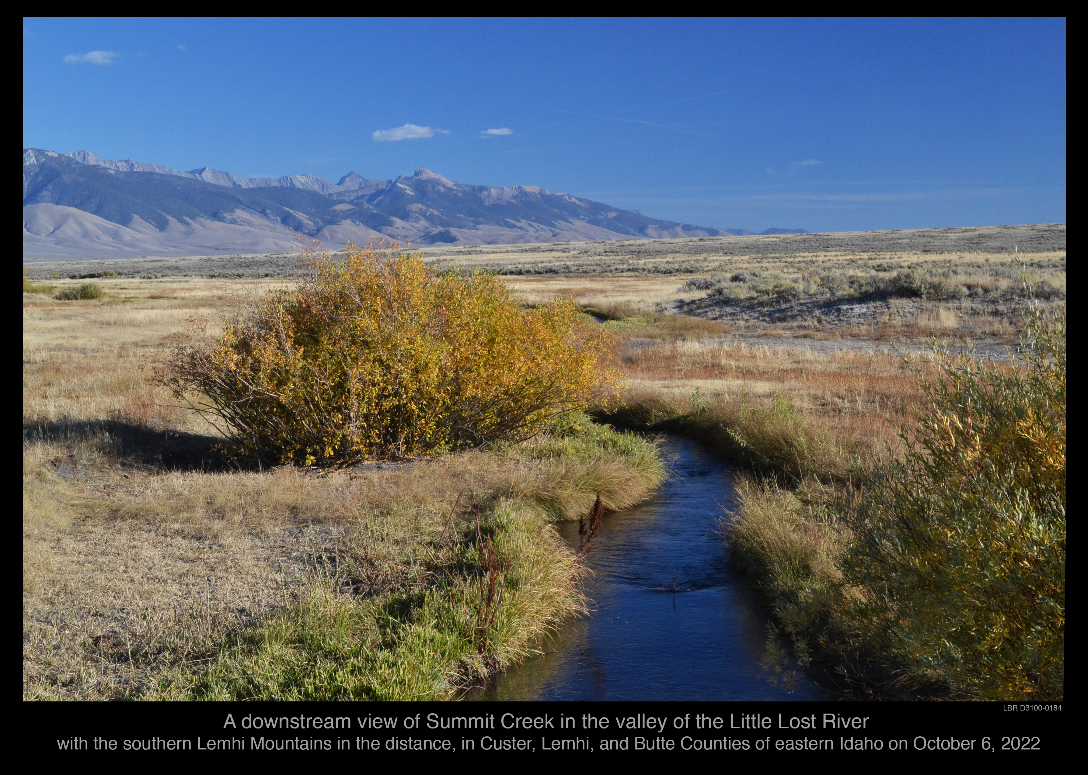
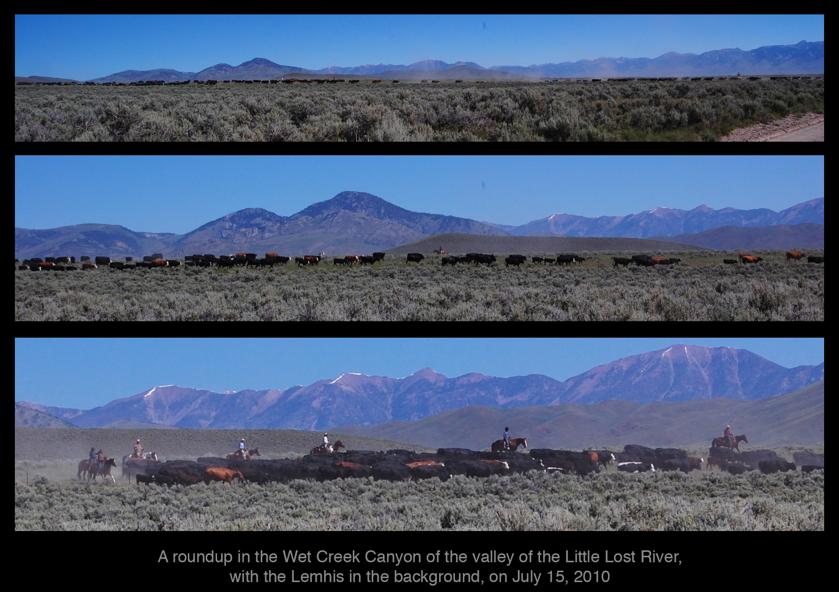
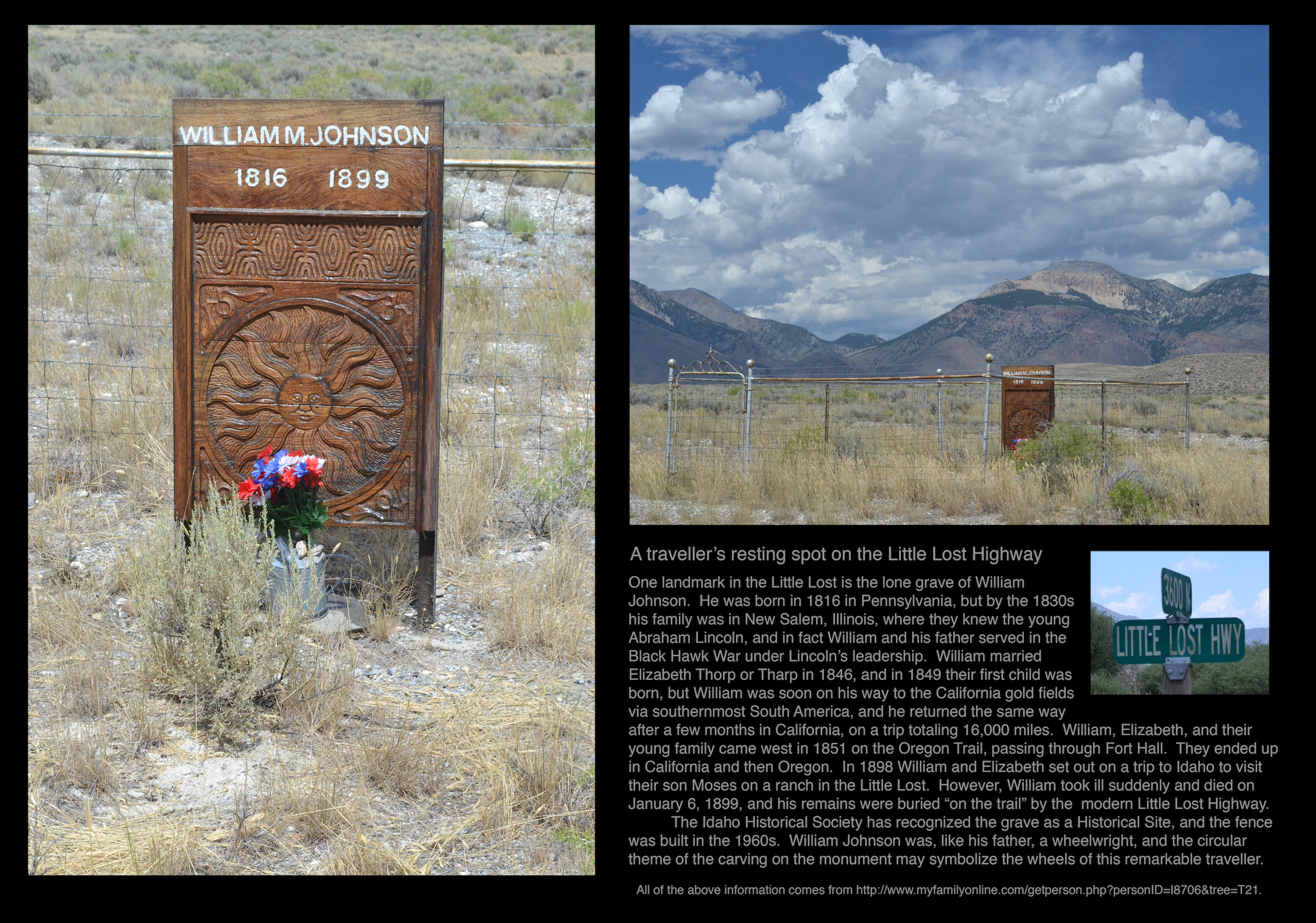
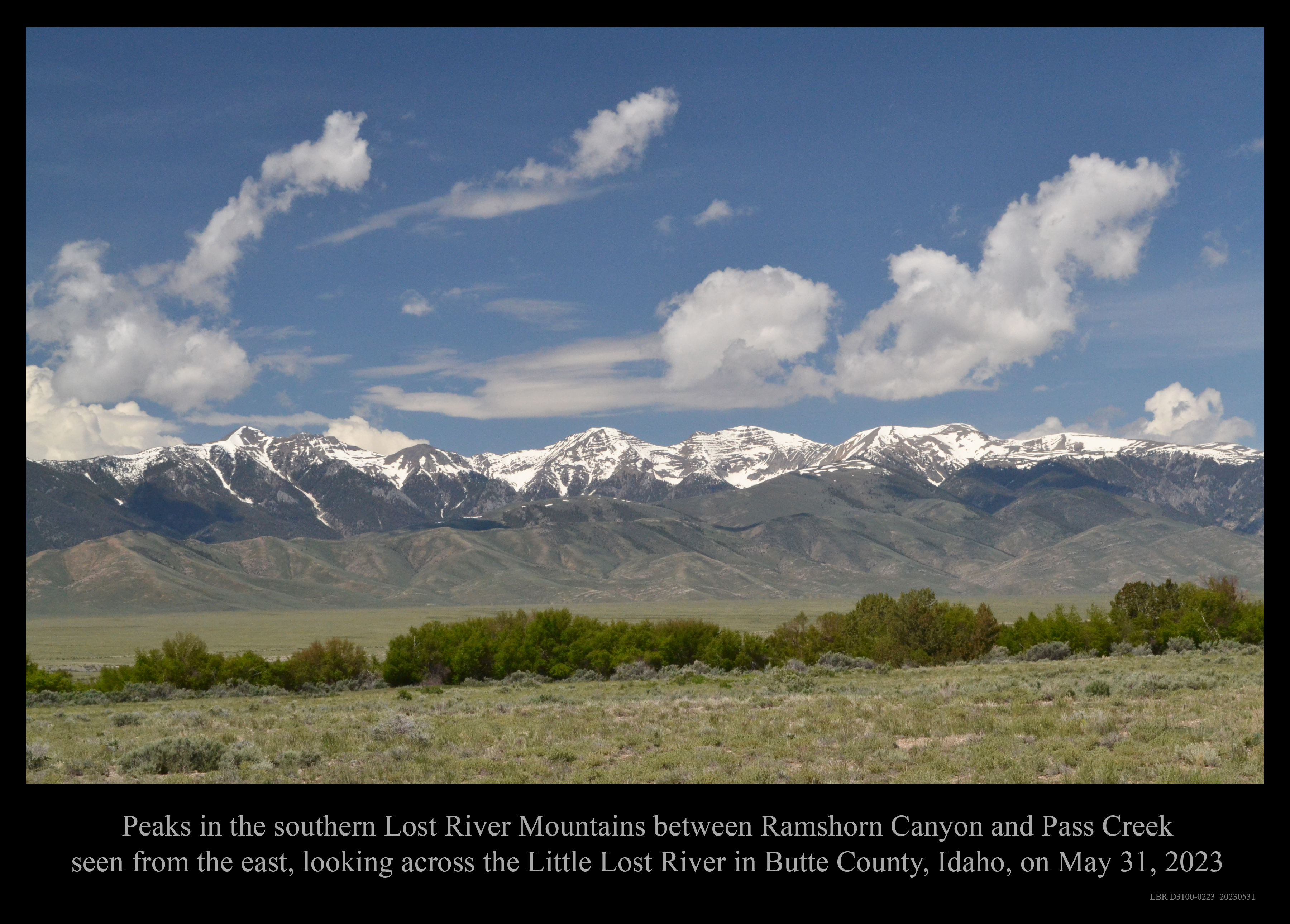
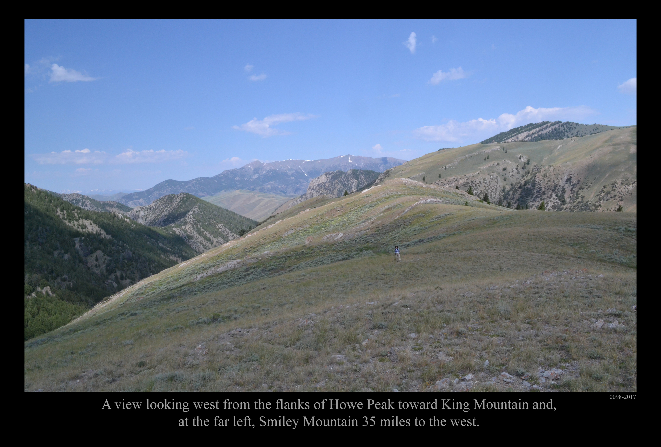
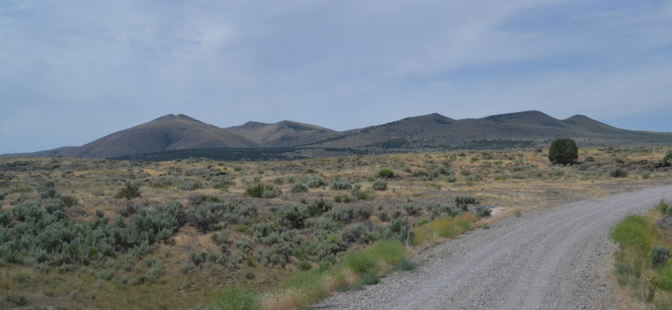
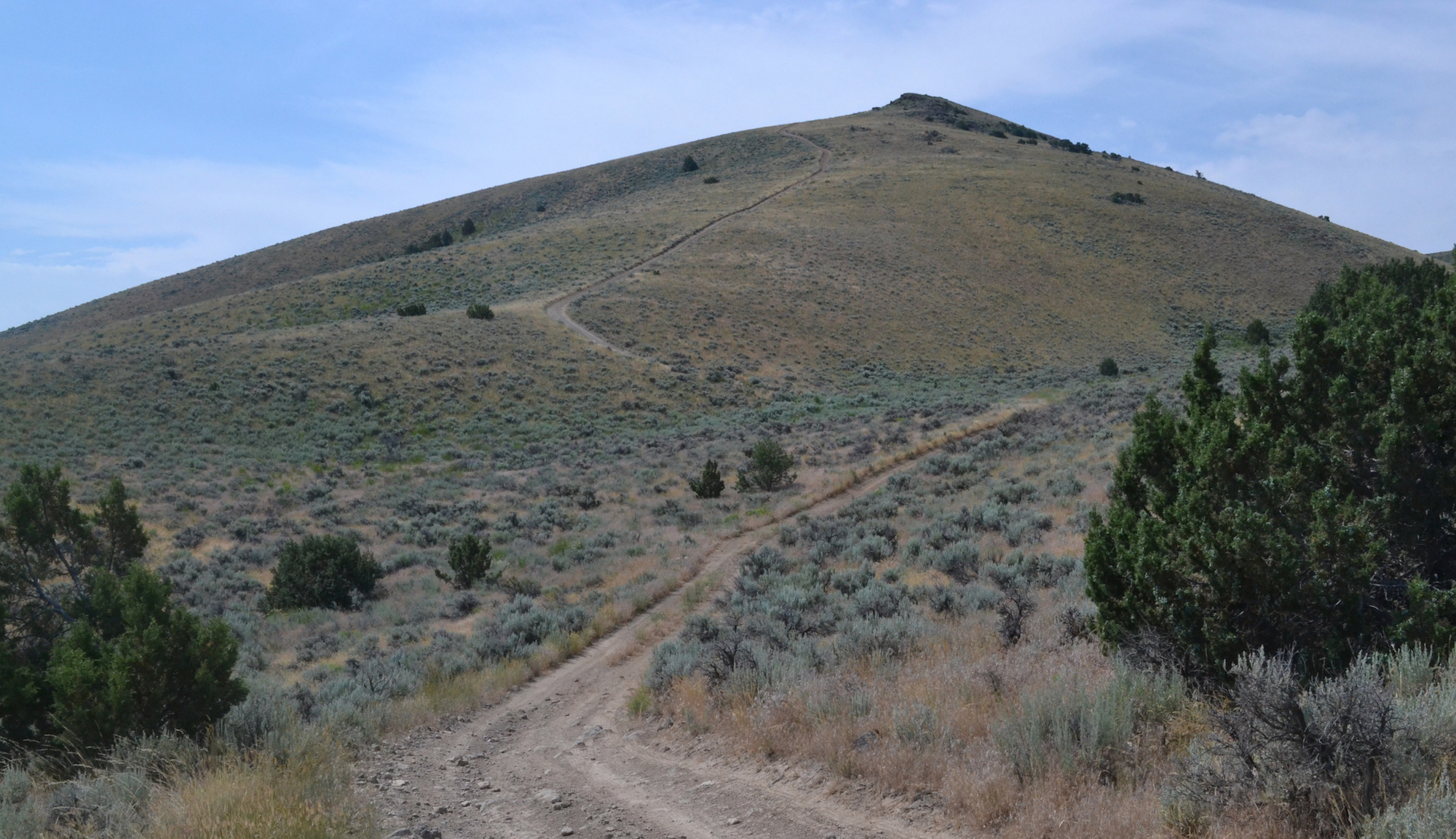
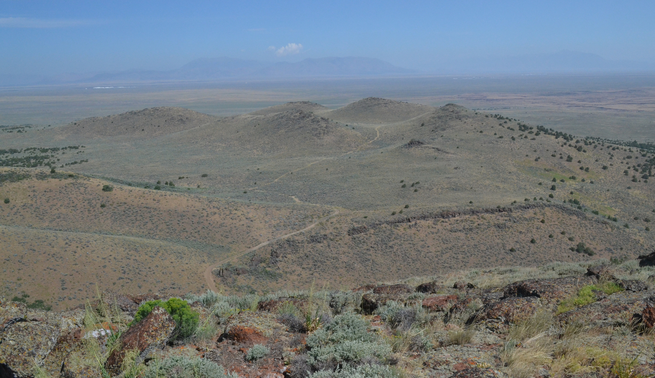
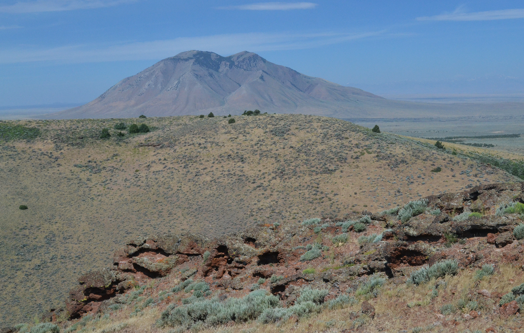
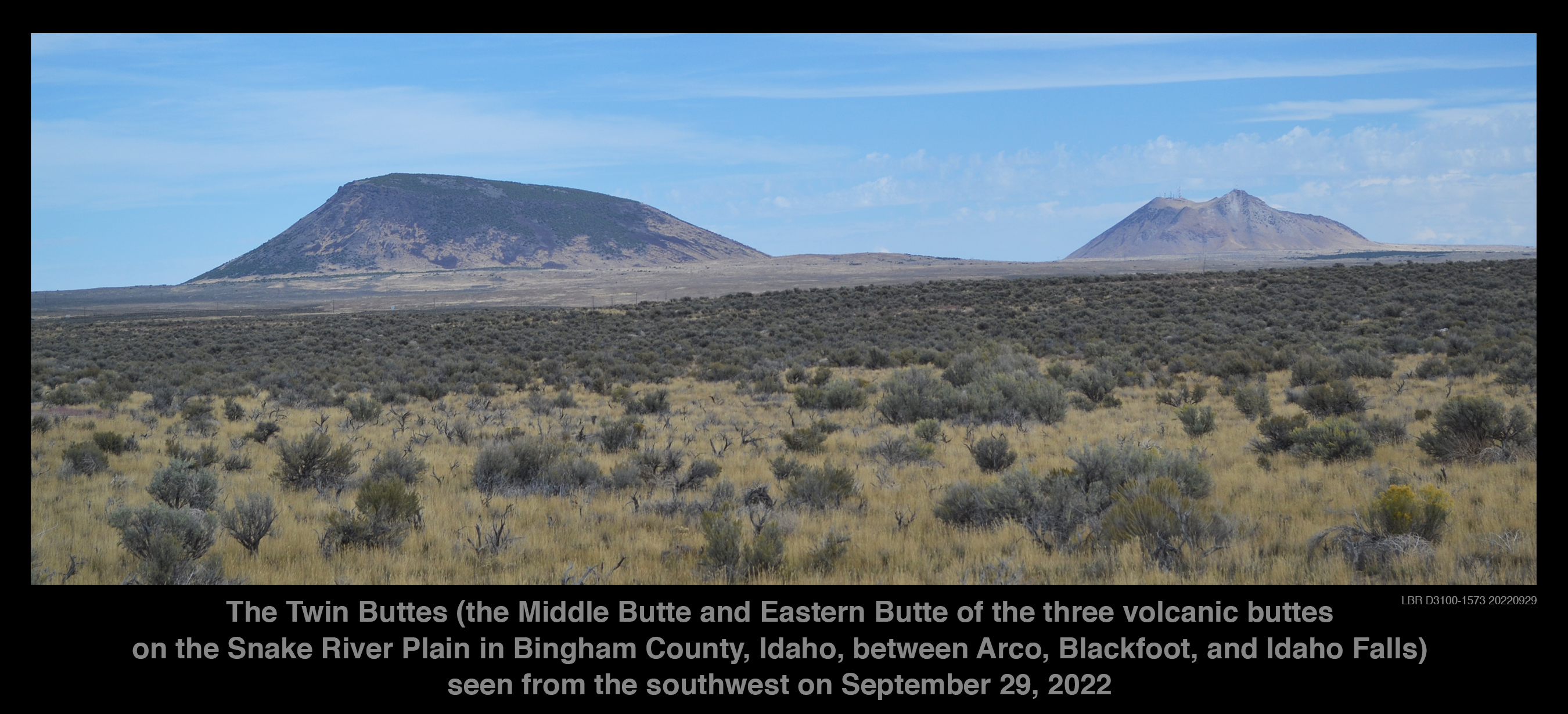
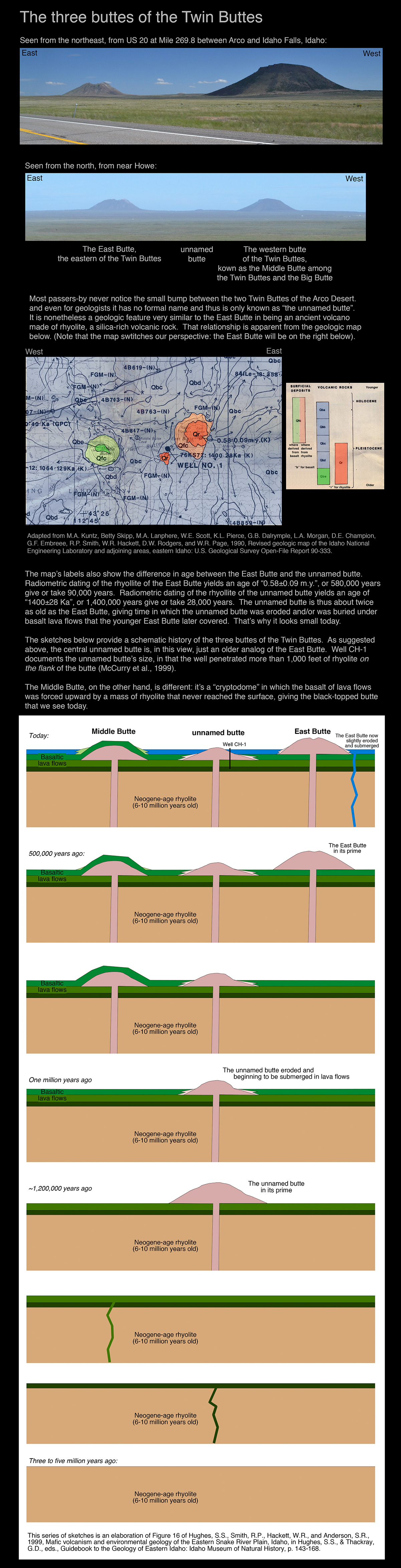
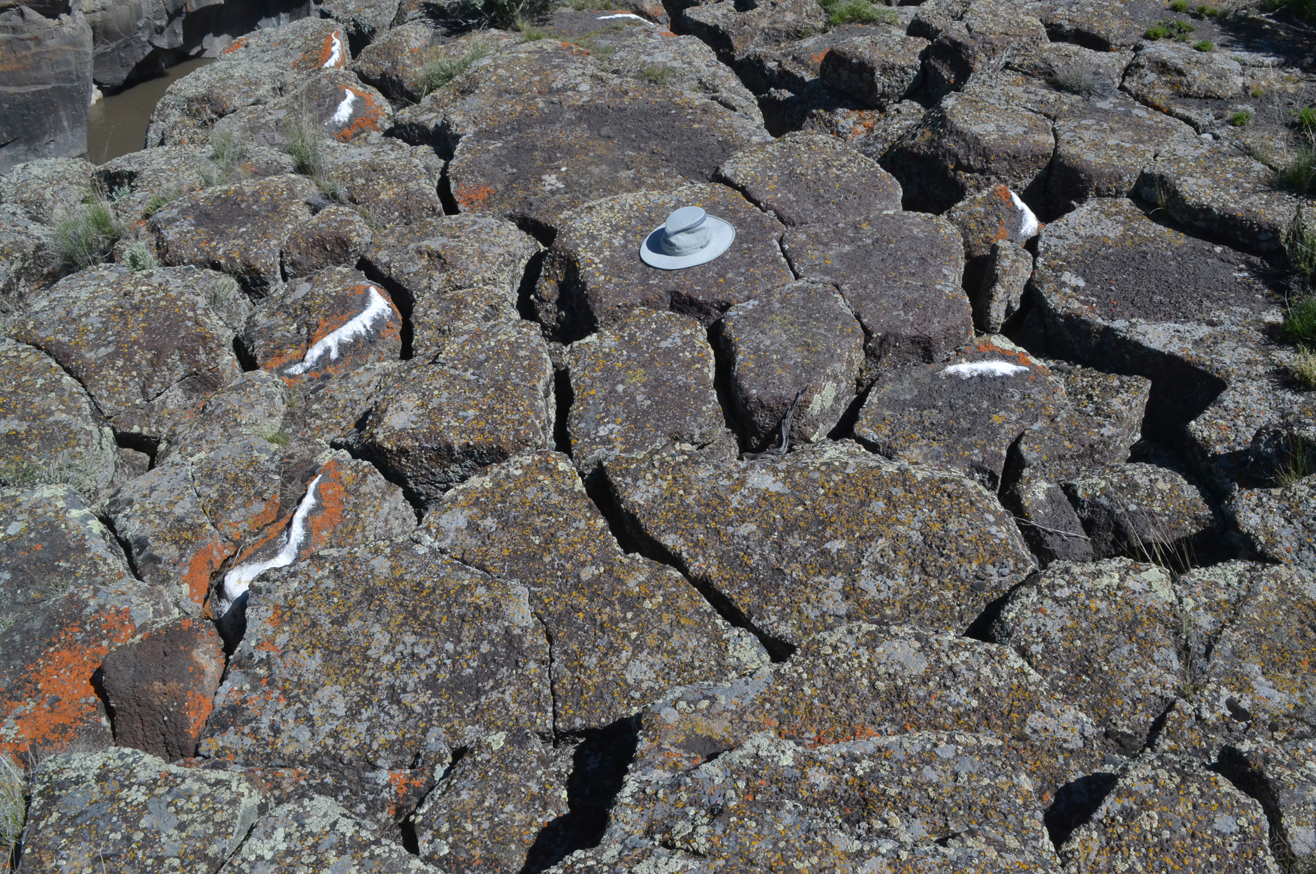
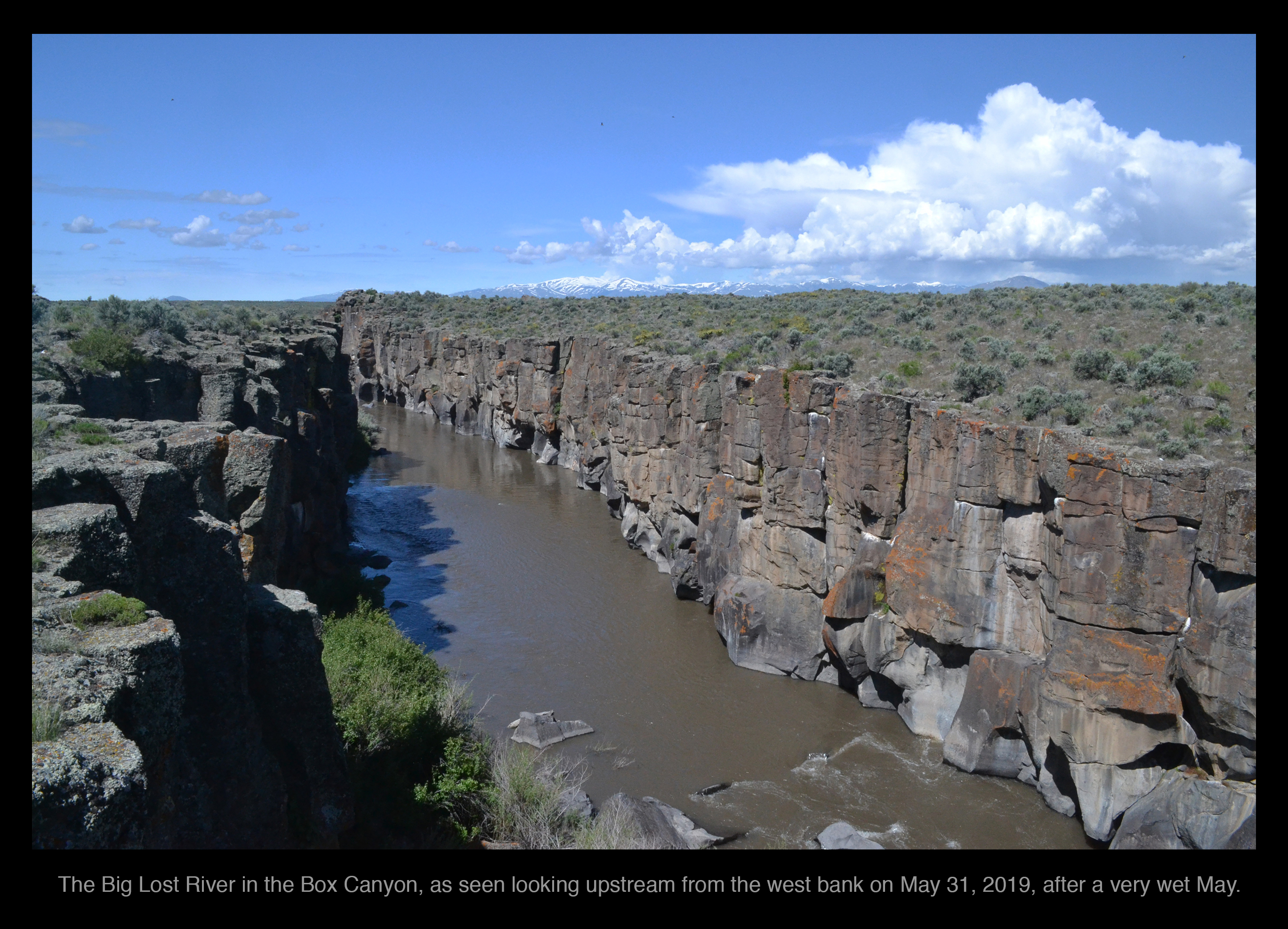
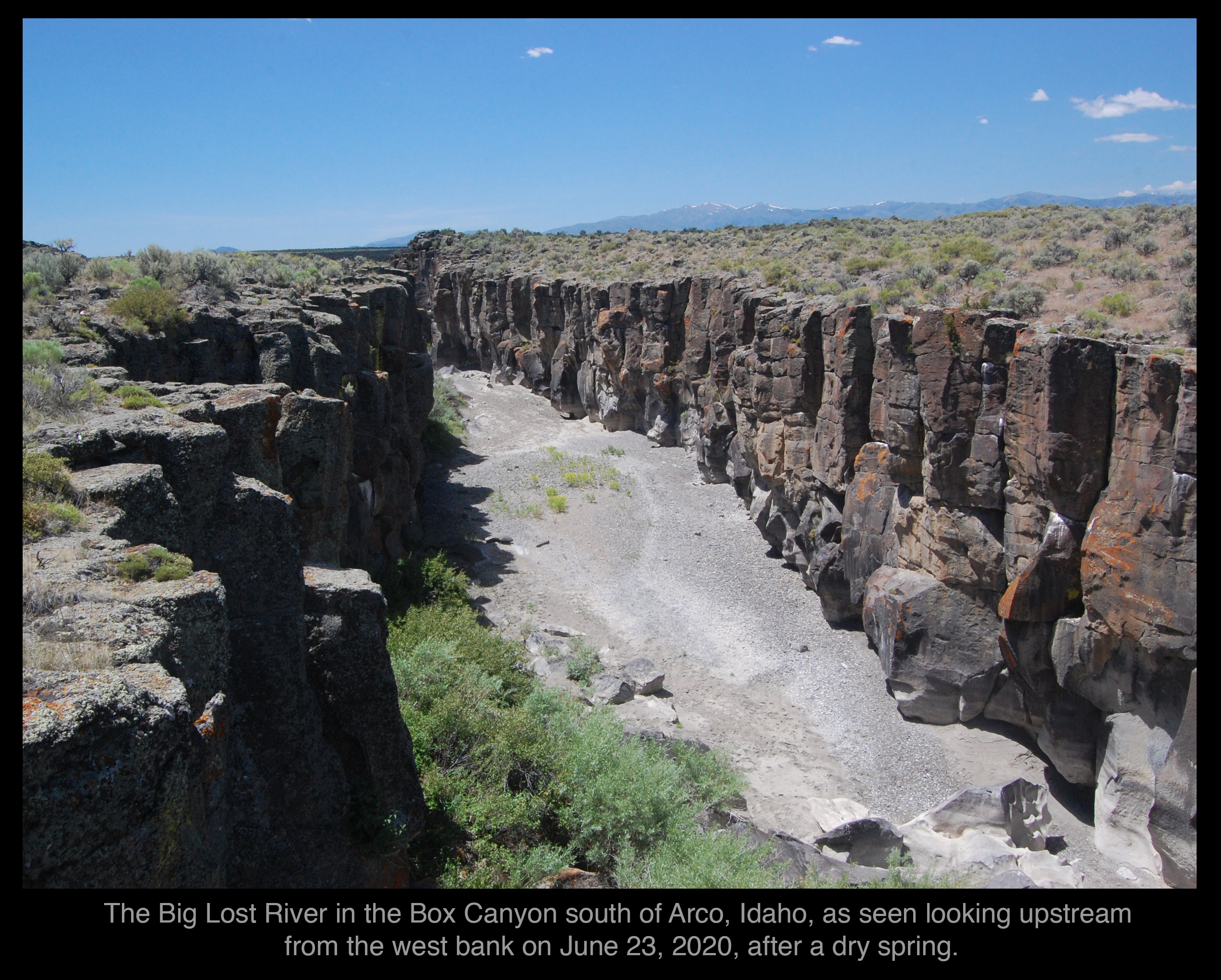
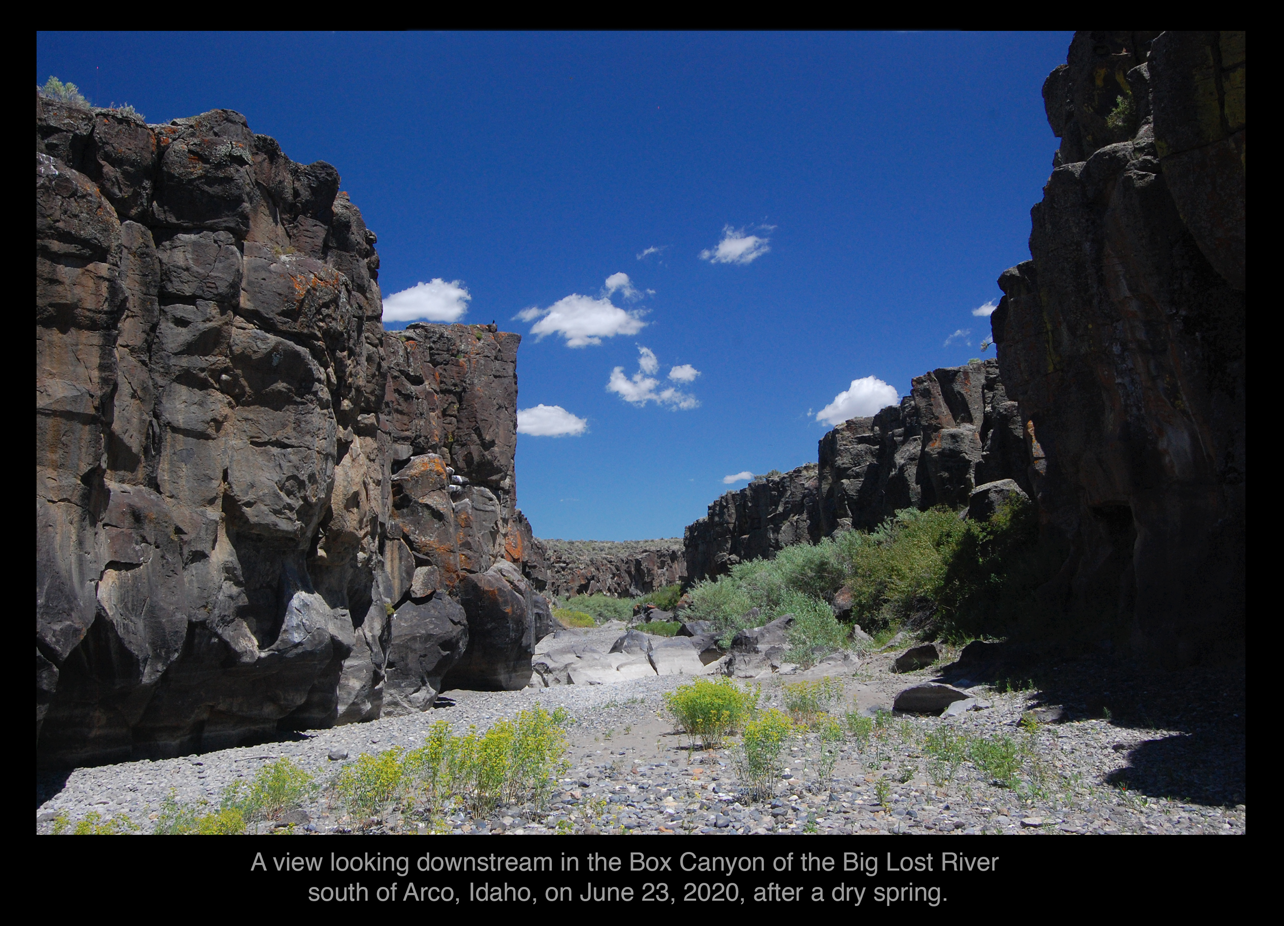
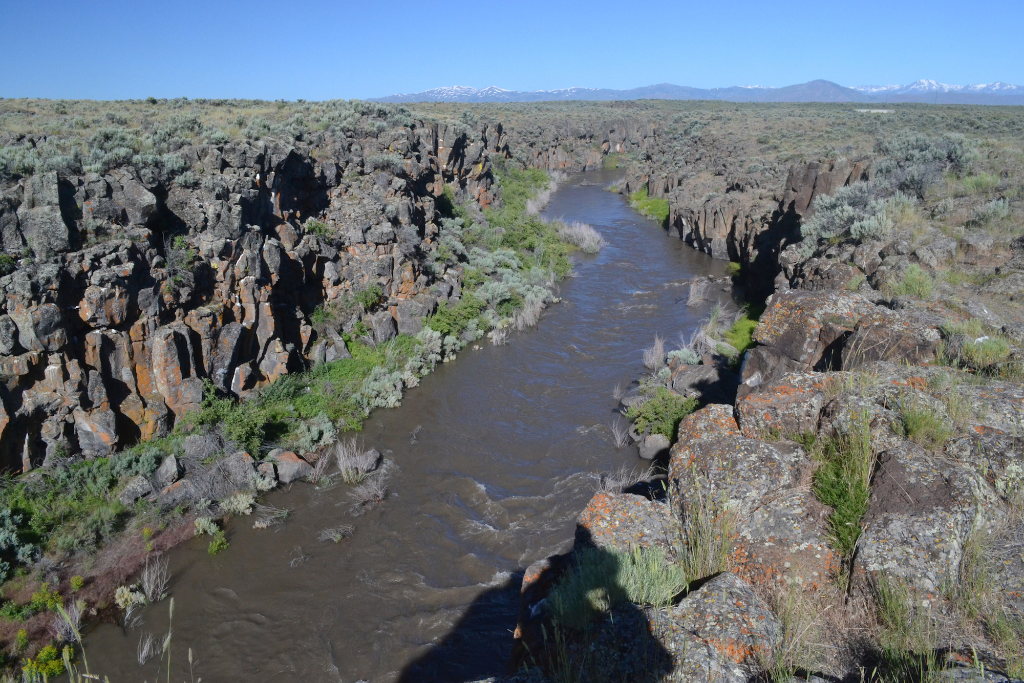
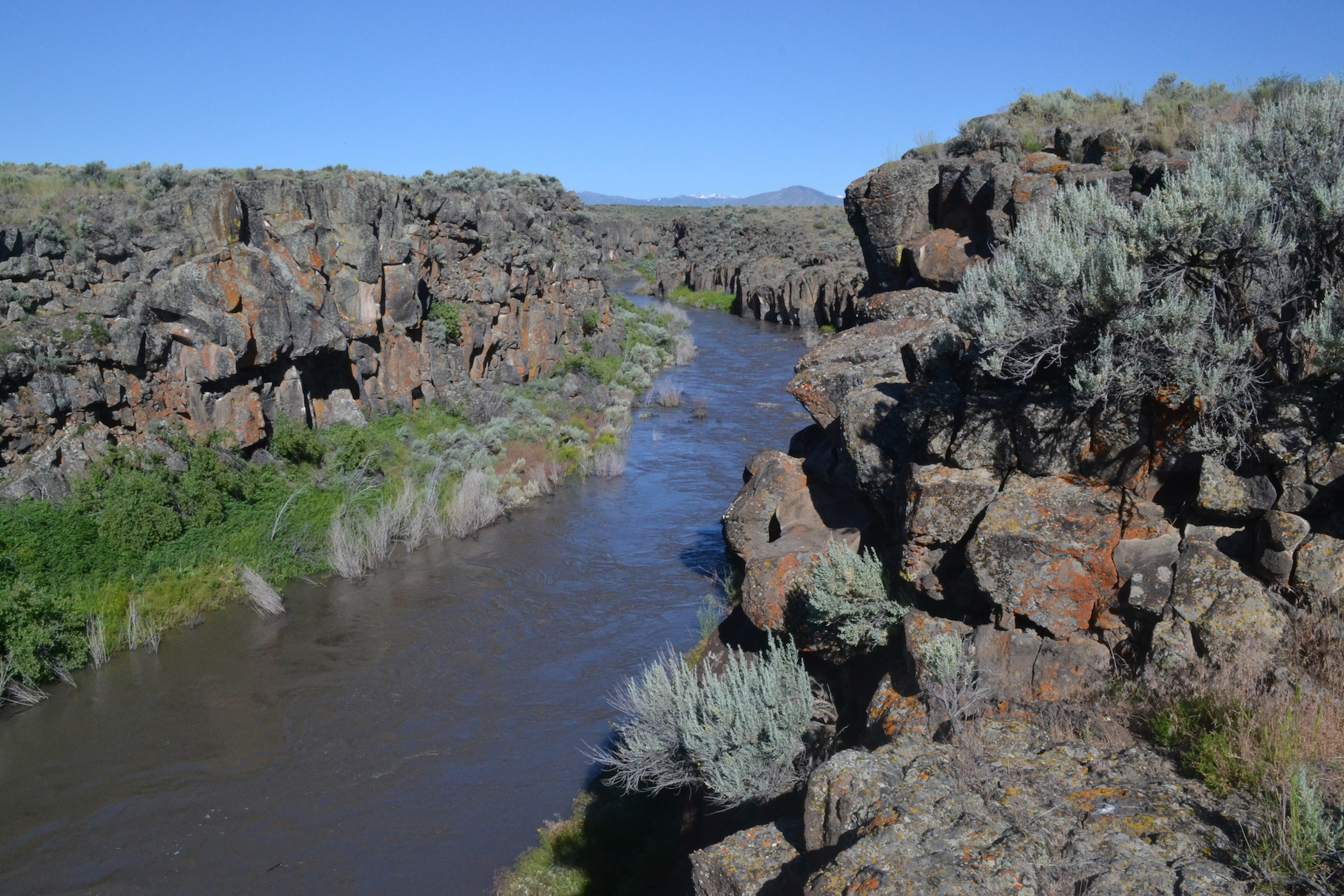
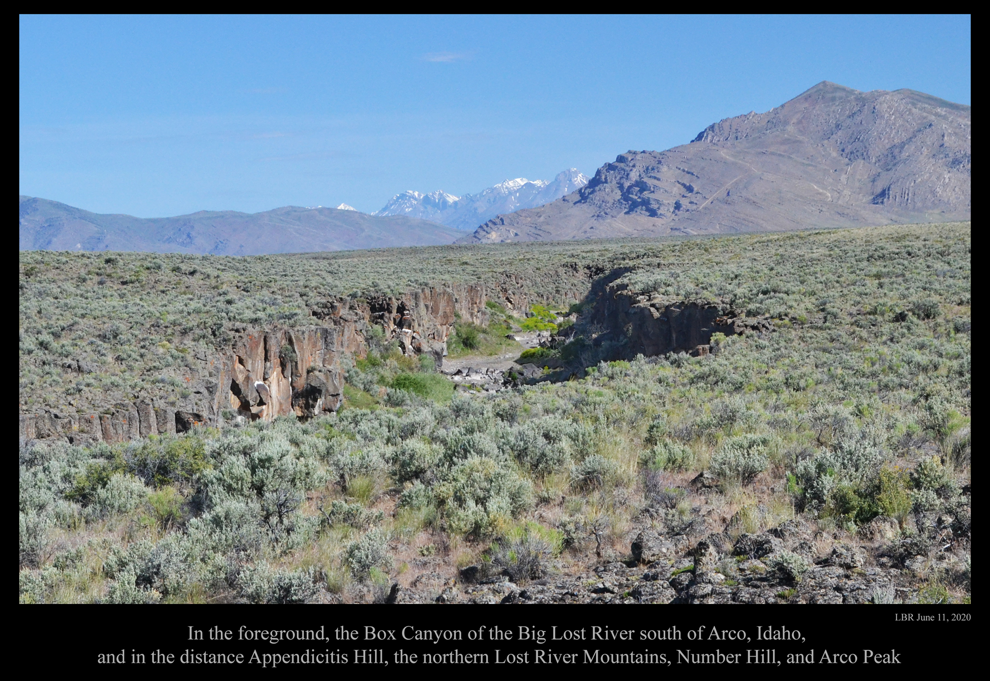
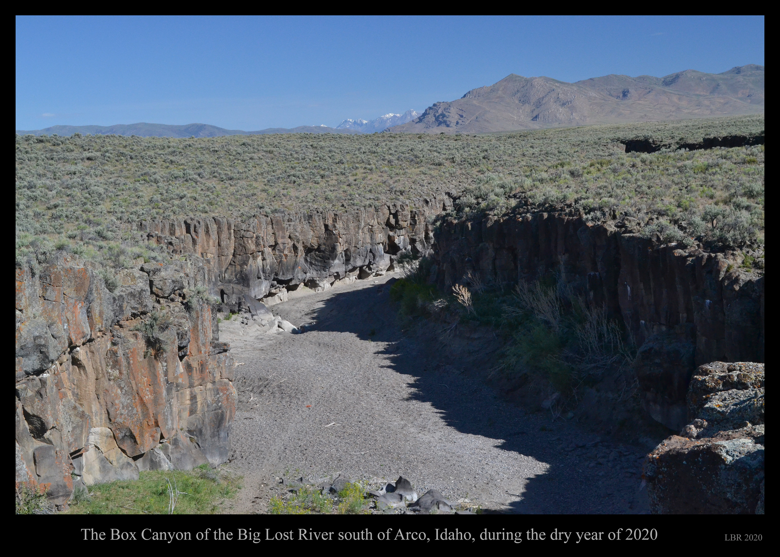
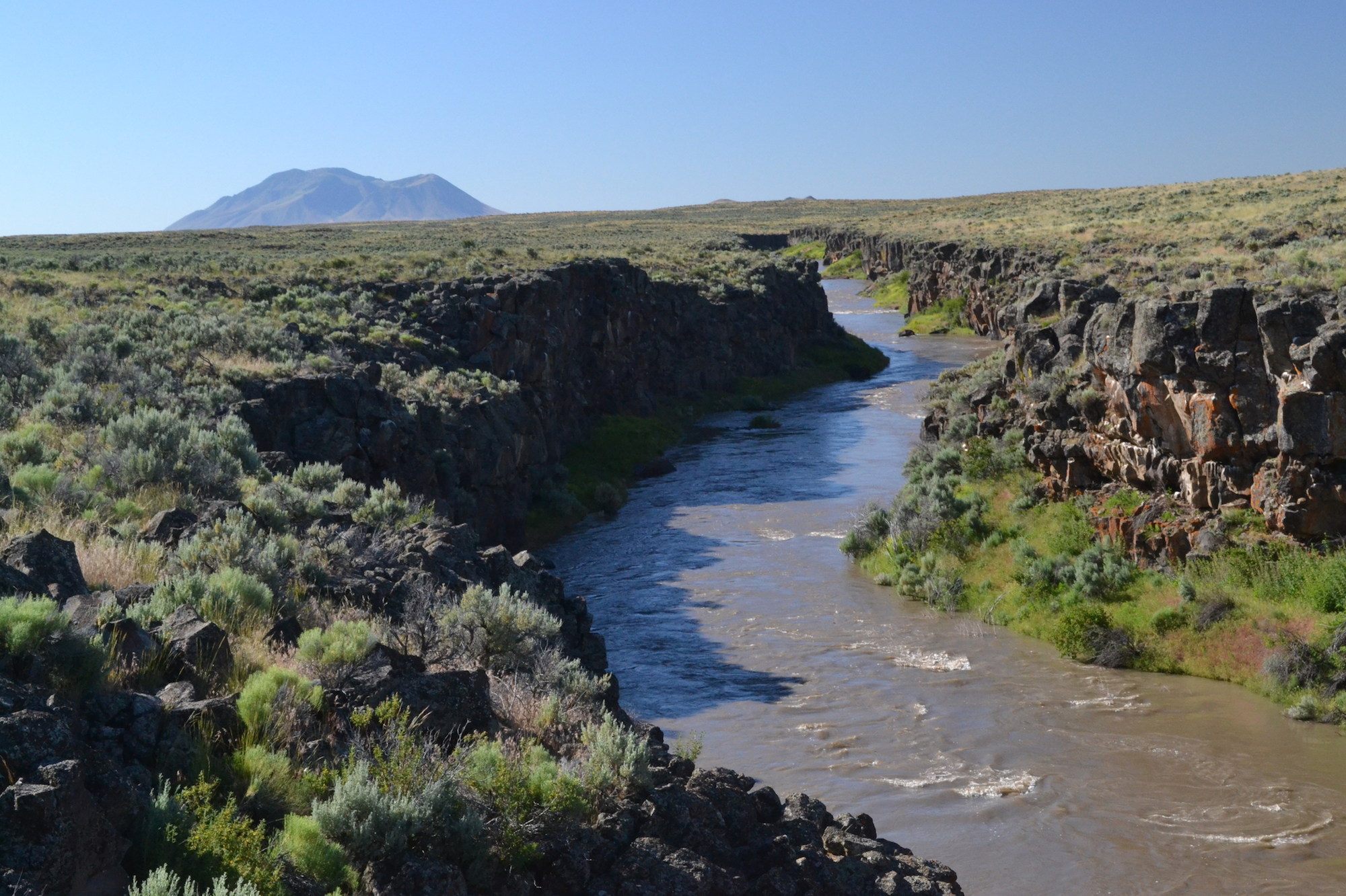
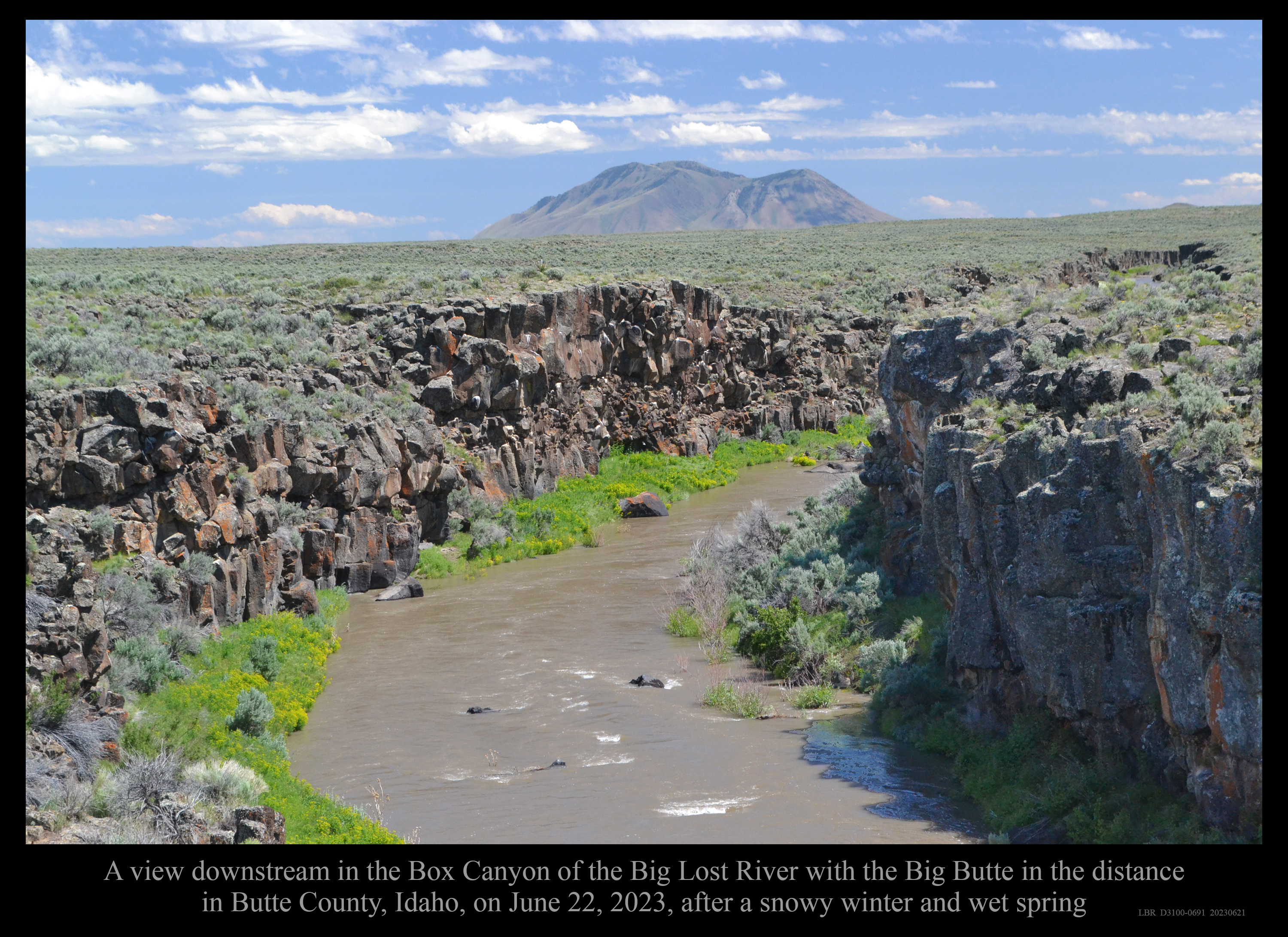
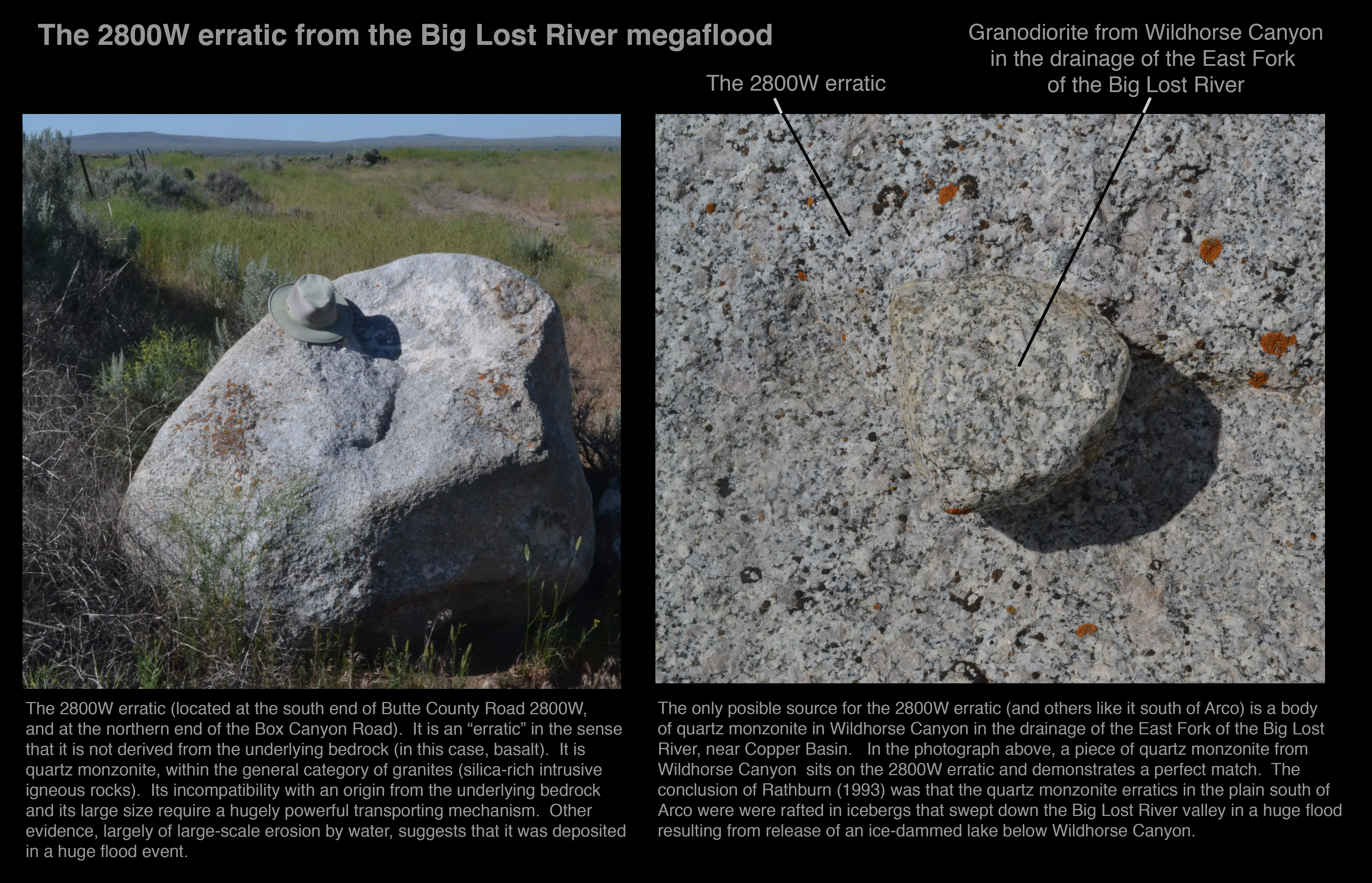
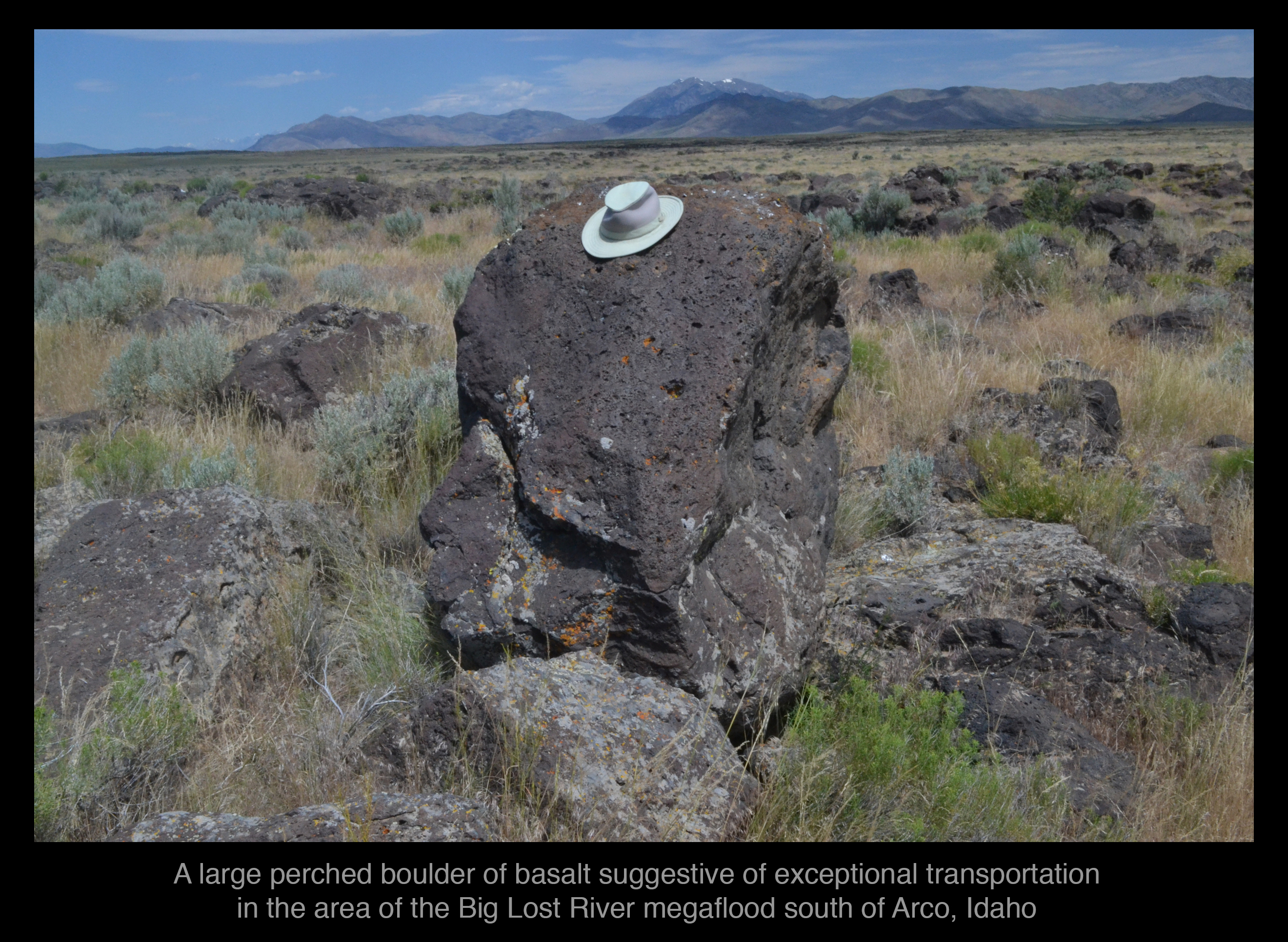
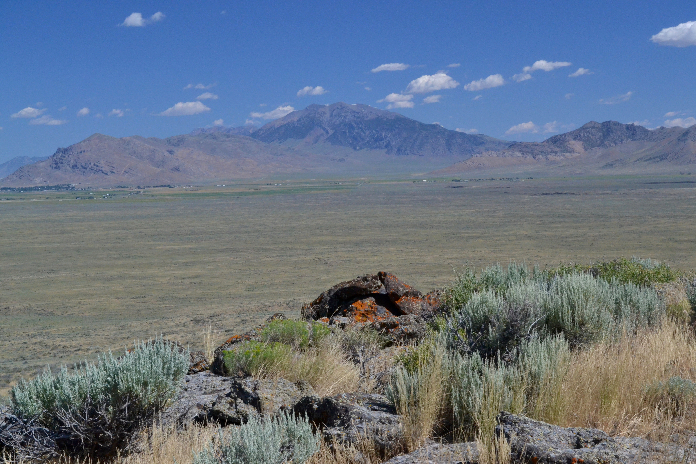
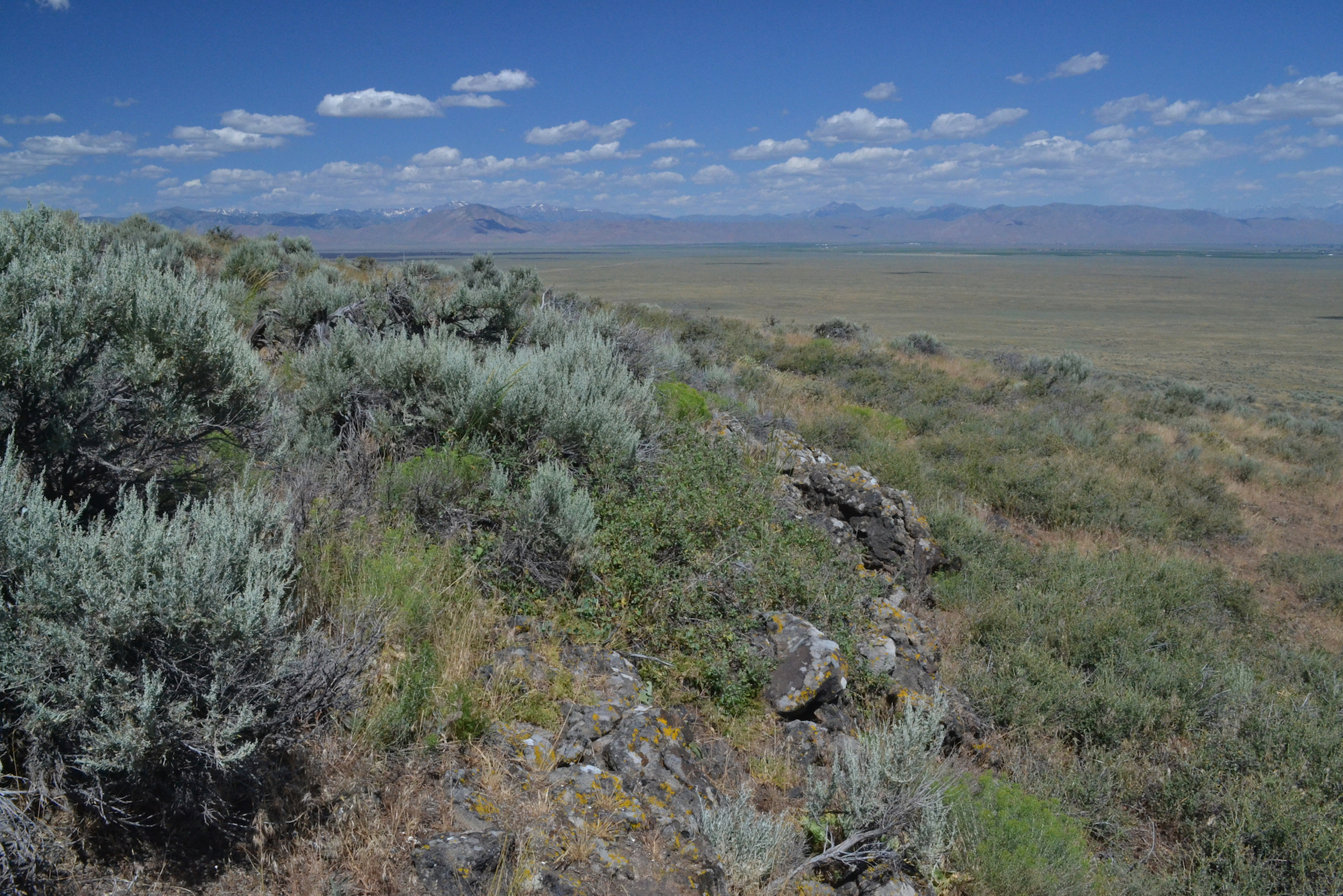
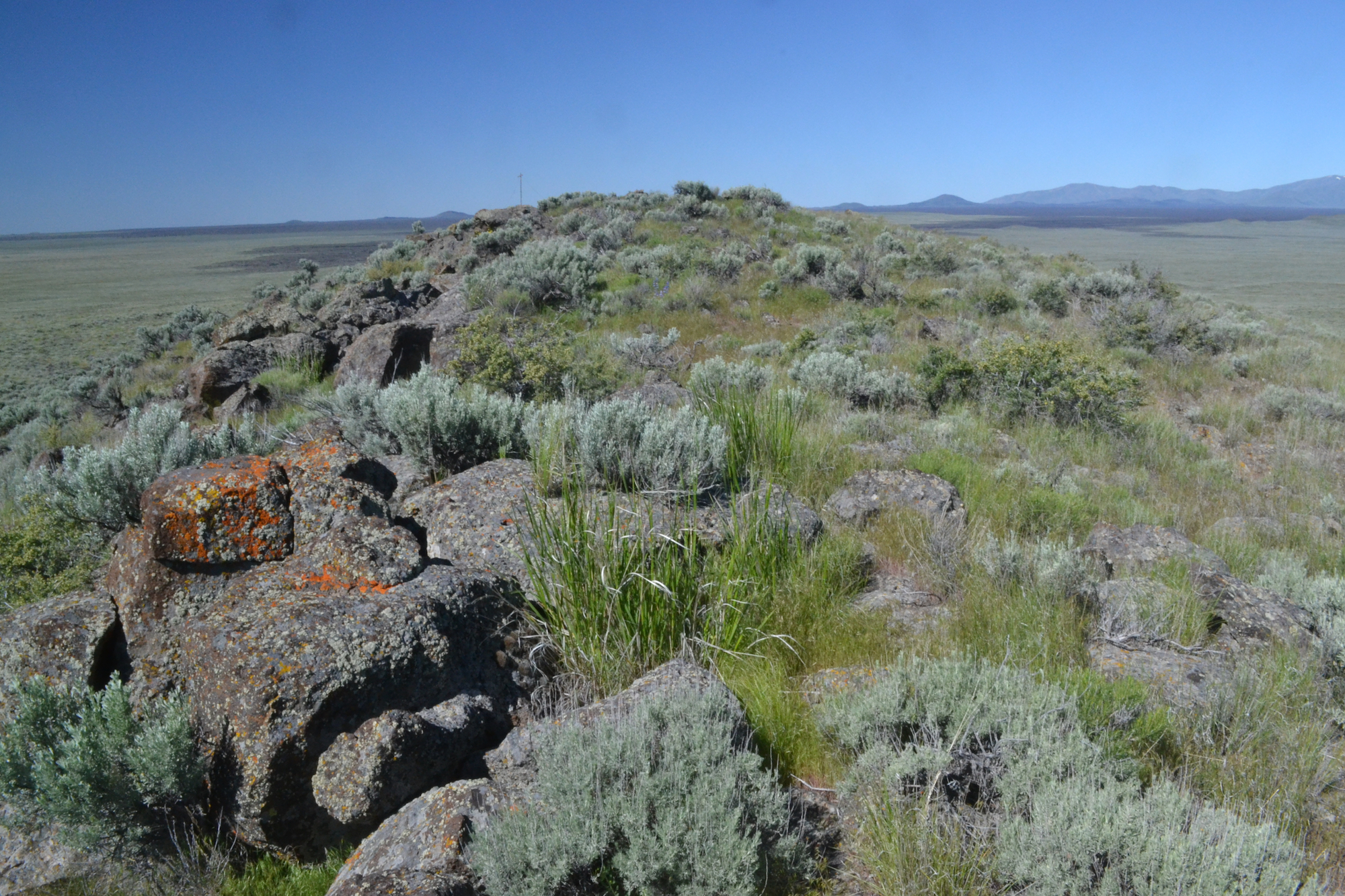
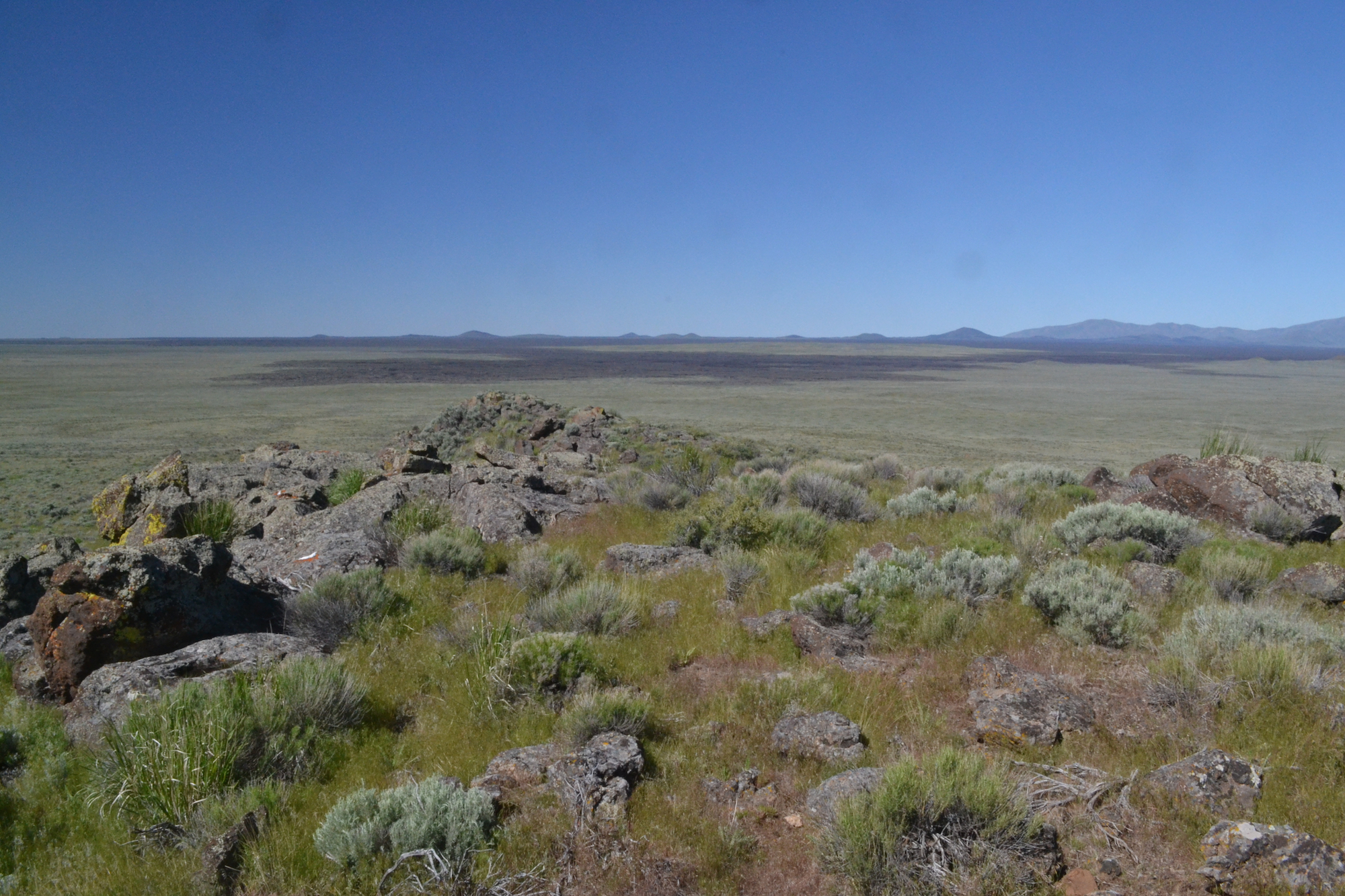
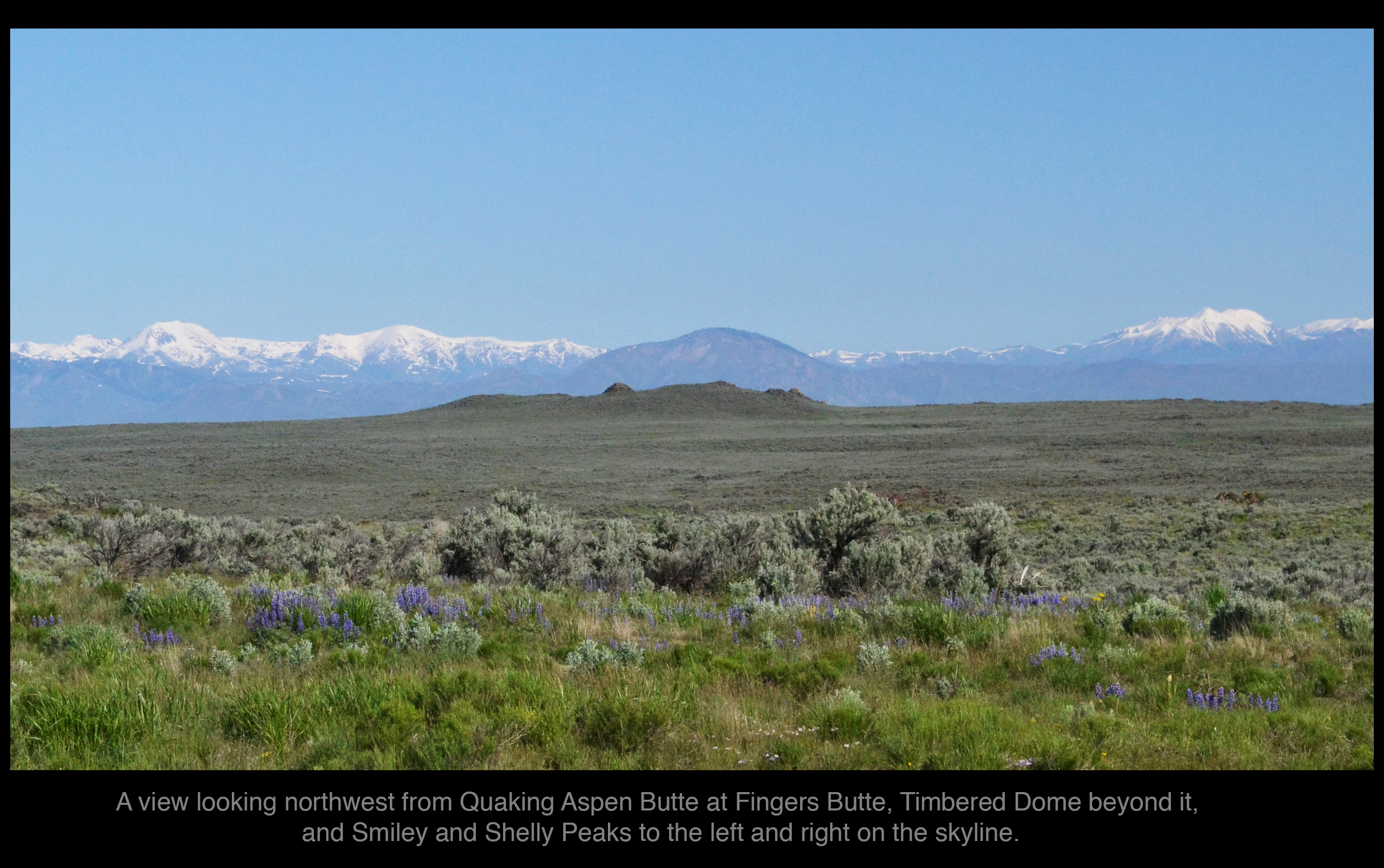
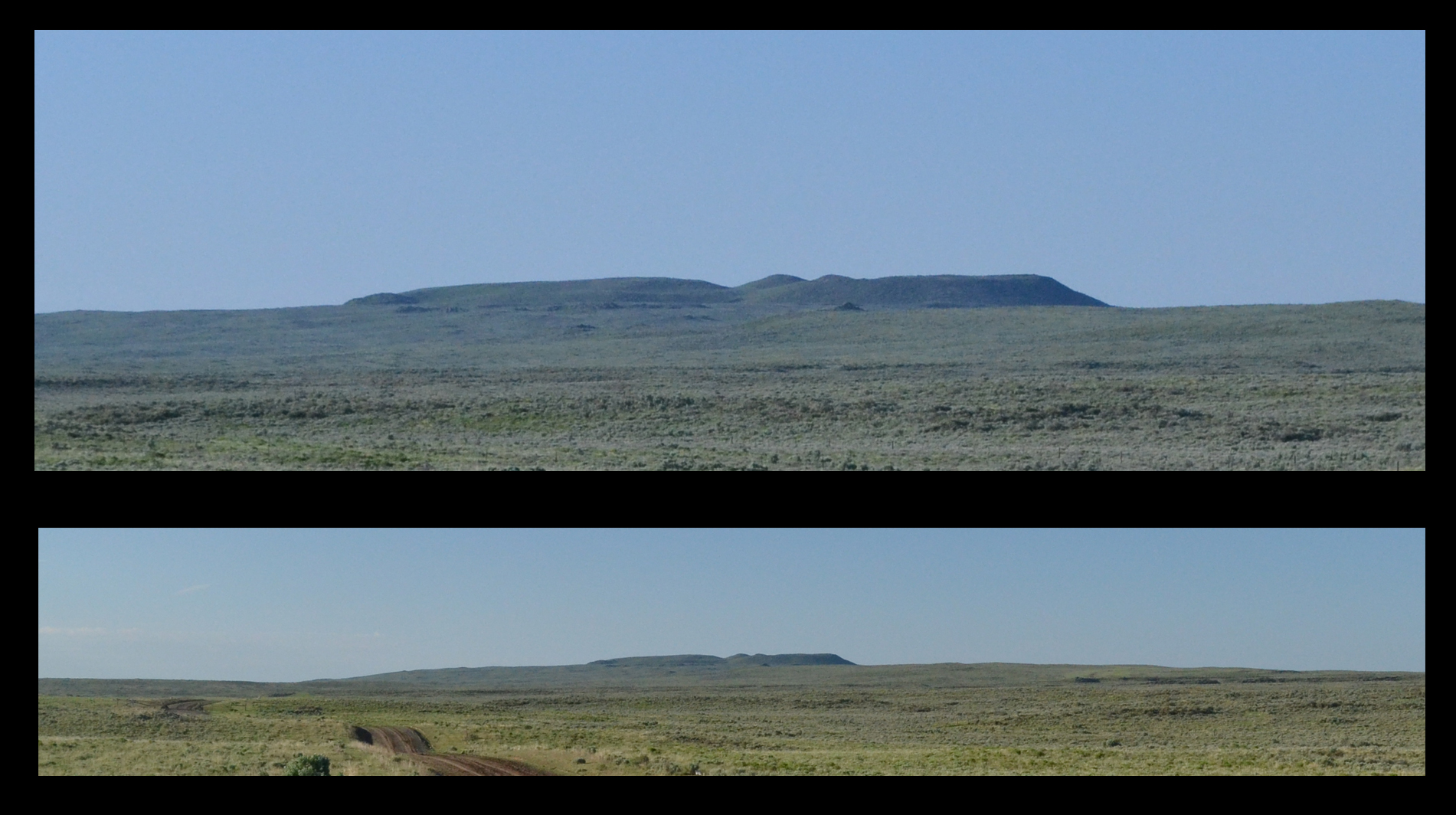
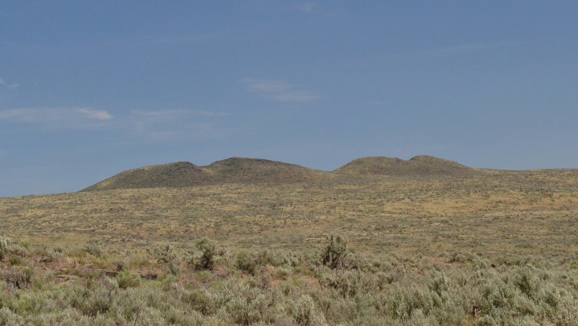
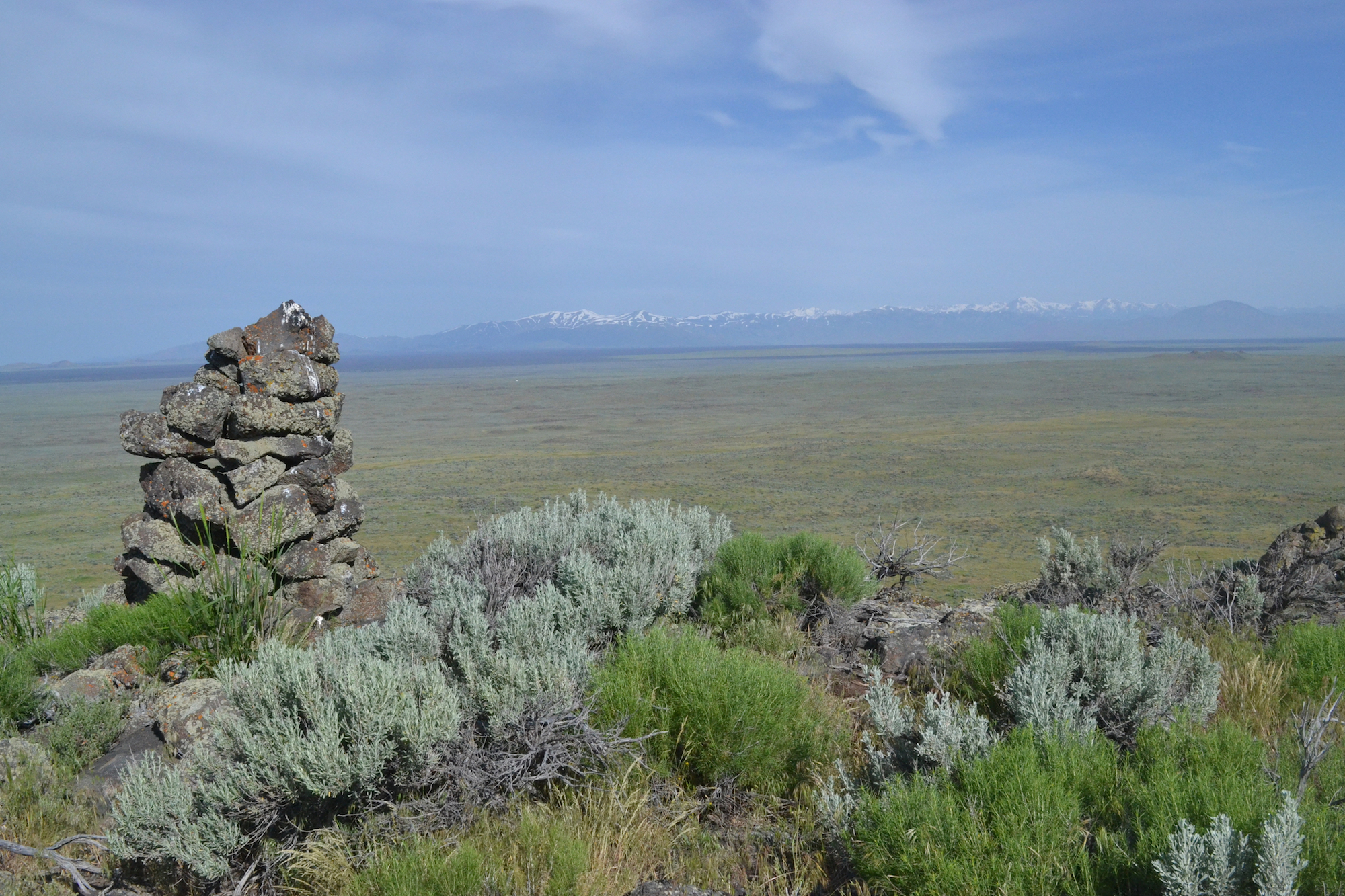
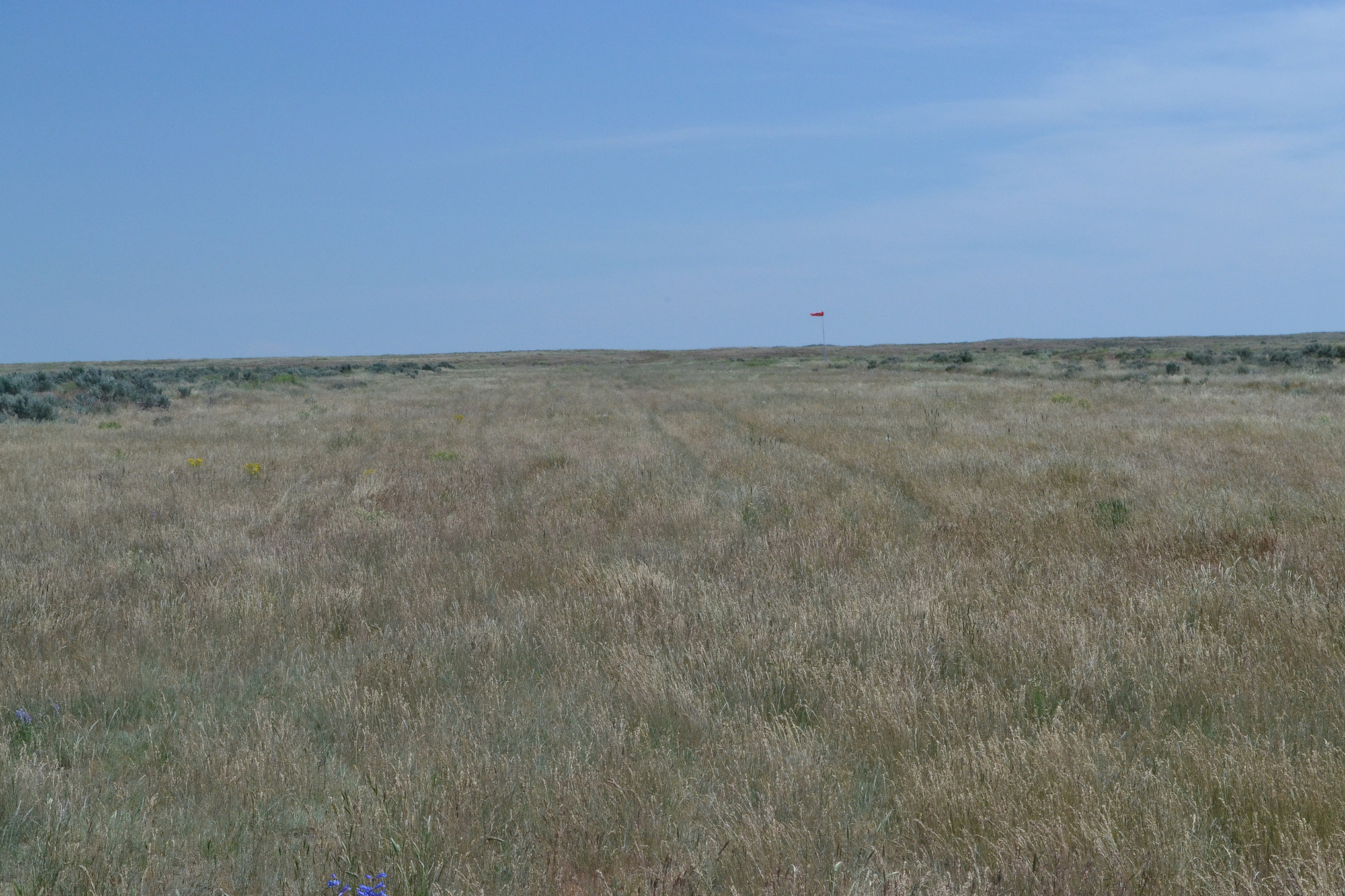
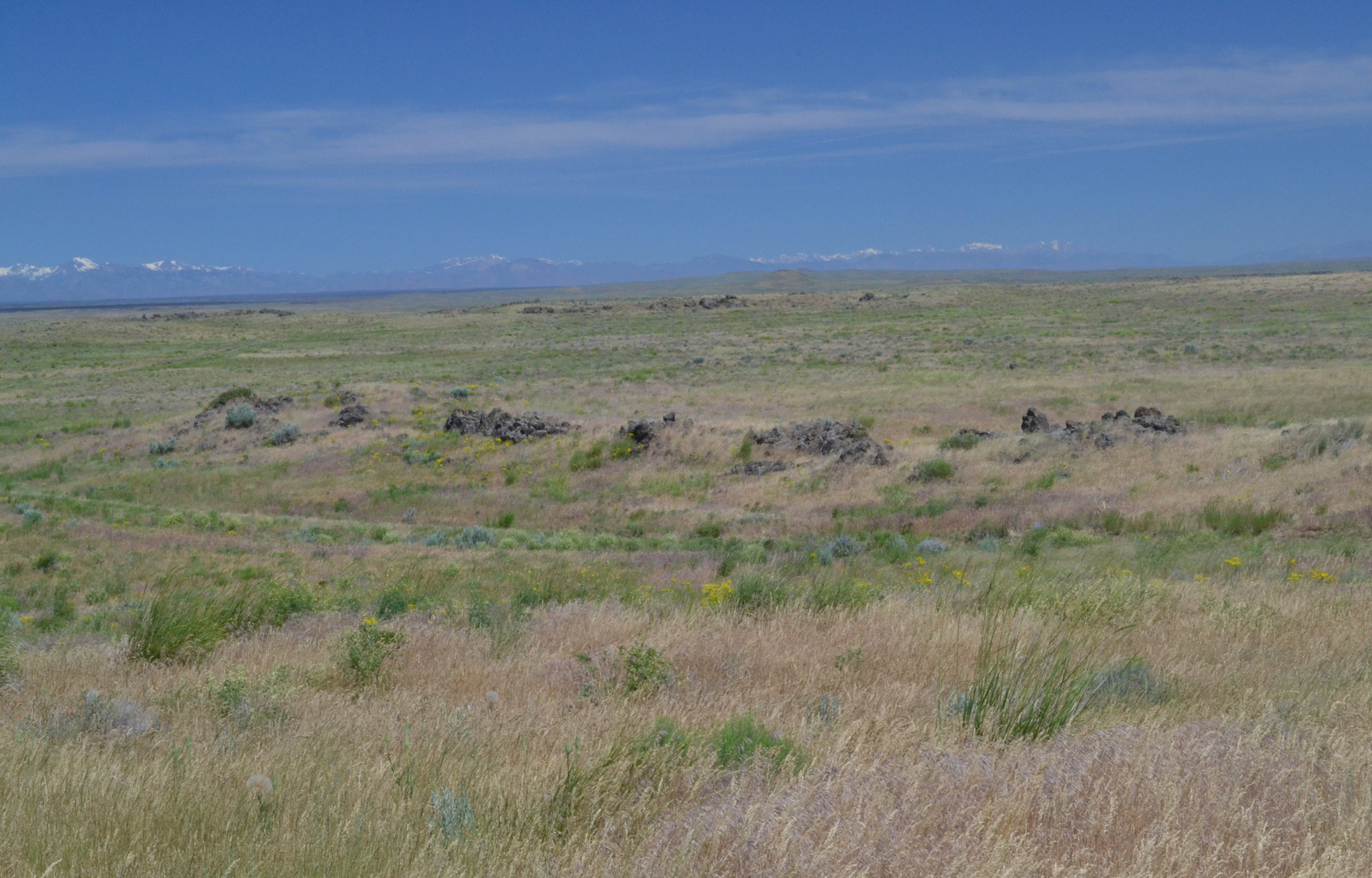
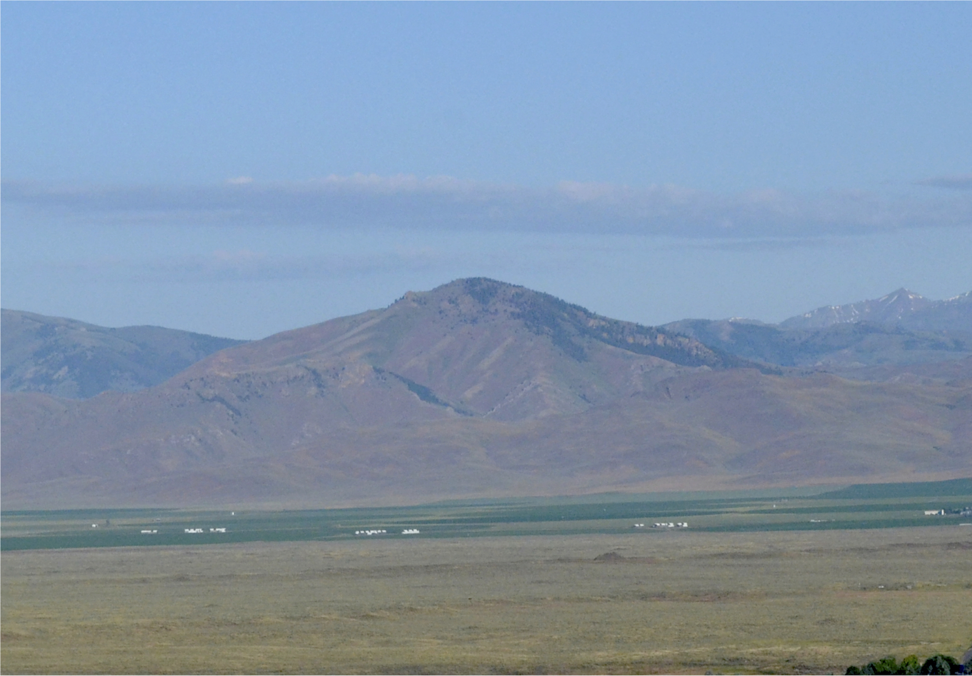
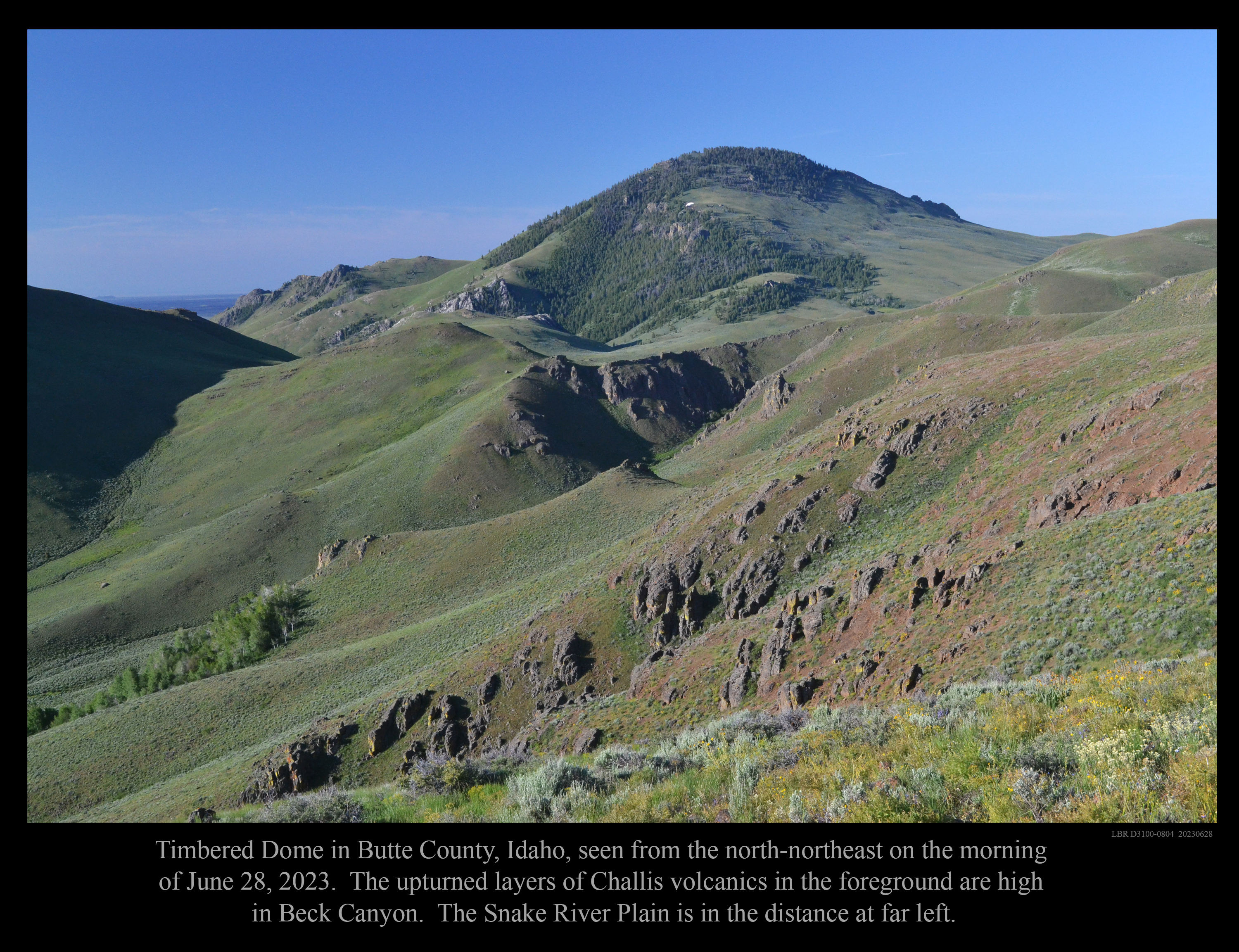
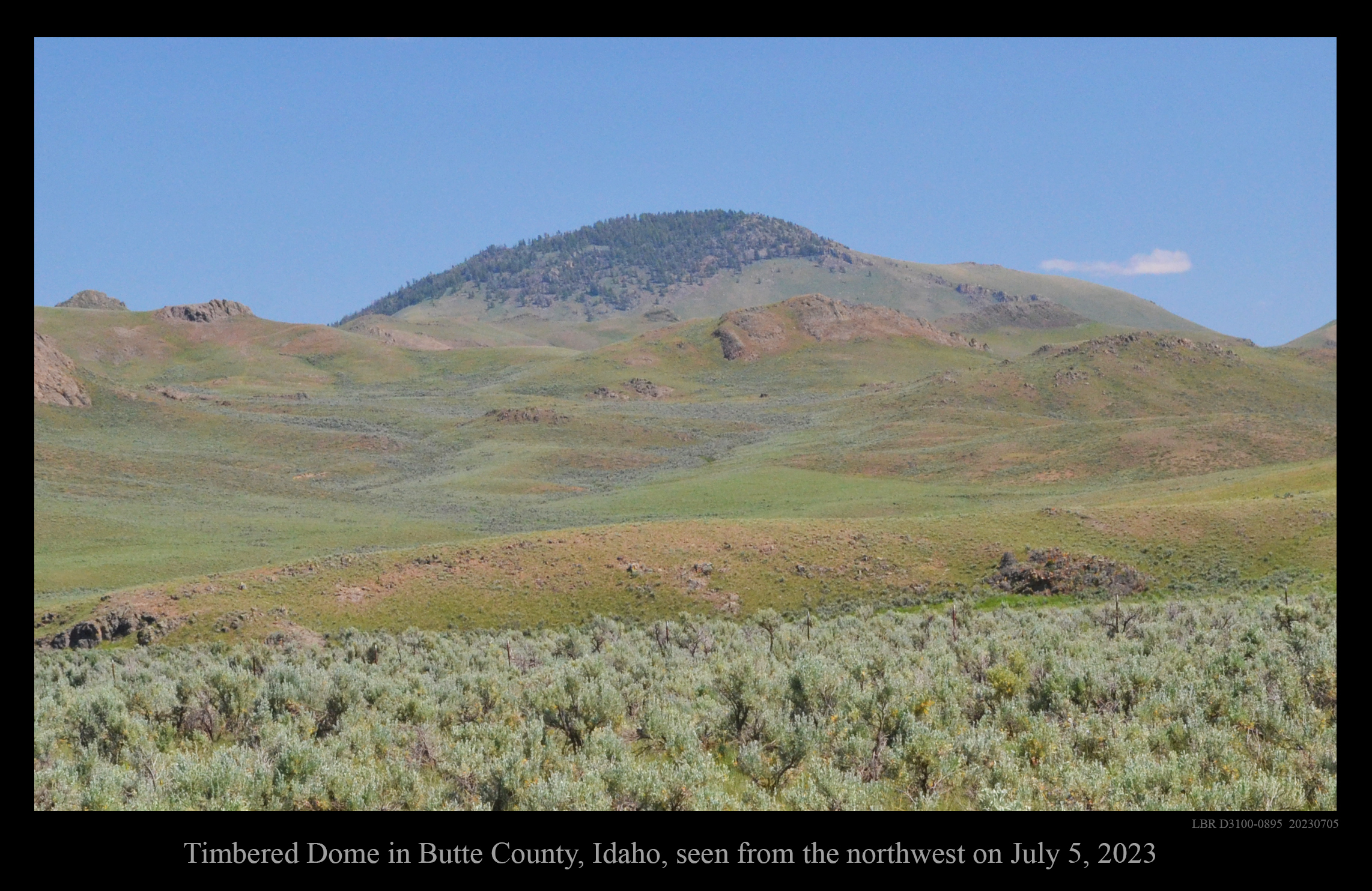
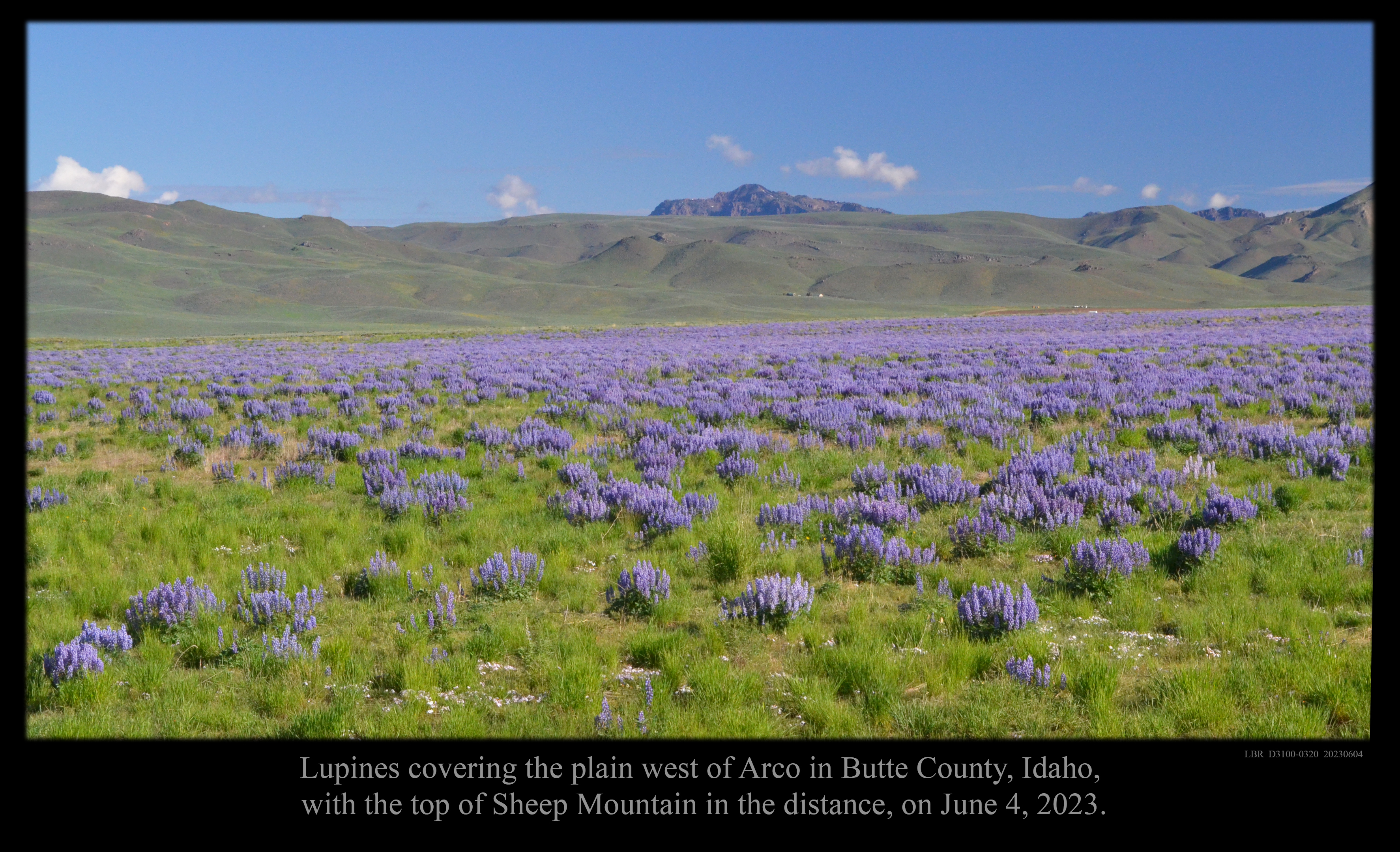
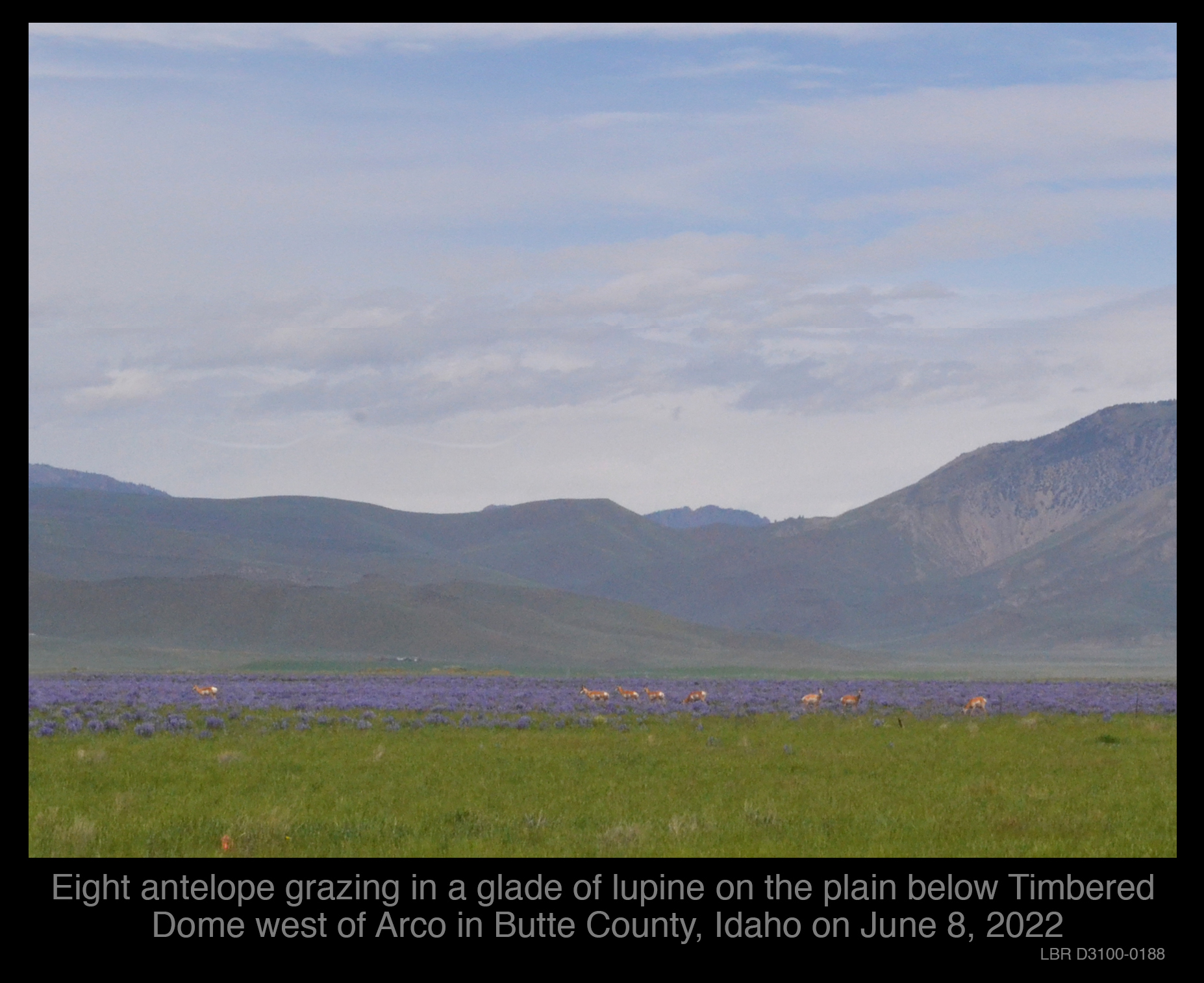
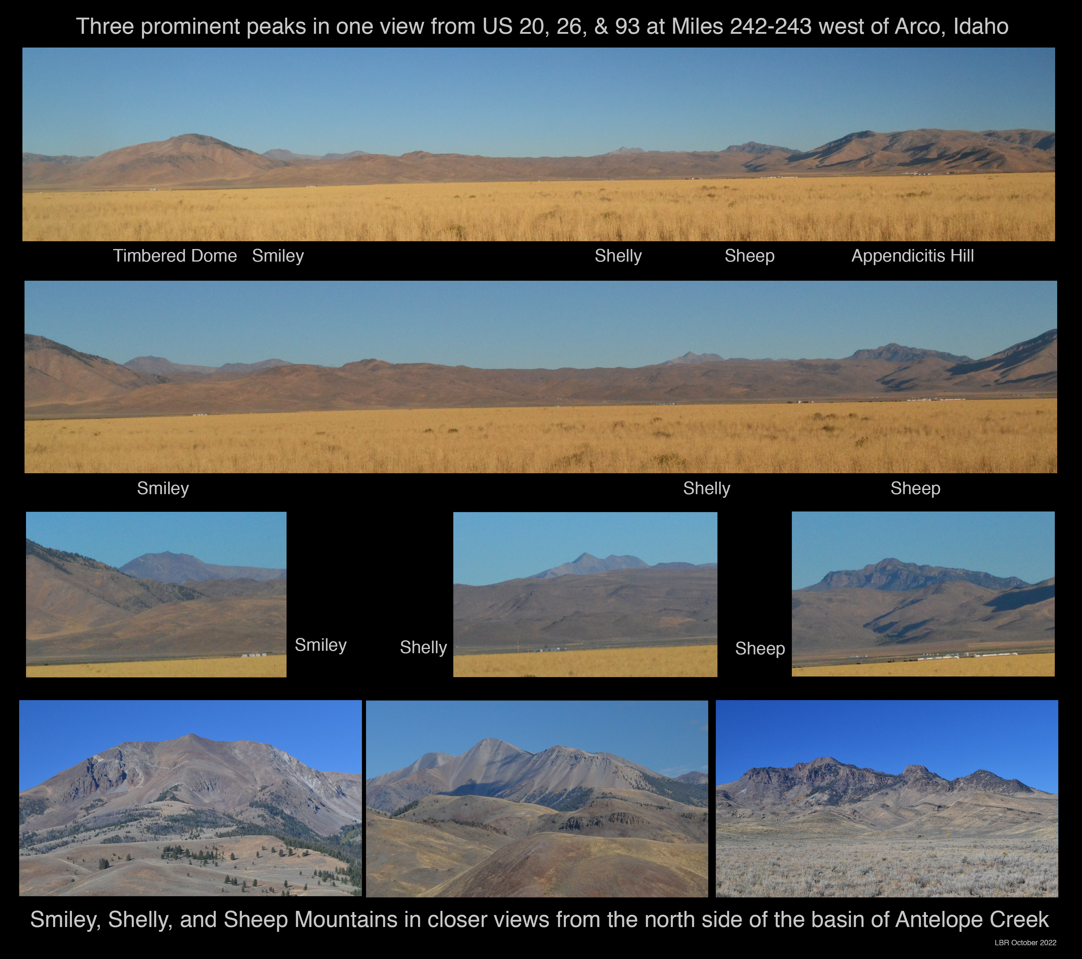
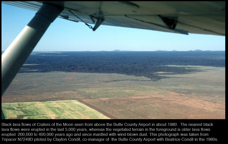
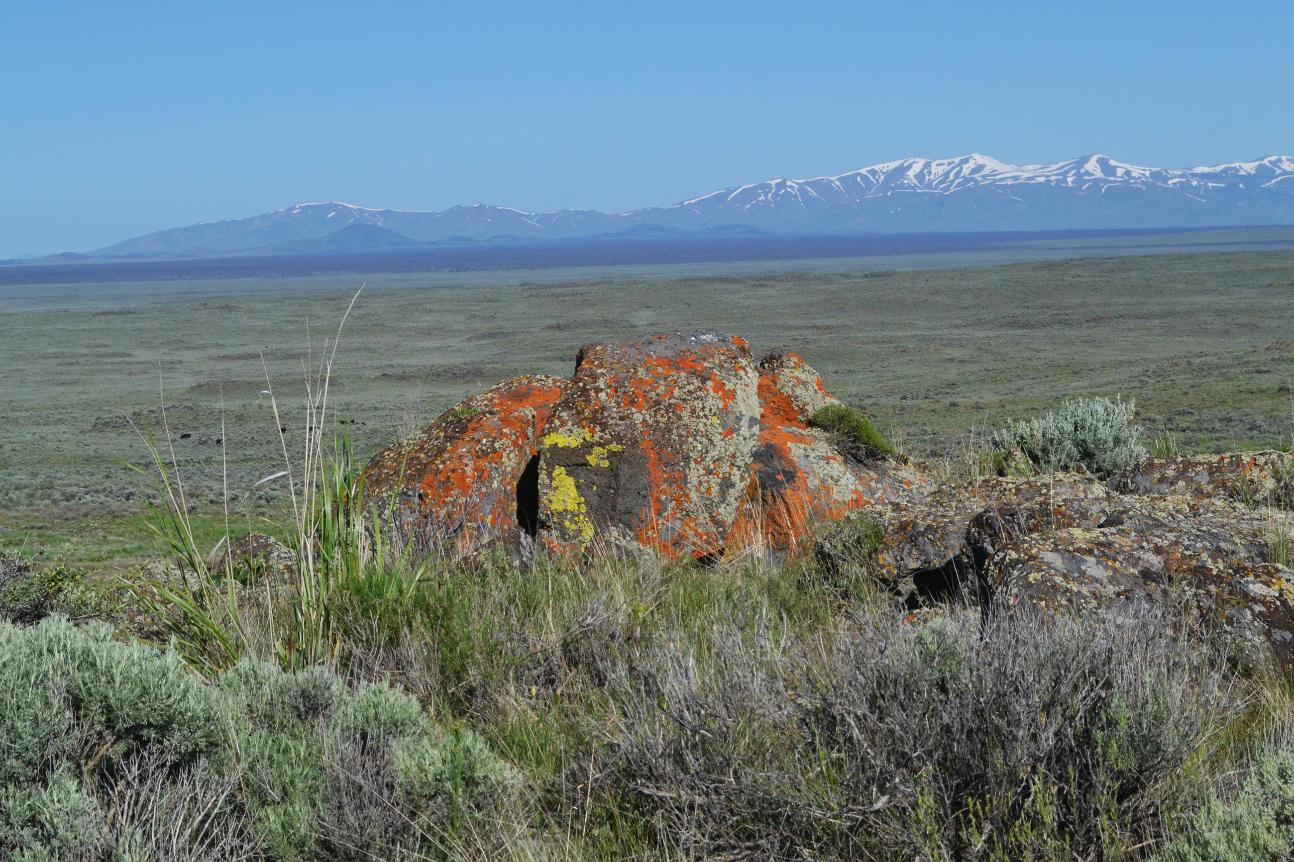
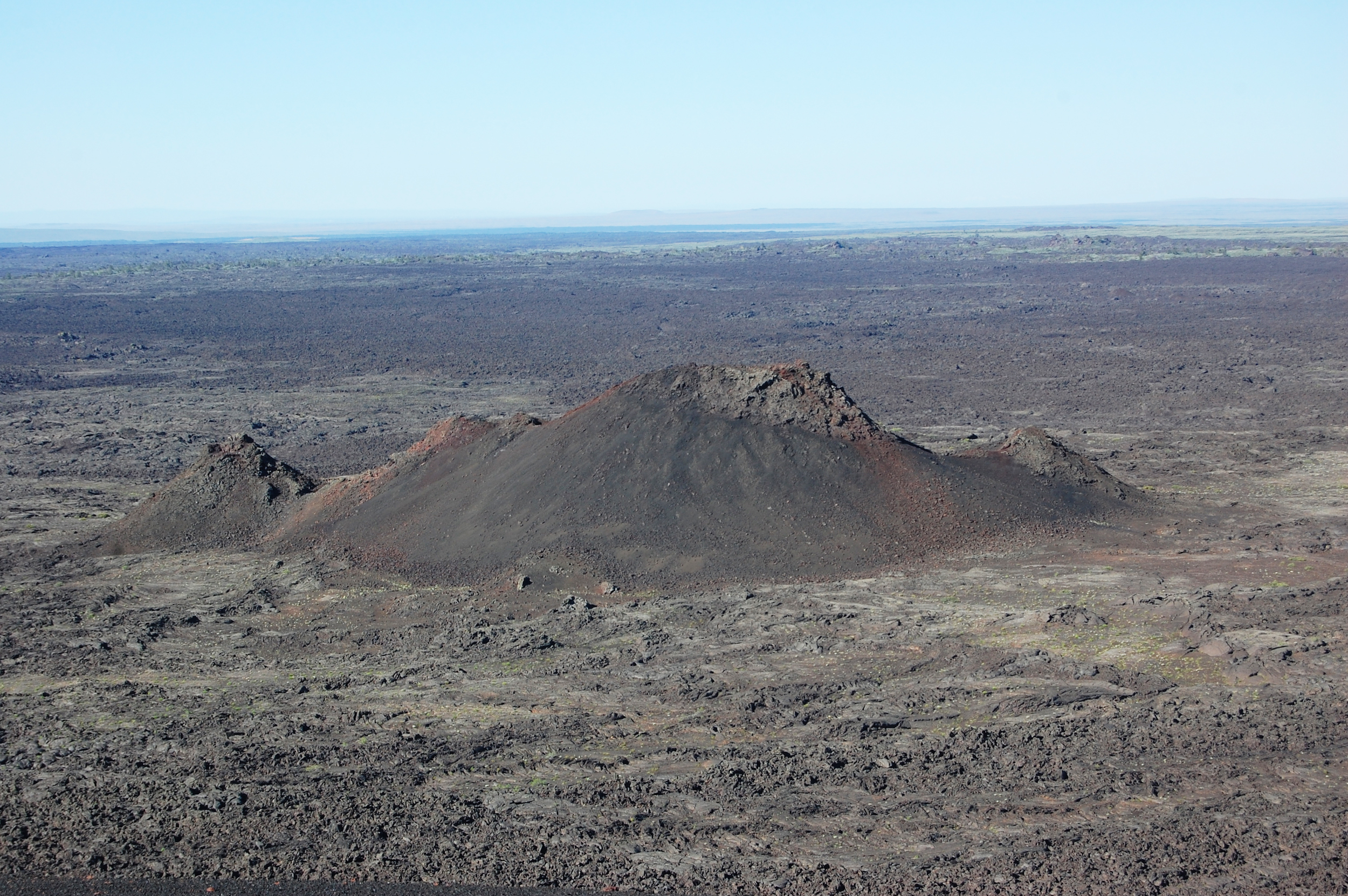
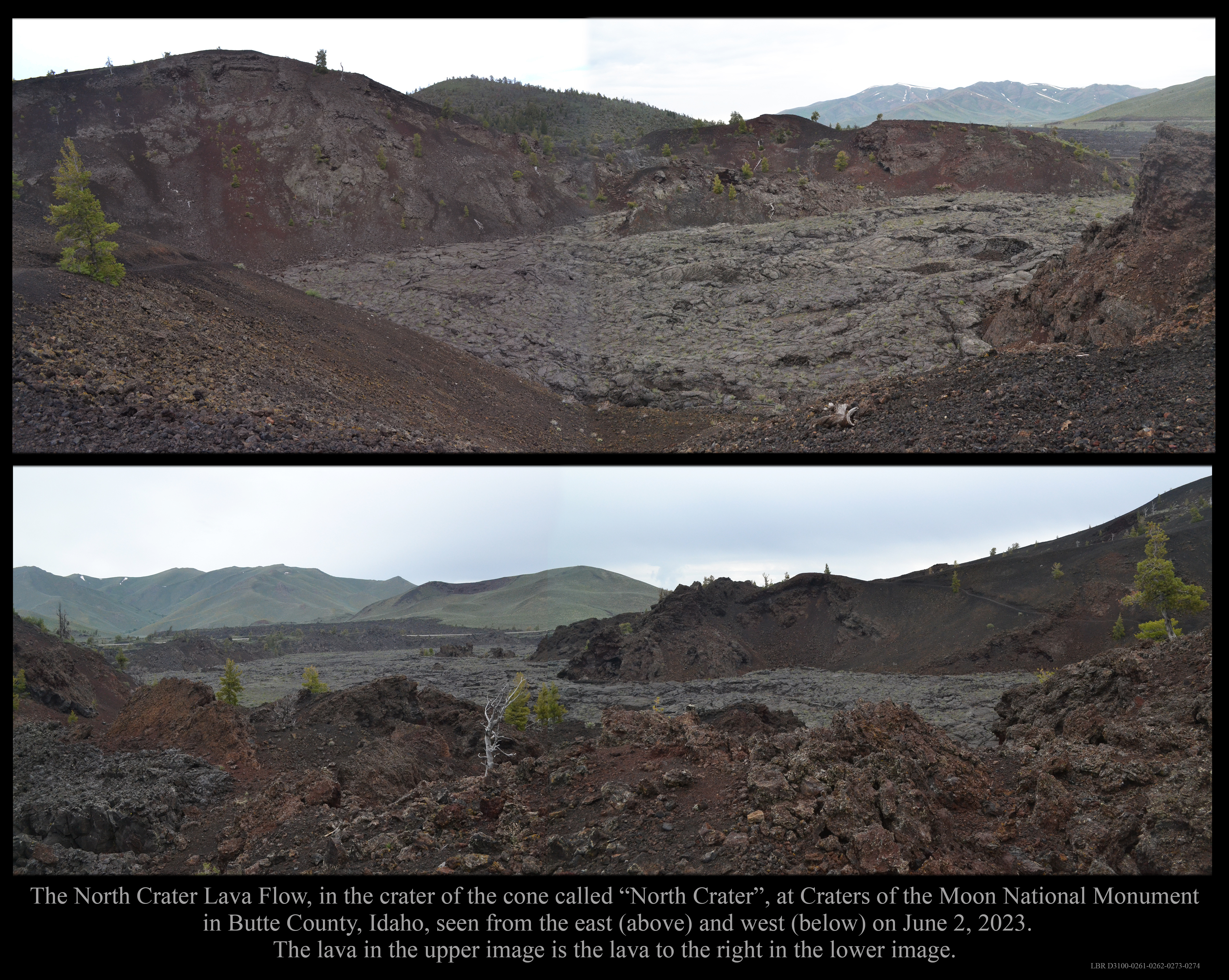
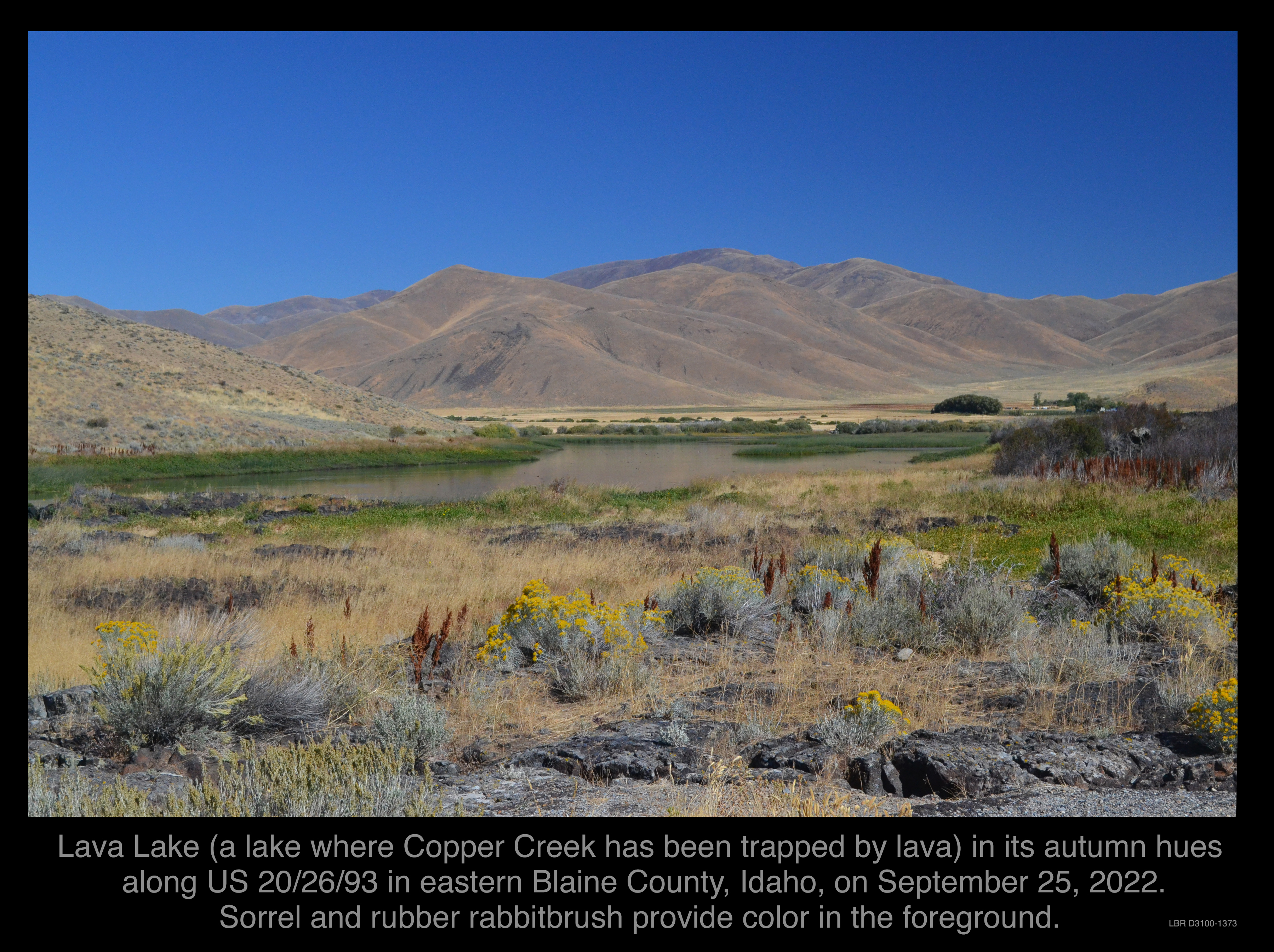
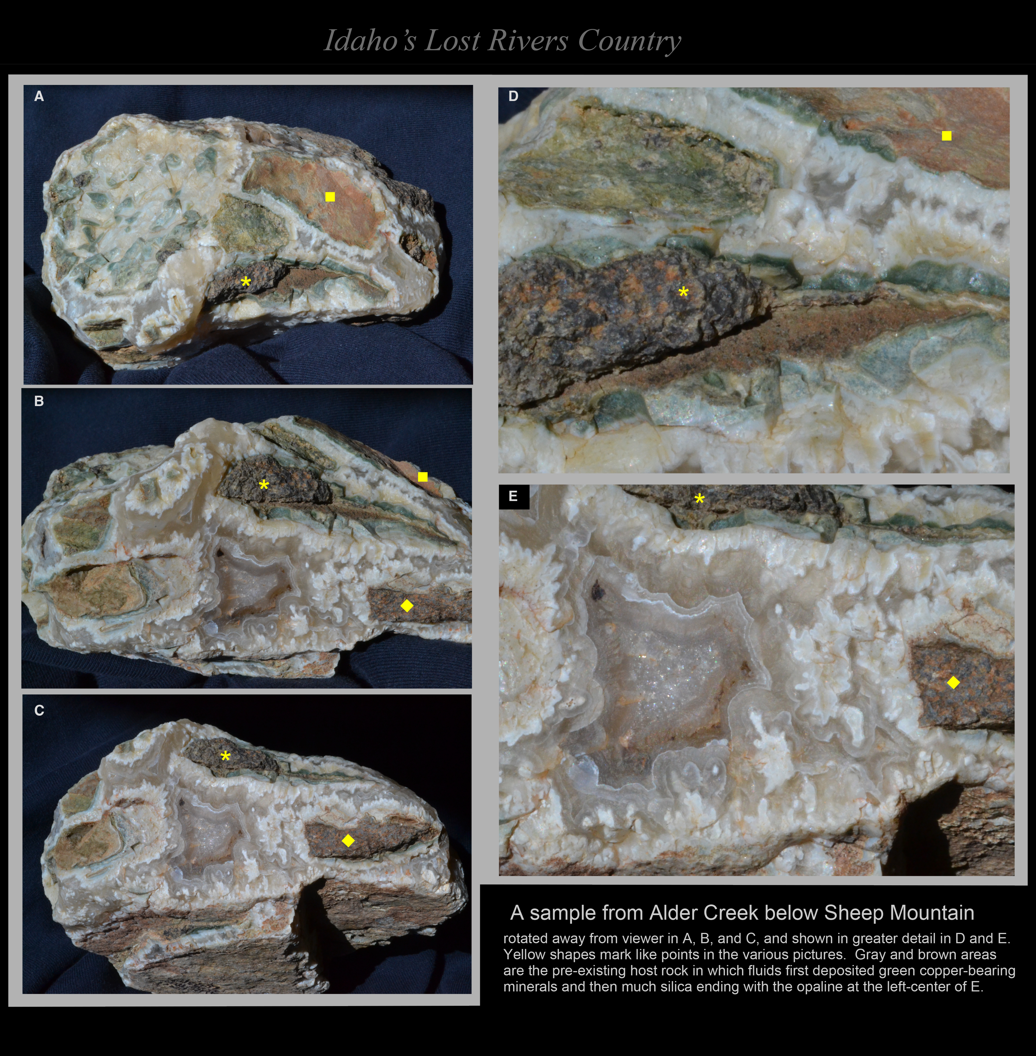
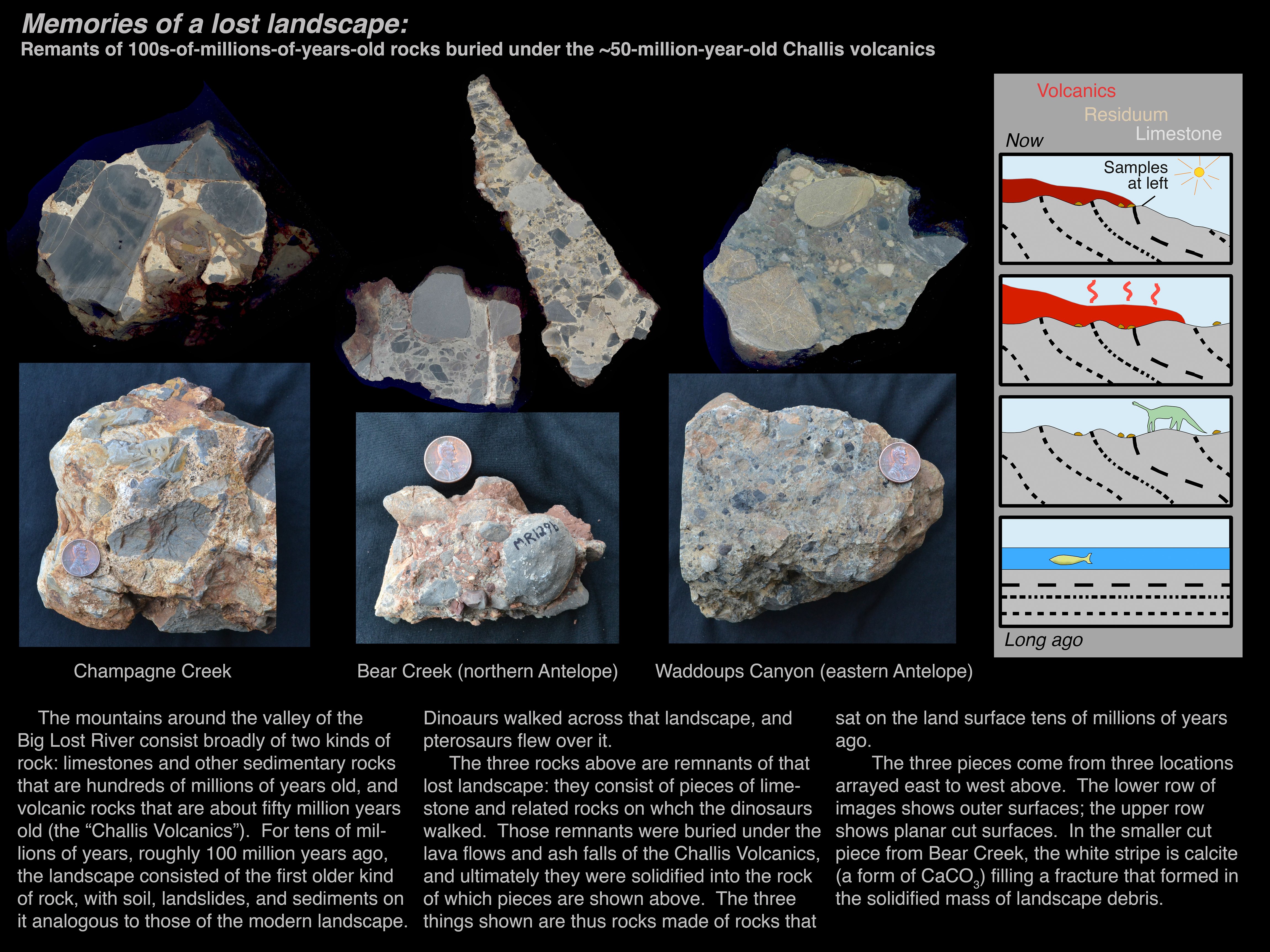
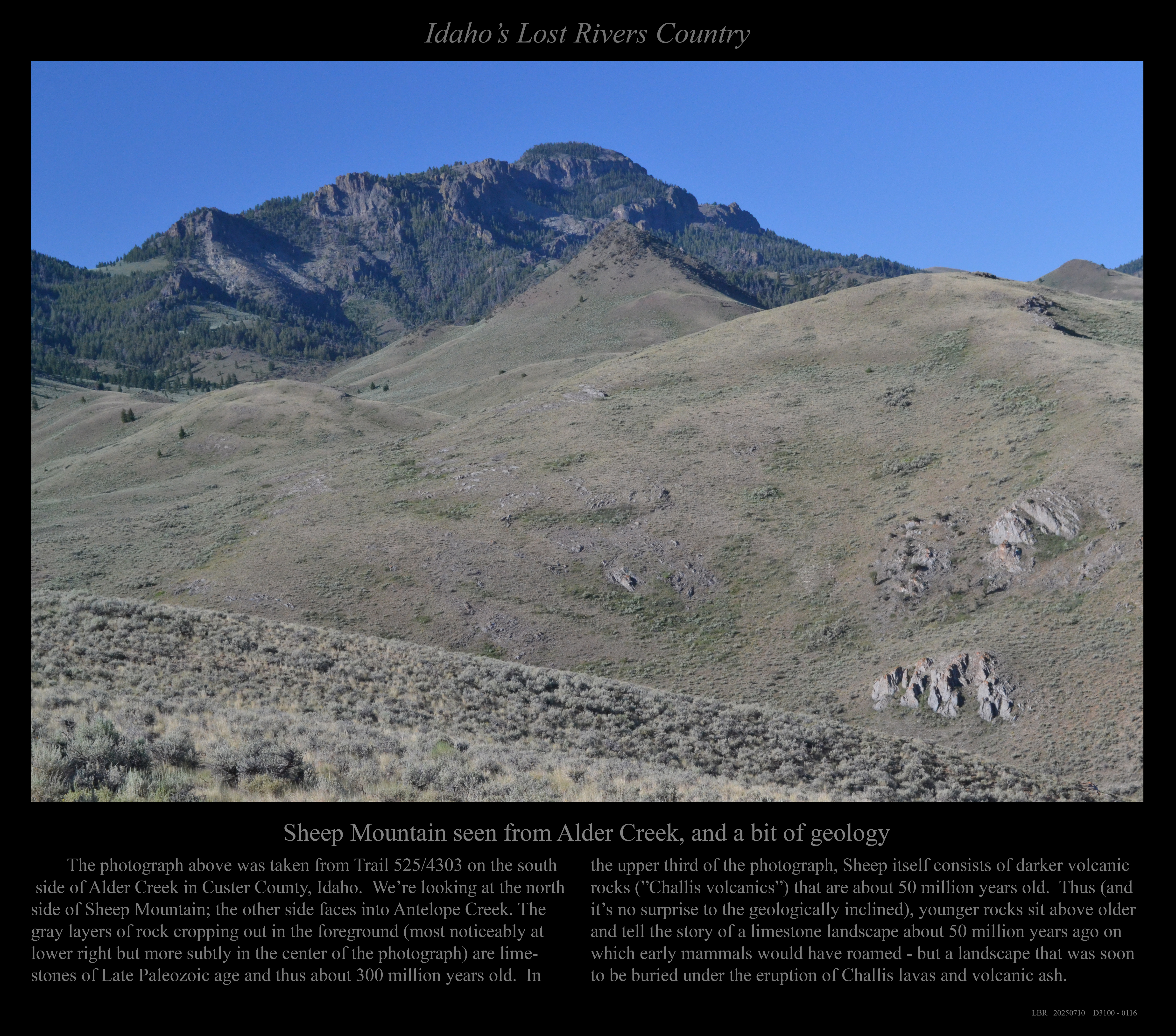
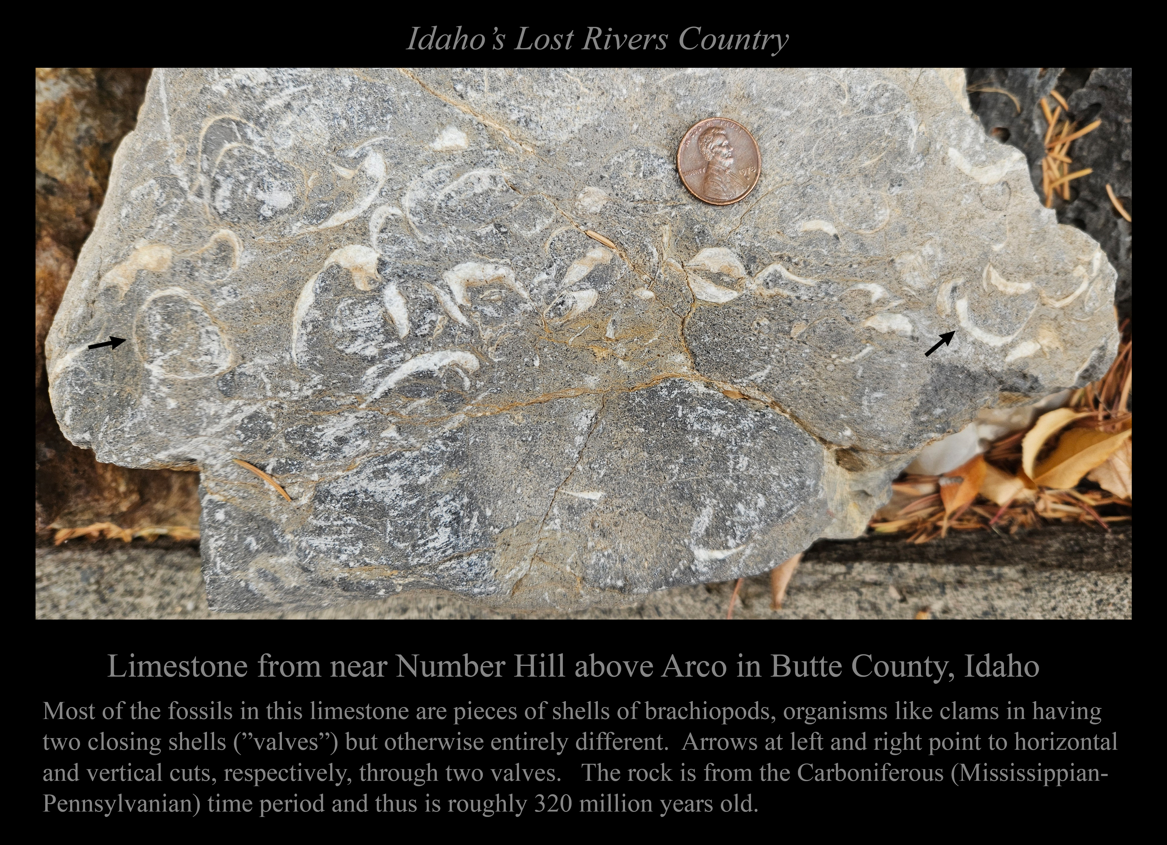
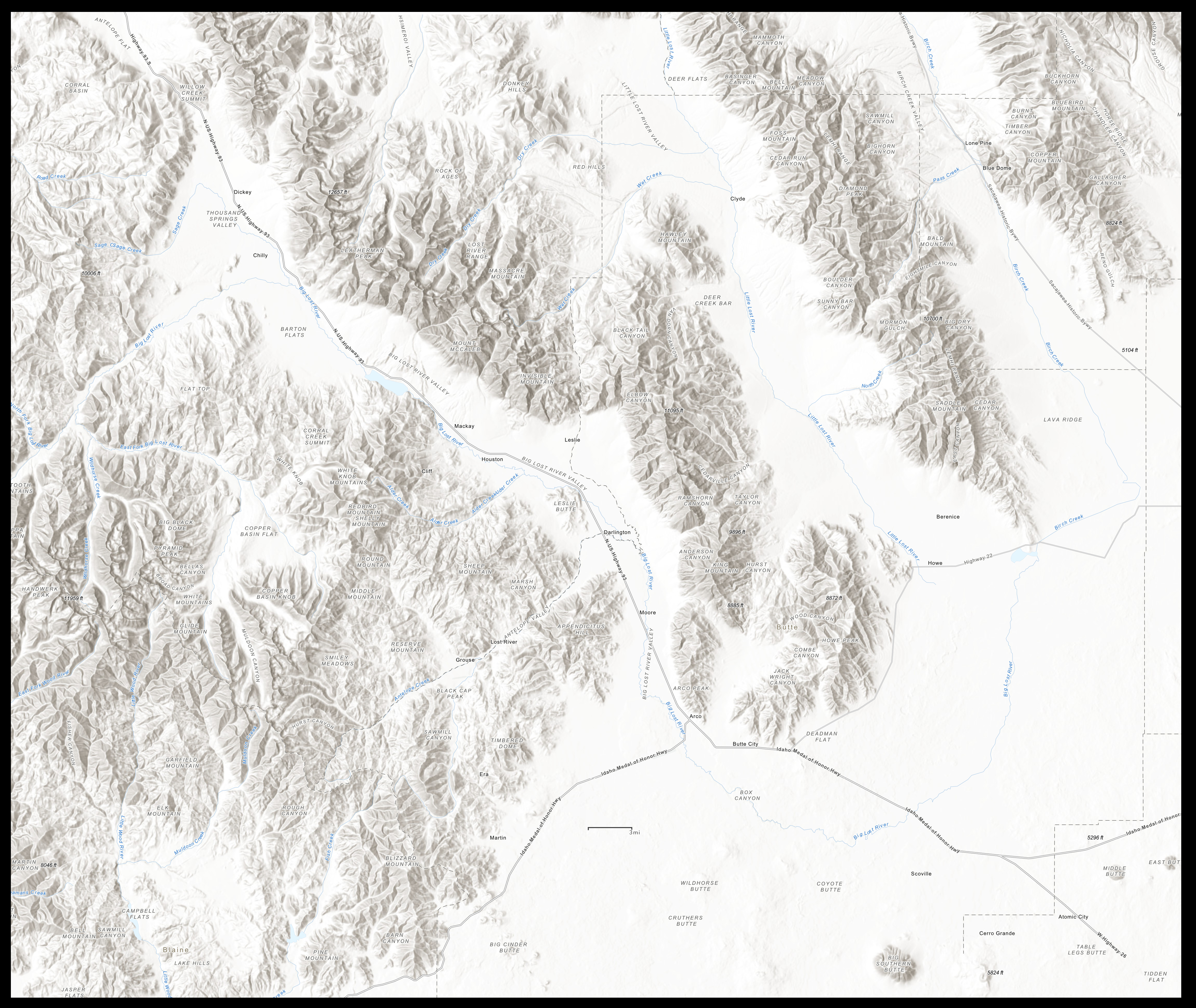
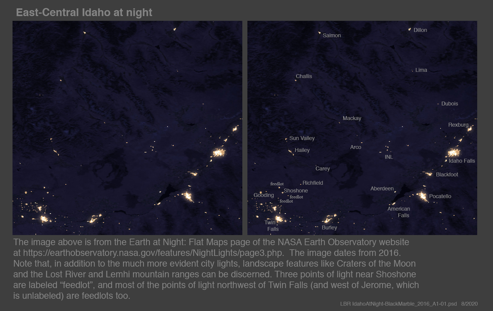
Photographs of the landscape in the Big Lost River Valley and the Arco Desert, in very rough order from north to south. Unless otherwise noted, all images are less than 5 MB. There is also a base map labeling some of the places mentioned. There are many pictures here; some favorites are marked with -o)+(o- . < < < < < < < < THE HEADWATERS REGION > > > > > > > > In the headwaters region, Part I: Copper Basin and the East Fork of the Big Lost River The peaks of the Wildhorse Creek drainage and Copper Basin seen from the flanks of Borah. The western White Knob Mountains seen from Copper Basin. The Swamp, the headwaters of the East Fork, under the White Knobs. The meandering East Fork below its confluence with Cabin Creek. The northern Lost River Mountains seen from Copper Basin. A moose crossing Star Hope Creek. Views up Star Hope Creek in autumn. A view west from the Burma Road across Copper Basin to Standhope Peak. Three views of glacially sculpted valleys in western Copper Basin. Bellas Canyon and Diamond Peak in autumn color. The tree-lined northwest-flowing East Fork of the Big Lost River in Copper Basin. Going up to Bellas Lake above Copper Basin: A meadow on the trail to Bellas Lake. The stream feeding Bellas Lake. The spring from which the stream flows to feed Bellas Lake. The rock glacier from which the spring emerges just above Bellas Lake. In the headwaters region, Part II: Going up Fall Creek The falls of Fall Creek, a tributary to Wildhorse Creek. A cascade higher in Fall Creek. Boulders higher in Fall Creek Canyon. In the headwaters region, Part III: Going up Wildhorse Canyon Wildhorse Canyon from the Copper Basin Road bridge far downstream. A meandering Wildhorse Creek and steep Old Hyndman Peak, seen from sagebrush country well downstream. Wildhorse Creek meandering through marshes, and Old Hyndman peaking over a ridge, seen midway up the canyon, in 2020 and 2021. The flat valley floor and U-shaped canyon of Wildhorse. The glacial U-shaped canyon of Wildhorse. A beaver dam adjacent Wildhorse Creek. A rushing tumbling Wildhorse Creek and Hyndman Peak seen higher up. -o)+(o- The headwaters of Wildhorse Creek under Old Hyndman Peak. Old Hyndman and Hyndman Peaks and Duncan Ridge. In the headwaters region, Part IV: Going up Kane Creek to Devil's Bedstead etc. A view looking west across Summit Creek and up Kane Creek at Devil's Bedstead. Devil's Bedstead from the right fork of Kane Creek, on the Summit Creek Trail. Glacial features high in the canyon of Kane Creek. In the headwaters region, Part V: Coming down the valley of Summit Creek (the middle fork of the Big Lost River) Above Trail Creek Summit: A view up the canyon of Summit Creek, above Trail Creek Summit. A view of Summit Creek looking downstream. A rock collection from Summit Creek above Trail Creek Summit. A meadow in the valley of Summit Creek above Trail Creek Summit. From Trail Creek Summit to Phi Kappa Creek: A granite hillside above the road to Big Fall Creek Lake. The canyon of Little Fall Creek in autumn color. An old mine in Phi Kappa Canyon. A view down Phi Kappa Canyon to Summit Creek. Below Phi Kappa Creek: A 2022 view of the same spot in the valley of Summit Creek - with beaver dams!. Summit Creek beaver dams in the same spot in late 2024. Beaver marsh and sagebrush plain in the valley of Summit Creek. A view up Summit Creek in Autumn 2024. -o)+(o- A view looking across the North Fork and up the valley of Summit Creek (i.e., up Trail Creek Road). A view looking downstream at terraces of sediments in the valley of Summit Creek. Summit Creek (then the Lost River) on an 1897 map. In the headwaters region, Part VI: Coming down the North Fork of the Big Lost River Cirques and horns at the upper end of valley of the North Fork. -o)+(o- One of those cirques. A view up the North Fork canyon at Ryan Peak in the Boulder Mountains. A view farther up the North Fork canyon at peaks in the Boulder Mountains. A beaver pond in the North Fork. A view looking downstream at an un-dammed section of the North Fork. Local residents near the confluence of the North Fork and East Fork. The confluence of the North Fork and East Fork. Heavy traffic on Trail Creek Road. < < < < < < < < THE MAIN VALLEY OF THE BIG LOST RIVER > > > > > > > > Dickey Peak and the southernmost Pahsimerois The southern Pahsimeroi Mountains and Dickey Peak. Dickey Peak in the northernmost Lost River Mountains seen from the Borah Trail. A trail above Doublesprings Pass. The southern Pahsimerois and the northern Lost Rivers (and Dickey and Borah). The northern Big Lost River Mountains Horseshoe Peak south of Doublesprings Pass. Borah Peak seen from Willow Creek Summit in 2022. The northern Lost River Mountains from Willow Creek Summit in 2011. Two views of Borah Peak from the northwest and west. . . . . . and the same with a bit more snow. Borah Peak in the northern Lost River Mountains, seen from Corral Creek Summit . A view down the Borah Peak Trail. -o)+(o- The northern Lost River Mountains seen from the Burma Road. White Cap, Leatherman, Badrock and Church in morning light and autumn color. Leatherman Peak, Badrock Peak, and Mount Church in the northern Lost River Mountains. Views (1) up and (2) out of the canyon of Lone Cedar Creek. Lost River Peak in the northern Lost River Mountains. The northern Lost Rivers in their longest view (Borah to McCaleb and more). The glaciated alpine landscape of the northern Lost River Mountains. The northern Lost River Mountains from well to the south. The northern Big Lost River Valley A view from above Willow Creek Summit in 2019: the Lost Rivers, White Knobs, and Pioneers. The Chilly Buttes and the northeast-flowing stretch of the Big Lost River. The White Knobs and the Pioneer Mountains seen from Willow Creek Summit in 2011. -o)+(o- The view west from Double Springs Pass of the Chilly Buttes and the Pioneer Mountains. One of the last vestiges of Whiskey Springs. The Chilly Slough and Thousand Springs. The Mackay Reservoir and full pool and when drained for dam repair. The Big Lost River resuming its travels just below the Mackay Dam. The Big Lost River in the canyon just below the Mackay Dam. The Lost Rivers from the Shay Grade above Mackay. The White Knobs and the Mackay Mining District The White Knob Mountains seen from across the valley All of the Whiteknob Mountains, seen from Houston Road near Leslie . Shelly and the White Knobs seen from near Smiley Peak. The White Knob Mountains seen from four directions A rock collection from the Mackay mining area The trestle of the Mackay mining railway. A Shay engine and train on the trestle. Cabins at the old Mackay mine. Chimney Gulch An adit and cabin in Chimney Gulch. The Chimney Gulch cabin from above, and the Lost Rivers in the distance. The north side of Sheep Mountain from above Chimney Gulch. Mt. McCaleb Mt. McCaleb seen from above Mackay. .Mt. McCaleb seen from the mining district above Mackay. Mt. McCaleb, lightly dusted with snow. Mt. McCaleb and the canyon of Lower Cedar Creek. The southern Northern Lost River Mountains. Lower Cedar Creek Literally an overview: Lower Cedar Creek from the Shay Railroad Grade. Lower Cedar Creek's arroyo and fan unmarked and marked. Lower Cedar Creek's arroyo down its fan. Lower Cedar Creek flowing well in June 2023. A dam low on Lower Cedar Creek. A small rock glacier on Lower Cedar Creek. A hole in the ridge above Lower Cedar Creek. Lower Cedar Creek crags and landslides. The Lower Falls of Lower Cedar Creek. The Upper Falls of Upper Cedar Creek gushing from a cave. The upper canyon of Lower Cedar Creek. Leslie Butte etc. The valley of the Big Lost River and the Leslie Butte area, seen from the mining railroad. -o)+(o-Meanders of the Big Lost River and the northern Lost River Mountains seen from Leslie Butte. The northern Lost River Mountains in snow in January 2016. Pass Creek is at the far right. Satellite views up and down the valley, labelled and un-labelled. < < < < < < < < PASS CREEK > > > > > > > > The valley of Pass Creek: below and in the Narrows From below Pass Creek, a view down the Big Lost River Valley. Pass Creek on its alluvial fan below the Pass Creek Narrows. Layers of limestone in the Pass Creek Narrows. The Pass Creek Narrows from within. -o)+(o- The Pass Creek Narrows, seen from above The west side of the Pass Creek Narrows The northern Pass Creek Narrows, seen from above The valley of Pass Creek: Above the Narrows The valley of Pass Creek, seen from above the narrows The Twin Lakes of Cave Gulch in Pass Creek, with Sheep Mountain in the distance The west side of the valley of Pass Creek, seen from high in Cave Gulch Methodist Creek and Bear Creek, seen from high in Cave Gulch The canyon of Mud Lake, seen from high in Cave Gulch -o)+(o- The view looking west from Blacktail Summit of Mud Lake and the Pass Creek Narrows. The canyon of Methodist Creek. In the valley of Pass Creek: Bear Creek Canyon and Lake The anticline at the mouth of Bear Creek Canyon. Crags above Bear Creek Canyon. A talus field in Bear Creek Canyon. A meadow in Bear Creek Canyon. Bear Creek Lake from a bit farther away. Bear Creek Canyon above Bear Creek Lake. < < < < < < < < THE BIG LOST RIVER VALLEY BELOW PASS CREEK > > > > > > > > In the southern Big Lost River valley: Elbow Canyon A wall of sandstone in Elbow Canyon. This wall consists of vertical layers that were horizontal when deposited. A view out of Elbow Canyon over the valley of the Big Lost River to Sheep Mountain. Sandstone cliffs low in Elbow Canyon. Limestone cliffs high in Elbow Canyon. An Elbow Canyon rock collection. In the southern Big Lost River valley: Alder Creek Sheep Mountain from Alder Creek Trail 4303. Sheep from higher up on Alder Creek Trail 4303. White Cap, Borah, and Leatherman seen from high on the south side of Alder Creek. The northern Lost River Mountains seen from Alder Creek Trail 4303. Mount McCaleb framed by Challis volcanics from Alder Creek Trail 4303. The southern Lost River Mountains seen from Alder Creek in summer 2016. -o)+(o- The southern Lost River Mountains seen from Alder Creek in November 2014. The White Knobs and Lost Rivers from one spot in Alder Creek in October 2025. .Shelly Peak from Alder Creek. Challis volcanics, Shelly, and Redbird seen from Alder Creek. Shelly Peak and Challis volcanics seen from high along Trail Creek. Limestone layers on the flanks of Shelly as seen from high in Trail Creek. A view southward down Tuscarora Gulch toward Alder Creek. In the southern Big Lost River valley: Ramshorn Canyon Two views of Ramshorn Canyon from afar. Ramshorn Canyon seen from across the valley of the Big Lost River. The alluvial fan of Ramshorn Canyon seen from the air. -o)+(o- The landslide in Ramshorn Canyon and the meadow that has formed upstream from it. Fins of limestone high in Ramshorn. In the southern Big Lost River valley The southern Lost River Mountains: 10 MB file or 5 MB file. The Big Lost River amidst fall color at the 3800N bridge. The Big Lost River at the 3700N bridge east of Darlington. The Big Lost River an the 3175N bridge at Moore. The Big Lost River Valley and the mountains beyond seen from Beverland Pass in 2009 . . . . . . and on a clearer morning in 2024. Appendicitis Hill in morning light. -o)+(o-The southern Big Lost River Valley and the Big Butte. < < < < < < < < ANTELOPE VALLEY > > > > > > > > The valley of Antelope Creek I: far downstream Antelope Canyon seen from well to the east.
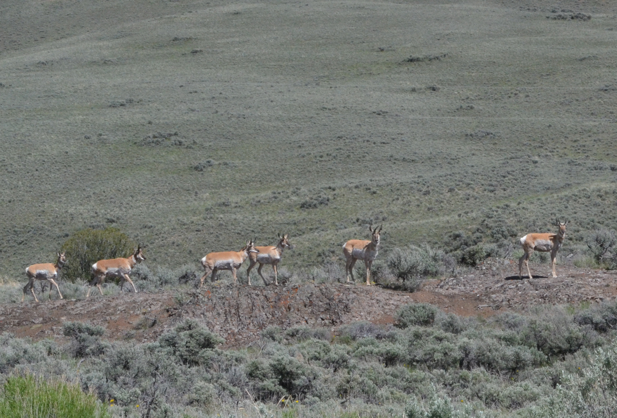
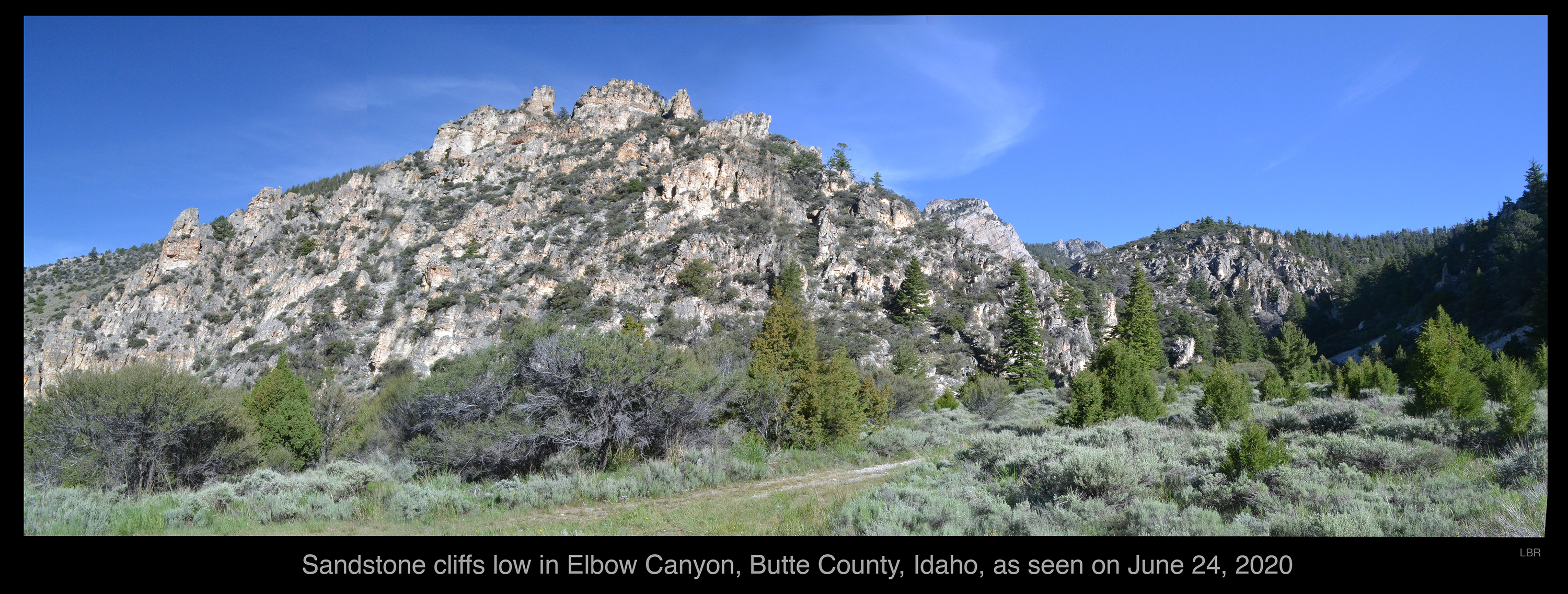
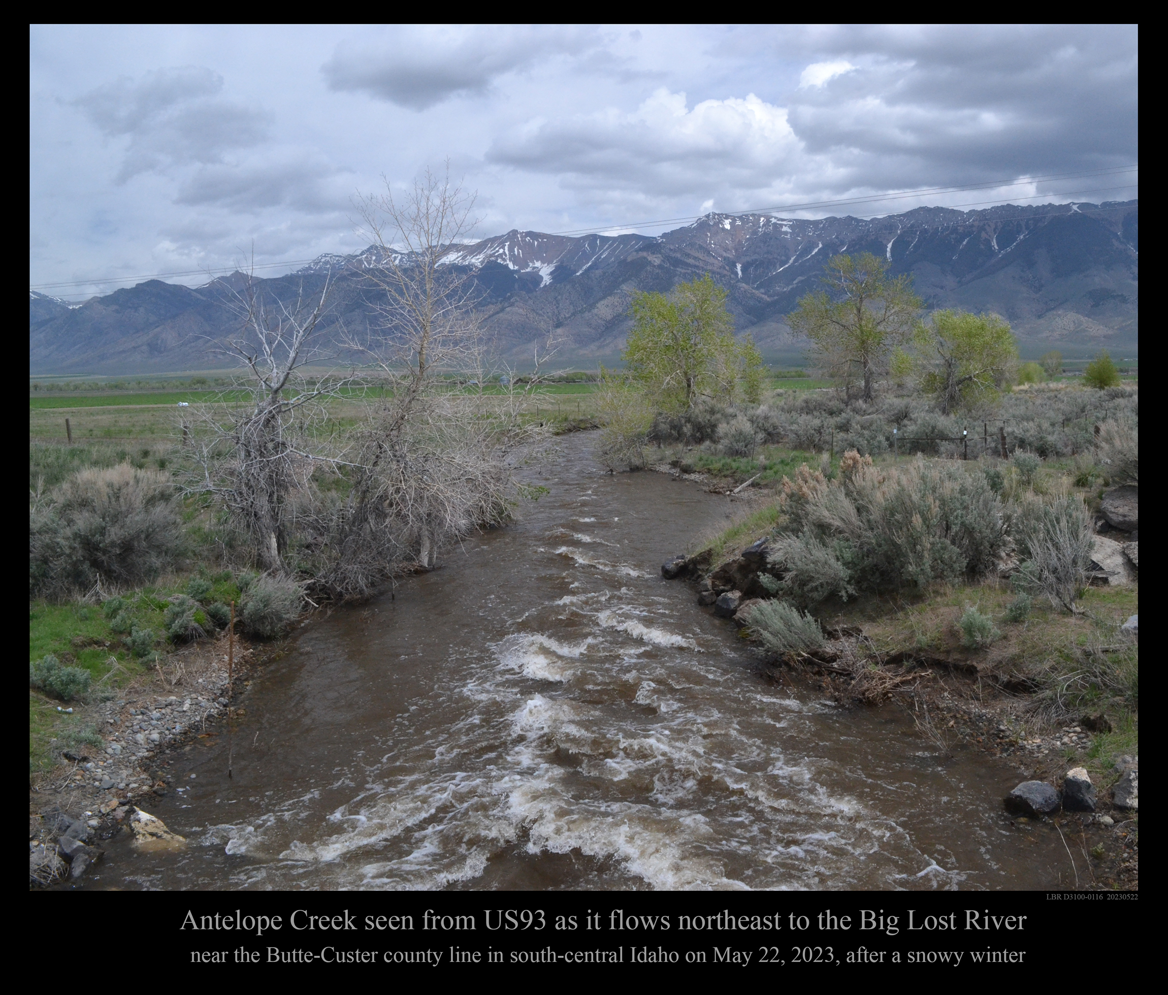
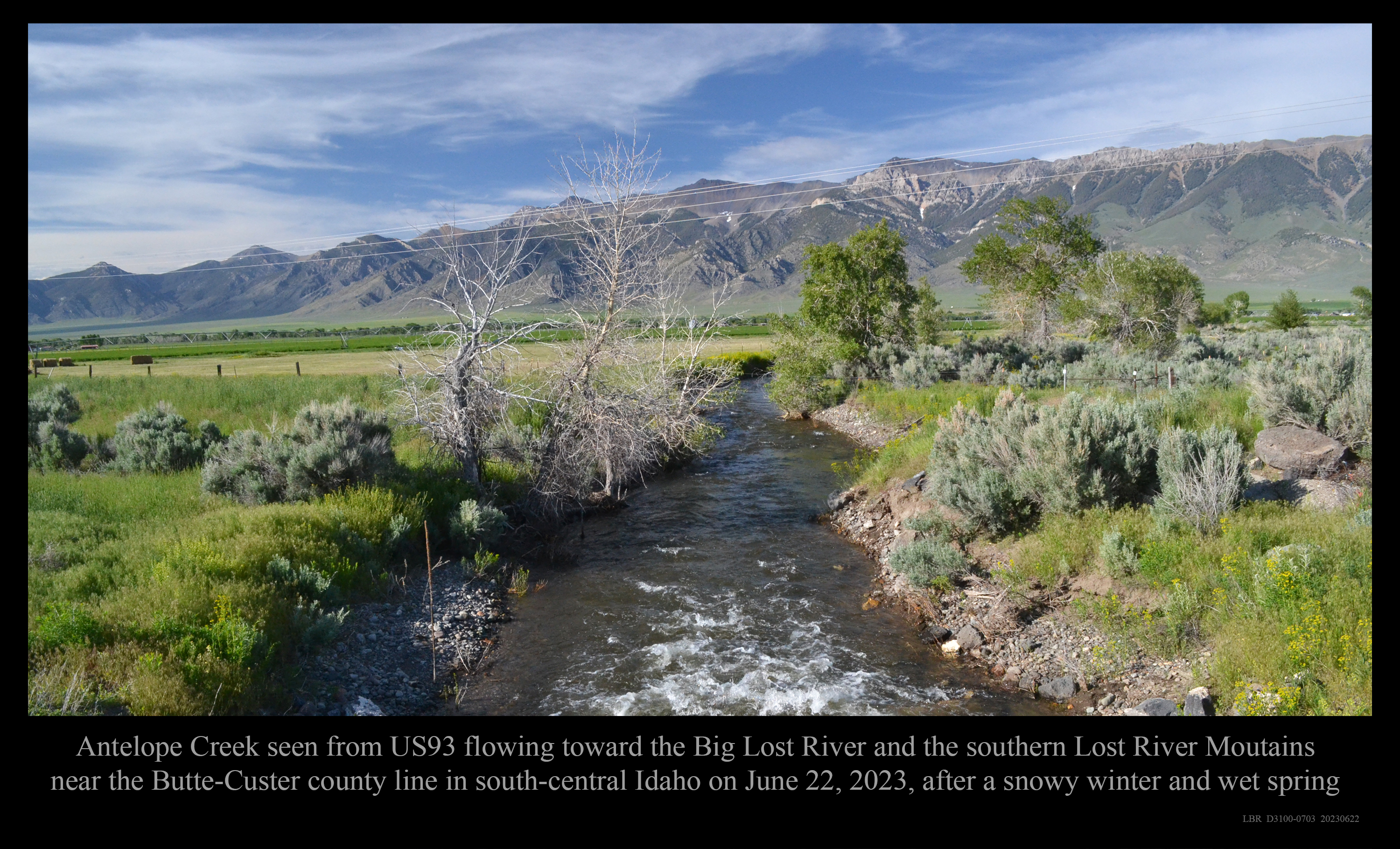
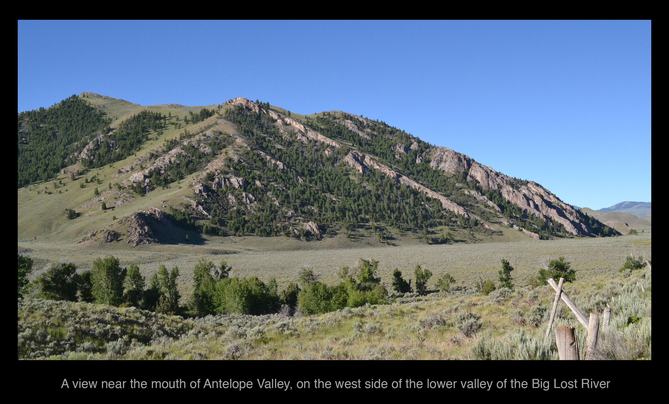
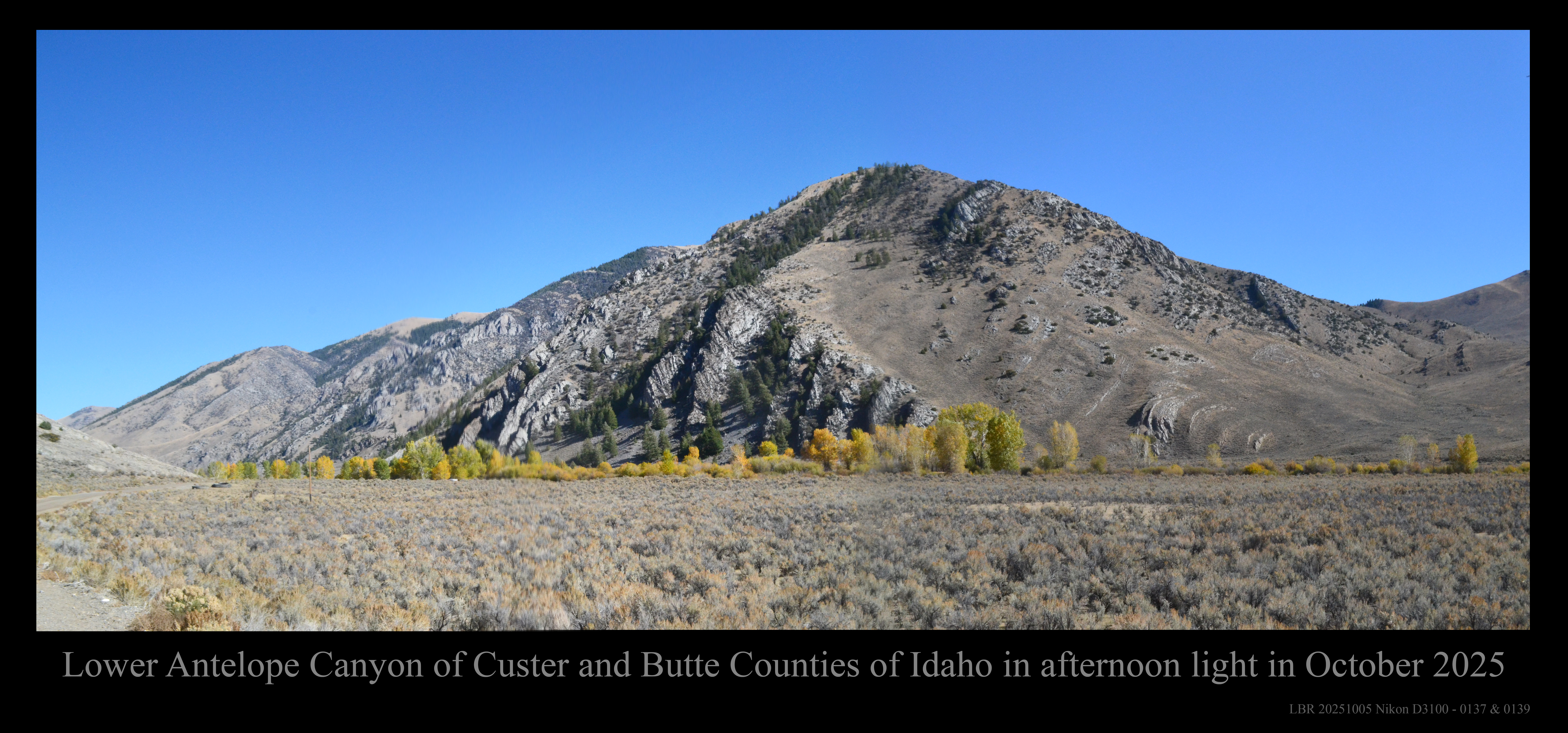
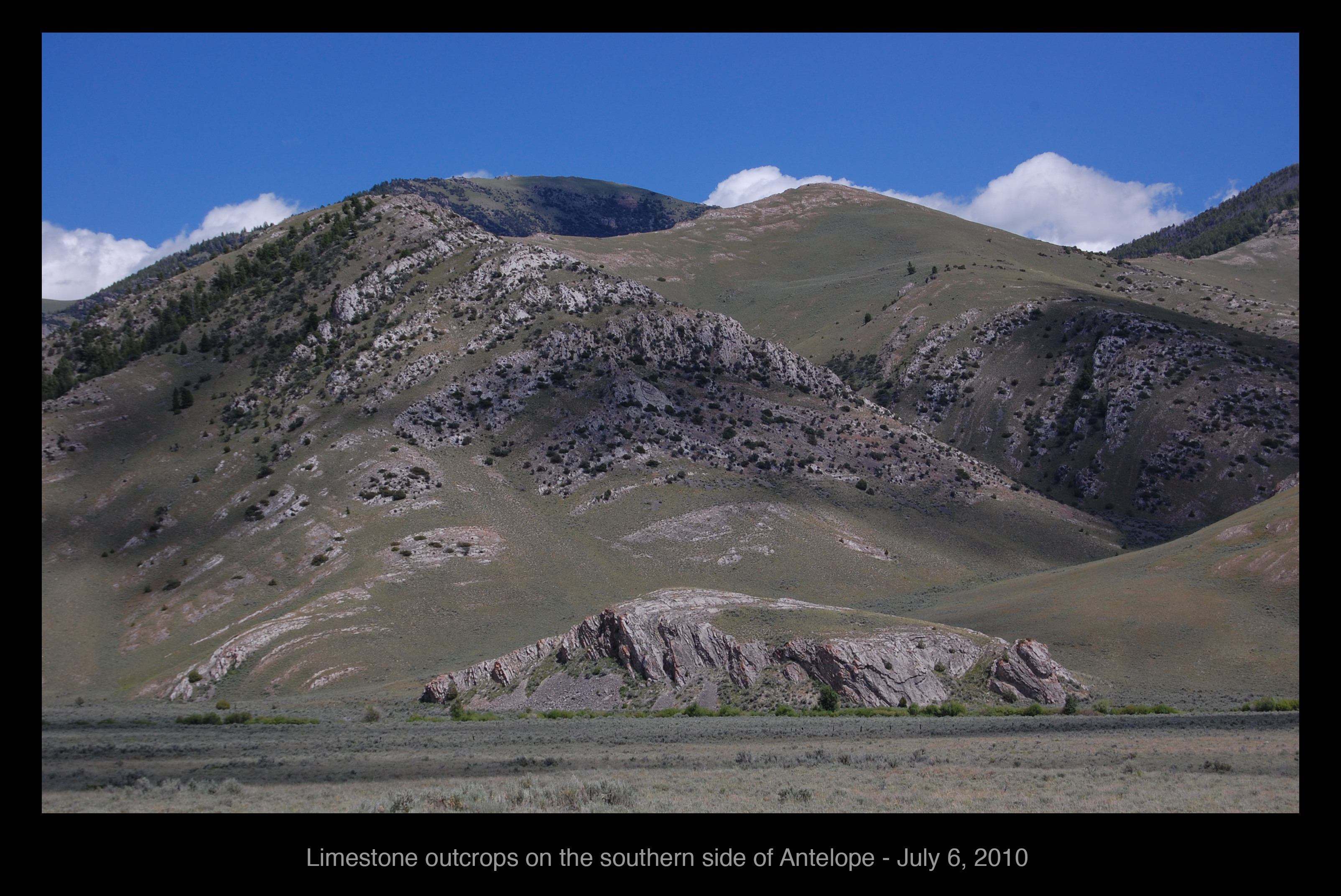
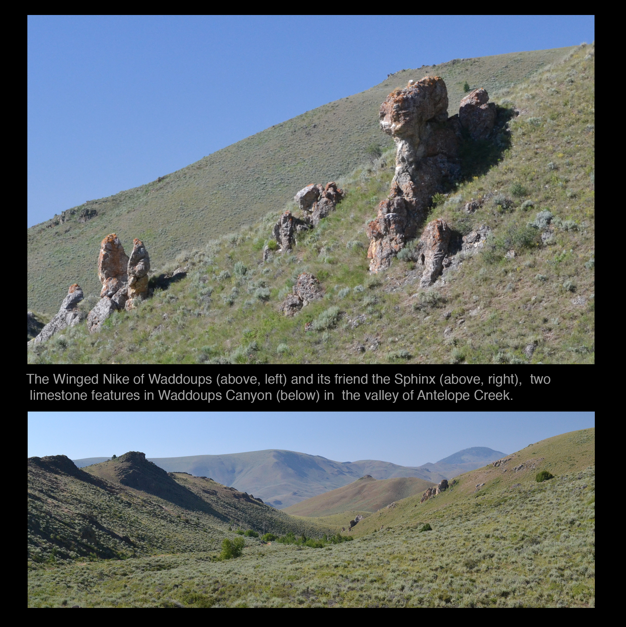
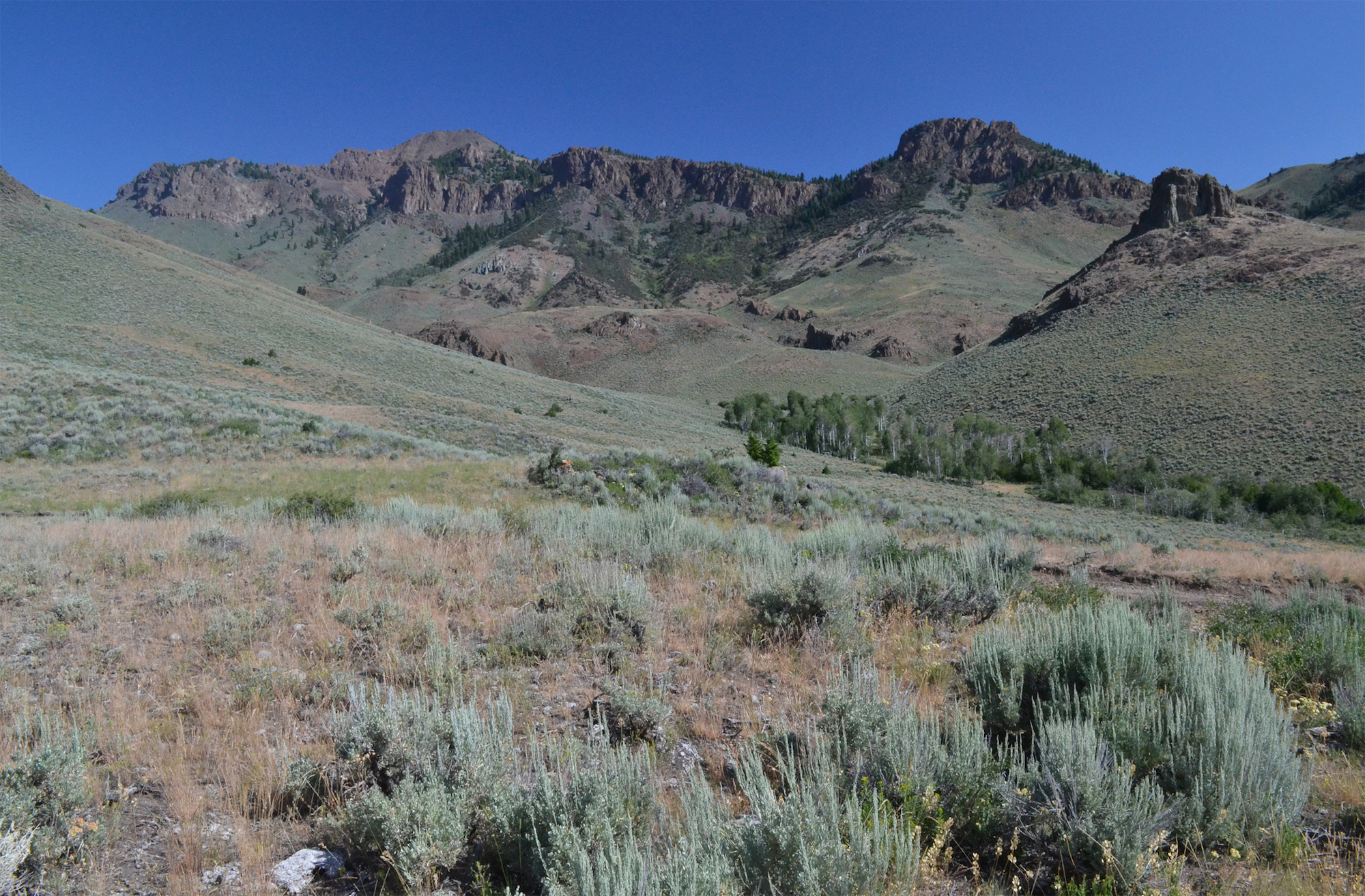
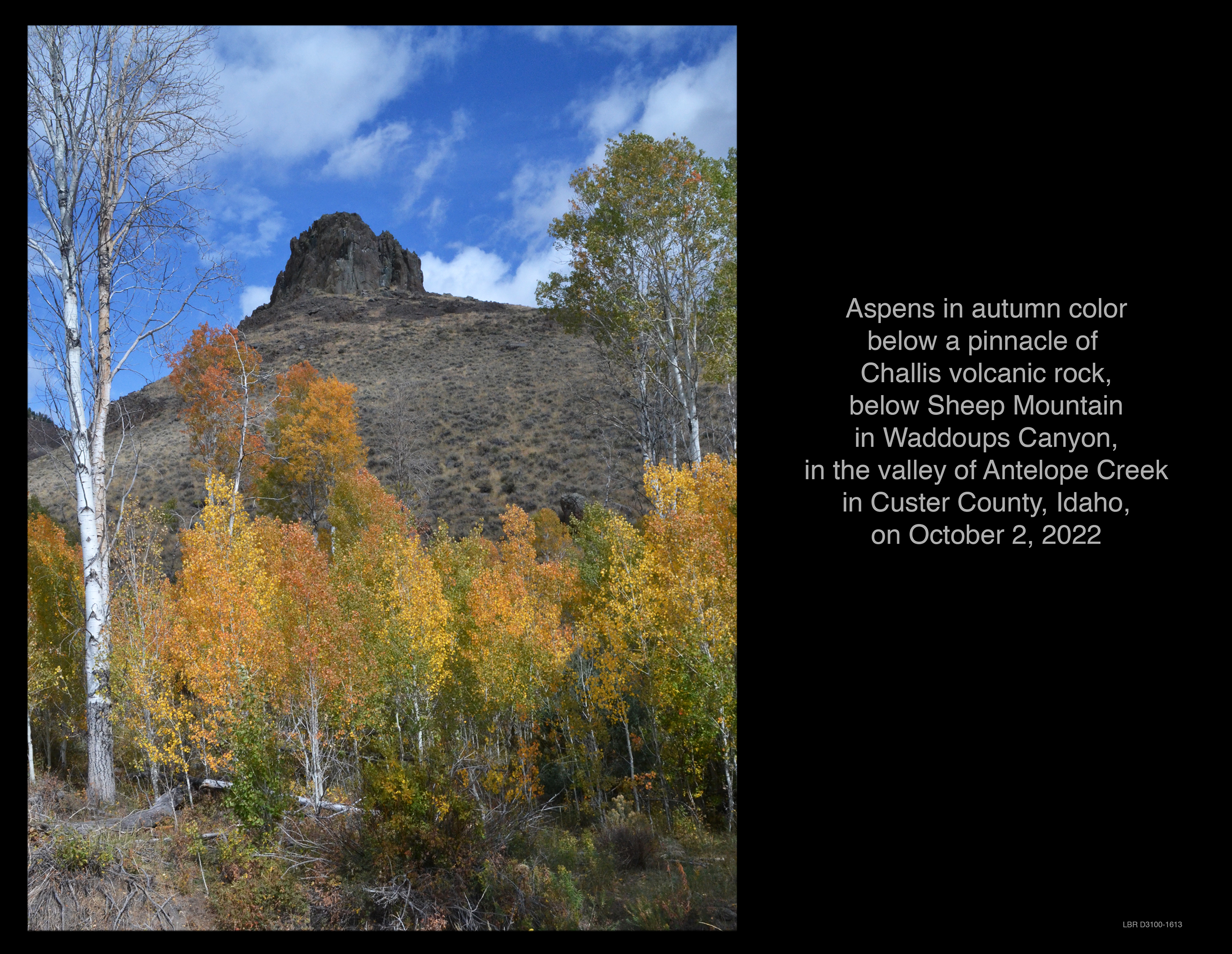
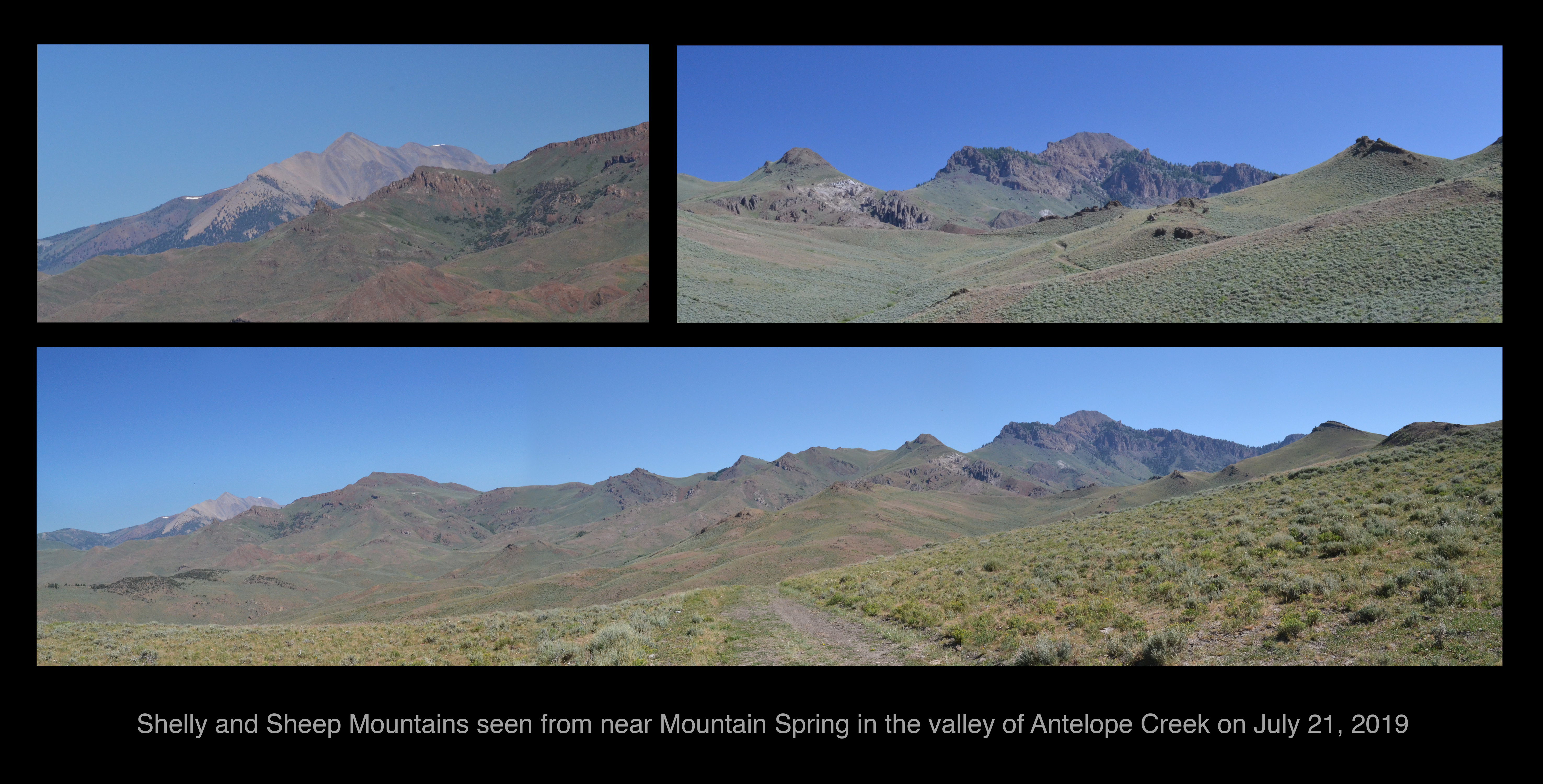
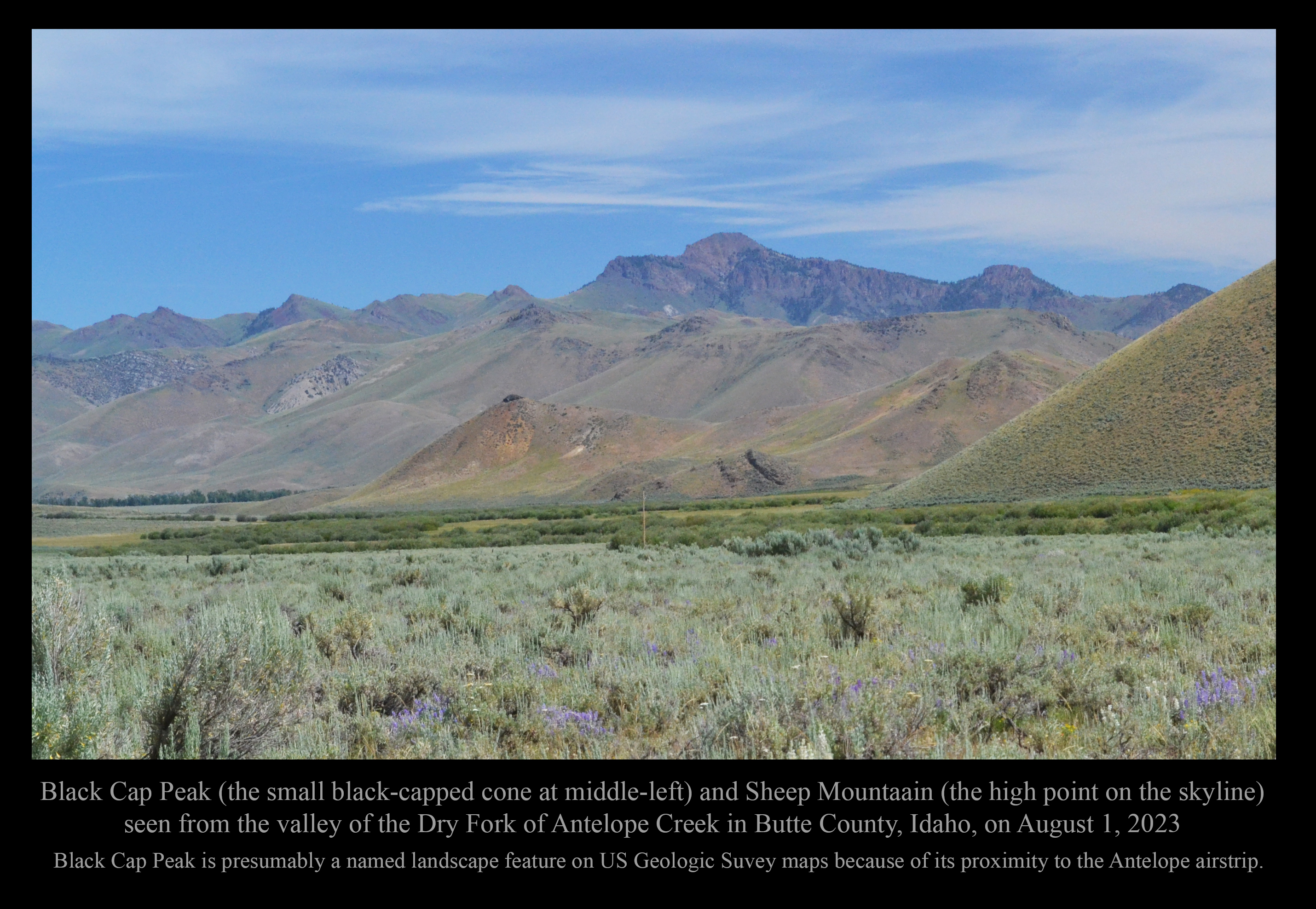
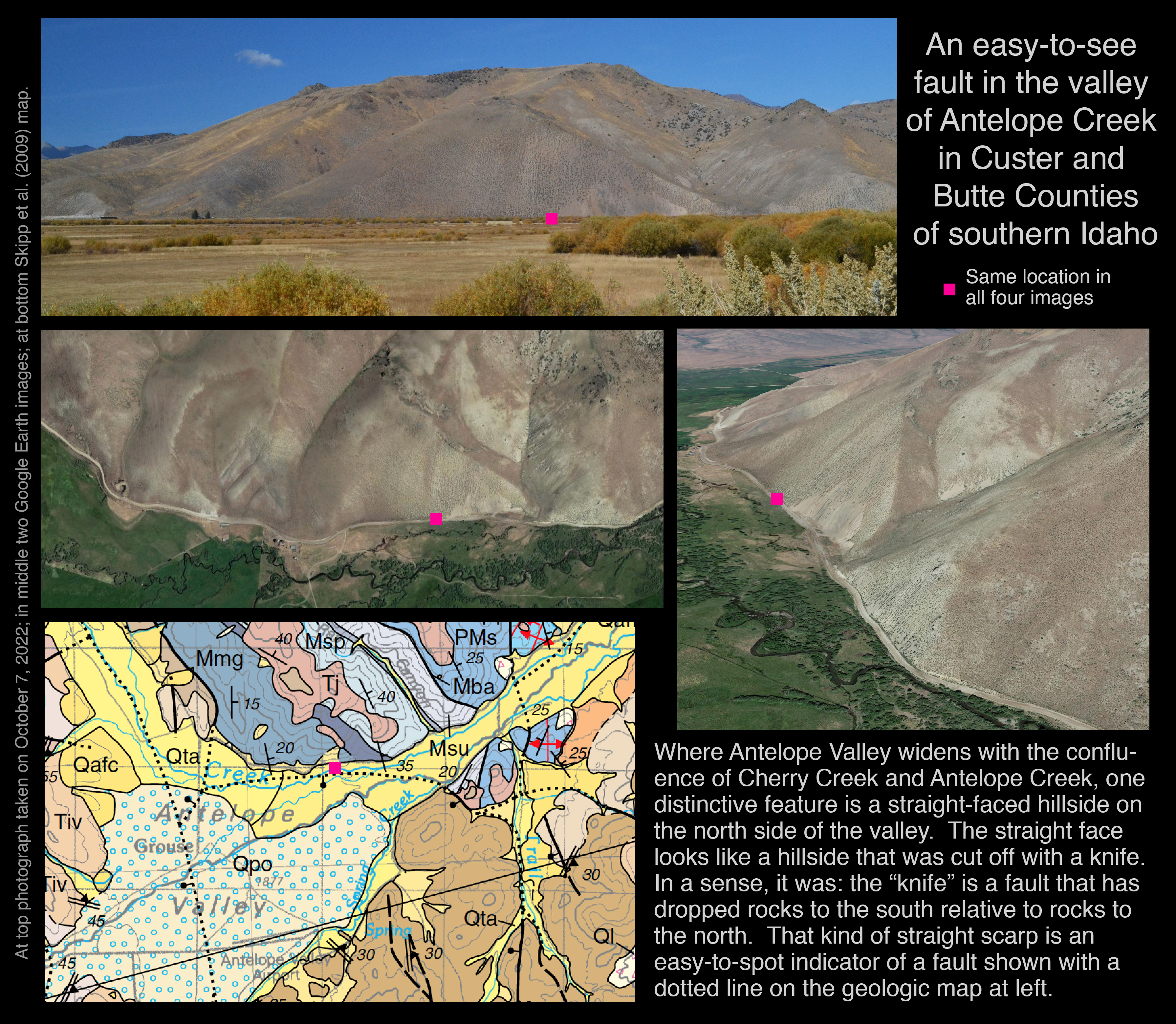
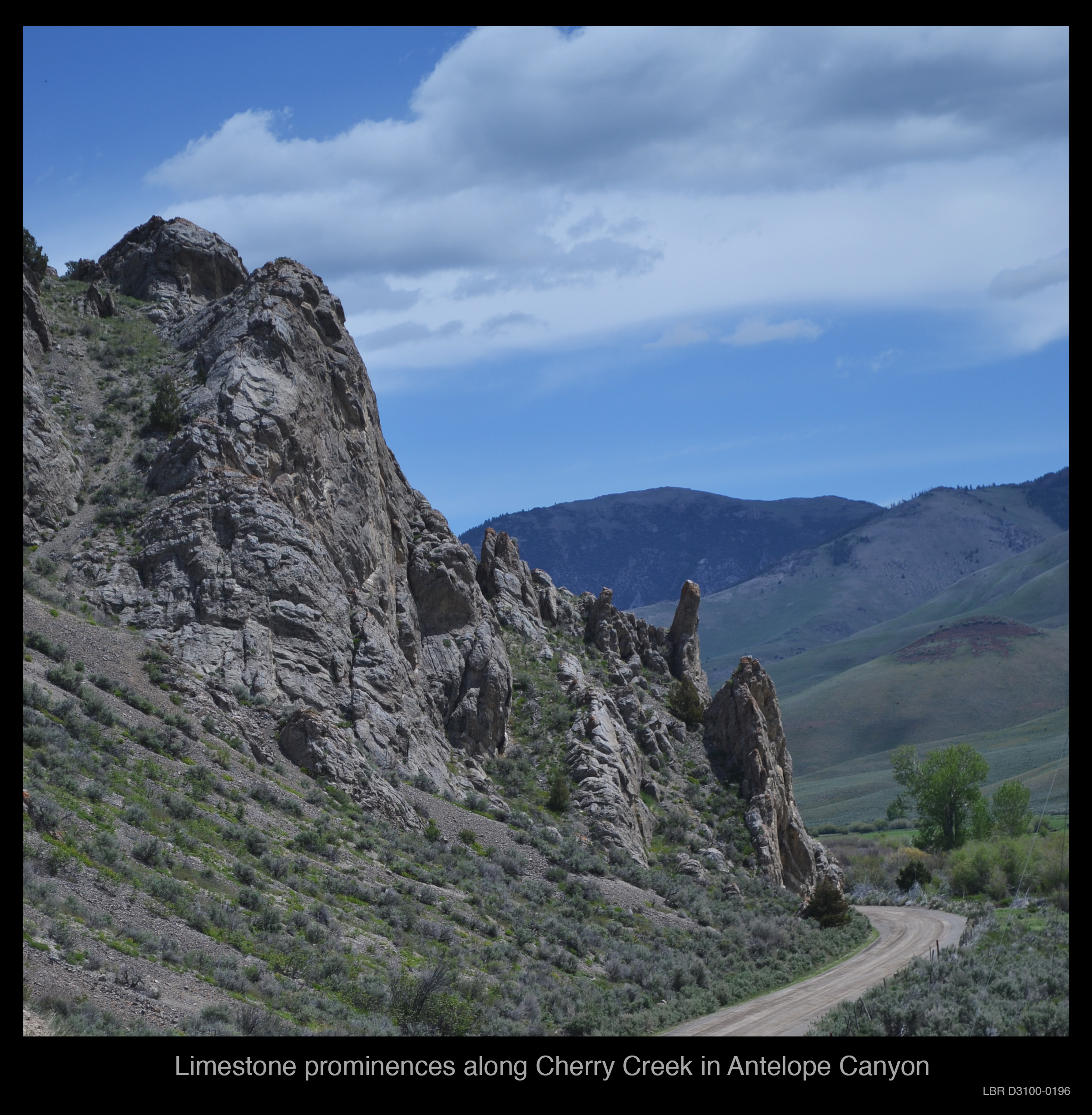
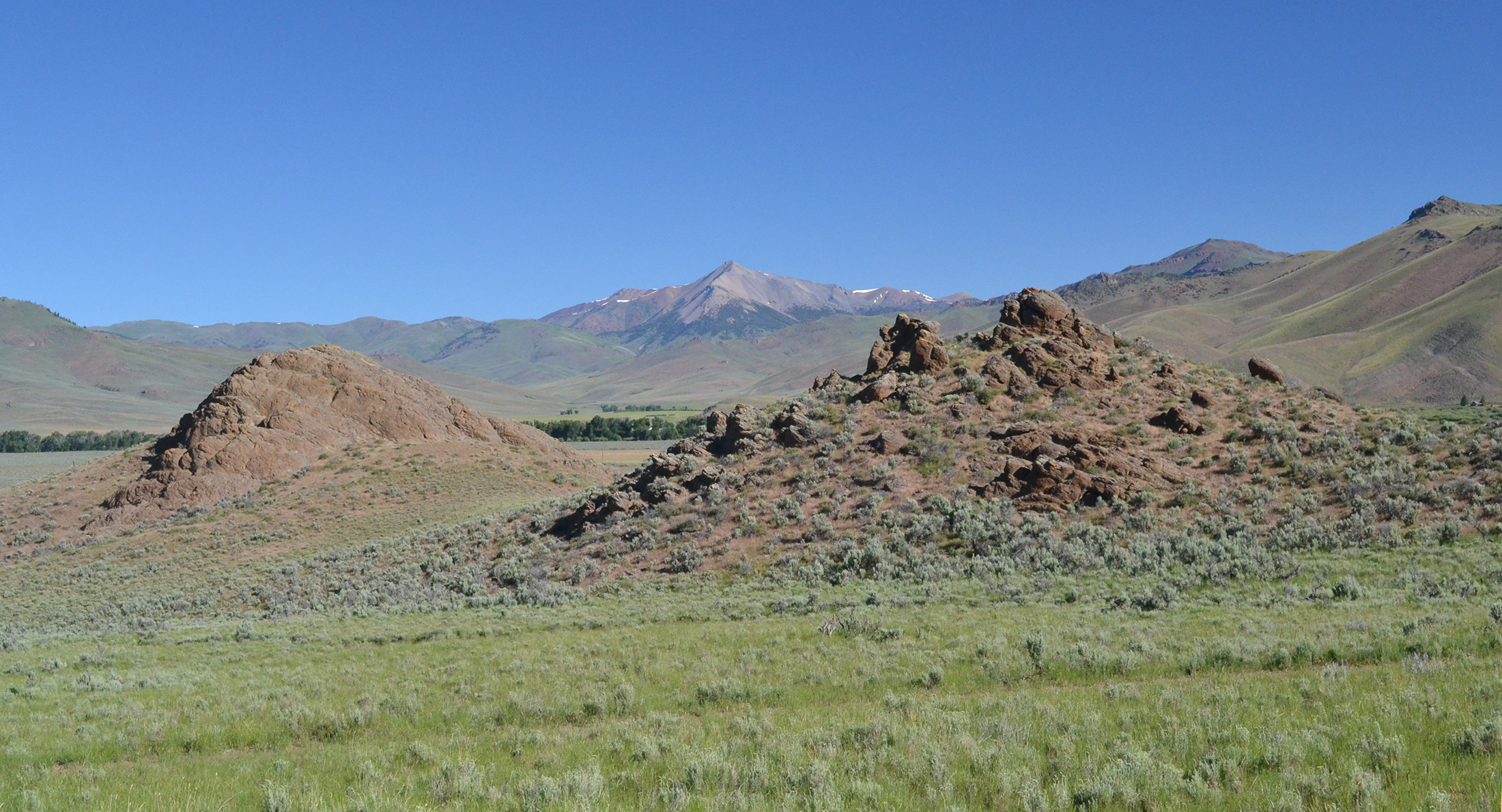
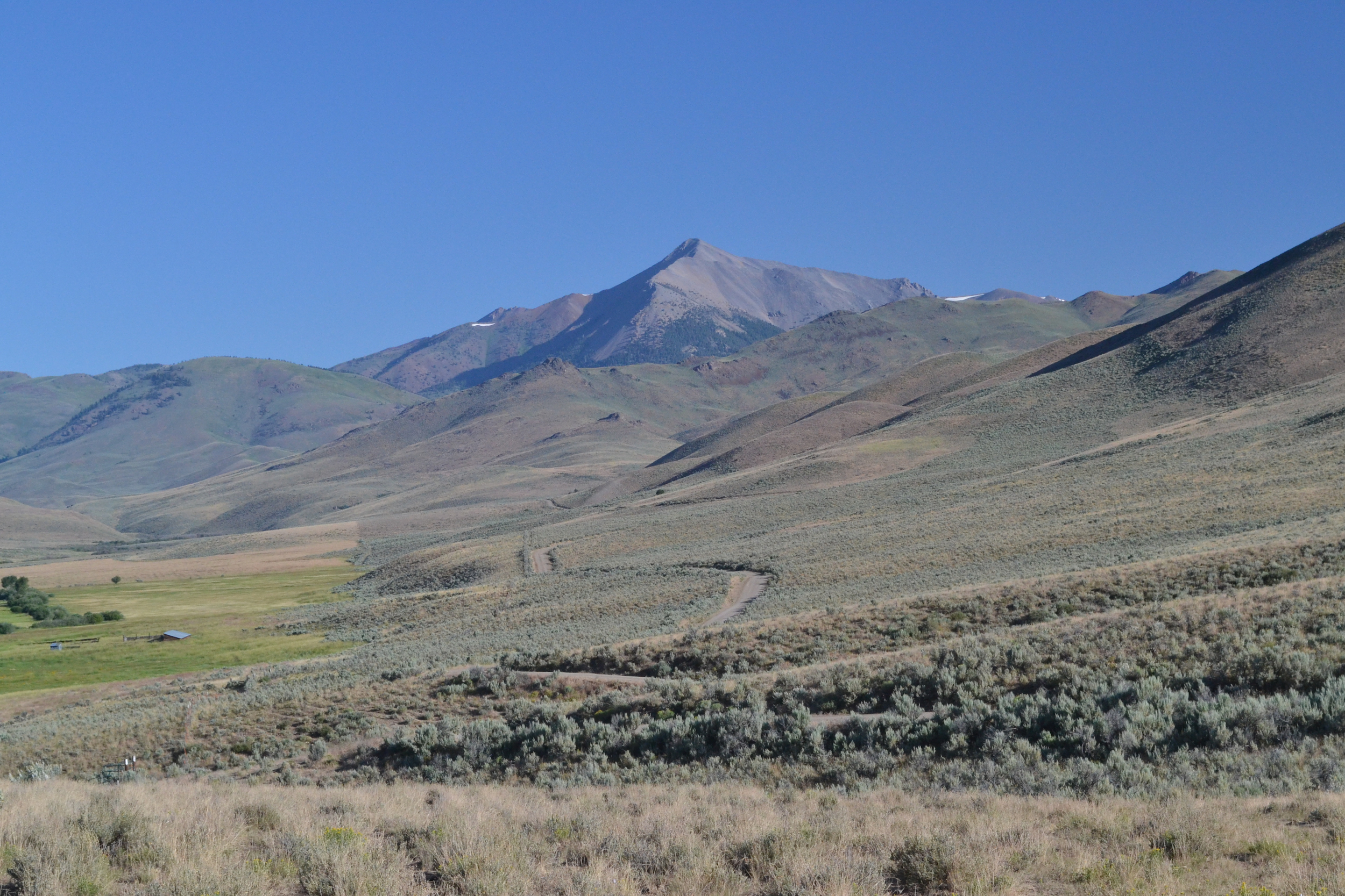
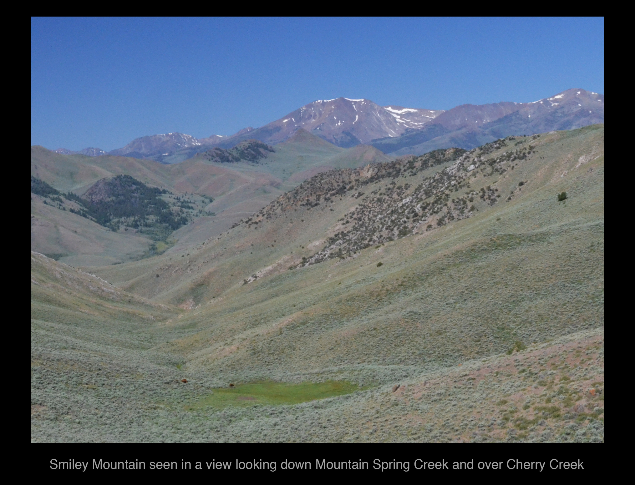
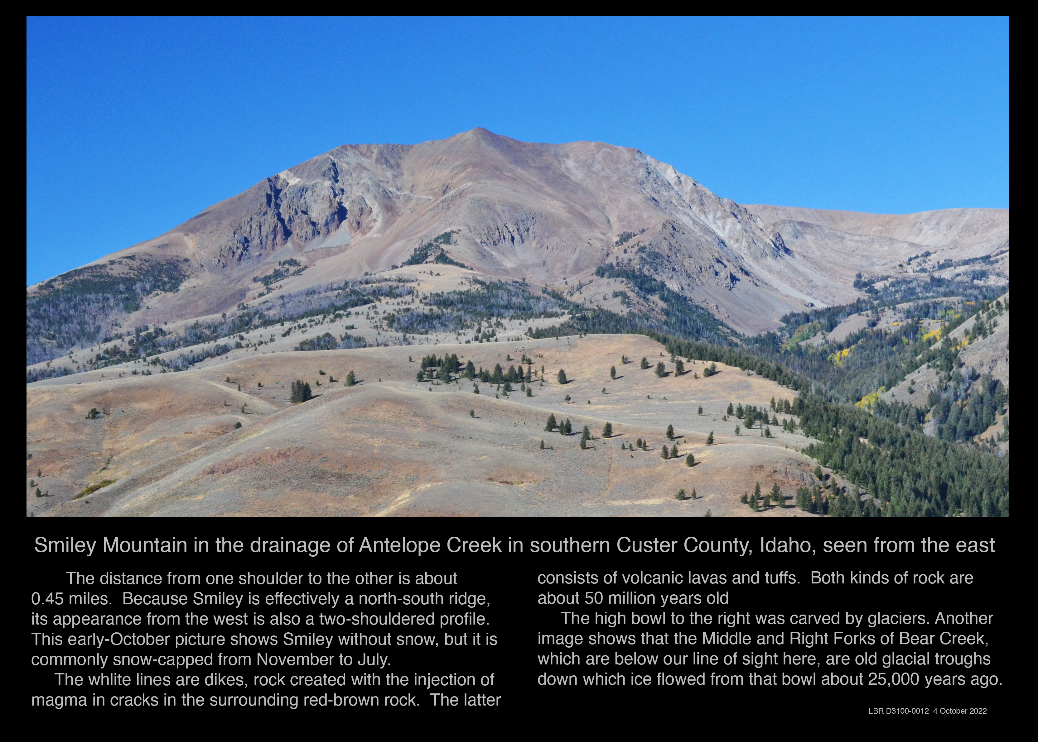
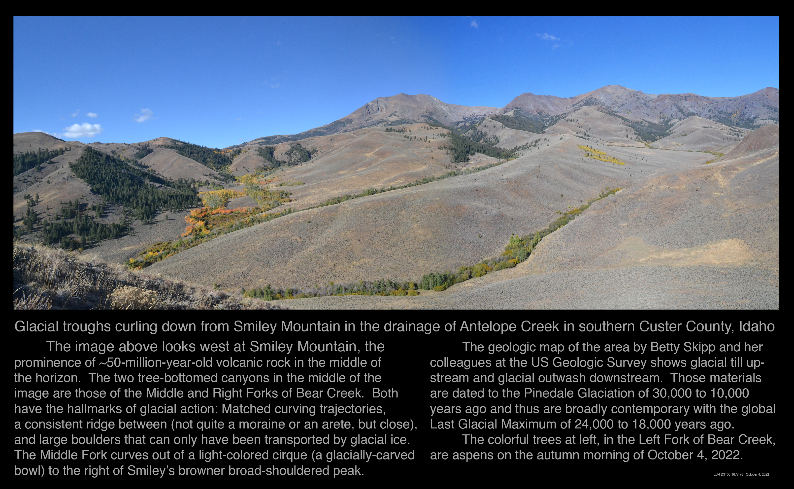
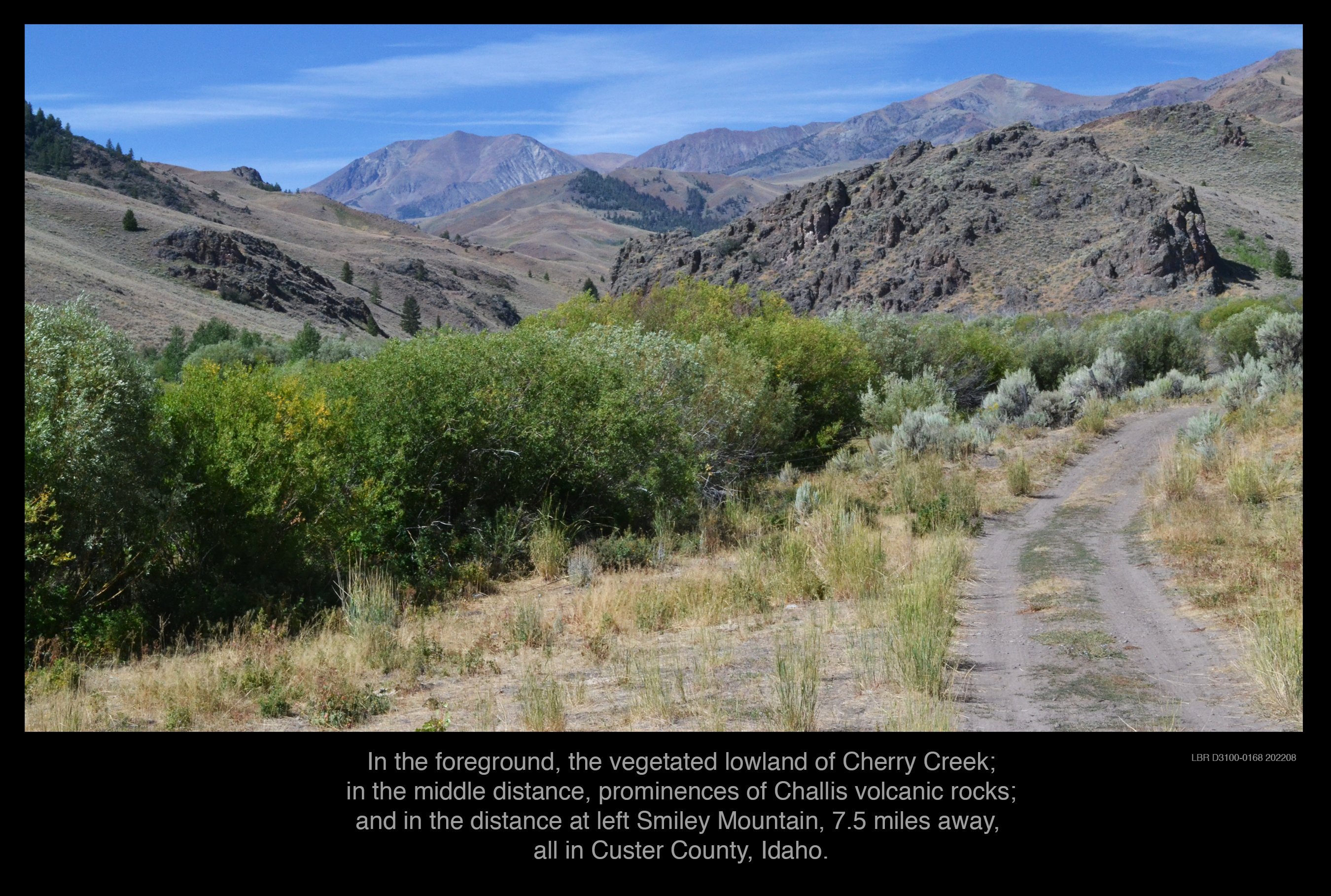
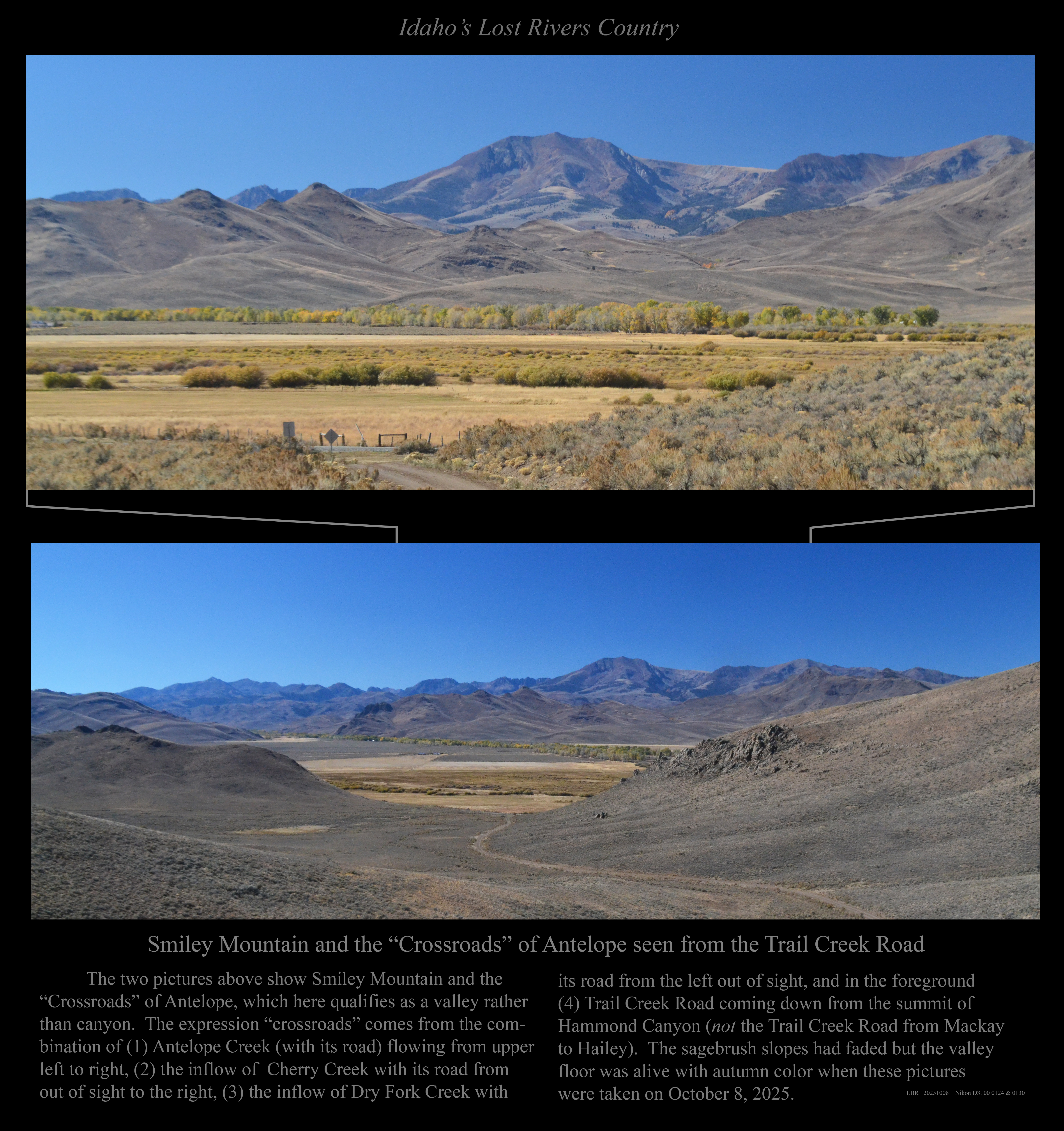
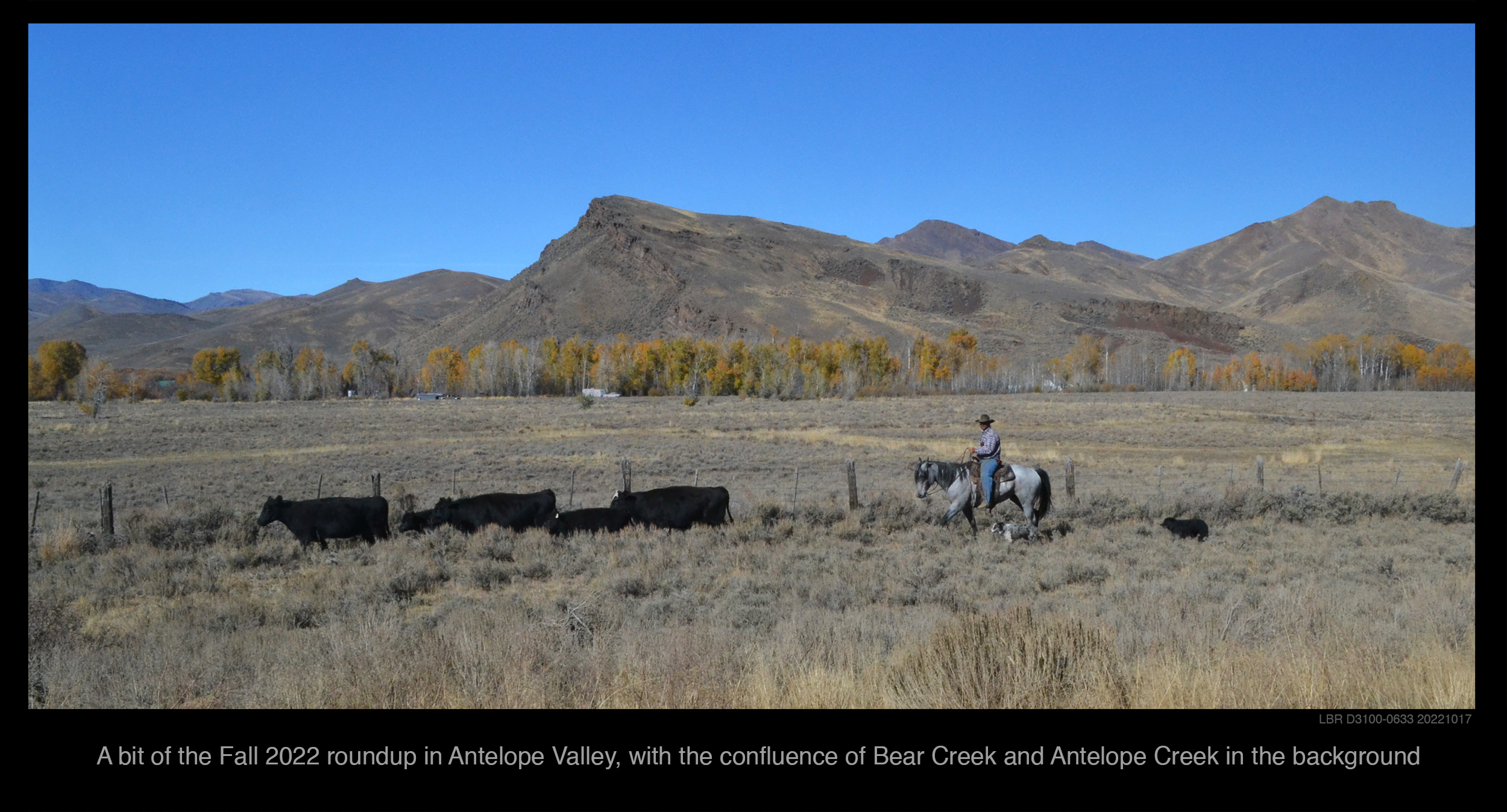
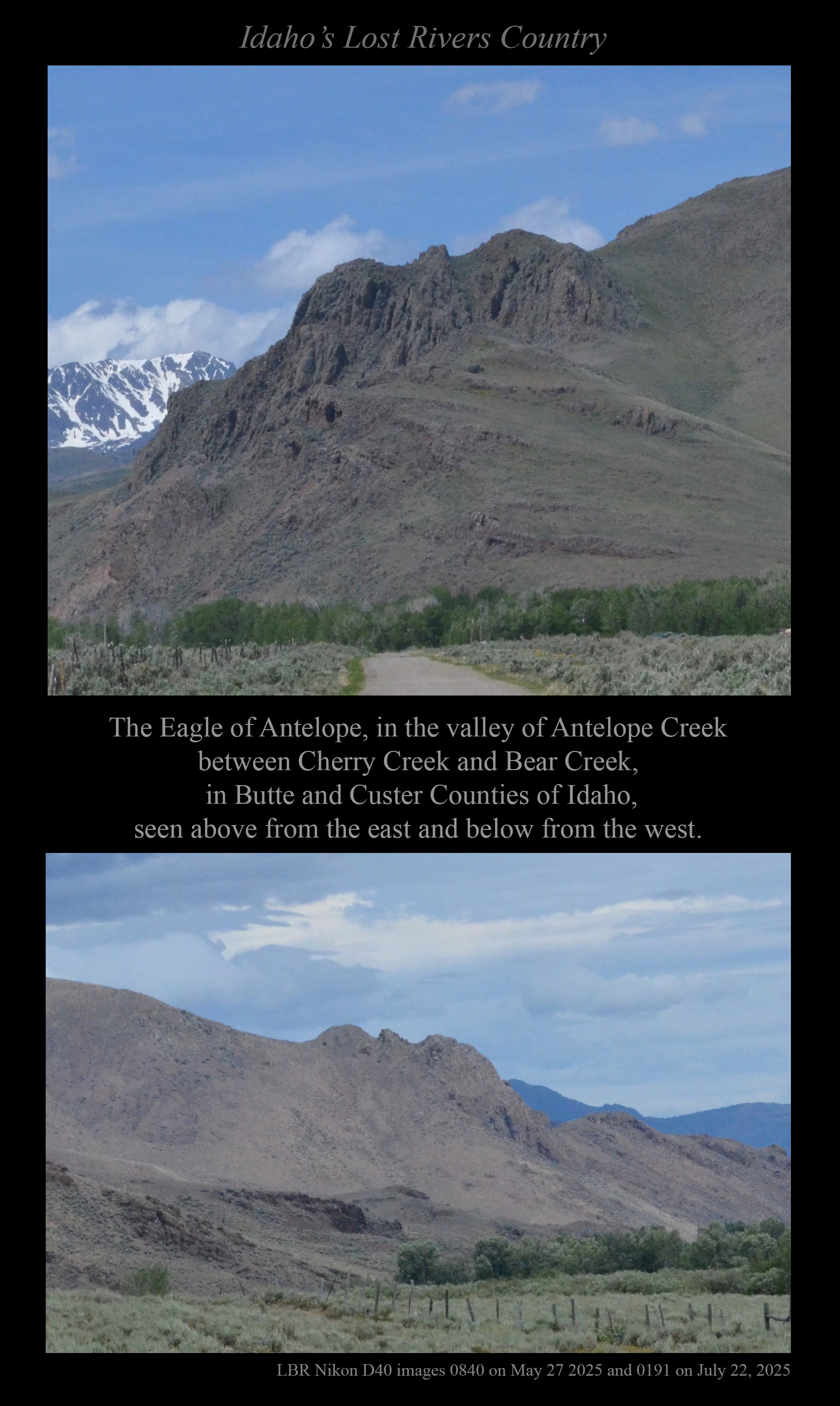
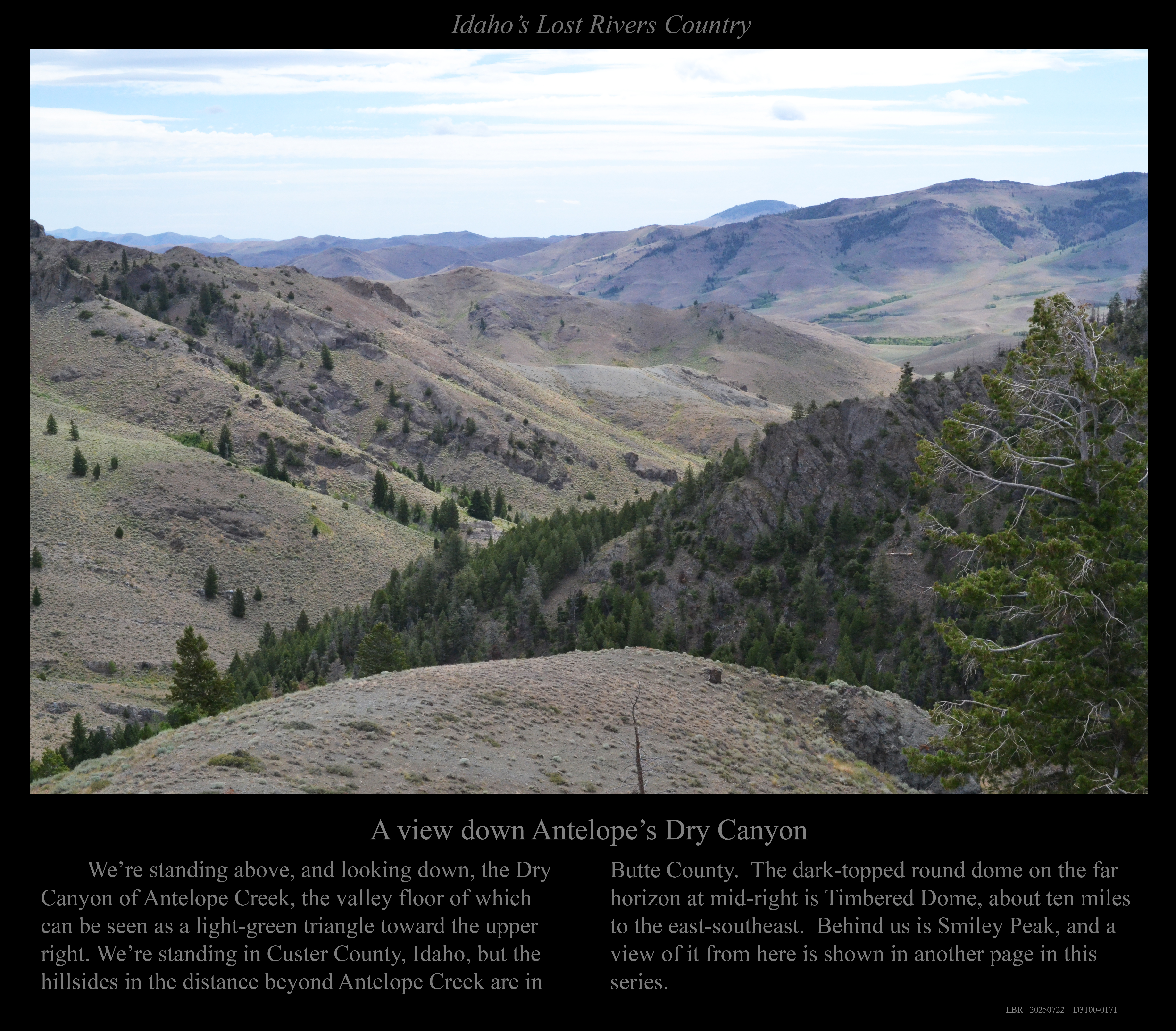
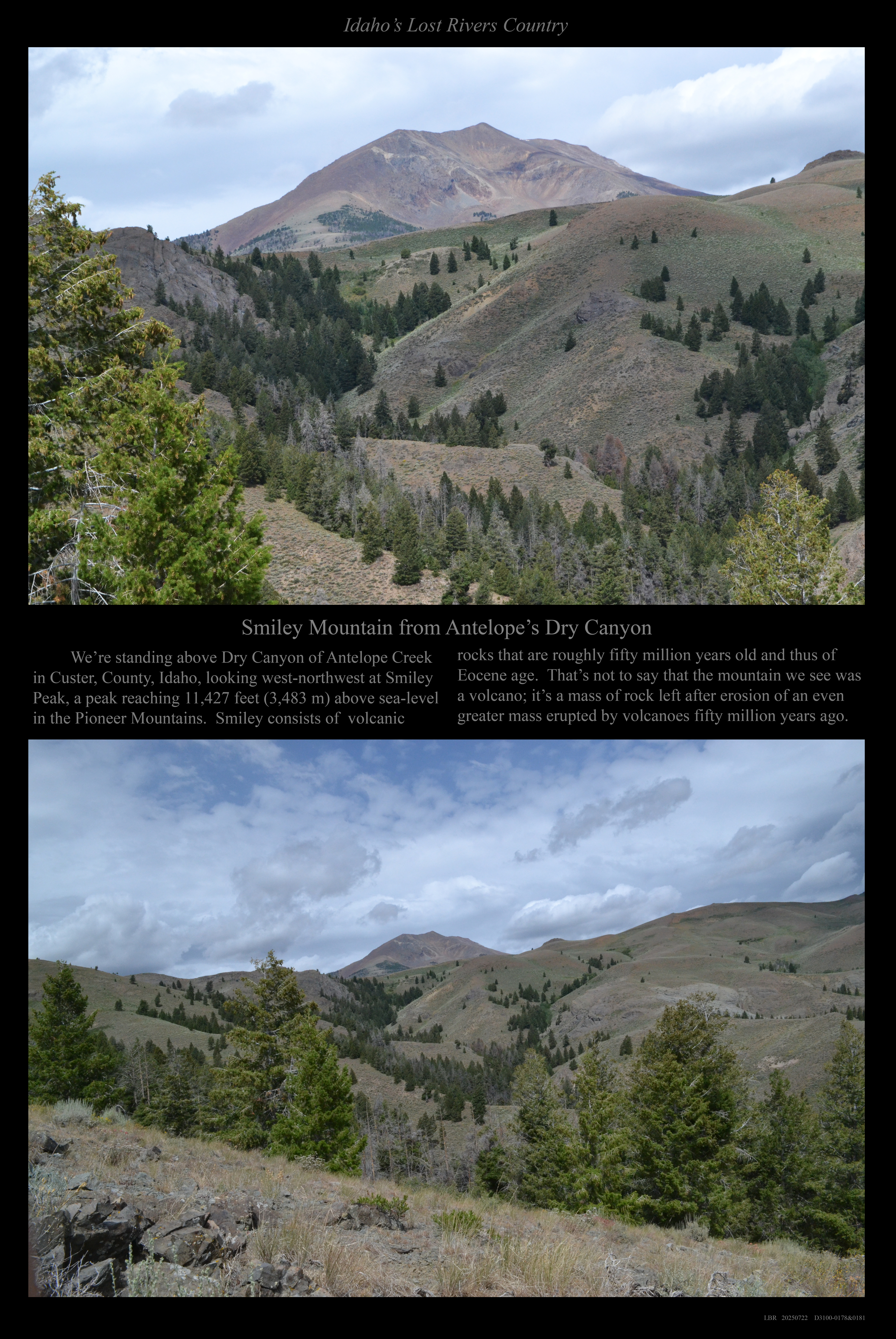
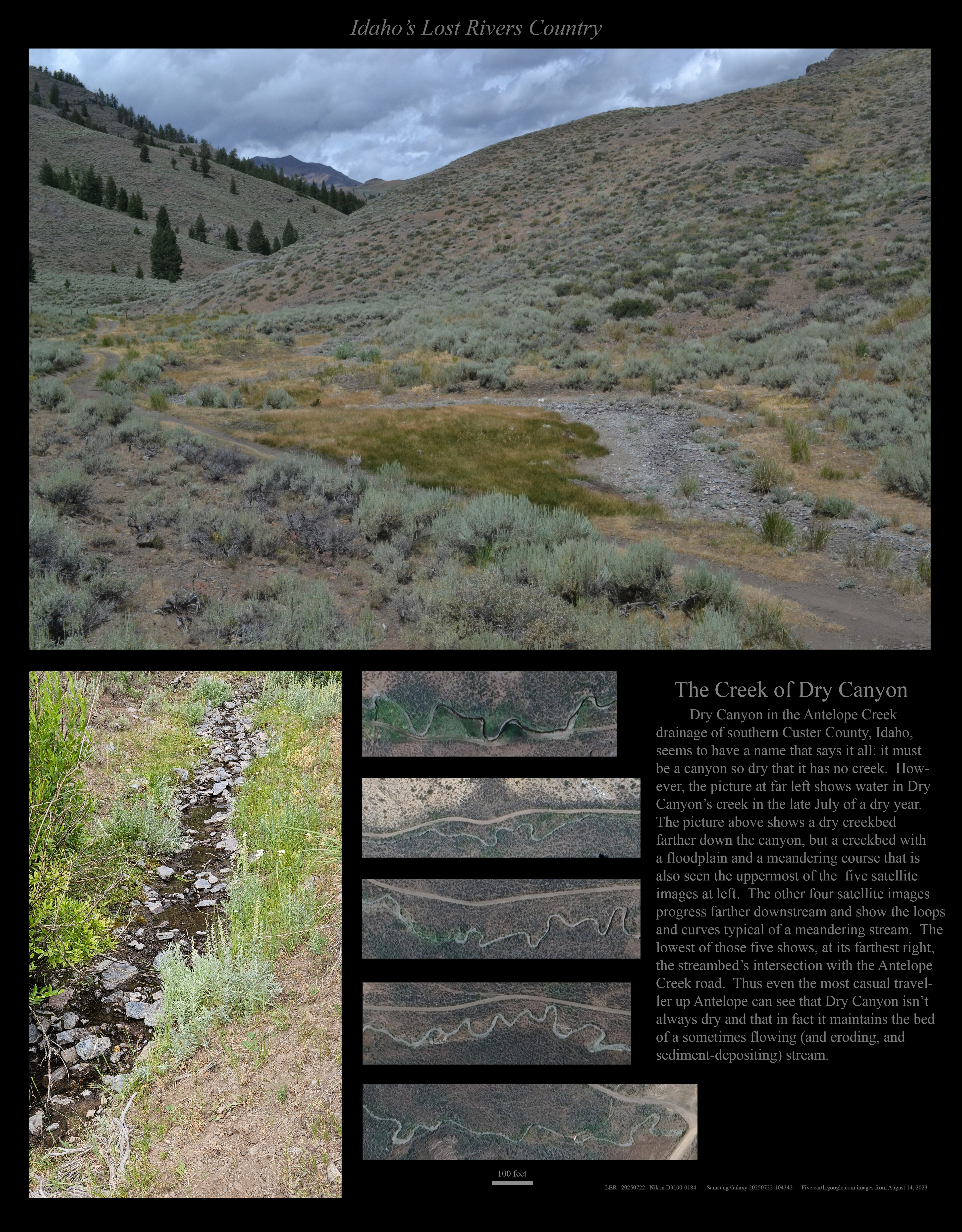
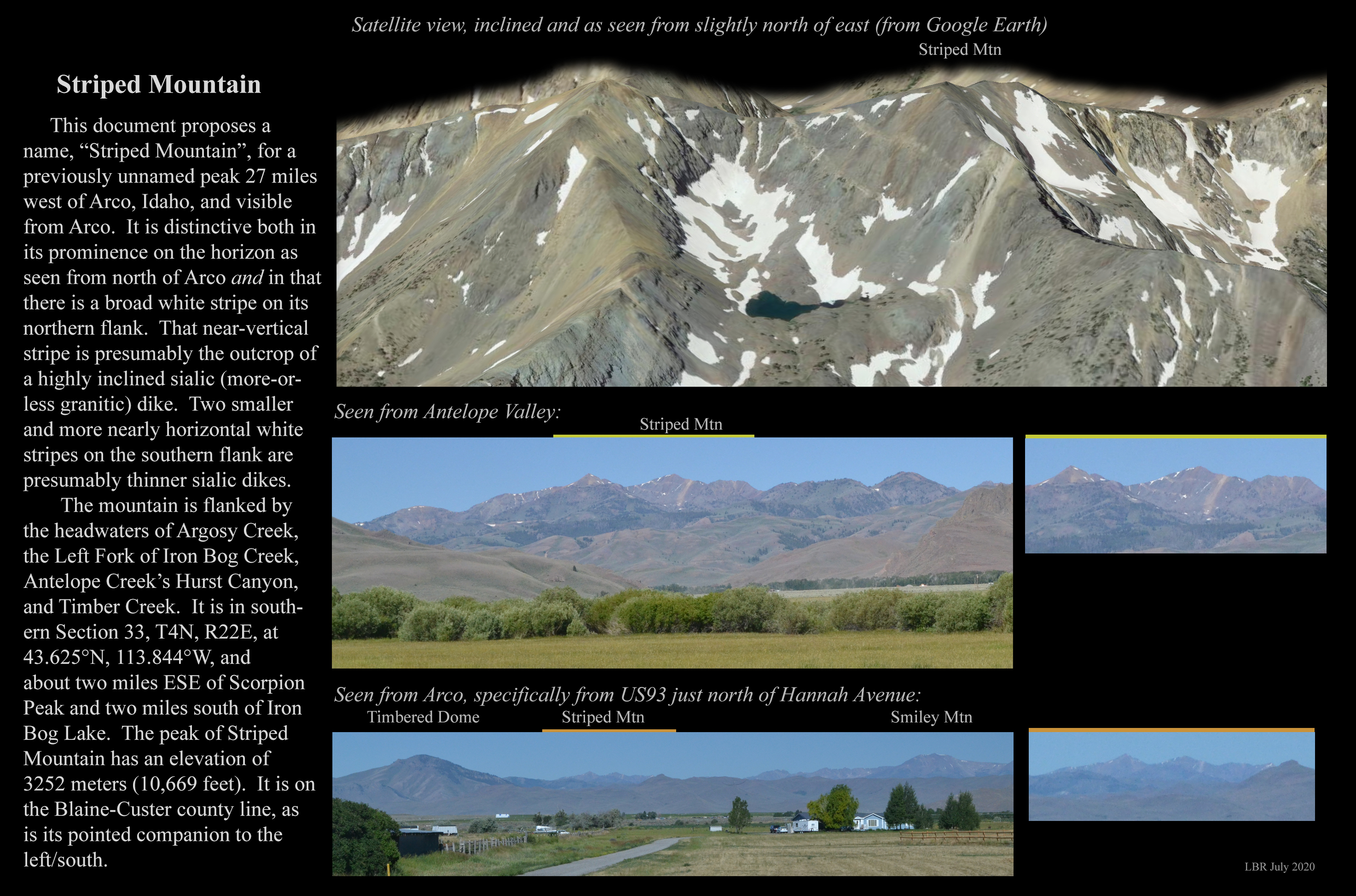
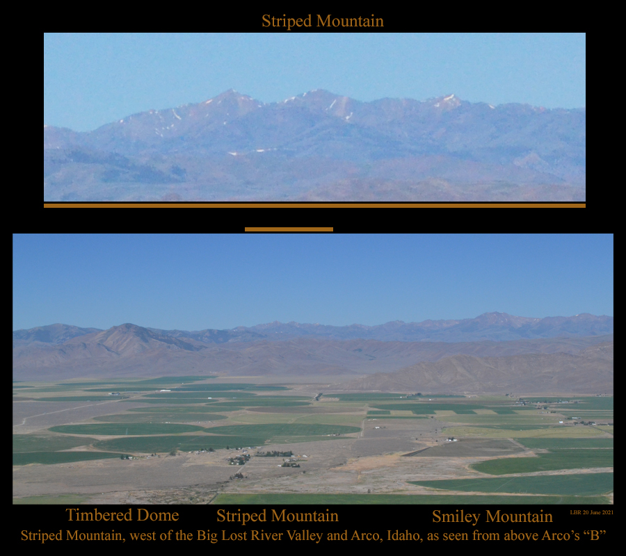
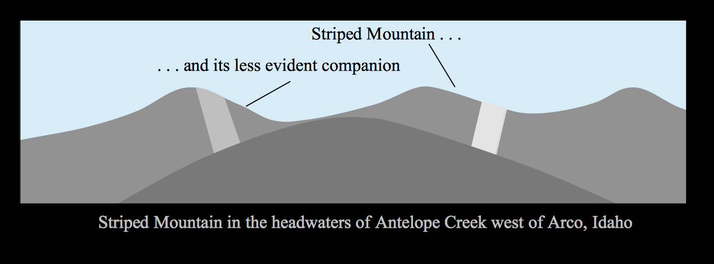
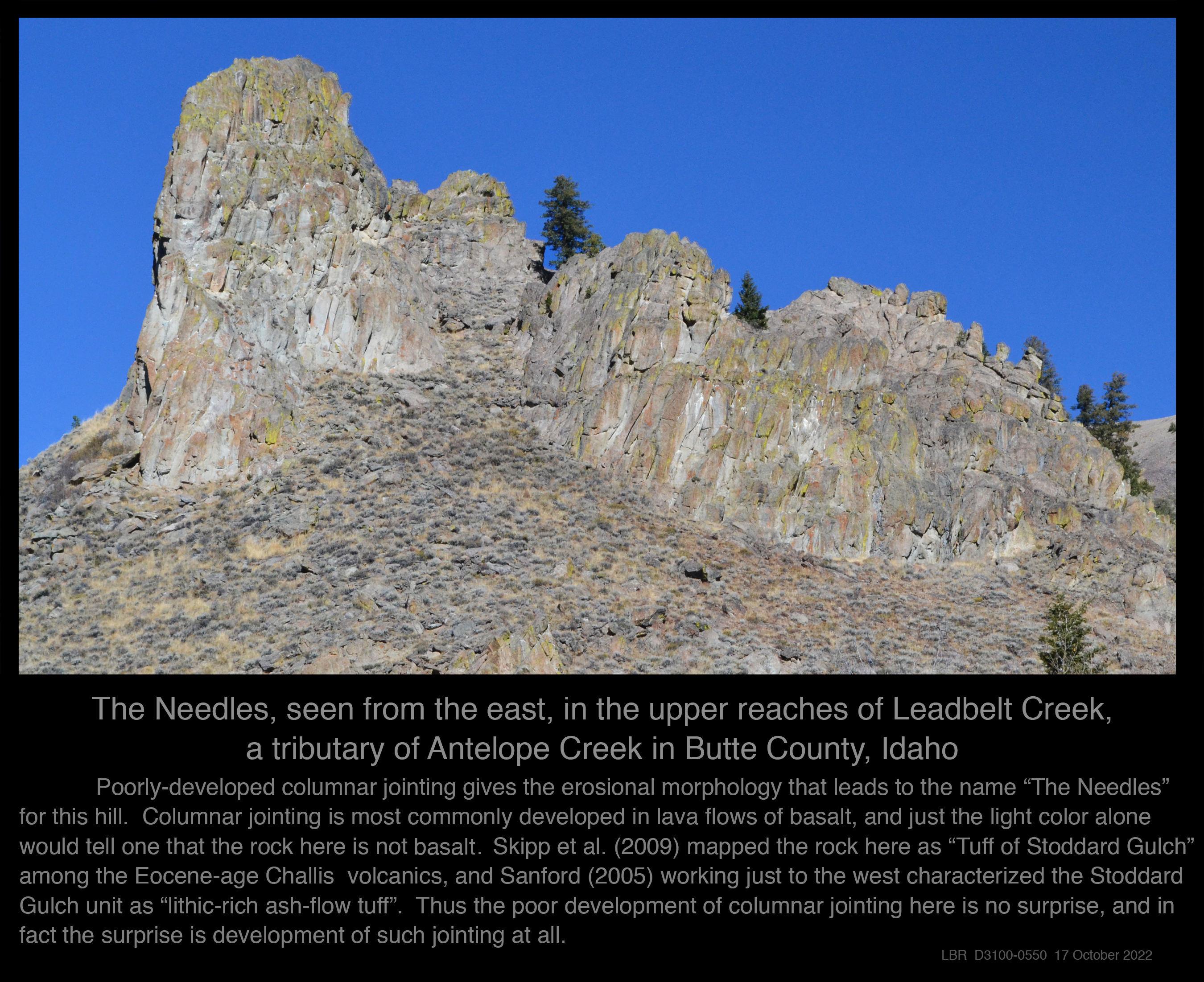
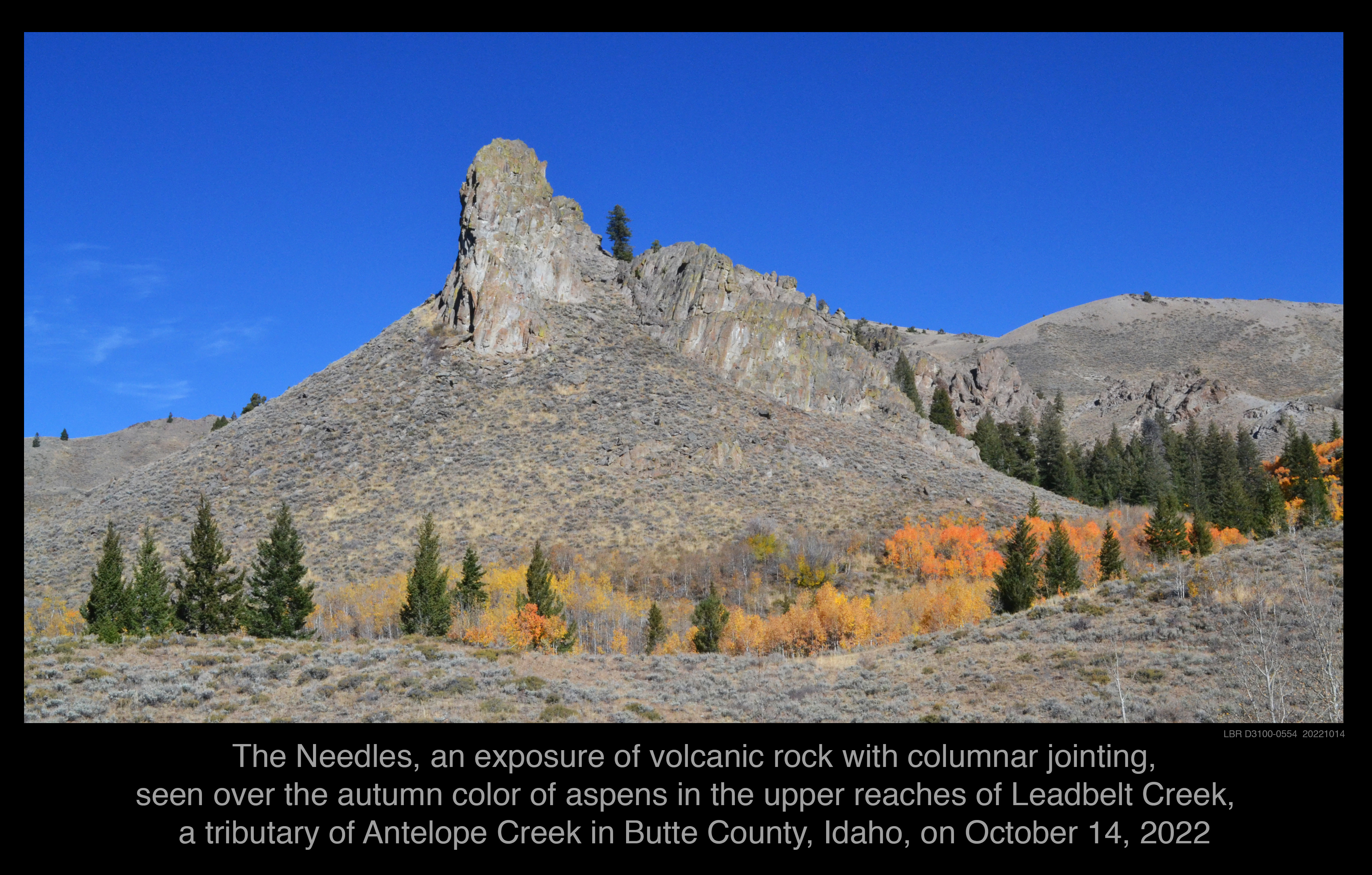
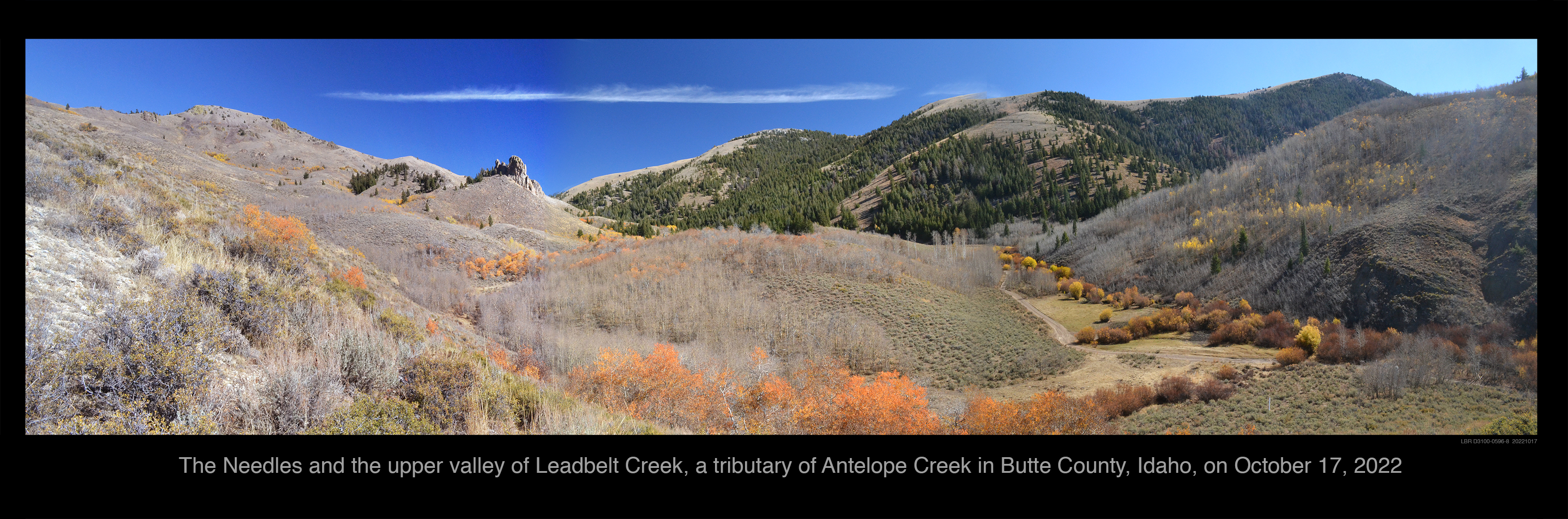
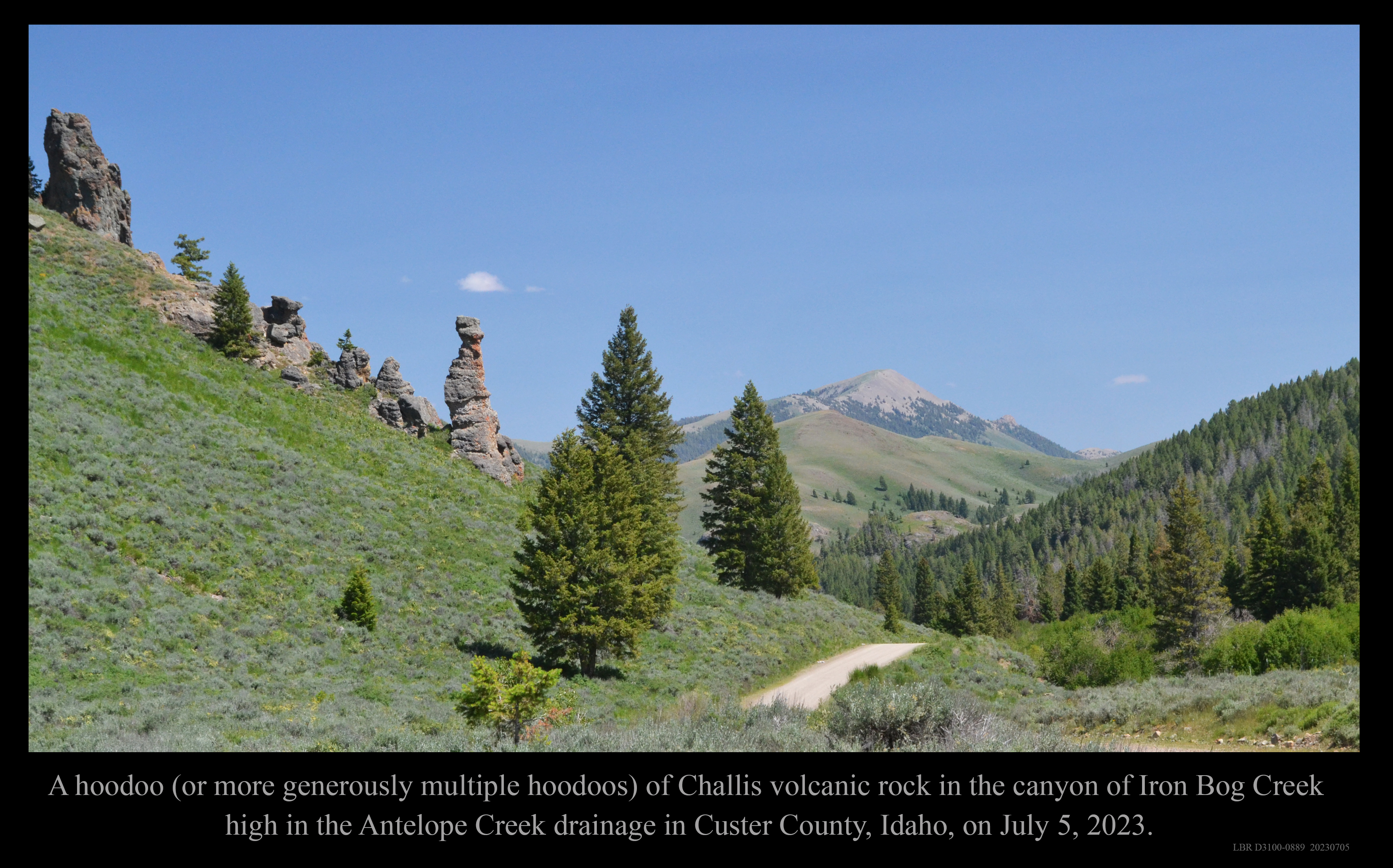
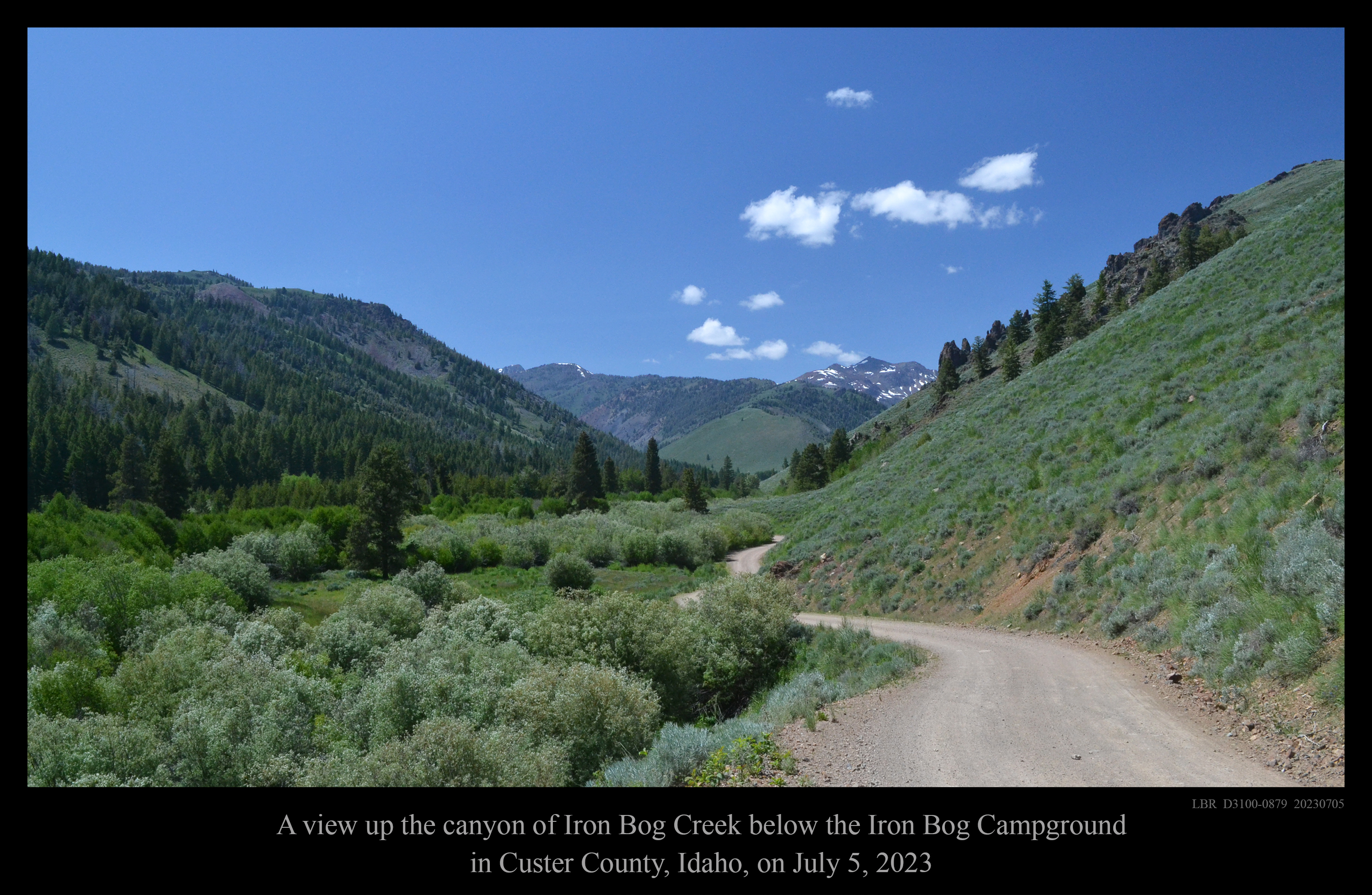
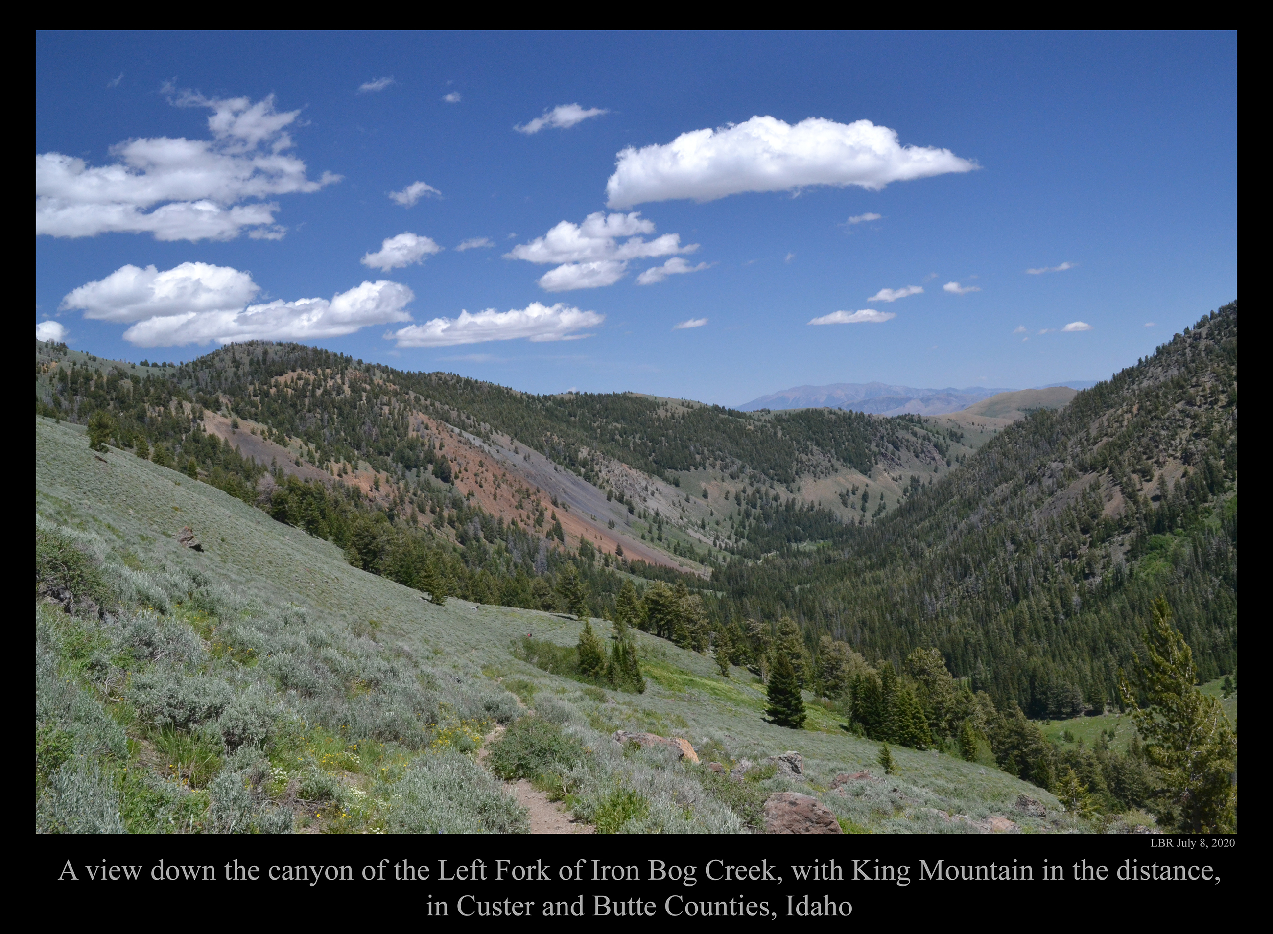
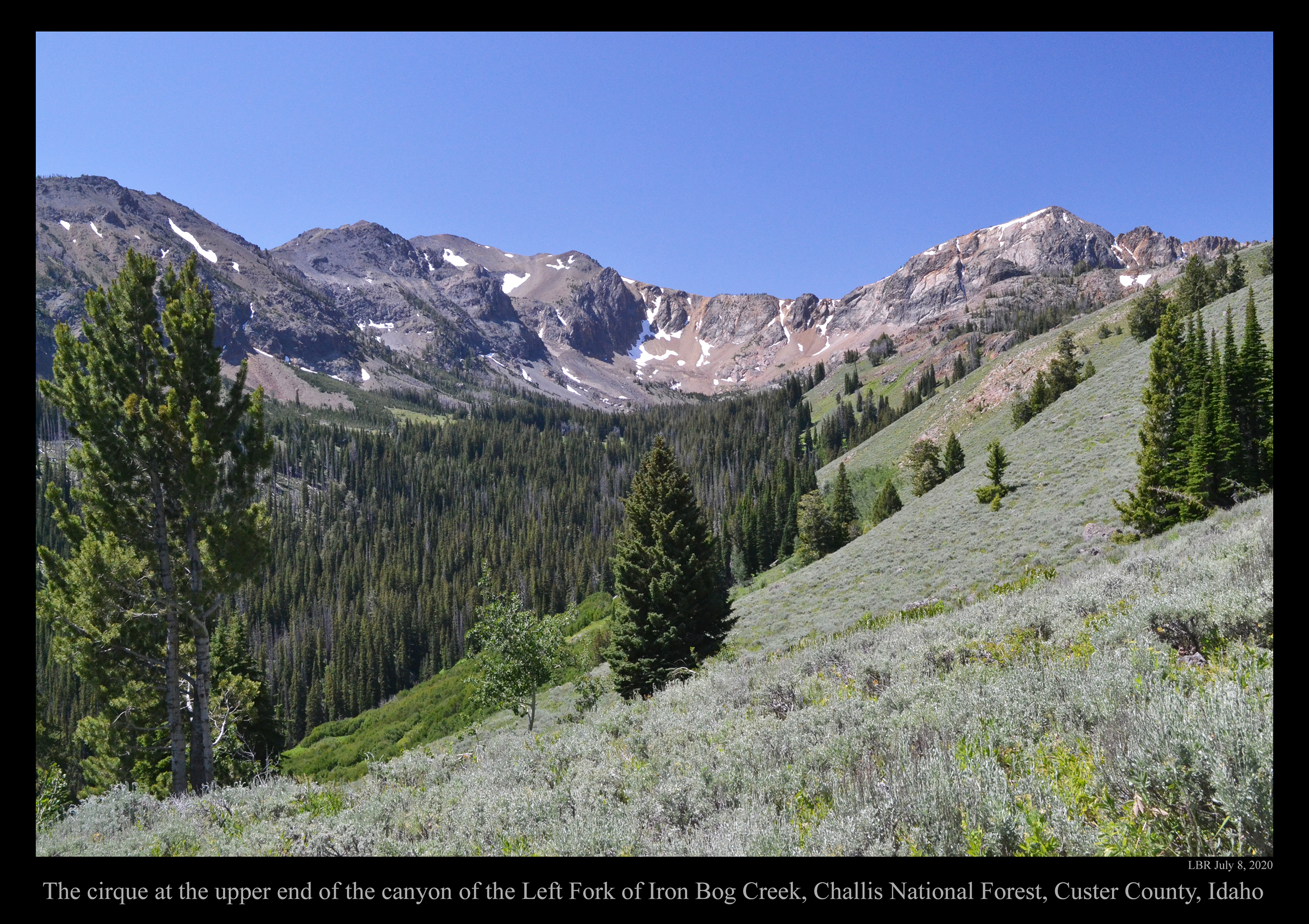
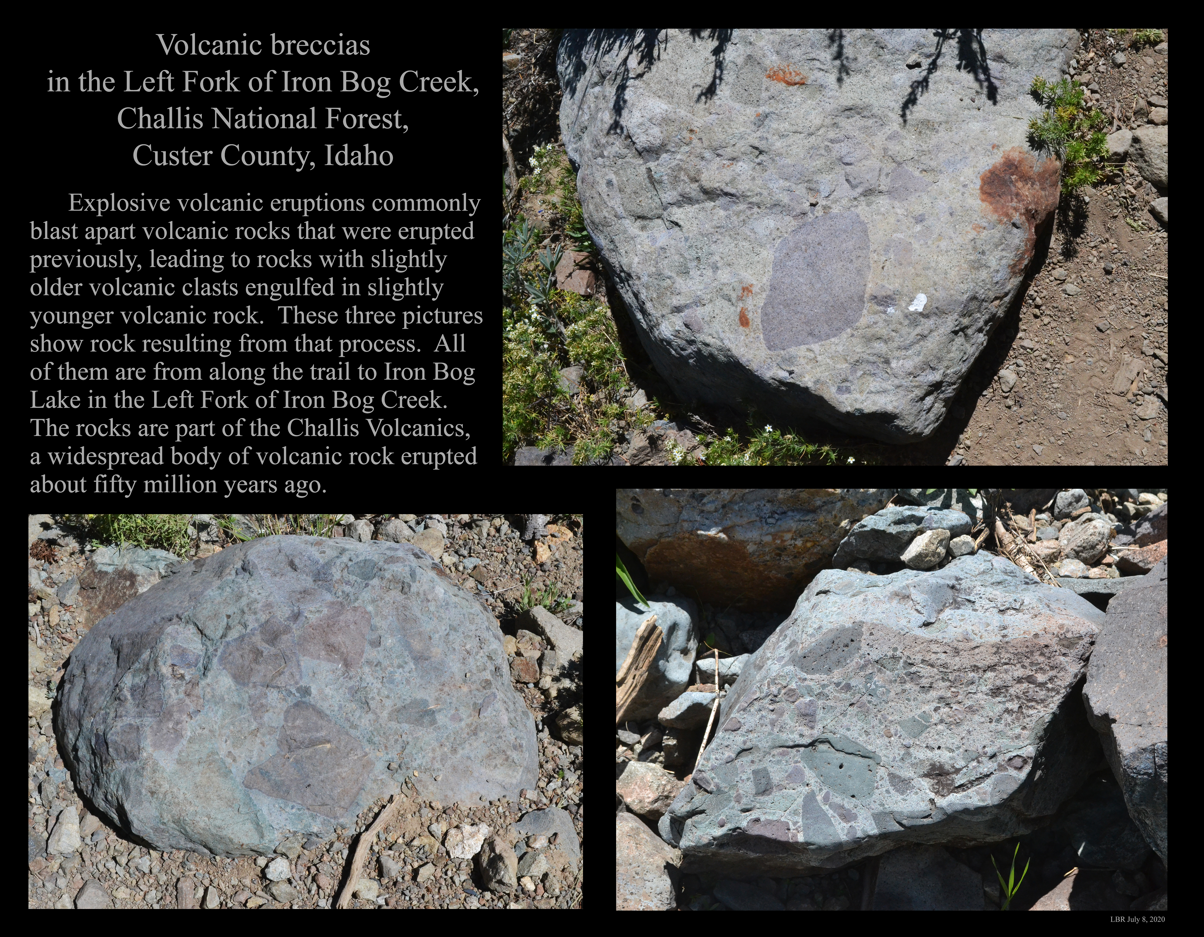
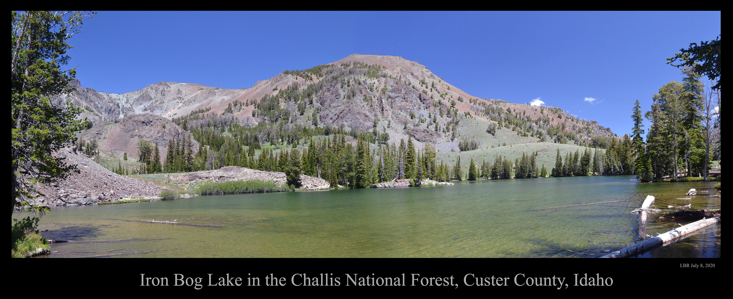
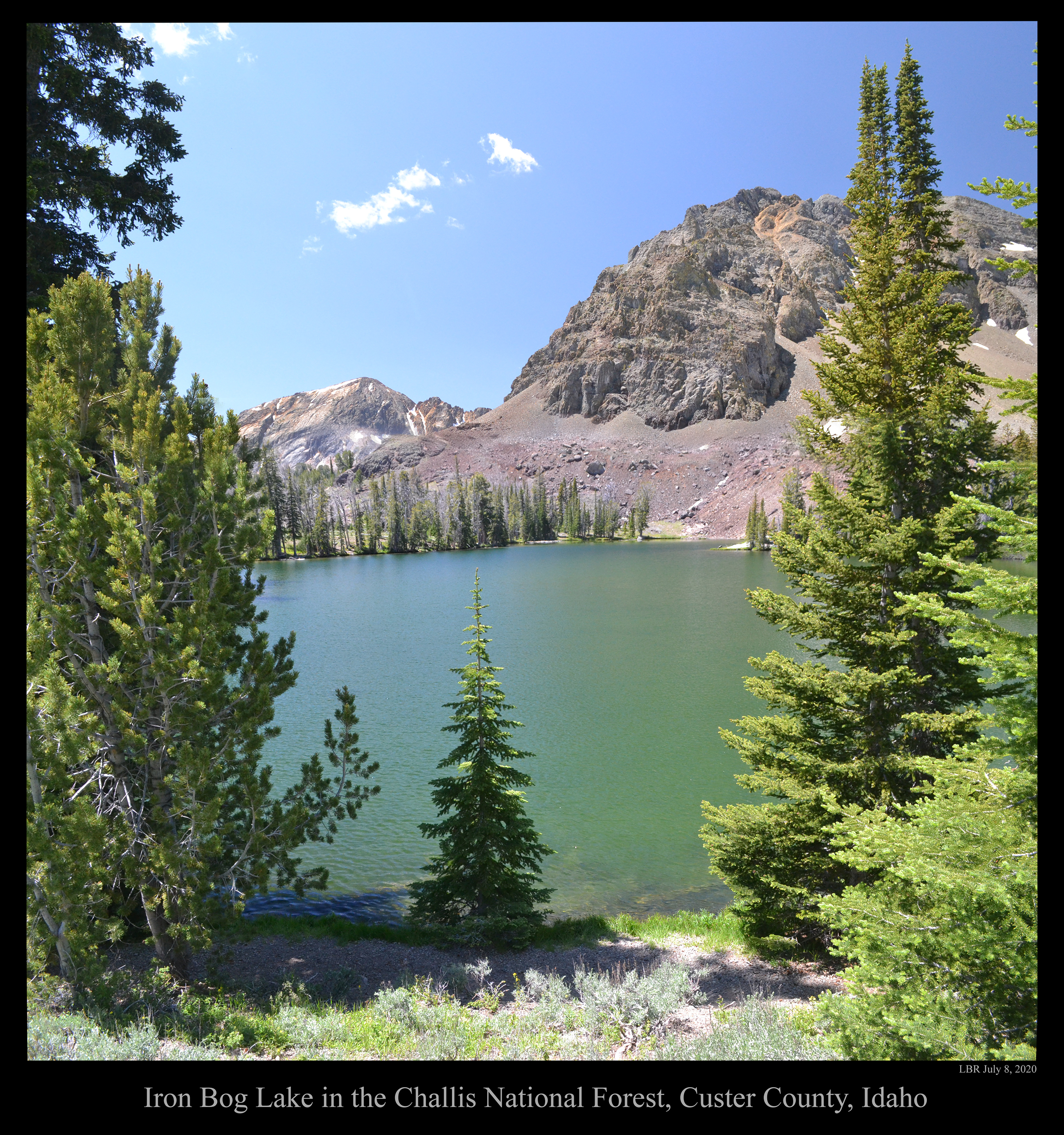
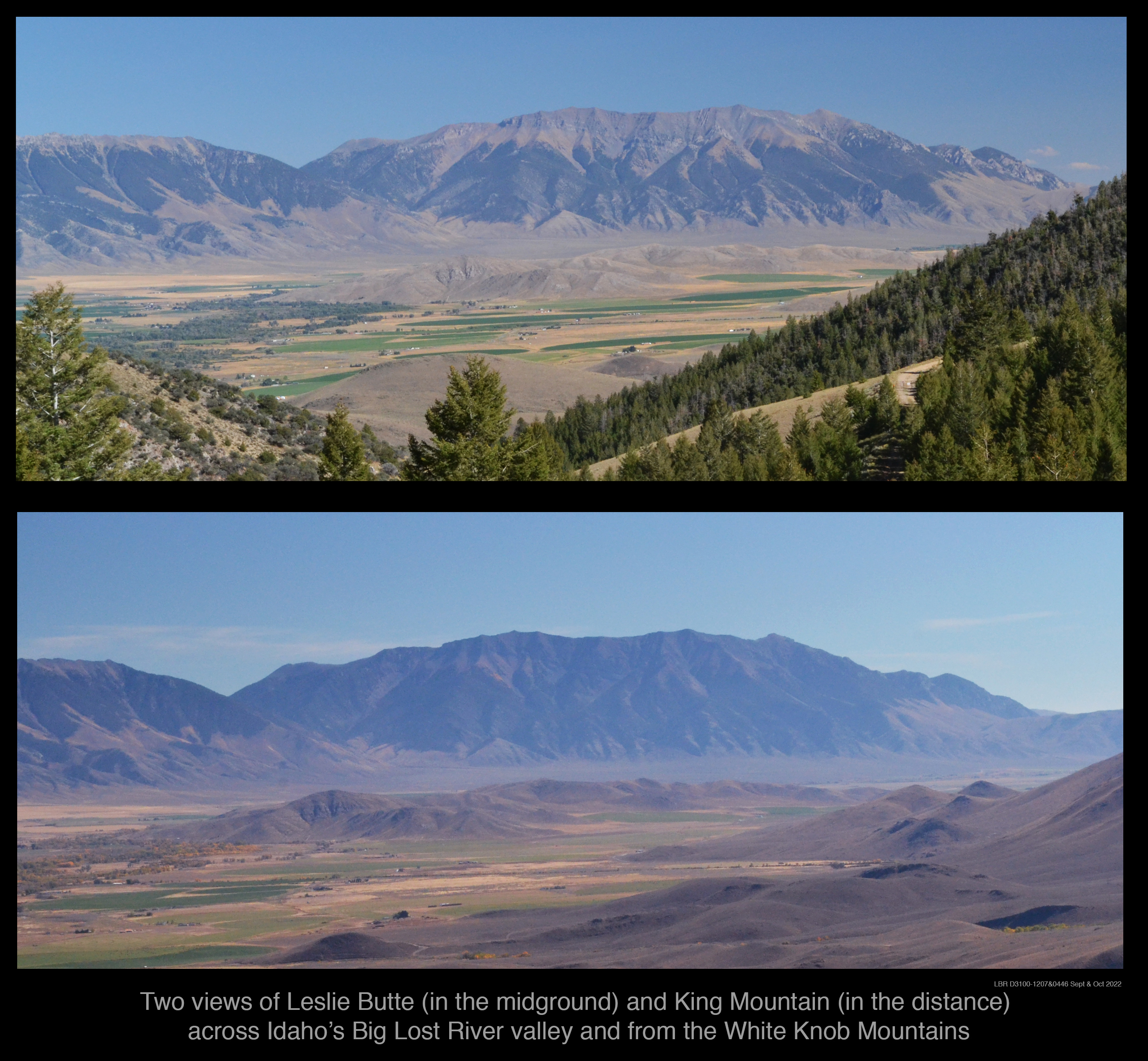
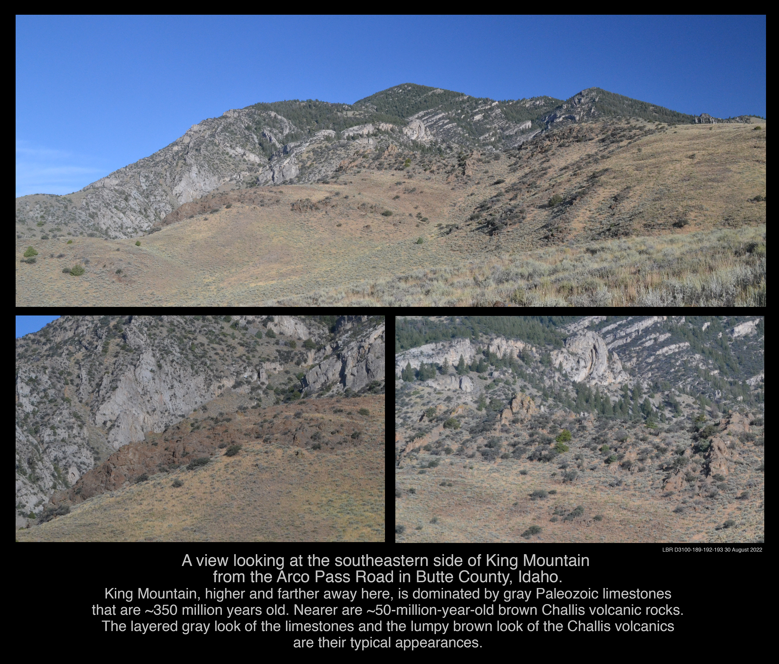
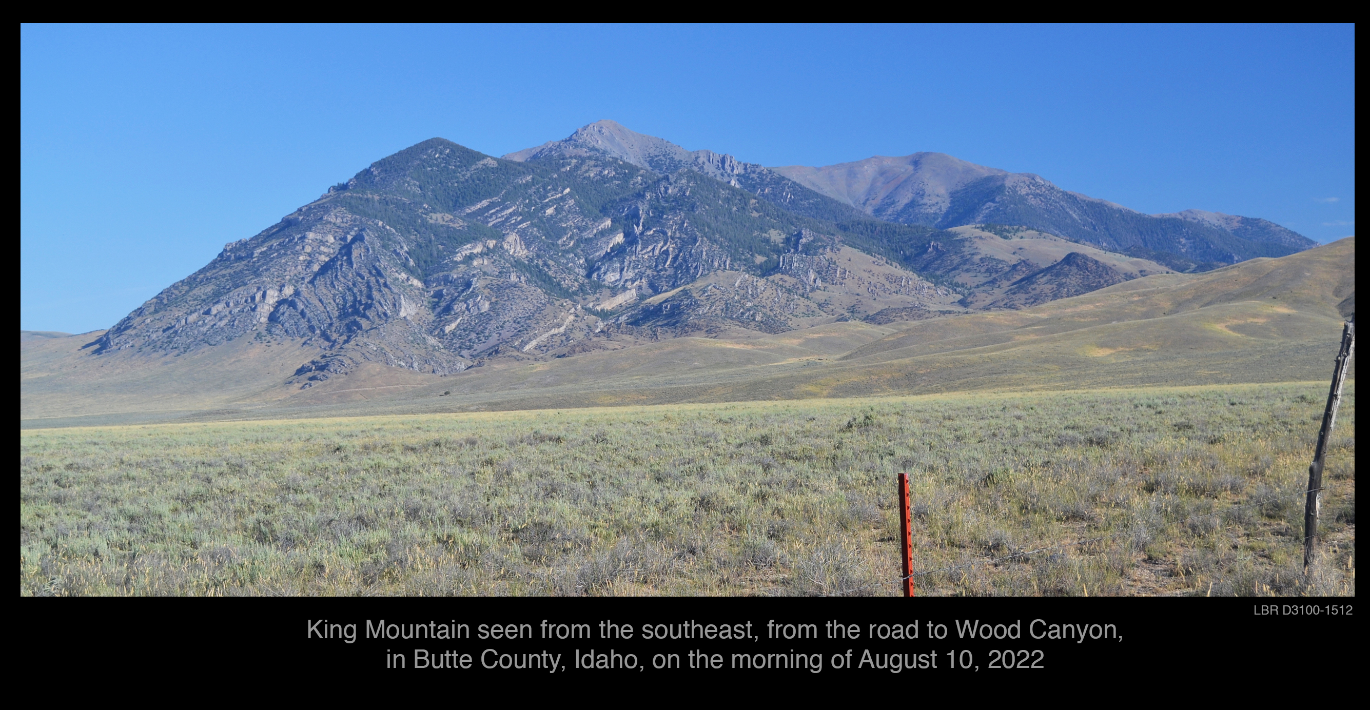
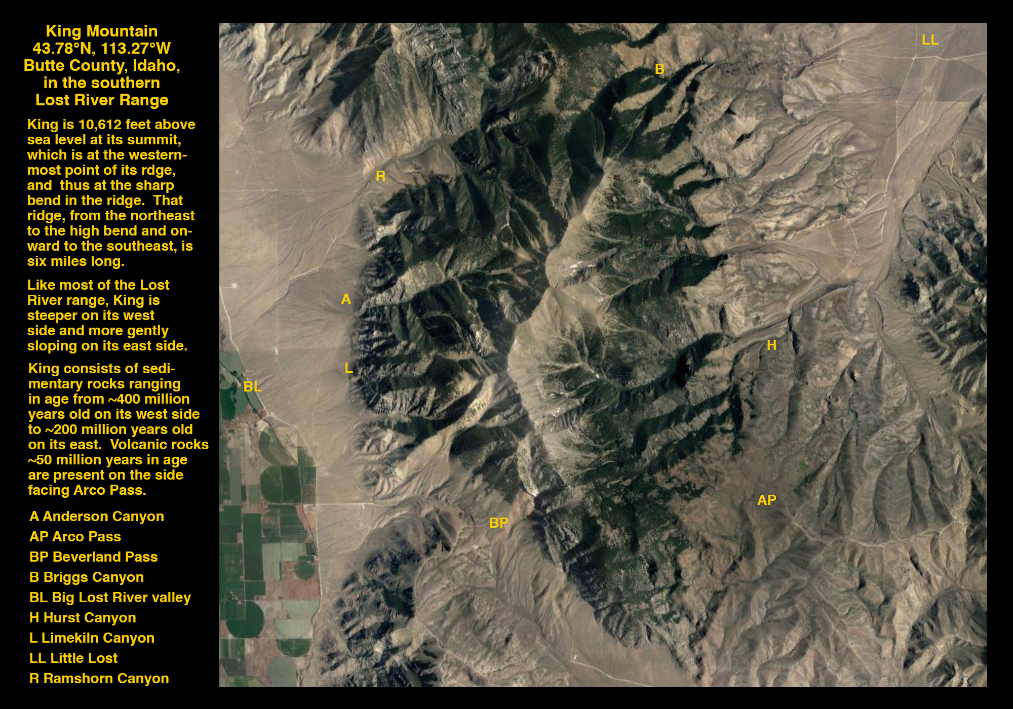
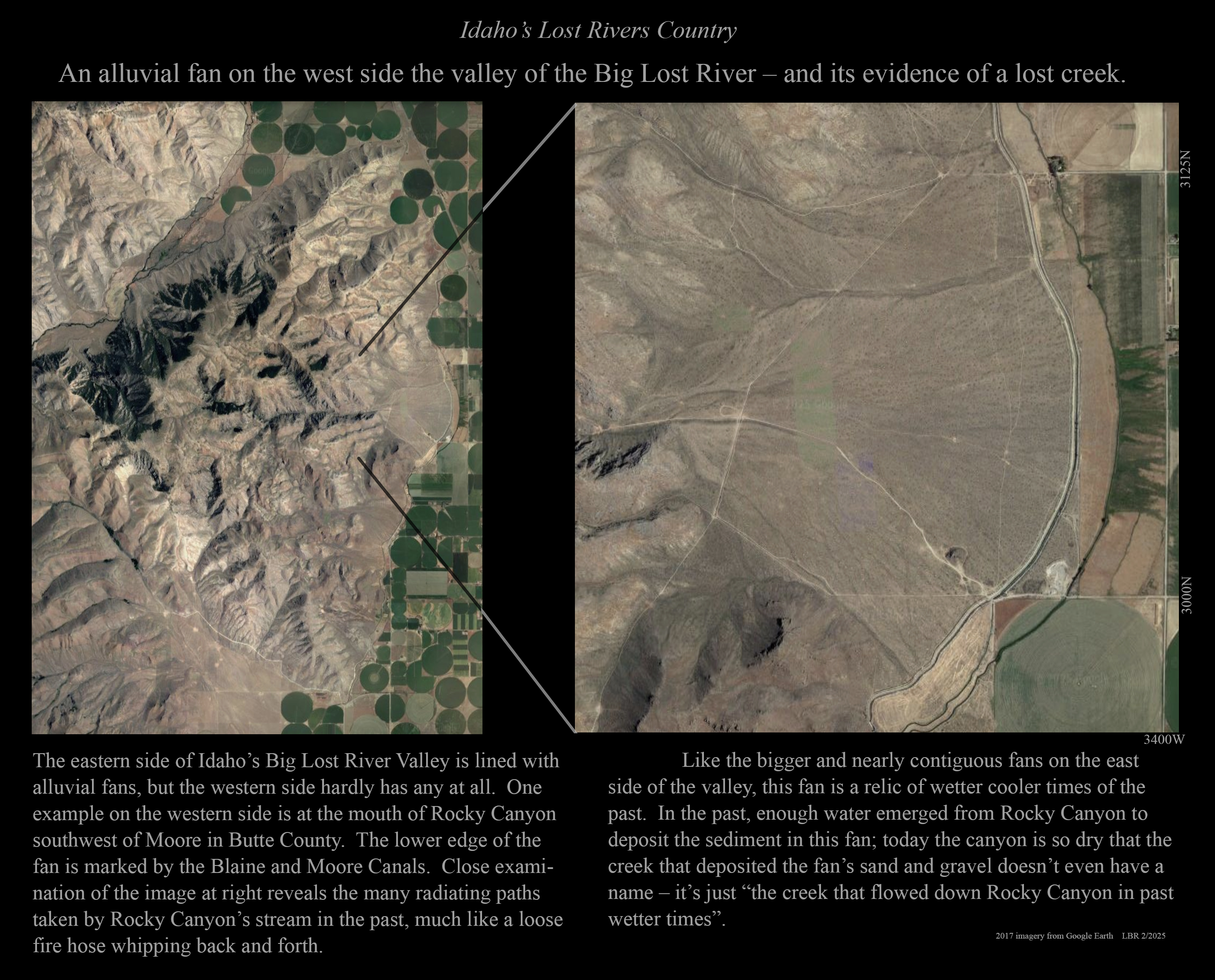
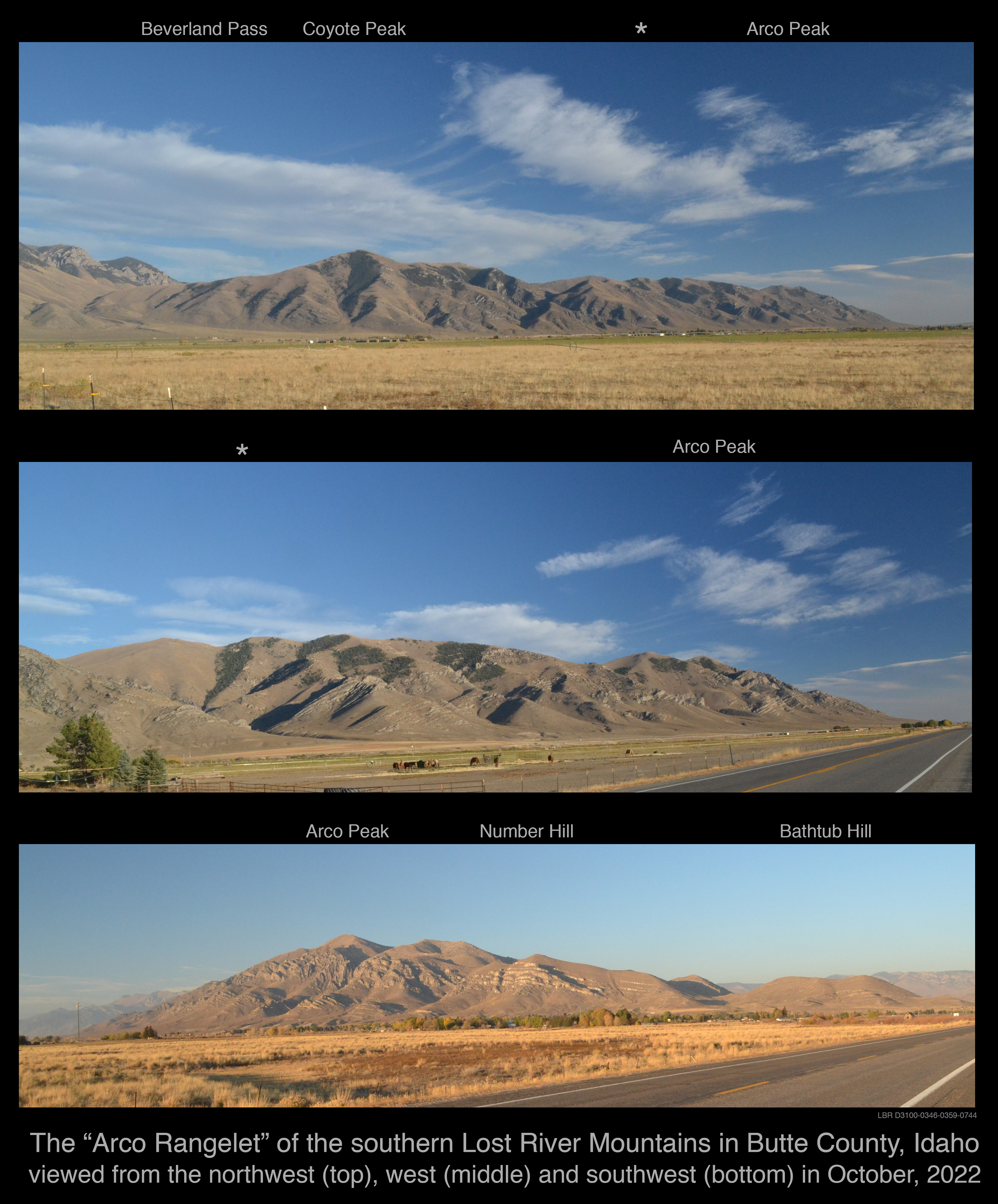
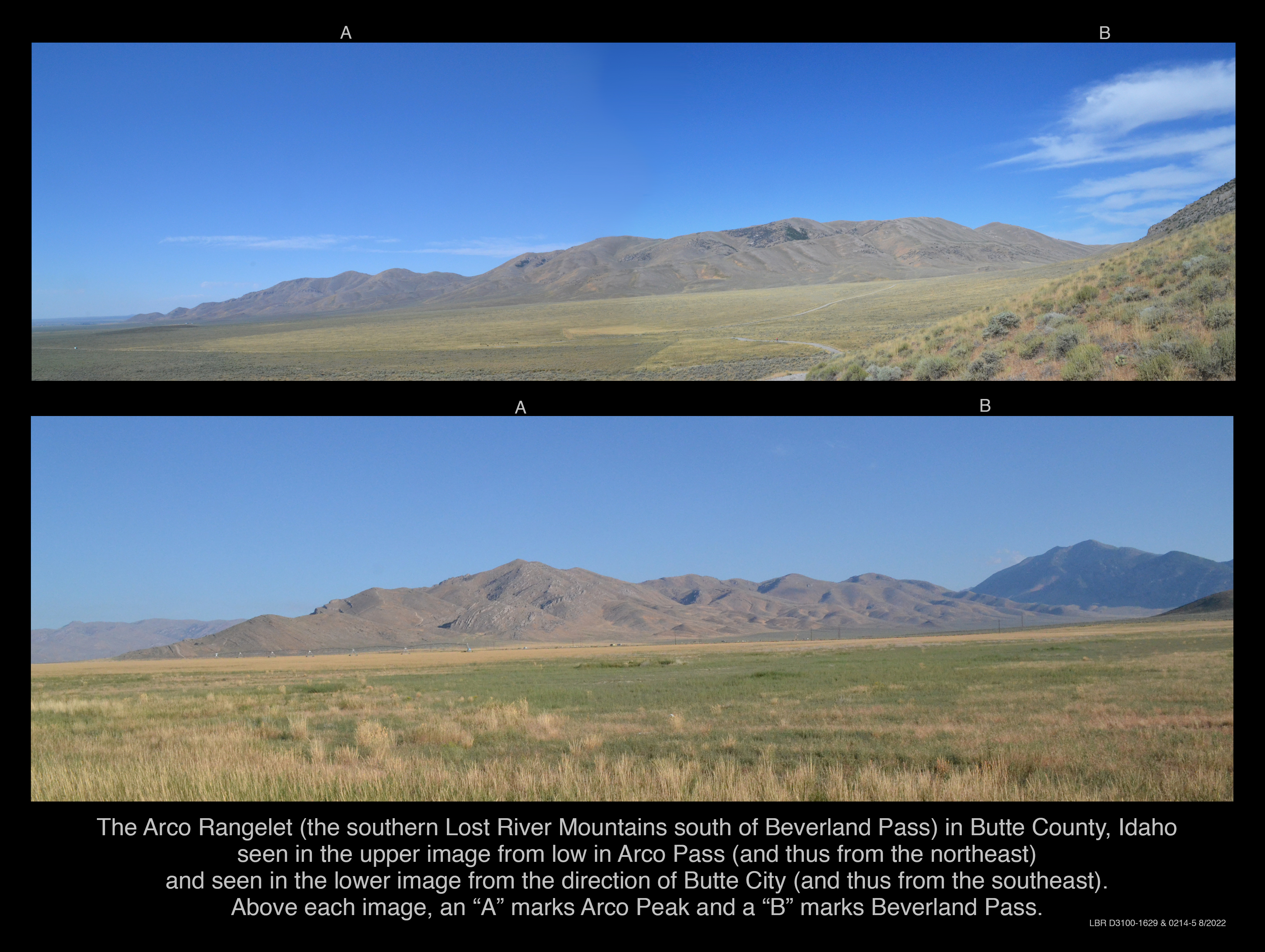
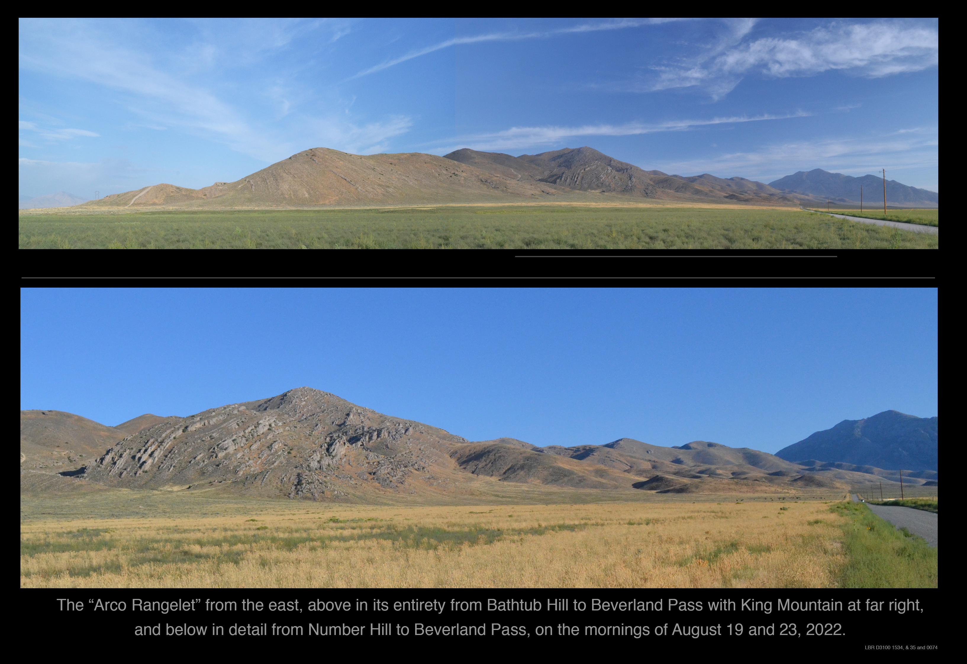
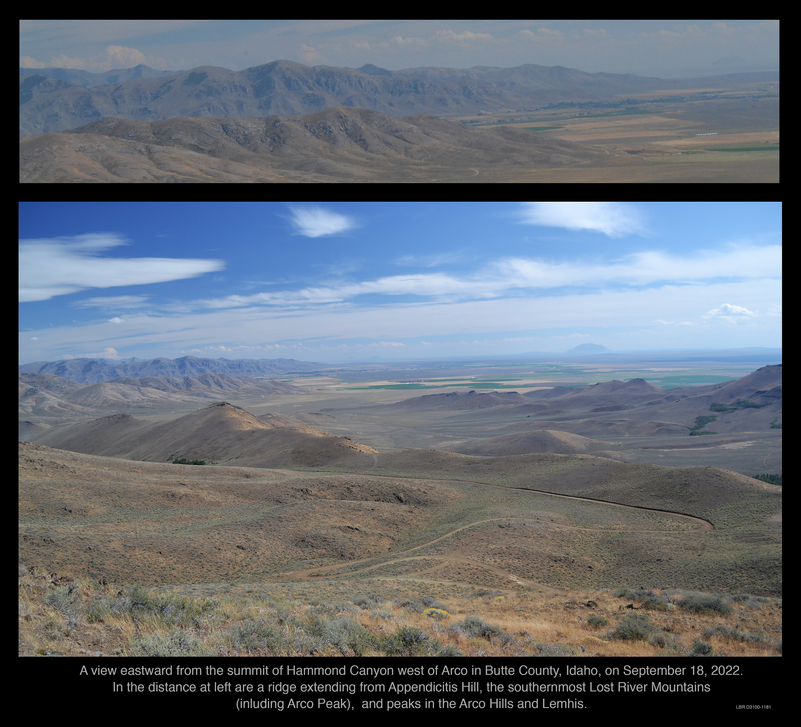
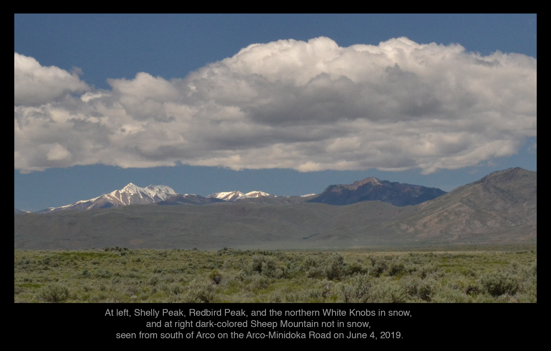
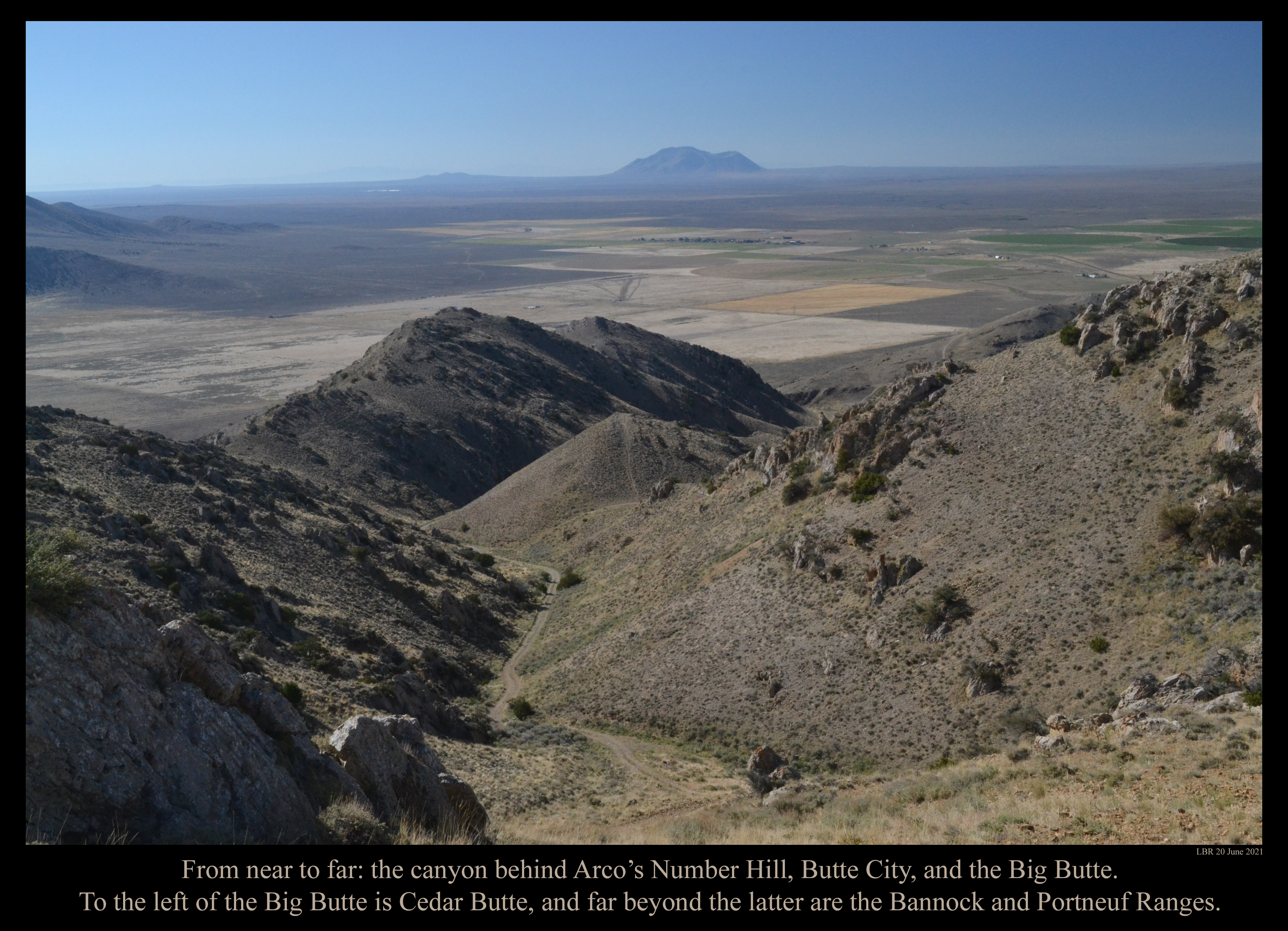
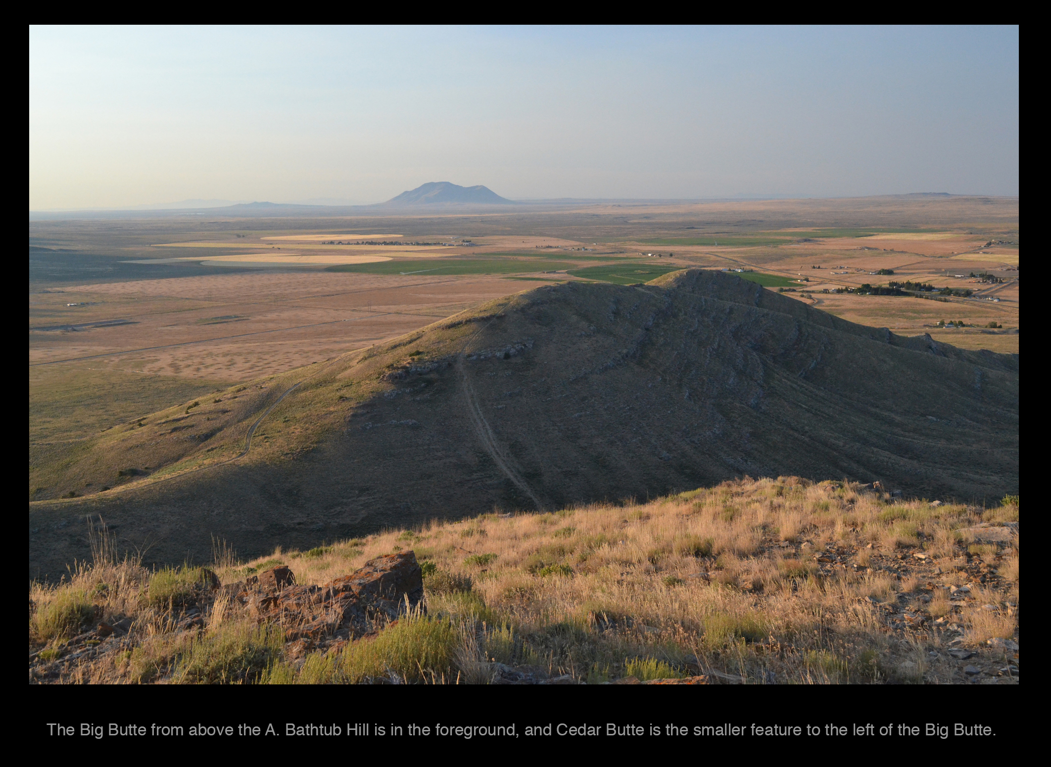
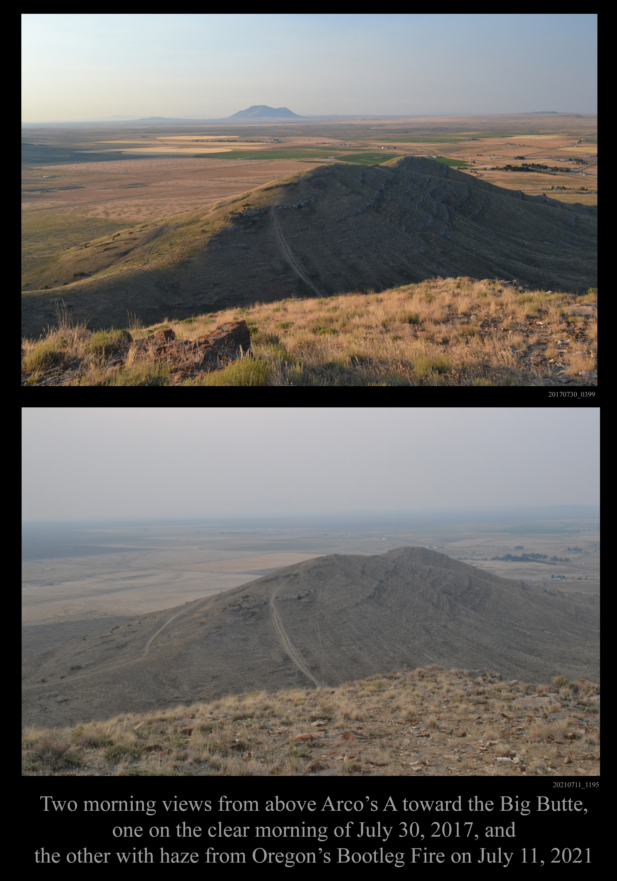
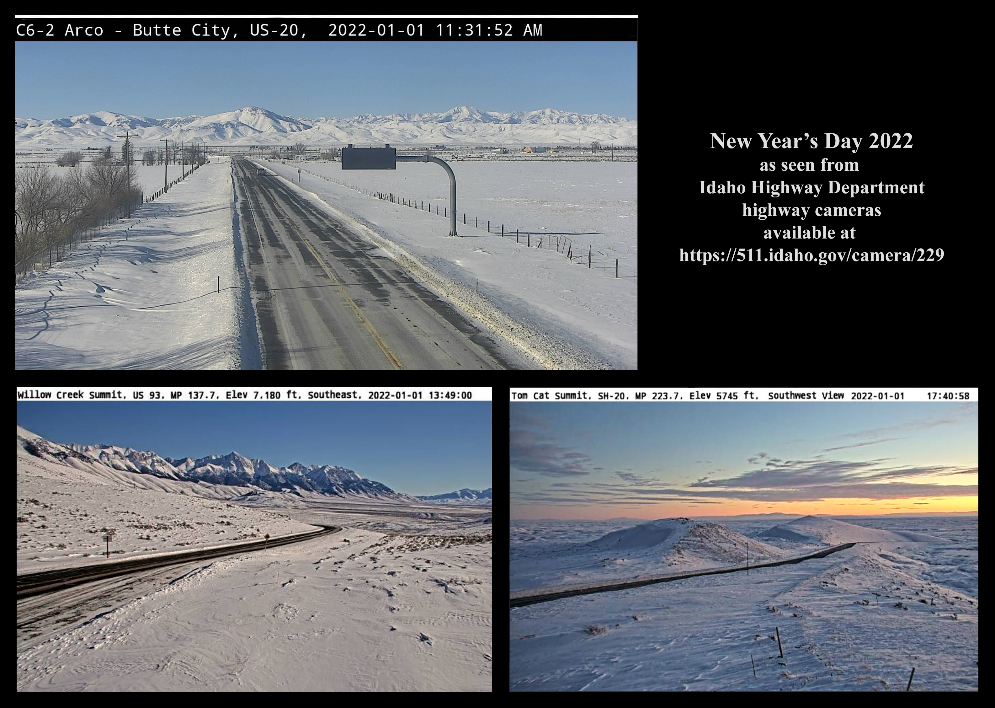
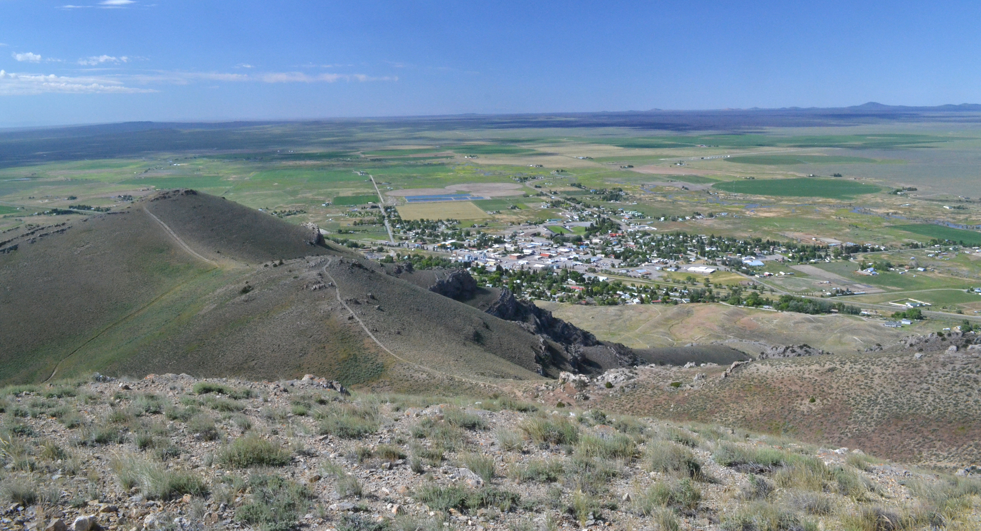
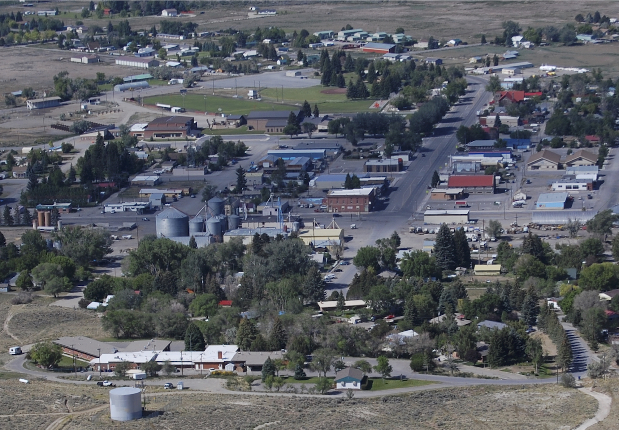
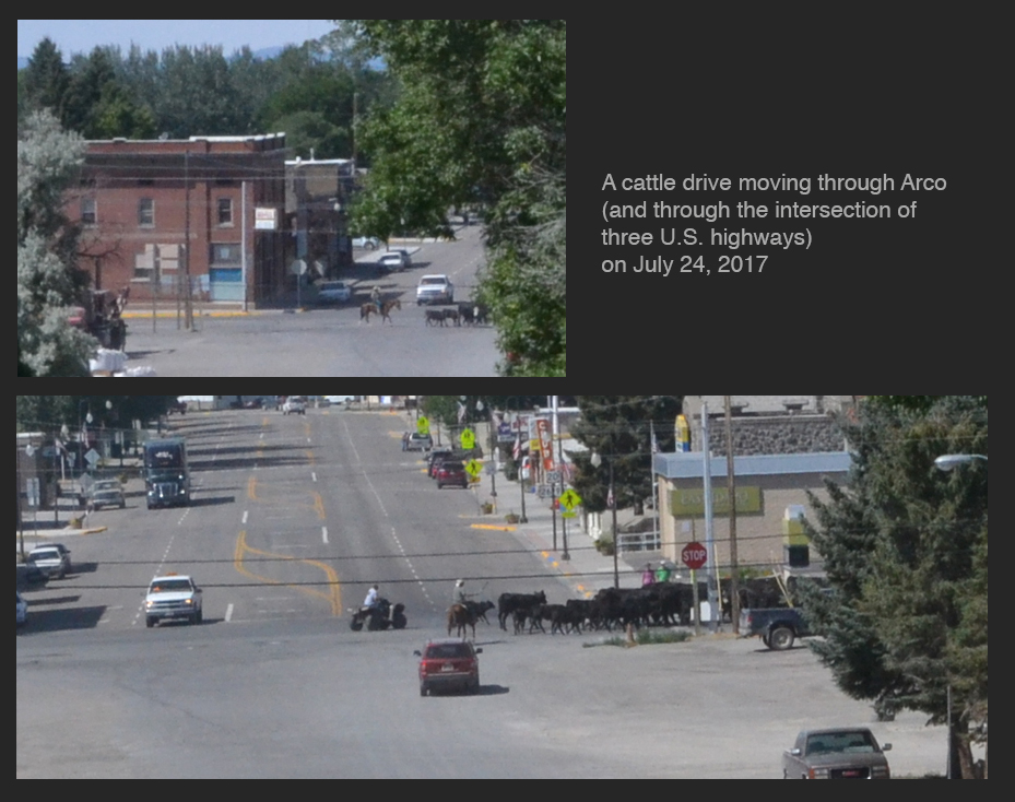
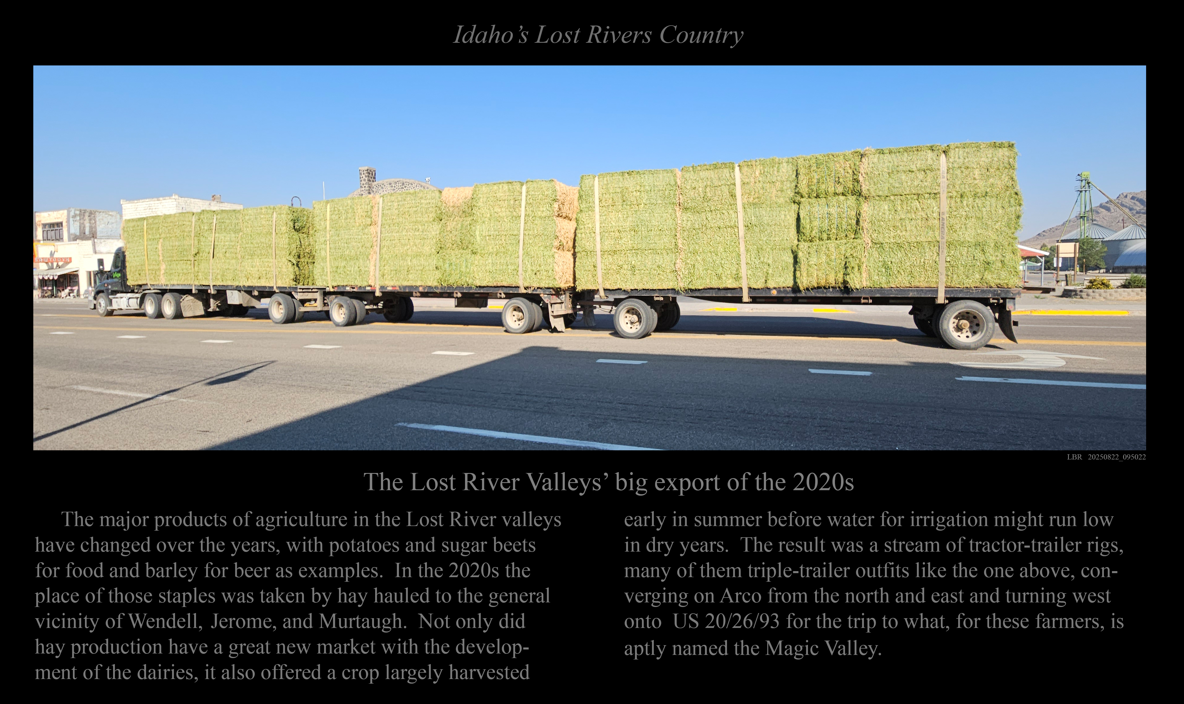
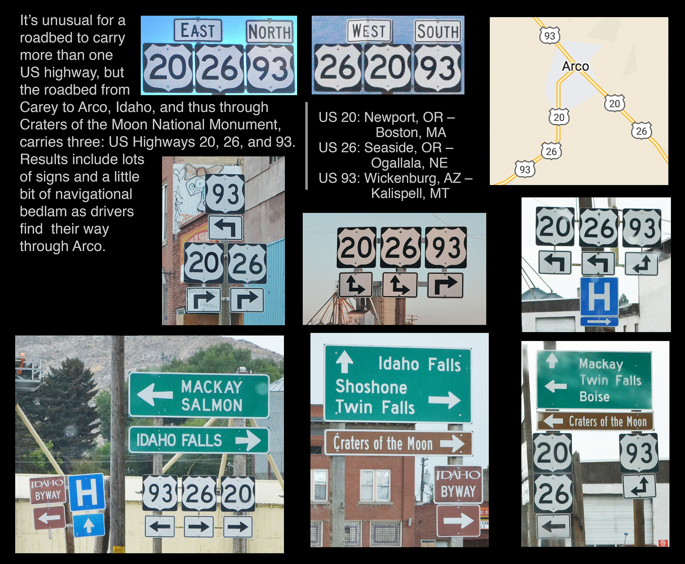
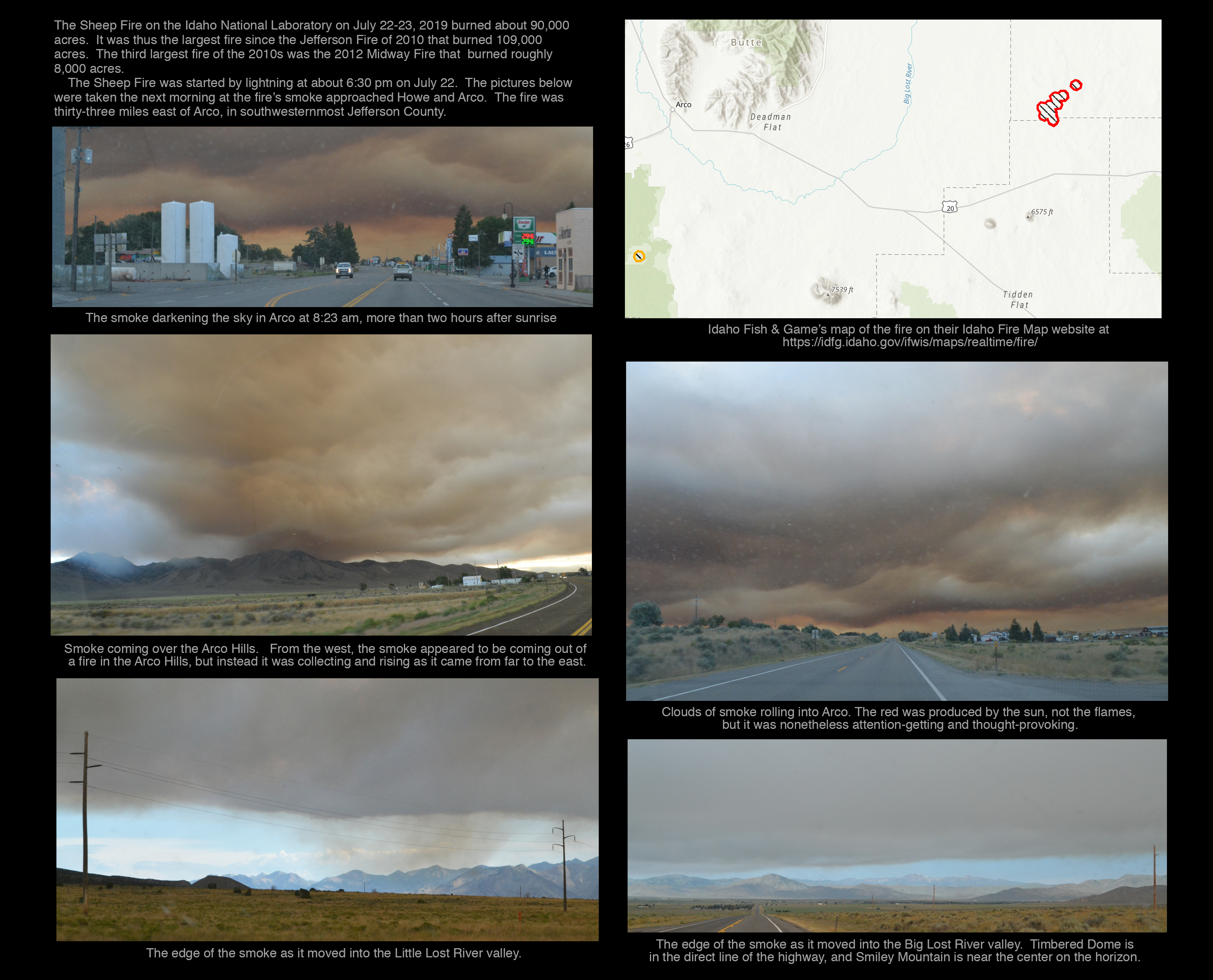
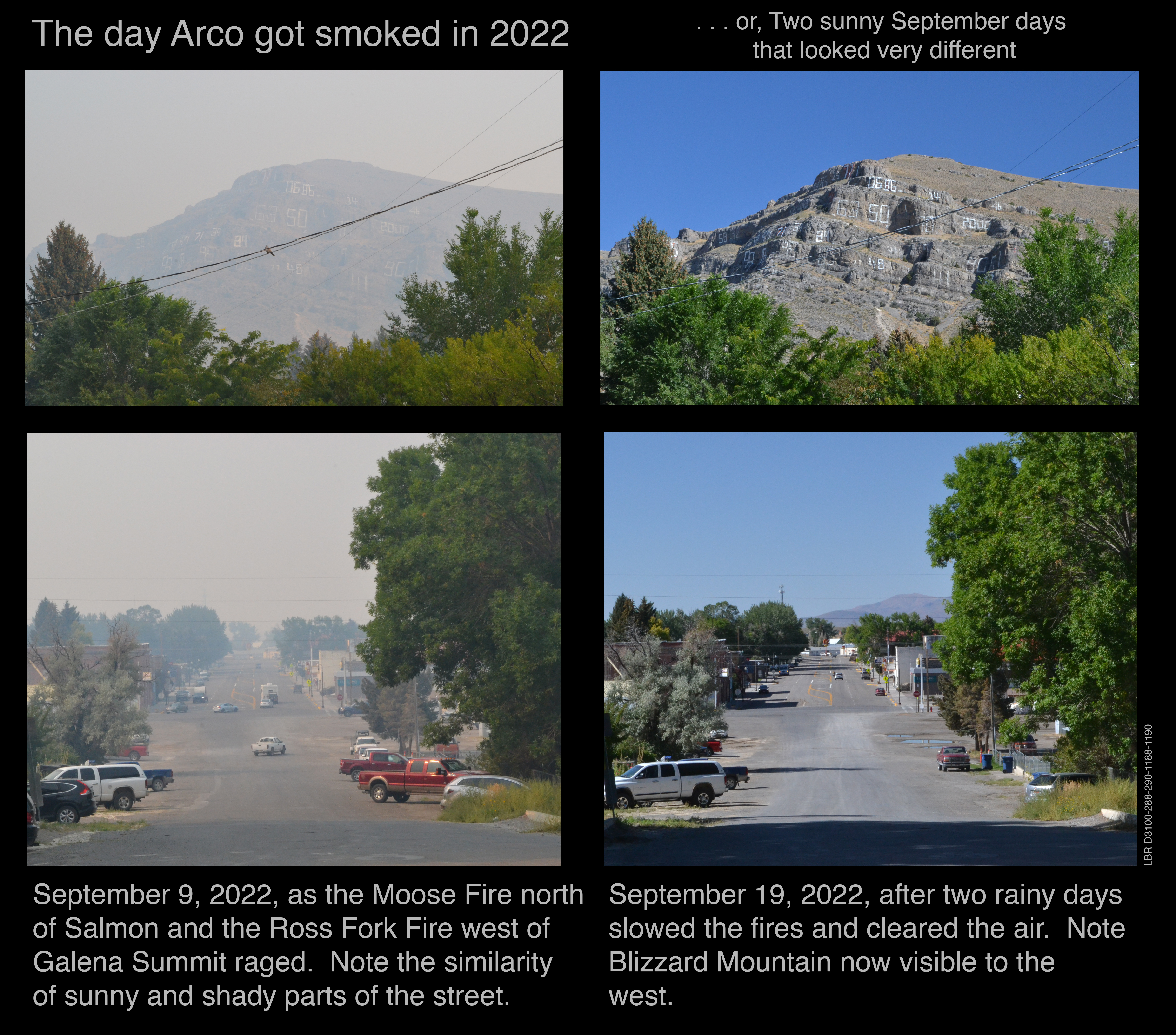
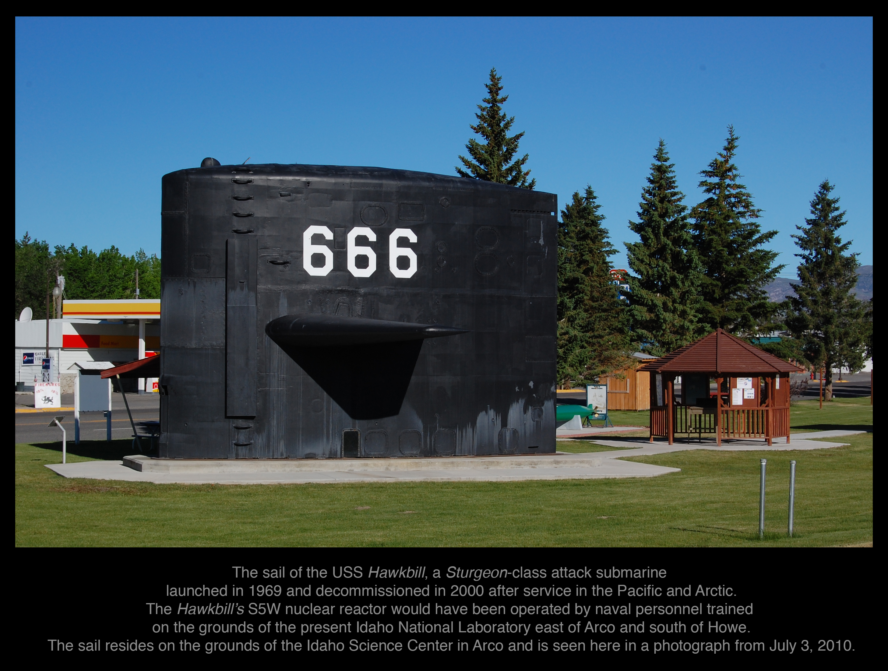
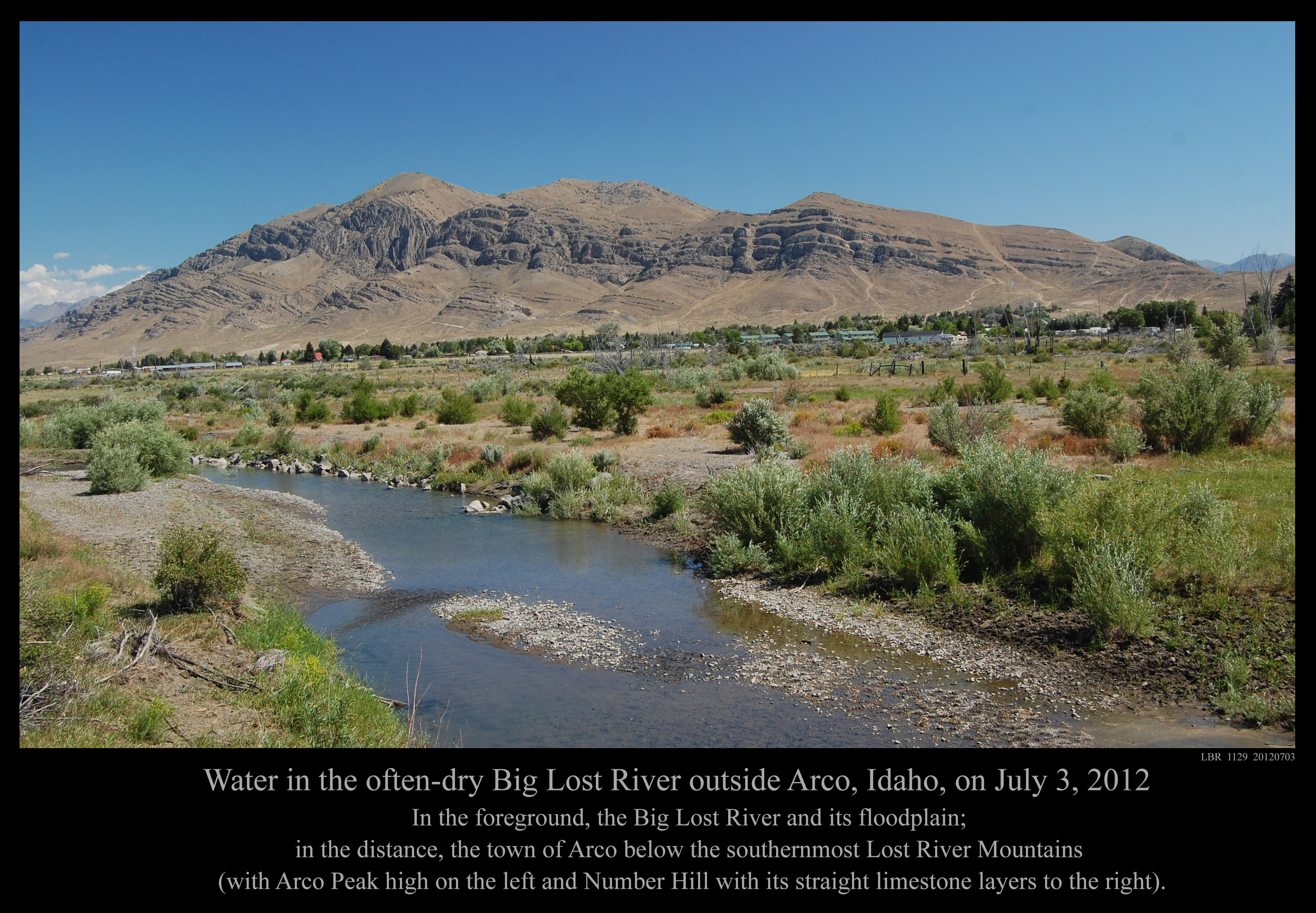
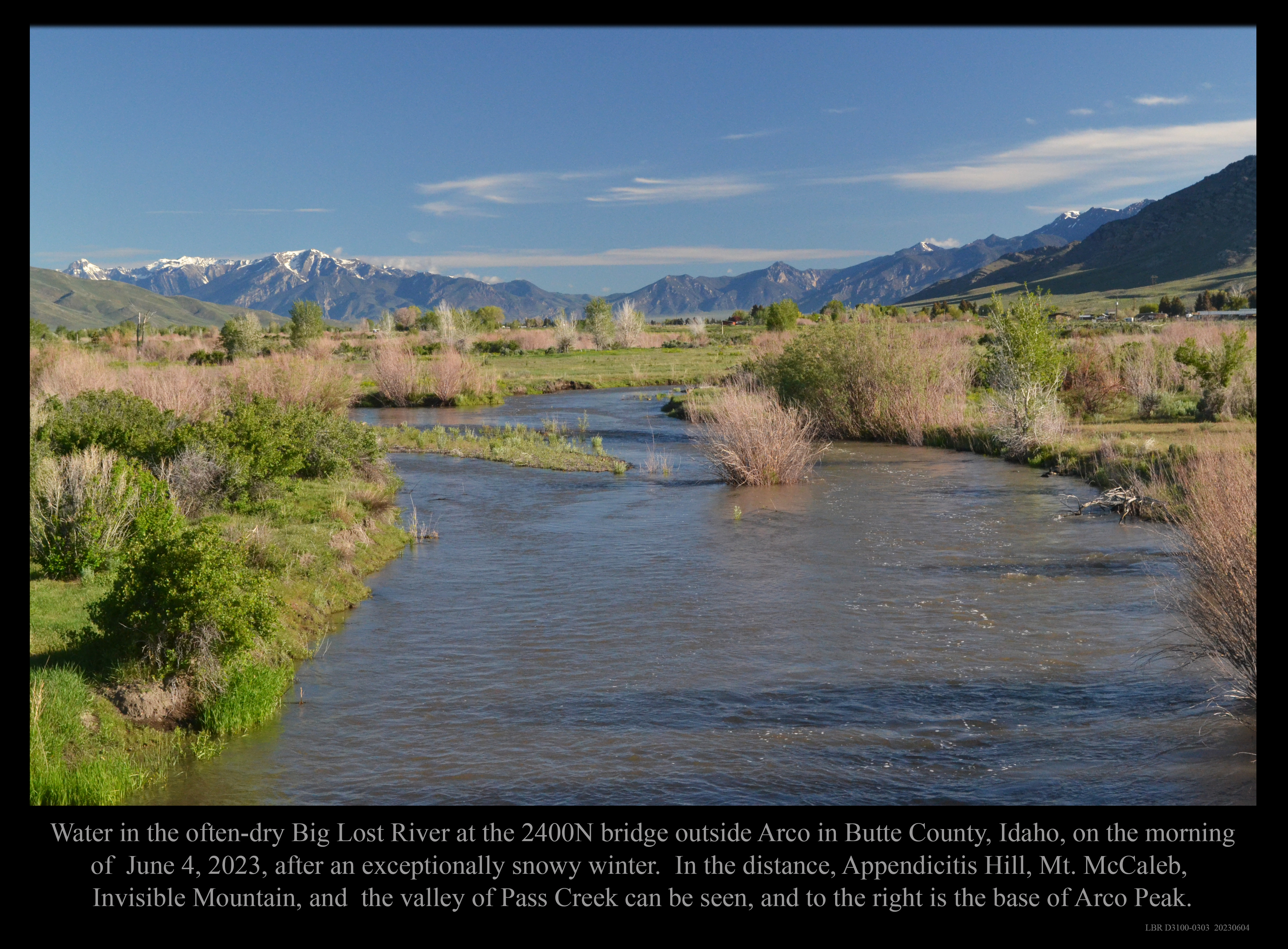
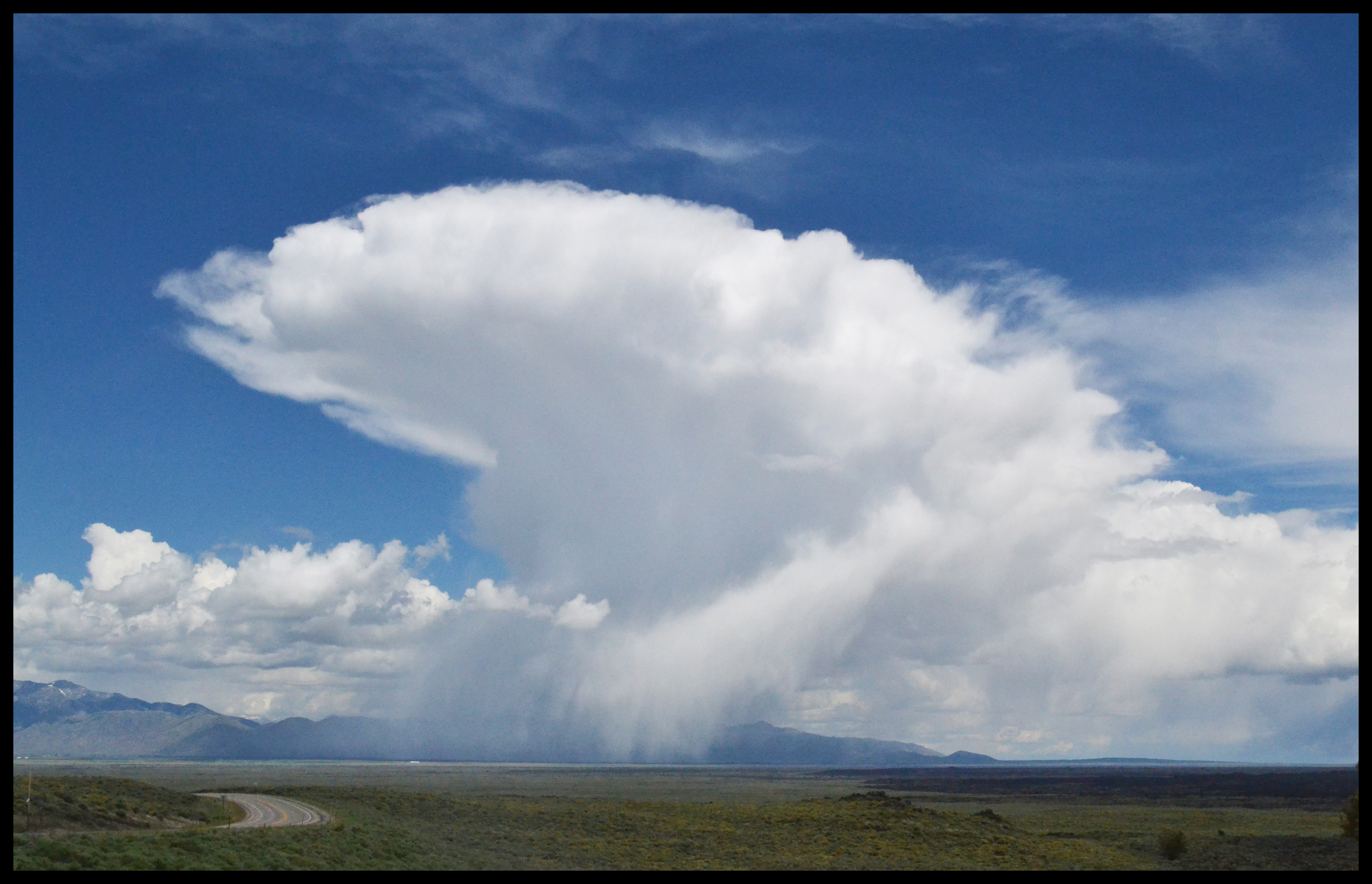
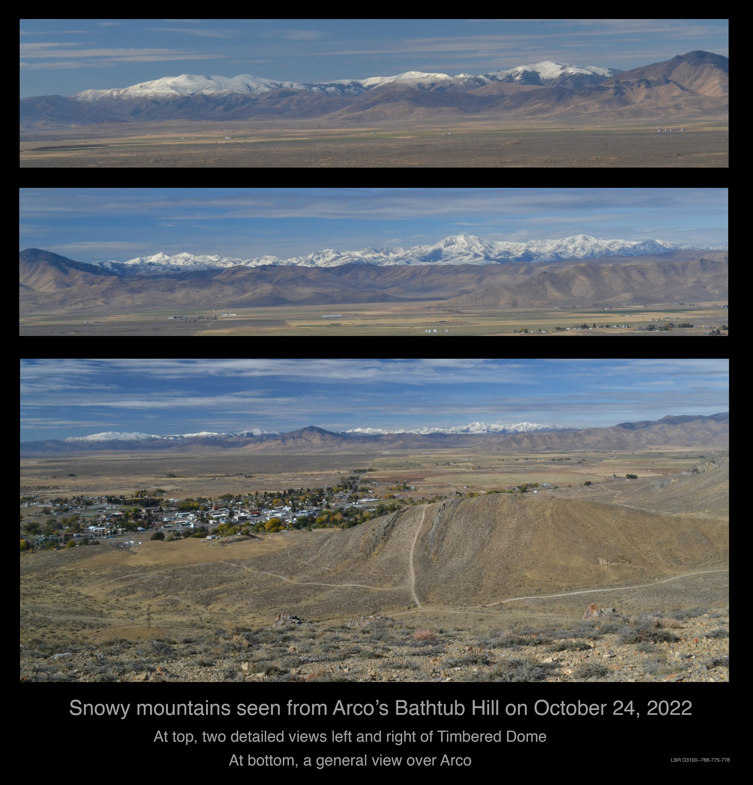
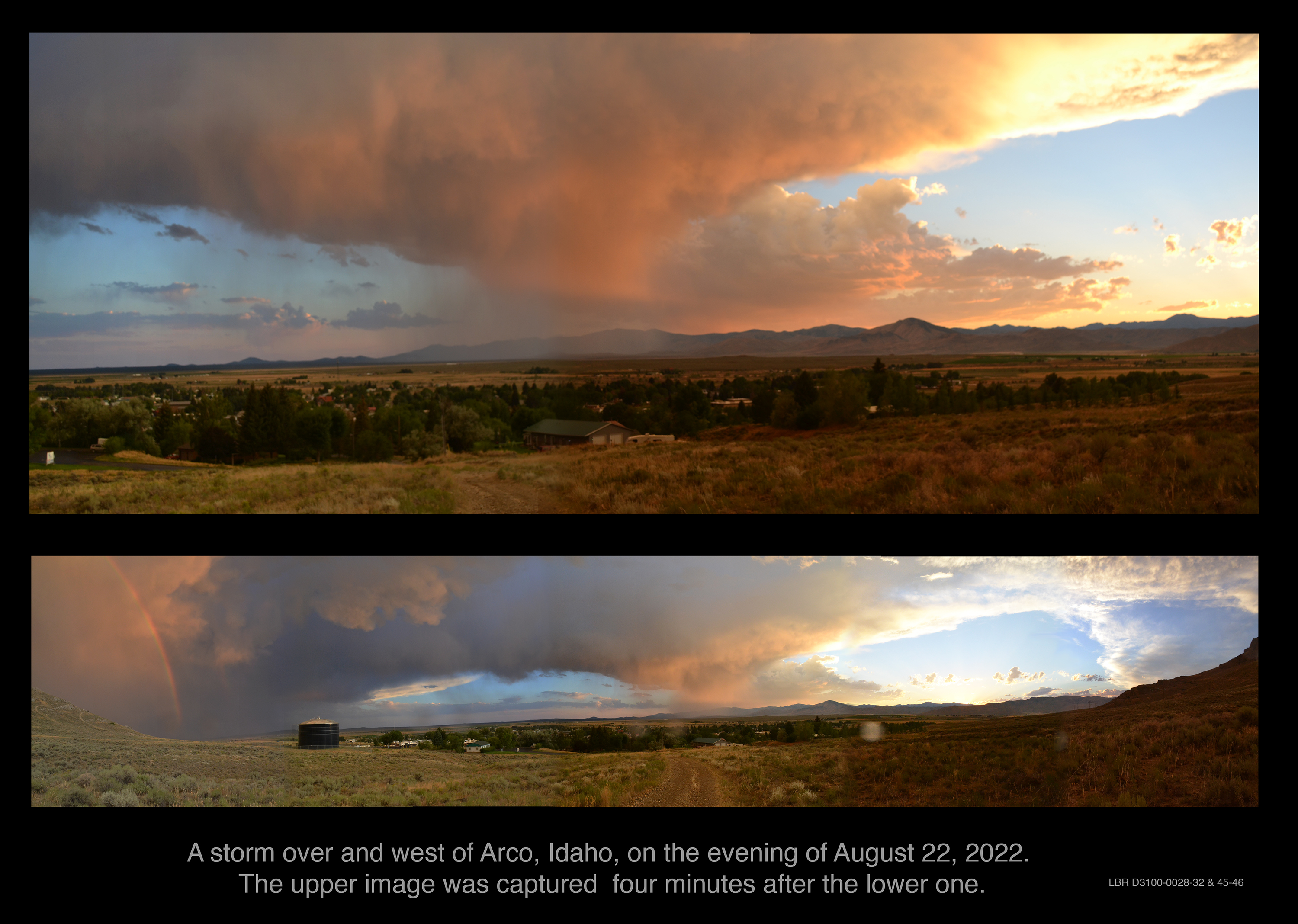
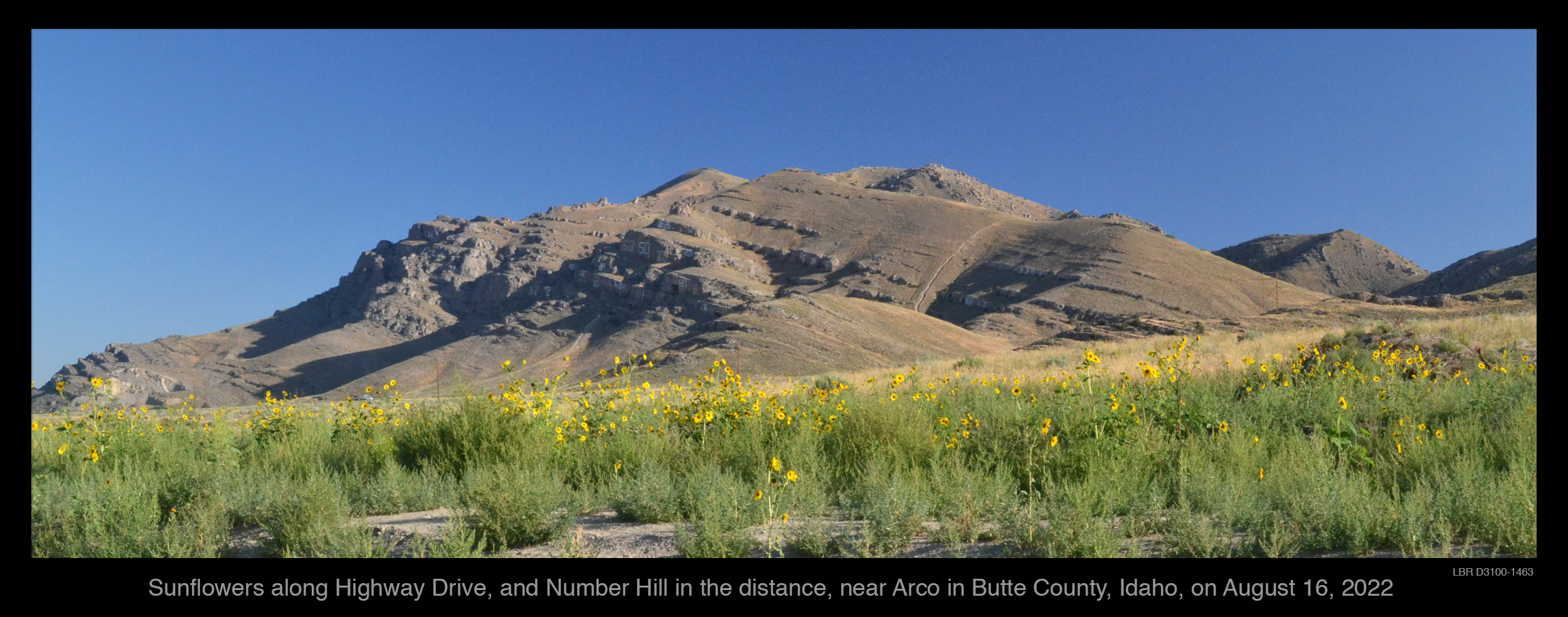
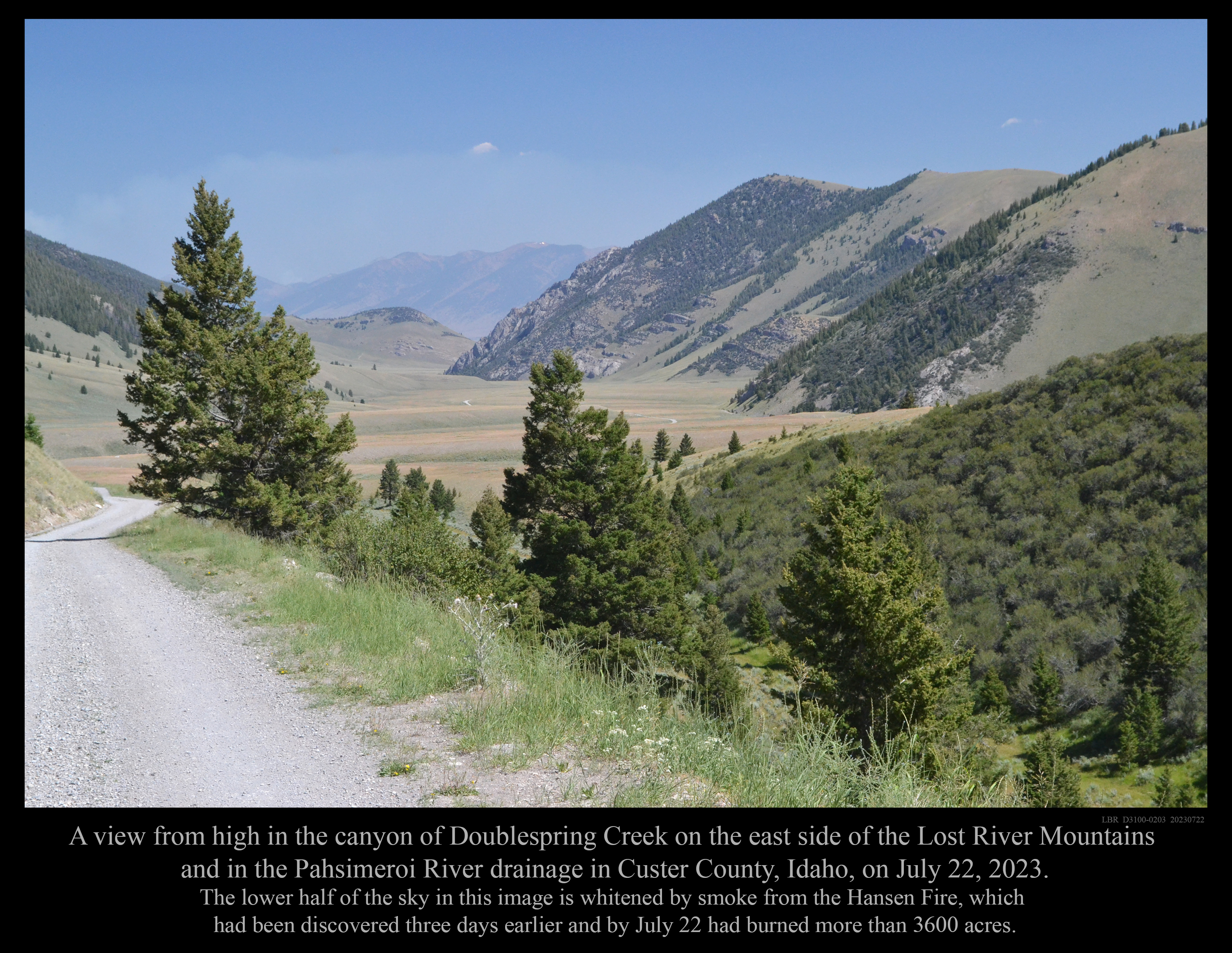
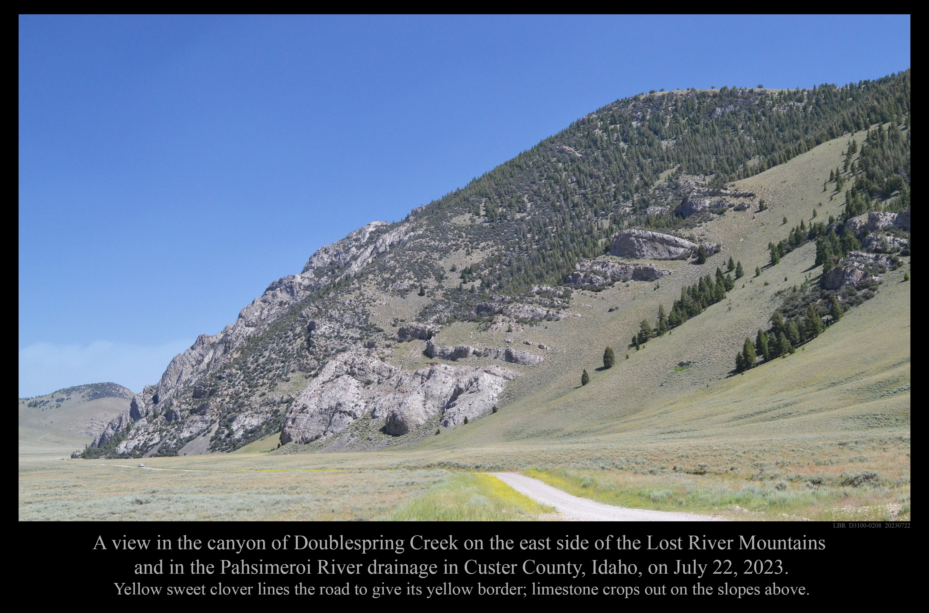
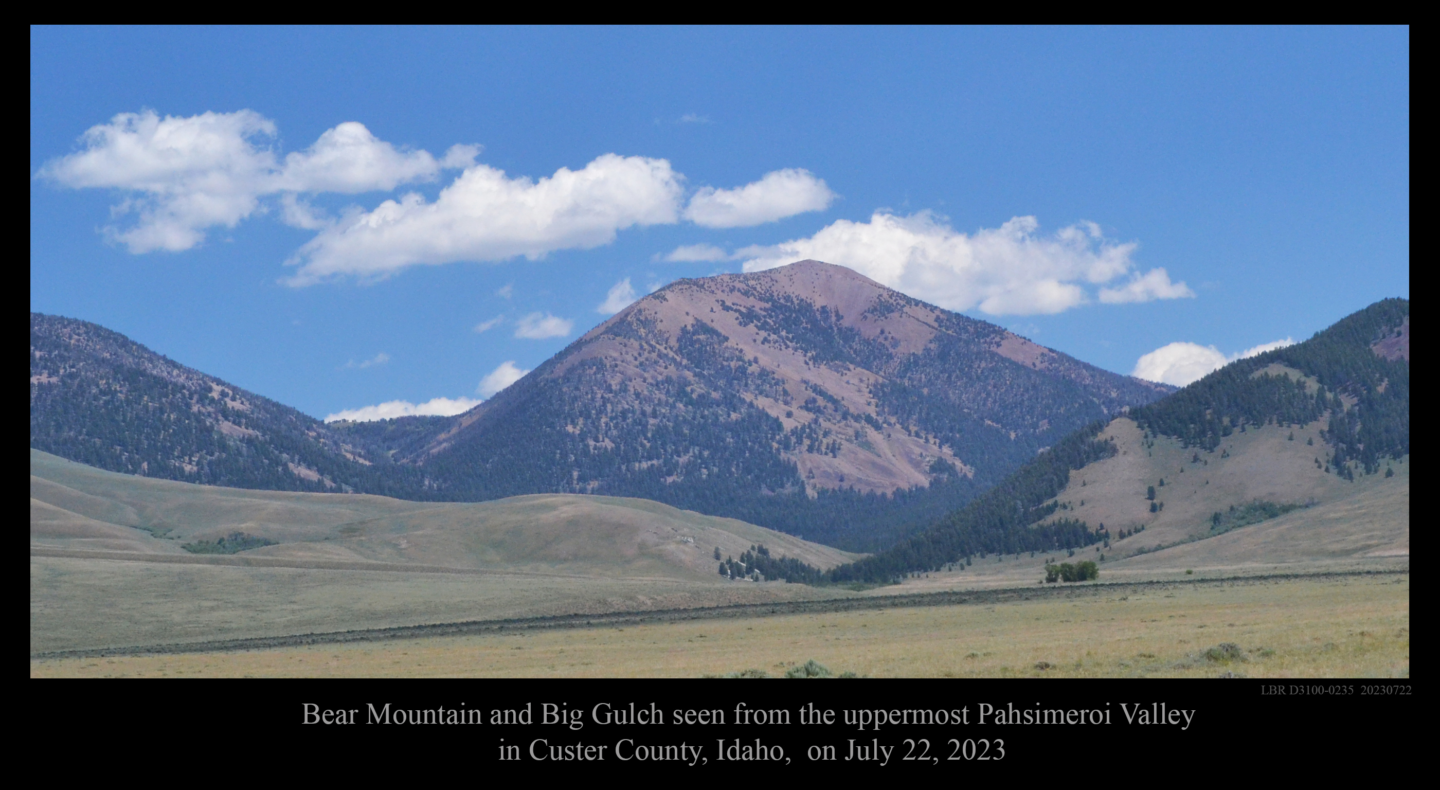
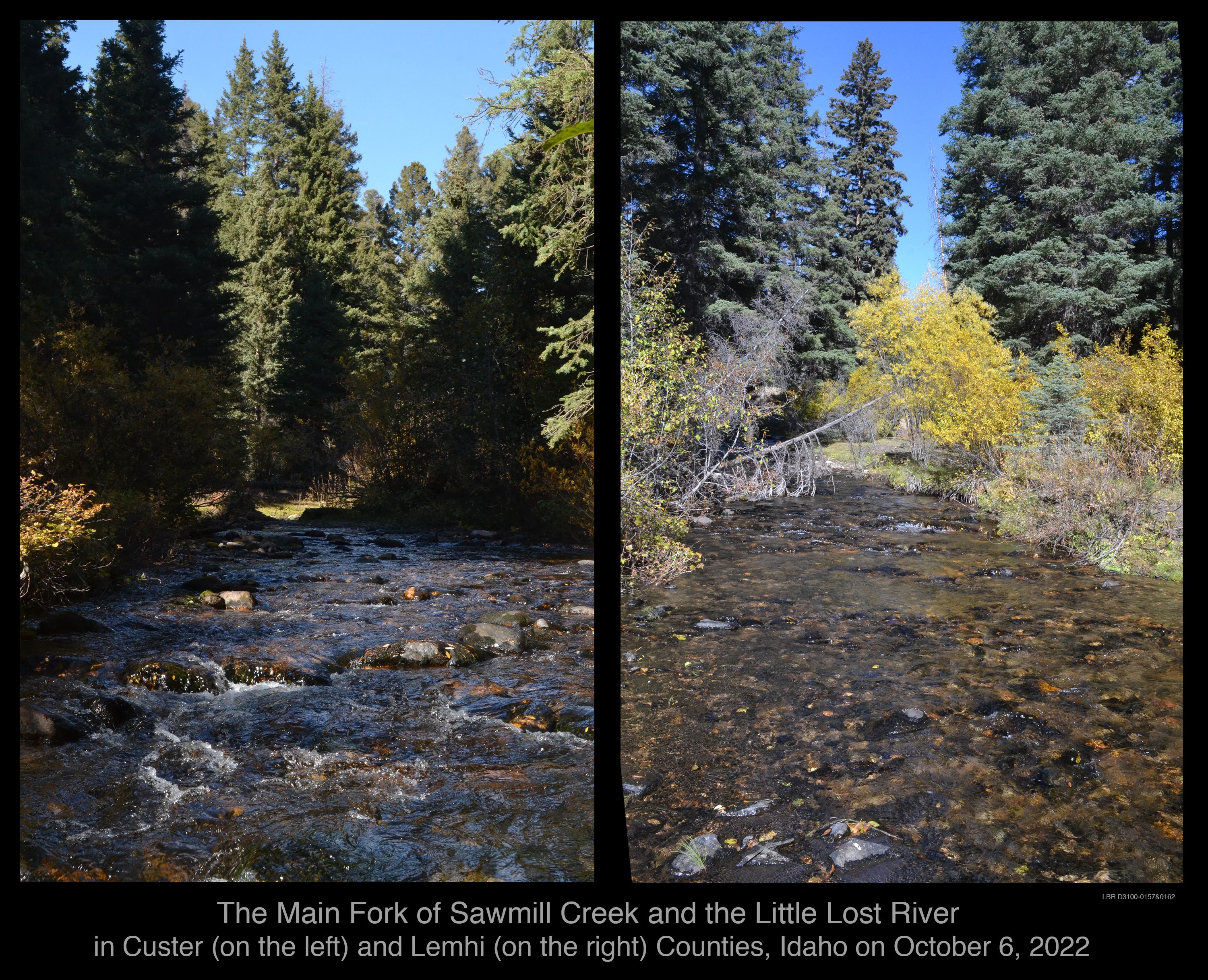
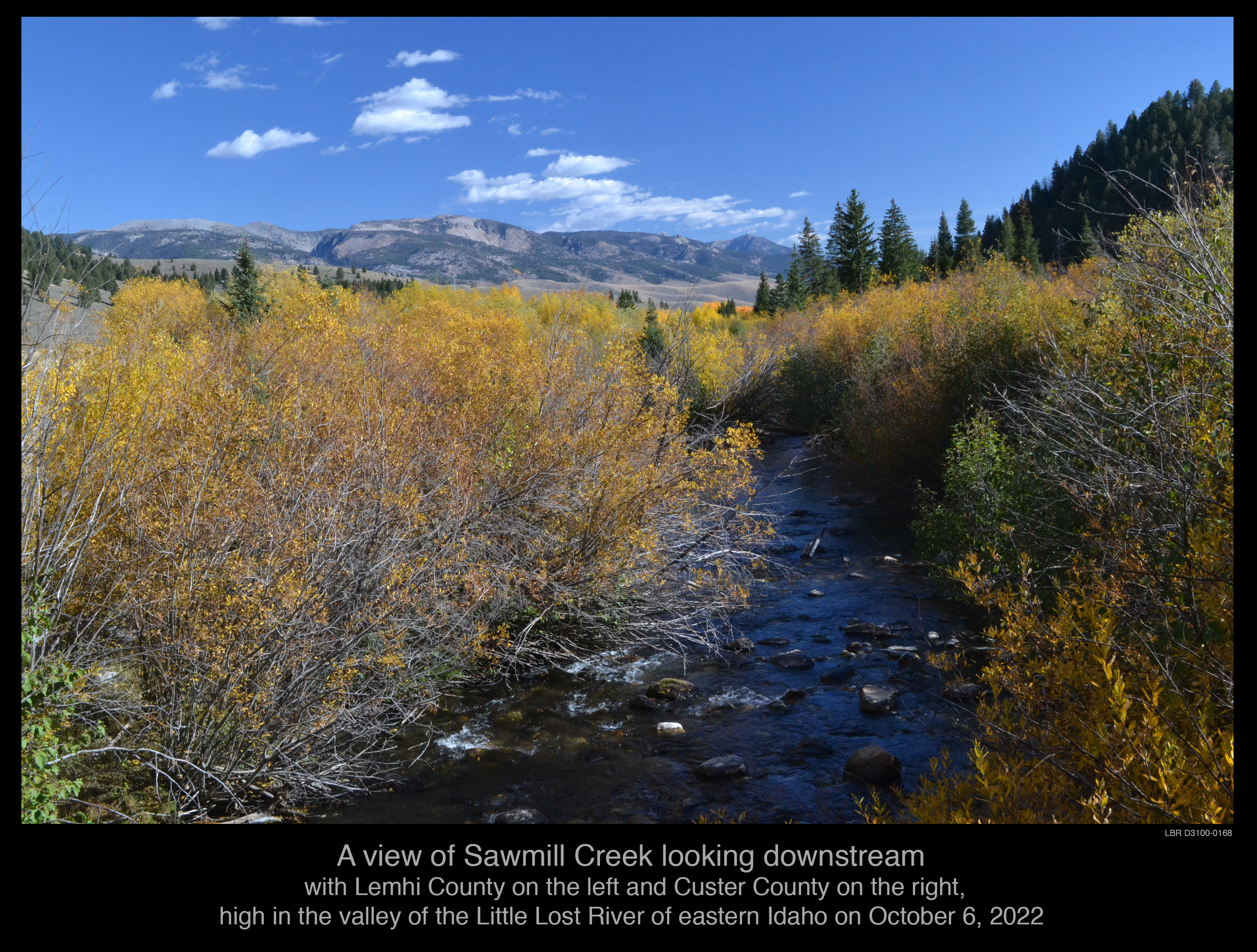
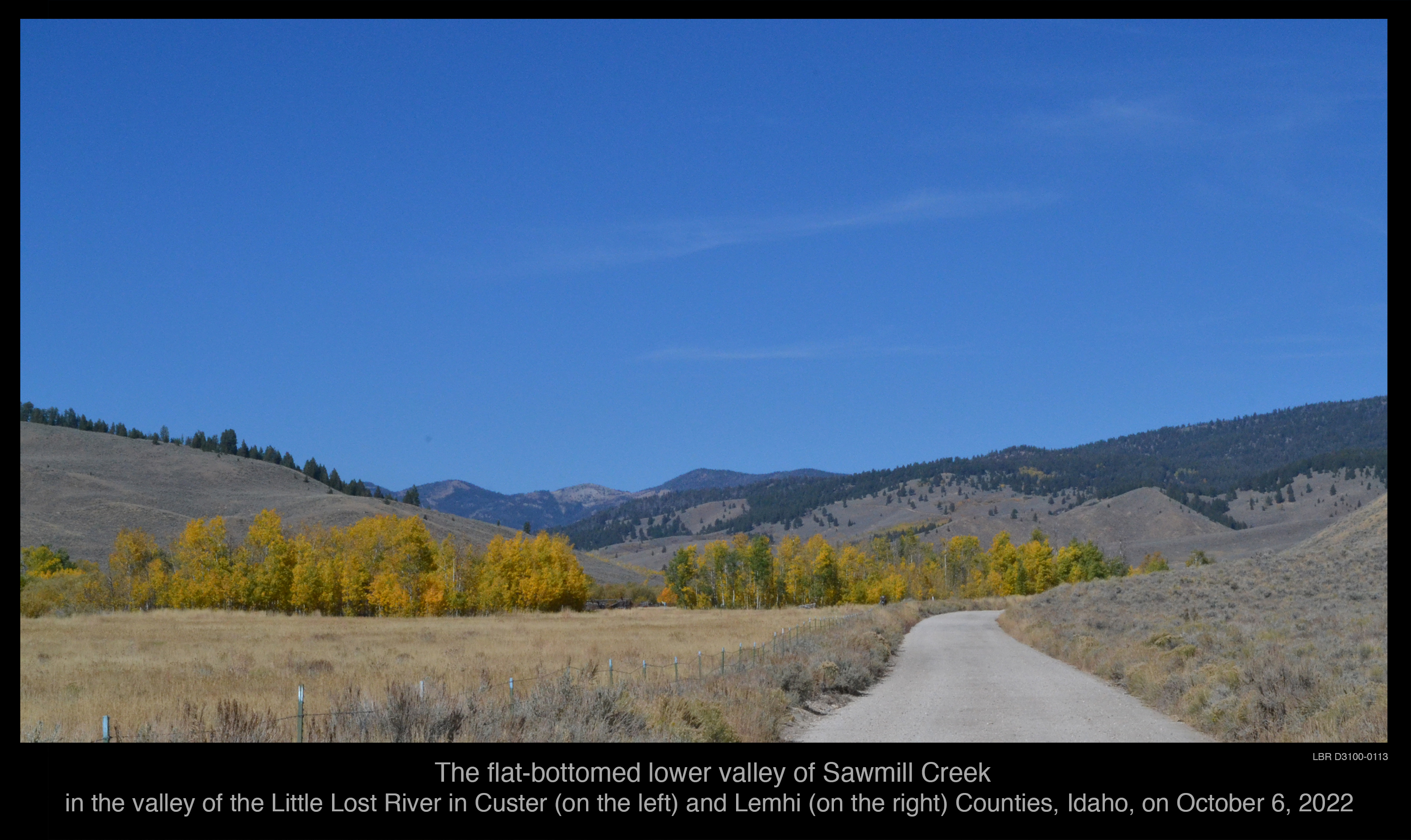
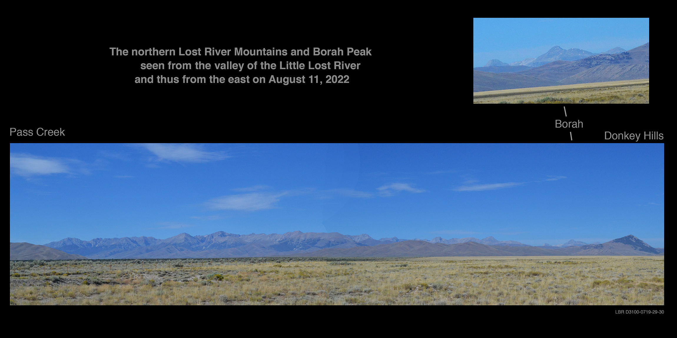
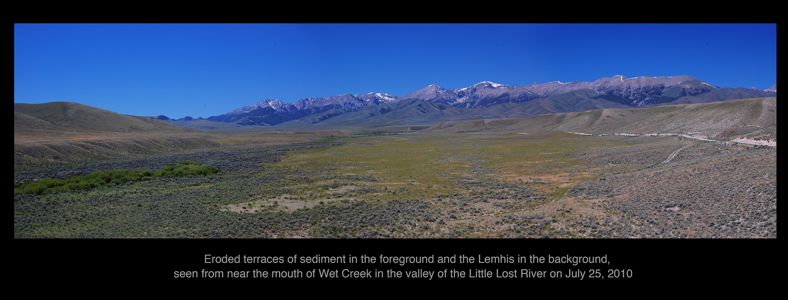
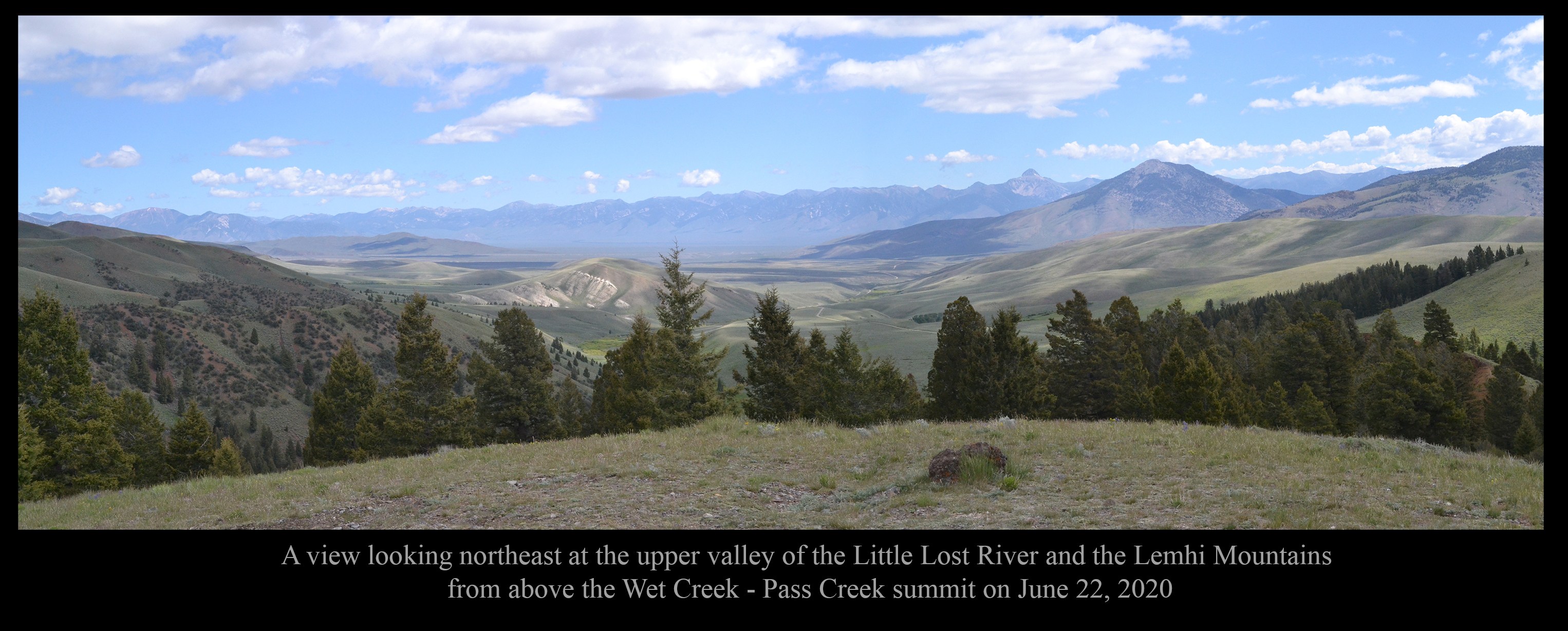
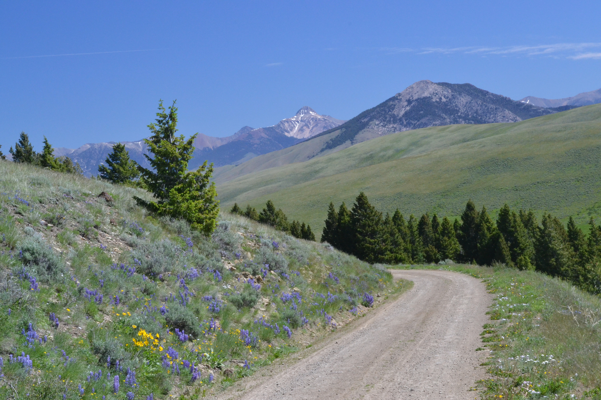
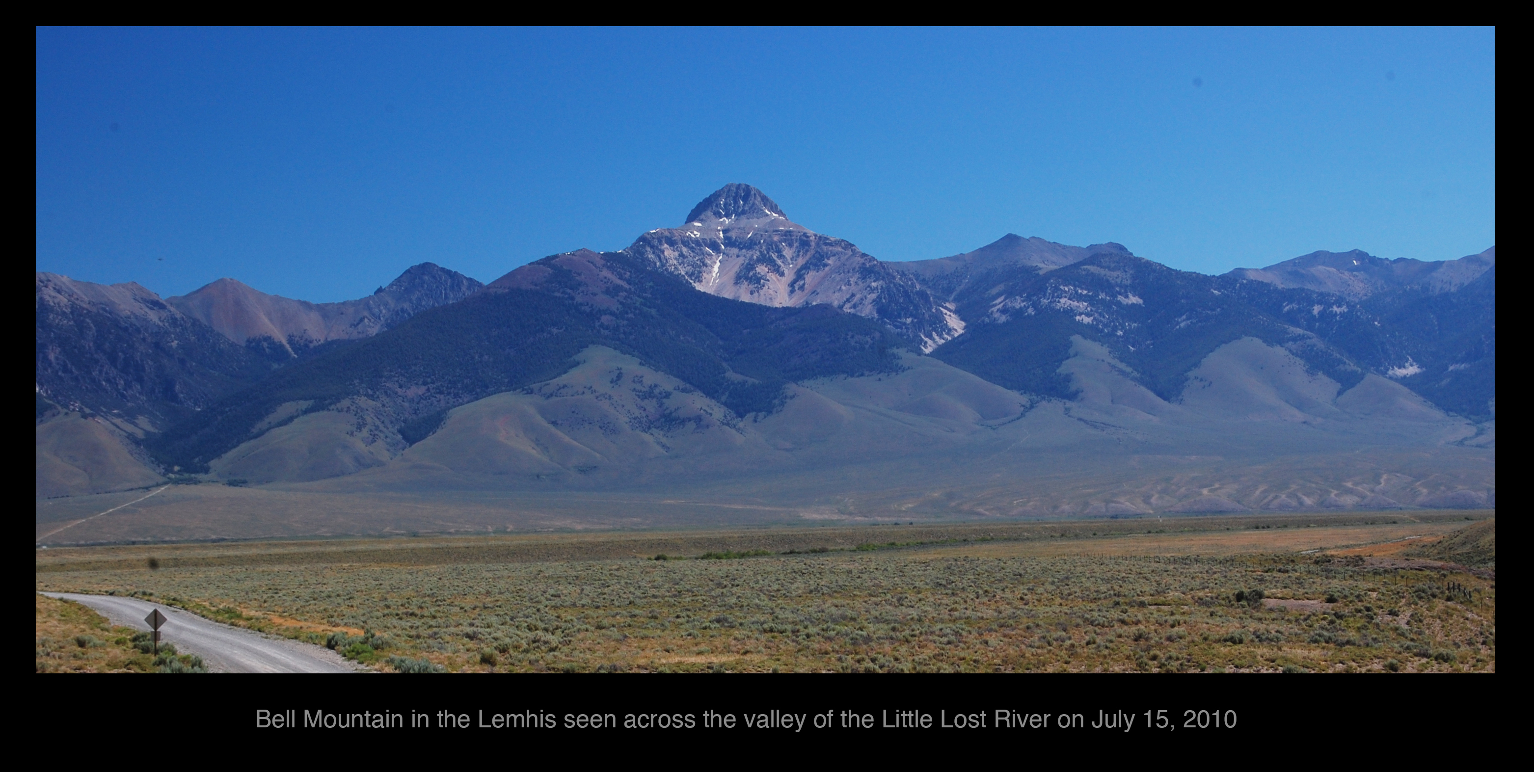
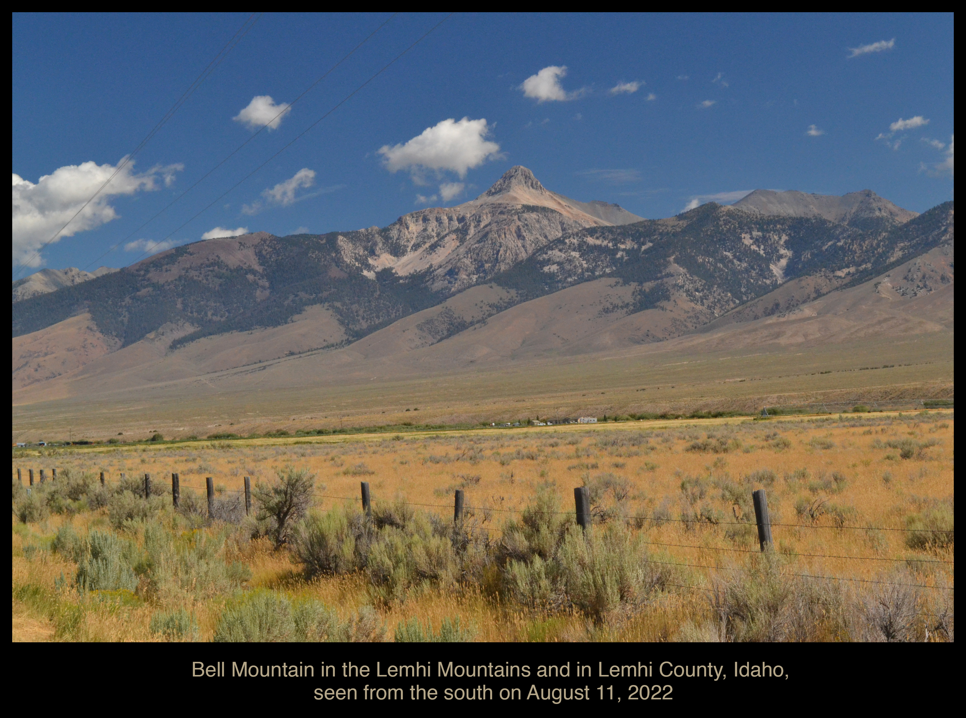
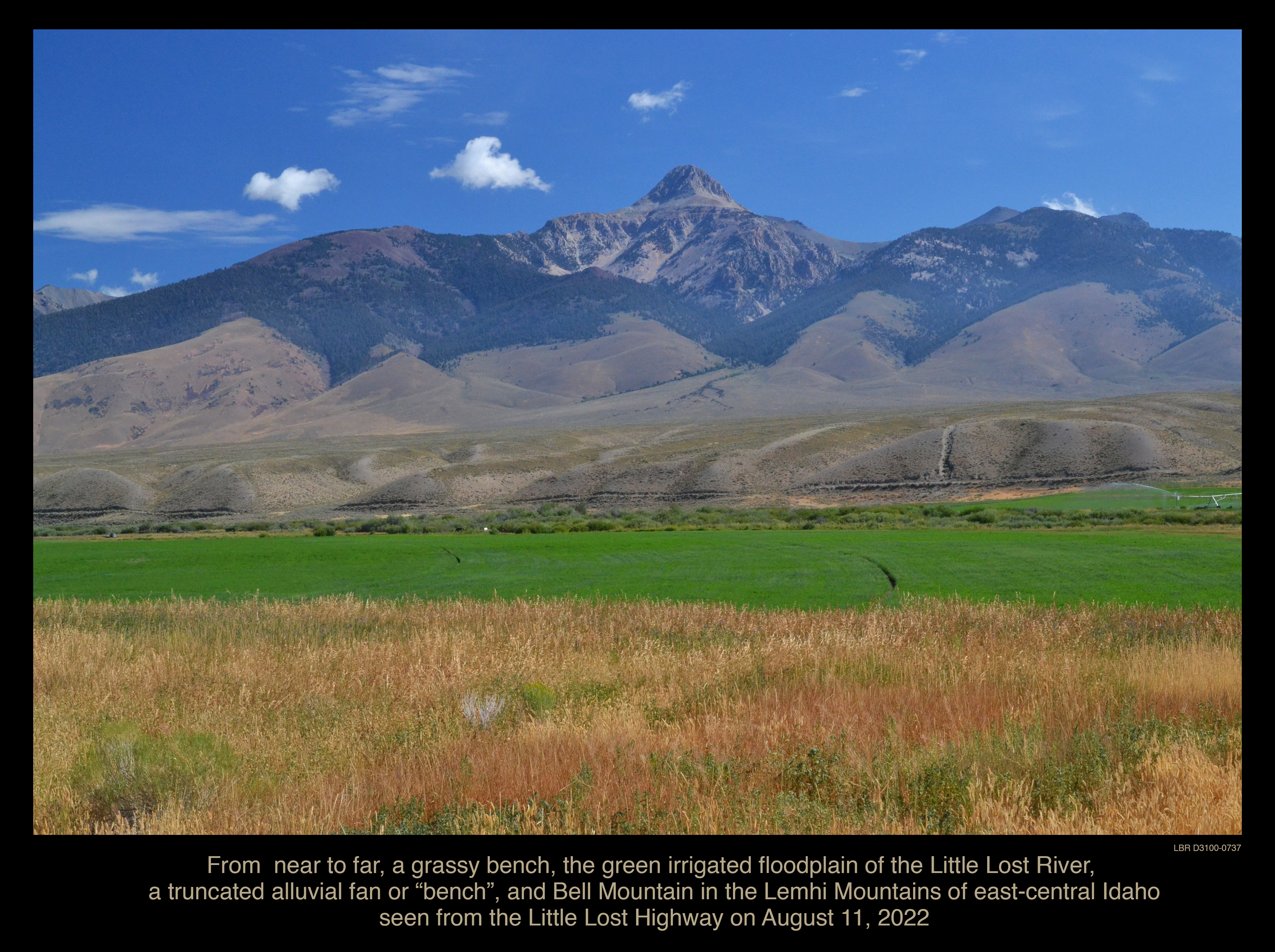
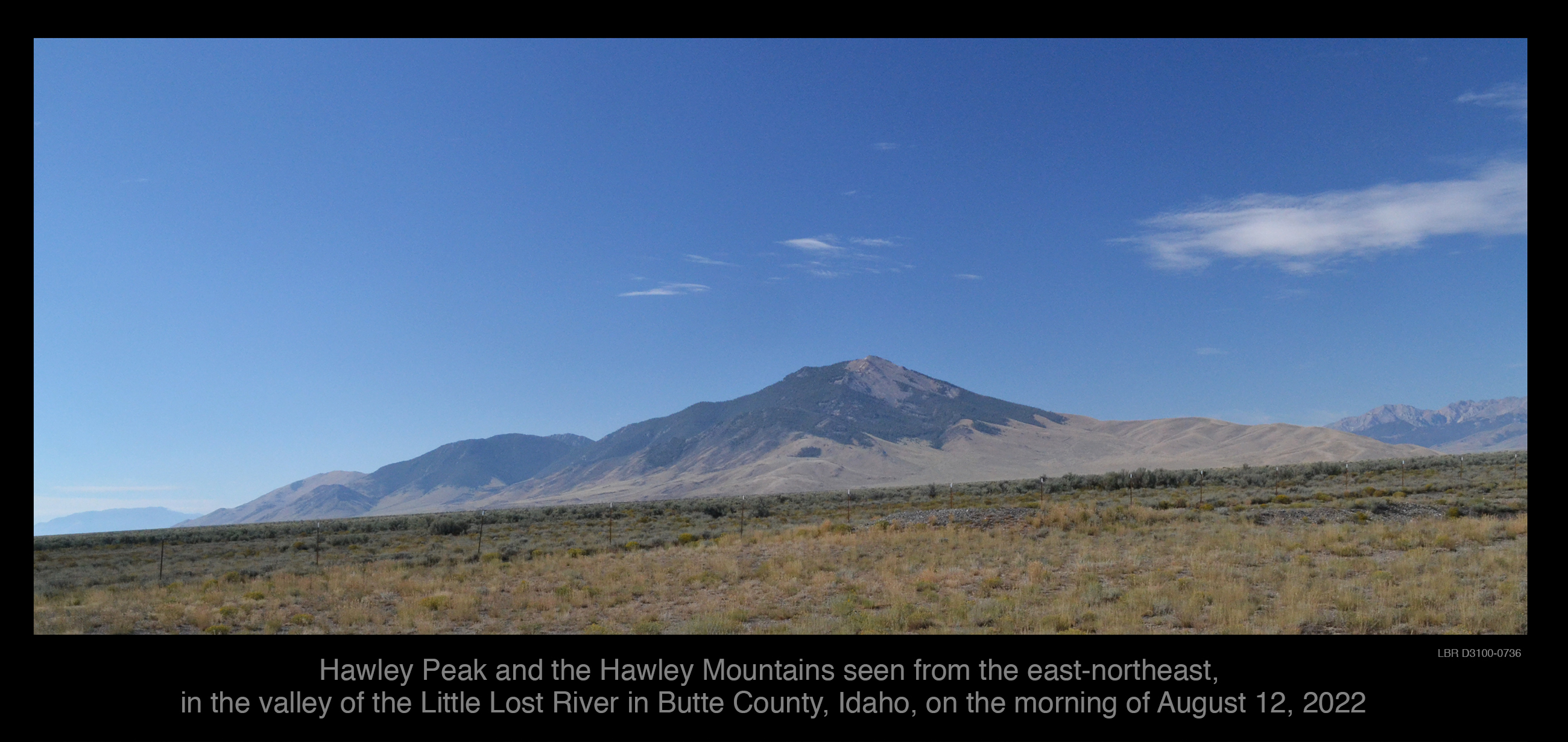
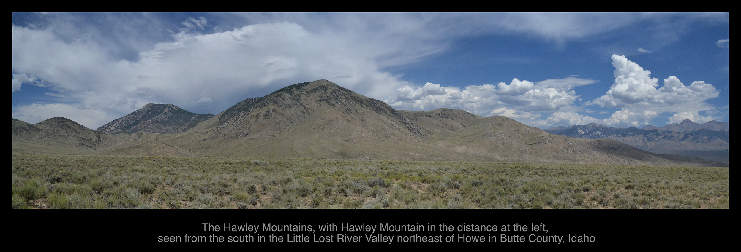
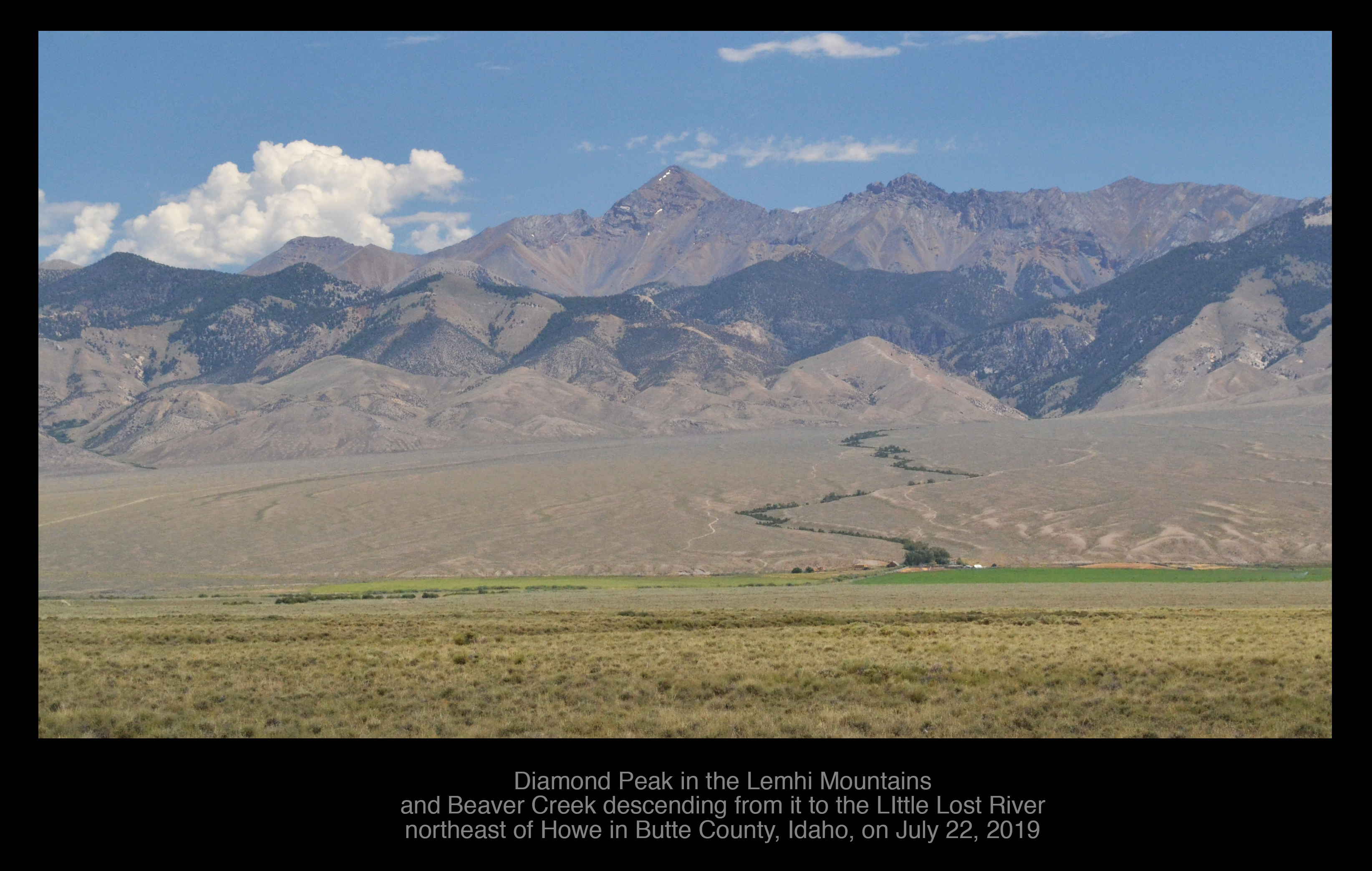
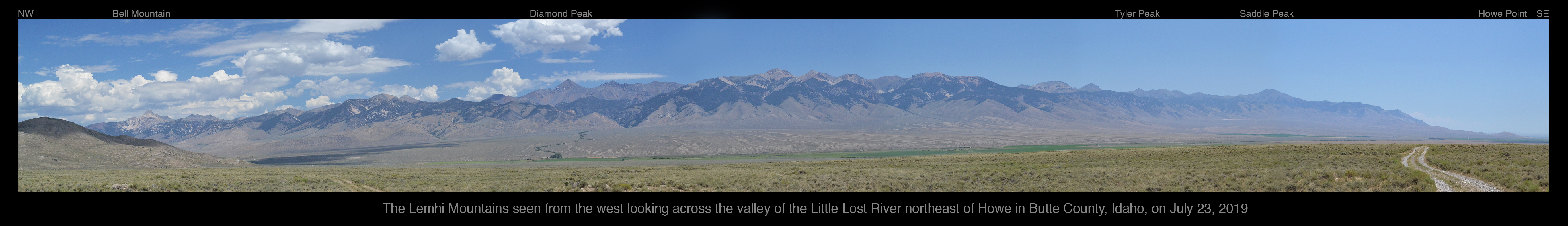
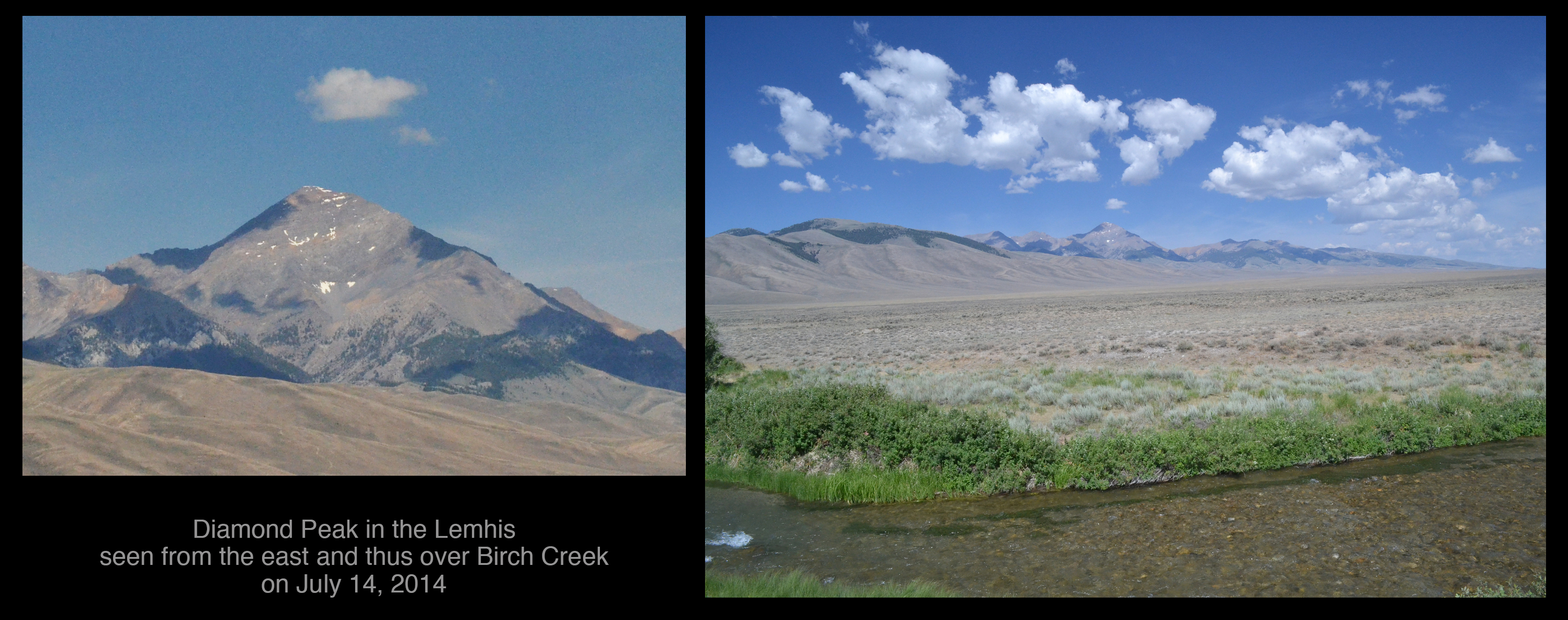
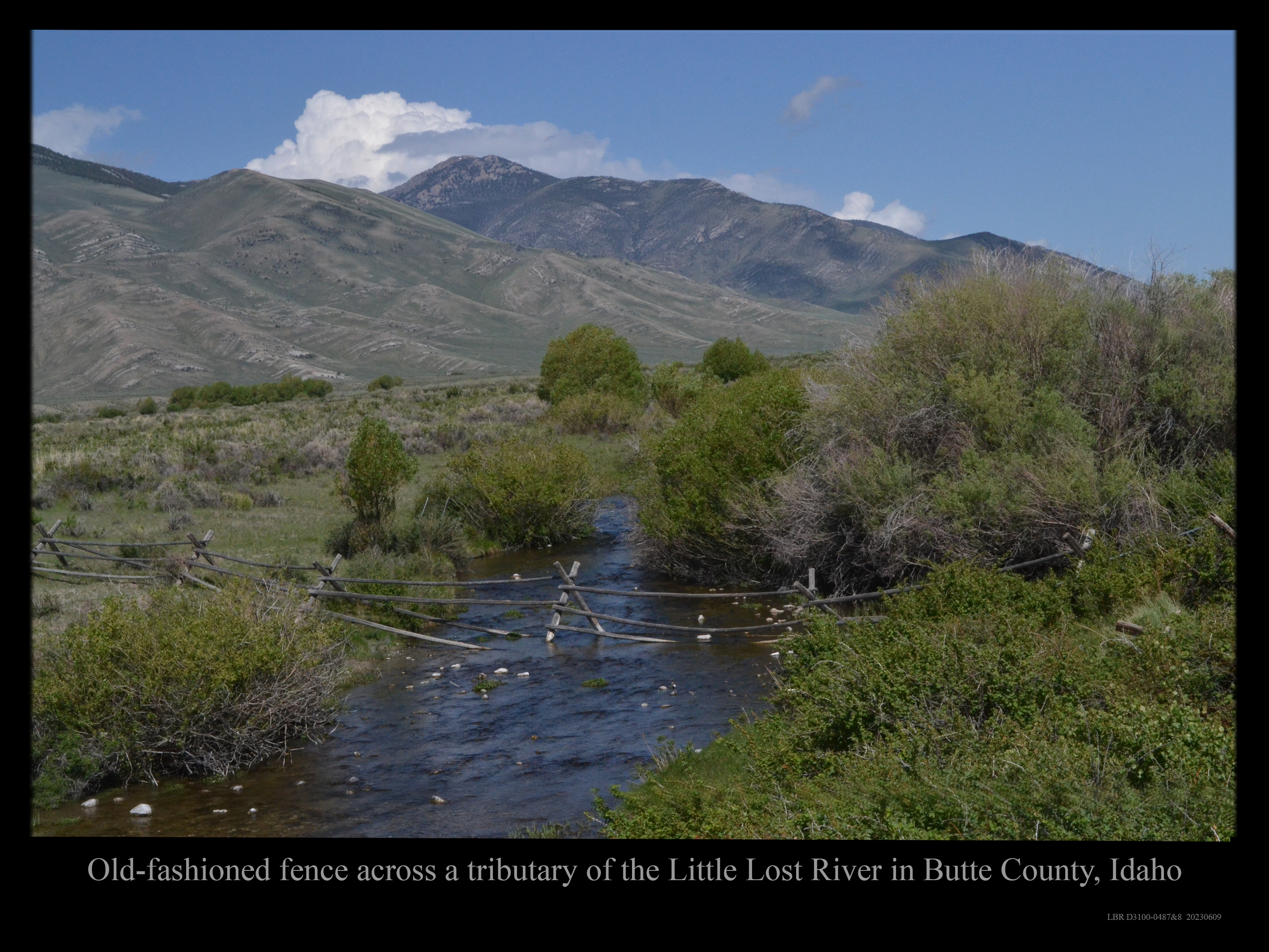
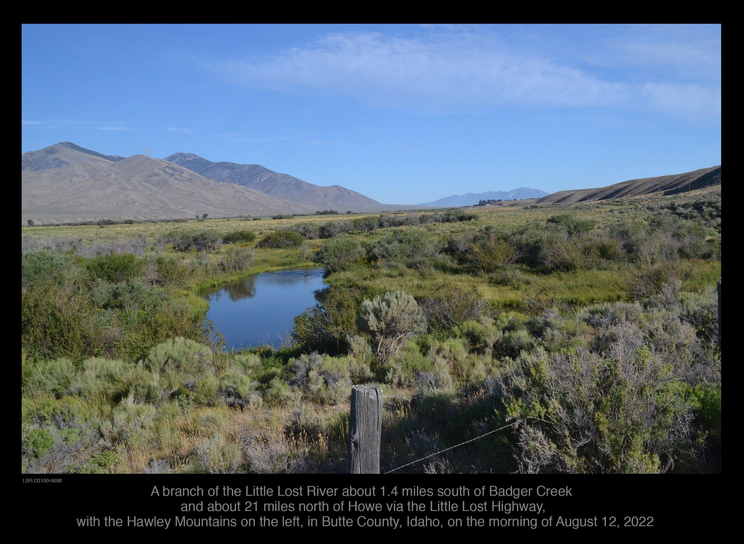
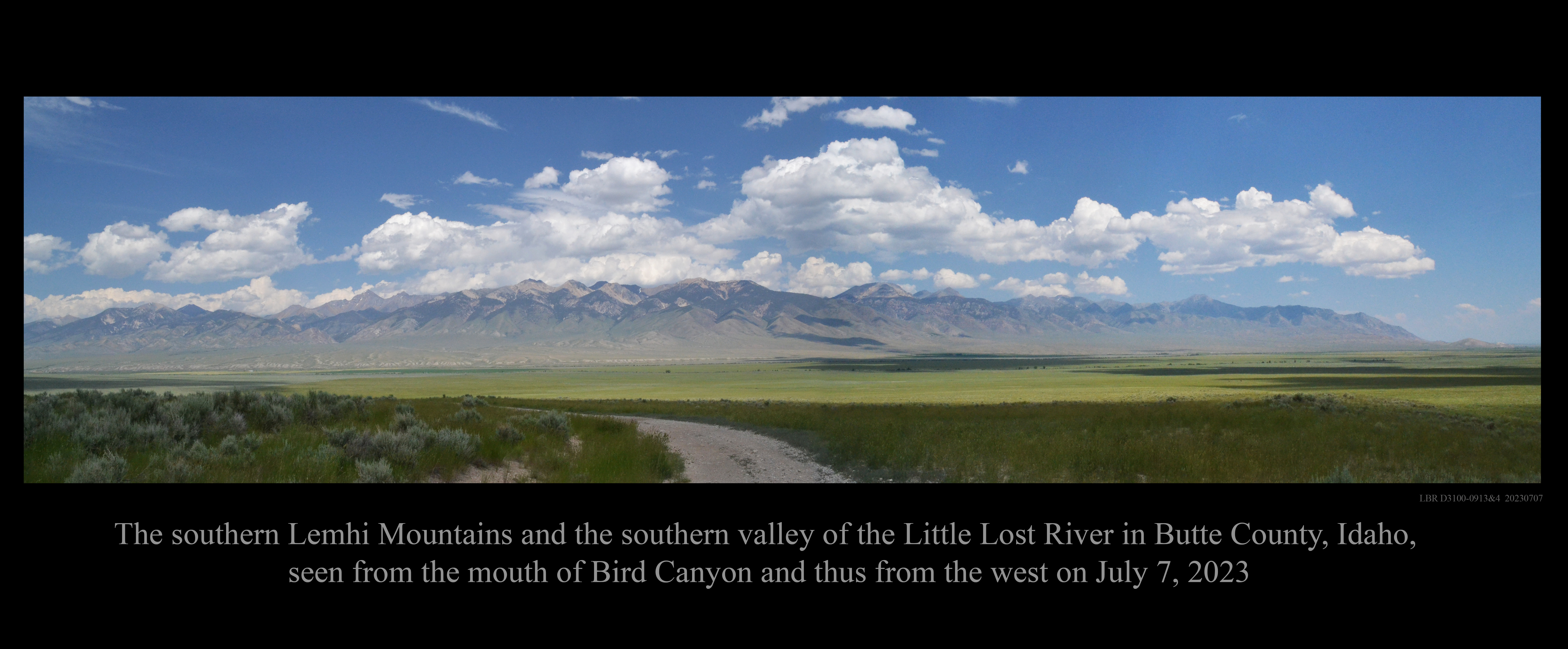
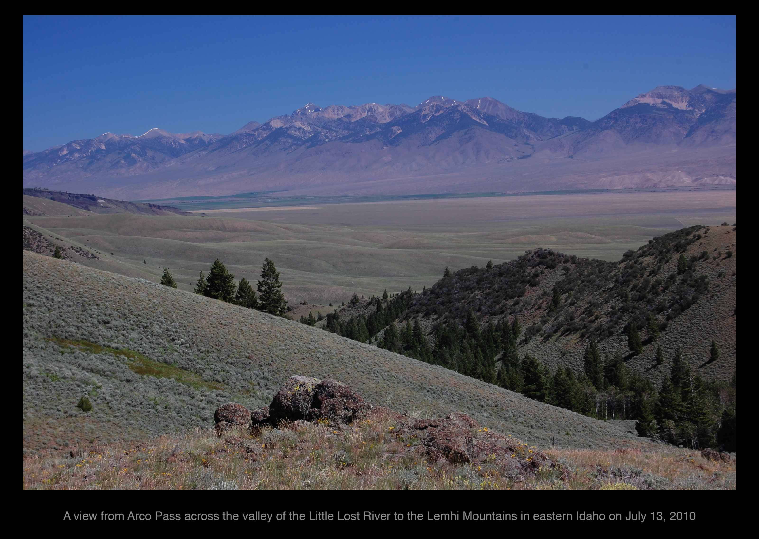
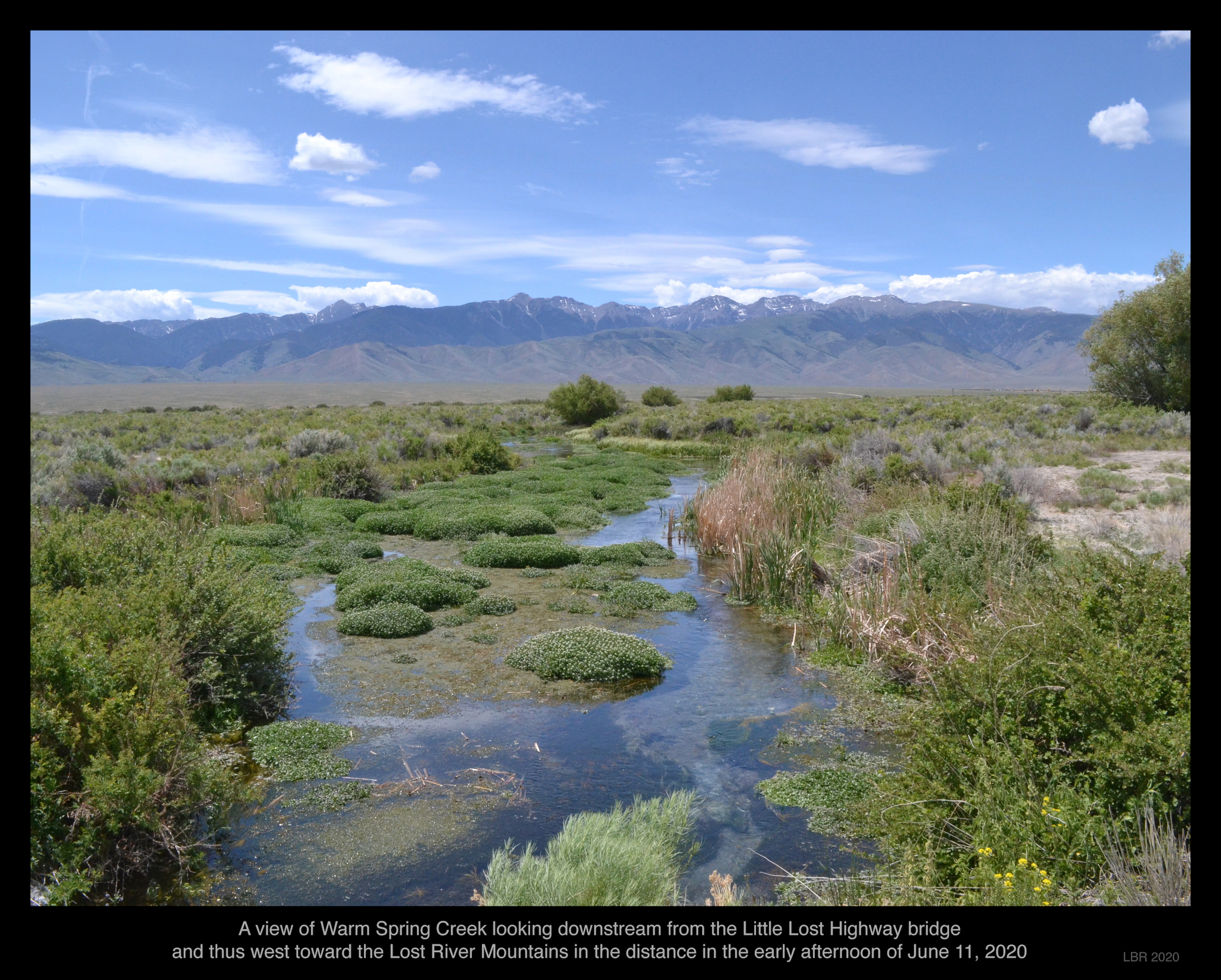
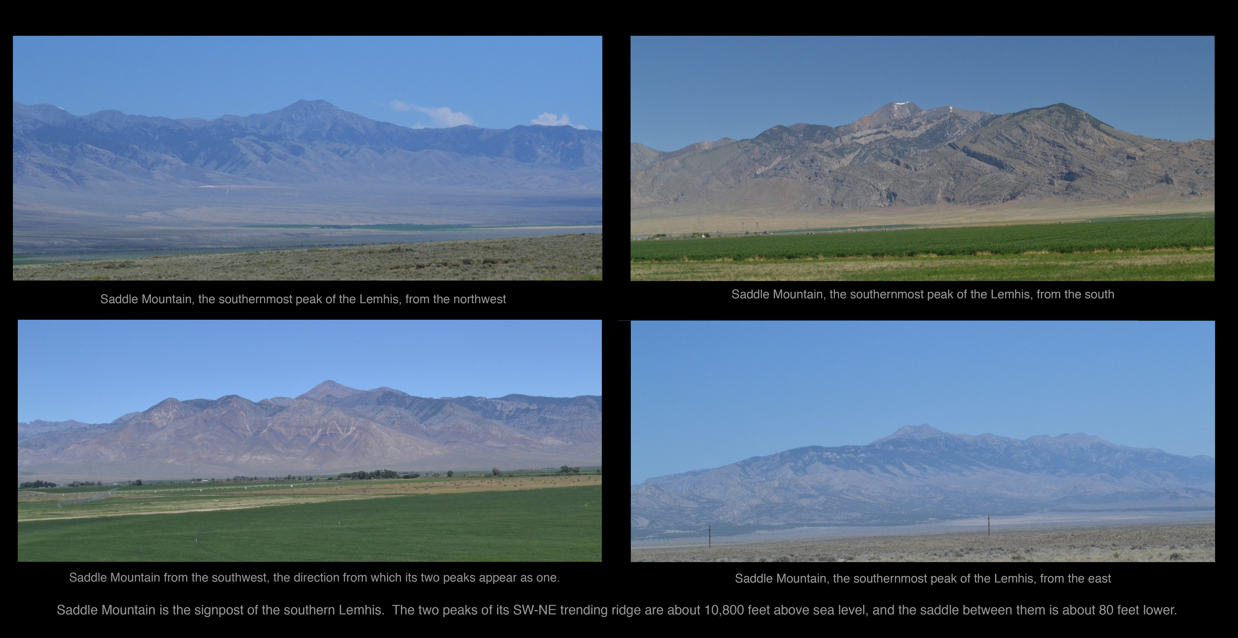
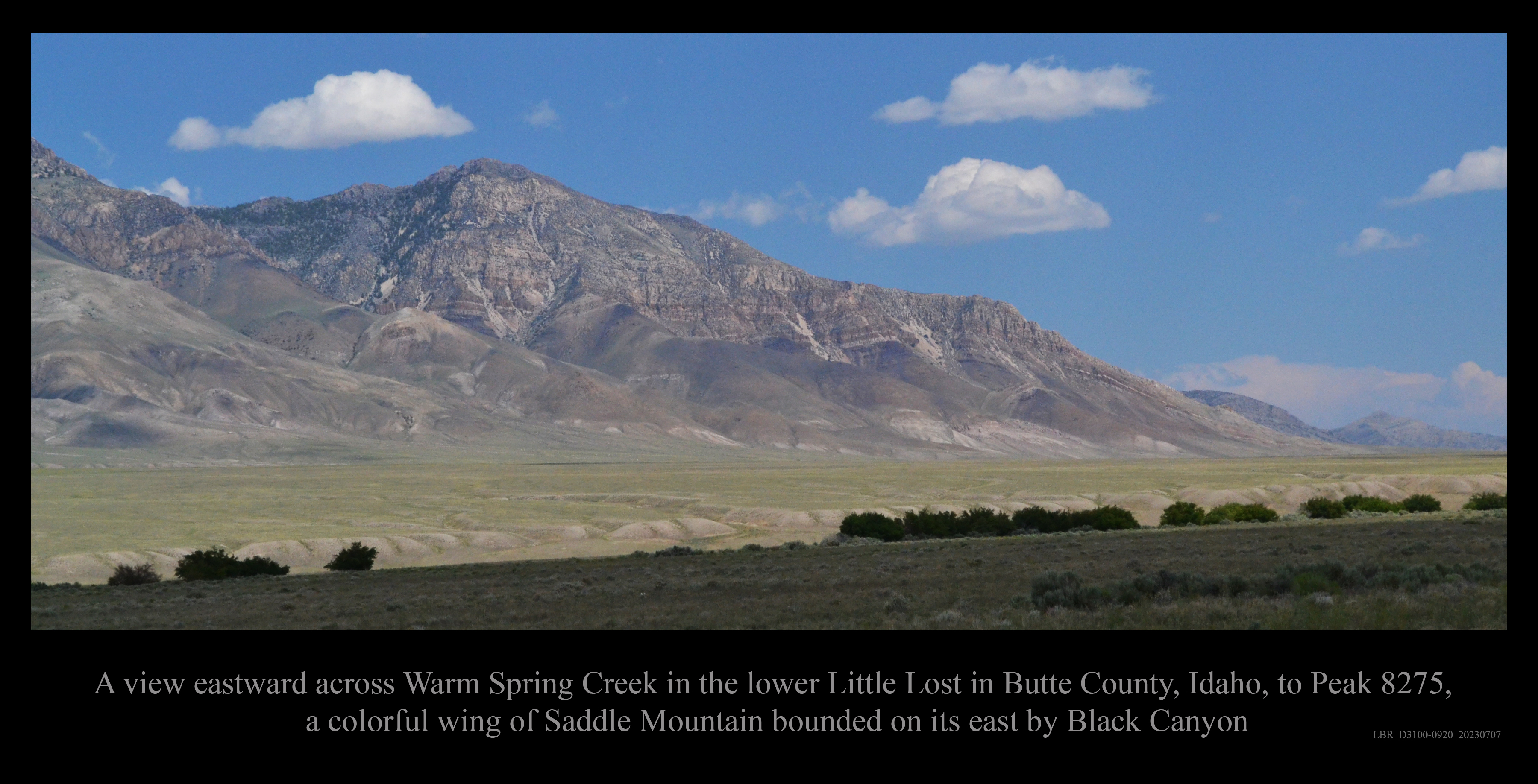
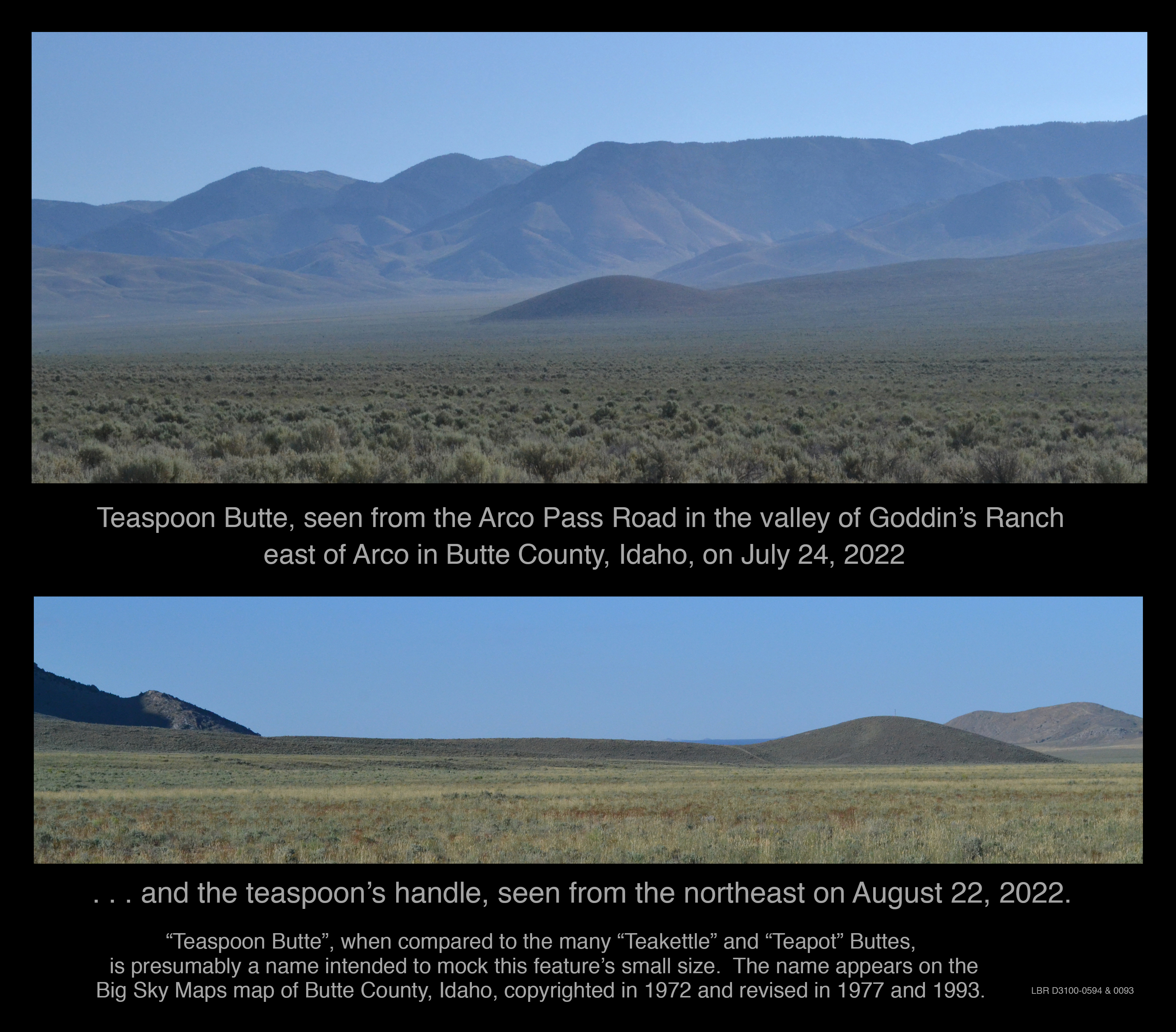
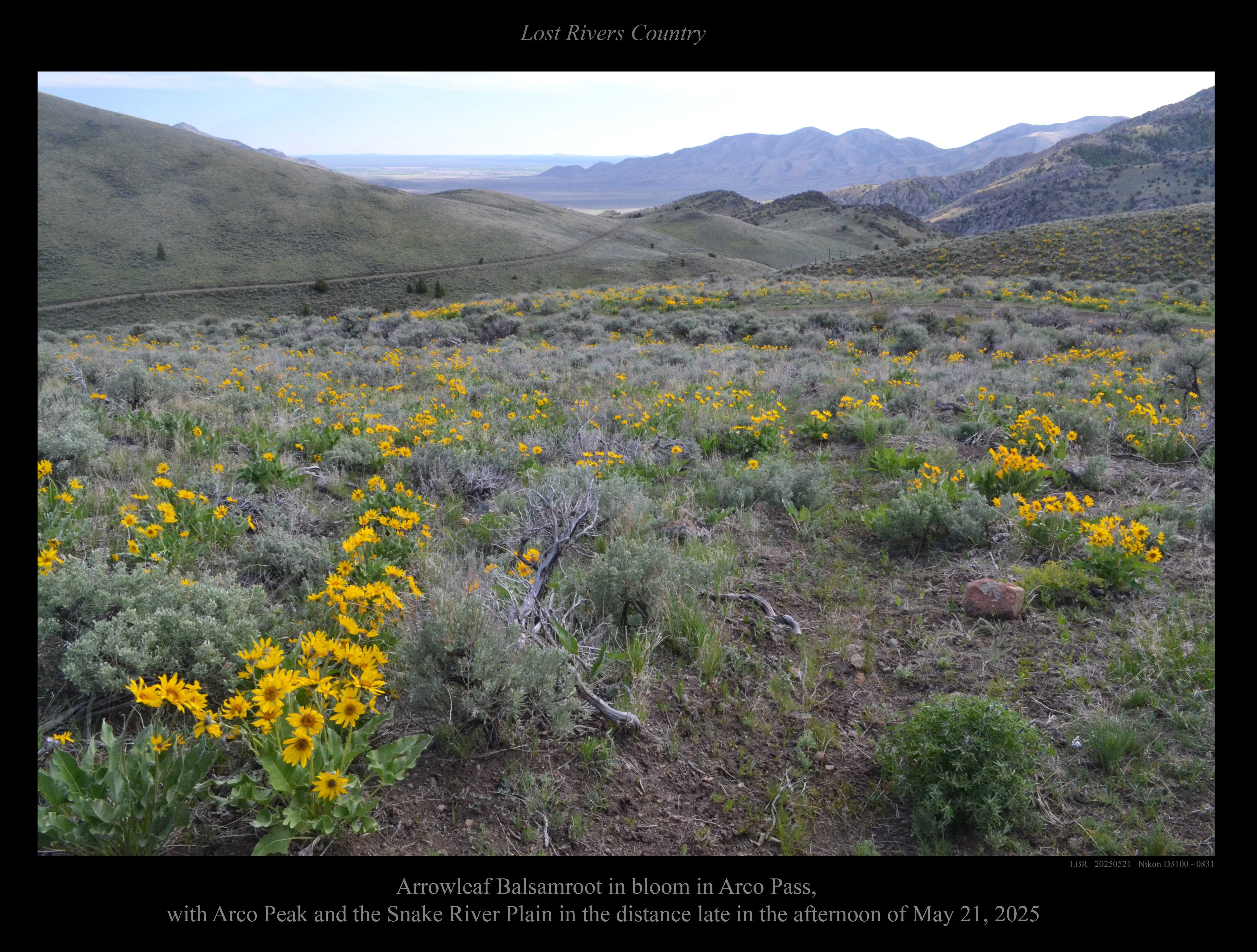
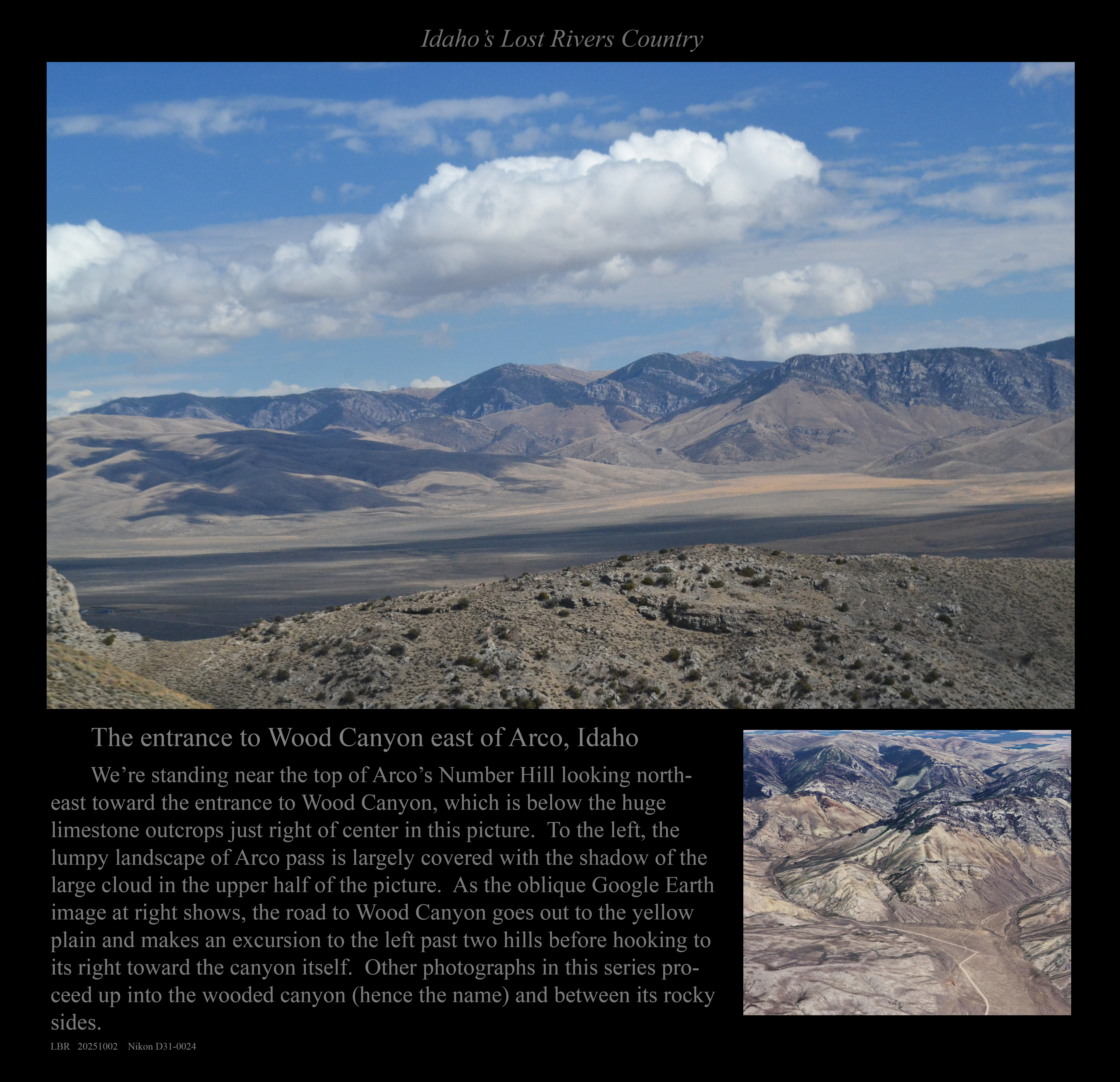
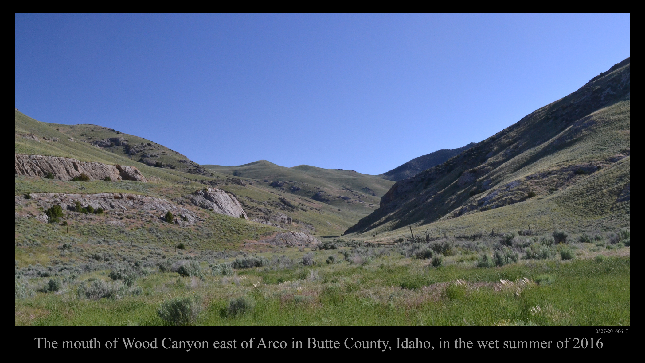
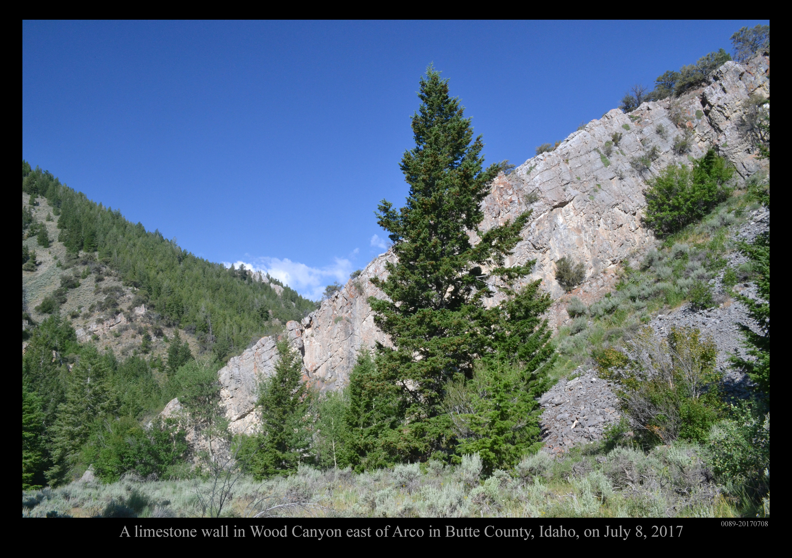
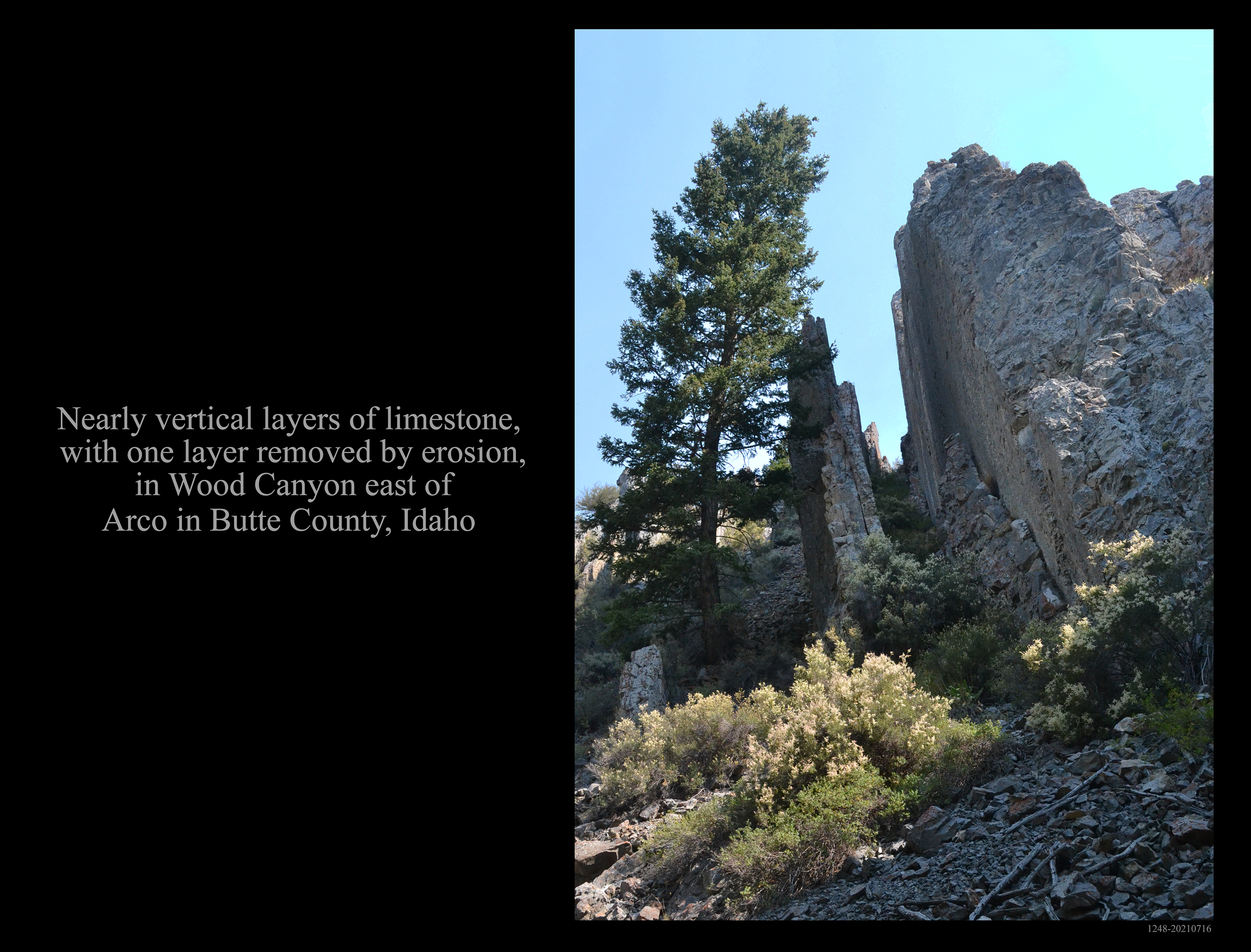
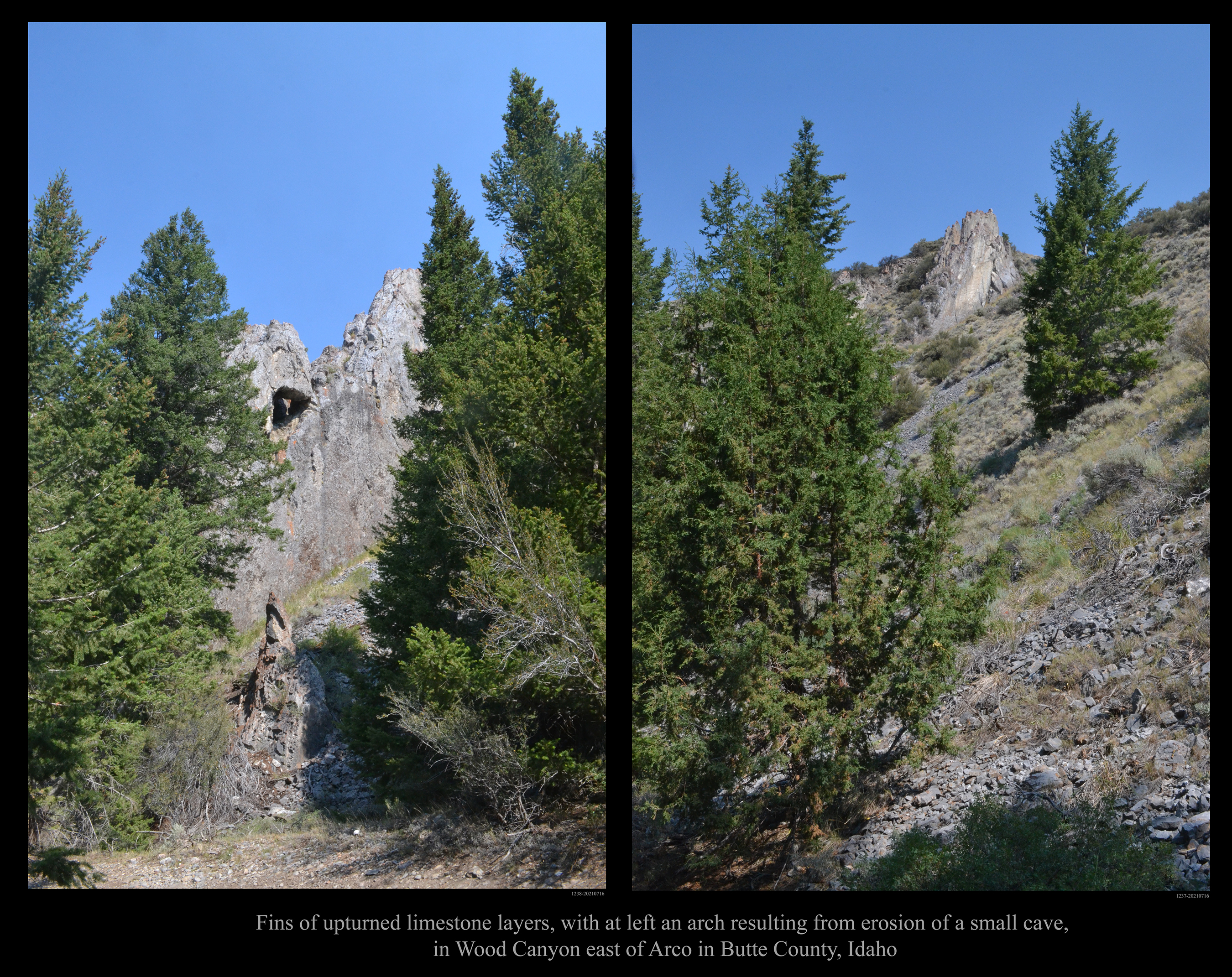
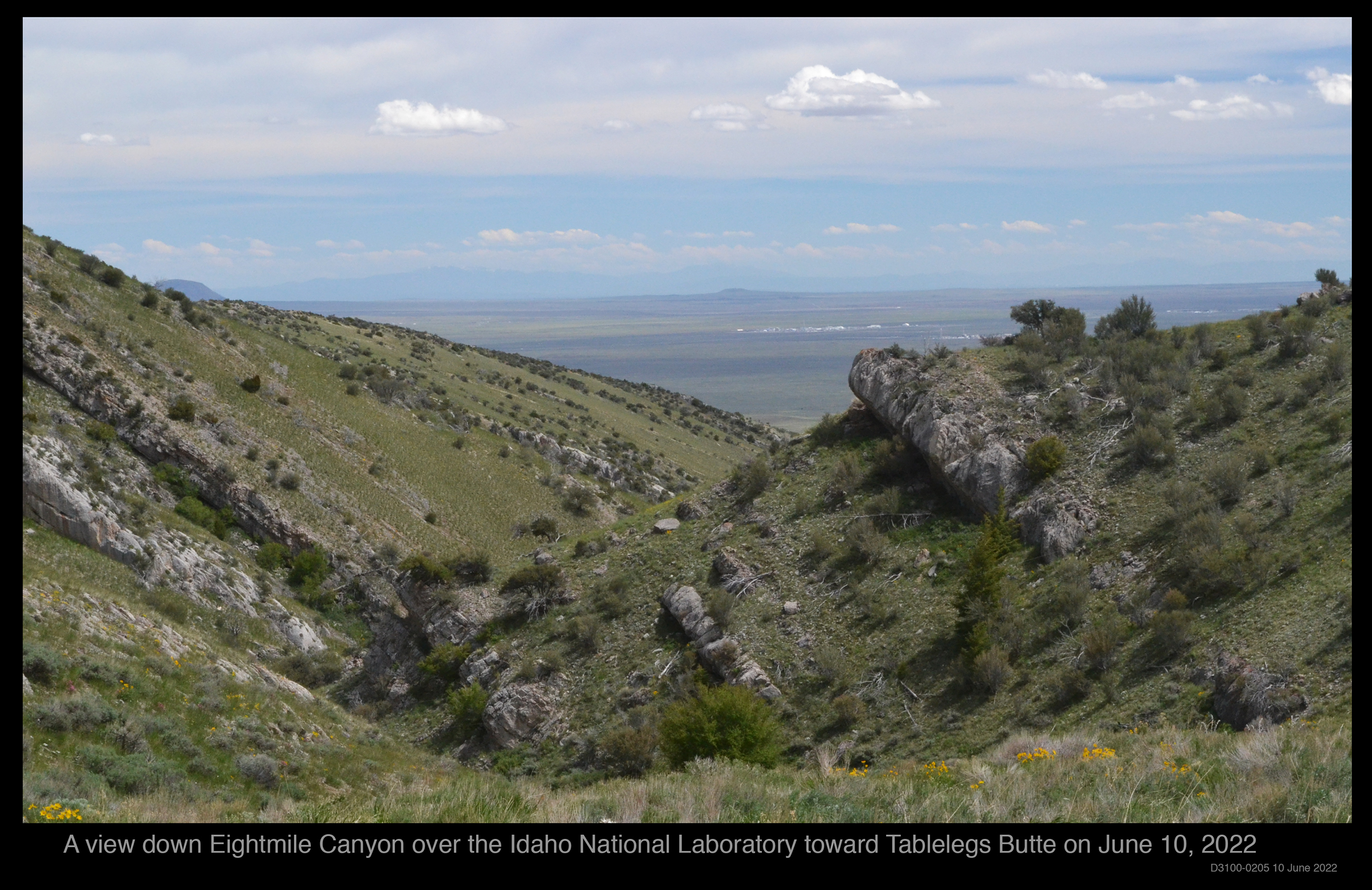
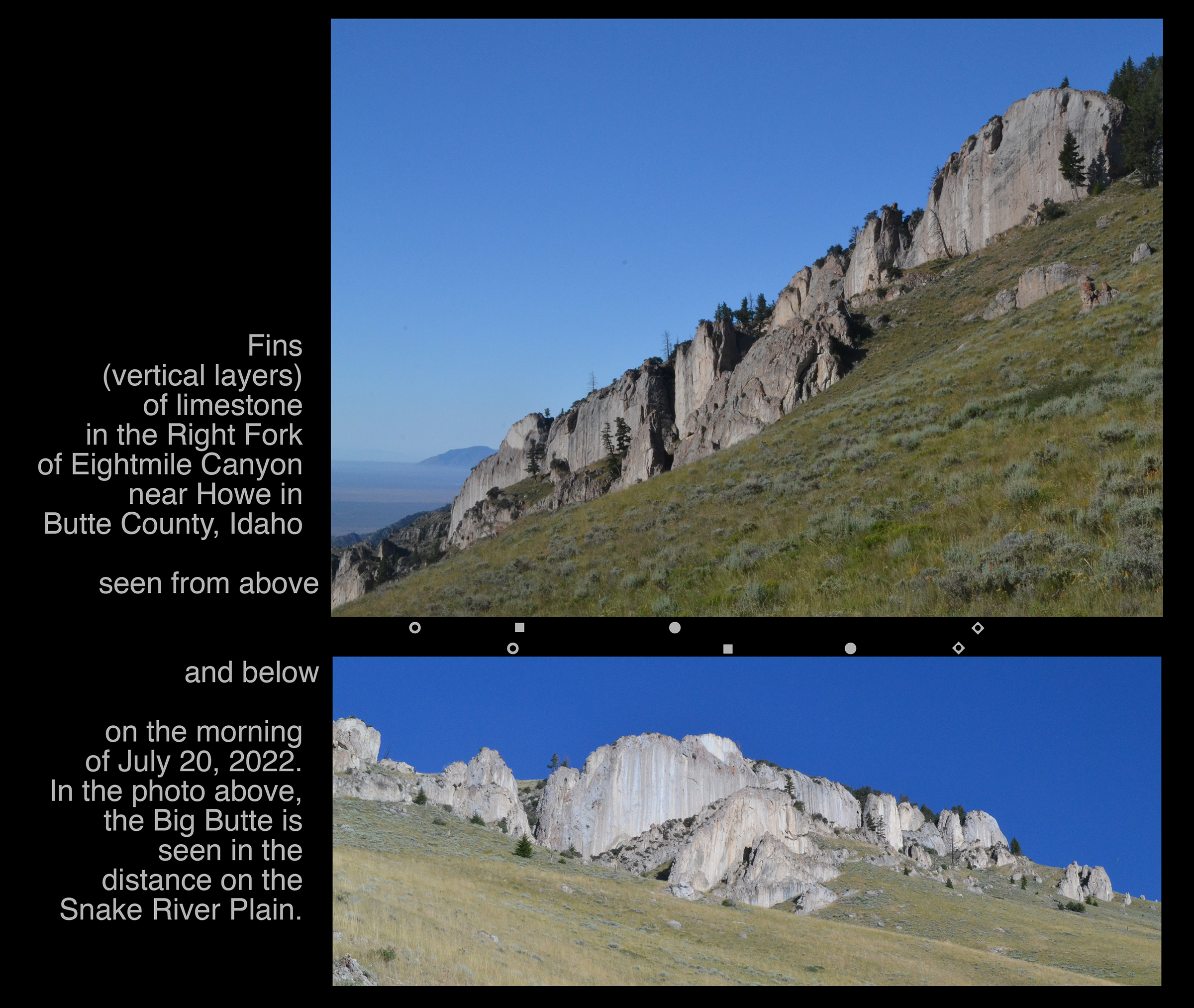
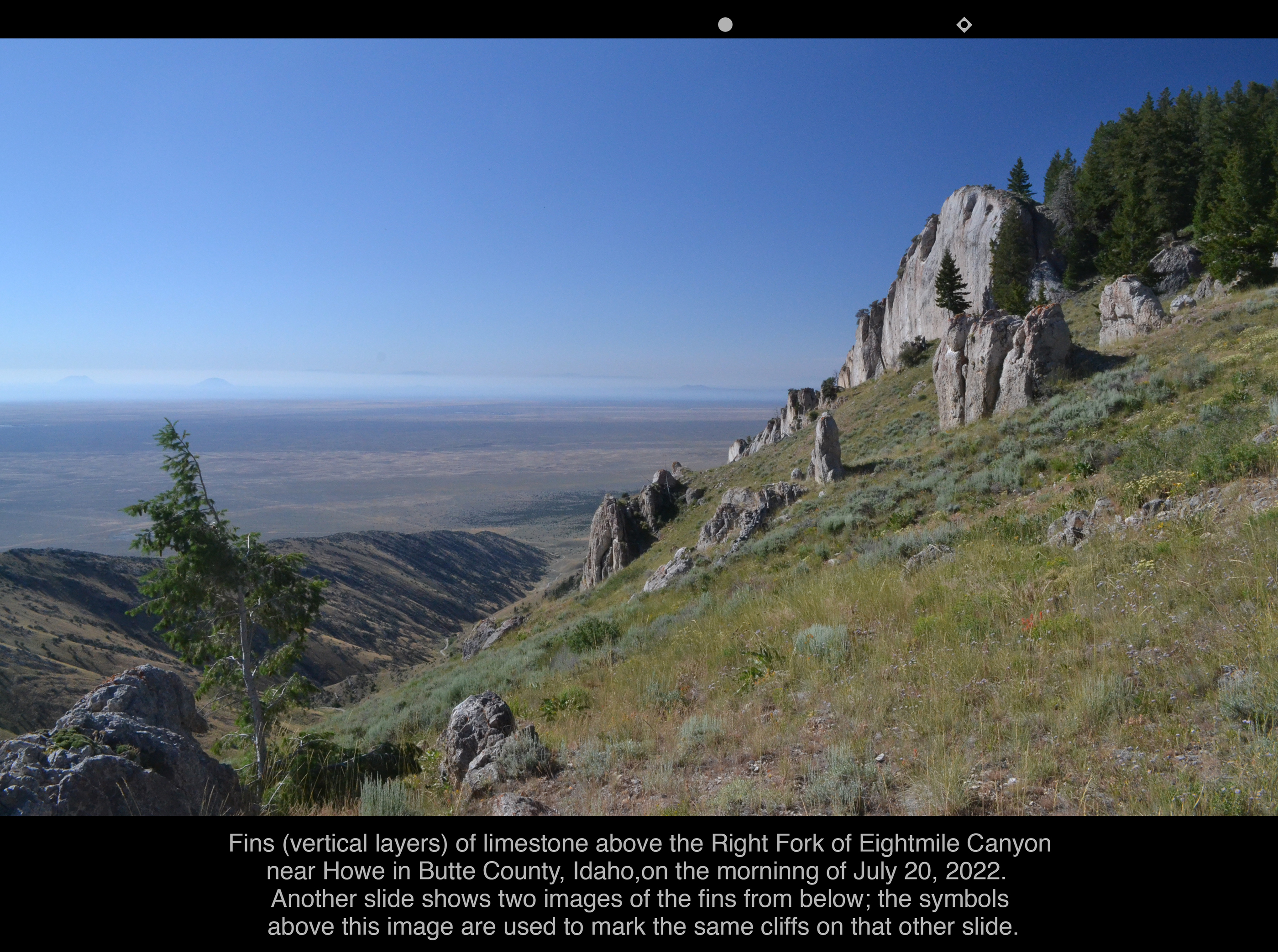
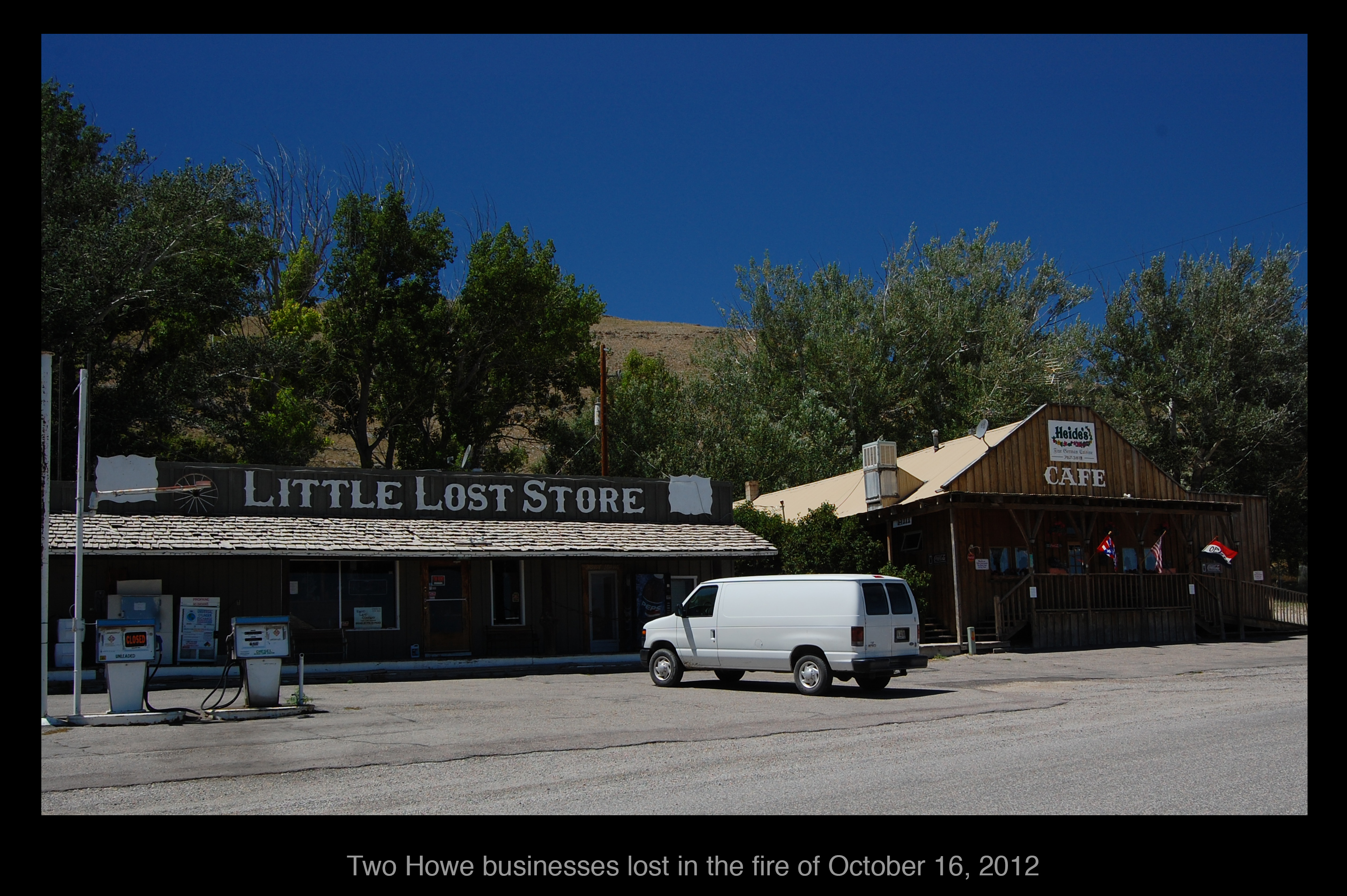
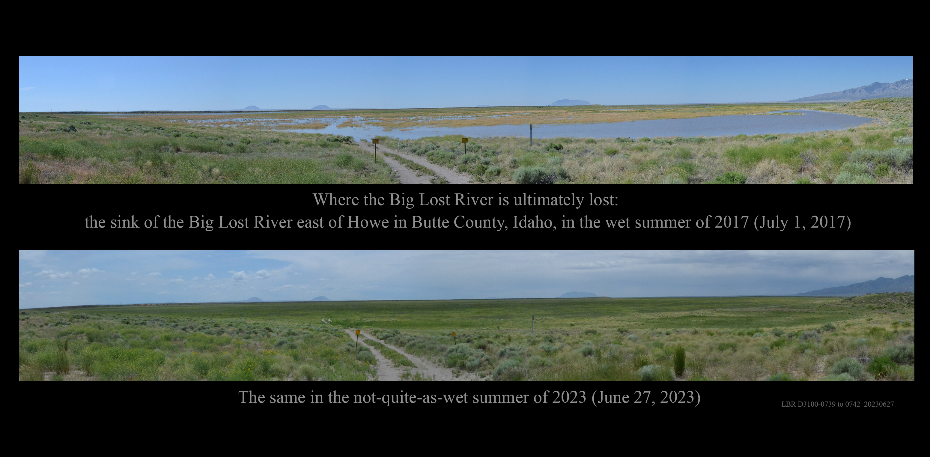
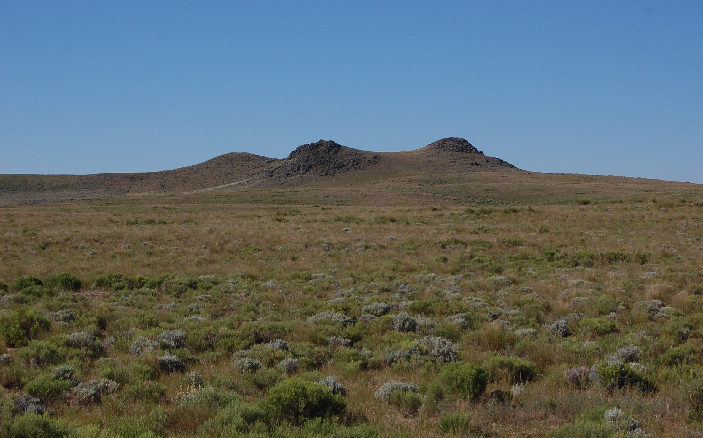
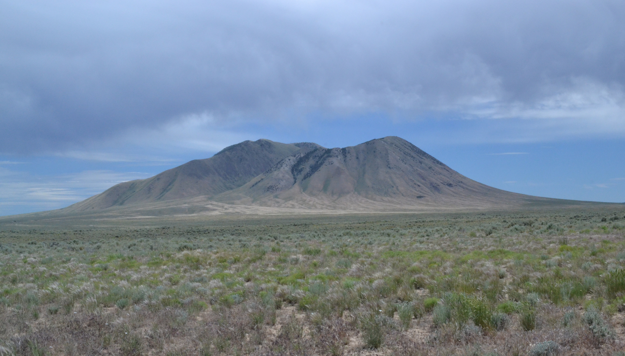
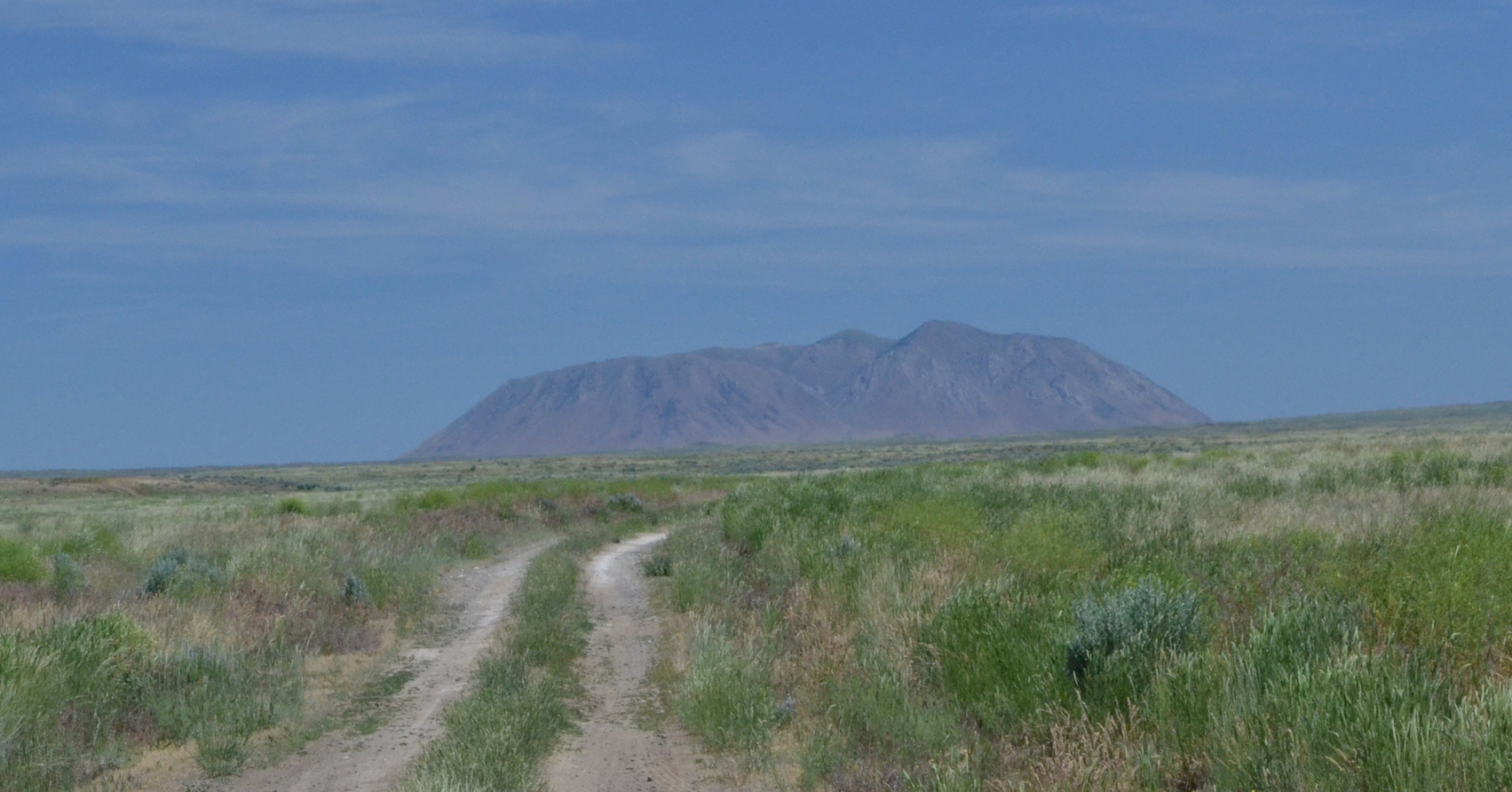
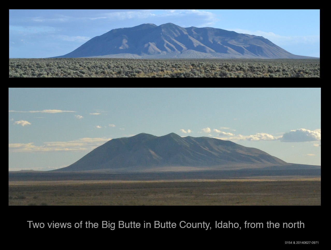
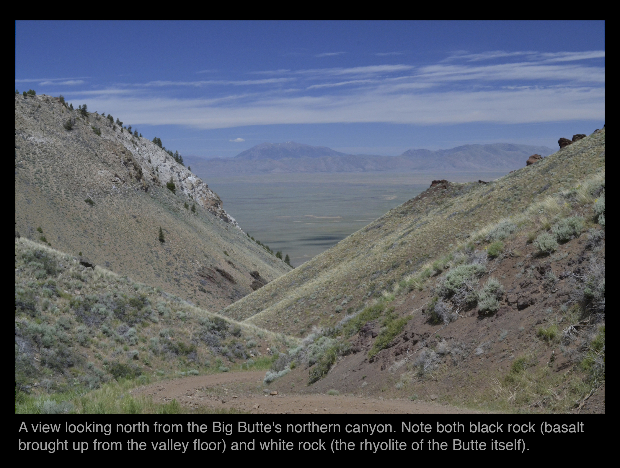
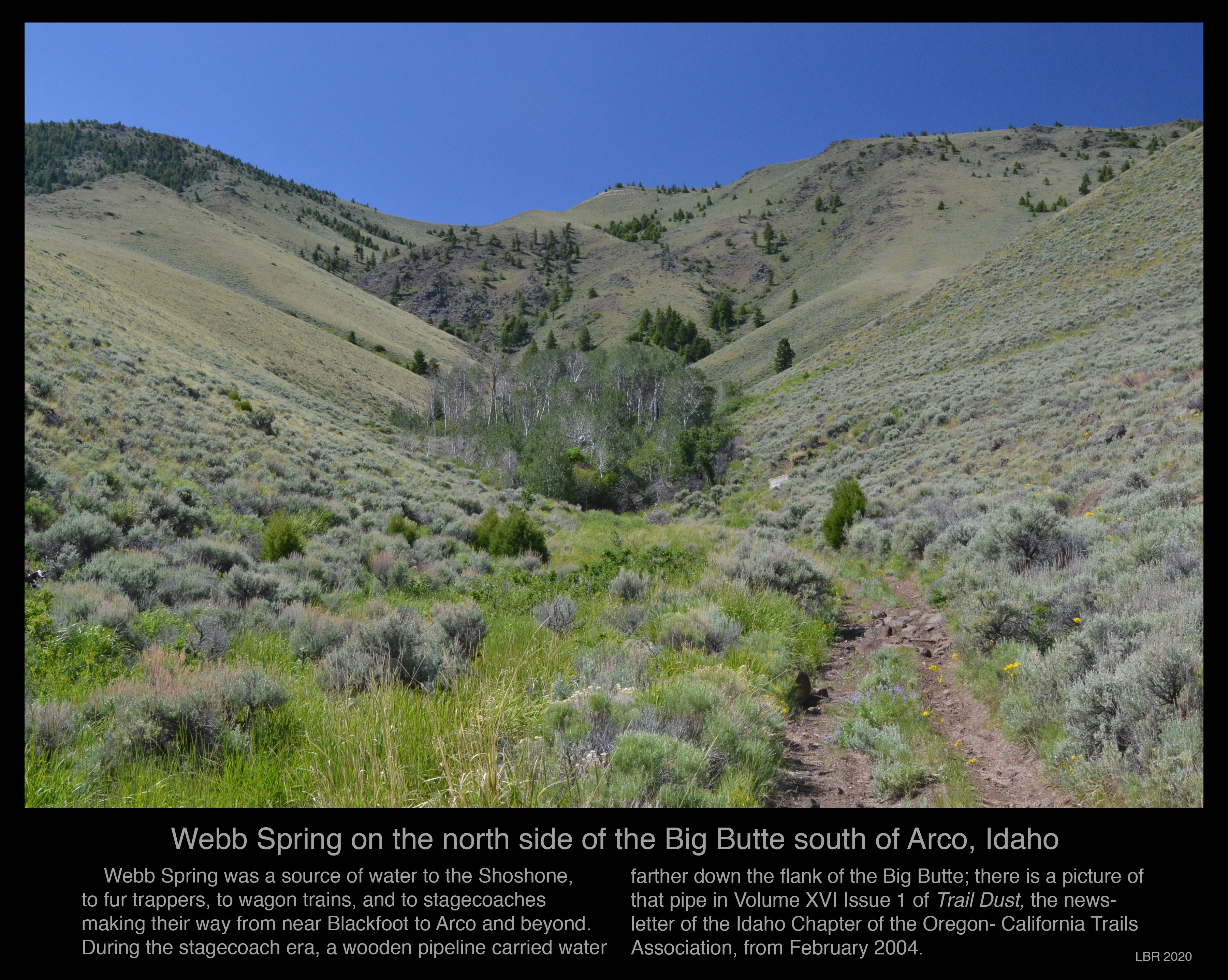
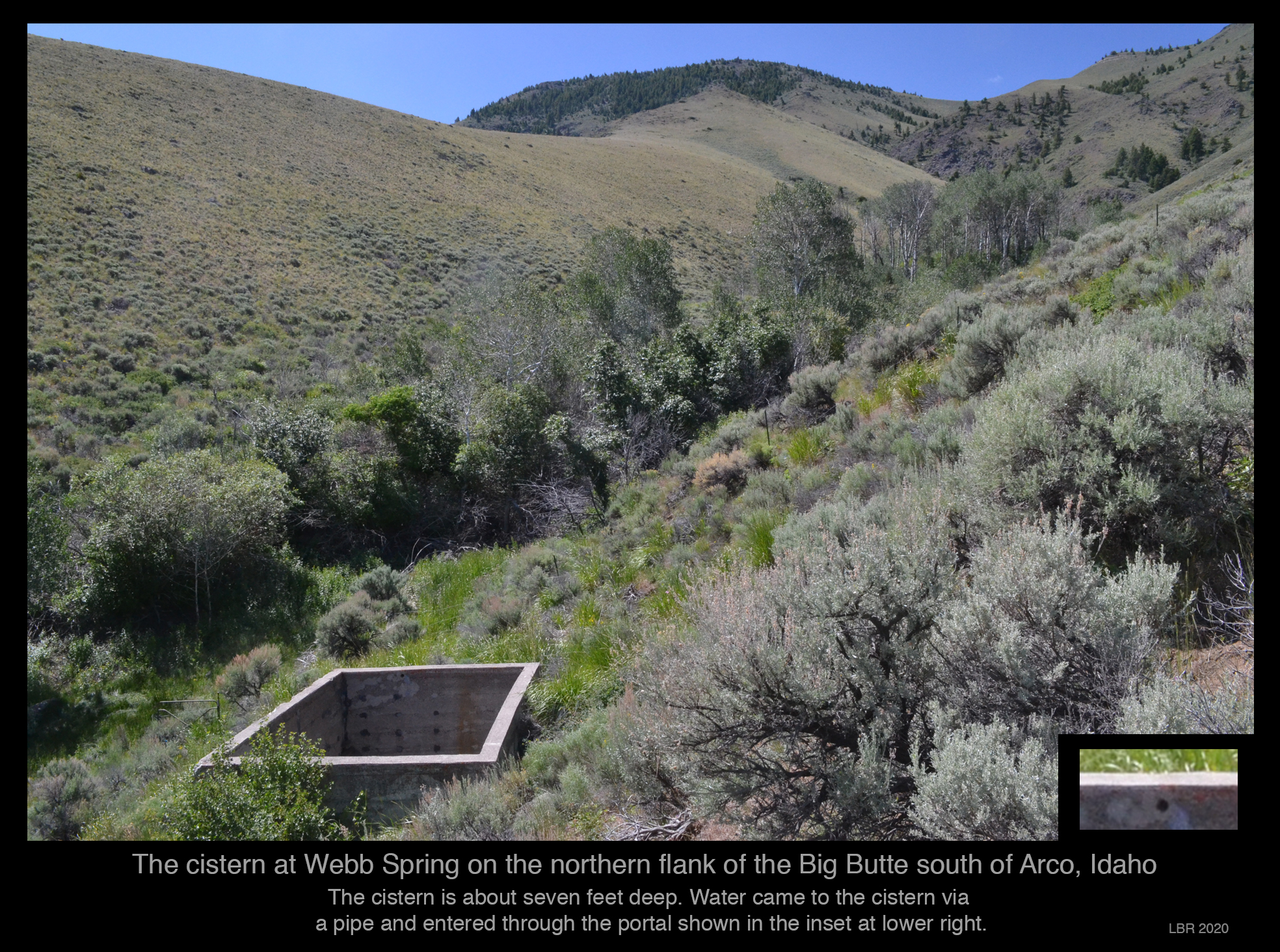
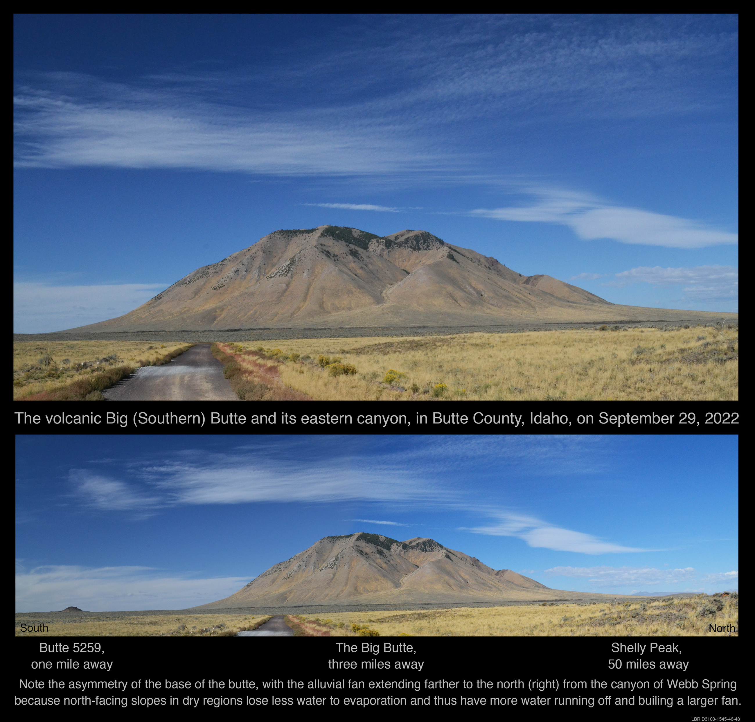
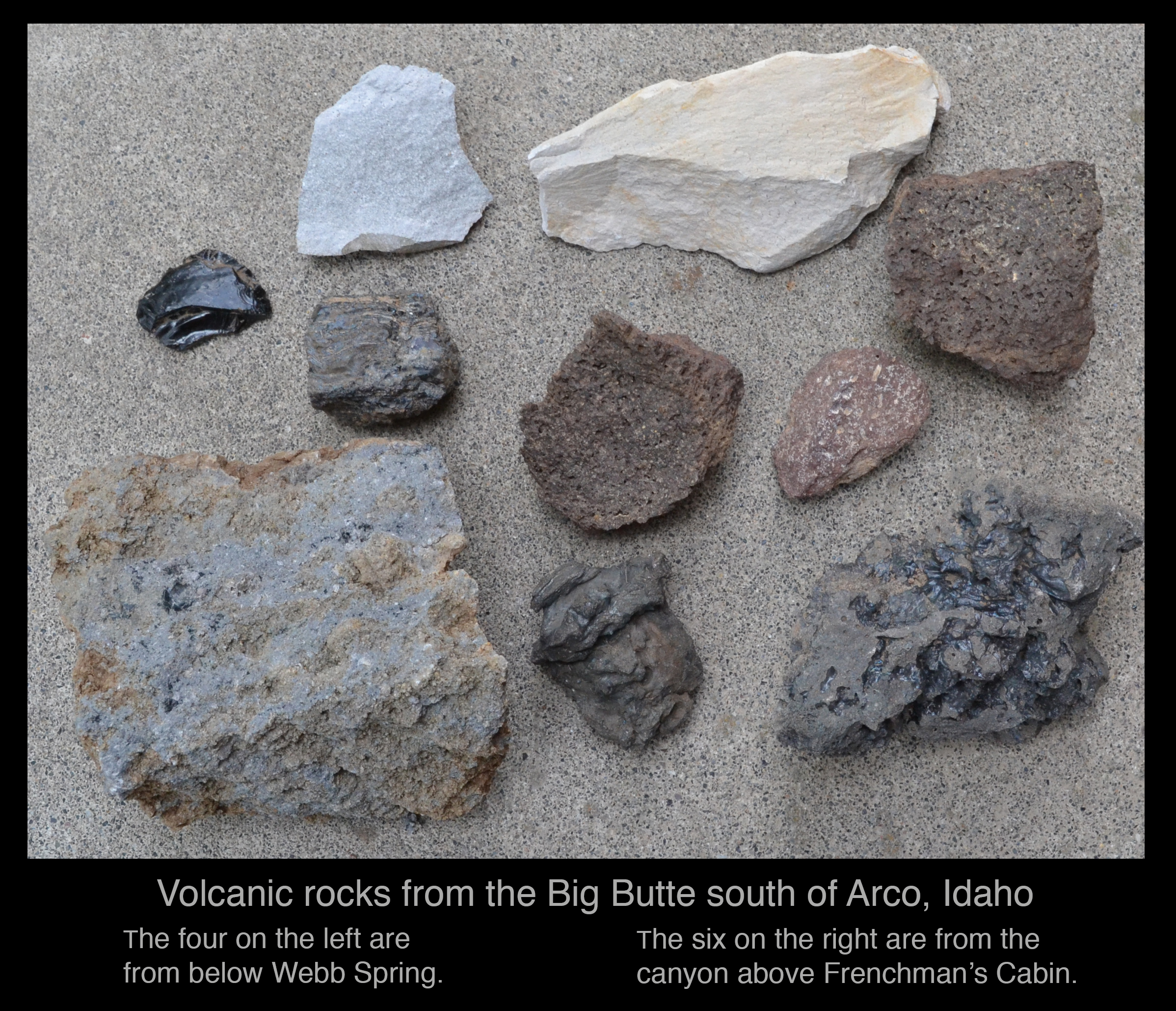
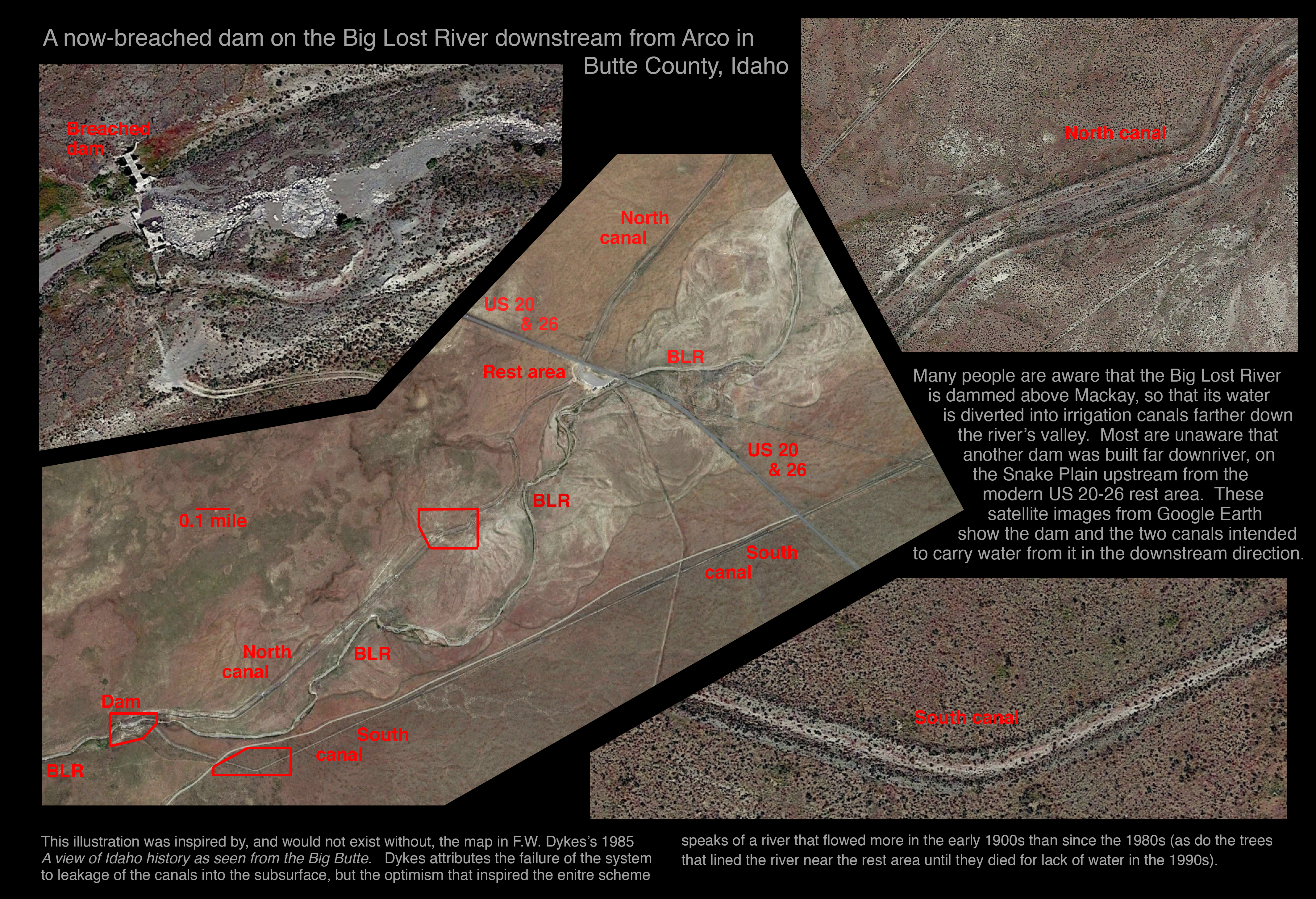
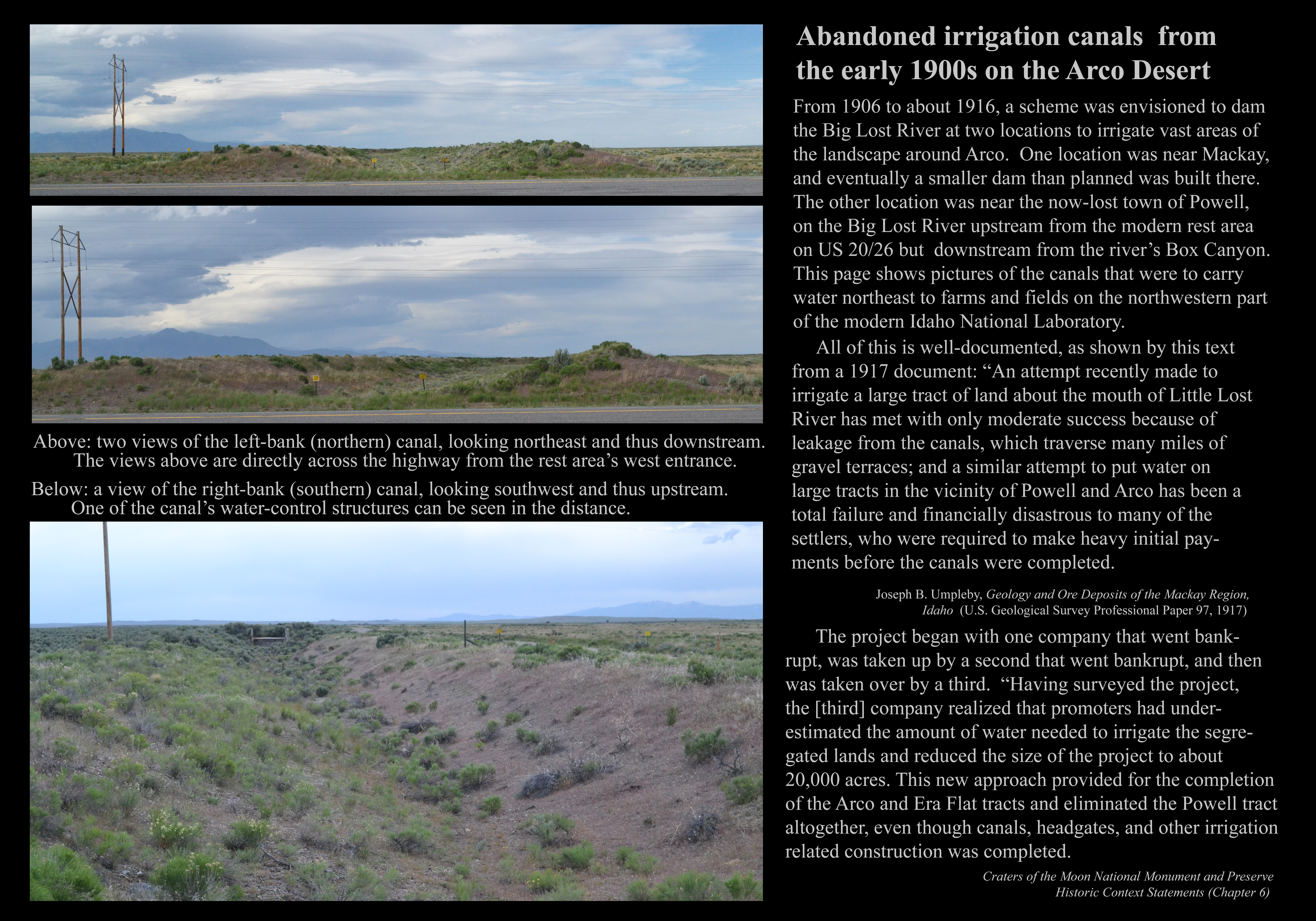
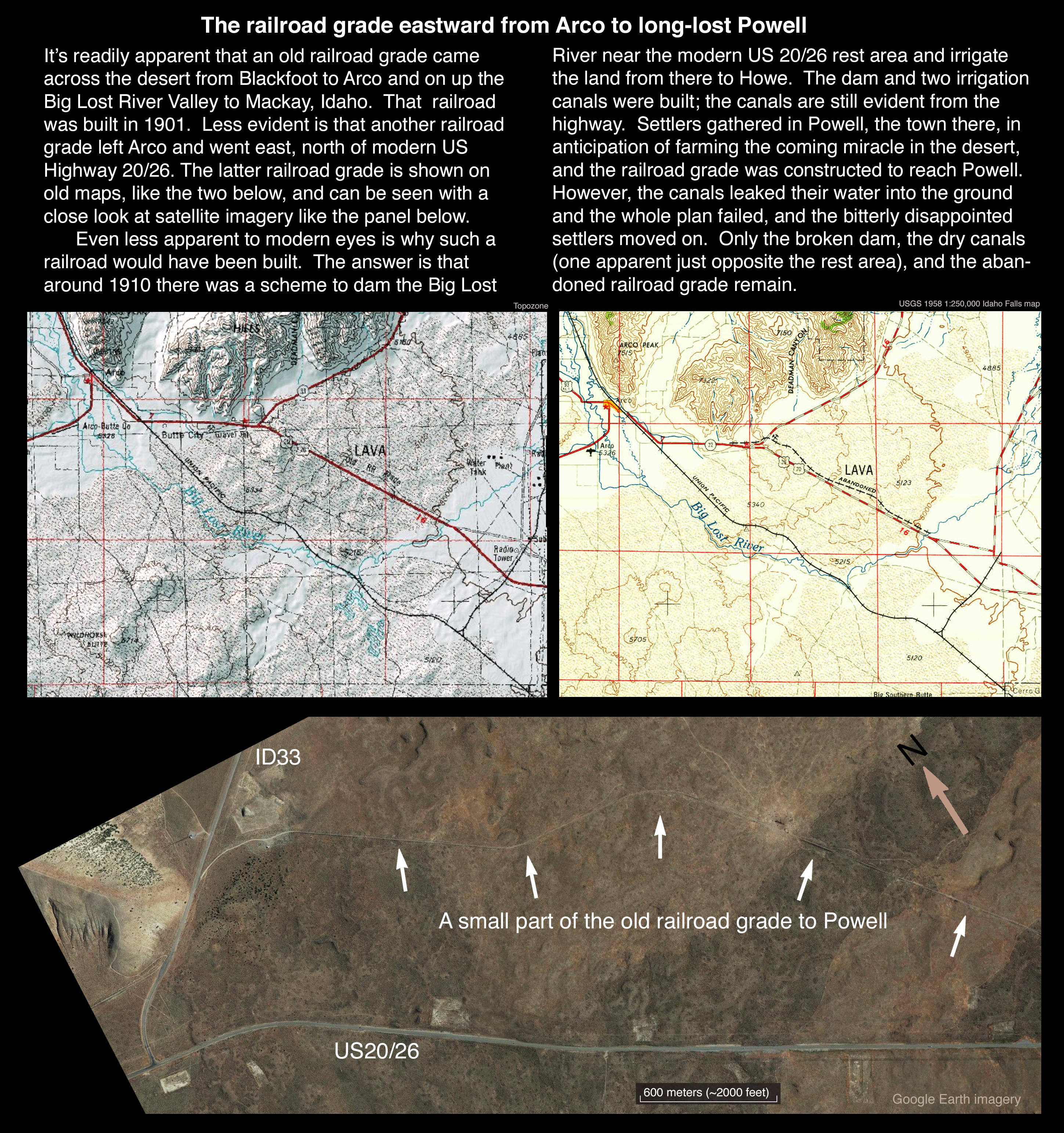
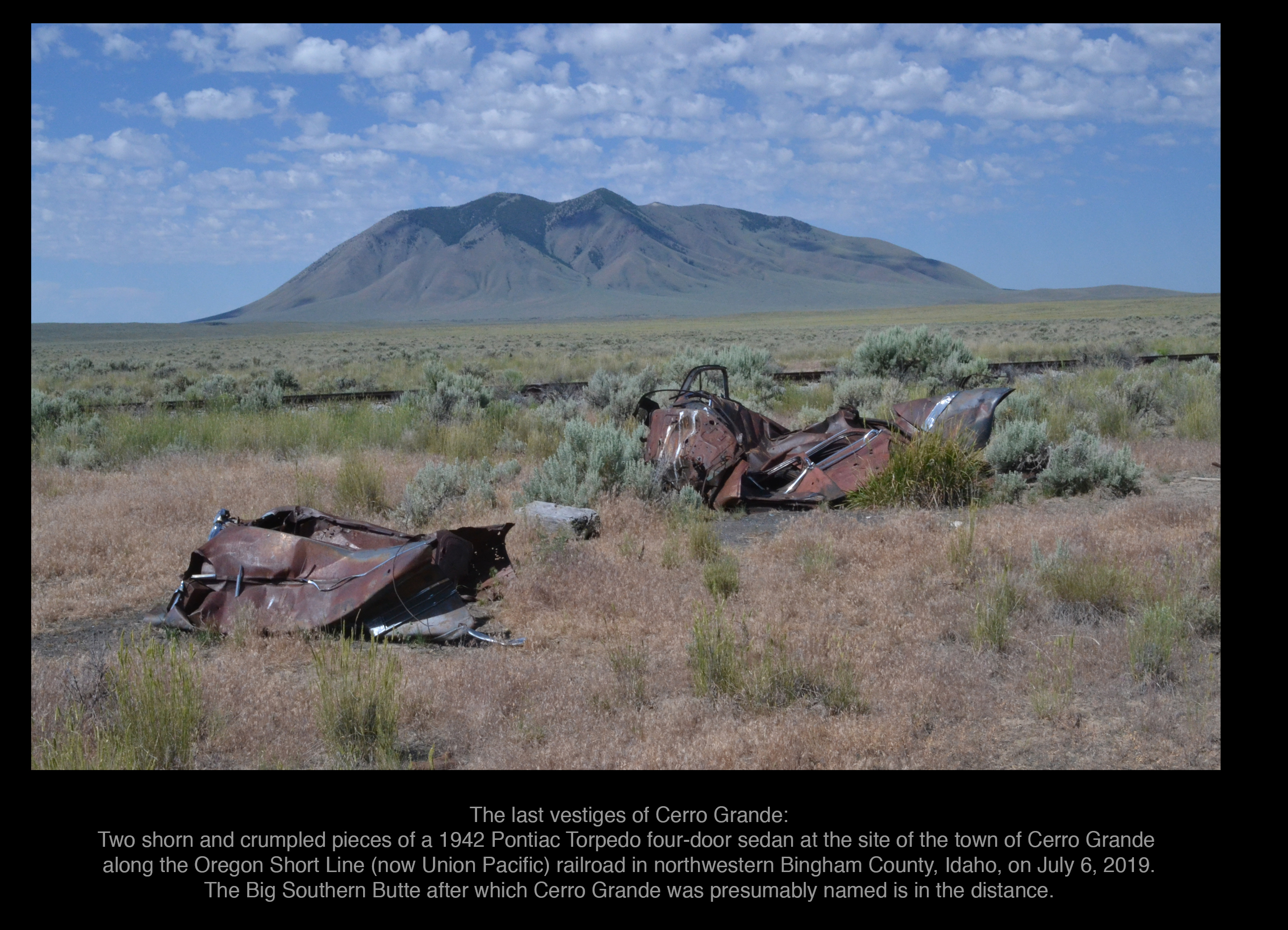
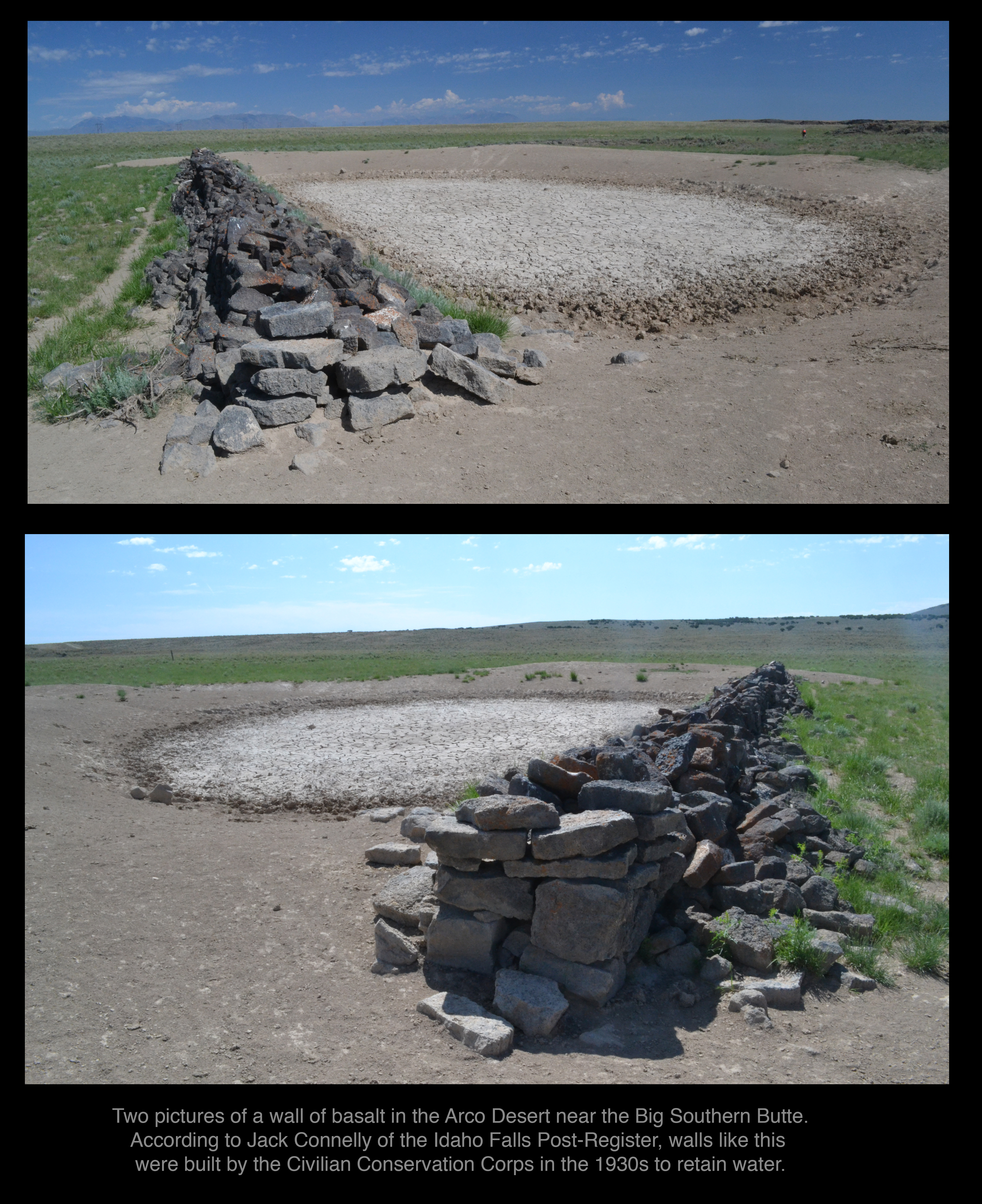
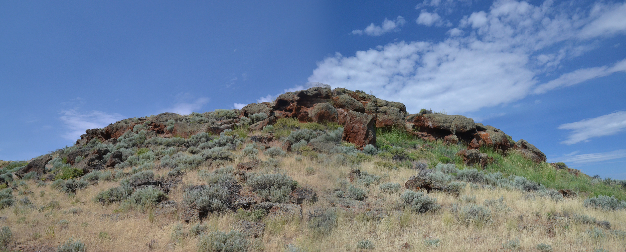
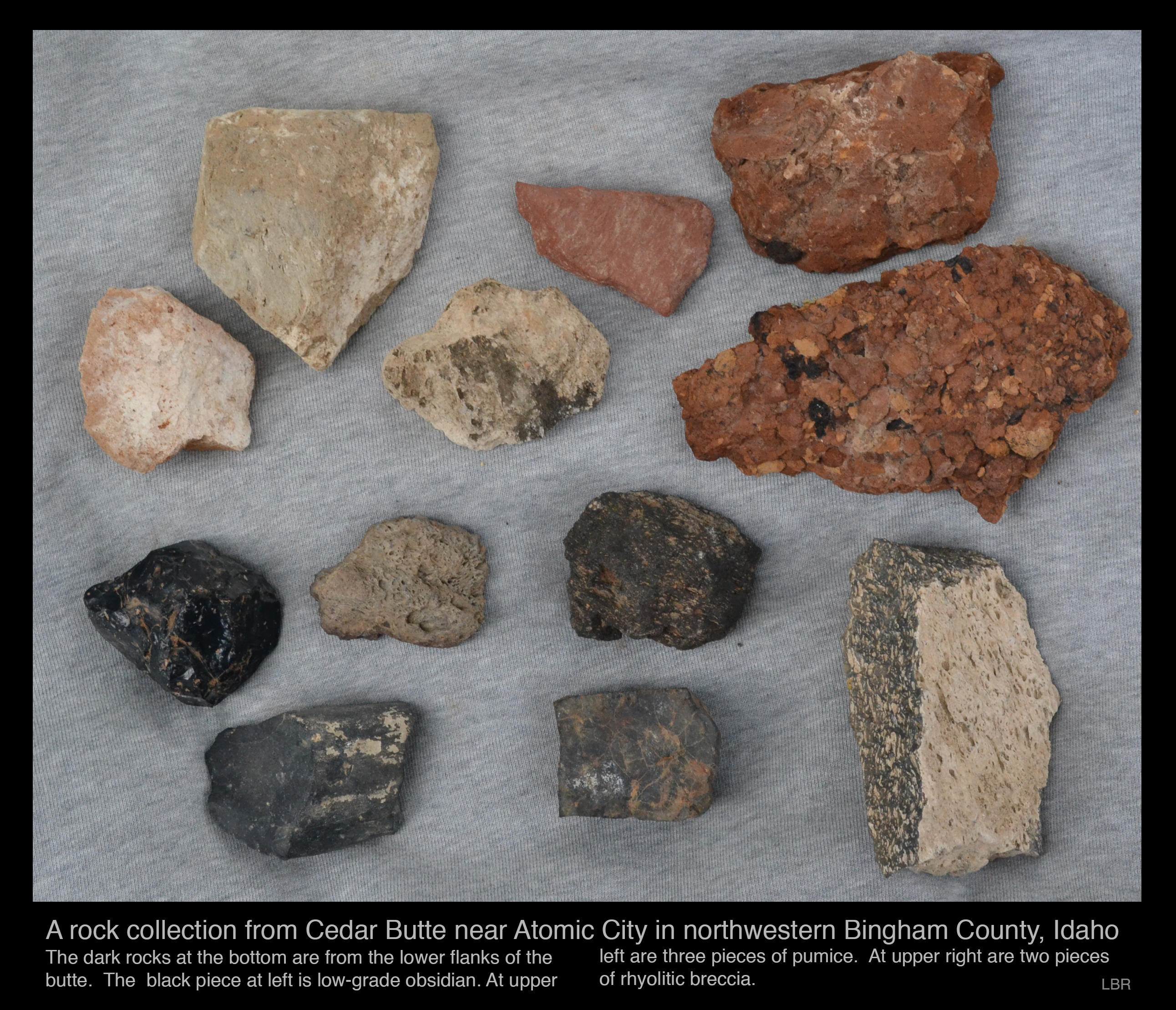
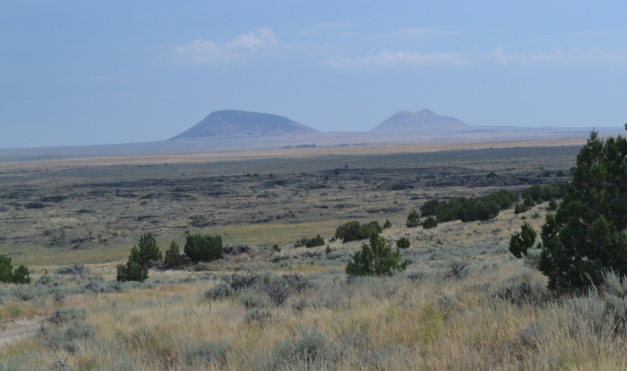
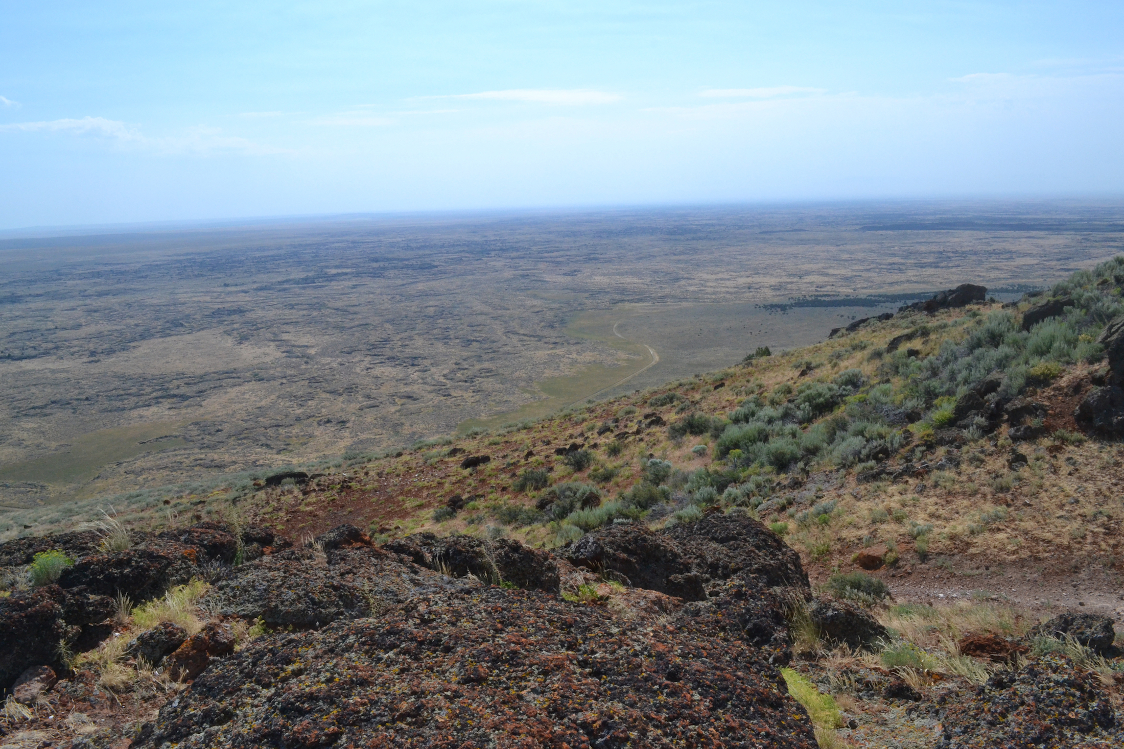
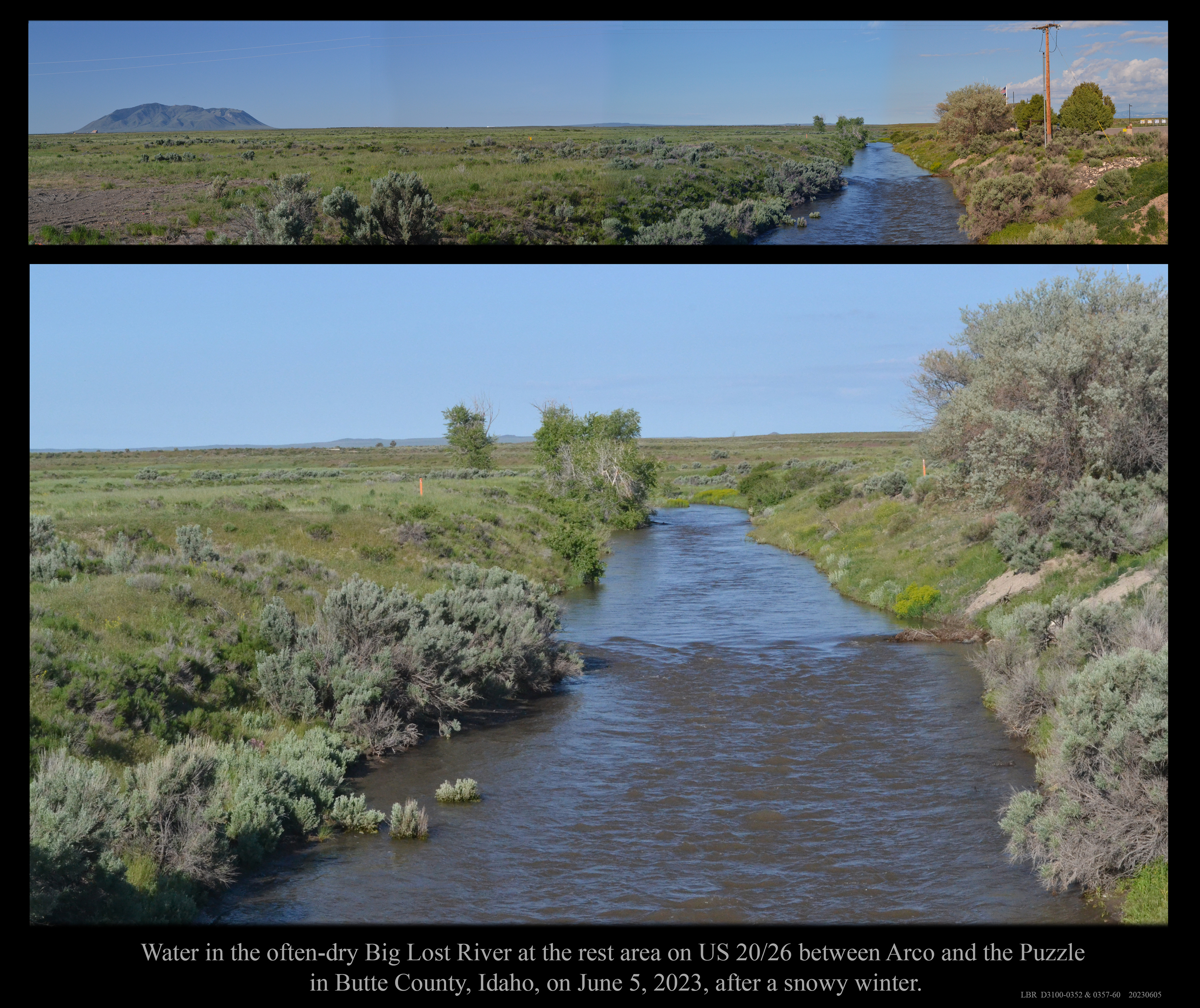
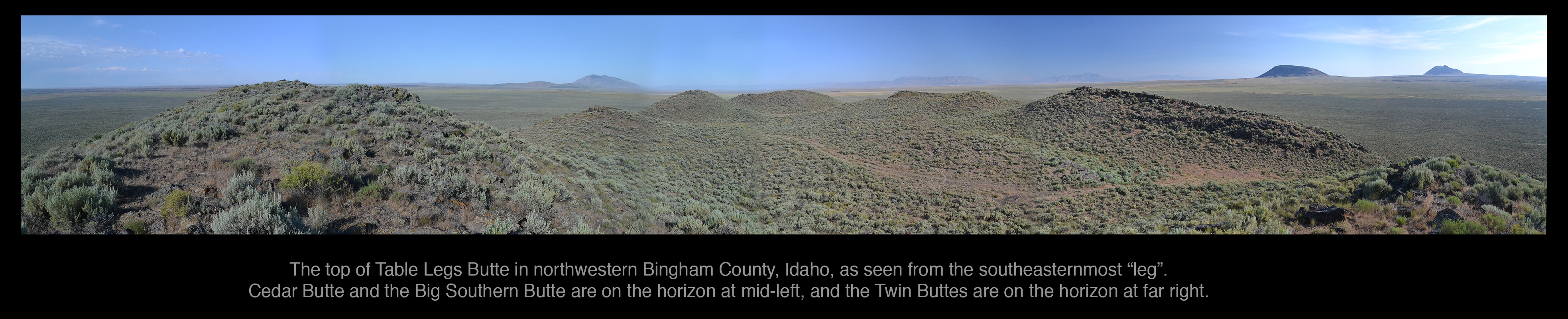
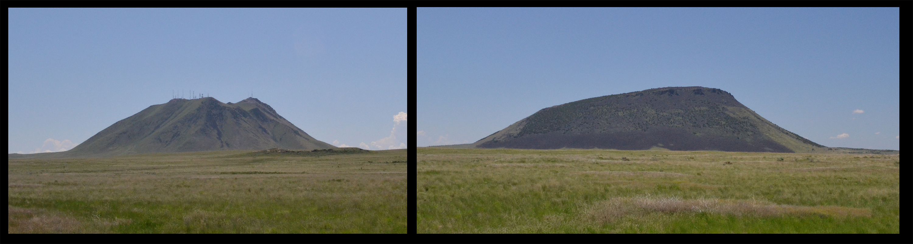
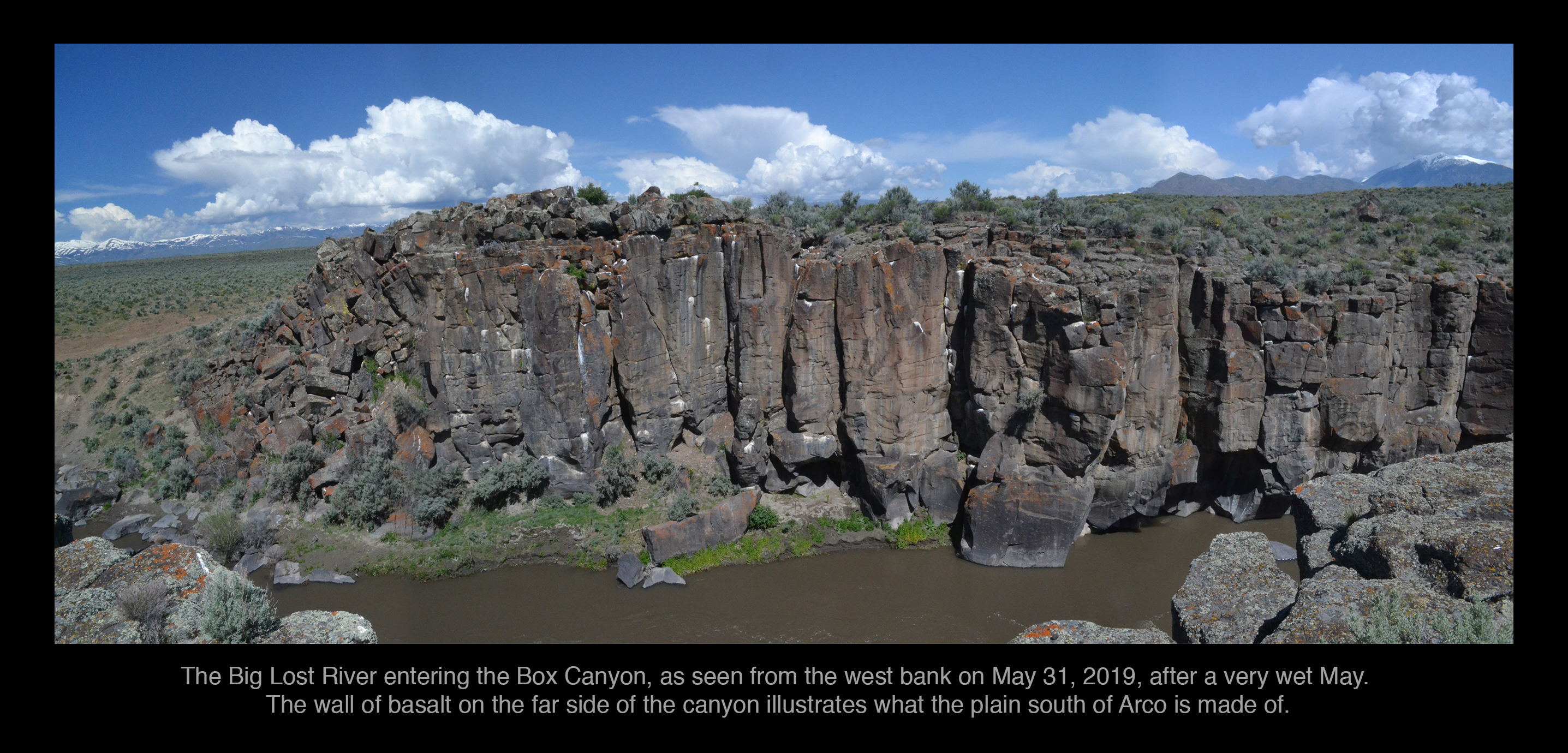
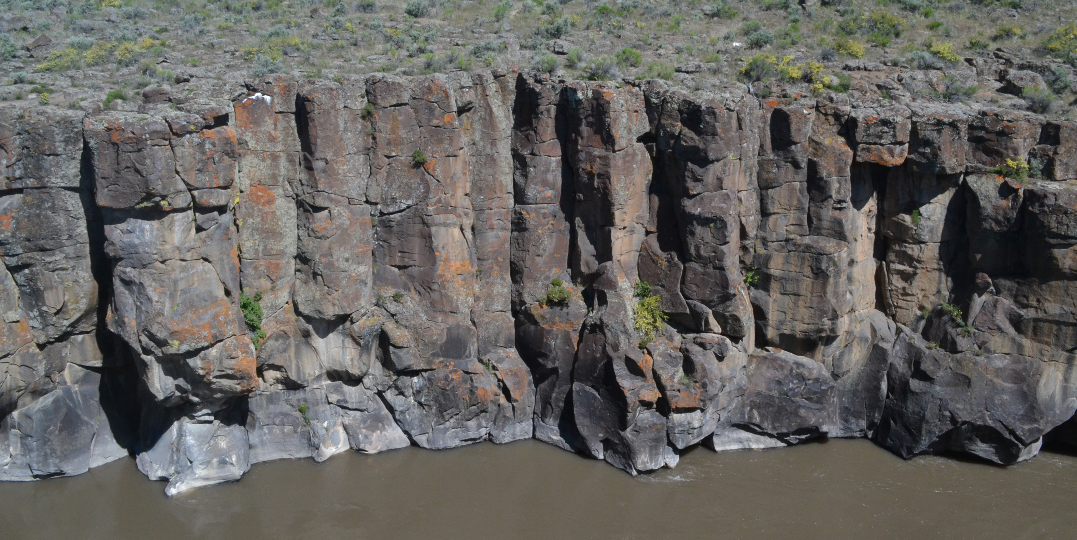
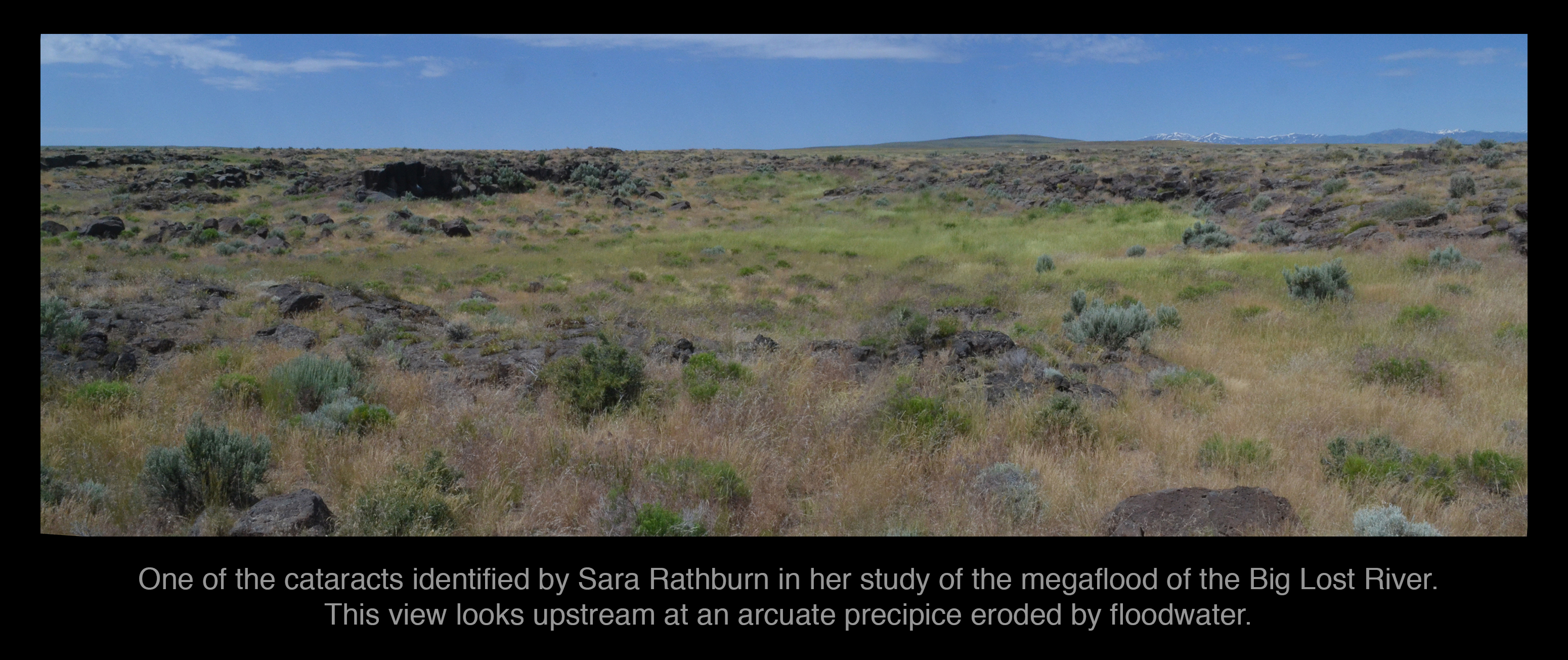
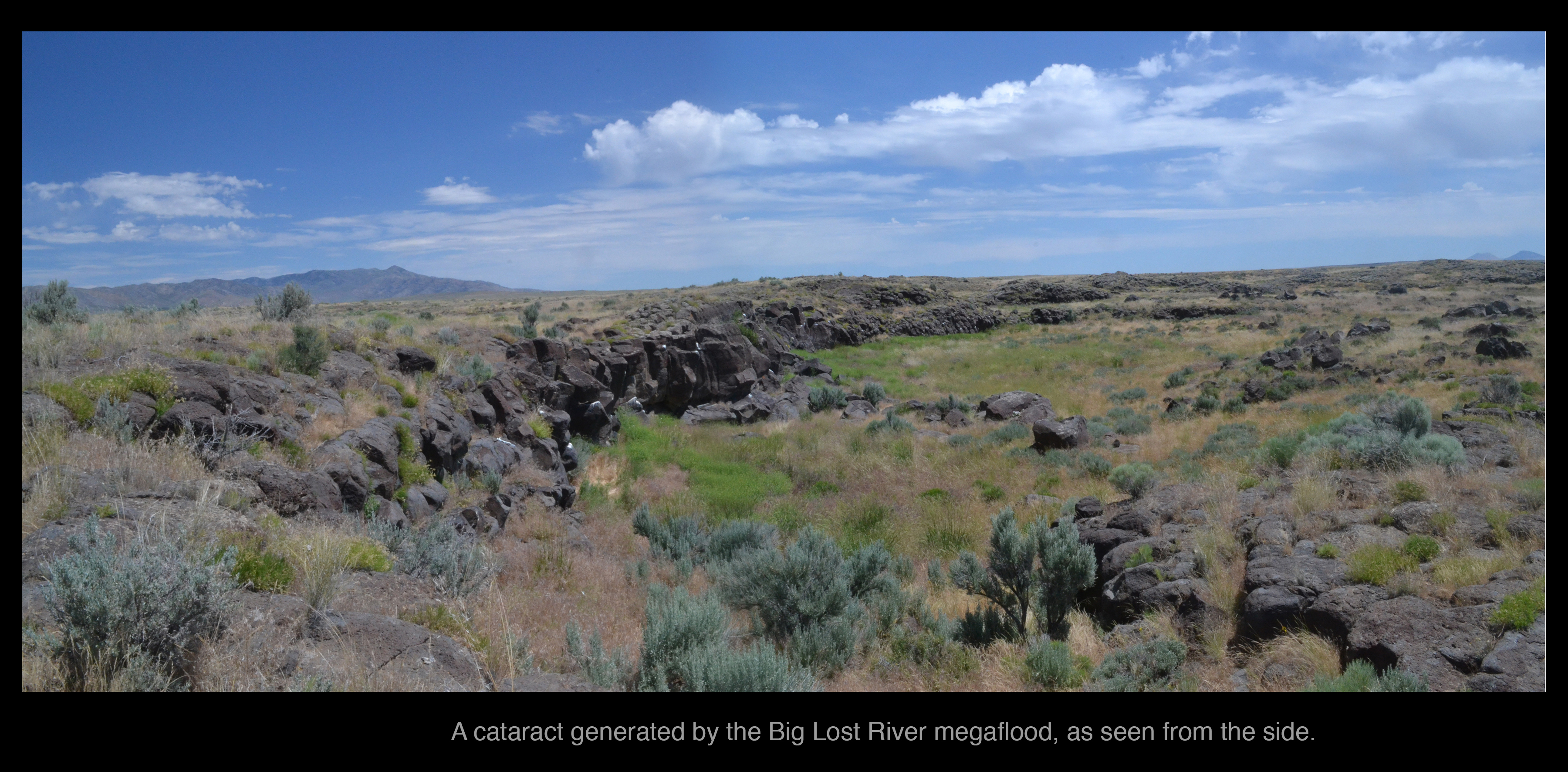
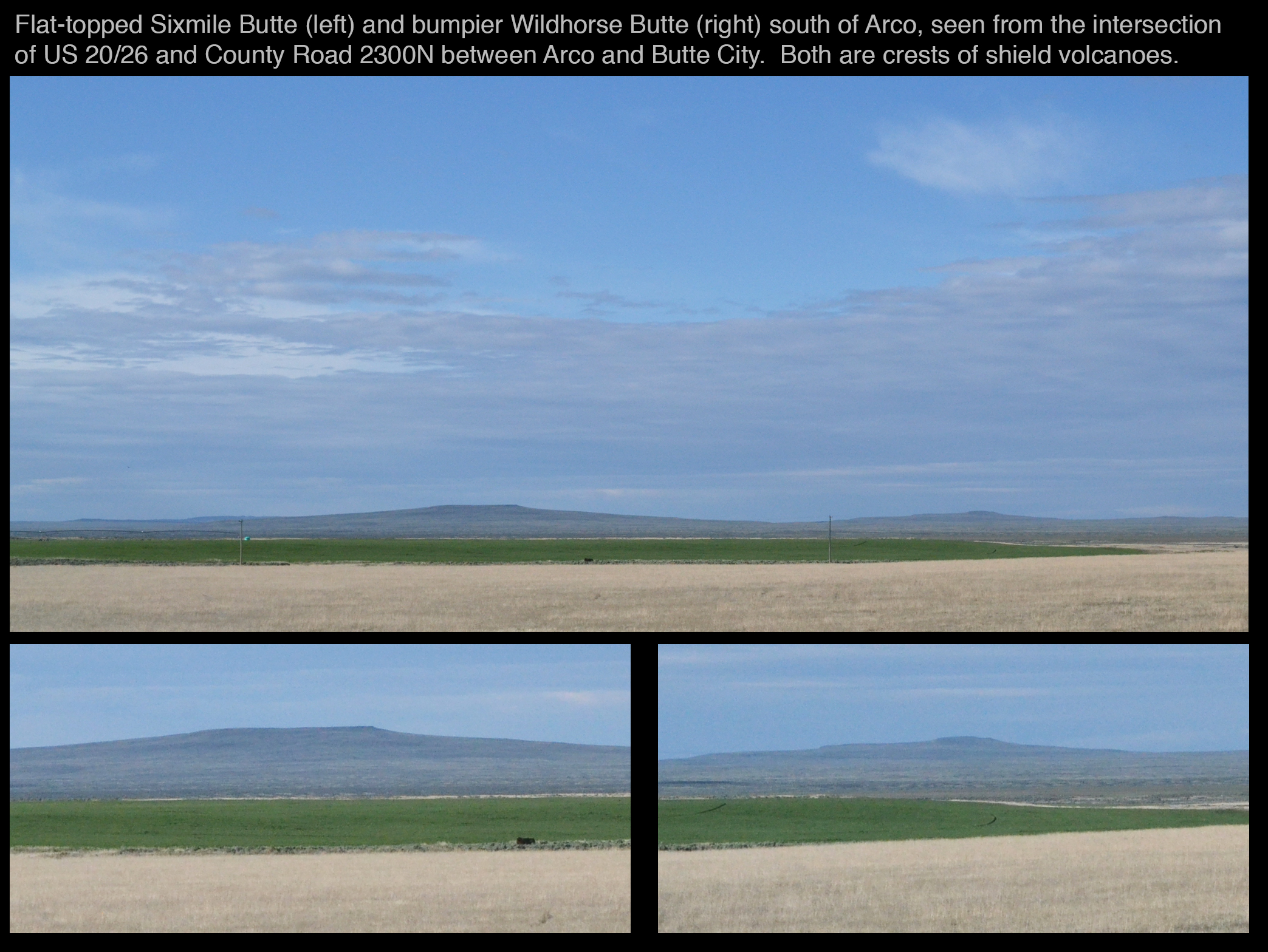
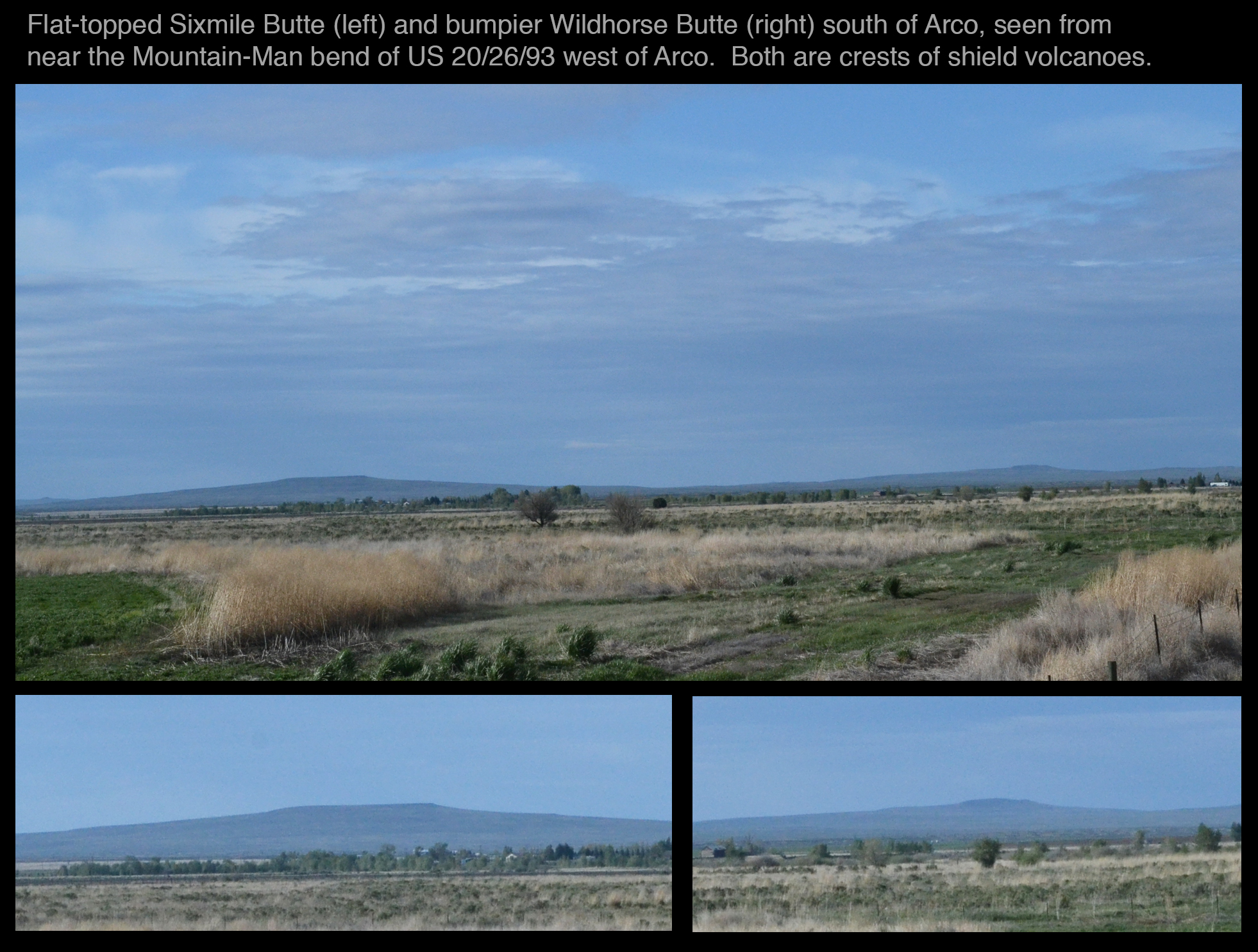
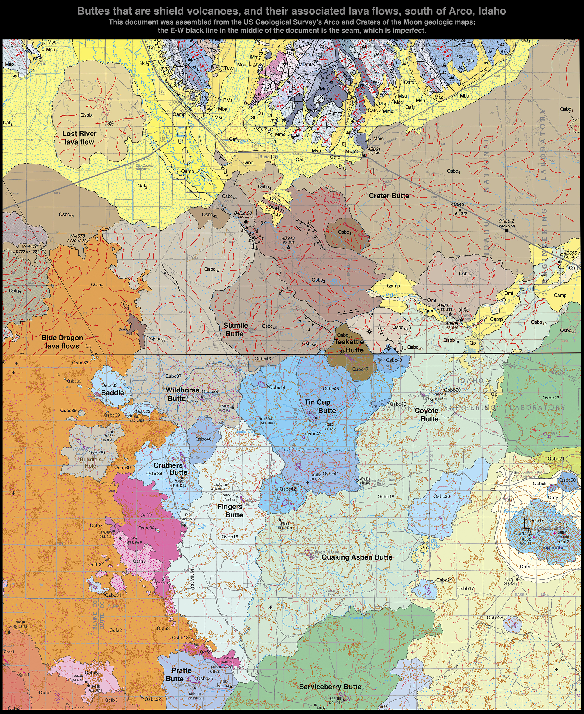
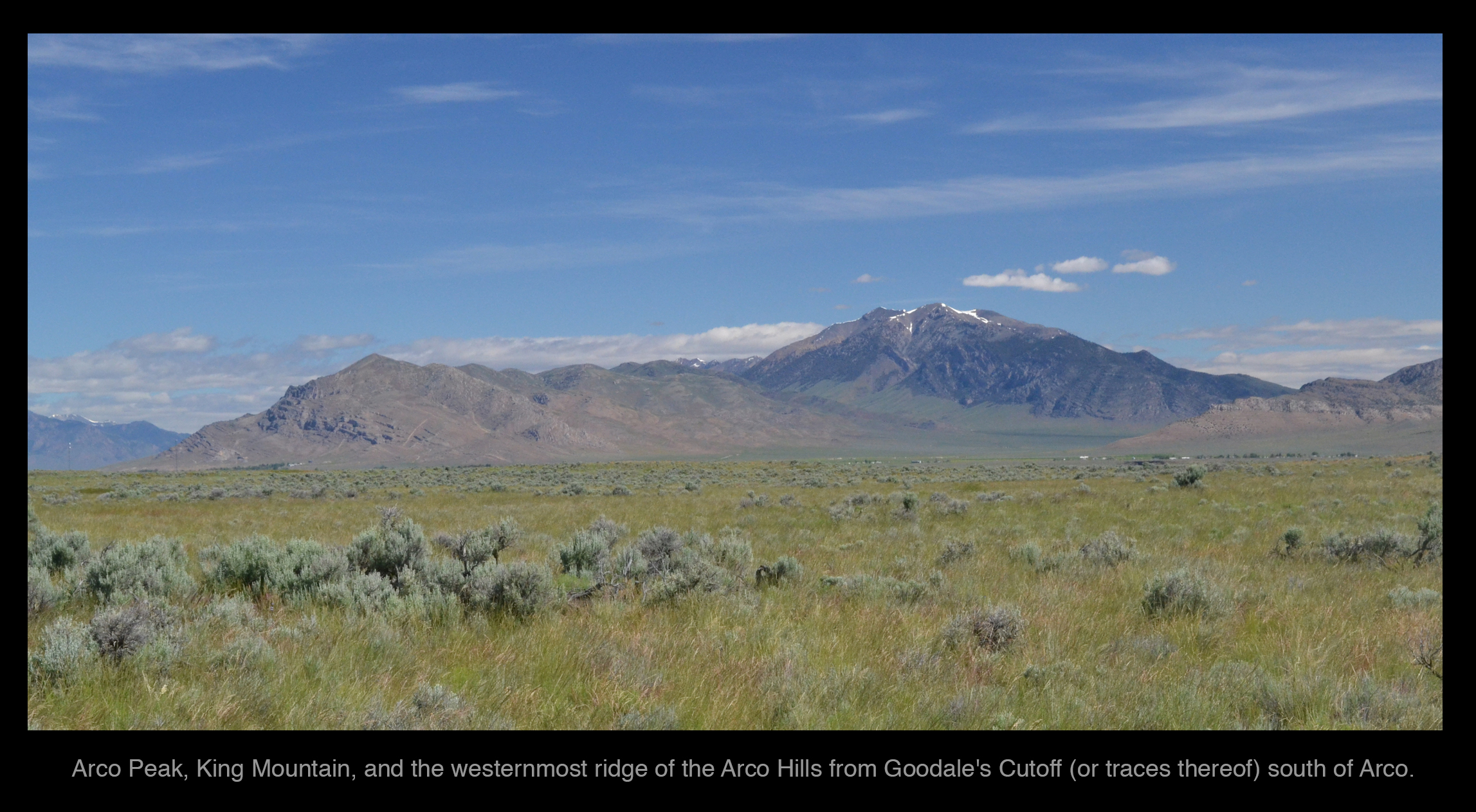
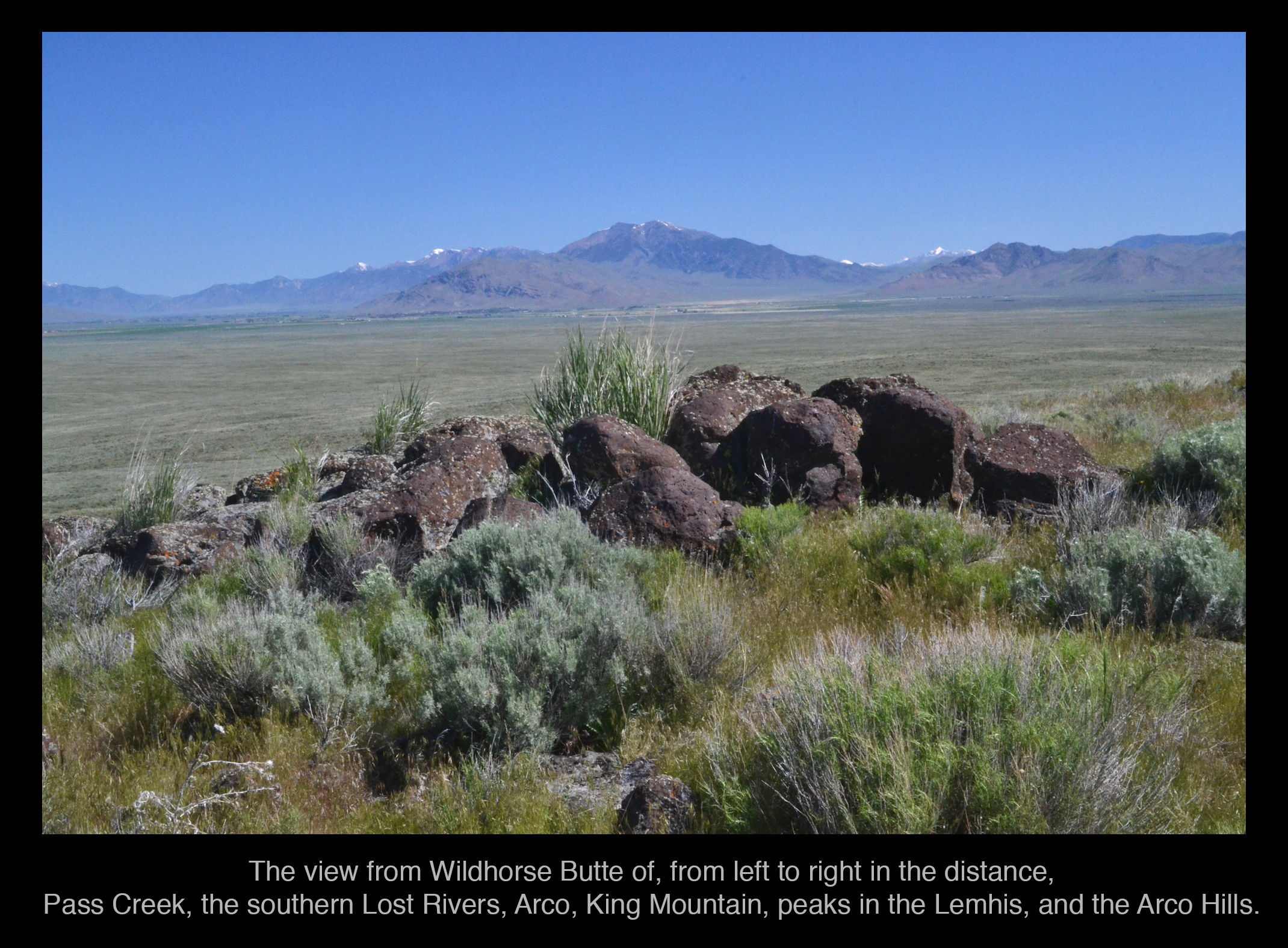
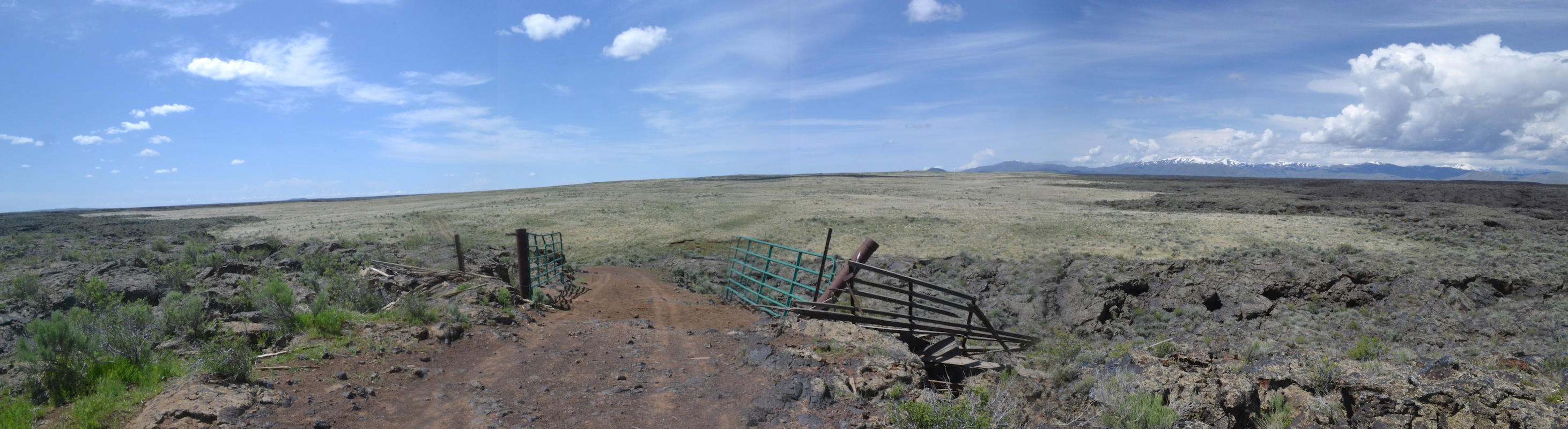
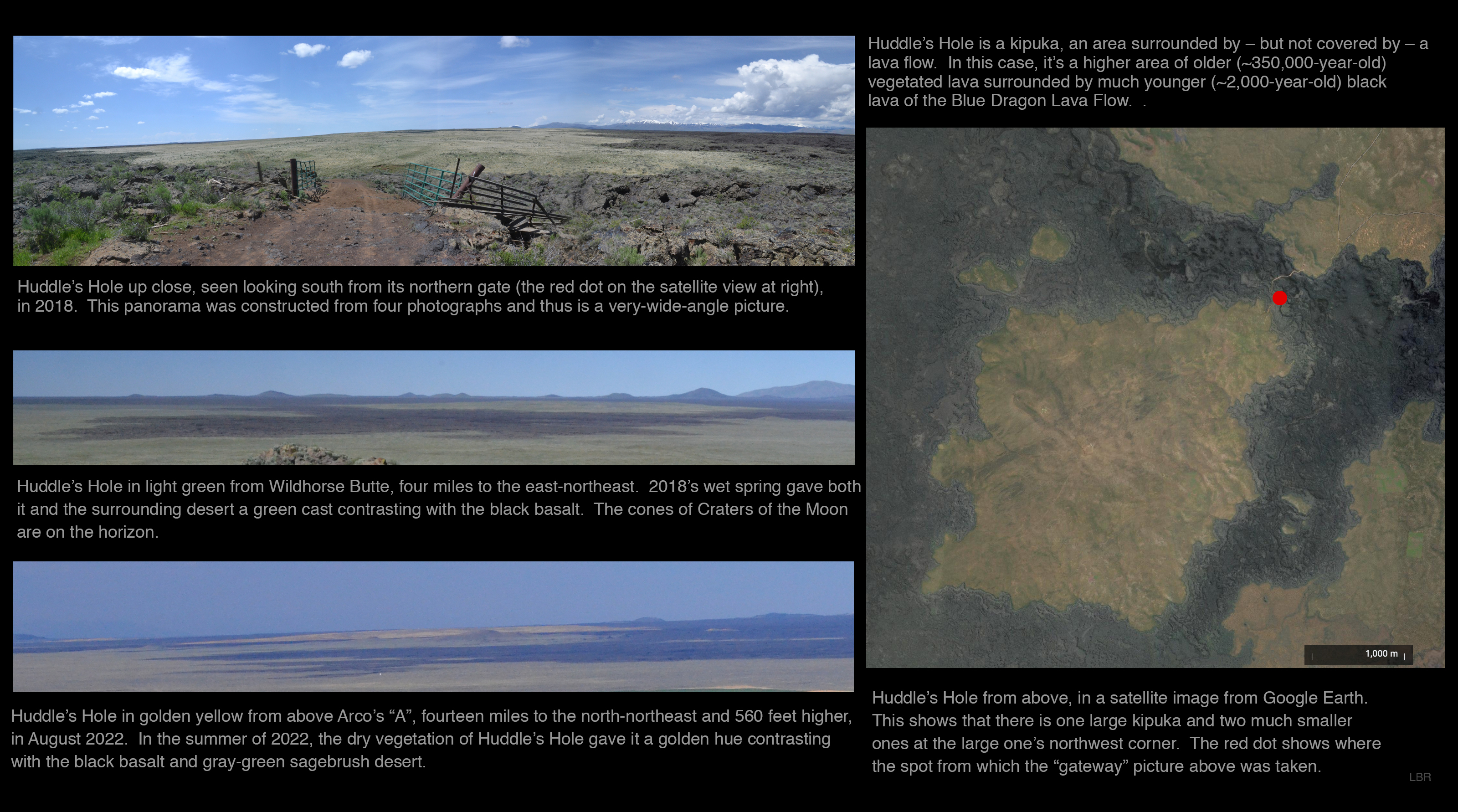
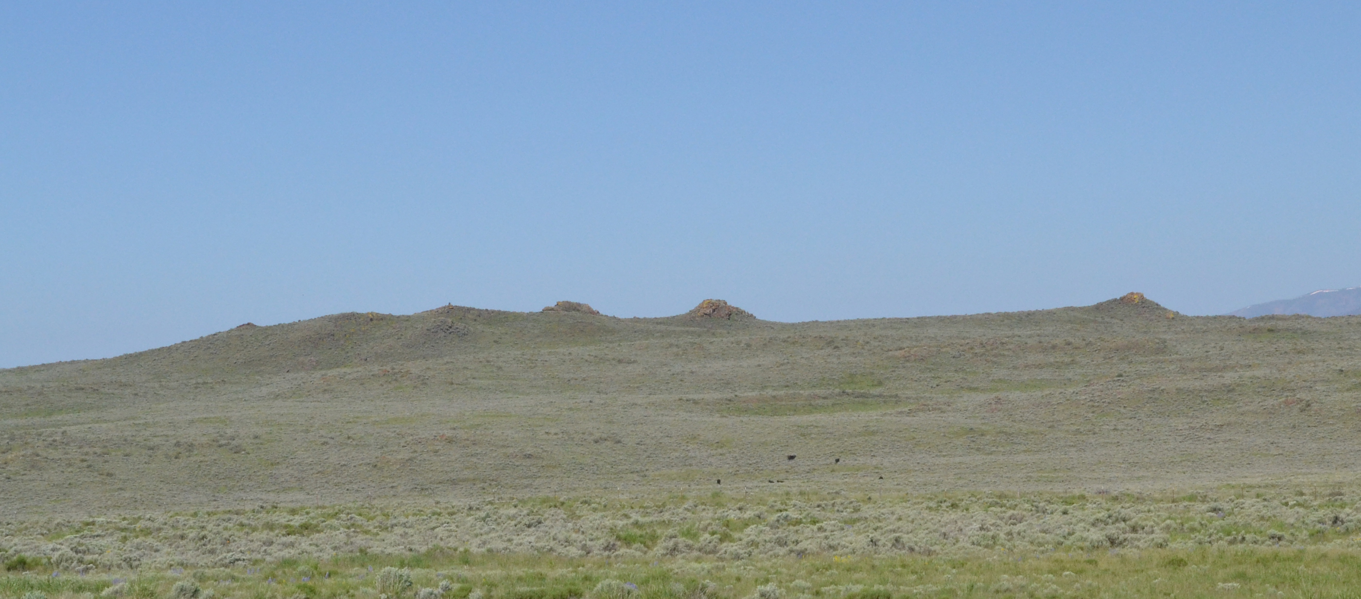
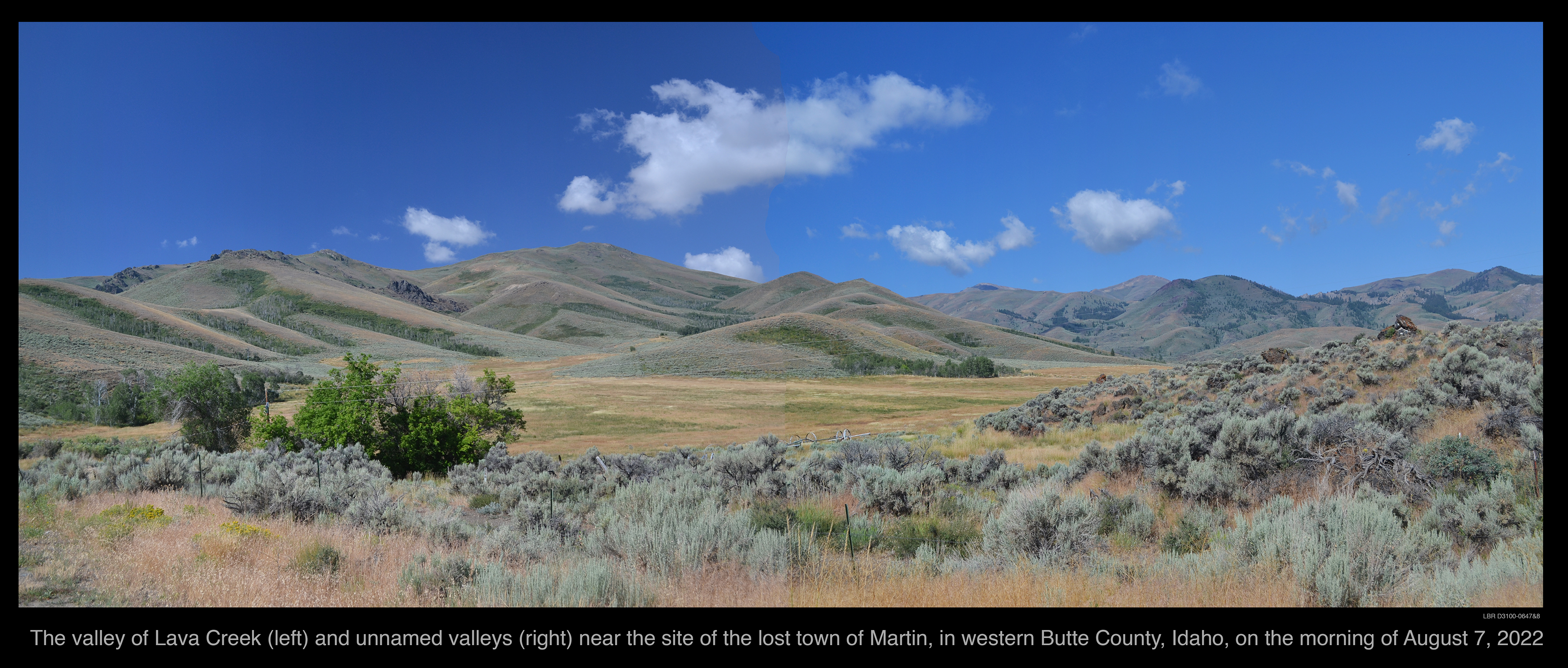
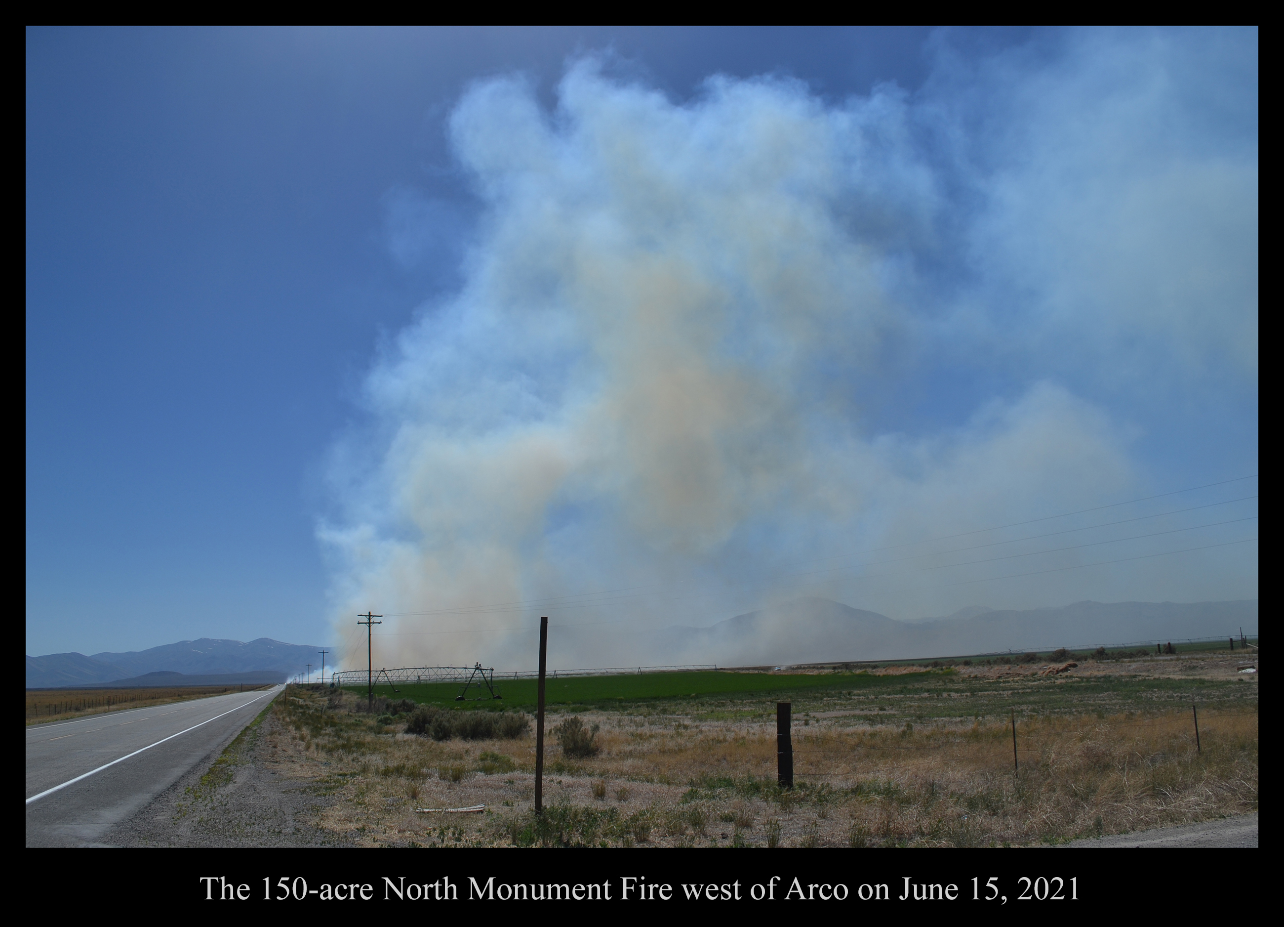
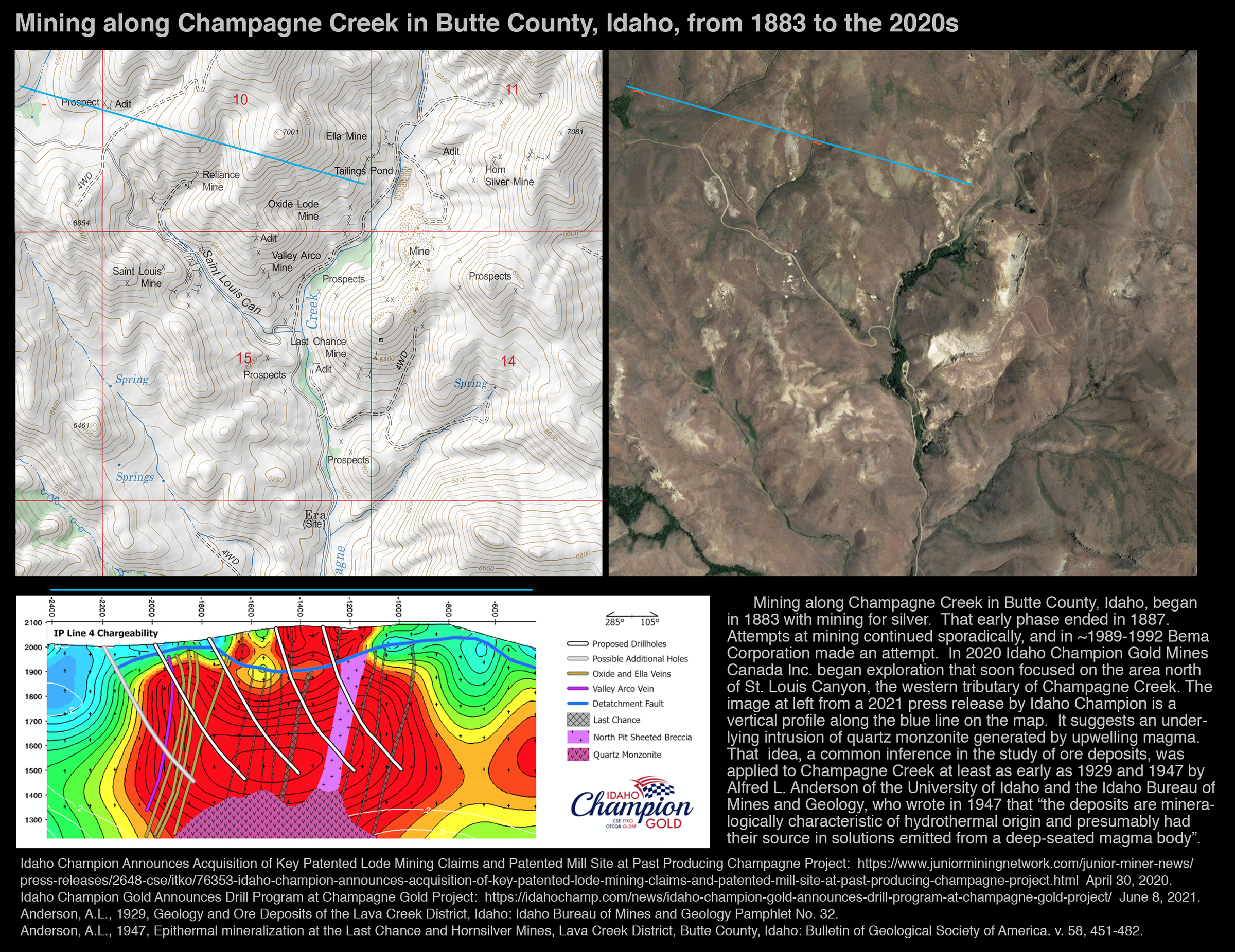
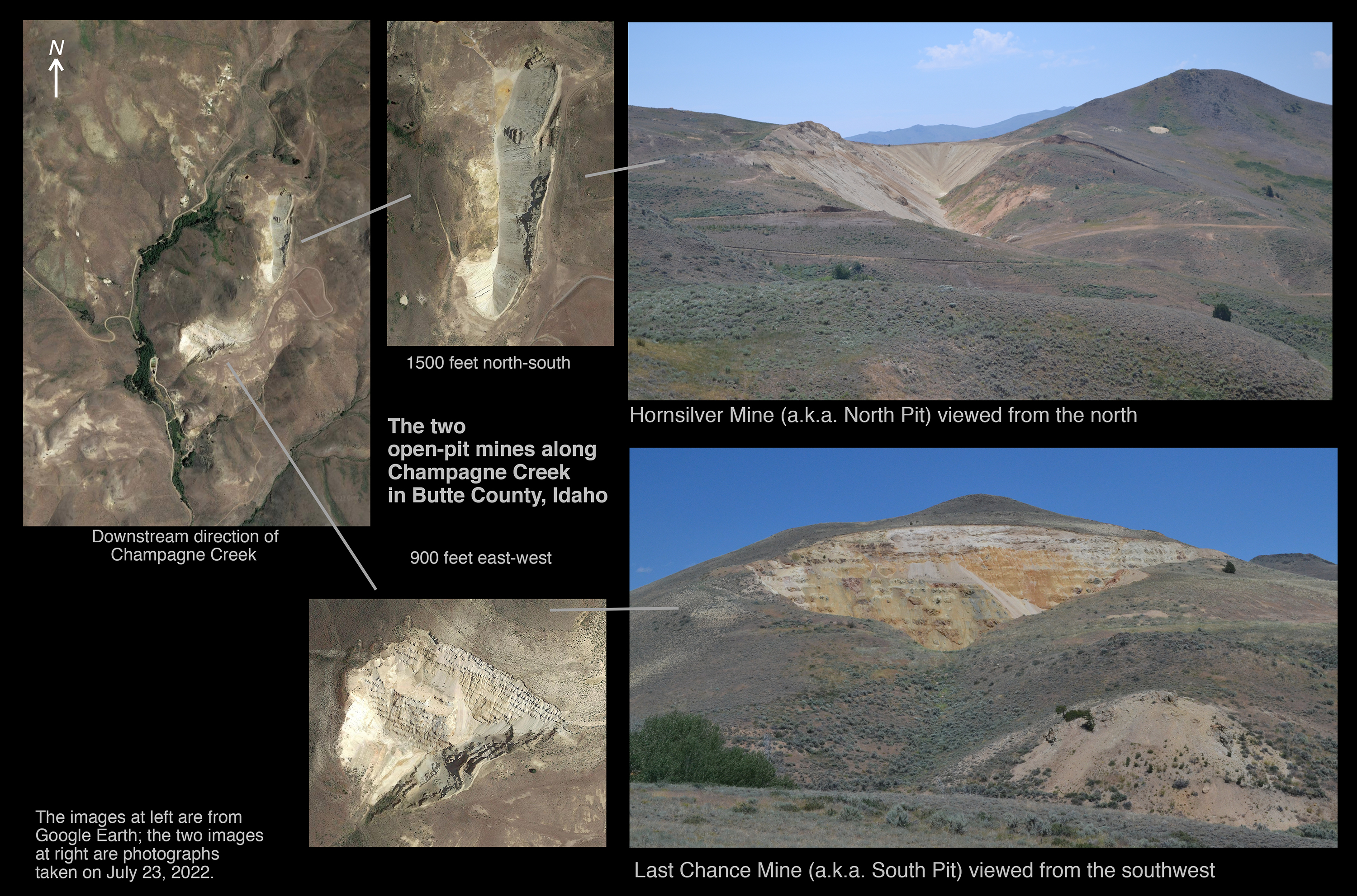
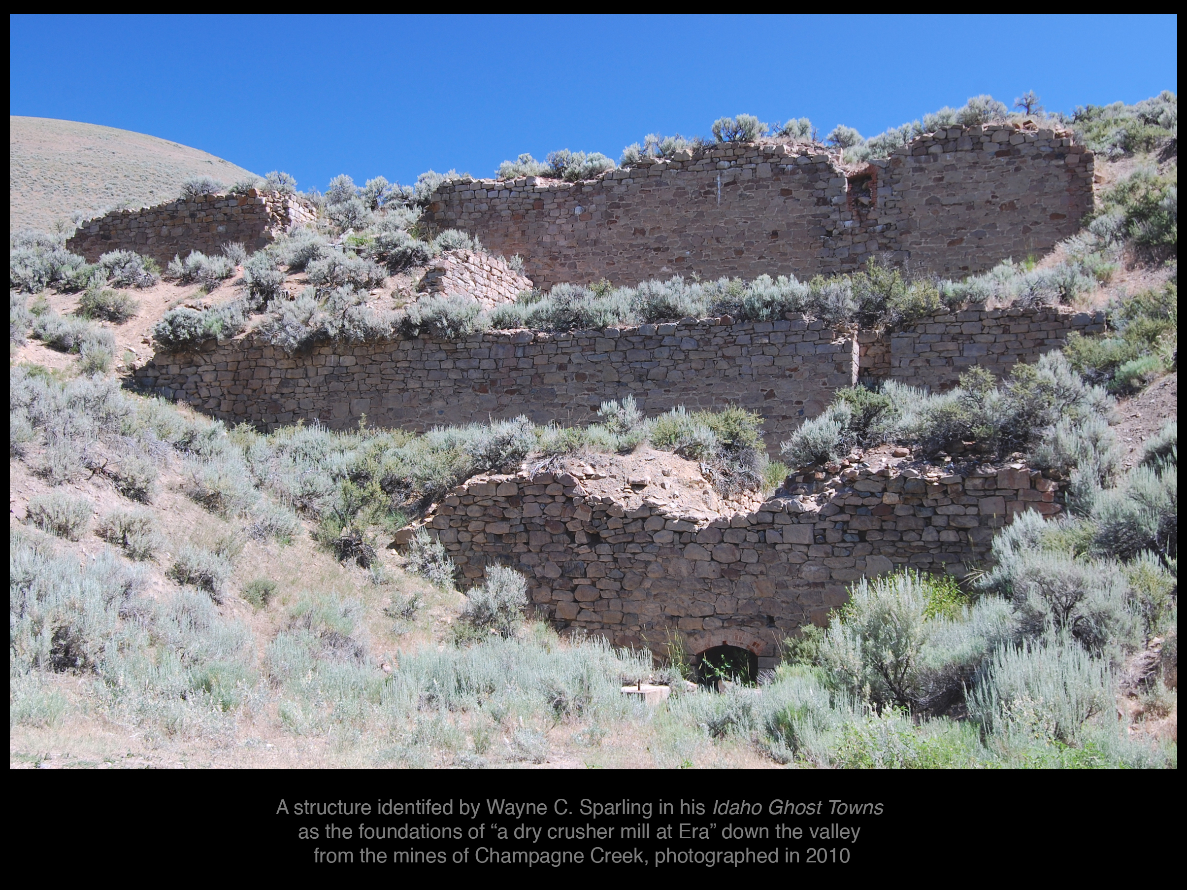
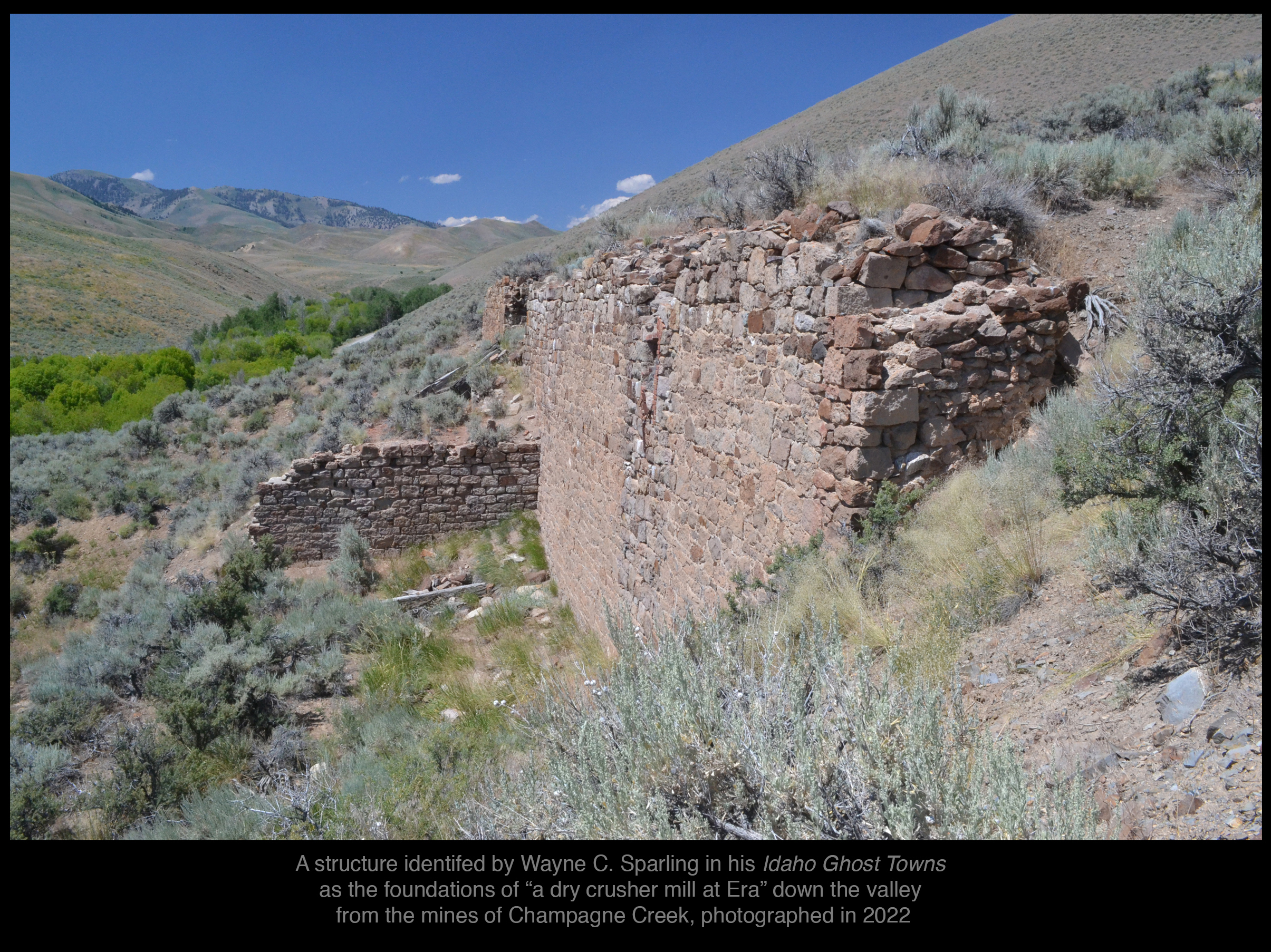
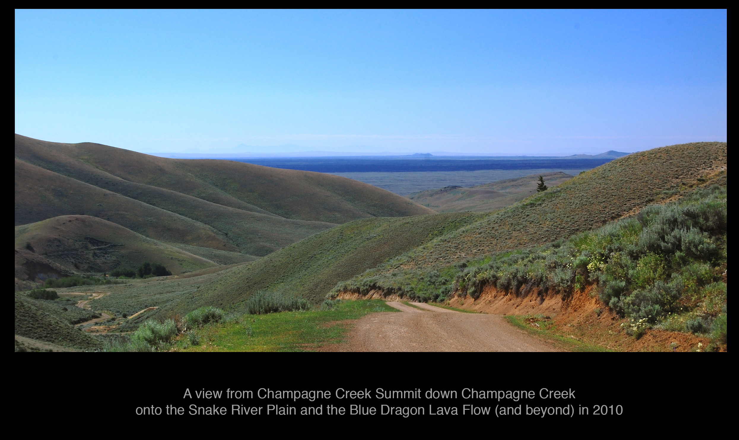
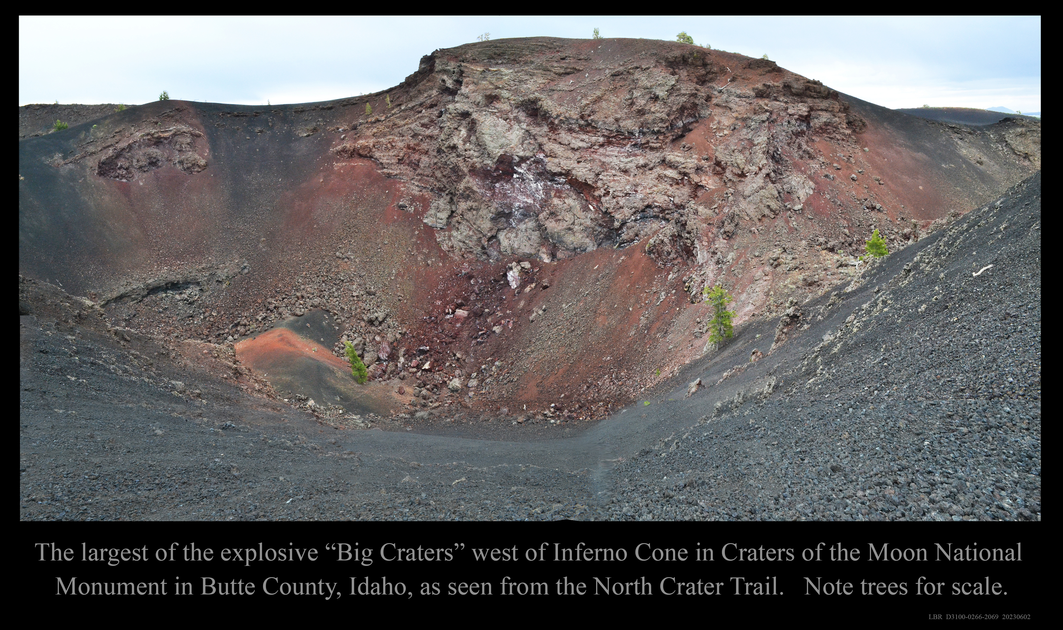
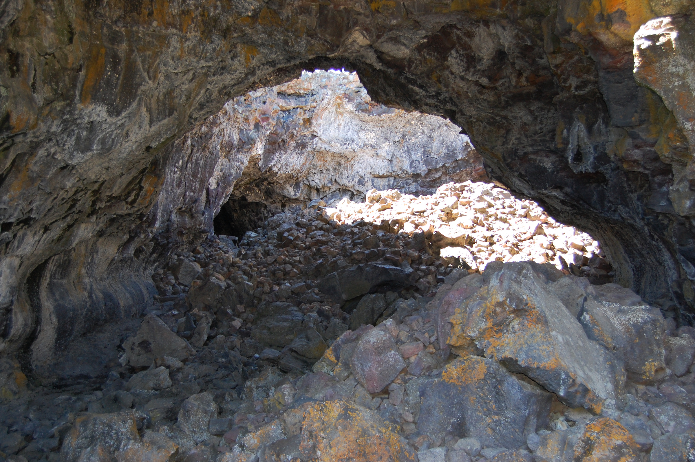
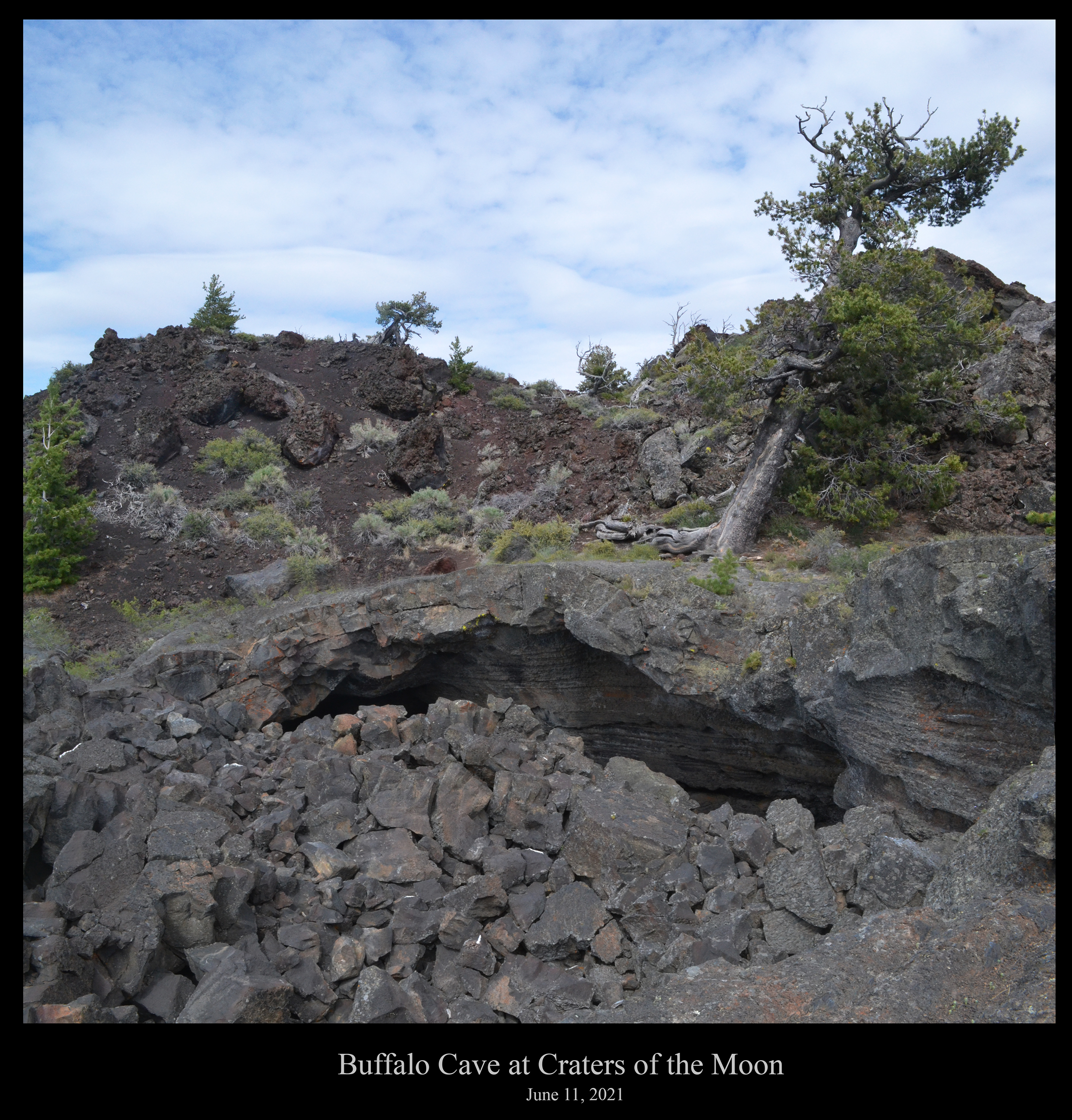
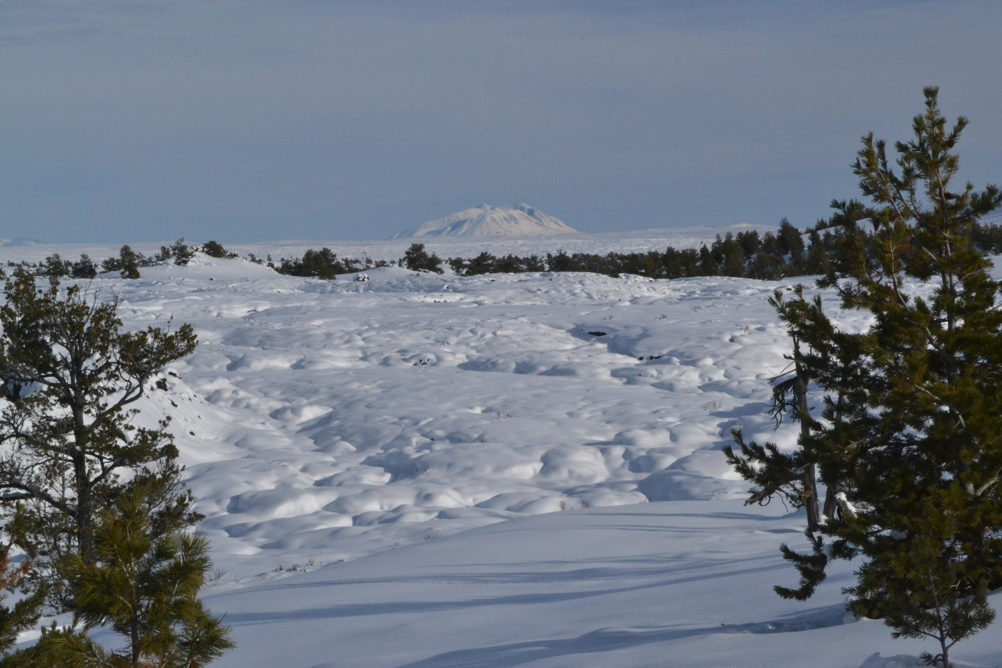
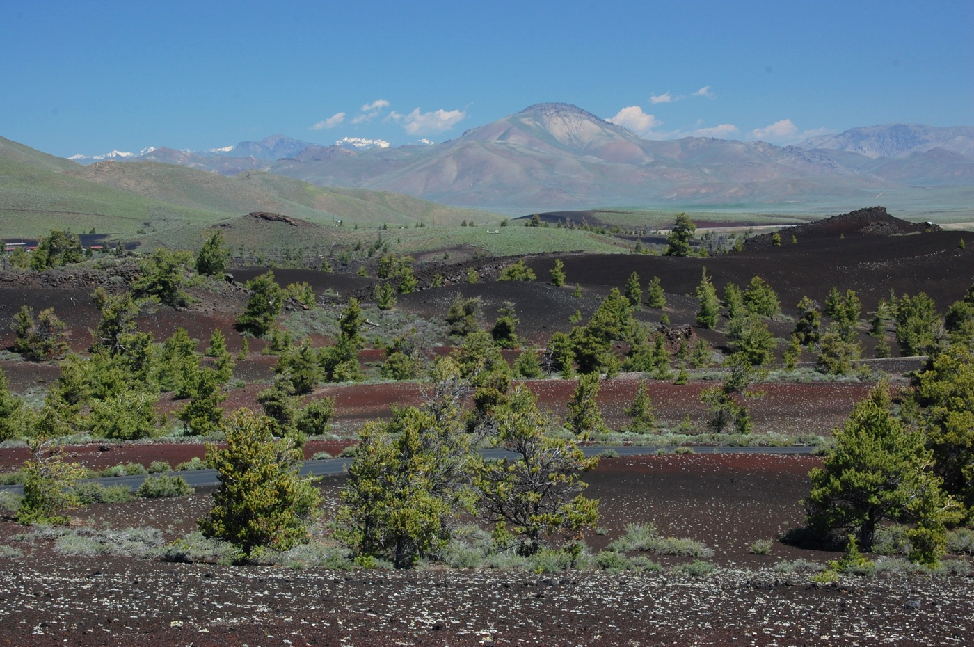
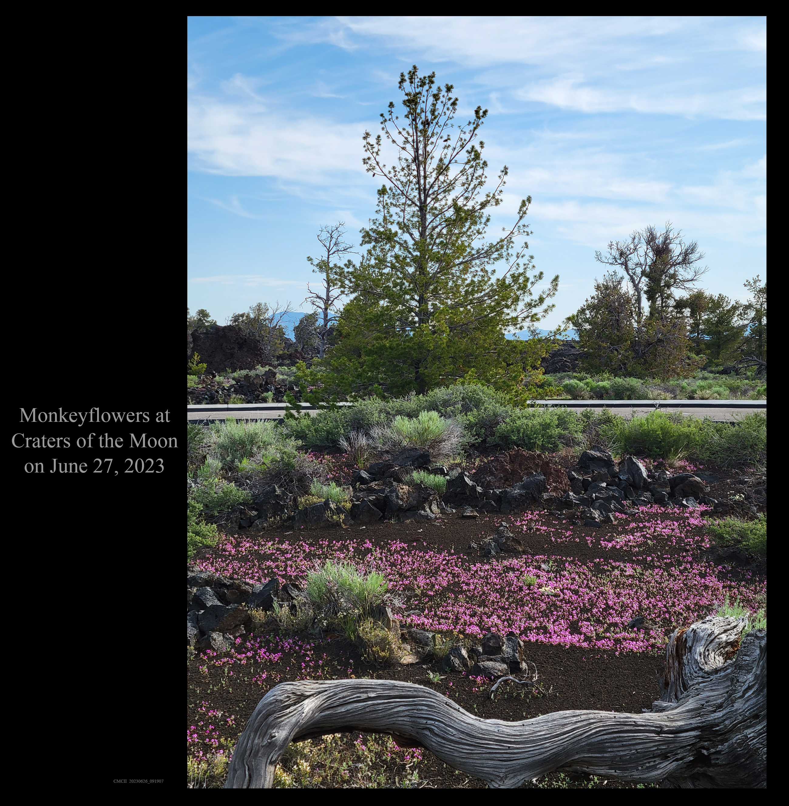
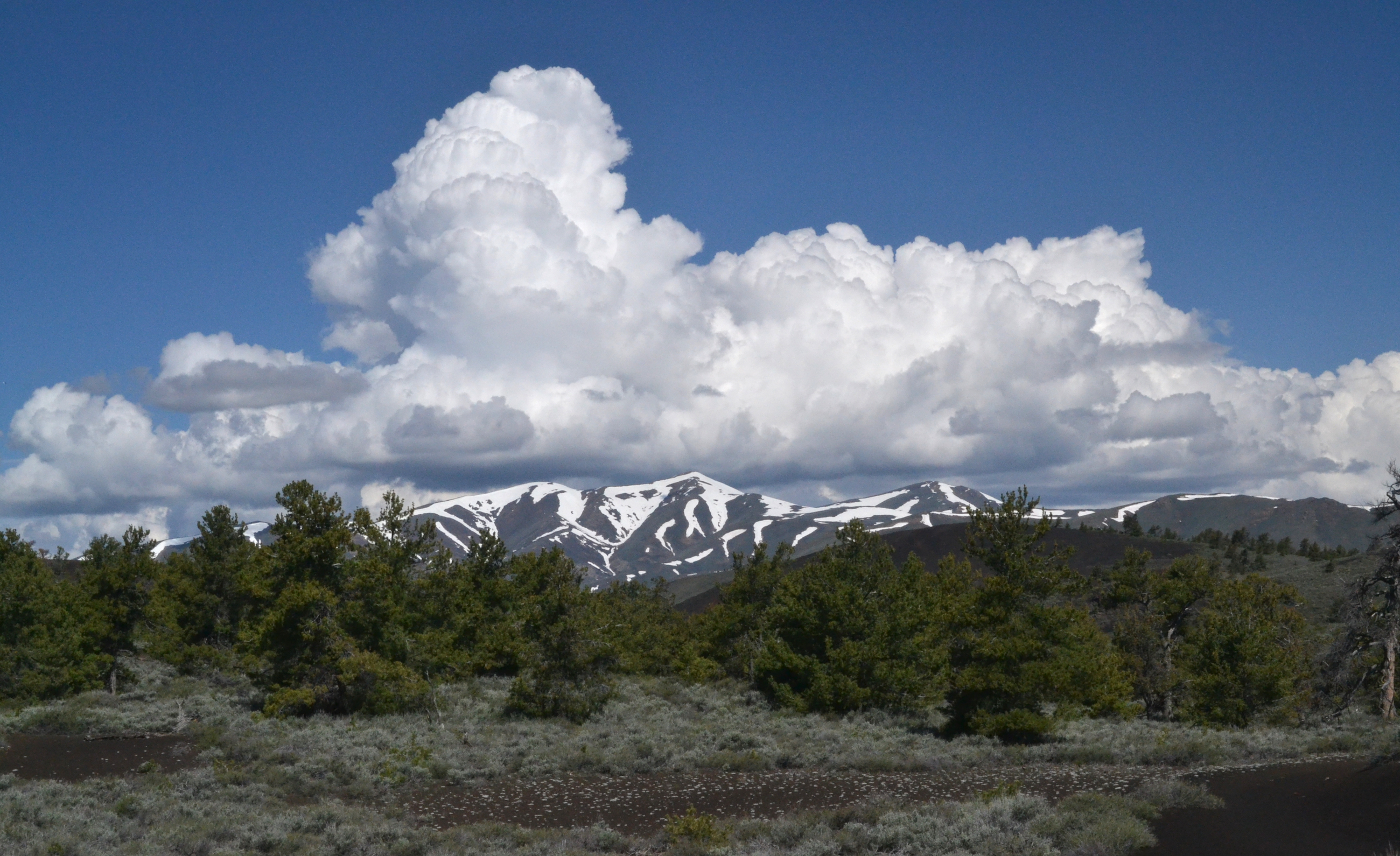
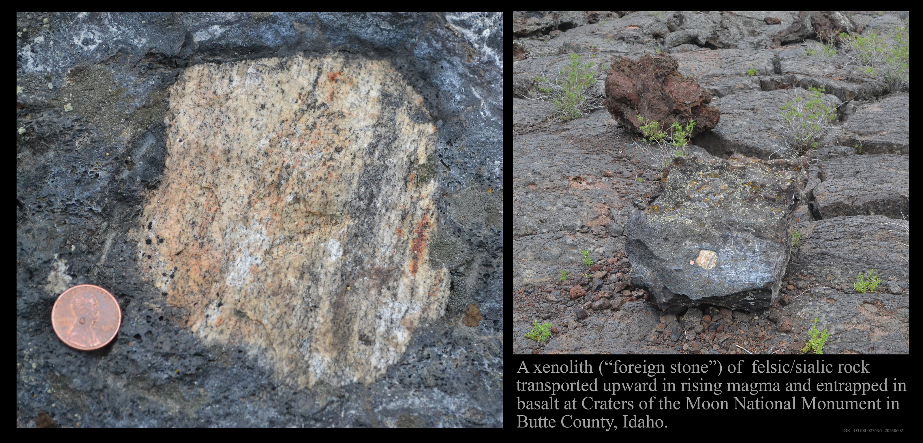
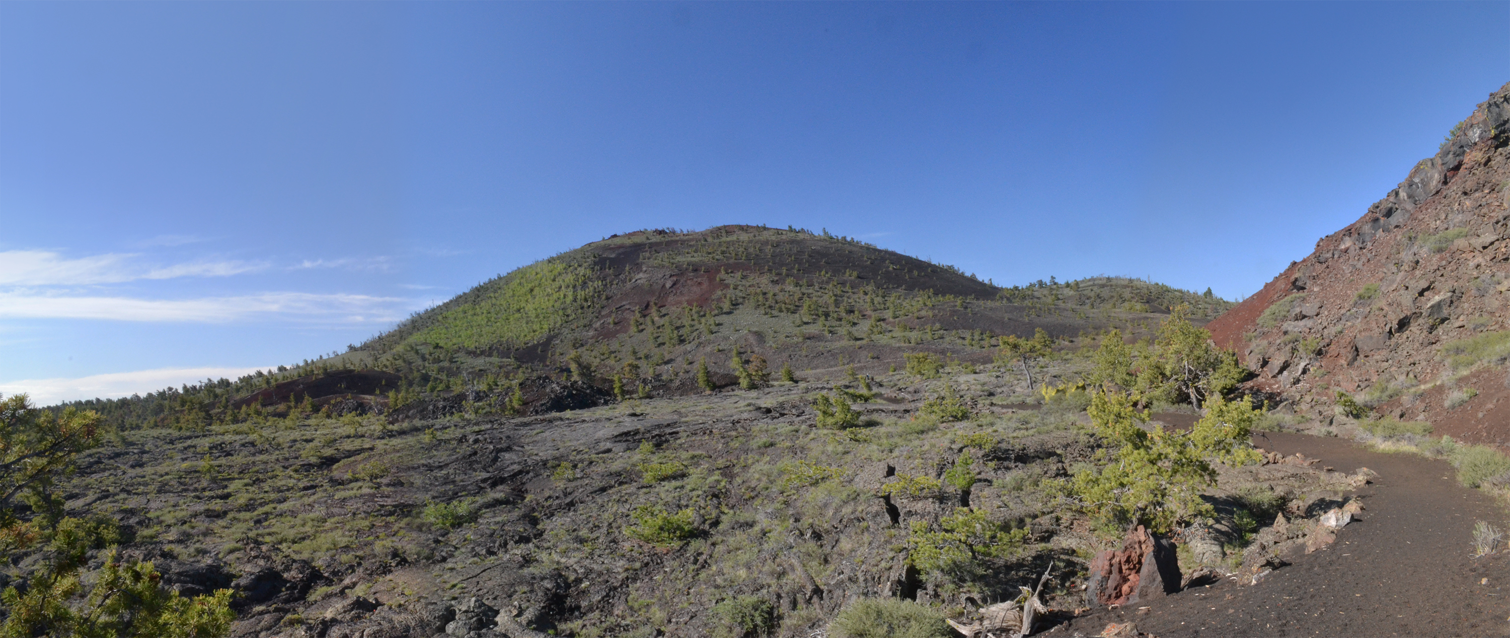
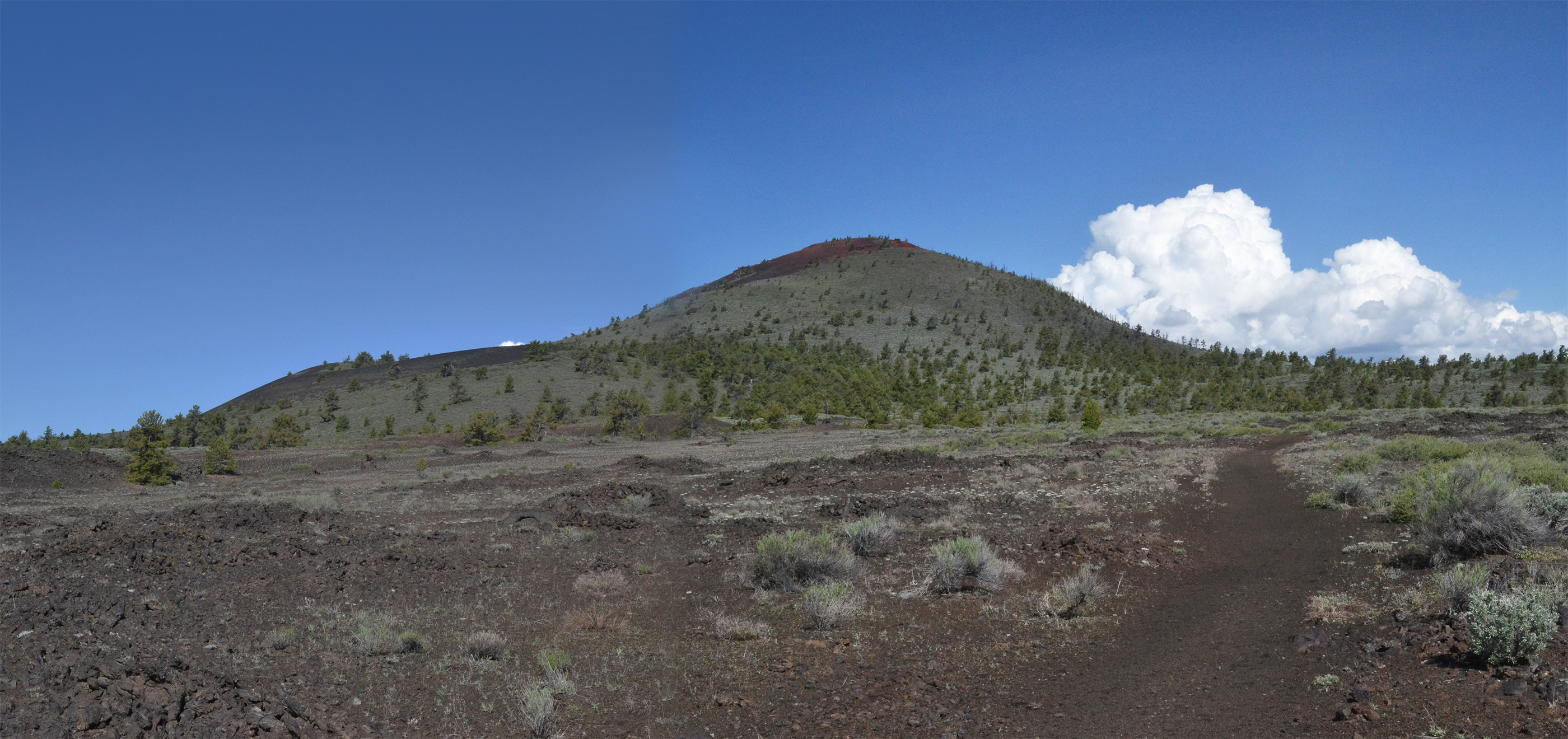
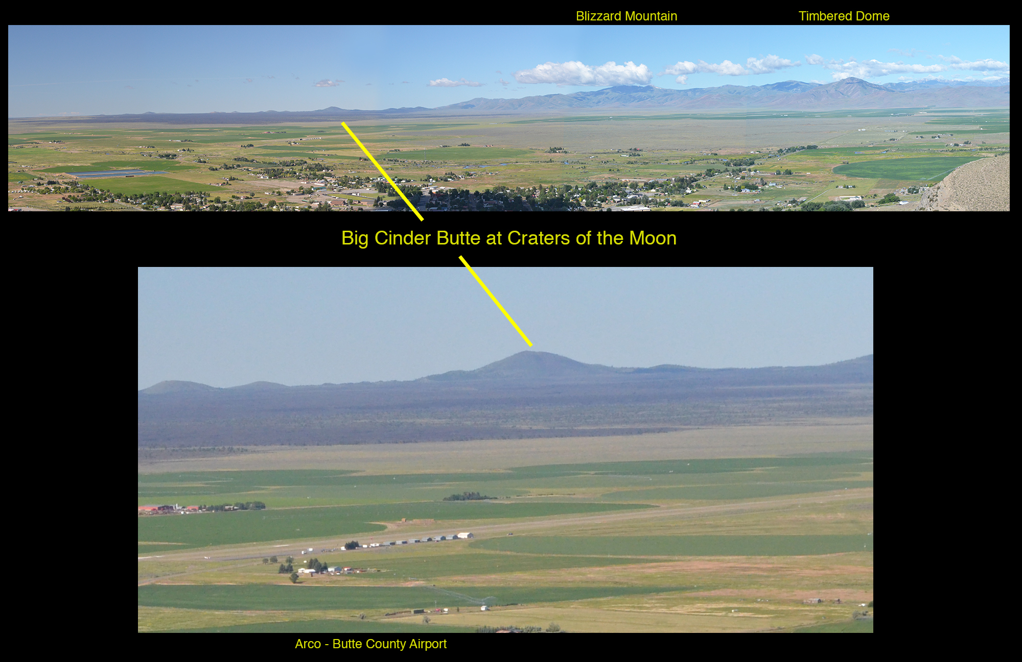
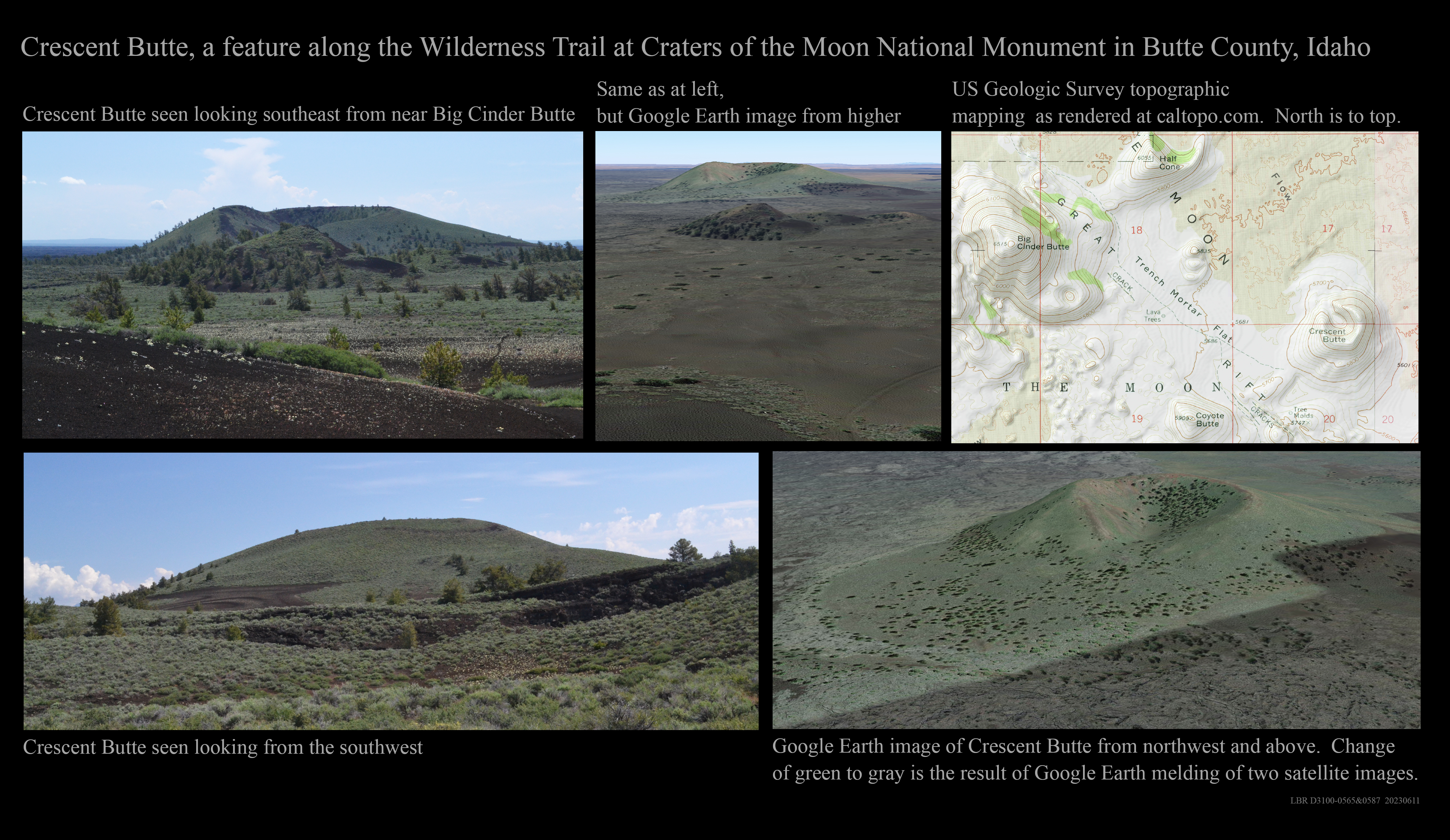
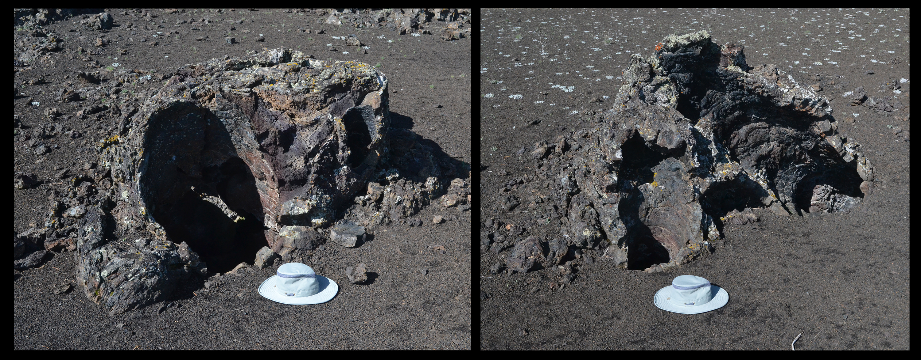
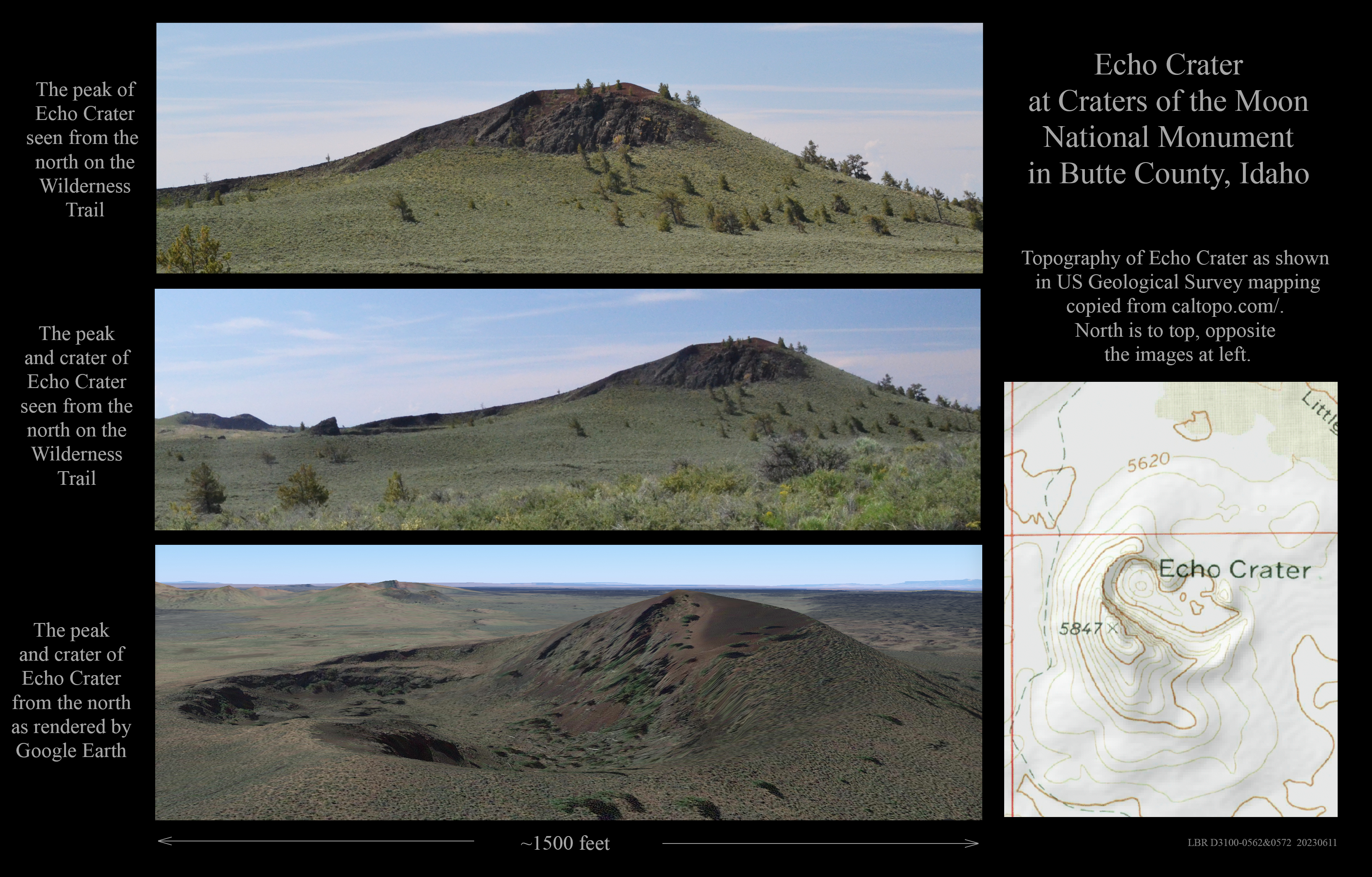
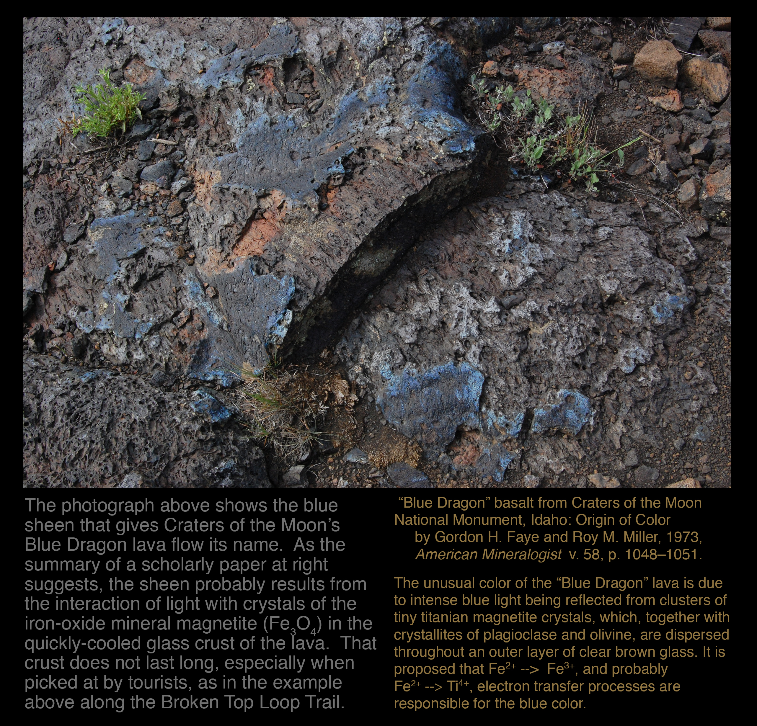
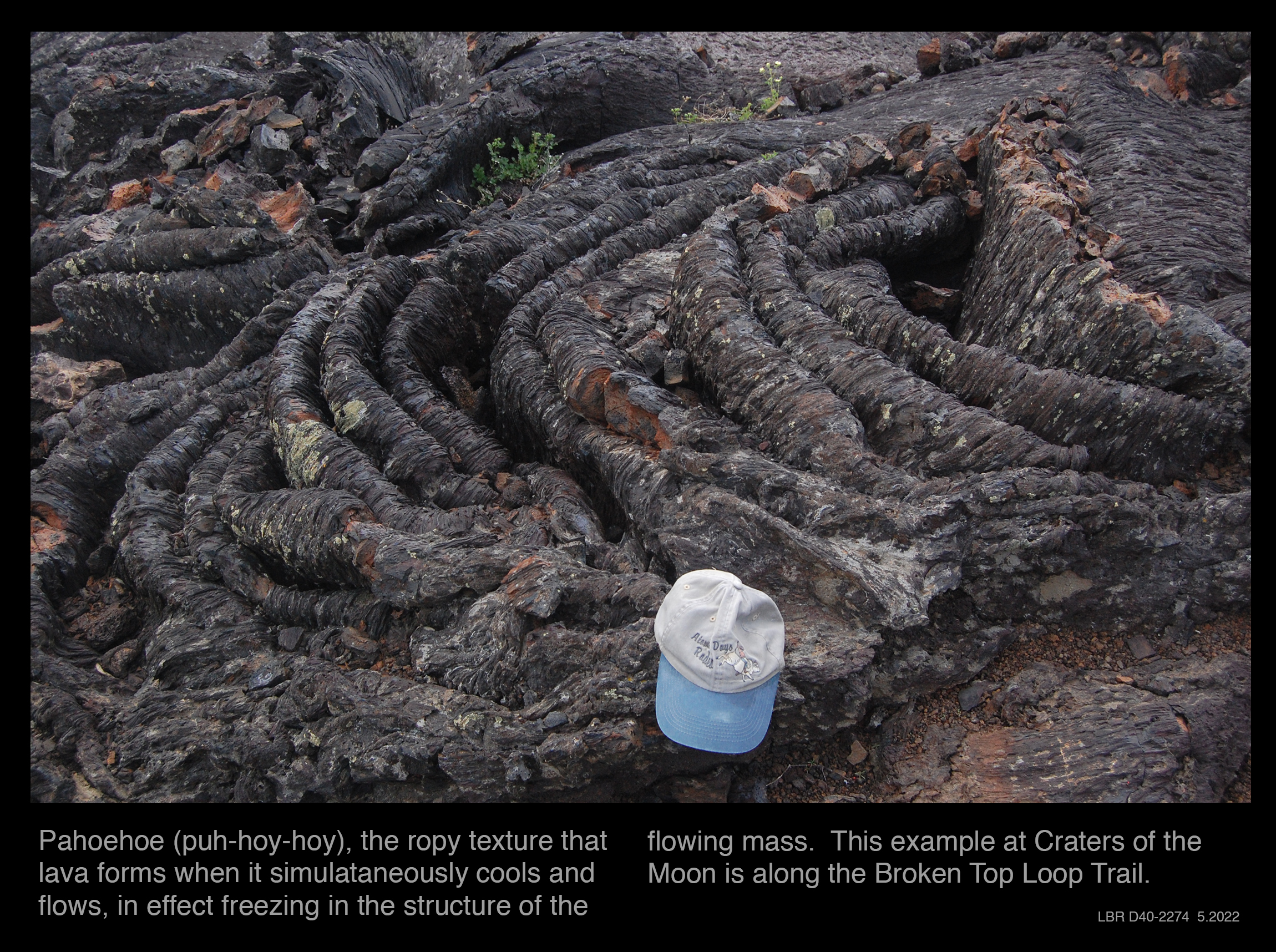
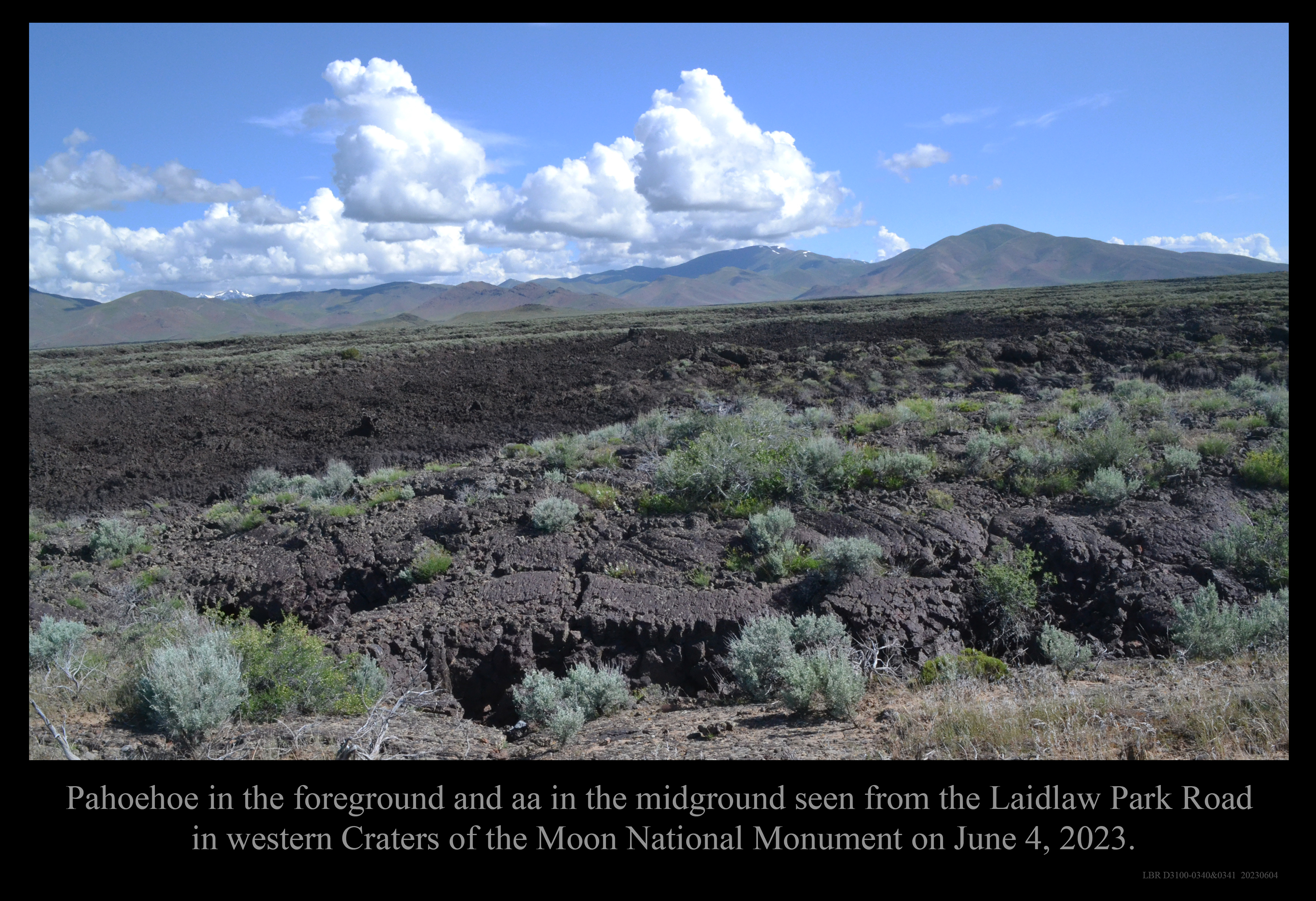
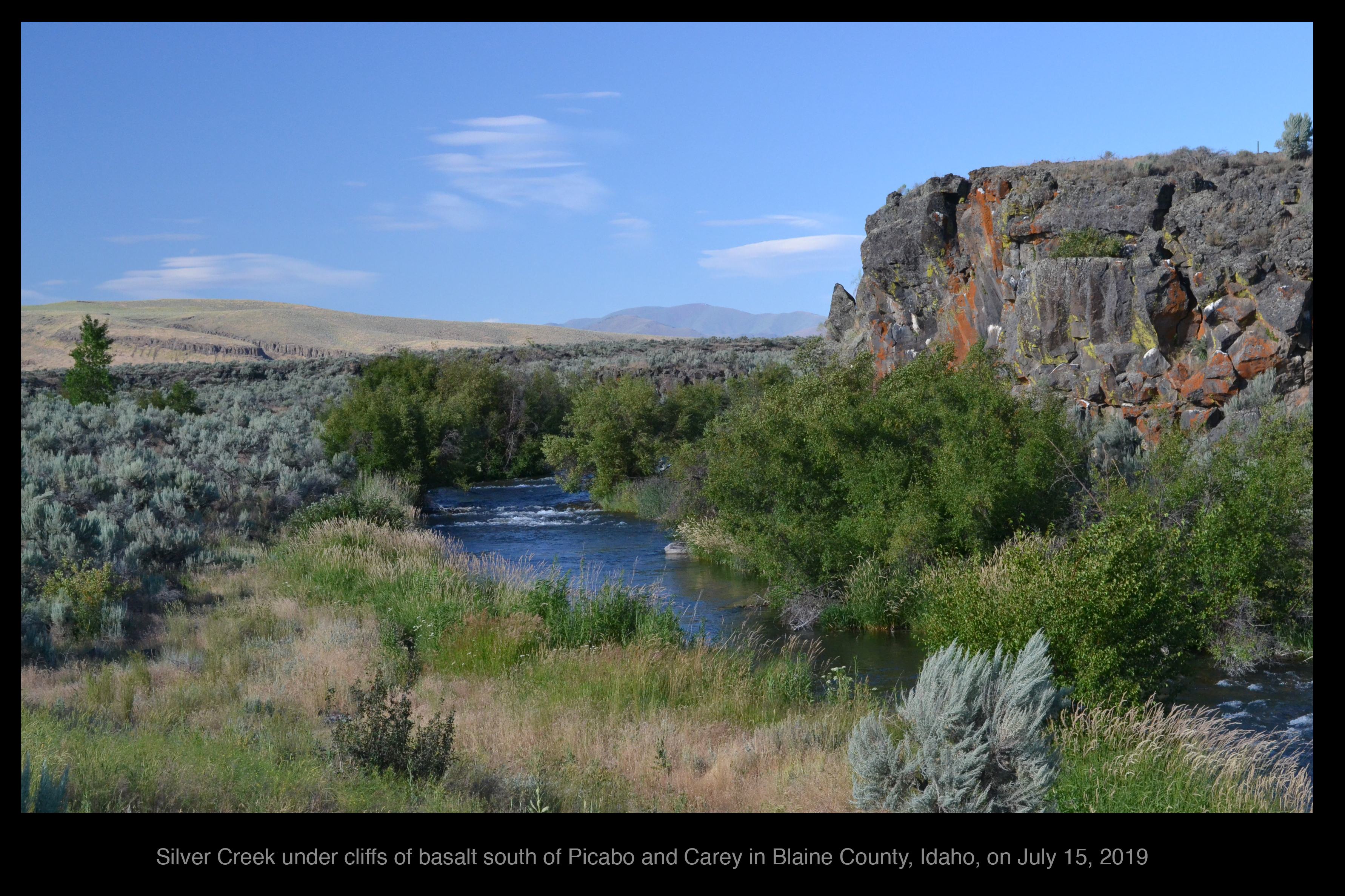
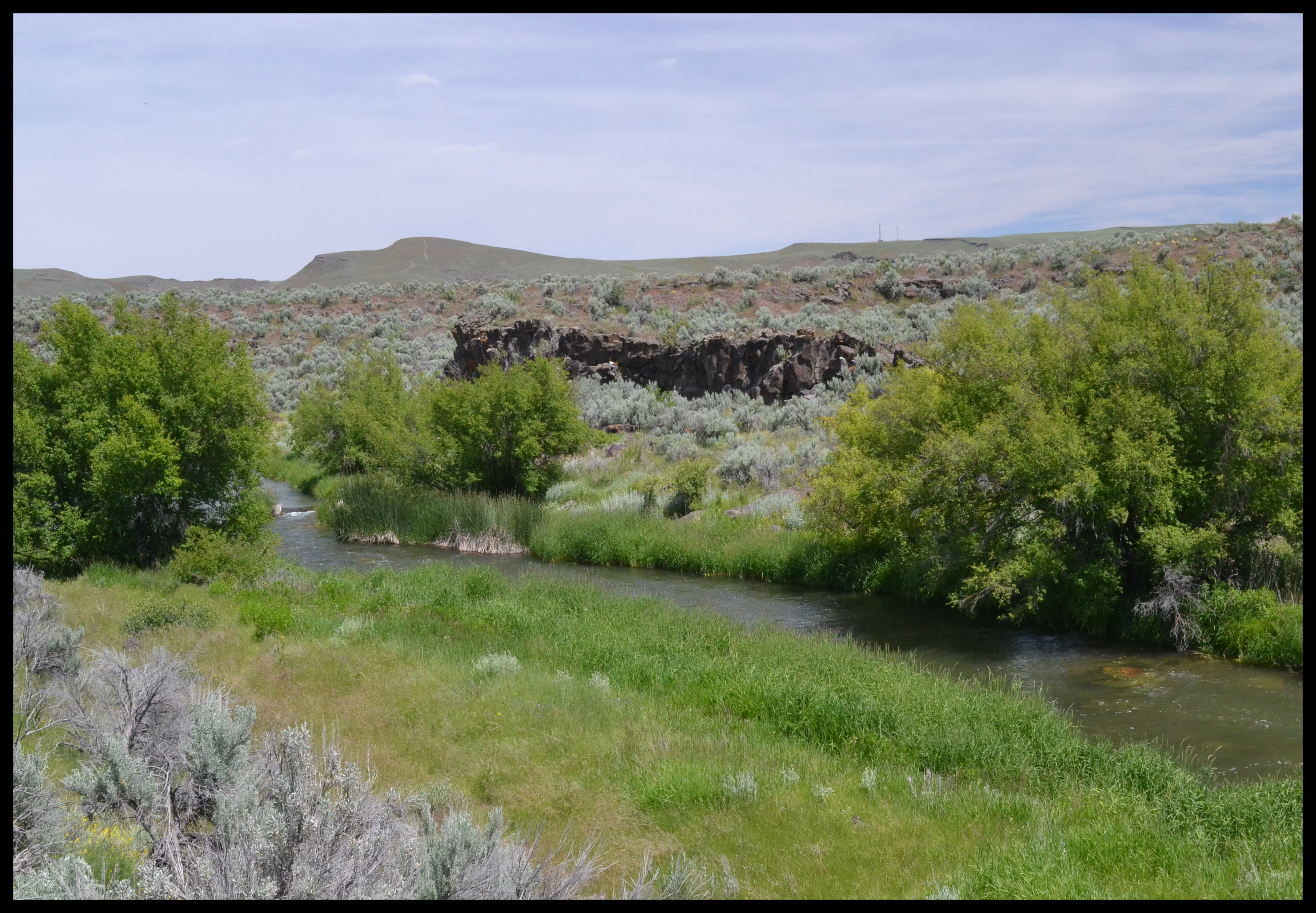
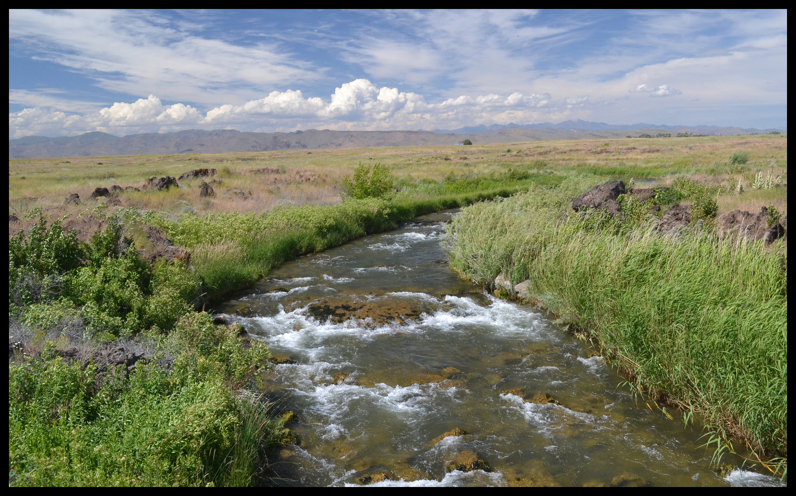
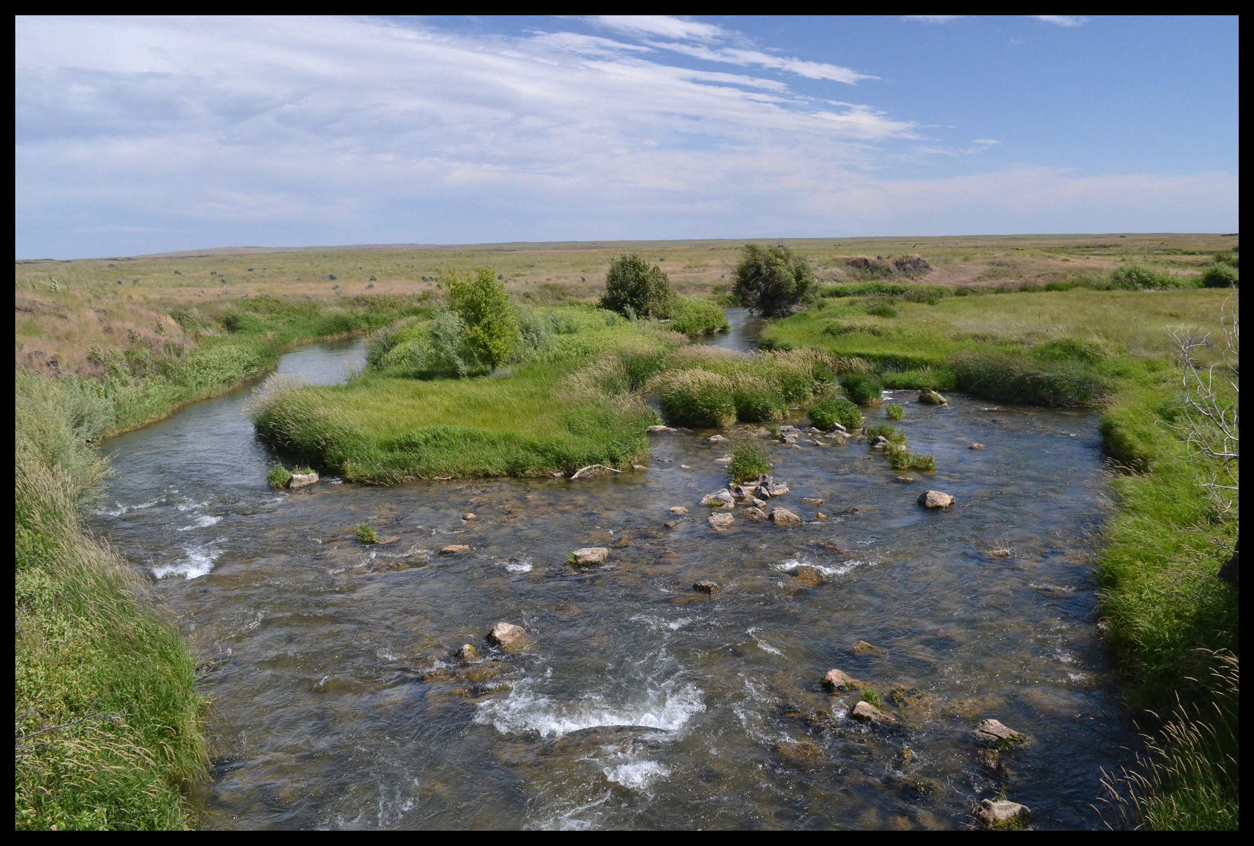
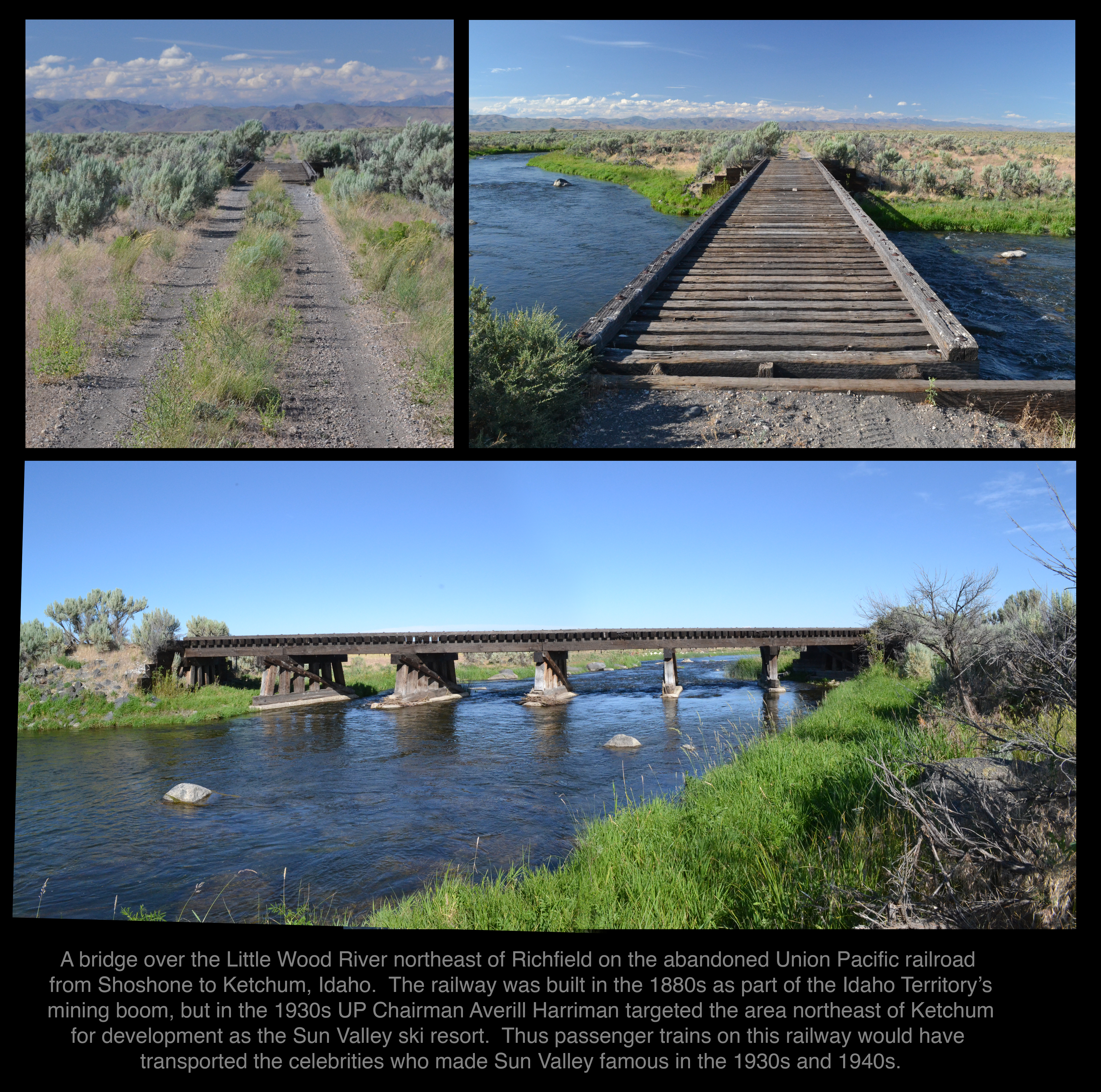
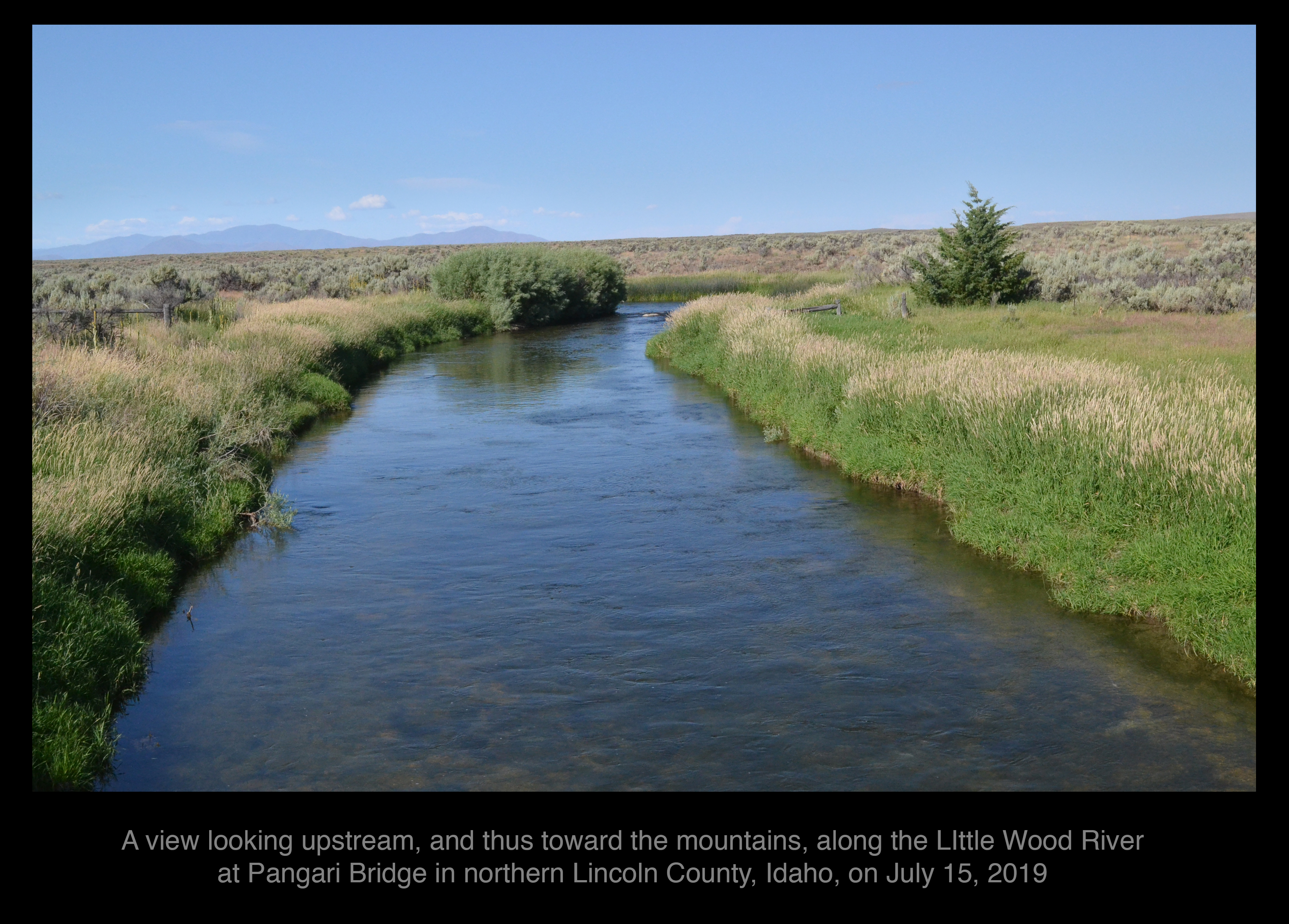
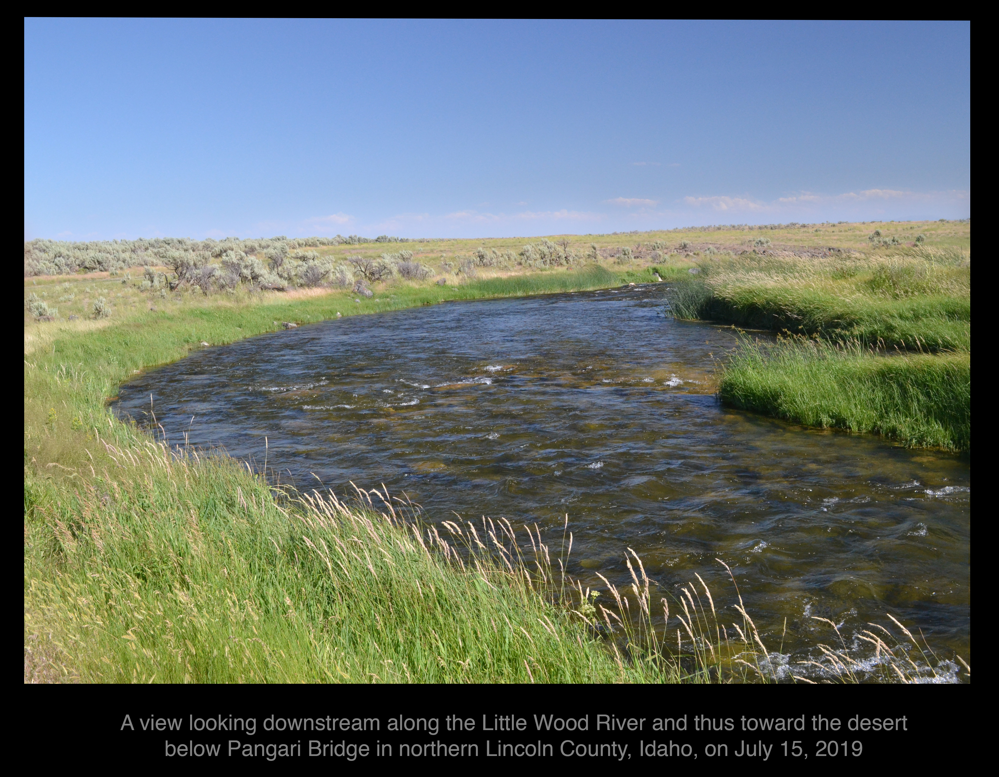
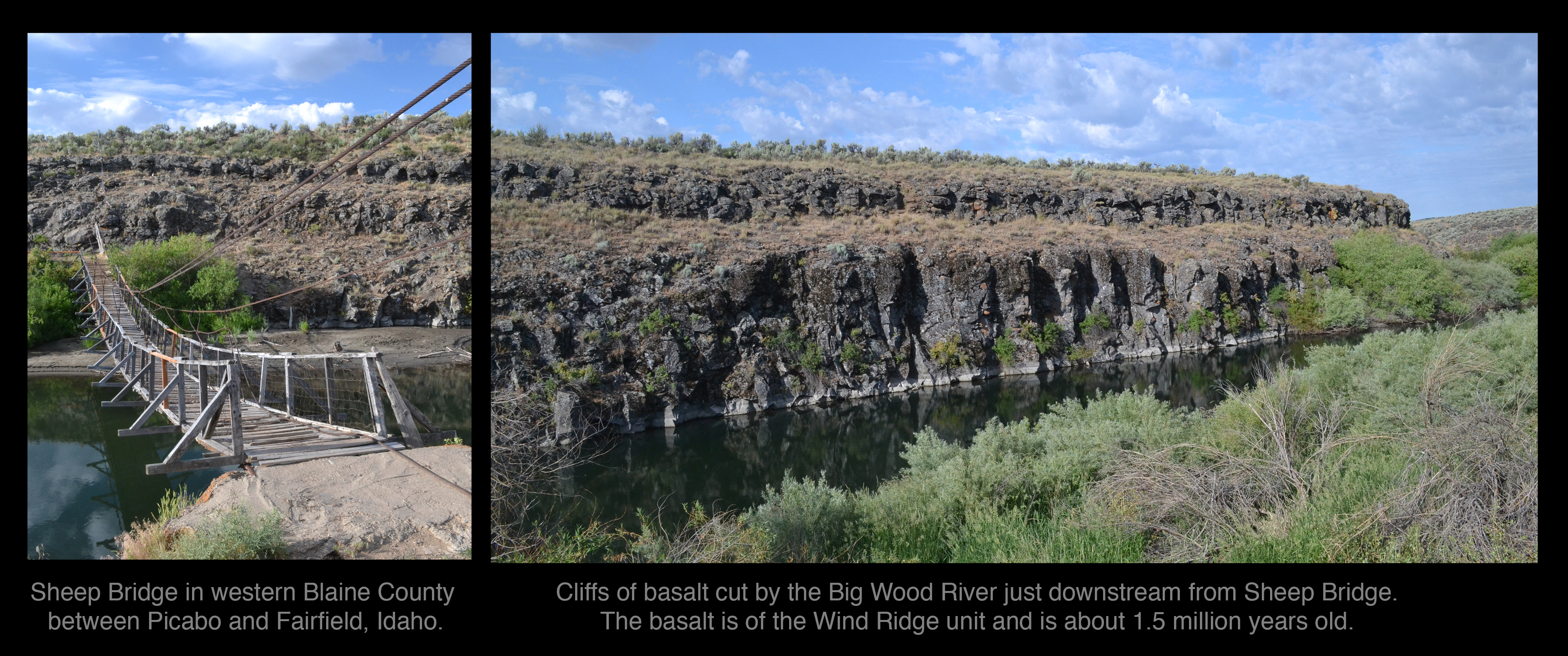
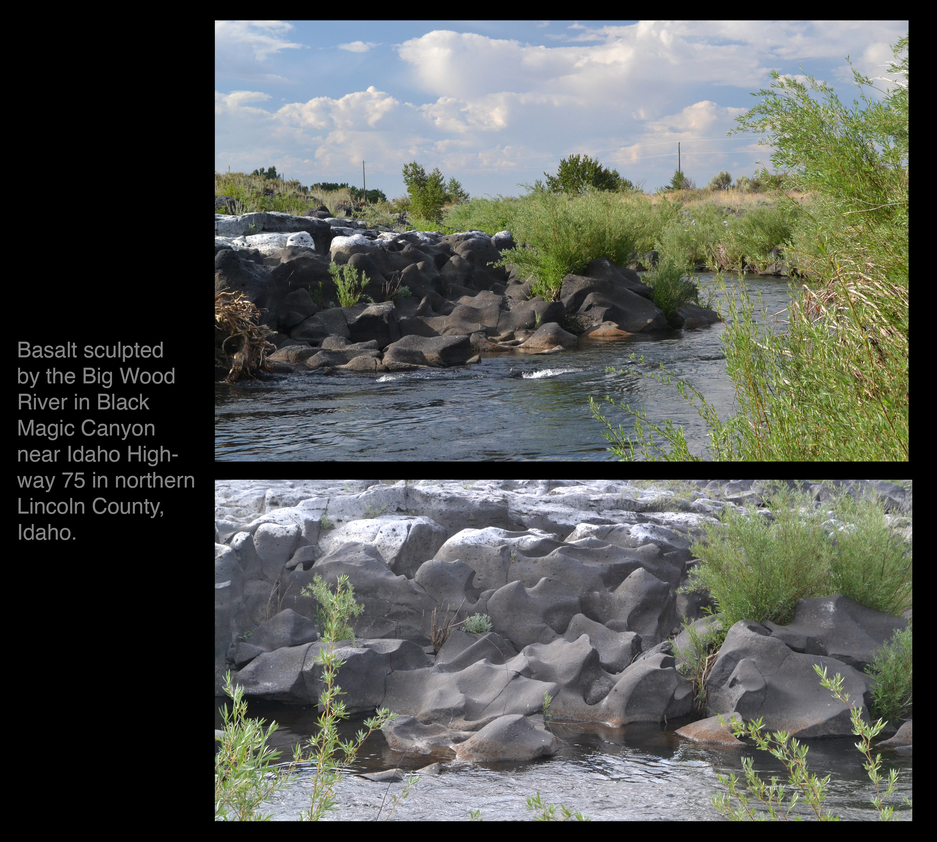
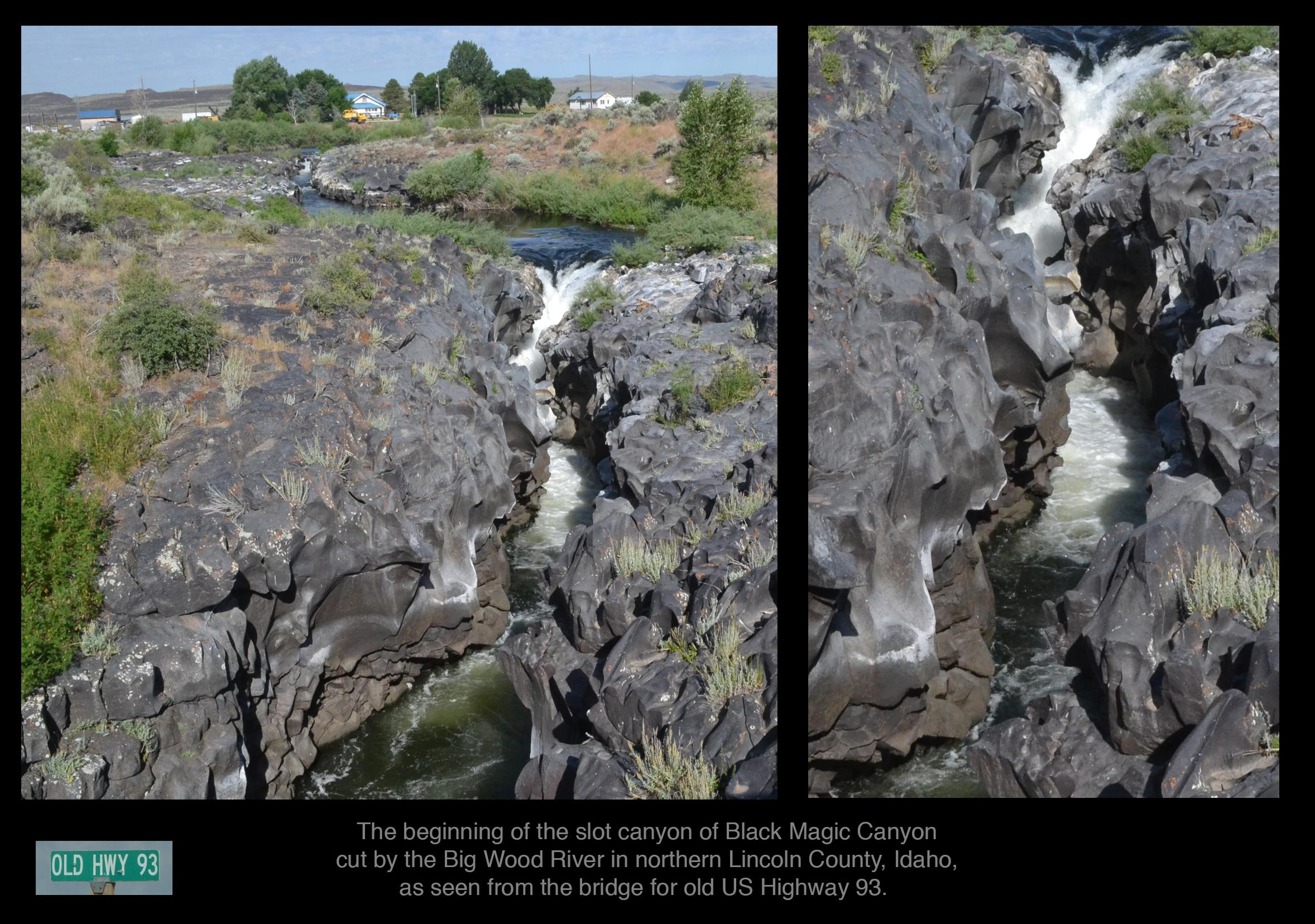
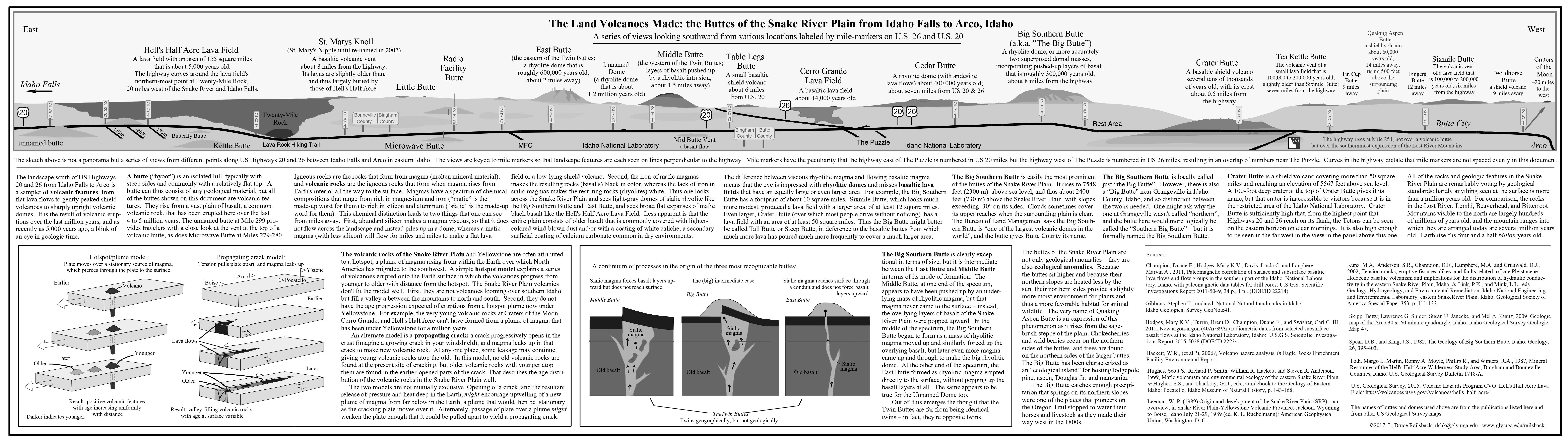
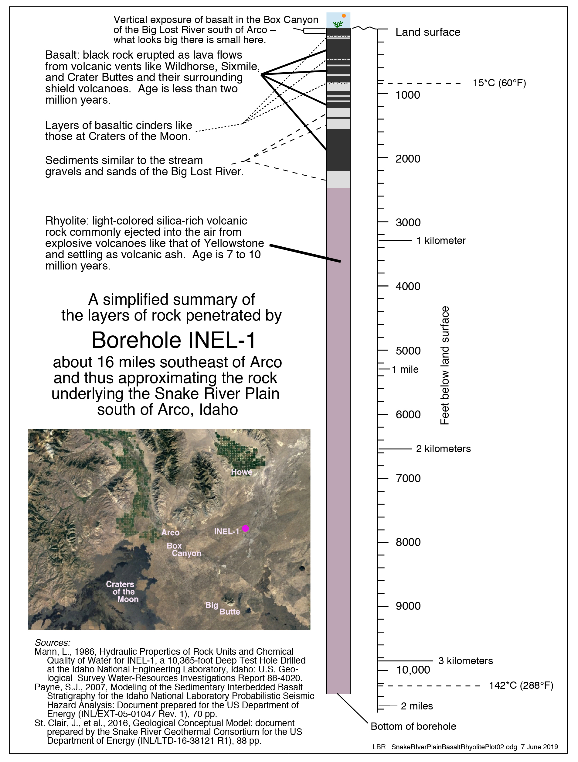
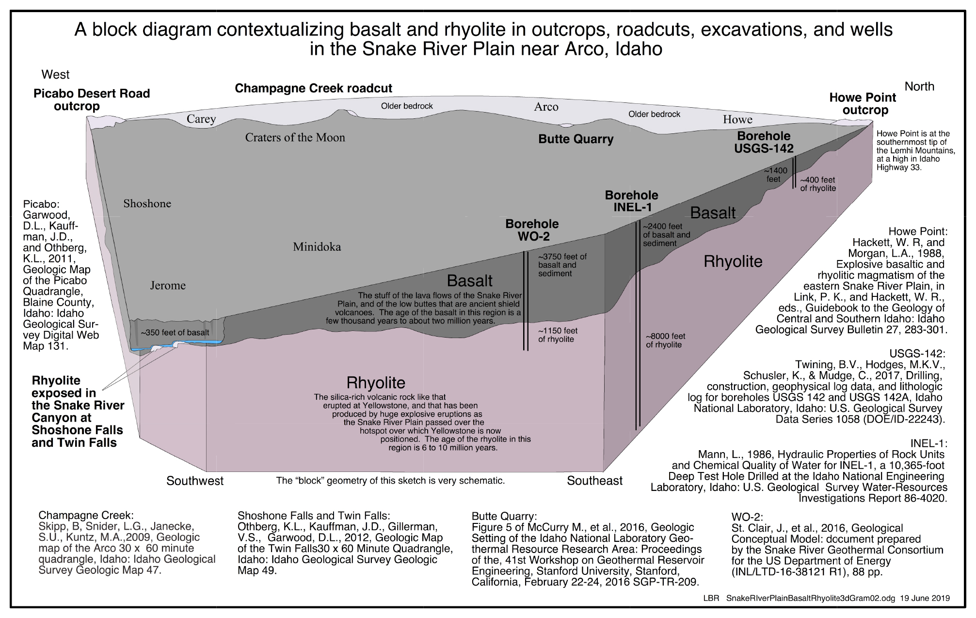
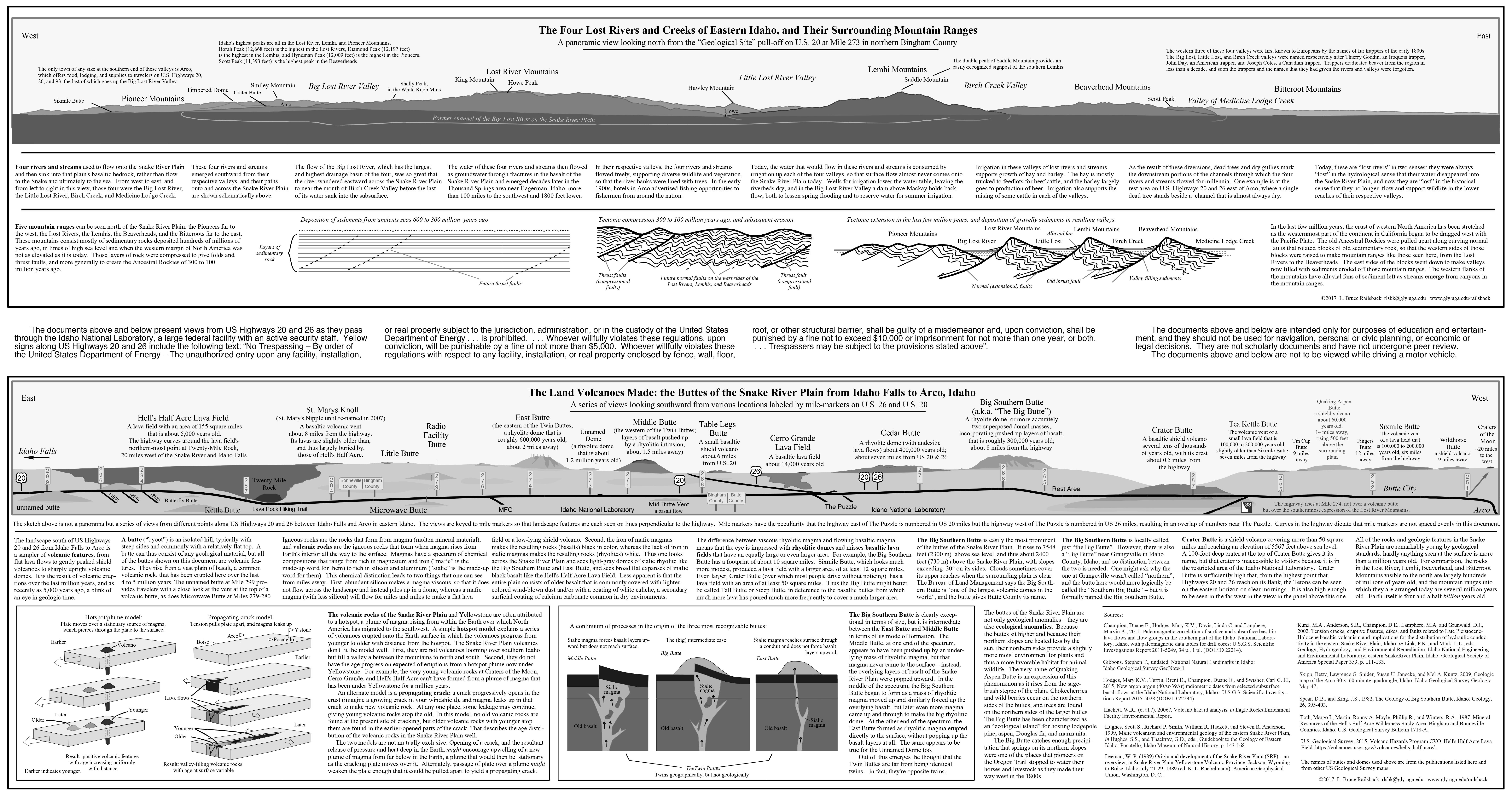
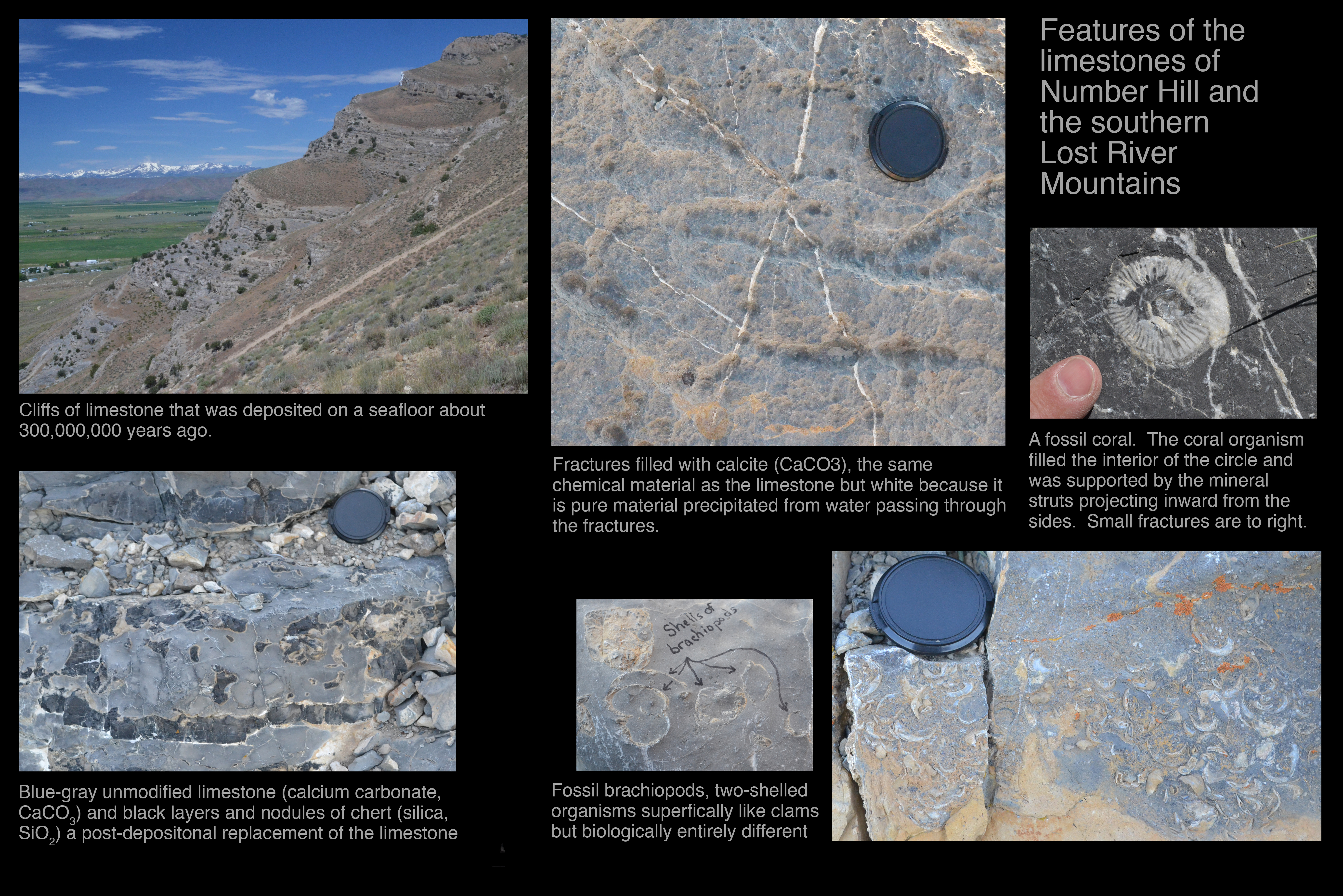
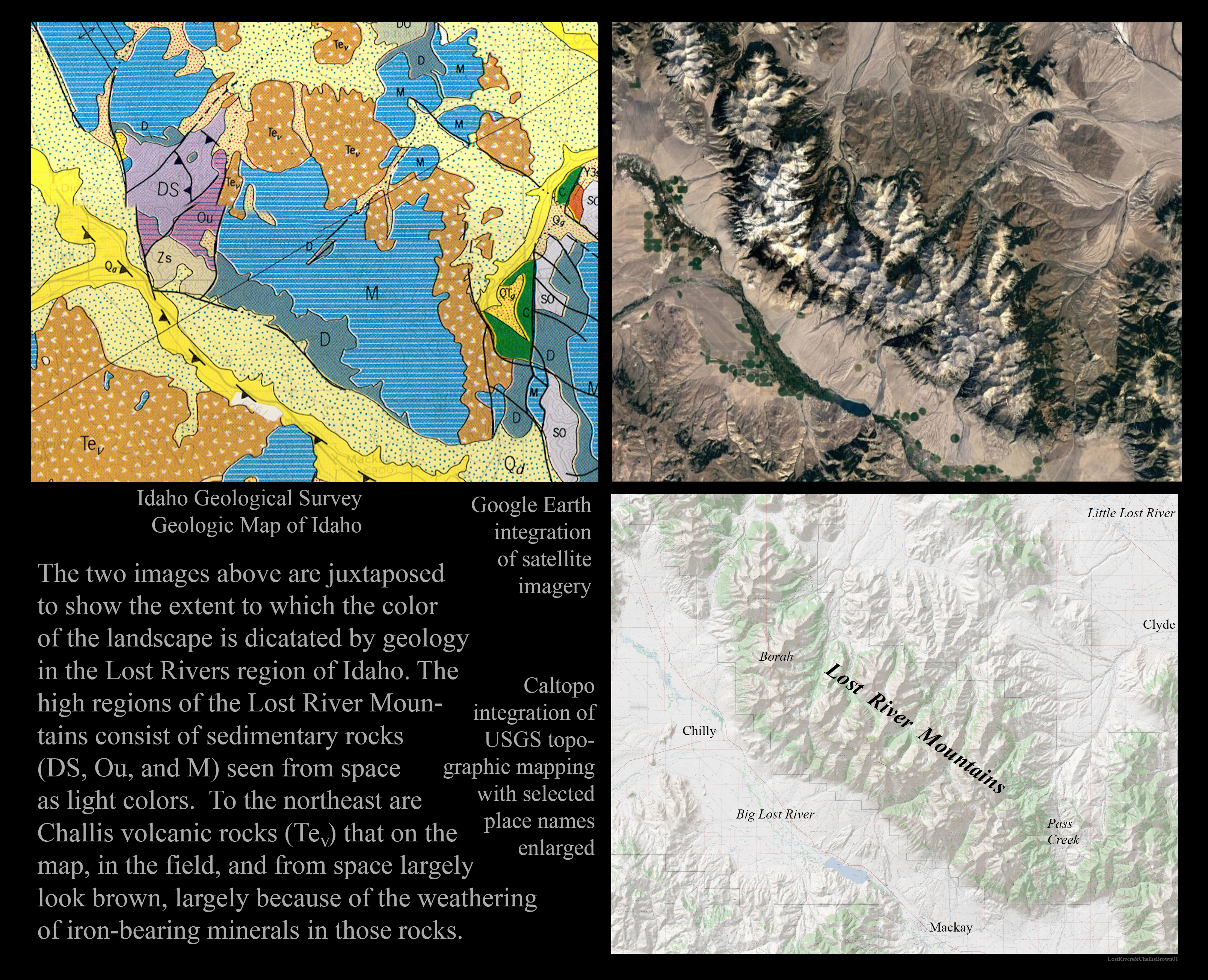
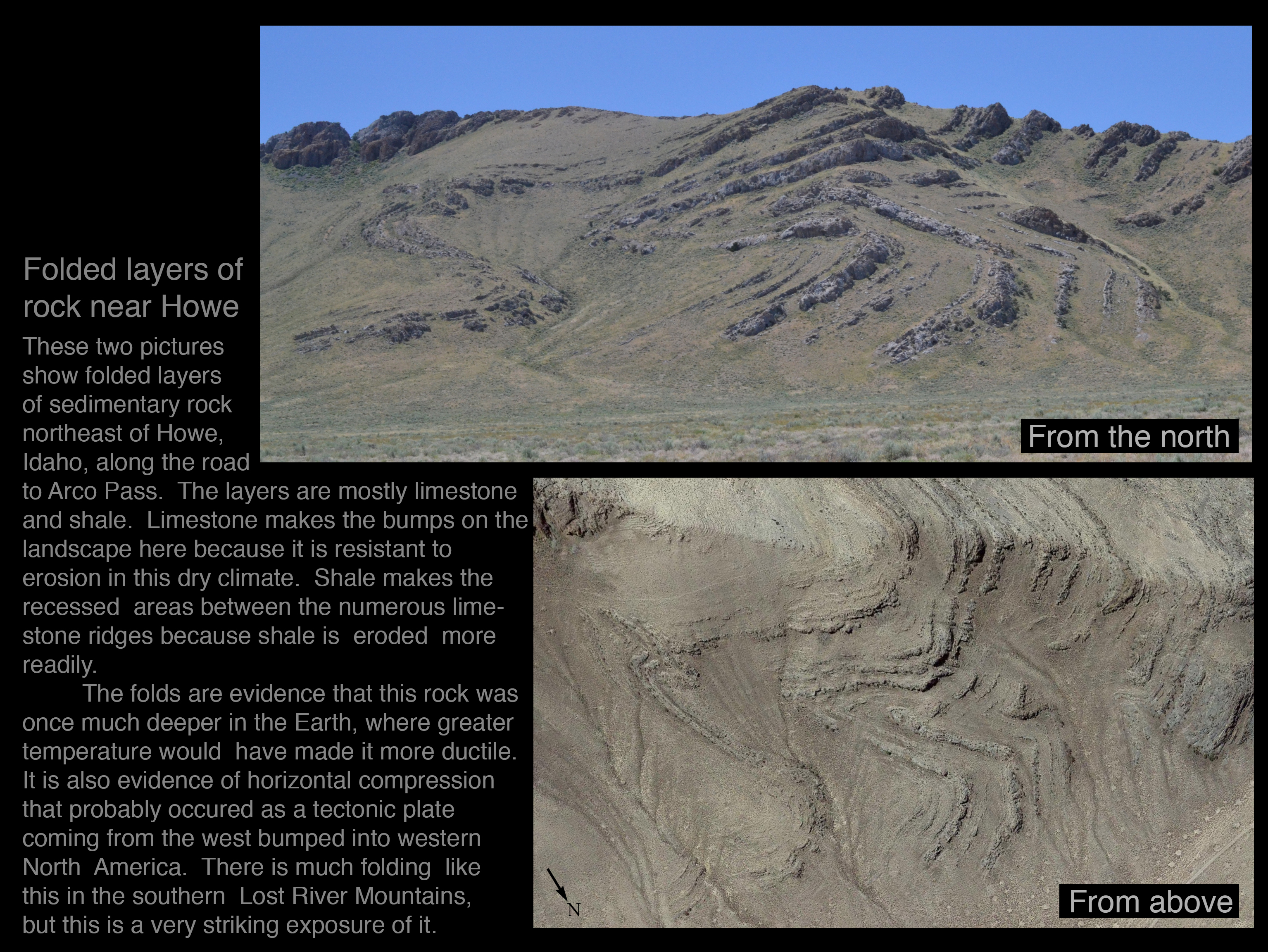
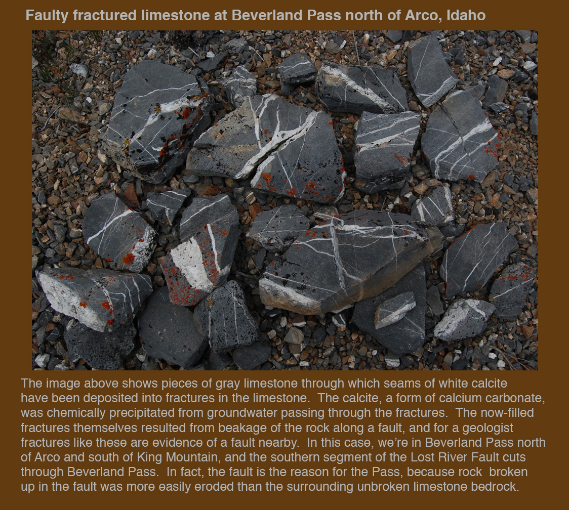
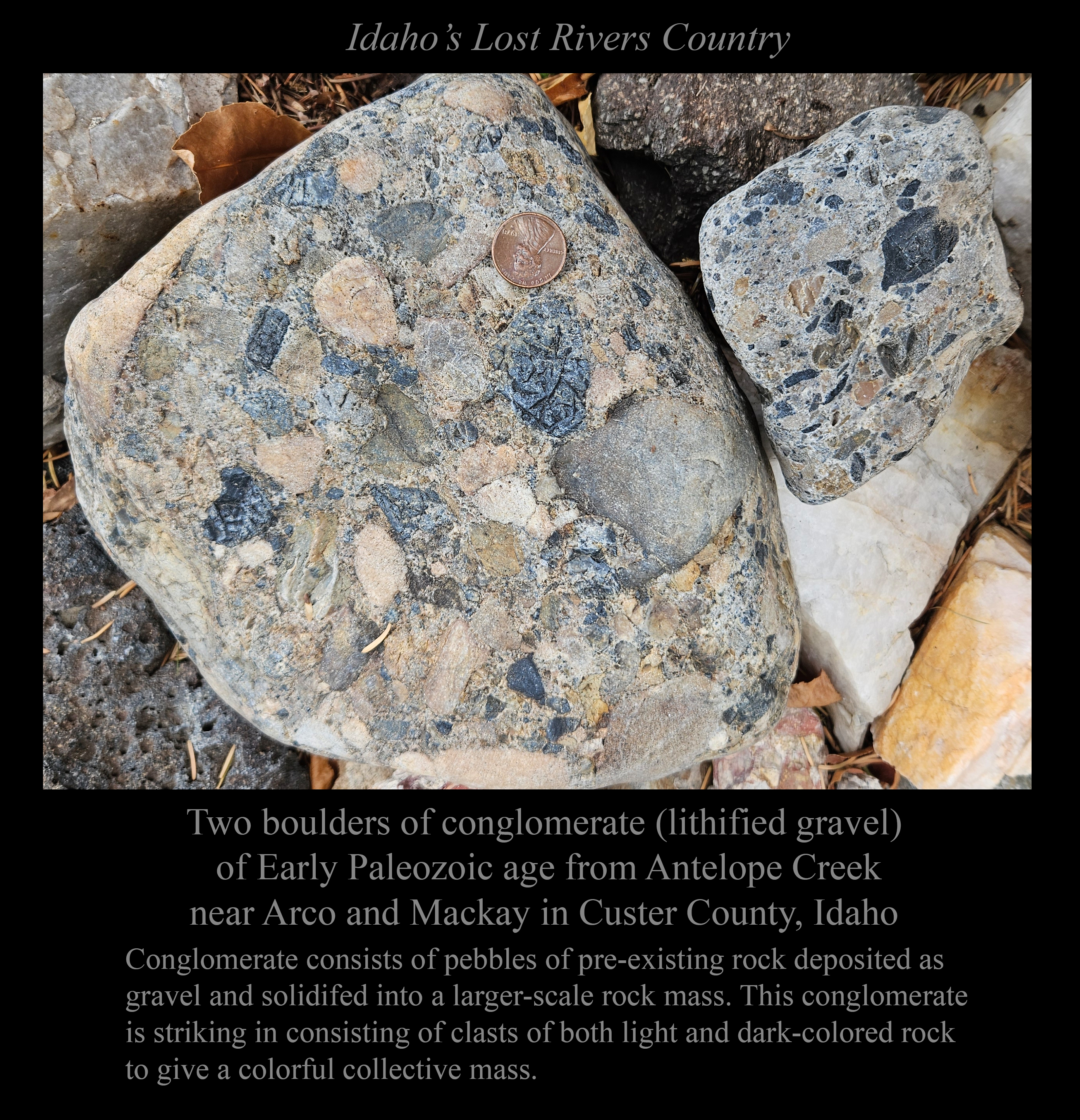
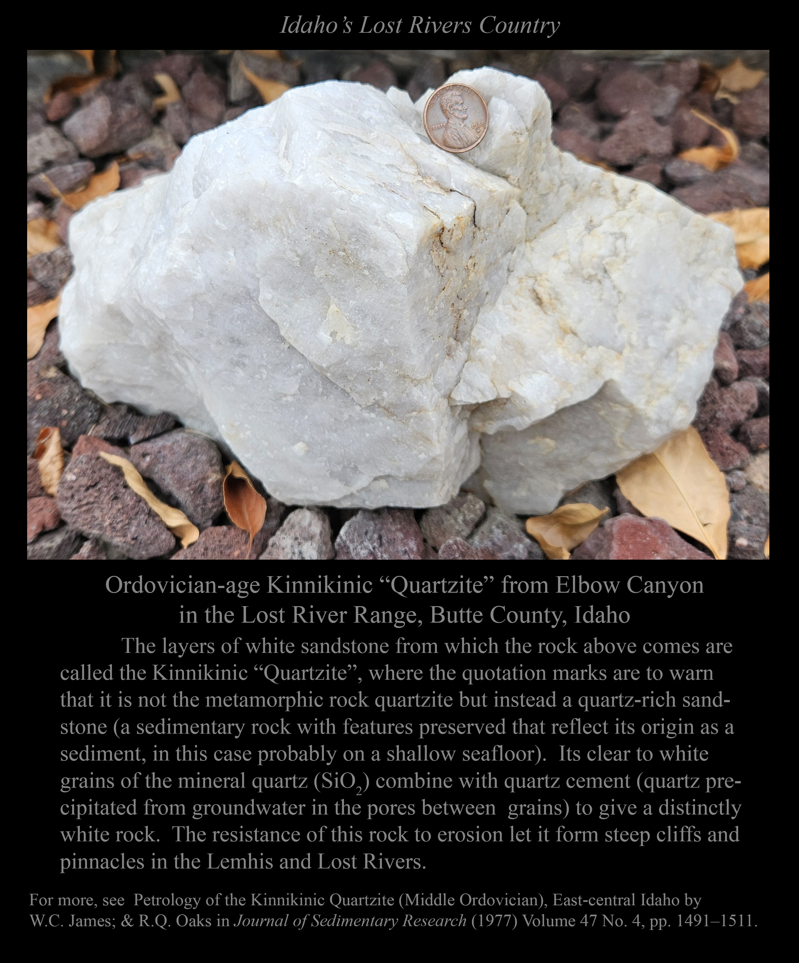
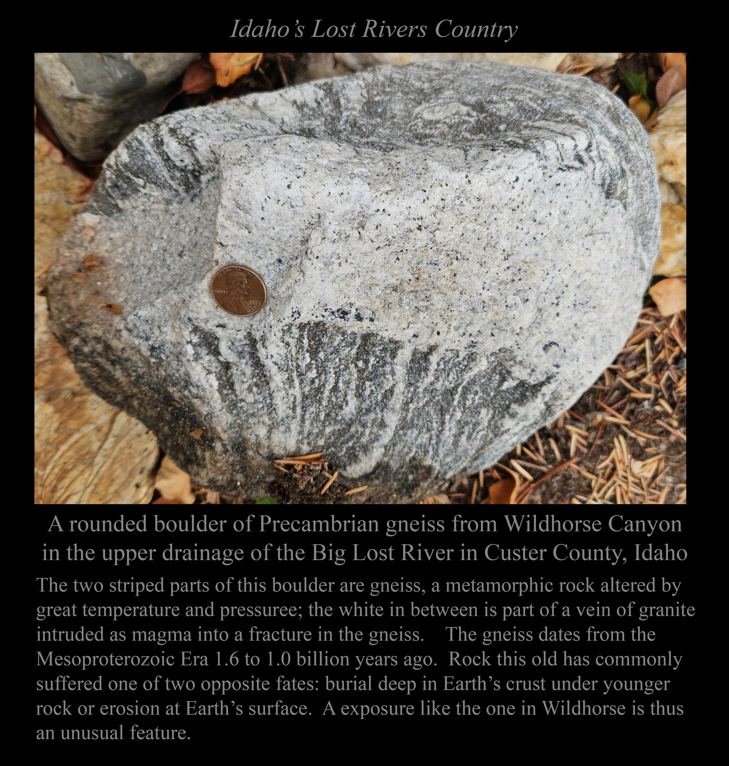
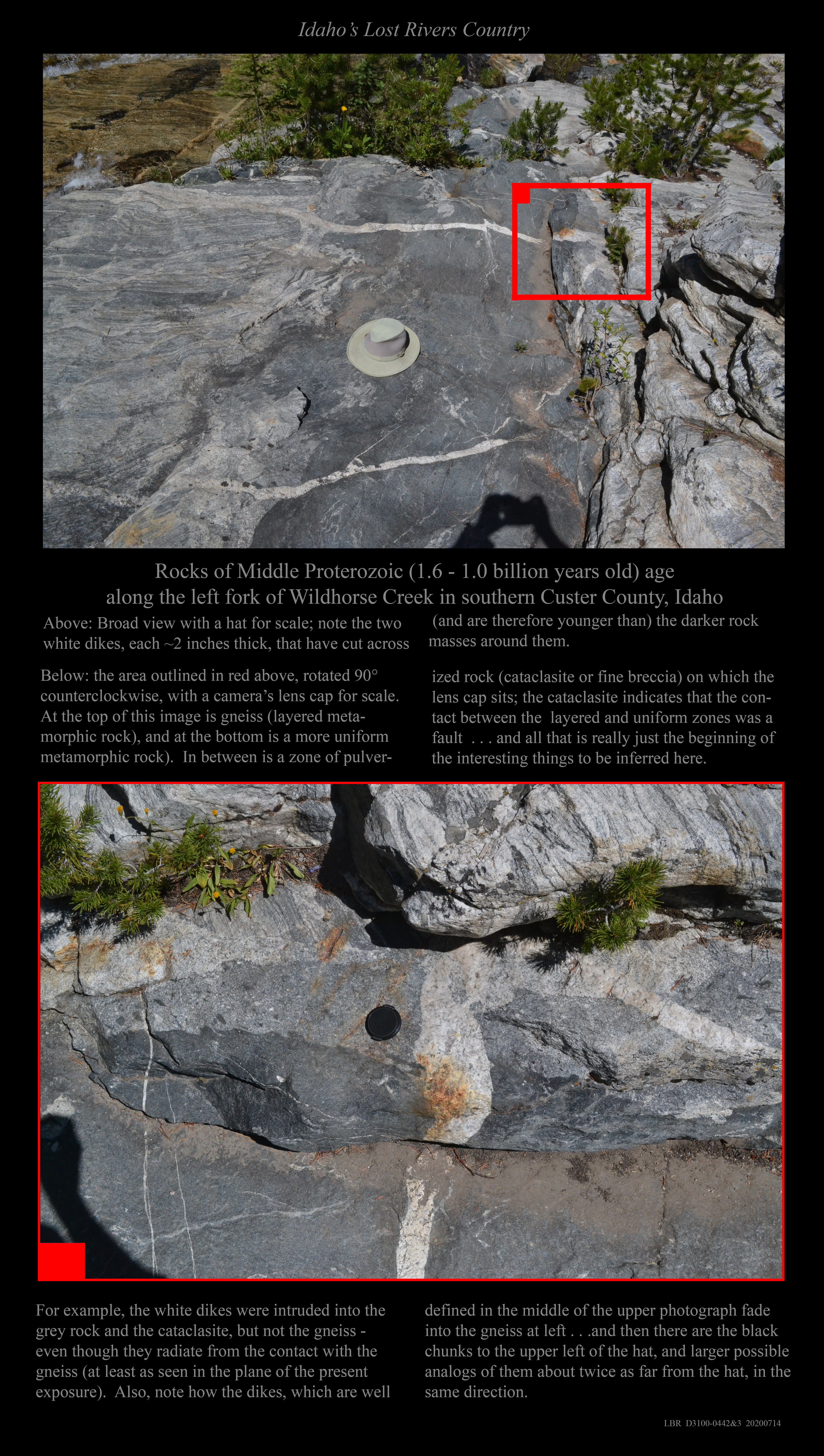
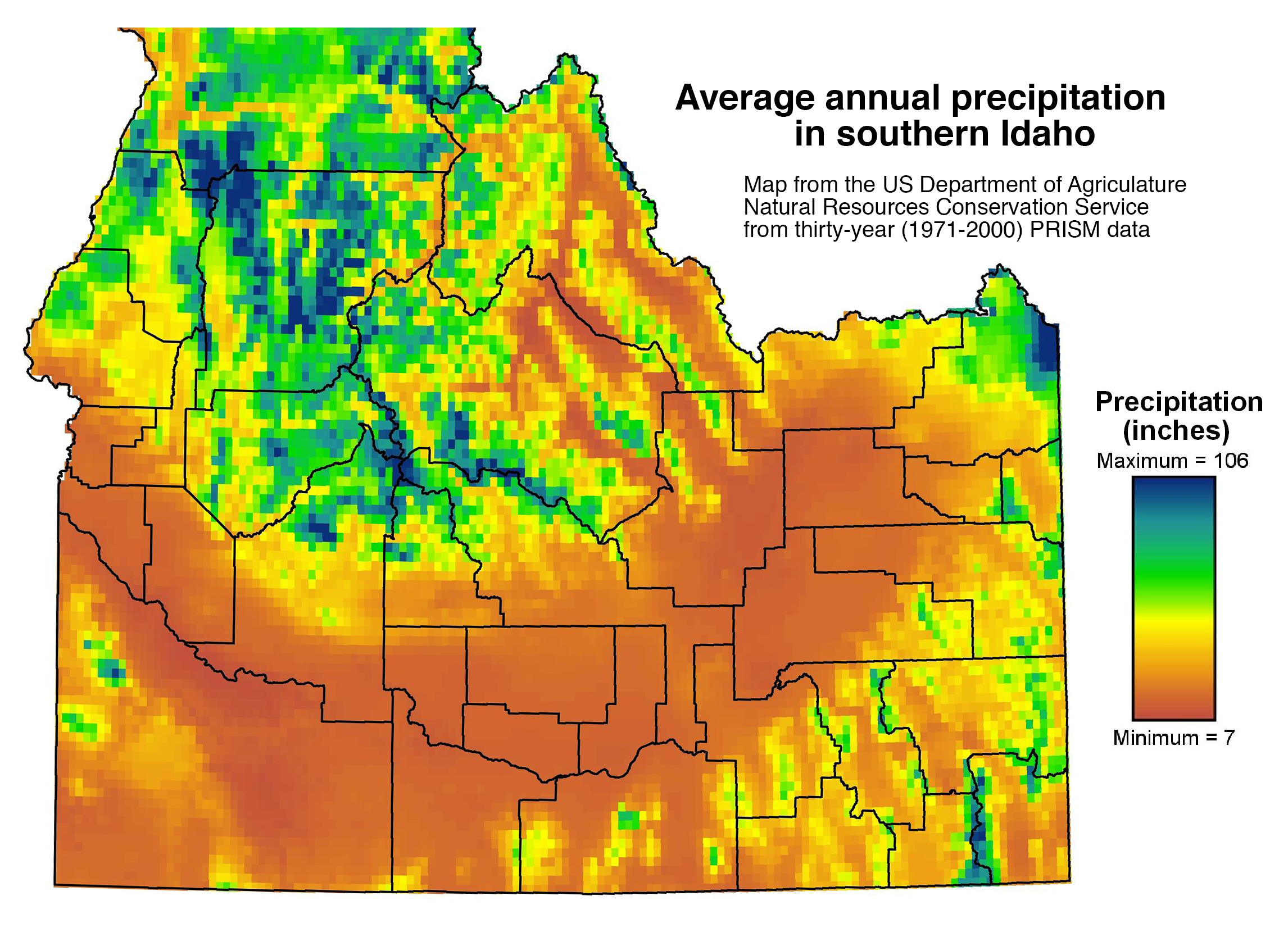
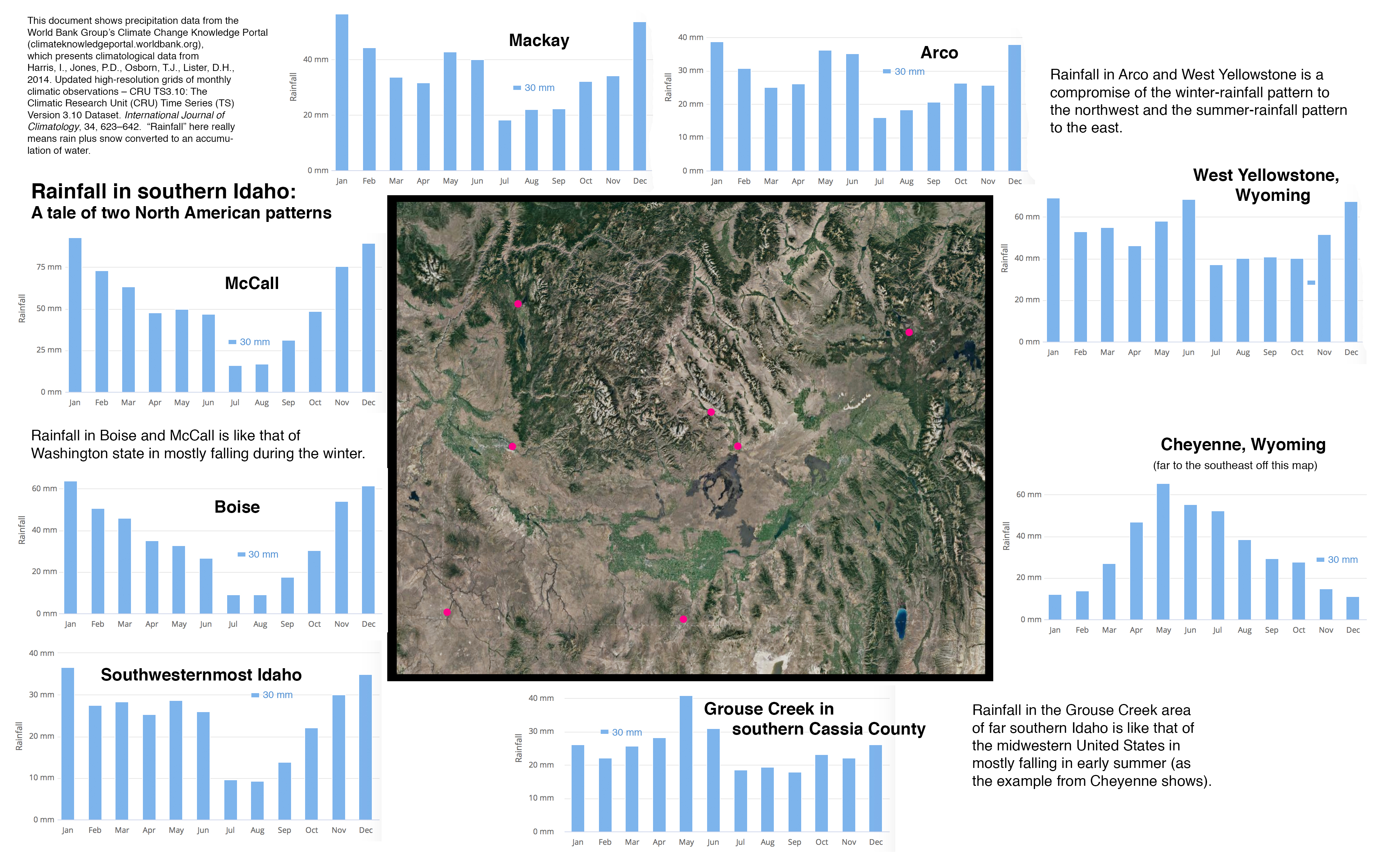
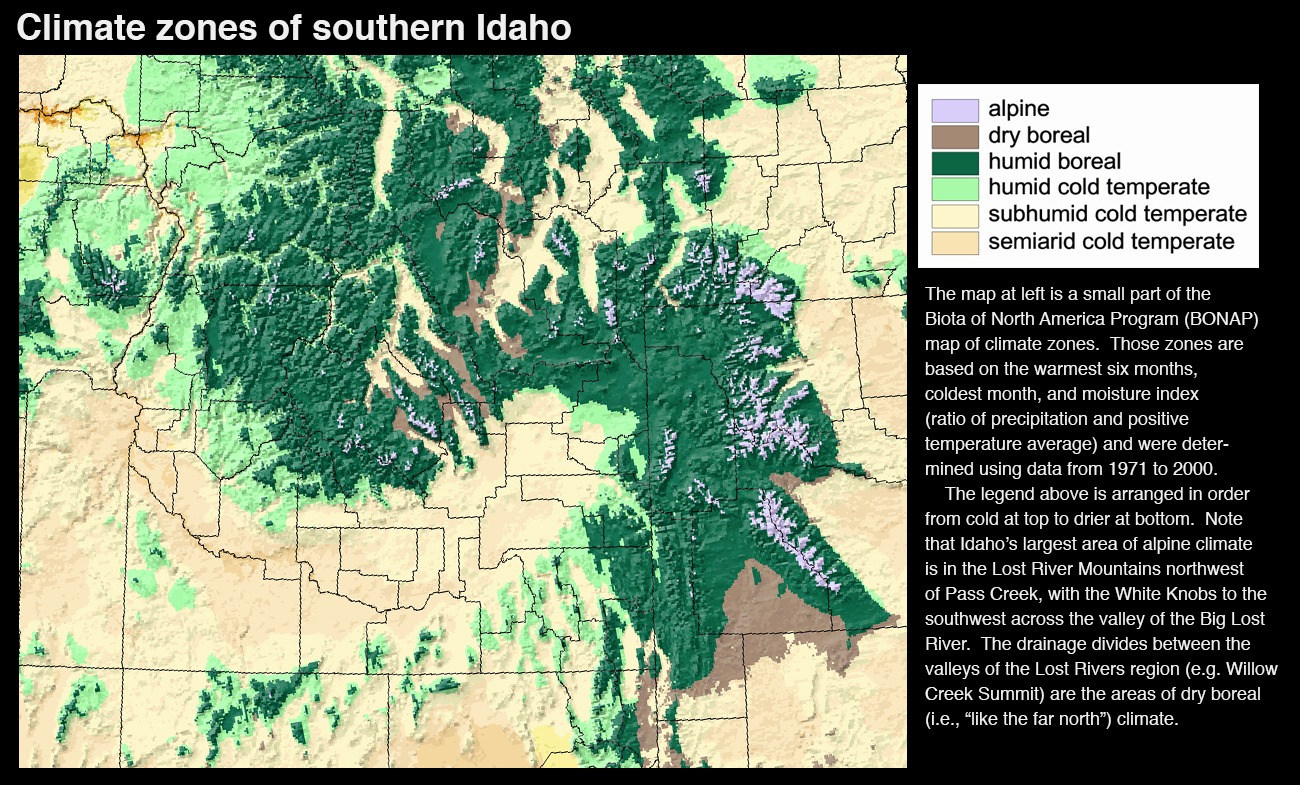
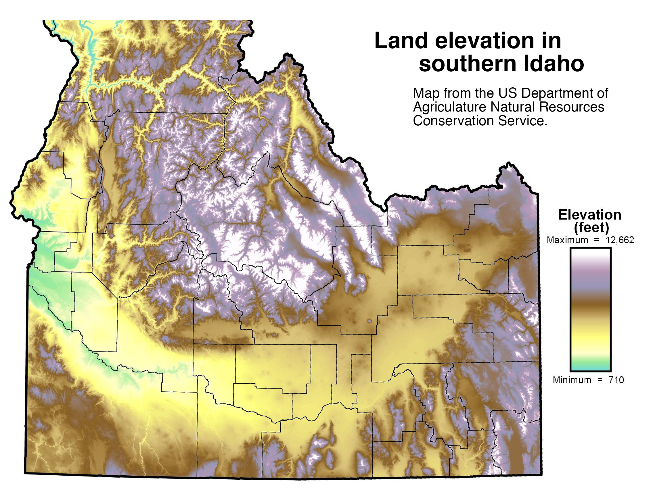
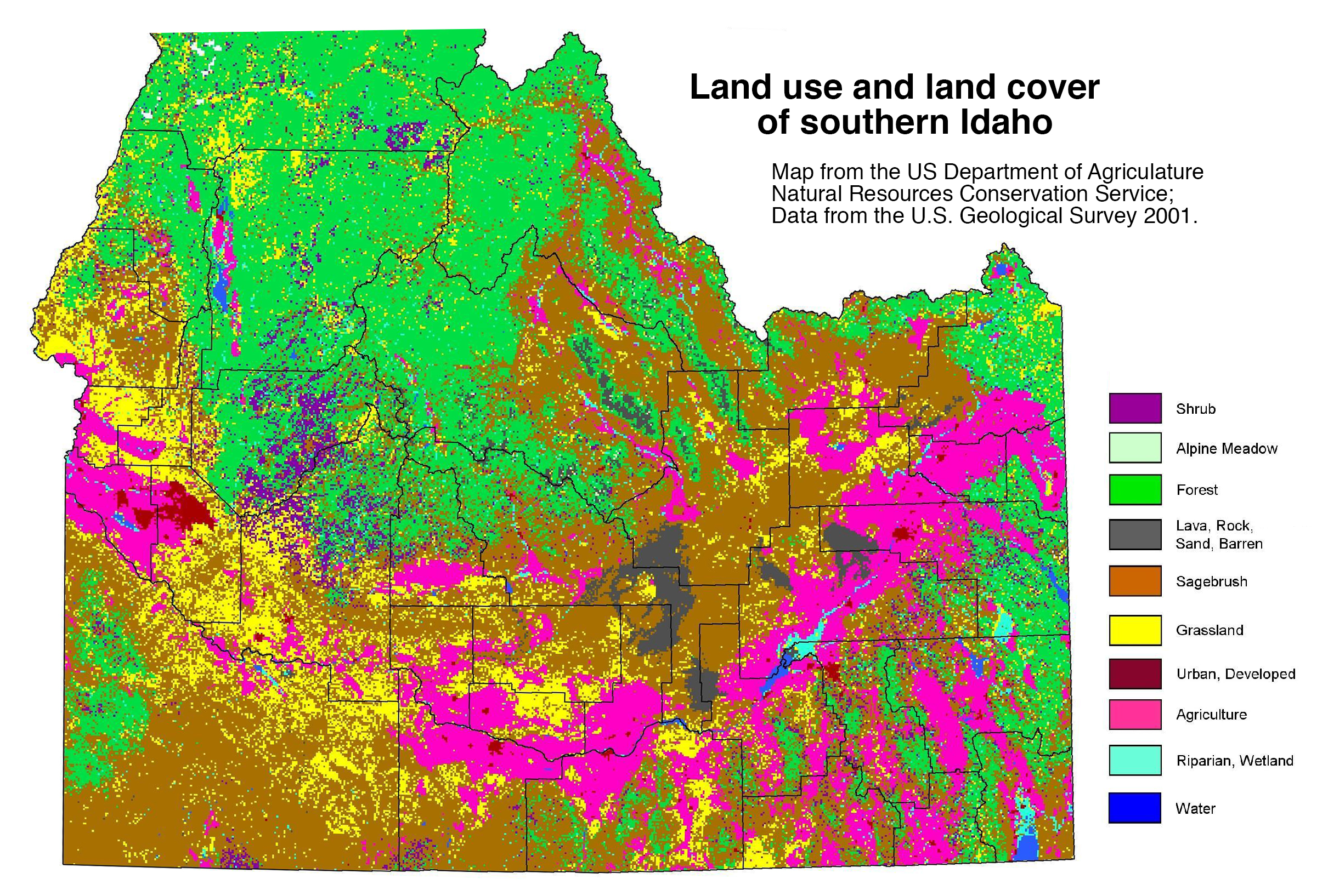
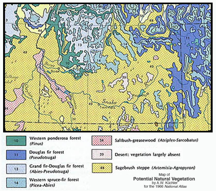
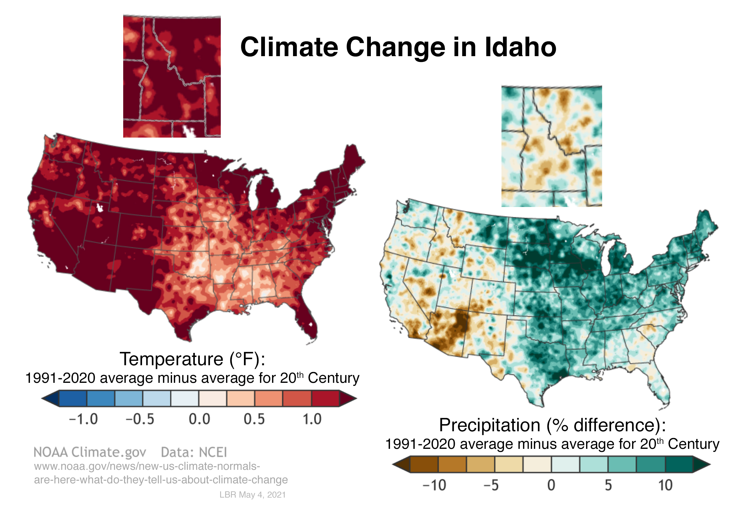
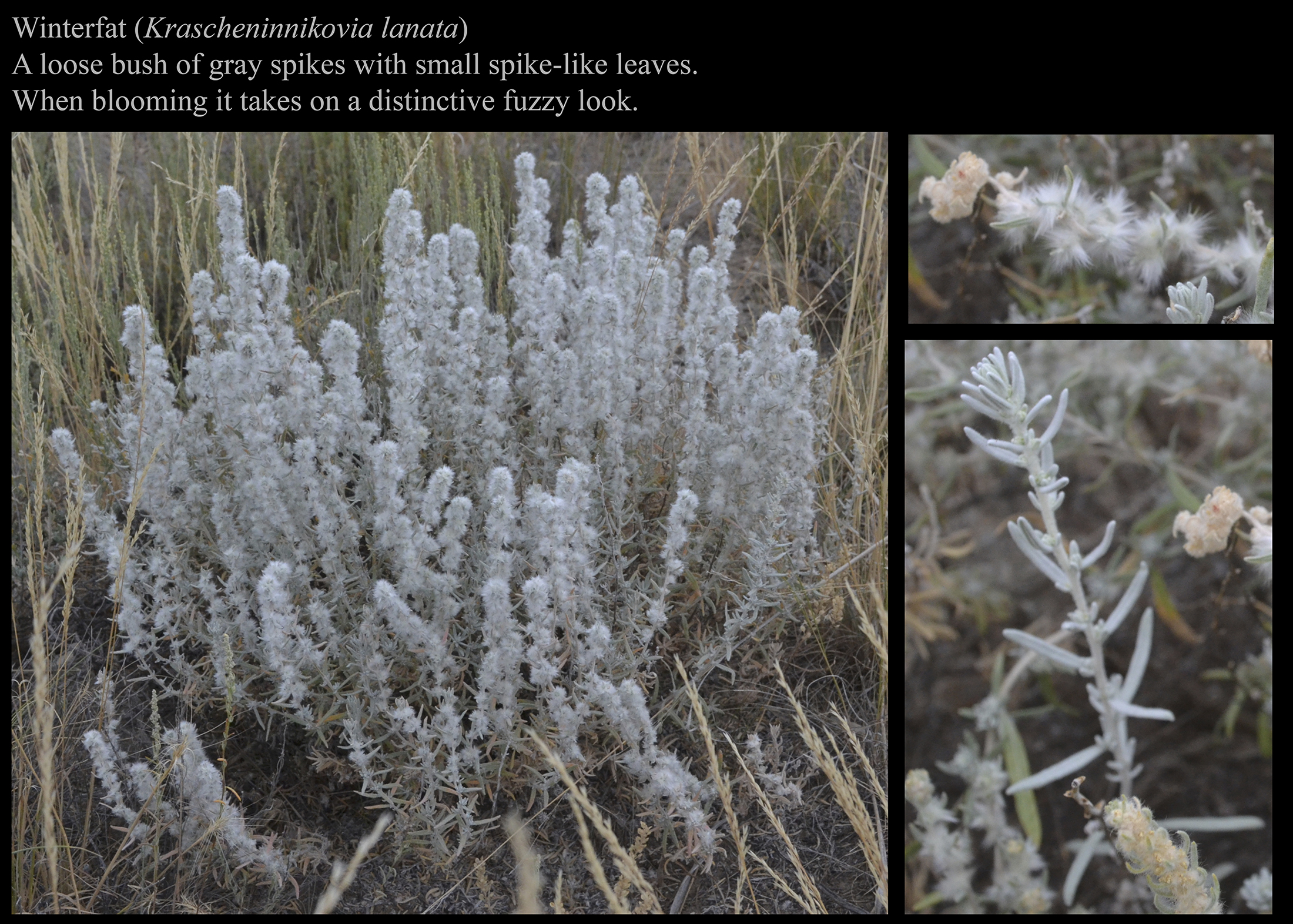
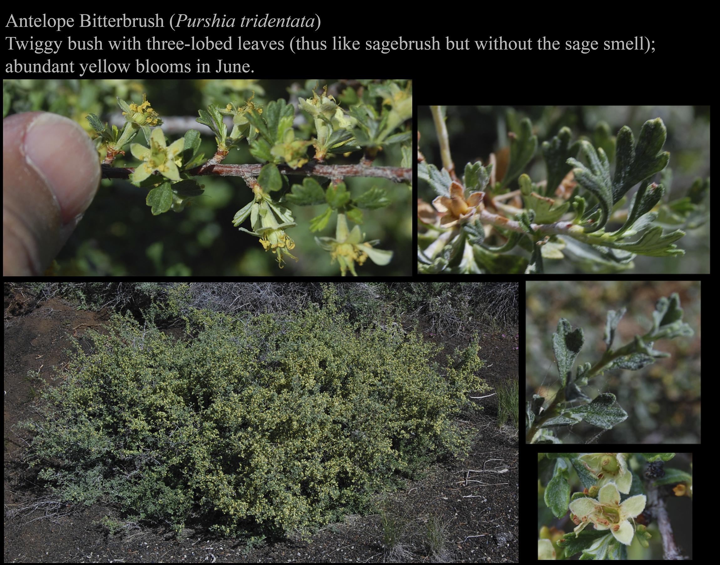
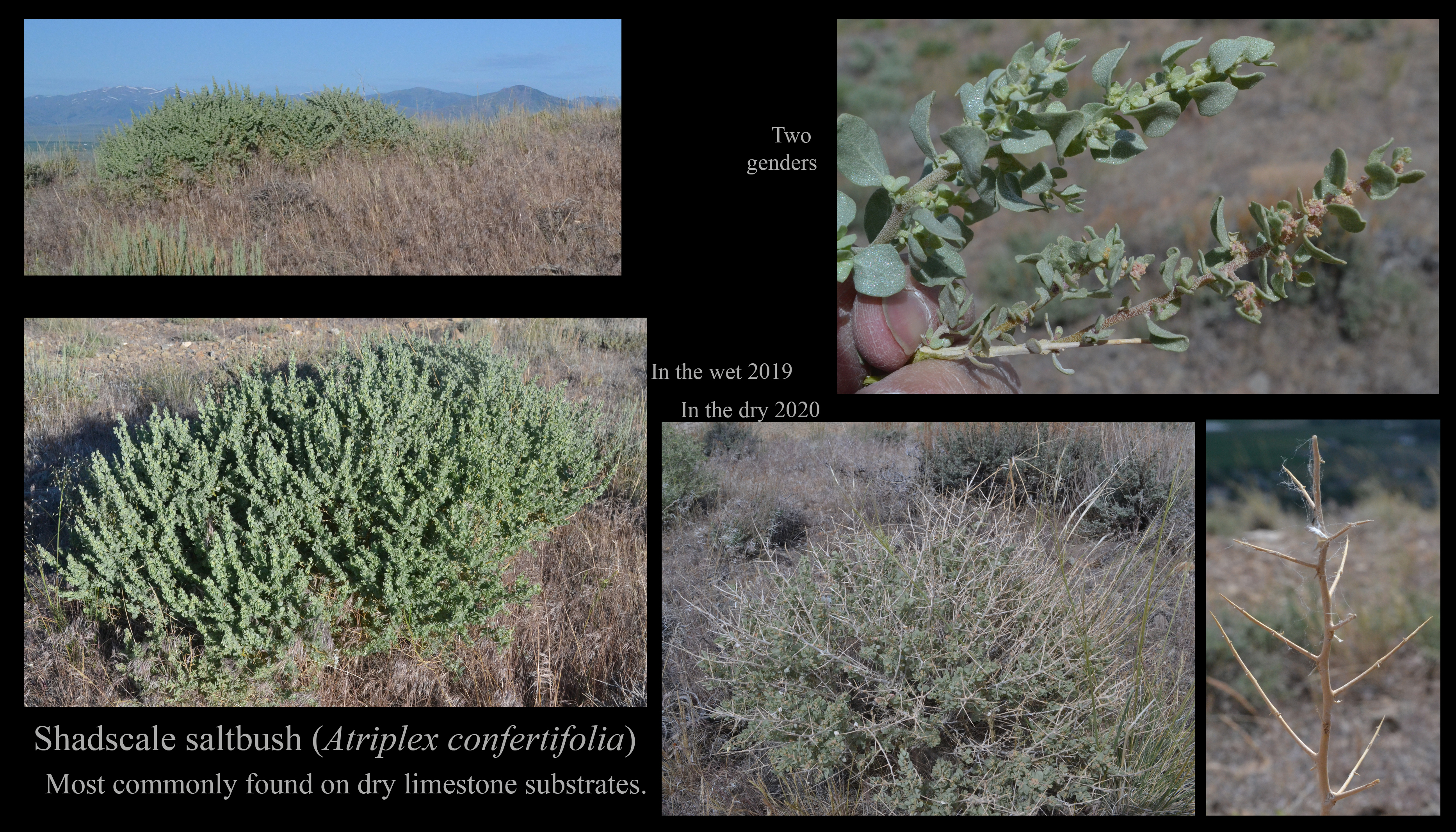
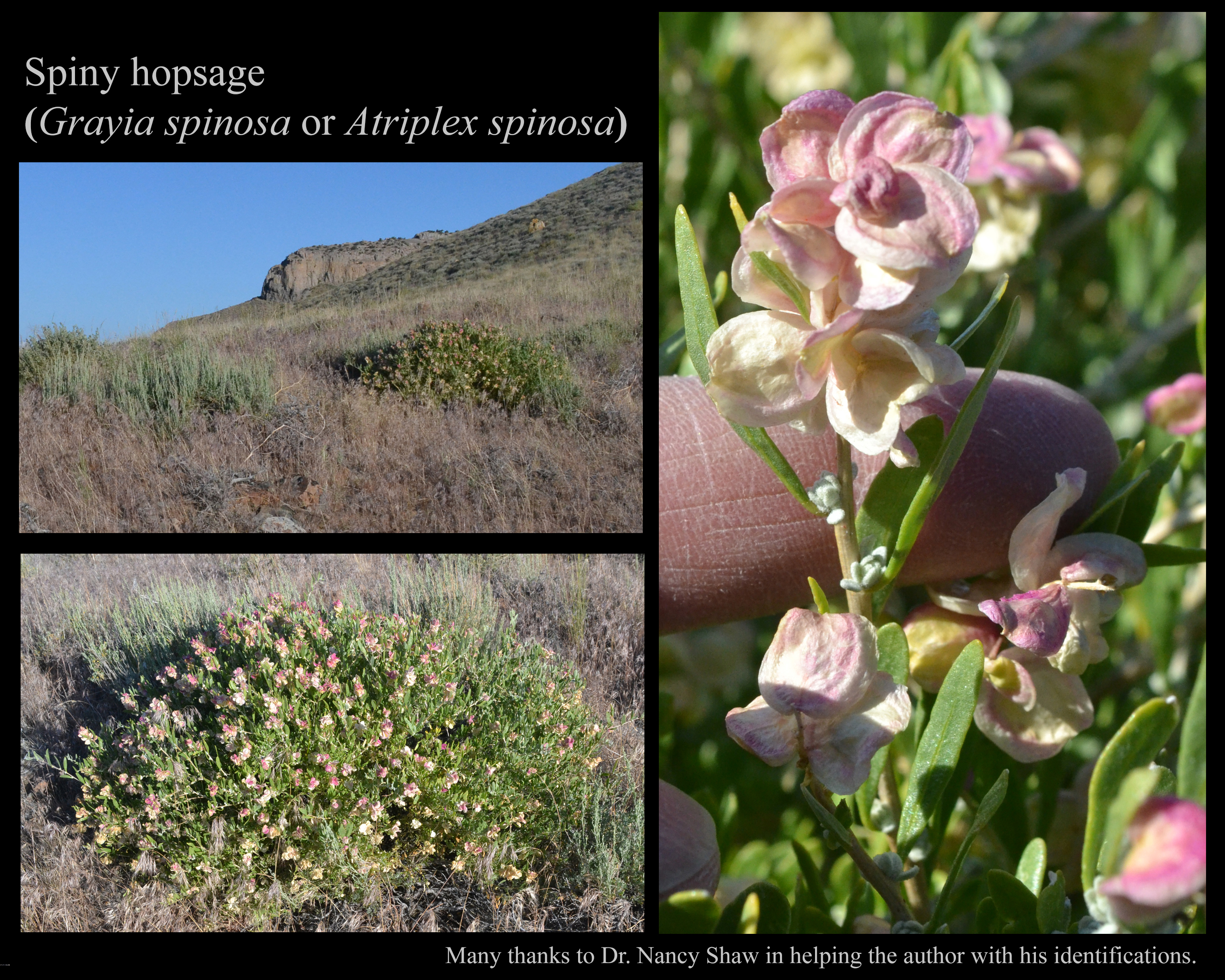
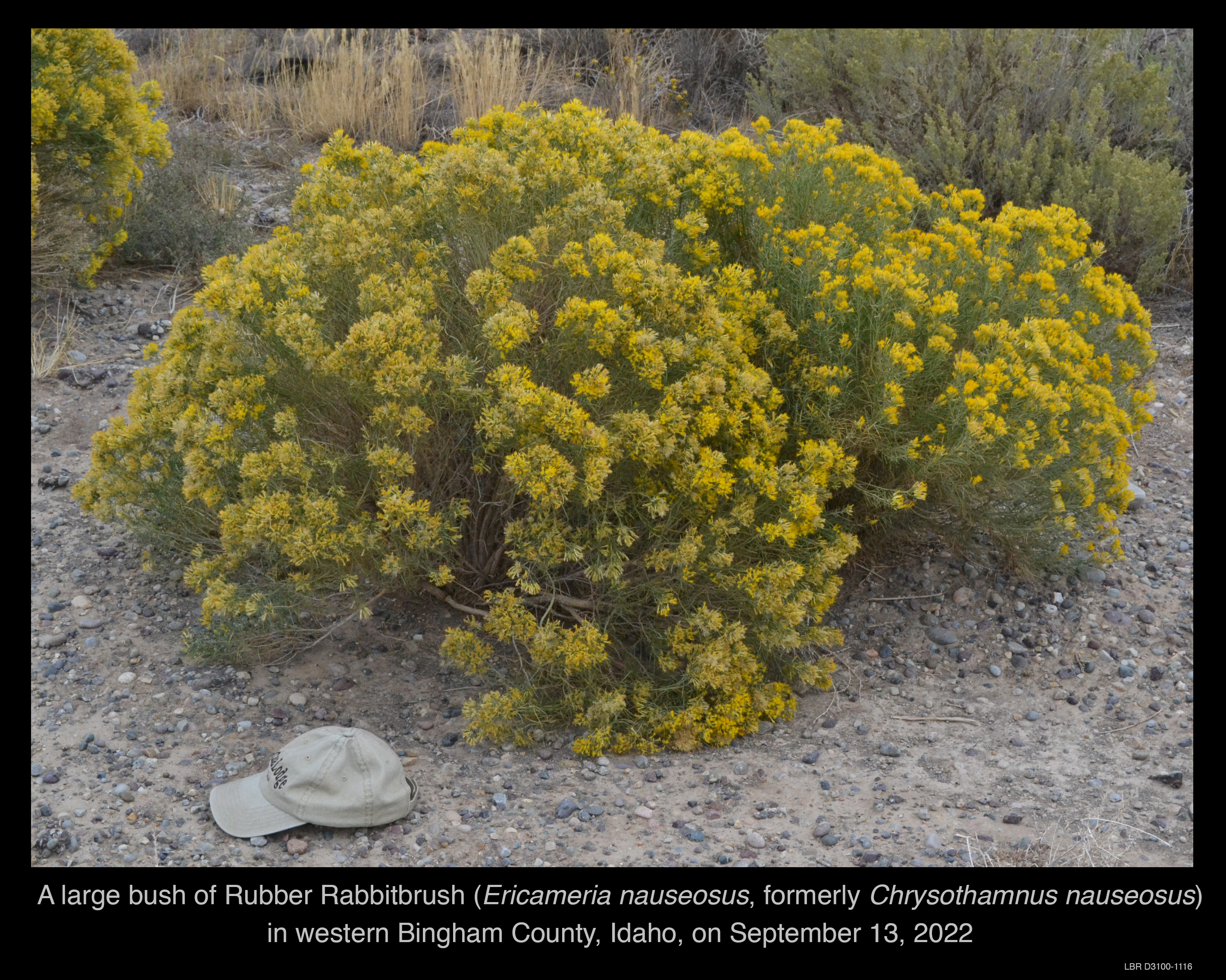
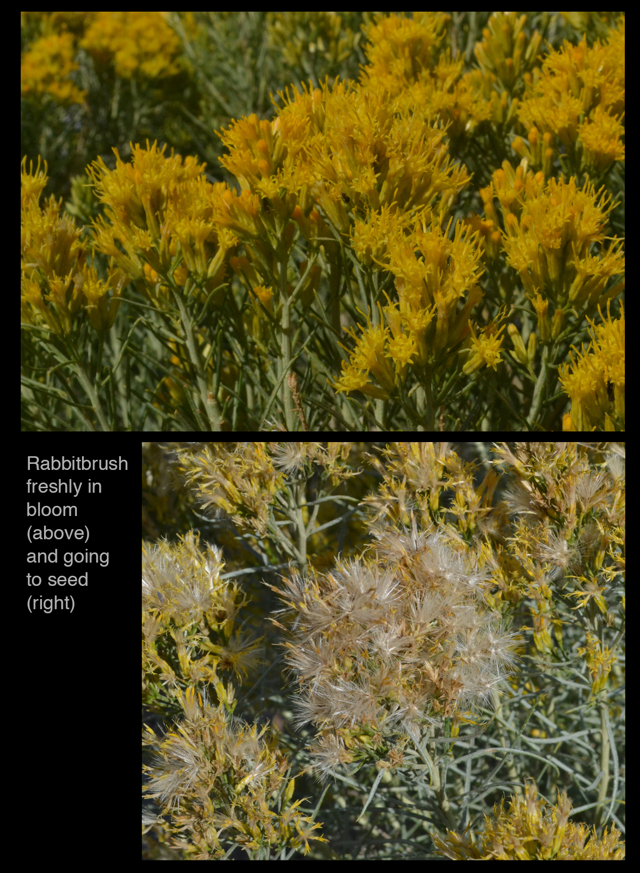
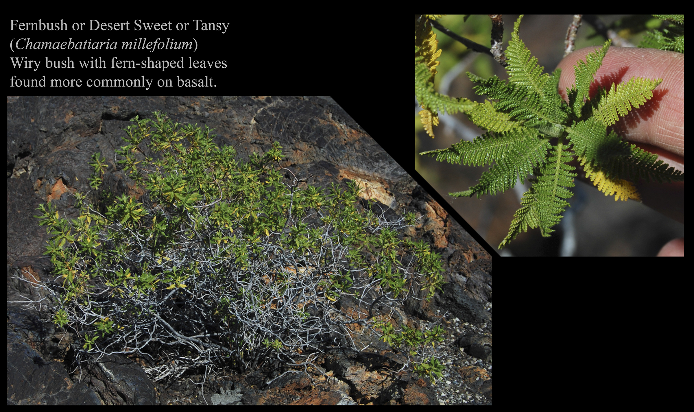
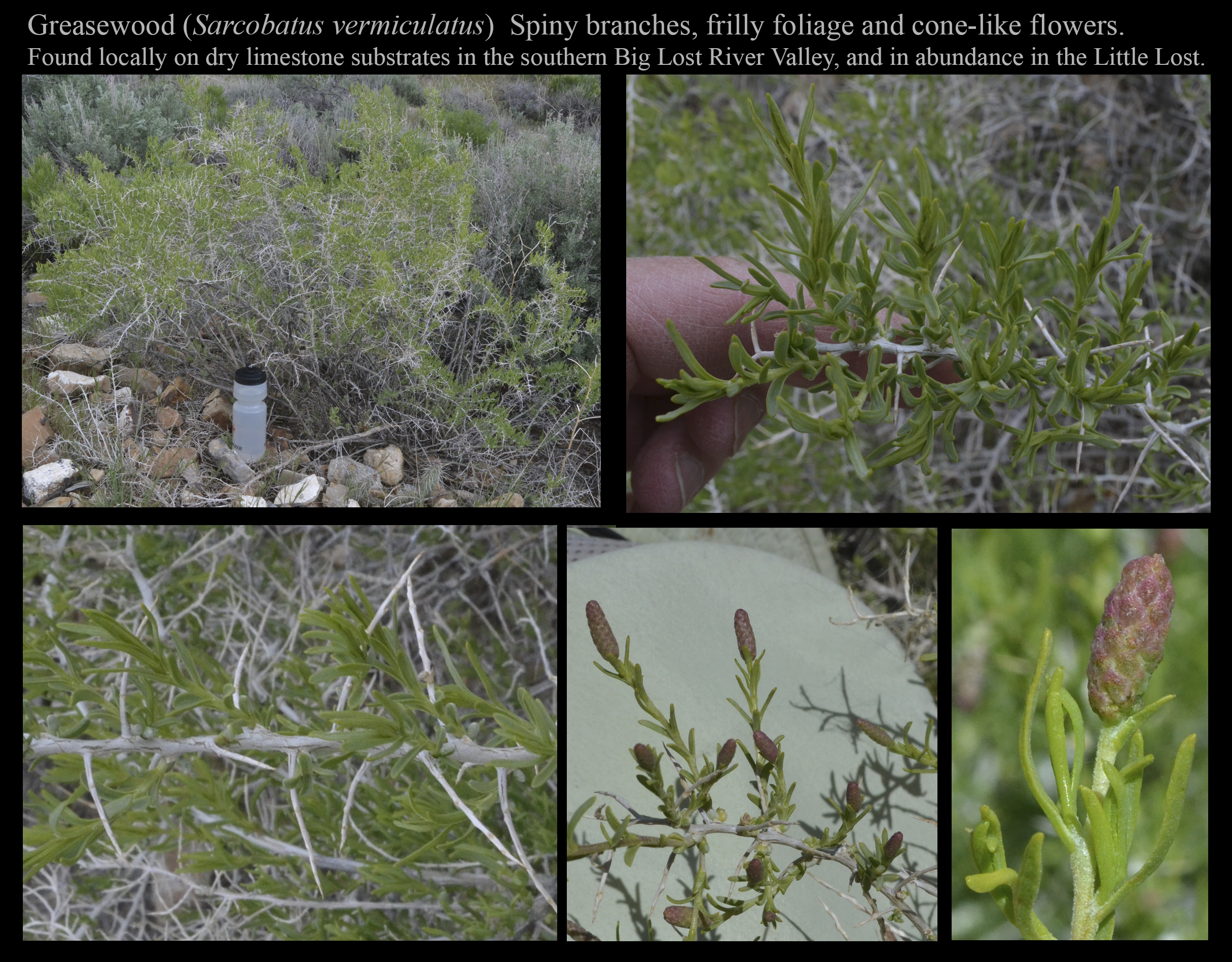
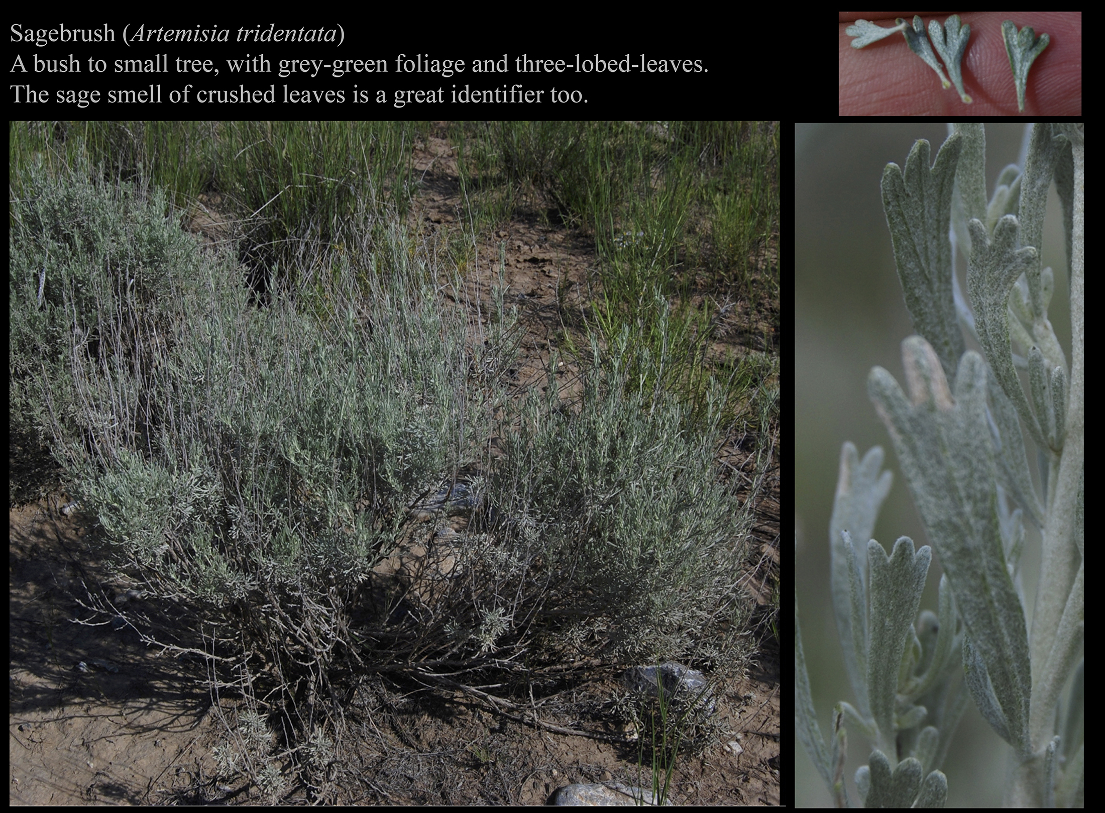
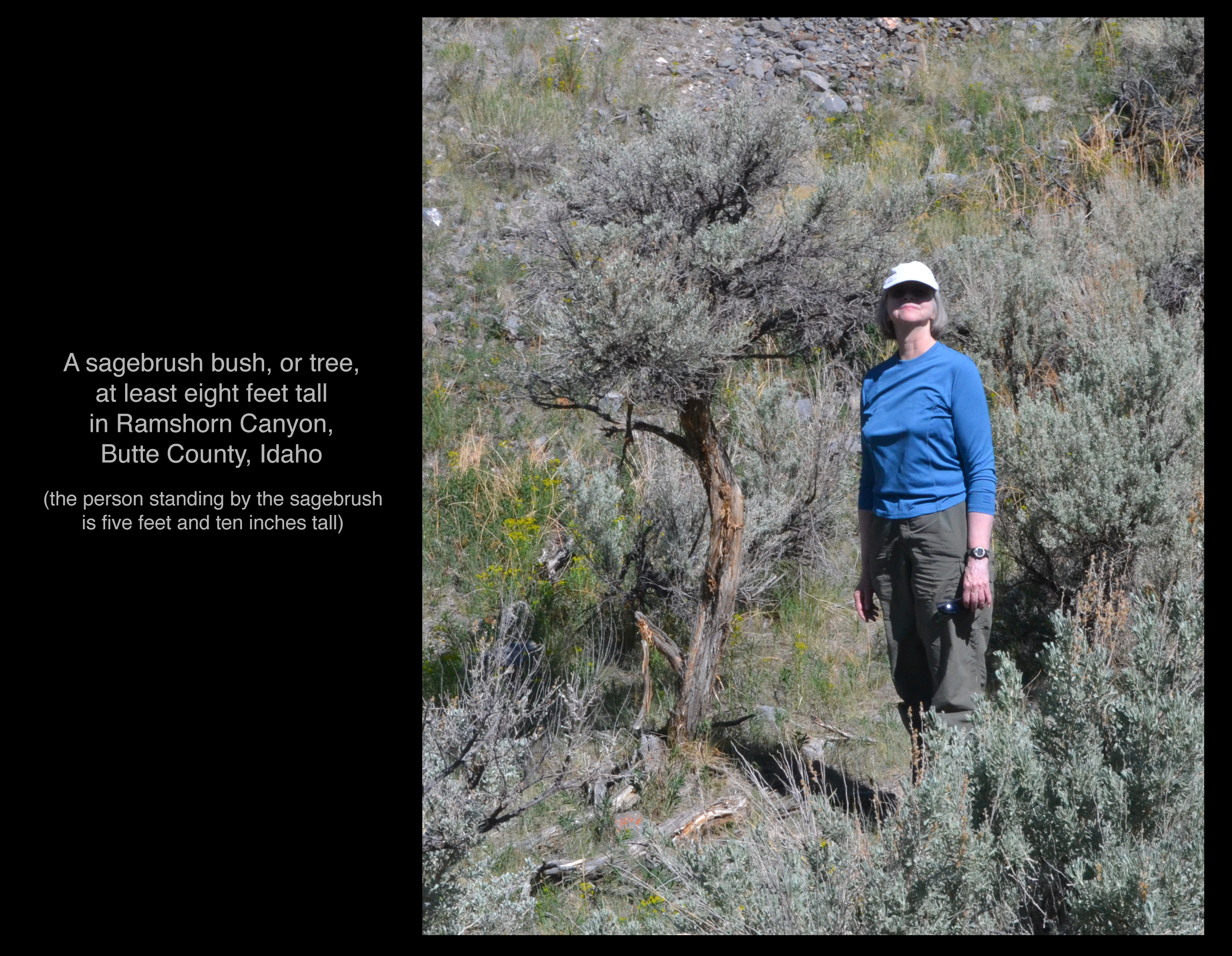
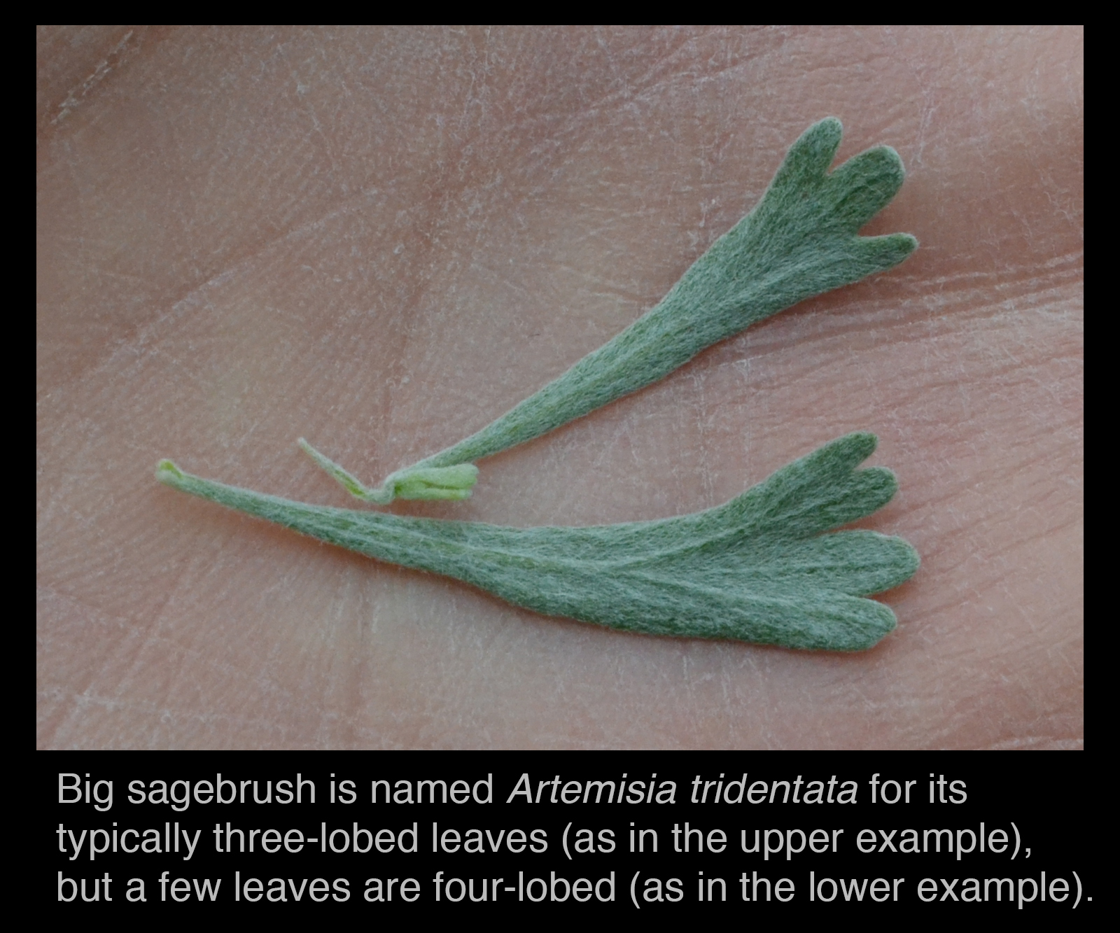
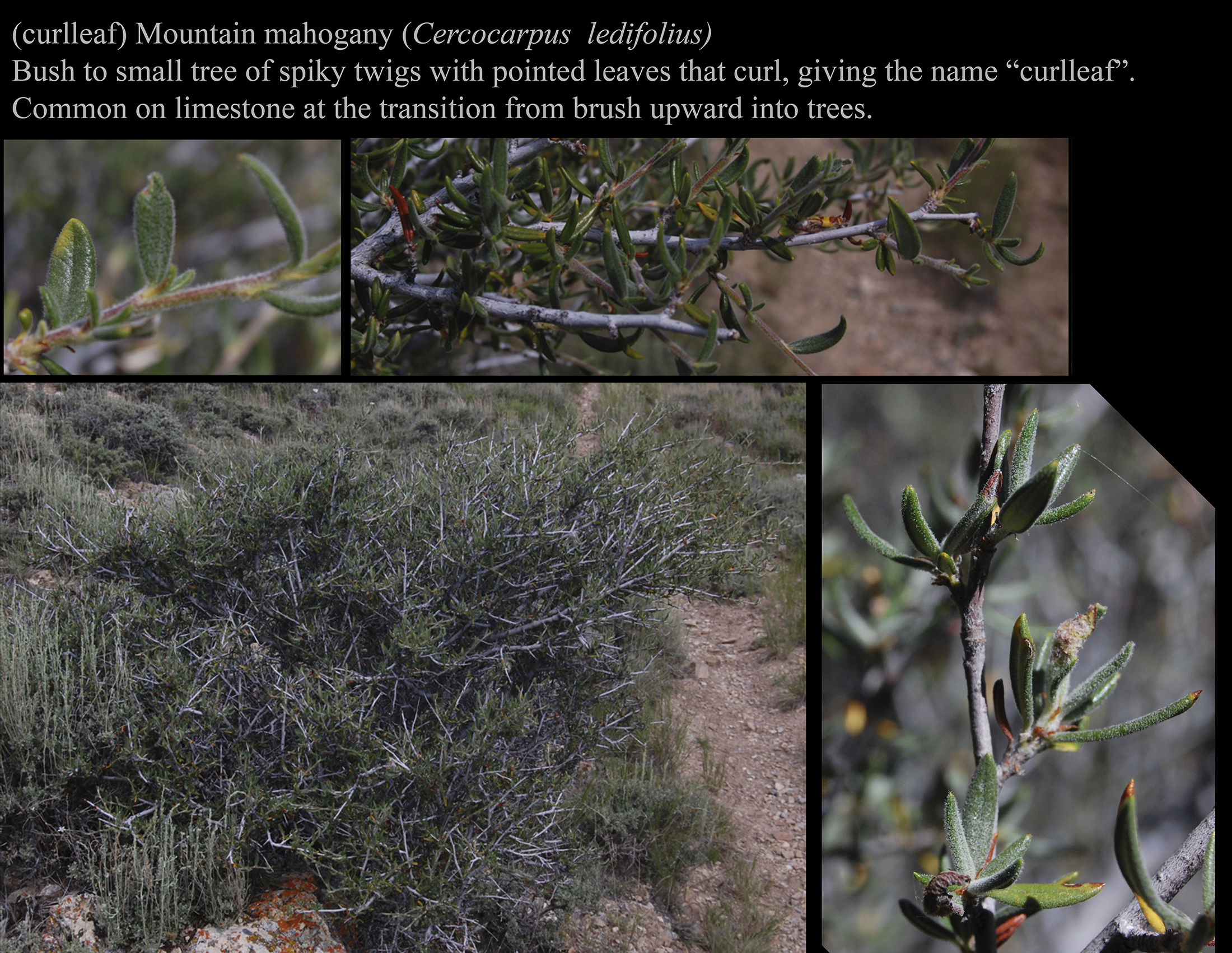
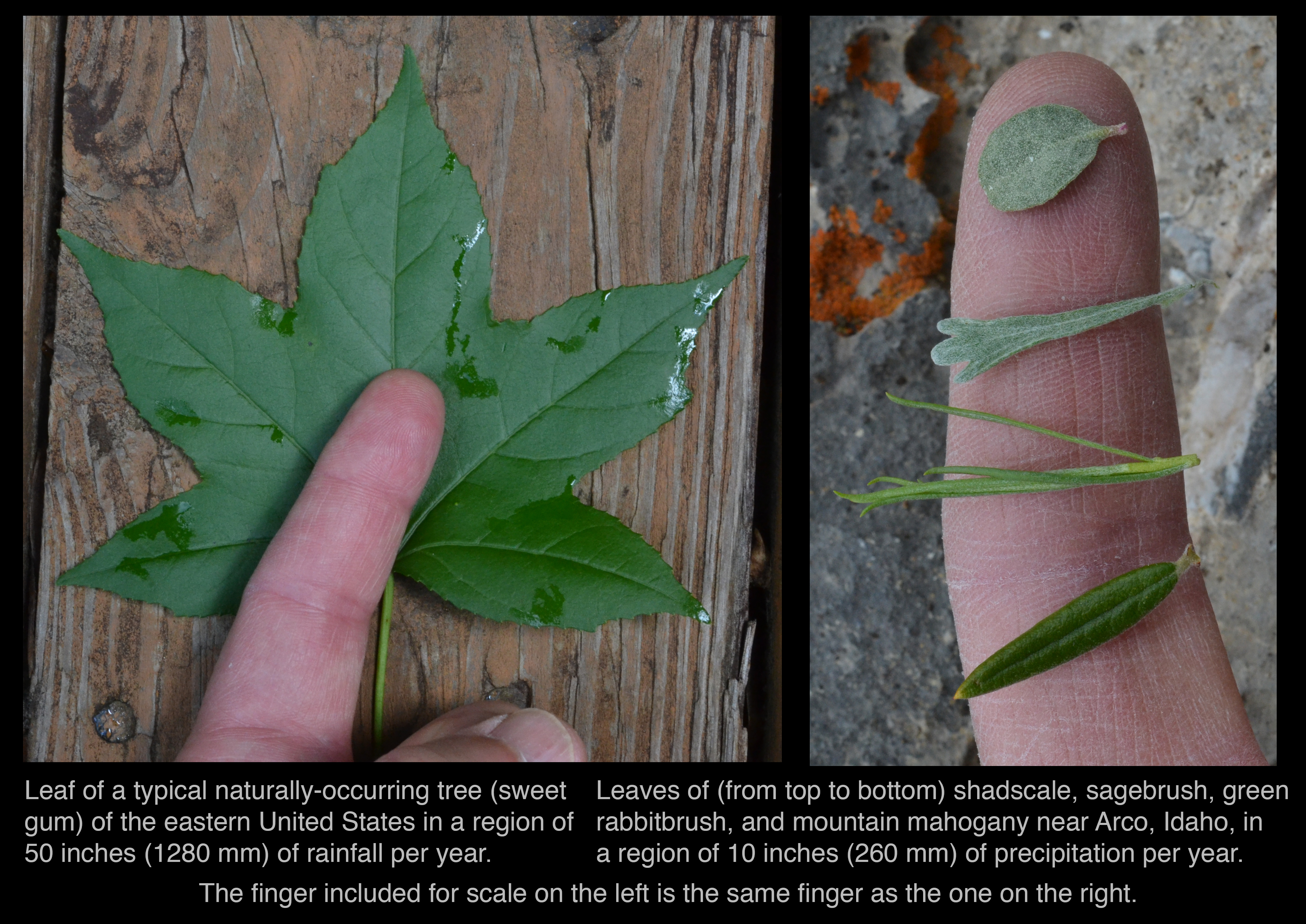
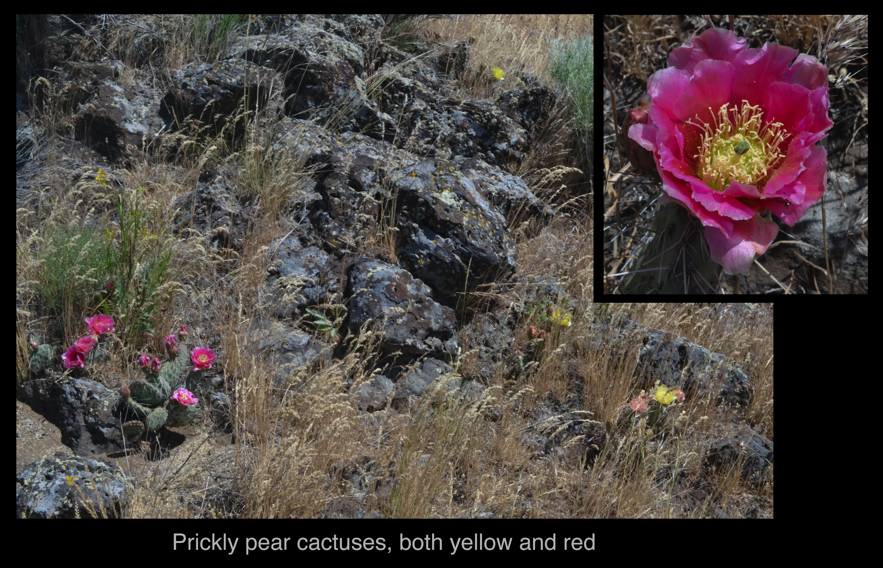
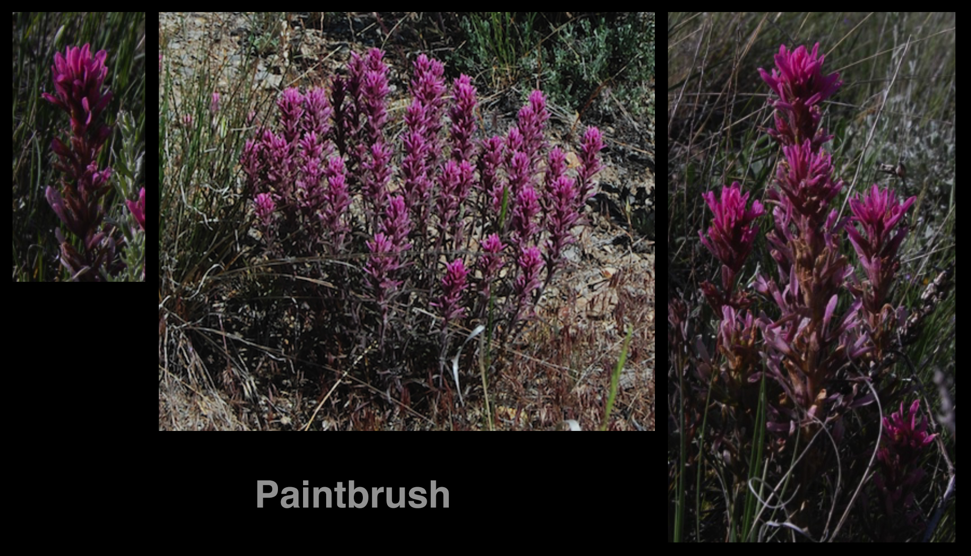
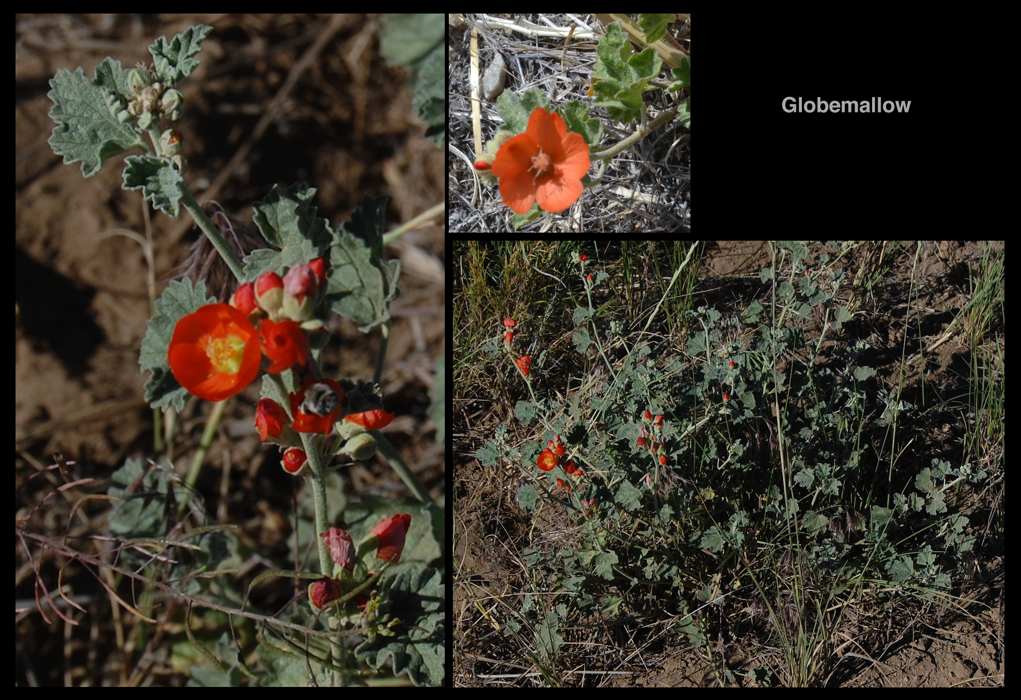
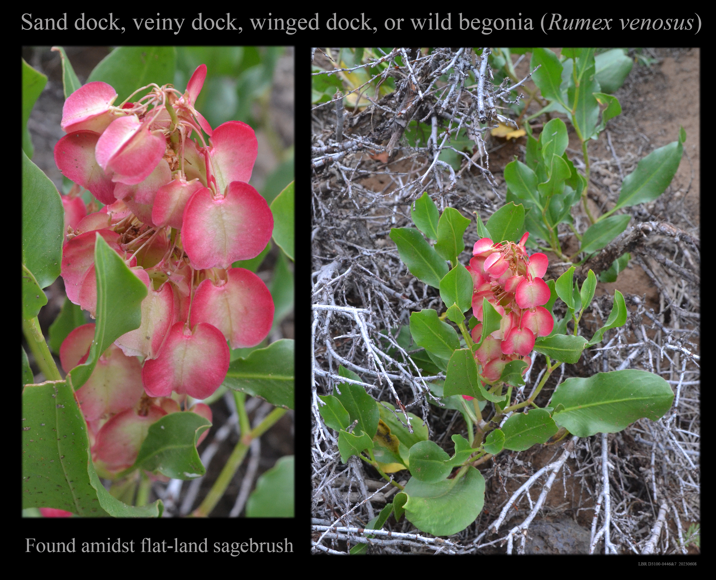
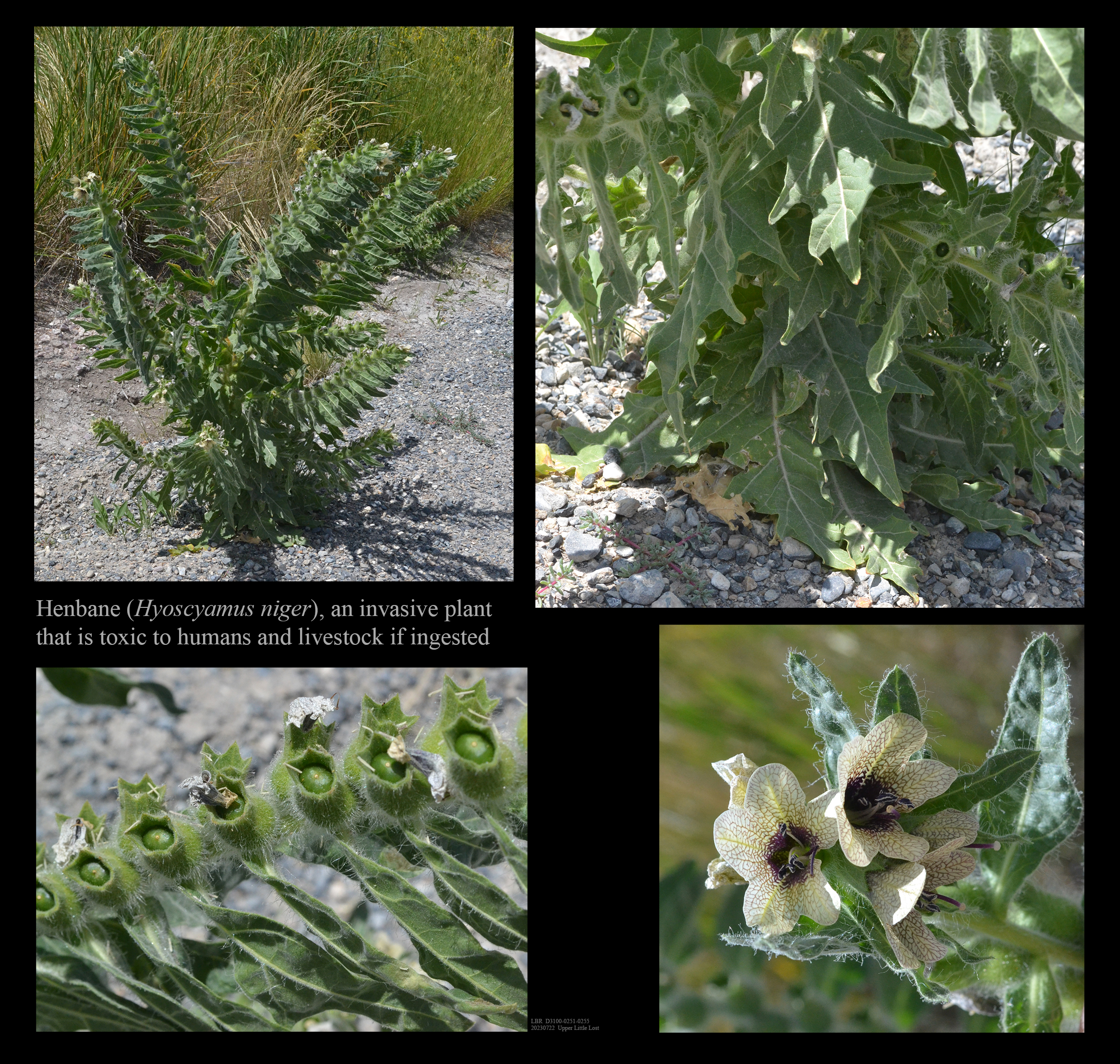
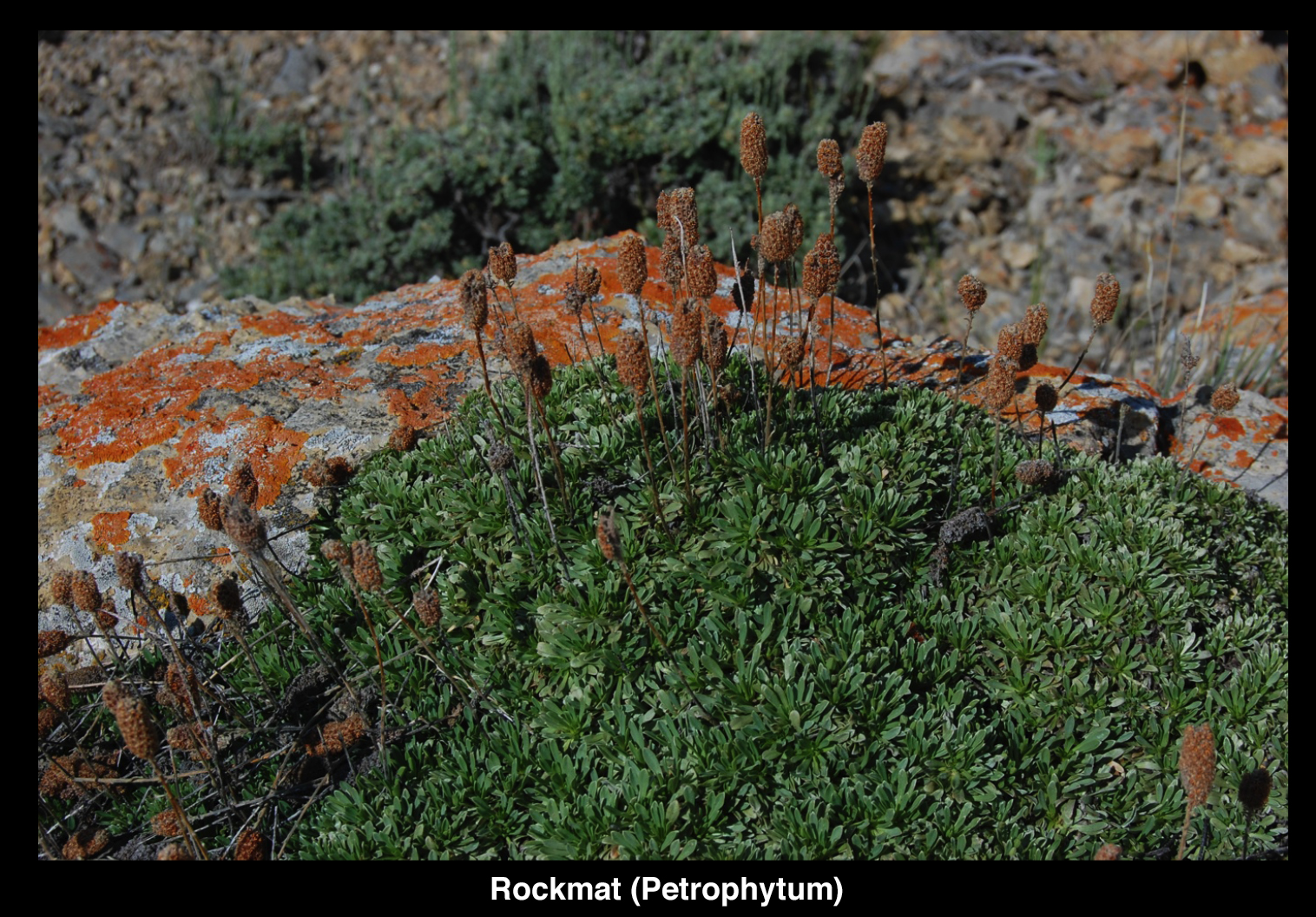
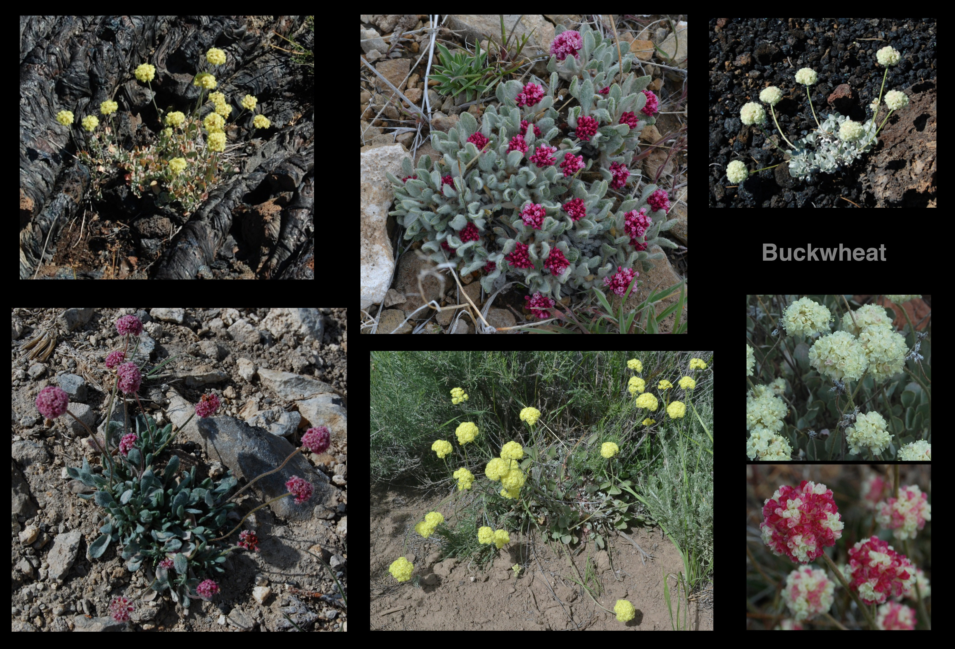
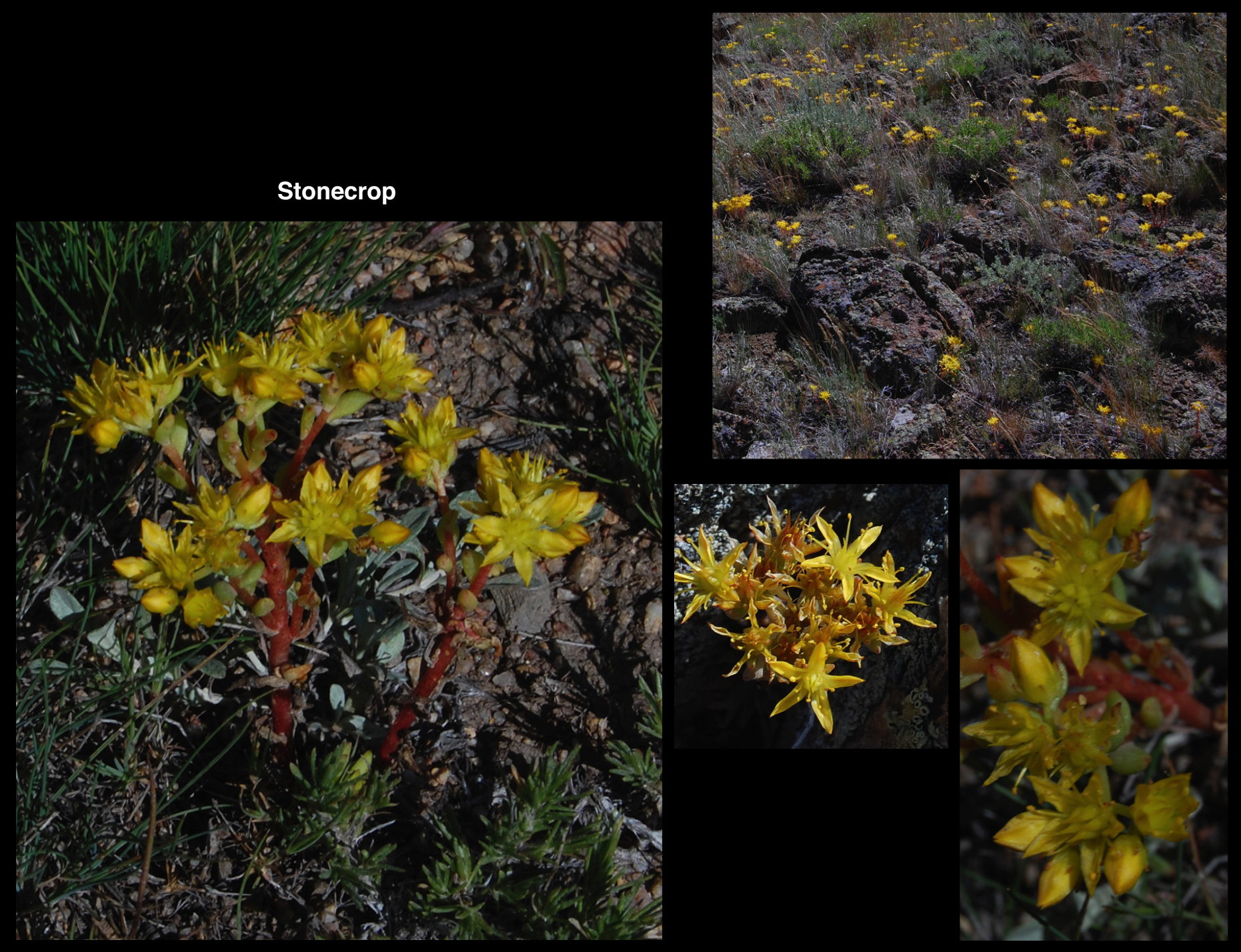
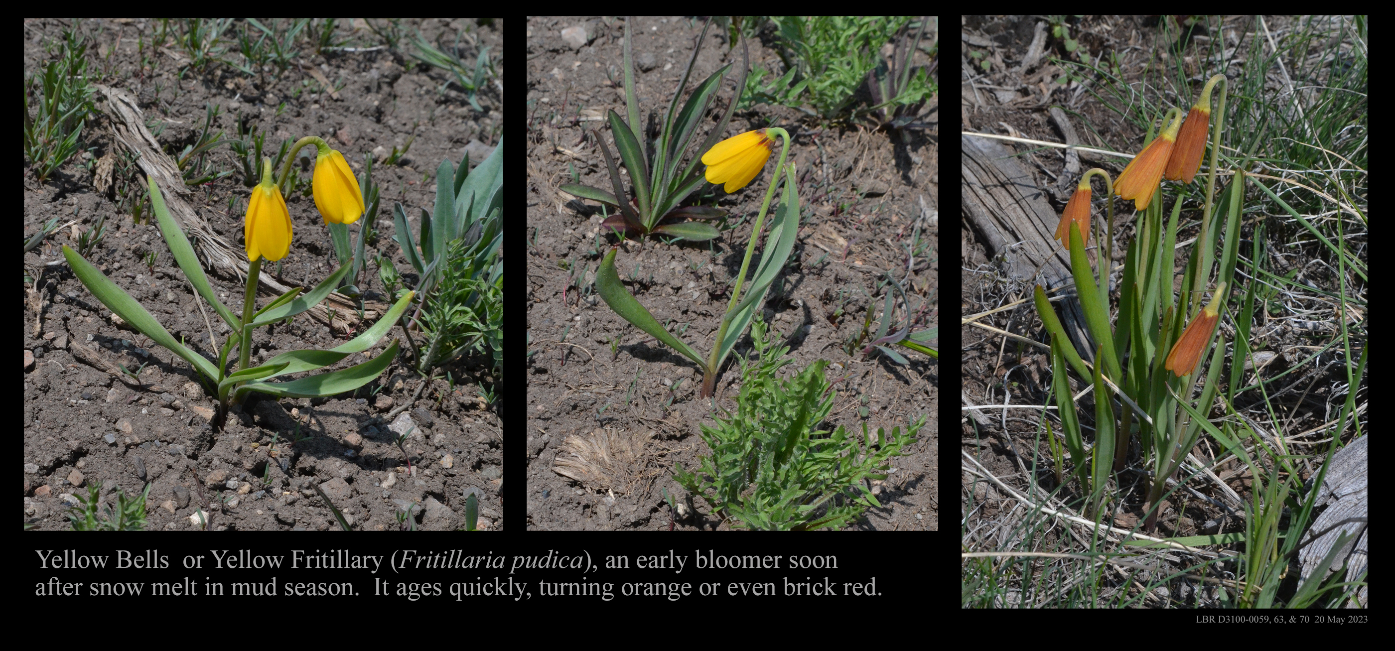
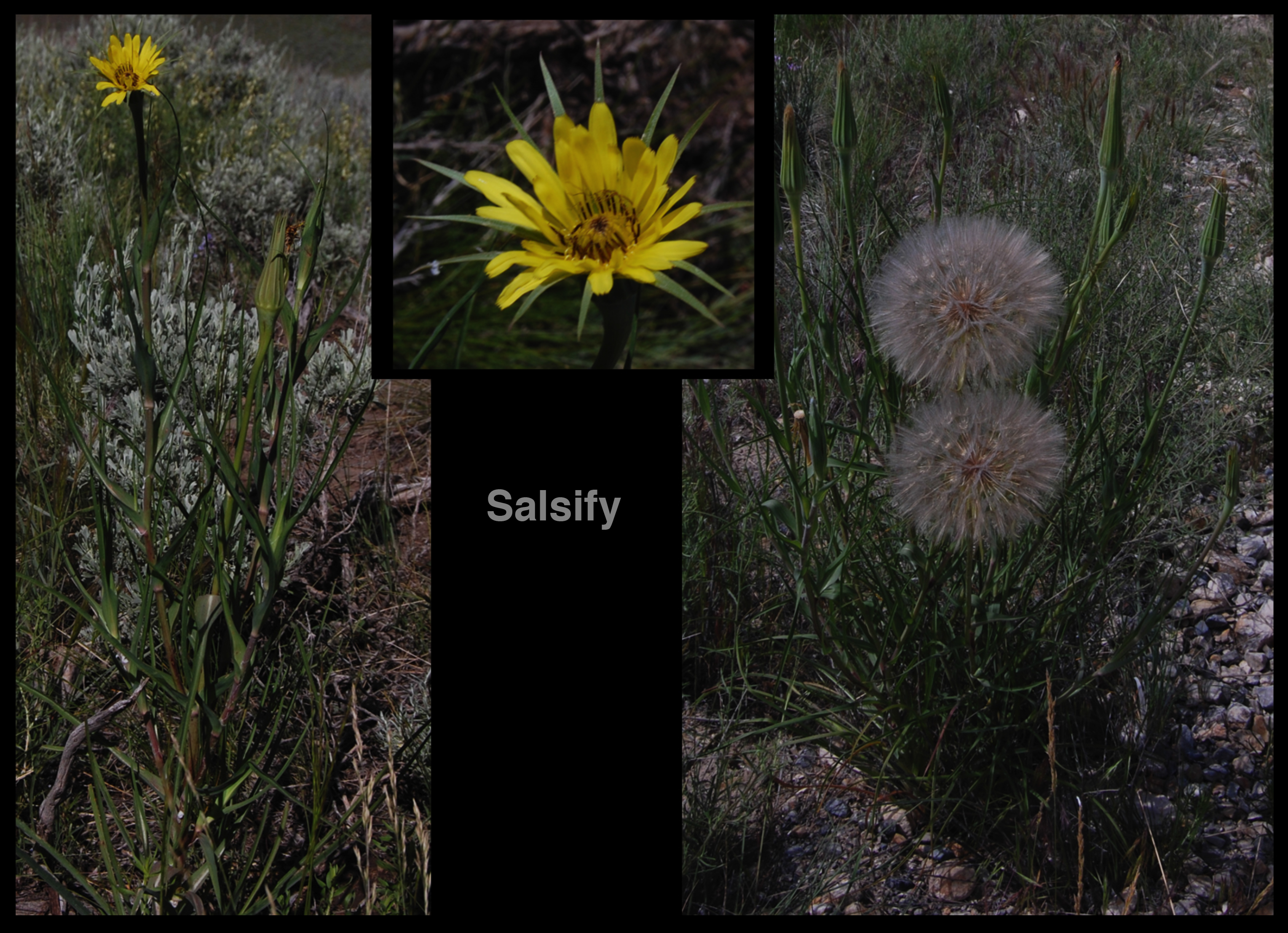
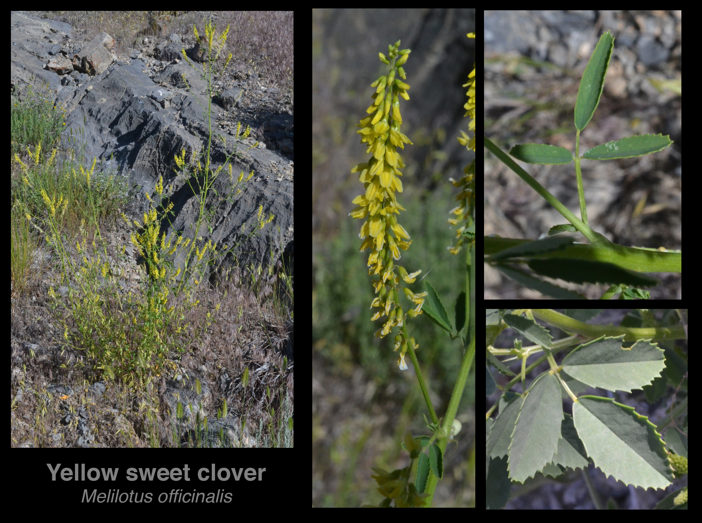
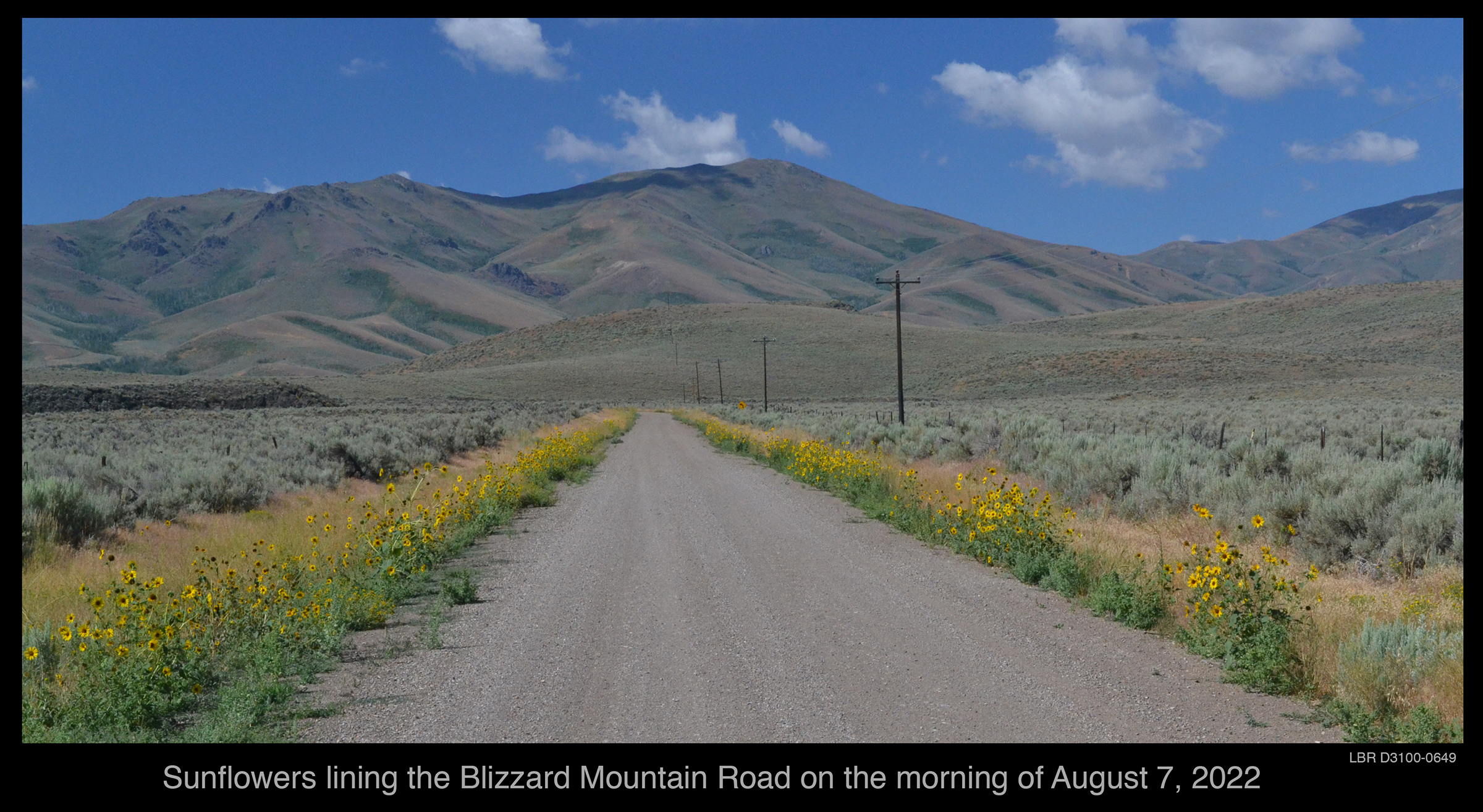
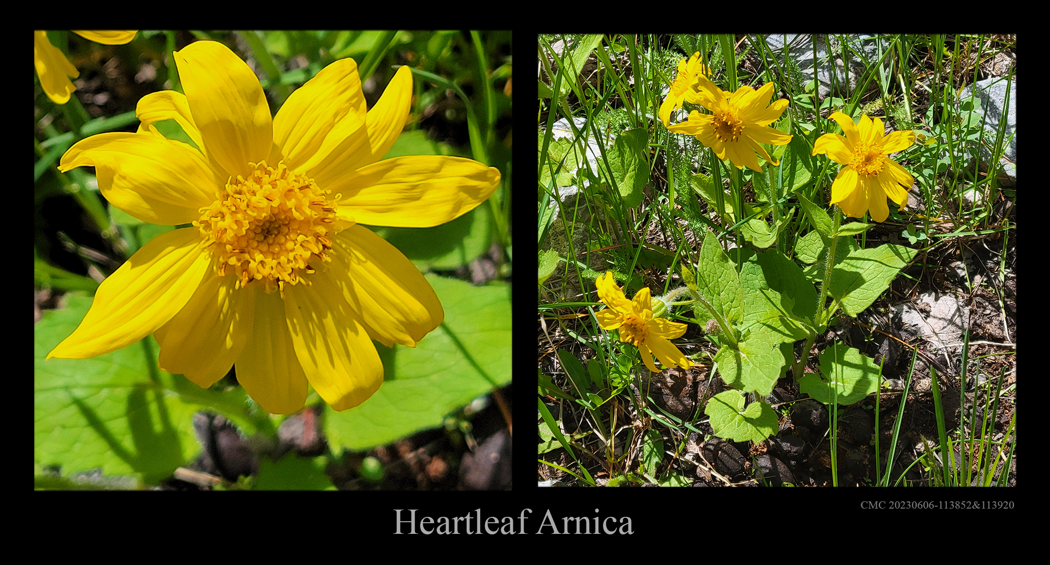
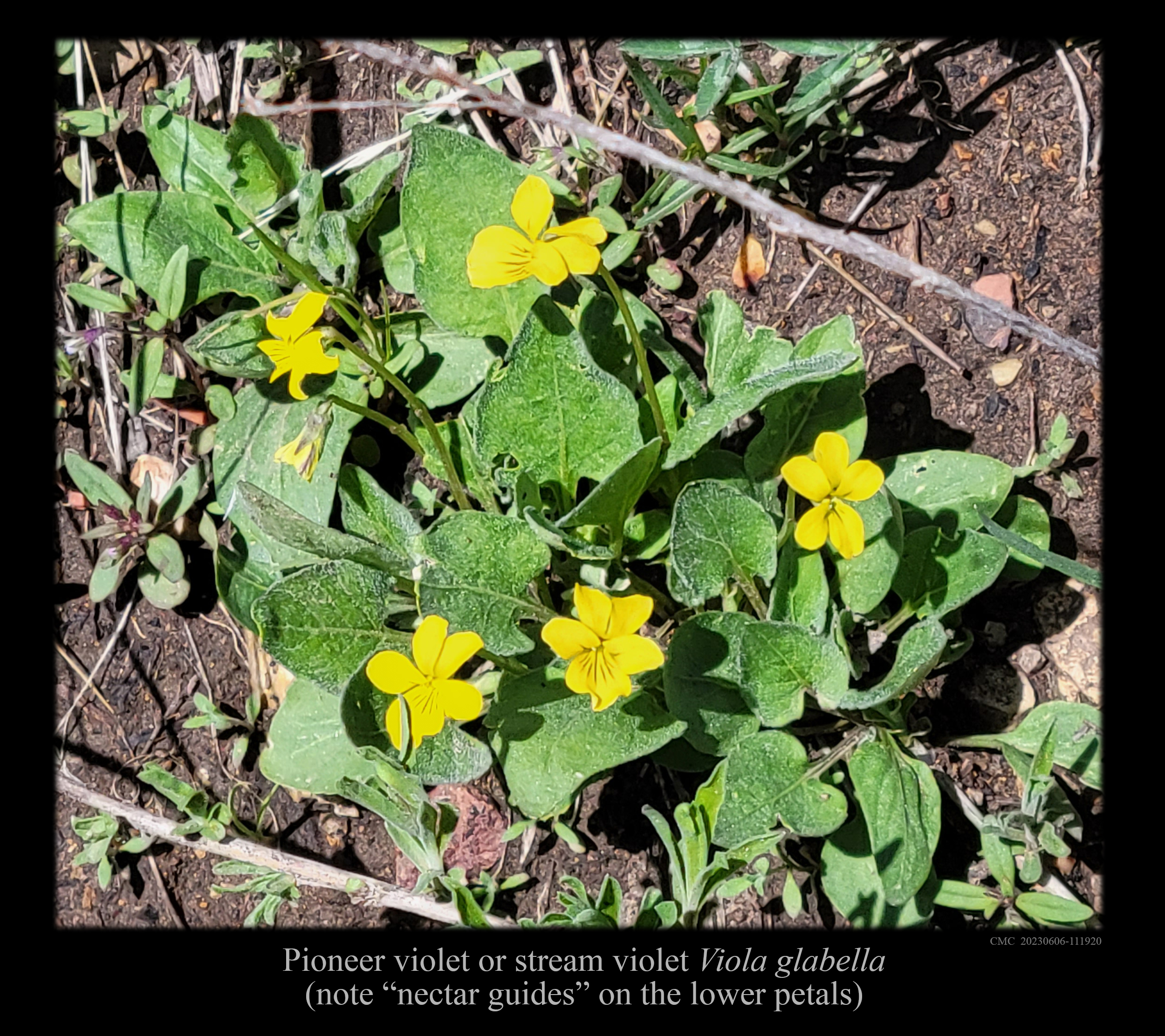
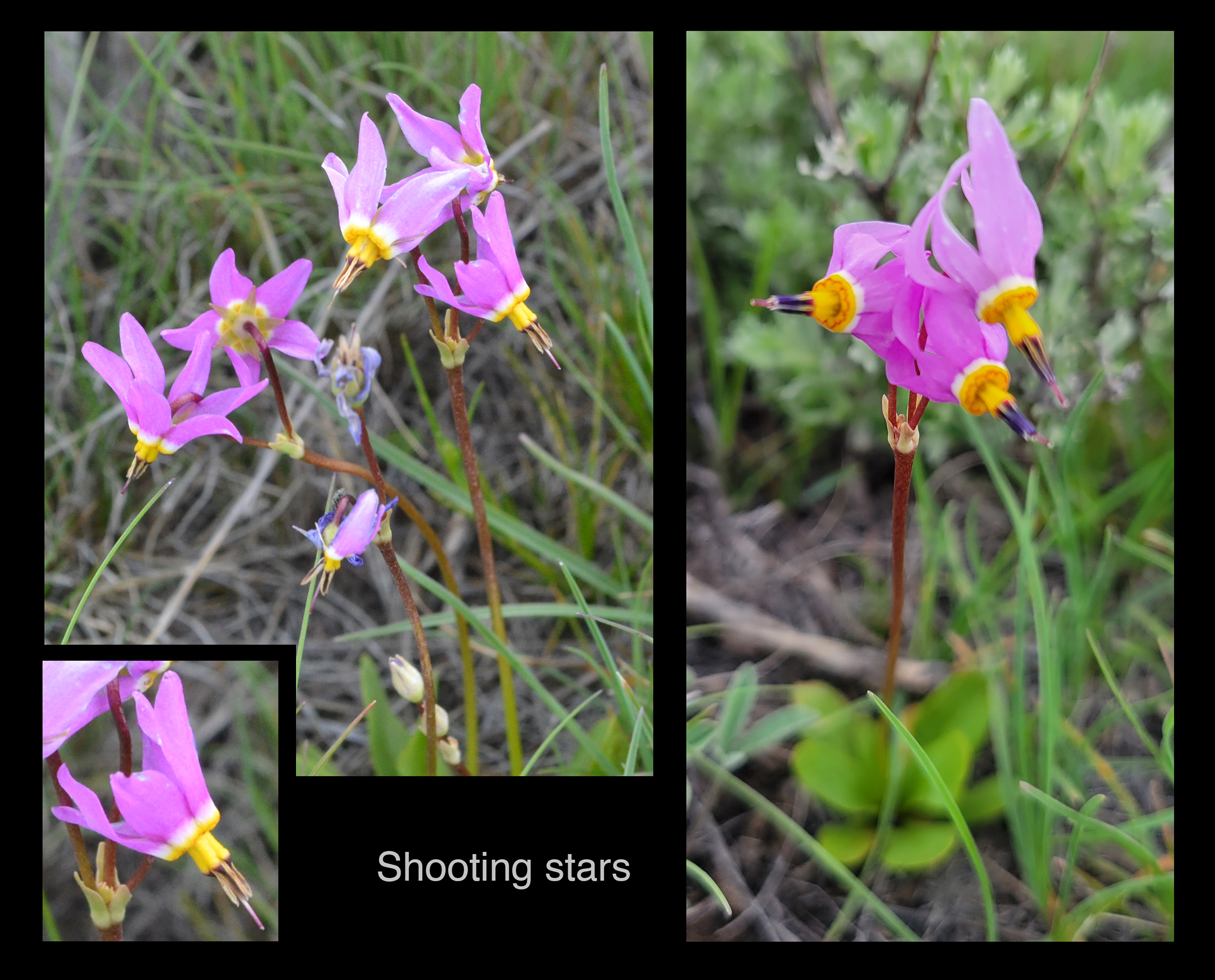
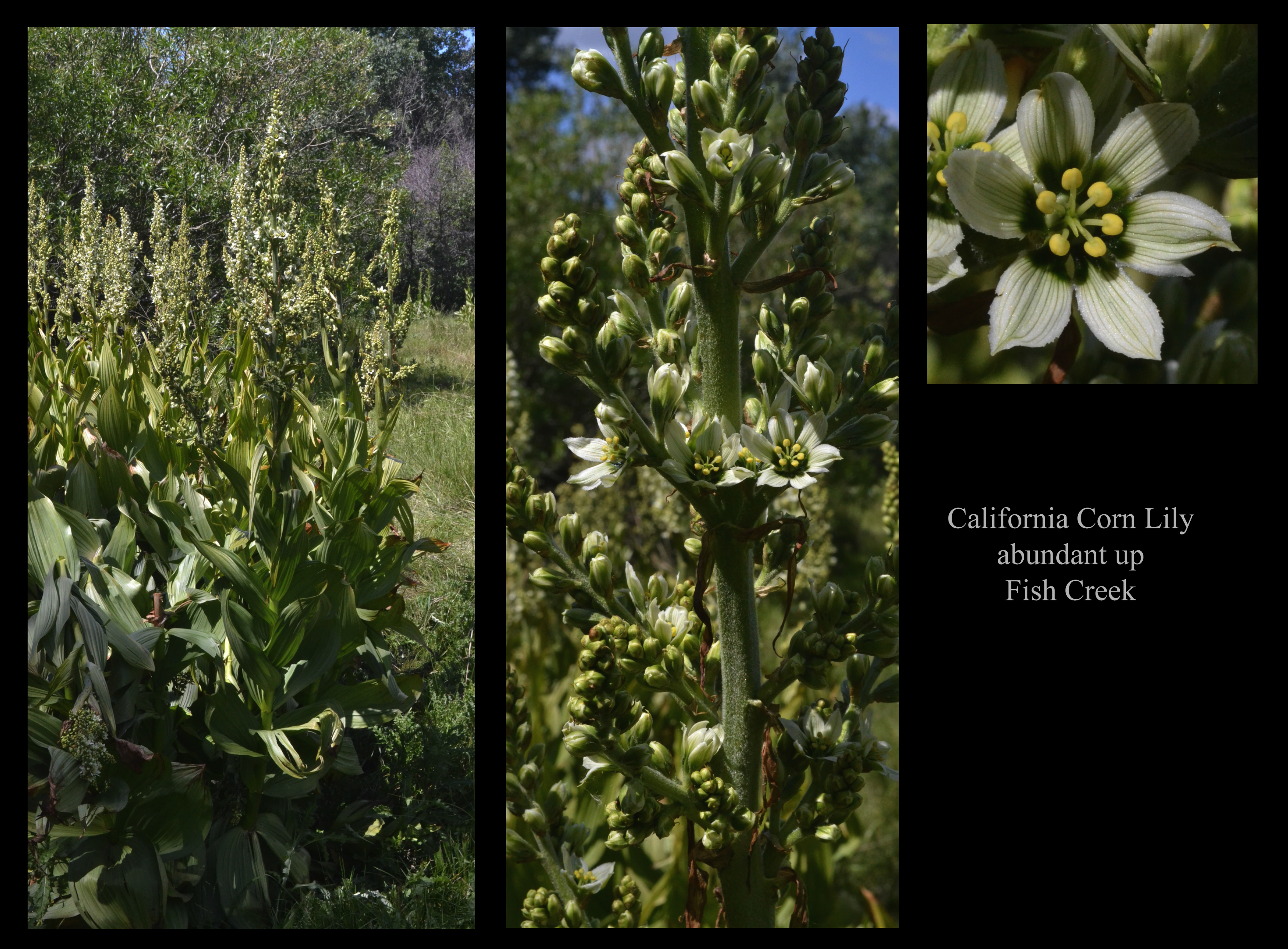
Antelope Creek downstream from US 93 (a rare sight) in May 2023 and June 2023. -o)+(o- Scenery low in the valley of Antelope Creek. . . . and just a bit higher in the valley of Antelope Creek. Limestone outcrops in the valley of Antelope Creek. The valley of Antelope Creek II: Waddoups Canyon and Sheep Mountain The Winged Nike of Waddoups Canyon, on the way to Sheep Mountain. Sheep Mountain from the southeast (as commonly approached on the Waddoups Canyon Road). Sheep Mountain from the south. Shelly and Sheep from the south. Sheep Mountain and Black Cap Peak in Antelope. The valley of Antelope Creek III: Cherry Creek and Shelly Peak A fault scarp near the mouth of Cherry Creek. Limestone prominences along the lower reaches of Cherry Creek. Two volcanic prominences in Antelope, Cherry Creek, and Shelly Peak. Shelly Peak and Cherry Creek from the south side of Antelope. Shelly from Antelope in October. .Shelly and the valley of Cherry Creek. Shelly from high in the canyon of Cherry Creek. Round Mountain and Shelly Peak from high in the canyon of Cherry Creek. A view down the canyon of Dry Fork Creek, with Shelly and Sheep in the distance.. . The valley of Antelope Creek IV: Smiley Mountain Smiley seen over the Antelope "crossroads" and marsh. A broader view of the Antelope "crossroads" and marsh and Smiley . Smiley Mountain and the meadow of Antelope Valley. Smiley and Antelope: Two different October views from the same spot. .Smiley Mountain from Mountain Spring (not the best of these pictures). Smiley up close (might be the best). Glacial troughs descending from Smiley. Smiley seen over Challis volcanics from Cherry Creek. Antelope and its peaks seen from Hammond Summit. Antelope Crossroads and Smiley Peak seen from Antelope's Trail Creek Road. The valley of Antelope Creek V: the upper valley A bit of the 2022 fall roundup in Antelope. The canyon of Bear Creek seen from the south side of Antelope. The canyon of Bear Creek from lower in Antelope. A view down Dry Canyon on the north side of Antelope. Smiley from high in Dry Canyon. . . . but Dry Canyon is not always dry. A view down Antelope from the west. Striped Mountain from upper Antelope. Striped Mountain above Antelope, but seen from Arco and from above the "B" and in a sketch. The valley of Antelope Creek VI: Leadbelt Creek and The Needles The Needles and the valley of Leadbelt Creek. The valley of Antelope Creek VII: Iron Bog Below the campground: hoodoos above Iron Bog Creek. Below the campground: the canyon (or almost valley) of Iron Bog Creek. Above the campground: a view up the canyon of Iron Bog Creek. A view from high down the canyon of Iron Bog Creek and out to King Mountain. The cirque at the top of Iron Bog Canyon. Volcanic breccias in Iron Bog. -o)+(o- Iron Bog Lake. Iron Bog Lake (once is not enough). < < < < < < < < NEAR ARCO > > > > > > > > King Mountain King Mountain and Leslie Butte seen from the White Knobs. King Mountain from Leslie Butte. A snowy King Mountain at sunset. Posters for the Hang Gliding Championships at King Mountain. Folded layers of limestone in the southern face of King Mountain. The Natural Bridge on the flank of King Mountain. King Mountain seen from Arco Pass. King Mountain seen from the Wood Canyon Road. Appendicitis Hill's Rocky Canyon The alluvial fan at the mouth of Rocky Canyon, seen from above. .A view out of Rocky Canyon across the Big Lost River Valley to Coyote Peak. A view from well above Rocky Canyon. Views from 3600W Ridge The southern Big Lost River Valley from 3600W Ridge. Arco and the three buttes from 3600W Ridge. Timbered Dome from 3600W Ridge (from the northeast). and 3600W Ridge itself seen from Number Hill The Arco Rangelet of the southern Lost River Range -o)+(o- The Arco Rangelet from the west. The Arco Rangelet from the east - broad views. The Arco Rangelet from the east - a nearer view. Hammond Canyon A view east from the summit of Hammond Canyon. The view from Hammond Canyon into and across Antelope. Near Arco A vestige of the Lost River Highway. -o)+(o- The Big Lost River Valley and the northern Big Lost River Mountains seen from Arco Peak in 2012. A view west from Arco Peak to Sheep, Shelly, Redbird, and White Knob, unlabeled and labeled. The Lost River Lava Flow (an 7MB multi-image jpeg). The north vent of the Lost River Lava Flow seen from the south vent. Number Hill from the side and a snowy Smiley Mountain in June 2017. Smiley Mountain (in the center) and other peaks from Number Hill. -o)+(o- A sunrise view from Number Hill of the Big Lost River Valley and Smiley Mountain in July 2017. The B from the top of Number Hill . Shelly Peak, the White Knobs, and Sheep Mountain seen from south of Arco. The Canyon behind Number Hill (and the Big Butte) in wet 2016 and dry 2021. The Big Butte from above the A on a clear morning in 2017 and in the haze of 2021. A snowy New Year's Day 2022 seen in highway cameras near Arco. Arco itself Arco and the southern Lost River Mountains. Arco and the landscape to the south and west. Arco and Number Hill seen from the B in 2017. Arco seen from Number Hill in 2011. A more detailed view of Arco from Number Hill in 2012. Arco seen from above the A in 2019 . Arco in a more detailed view from above the A in 2019 . Arco seen from the top of Number Hill in 2020: a view from Number Hill to the horizon. Arco seen from the top of Number Hill in 2020: a high-resolution view. A cattle drive moving through Arco in 2017. A triple-trailor hay truck rolling through Arco in 2025. Arco: the junction of the three U.S. Highways. Smoke from the Sheep Fire arriving in Arco in 2019. Arco in smoke in September 2022. The sail of the USS Hawkbill and the number 666. Water in the Big Lost River at Arco in 2012. Water in the Big Lost River at Arco in 2023. Rain over Arco on June 9, 2019. Arco and snowy peaks in the distance. A rainbow and storm over Arco on August 22, 2022. Number Hill seen over sunflowers. < < < < < < < < THE PAHSIMEROI & LITTLE LOST > > > > > > > > Beyond the Little Lost: the Pahsimeroi Valley High in the canyon of Doublespring Creek. Midway down the canyon of Doublespring Creek. Lower in the canyon of Doublespring Creek. Bear Mountain and Big Gulch from the upper Pahsimeroi. The Little Lost and the Lemhis: the uppermost Little Lost The Little Lost River is the eastern counterpart of the Big Lost River; the two are separated by the Lost River Mountains. "Little Lost" can thus denote the Little Lost River or the Little Lost Highway, but most commonly it refers to the valley of the Little Lost River. The top of the Little Lost valley. Bear Mountain seen unimpeded from the upper Little Lost. Bear Mountain seen from the upper Little Lost but hidden by a white-winged southern neighbor. A view down Summit Creek toward its confluence with Sawmill Creek, with the Lemhis beyond. The Little Lost and the Lemhis: Sawmill Canyon Rushing waters in the Main Fork of Sawmill Creek. Sawmill Creek in autumn foliage. A view across Sawmill Canyon to Bear Mountain. Bear Mountain and autumn aspens. The flat valley floor in the lower reaches of Sawmill Creek. The Little Lost and the Lemhis: the upper valley (Wet Creek & Bell Mountain) The view from the northern Little Lost westward to the Lost River Mountains and Borah Peak. Eroded Wet Creek terraces in the Little Lost, and the Lemhis. A broad view of the northern Lemhis from the Loristica Overlook above Pass Creek Summit. A view east from above Pass Creek Summit to Bell Mountain in the Lemhis. Bell Mountain, the Little Lost, and the Lemhis: a broad view. Bell Mountain from the southwest. Bell Mountain and the Little Lost's floodplain: a colorful view. The Little Lost and the Lemhis: The southern Little Lost and Lemhis Hawley Mountain and the Hawley Mountains in the Little Lost, seen from the north. The Hawley Mountains seen from the south. The Little Lost River at the 5700N bridge. Diamond Peak in the Lemhis and Badger Creek in the Little Lost. A panorama of the Lemhis: Bell-Diamond-Tyler-Saddle. Diamond Peak and Lemhis from Arco Pass. Diamond Peak from the east (Birch Creek) side. Old-fashioned fence and a branch of the Little Lost River. A branch of the Little Lost River. The Little Lost and southern Lemhis seen from the mouth of Bird Canyon. The Little Lost and the Lemhis seen from Arco Pass. A traveller's resting spot on the Little Lost Highway. The southern Lost River Mountains seen from the Little Lost. Warm Spring Creek in the Little Lost in 2019. Warm Spring Creek in the Little Lost in 2020. Saddle Mountain in the Lemhis from the west, southwest, south, and east. Peak 8275 on the flank of Saddle Mountain. East of Arco: Arco Pass Folded layers of limestone in the southern face of King Mountain. A view over Teaspoon Butte and over Arco Pass to Diamond Peak. -o)+(o- A view west from Arco Pass into the valley of Godfrey's Ranch in 2009. Views of the Arco rangelet, King Mountain, and Arco Pass from the Wood Canyon Road. East of Arco: Wood Canyon The entrance to Wood Canyon seen from atop Number Hill. The entrance to Wood Canyon seen on the ground. Limestone layers above Wood Canyon. A limestone wall in Wood Canyon. Vertical layers of limestone in Wood Canyon. Remnants of a cave in Wood Canyon. Wood Canyon seen from the east, and above. A view west from the flanks of Howe Peak. Between Arco and Howe: Eightmile Canyon A view low in Eightmile Canyon outward to Tablelegs Butte. The fins of Eightmile Canyon, seen from below. Fins in Eightmile Canyon, seen from above and below. Fins in Eightmile Canyon, seen from above. East of Arco: Howe and the Little Lost King Mountain seen from the eastern (Little Lost) side. The sink of the Big Lost River east of Howe. < < < < < < < < THE DESERT SOUTHEAST OF ARCO AND HOWE > > > > > > > > Going southeast from Arco: Tea Kettle Butte, Crater Butte and the Big Butte Tea Kettle (or Teakettle) Butte seen from the northeast. Crater Butte east of Butte City and over which US Highway 20/26 passes. Ponds made by the Big Lost River near the Big Butte during the wet early June of 2018. The Big Butte seen from the west. Note the alluvial fan at the base of canyon seen in the image above. The Big Butte seen from the south, from near Cox's Well. Two views of the Big Butte from the north. A view looking north from the Big Butte's northern canyon. The Big Butte with its head in the clouds. The canyon of Webb Spring, on the north side of the Big Butte. The eastern Canyon of the Big Butte. Going southeast from Arco: Dreams in the Desert at Old Powell and Cerro Grande The lower (Powell) dam of the Big Lost River downstream from Arco. Canals in the desert: the failed irrigation canals from ~1916 near old Powell. The old railroad grade from Arco to Powell (north of US 20/26). The last vestige of Cerro Grande. The Cerro Grande from Cerro Grande. Going southeast from Arco: Cedar Butte(s), Tablelegs Butte, and the Twin Buttes Cedar Butte (left) and the lesser Cedar Buttelets seen from the north-northeast. A Cedar Butte rock collection. The view looking north from Cedar Butte toward the lesser Cedar Buttelets. The Big Butte seen from the top of Cedar Butte. The view looking southeast from Cedar Butte over the Cerro Grande Lava Field. Water in the Big Lost River at the US 20/26 rest area in 2023. Table Legs Butte from the east. Table Legs Butte from the top of the southeast "leg". The Twin Buttes seen from US 20, as seen by every traveler. The Twin Buttes seen from the southwest. .The three buttes of the Twin Buttes (really!) The Twin Buttes, the Big Butte, and even Quaking Aspen Butte seen from Telegraph Hill. Southeast from Arco: The Box Canyon of the Big Lost River -o)+(o- The Big Lost River approaching the Box Canyon. The Big Lost River entering the Box Canyon. Columnar basalt seen from the side in the Box Canyon. Columnar basalt seen from the top on the flanks of the Box Canyon. The Big Lost River in the Box Canyon, as seen looking upstream from the west bank in the wet year of 2019. The Big Lost River not in the Box Canyon, as seen looking upstream from the west bank in the dry year of 2020. A view from the floor of the Box Canyon, looking downstream An instructive view looking upstream in the Box Canyon from the east bank in the wet summer of 2017. The same view in the dry year of 2020 \-(o)-(o)-/ An aesthetic view looking upstream in the Box Canyon from the east bank in the wet summer of 2017. The Box Canyon, and the Lost River Mountains in the distance The Box Canyon farther downstream in the dry year of 2020 A view looking downstream in the Box Canyon from the east bank toward the Big Butte in the wet summers of 2017 and 2023 . Southeast from Arco: the Big Lost River megaflood The Big Lost River megaflood 22,000 years ago. A cataract left by the Big Lost River megaflood, seen from downstream. A different cataract left by the Big Lost River megaflood, seen from the side. Going south from Arco: shield volcanoes Sixmile Butte and Wildhorse Butte seen from between Arco and Butte City. Sixmile Butte and Wildhorse Butte seen from the Mountain-Man bend on US20/26/93. The buttes of the Arco desert, seen from the southern vent of the Lost River Lava Flow. A map of the buttes, and of the lava flows that spread from them (a 7 MB file). Arco Peak, King Mountain, and the westernmost ridge of the Arco Hills from Goodale's Cutoff . Sixmile Butte: Flat-topped Sixmile Butte, seen from the Arco-Serviceberry Road. A less instructive but more aesthetic view from Sixmile Butte toward Arco Peak and King Mountain. The north side of Sixmile Butte. Wildhorse Butte: The top of Wildhorse Butte in 2018. Wildhorse Butte from the south - not scenic, but informative. Huddle's Hole: Huddle's Hole (a kipuka) seen in the mid-right distance from Wildhorse Butte. Huddle's Hole (a kipuka) seen from its northern entrance. Huddle's Hole is really Huddle's Hill!. The Saddle Butte near Huddle's Hole. A view of Fingers Butte showing why it's called "Fingers Butte". Quaking Aspen Butte: -o)+(o- A view looking northwest from Quaking Aspen Butte at Fingers Butte and other prominences. Quaking Aspen Butte seen from the north. Quaking Aspen Butte seen from the west. The cairn atop Quaking Aspen Butte and the view to the west. The north side of Quaking Aspen Butte in the wet summer of 2017. Cox's Well: A view looking north from south of Cox's Well. < < < < < < < < WEST OF ARCO > > > > > > > > West of Arco: Timbered Dome Timbered Dome on July 1, 2016, three days before the fire, as seen from Bathtub Hill east of Arco. -o)+(o- Timbered Dome from the south in 2018. Timbered Dome from the west in 2019. Timbered Dome from the northeast in 2023. Timbered Dome from the northwest, from Antelope. Another nice view of Timbered Dome. West of Arco Striped Mountain (and Smiley) west of Arco. A glade of lupines west of Arco, and Sheep Mountain in the distance. Eight antelope in a glade of lupine west of Arco. Smiley, Shelly, and Sheep from US 20/26/93 . . . and from the Arco-Minidoka Road. The last vestiges of the town of Martin. The valley of Lava Creek above Martin. The North Monument fire of 2021 west of Arco. West of Arco: Champagne Creek Two open-pit mines in Champagne Creek. The Last Chance Mine in the canyon of Champagne Creek. An old structure in the canyon of Champagne Creek from below and above. -o)+(o- The view from Champagne Creek Summit (really St. Louis Creek Summit) to the Snake River Plain. Southwest of Arco: Craters of the Moon Southwest of Arco is Craters of the Moon, officially represented by the National Park Service's Craters of the Moon website. A view of the Craters' Blue Dragon lava flow from the air. A view of COTM from the flank of Quaking Aspen Butte, looking over lichens on basalt. An eruptive cone at Craters, with Laidlaw Butte on the horizon. The biggest of the "Three Big Craters" of Craters of the Moon. Indian Cave at Craters in 2010. Dewdrop Cave at Craters in 2010. Buffalo Cave at Craters in 2021. The Big Butte seen from a snowy Craters of the Moon in January 2016. -o)+(o- Colorful expanses of cinders at Craters, and Timbered Dome in the distance. Monkeyflower at Craters of the Moon. Inferno cone (at lower right) and the Pioneer Mountains in snow and clouds on June 1, 2019. A xenolith in the basalt of Craters of the Moon. Big Cinder Butte, COTM's highest and largest feature, seen Sights from Craters' Wilderness Trail: Molds of tree stumps southeast of Big Cinder Butte. The blue of the Blue Dragon lava flow. Pahoehoe at Craters of the Moon. A view from the Tree Molds Trail across Craters lava to the hills beyond. Pahoehoe and aa along the Laidlaw Park road. Farther southwest: Picabo, Silver Creek, and the Little Wood River Volcanic rocks of very different age between Carey and Picabo. Silver Creek cutting through basalt south of Picabo and Carey. Silver Creek cutting through basalt farther south of Picabo and Carey. \-o)+(o- A view looking from Preacher Bridge upstream toward the mountains. A view looking from Preacher Bridge downstream toward the desert. An old railroad bridge over the Little Wood River. A view looking from Pangari Bridge upstream toward the mountains. A view looking from Pangari Bridge downstream toward the desert. Still farther southwest: the Big Wood River and beyond The Big Wood River cutting through basalt near Sheep Bridge between Picabo and Fairfield. The Big Wood River sculpting basalt in the Black Magic Canyon. The Big Wood River's slot canyon in the Black Magic Canyon. There are eight posters about the landscape around Arco. The first five are listed here in a rough geographic order from northwest to southeast, with the fifth just an expansion of the fourth. They are available here for download, and paper copies will soon be offered for sale by the Arco Pretty City Committee. > > > Poster 1, a sketch of the Lost River Mountains from Willow Creek Summit to Arco. It also has lots of text about the Lost River Range, the Big Lost River Valley, Arco and Mackay, etc.. An early version of this document has hung on the wall at Pickle's for several years. The latest version is available as a pdf and jpeg (an 8087x3635-pixel 16 MB file). > > > Poster 2, a sketch of a panorama from Craters of the Moon to Arco, looking north to the mountains. It is available as a pdf and jpeg (a 7772x1175-pixel 2 MB file). > > > Poster 3, a sketch of a panorama looking north from the Twin Buttes and thus at the Lost River, Lemhi, Beaverhead, and Bitterroot mountains. It also has an explanation of their origin. It is available as a pdf and jpeg (a 7772x1720-pixel 4 MB file). > > > Poster 4, a sketch of the volcanic landscape south of US 20 from Arco to Idaho Falls, with an explanation of its origin that is less long-winded than the one in Poster 5. It is available as a pdf and jpeg (a 7771x1260-pixel 4 MB file). > > > Poster 5, a sketch of the volcanic landscape south of US 20 from Arco to Idaho Falls, with a more complete explanation of that landscape's origin than the one in Poster 4. It is available as a pdf and jpeg (a 7816x2193-pixel 7 MB file). > > > Poster 6 showing the geologic history of Lost Rivers, Lemhis, and Beaverheads. It has the series of cross-sections also shown on Posters 1 and 3 and a three-dimensional sketch unique to Poster 6. It is available as a pdf and jpeg (a 1700x2409-pixel 2 MB file). > > > Poster 7, a profile of a borehole drilled in the Snake River Plain and thus about the rocks underlying the Snake River Plain south of Arco. It is available as a pdf and jpeg (a 2114x2806-pixel 2 MB file). > > > Poster 8, a block diagram putting in context the outcrops, boreholes, and excavations where the relationship of basalt and rhyolite of the Snake River Plain can be seen. It is available as a pdf and jpeg (a 3300x2050-pixel 3 MB file). There are also larger documents with combinations of Posters 2 to 5. For someone printing the posters, these Combo-Posters may be an efficient option. > > > Combo-Poster 1, which combines Posters 2, 3, and 4. It is available as a pdf and jpeg (a 7840x4200-pixel 9.8 MB file) > > > Combo-Poster 2, which combines Posters 3 and 5. It is available as a pdf and jpeg (a 7820x4119-pixel 11.2 MB file) Photographs of rocks and geologic features Brand new: less than 30,000 years old Wind's effect on the land surface. The blue of the Blue Dragon lava flow. Pahoehoe at Craters of the Moon. Caliche (or calcrete . . . or hardpan). Almost new: less than 10 million years old The excavation on Sunset Drive / Aikele Road / 2500N: images and geological inference (an 11MB jpeg). Volcanic rocks of very different age (50 ma and 500 ka) between Carey and Picabo. A Cedar Butte rock collection. A history of the Twin Buttes and their small friend. A xenolith in the basalt of Craters of the Moon. Ancient caves in the Little Lost. Outcrops of basalt and rhyolite south of Picabo. A roadcut of rhyolite near the mouth of Champagne Creek. The unconformity of basalt on "rhyolite" at Shoshone Falls. Getting older: tens of millions of years old ~50-million-year-old granite from Trail Creek. A rock collection from the Mackay mining area One example of Challis volcanics, a porphyry. A ~300-million-year-old fossil in a ~50-million-year-old volcanic rock. Challis-related mineralization from the Alder Creek side of Sheep Mountain. Relics of an ancient limestone landscape in lowest/earliest Challis volcanics. Rocky remnants of an ancient Lost Rivers landscape. Paleozoic limestone and Challis volcanics: literally an overview. Even older: hundreds of millions of years old Fossil-bearing limestone from near Number Hill. Features of the limestones of Number Hill and the southern Lost River Mountains. Sedimentary and volcanic parts of the Lost River Mountains. Folded layers of rock near Howe. Calcite-filled fractures at Beverland Pass. An Elbow Canyon rock collection A rock collection from Summit Creek above Trail Creek Summit. Early-Mid-Paleozoic conglomerate. Ordovician-age Kinnikinic Quartzite from Elbow Canyon. Seriously old: more than one billion years old 1.0 to 1.6- billion-year-old gneiss from Wildhorse Canyon. Relationships among ancient rocks in a Wildhorse outcrop. Thematic maps and images of southern Idaho: A satellite image of southern Idaho from Google Earth. An image of elevation in southern Idaho A lower-resolution geologic map of southern Idaho from the US Geologic Survey and A map of the annual amount of precipitation in southern Idaho. A map of seasonality of precipitation in southern Idaho, A map of climate zones in southern Idaho. A map of elevation in southern Idaho. A map of land use and land cover in southern Idaho. A map of vegetation in southern Idaho. A map of climate change in Idaho and the U.S.. Photographs of land-covering plants and brush covering the landscape around Arco, in order of size from shortest to tallest, with asterisks marking the two that are most common: Rabbitbrush in early summer and in bloom in fall* Fernbush or Desert Sweet or Tansy. Sagebrush and Sagebrush in early and late bloom. * Tree-like sagebrush Mountain Mahogany. . . . and a note about the size of dryland leaves. Photographs of wildflowers around Arco, very generally from dry to wet Prickly Pear Cactus - red or yellow flowers in spring to early summer. Paintbrush - purplish red flowers like erect paintbrushes, spring to early summer. (Desert) Globemallow - orange blooms on bushy plants, early summer. Sand Dock or Wild Begonia - pink-to-white blooms and large leaves, early summer. Bitterroot - white many-petaled flowers, spring to early summer. Henbane - white flowers with dark centers, leaves in parallel rows. Rockmat - mats of small leaved with erect stems supporting brush-like flowers, on rocky substrates. Scabland Penstemon - small version of penstemon (below) with white flowers.
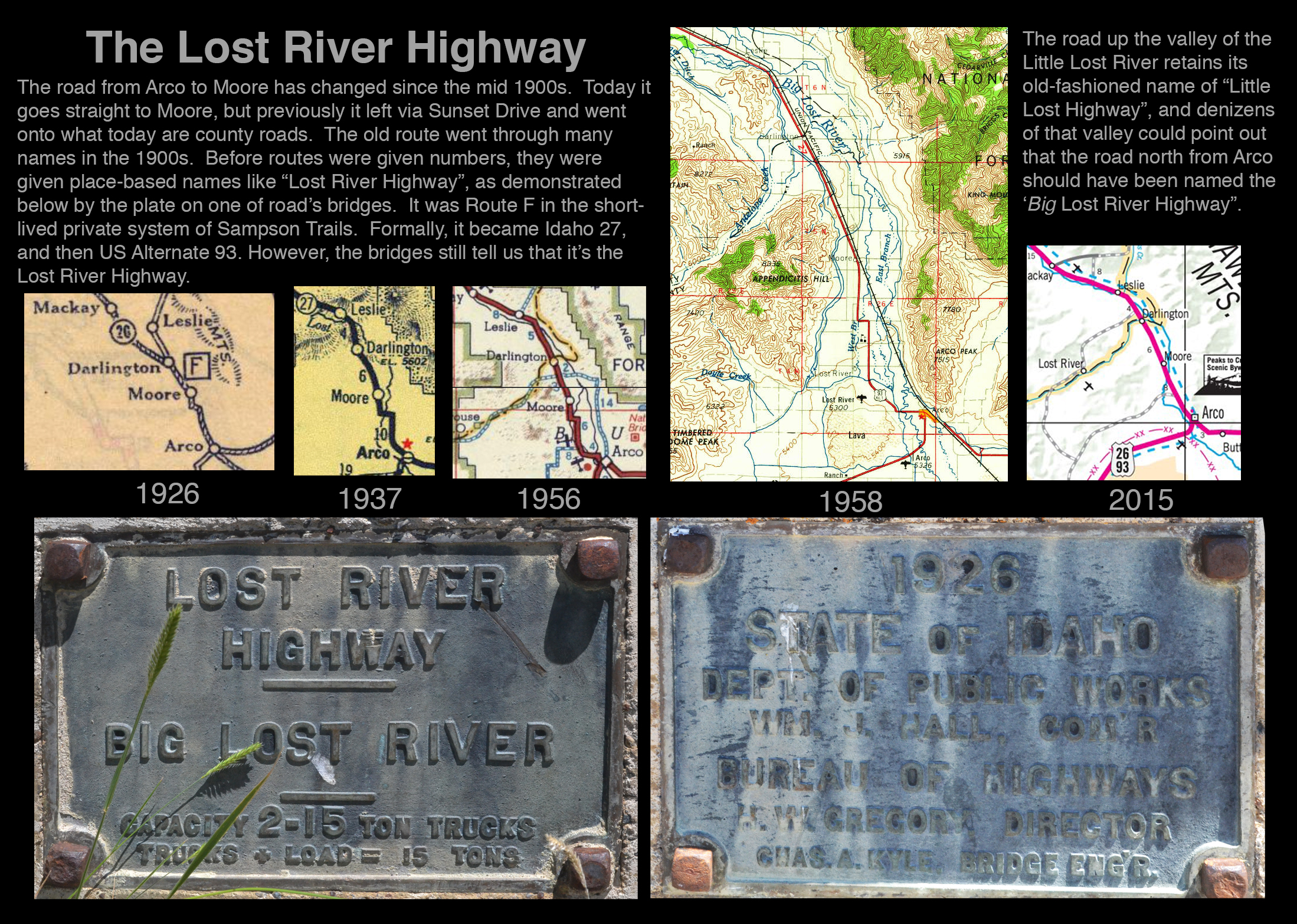
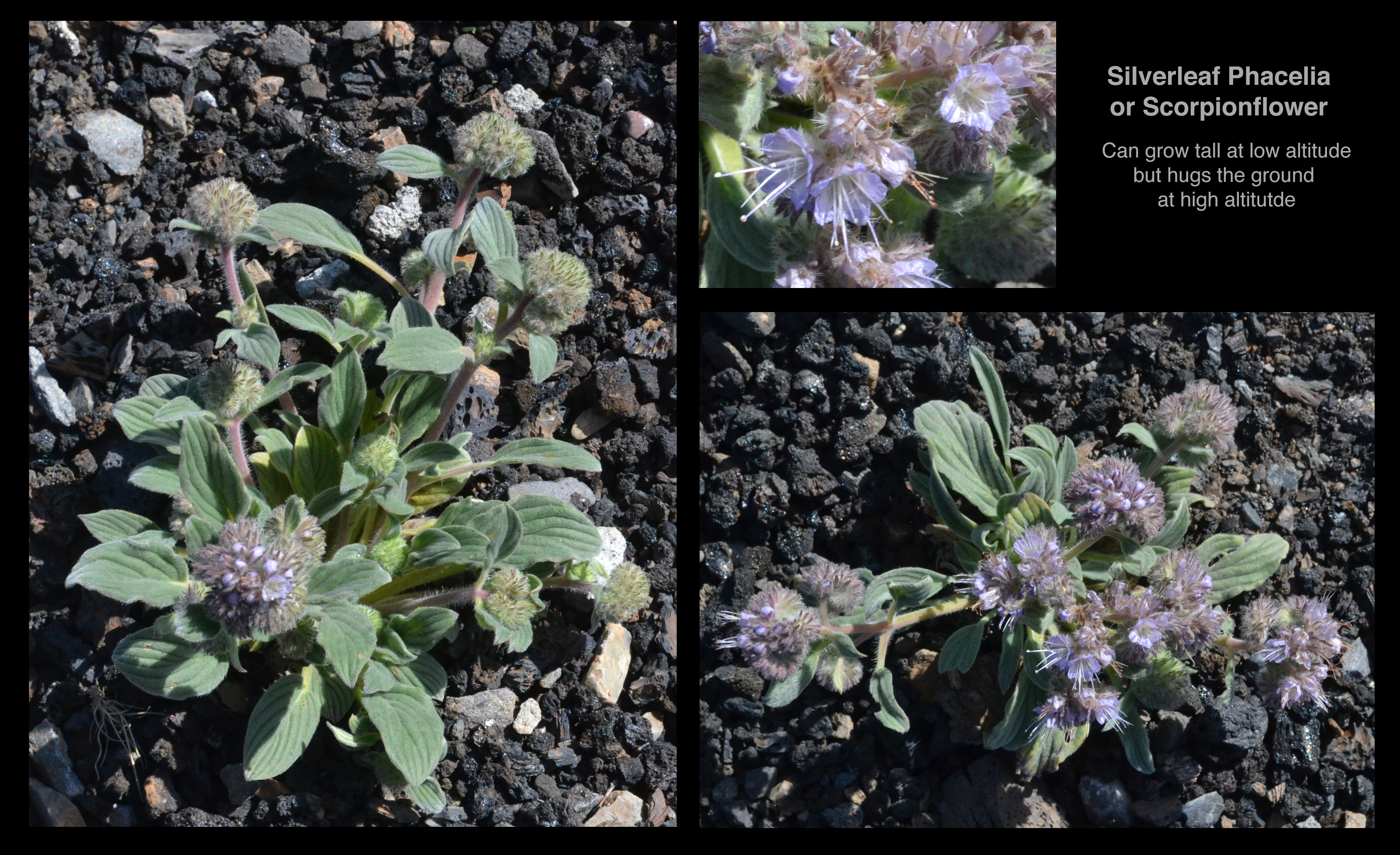
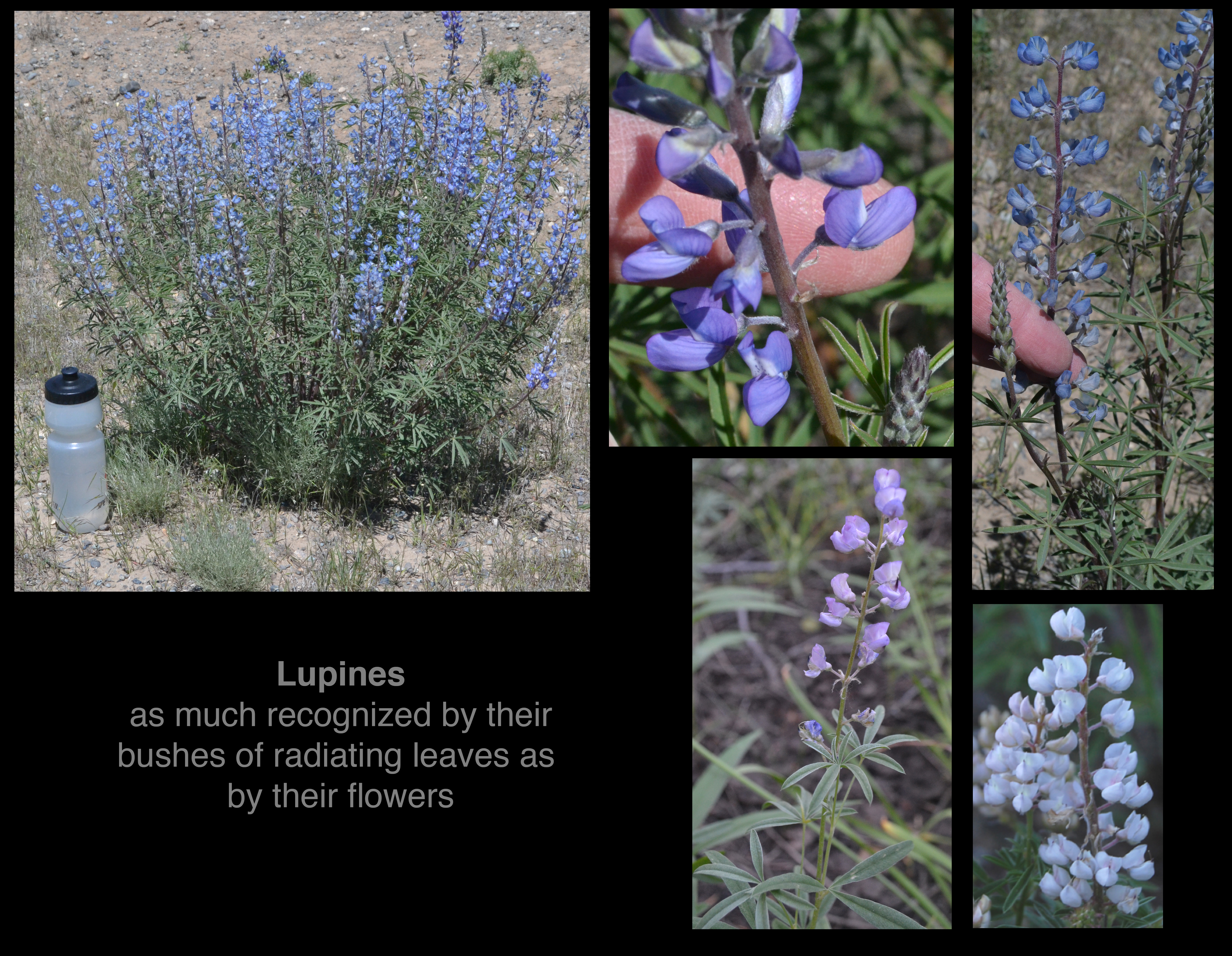
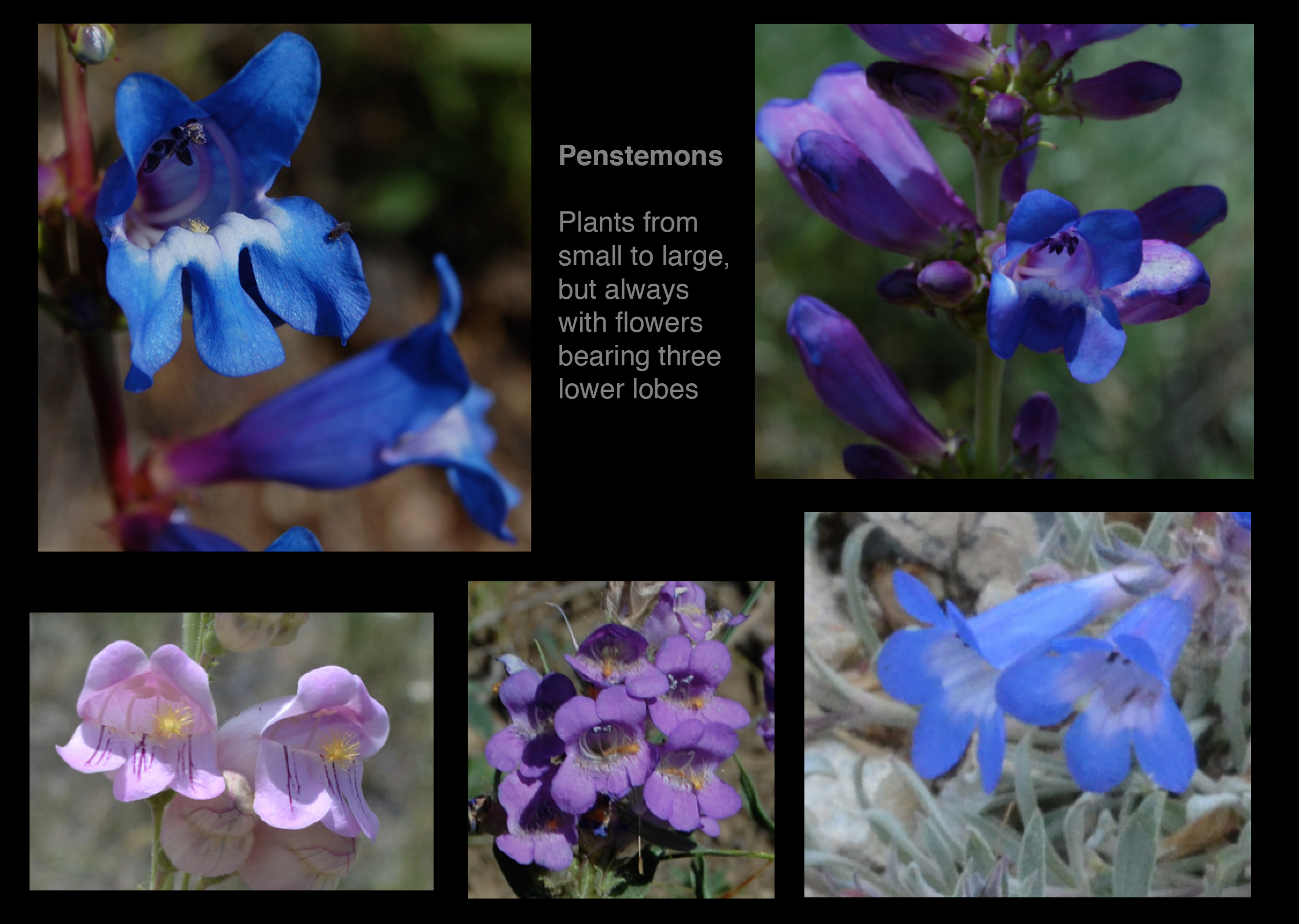
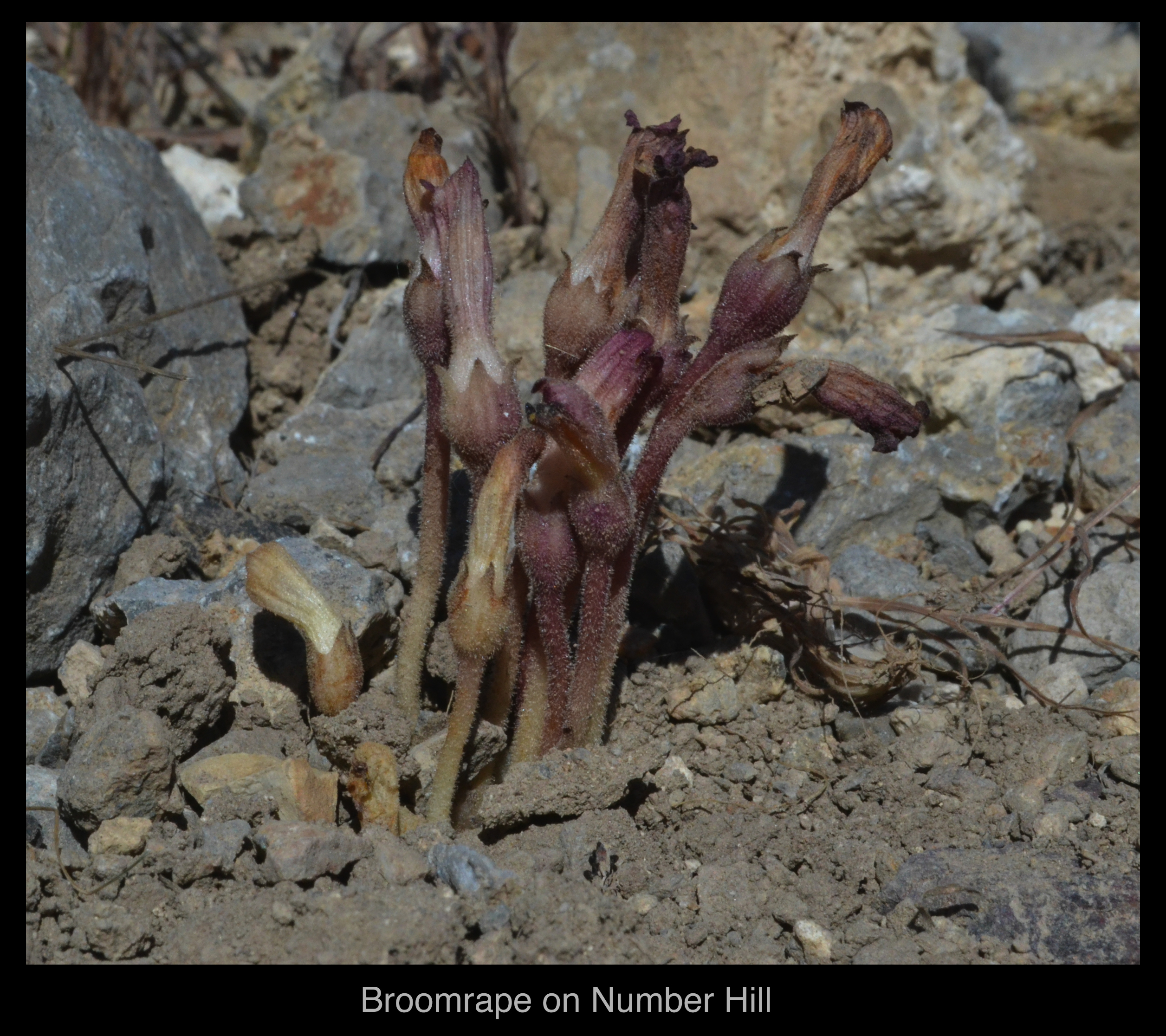
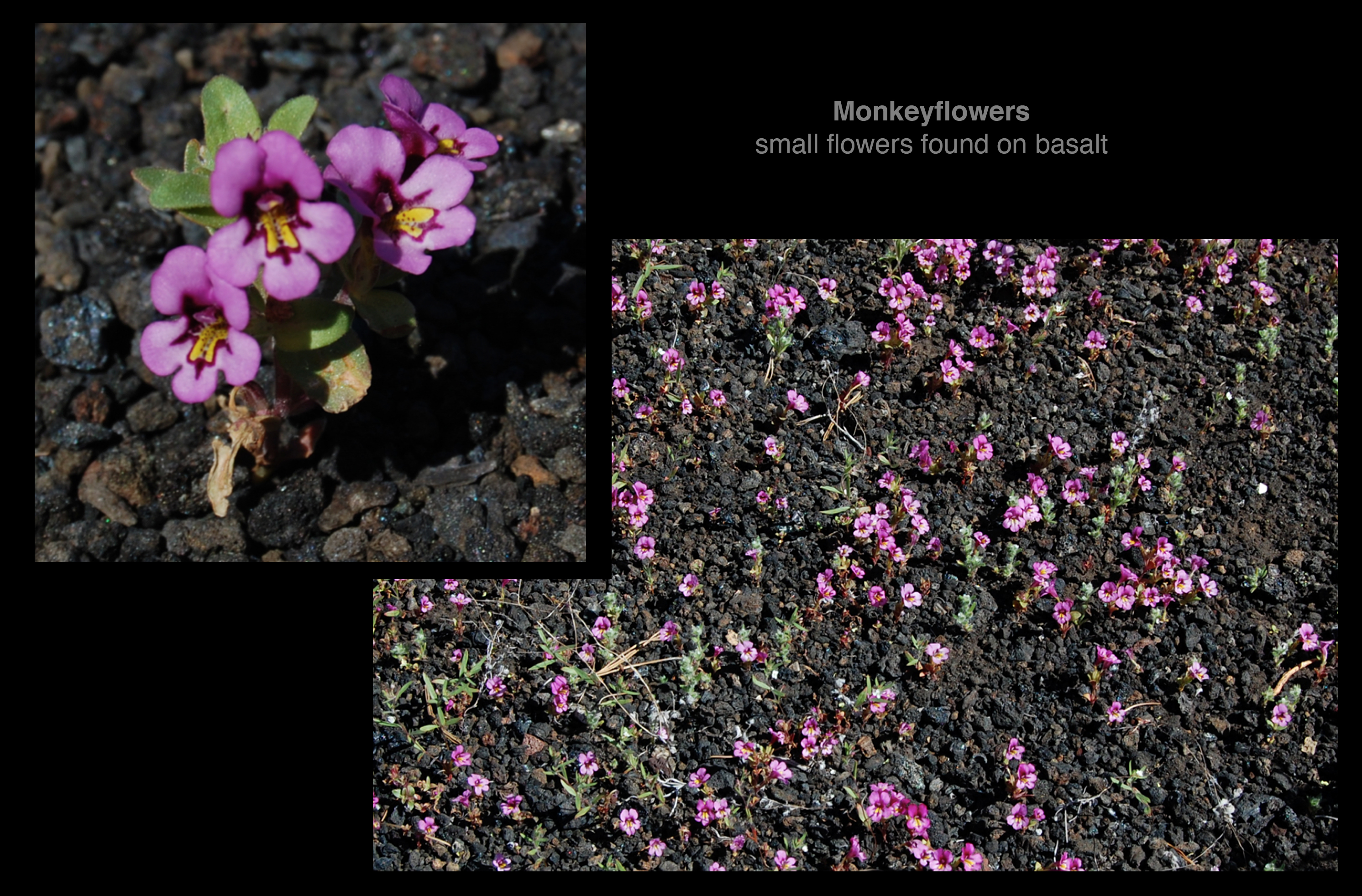
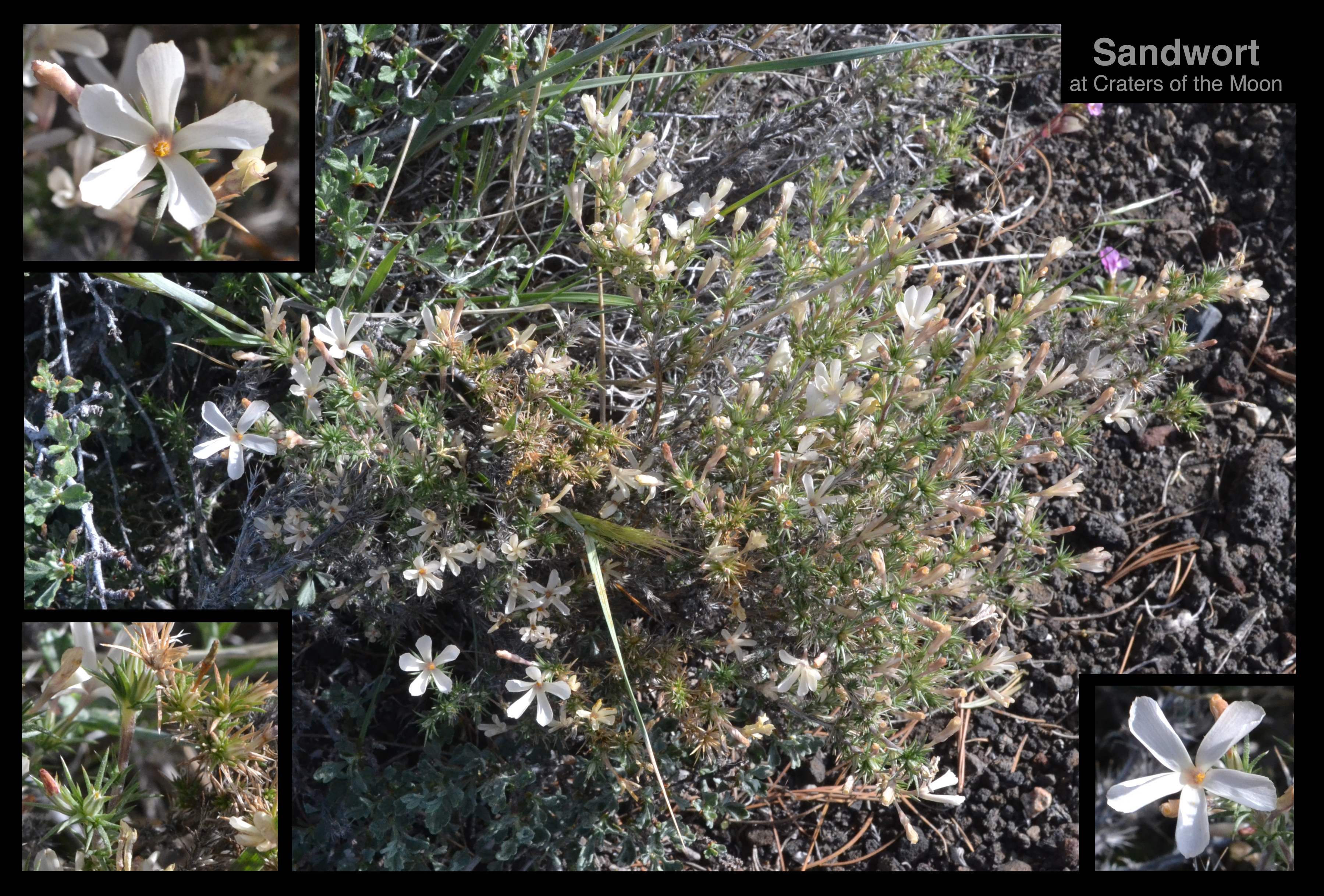
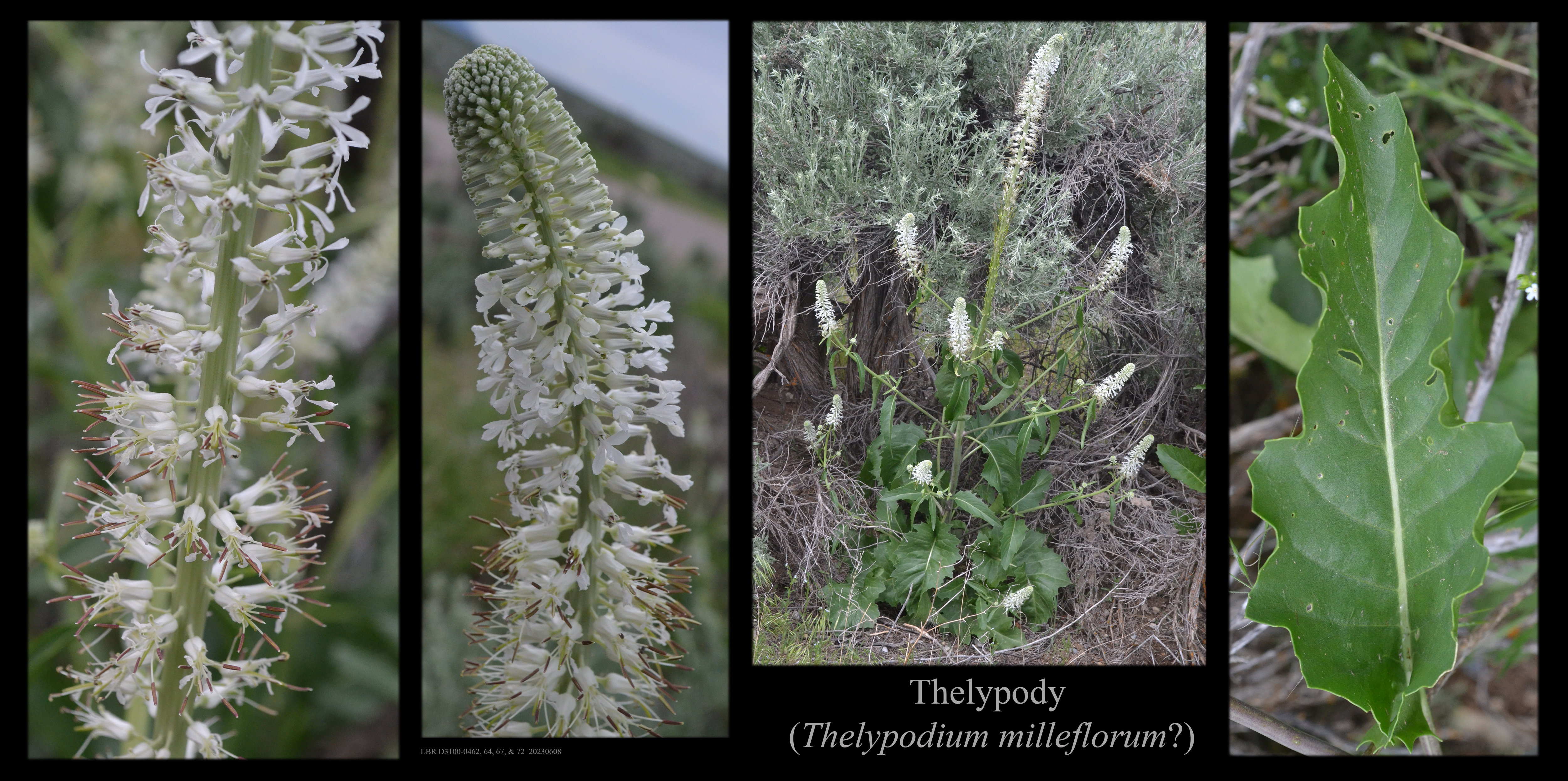
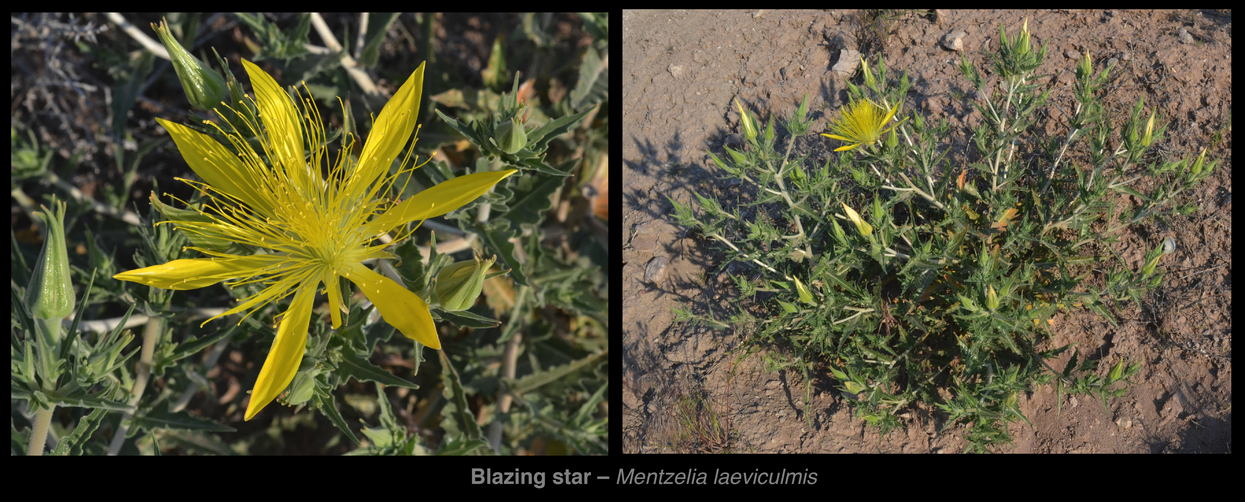
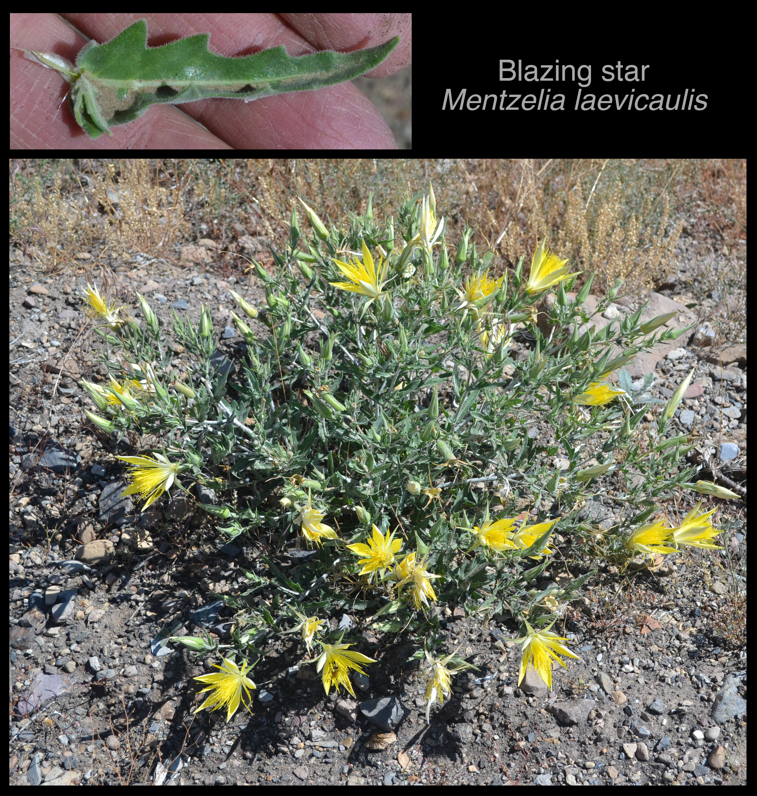
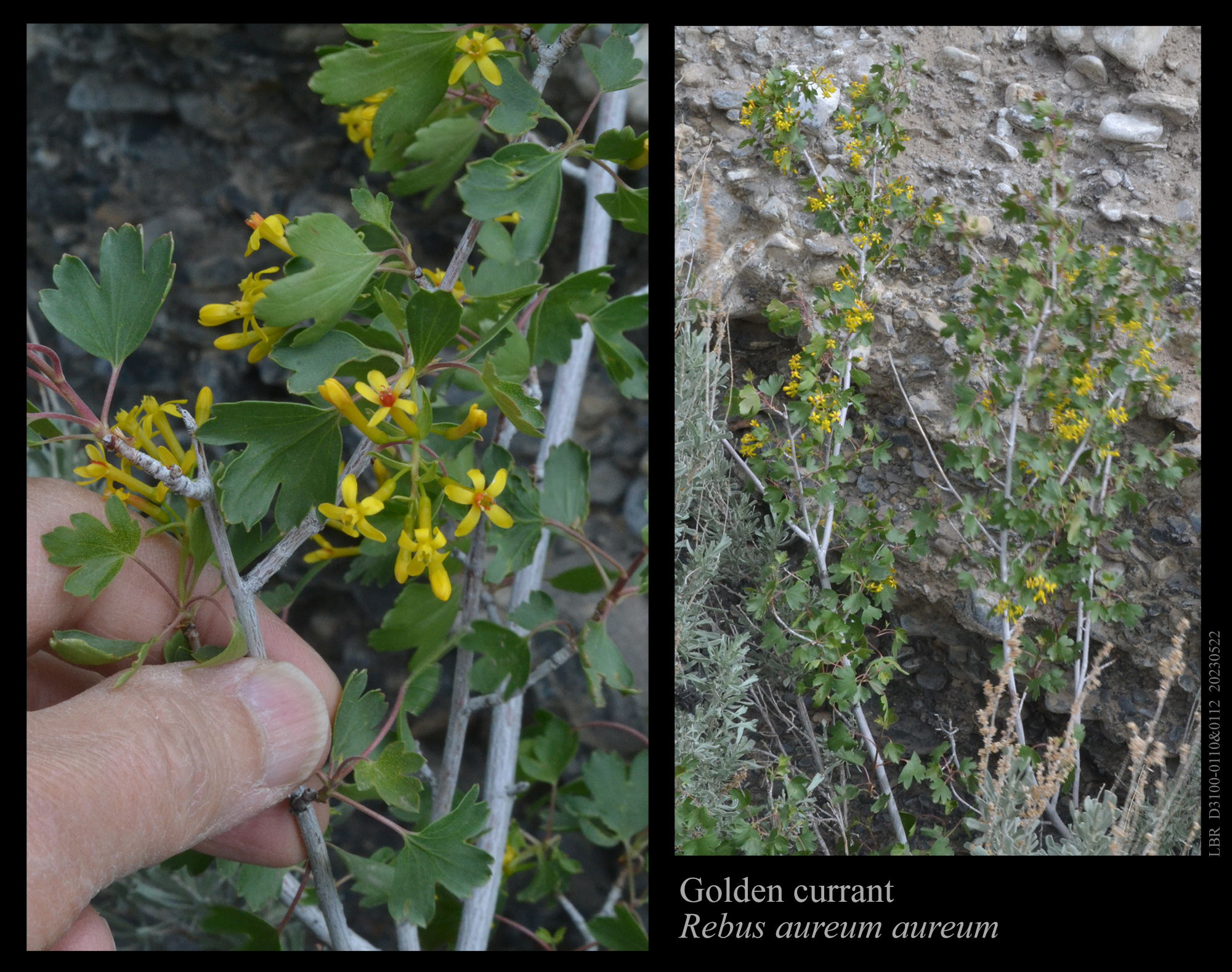
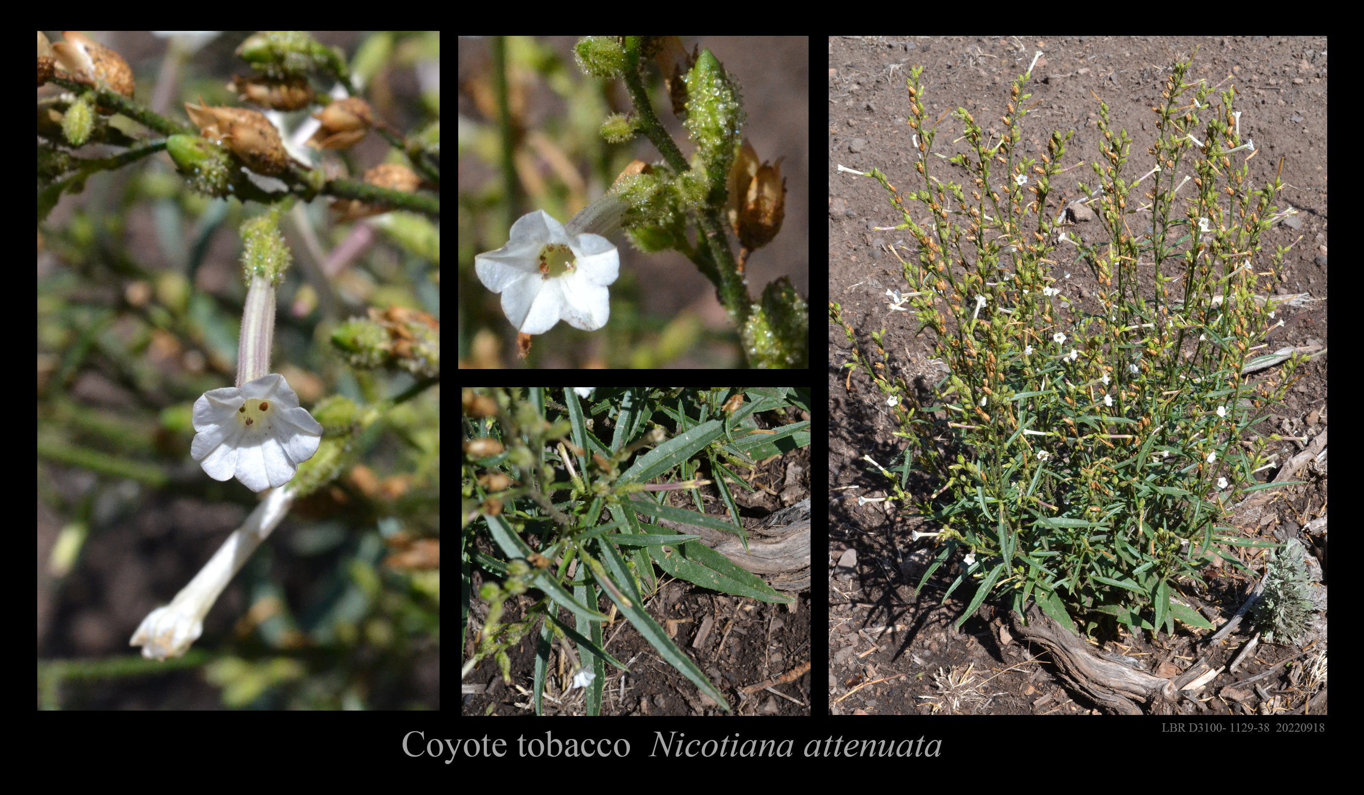
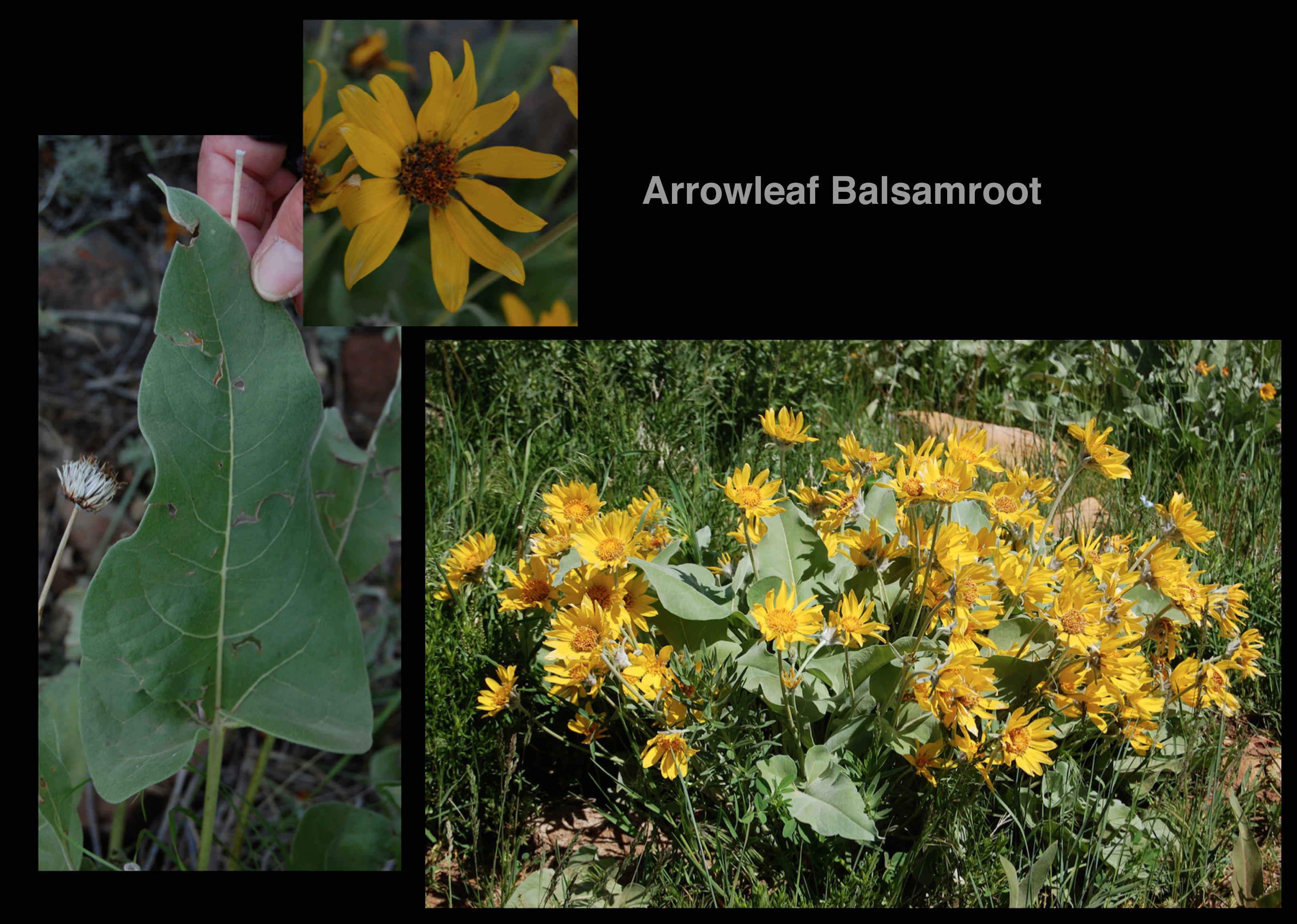
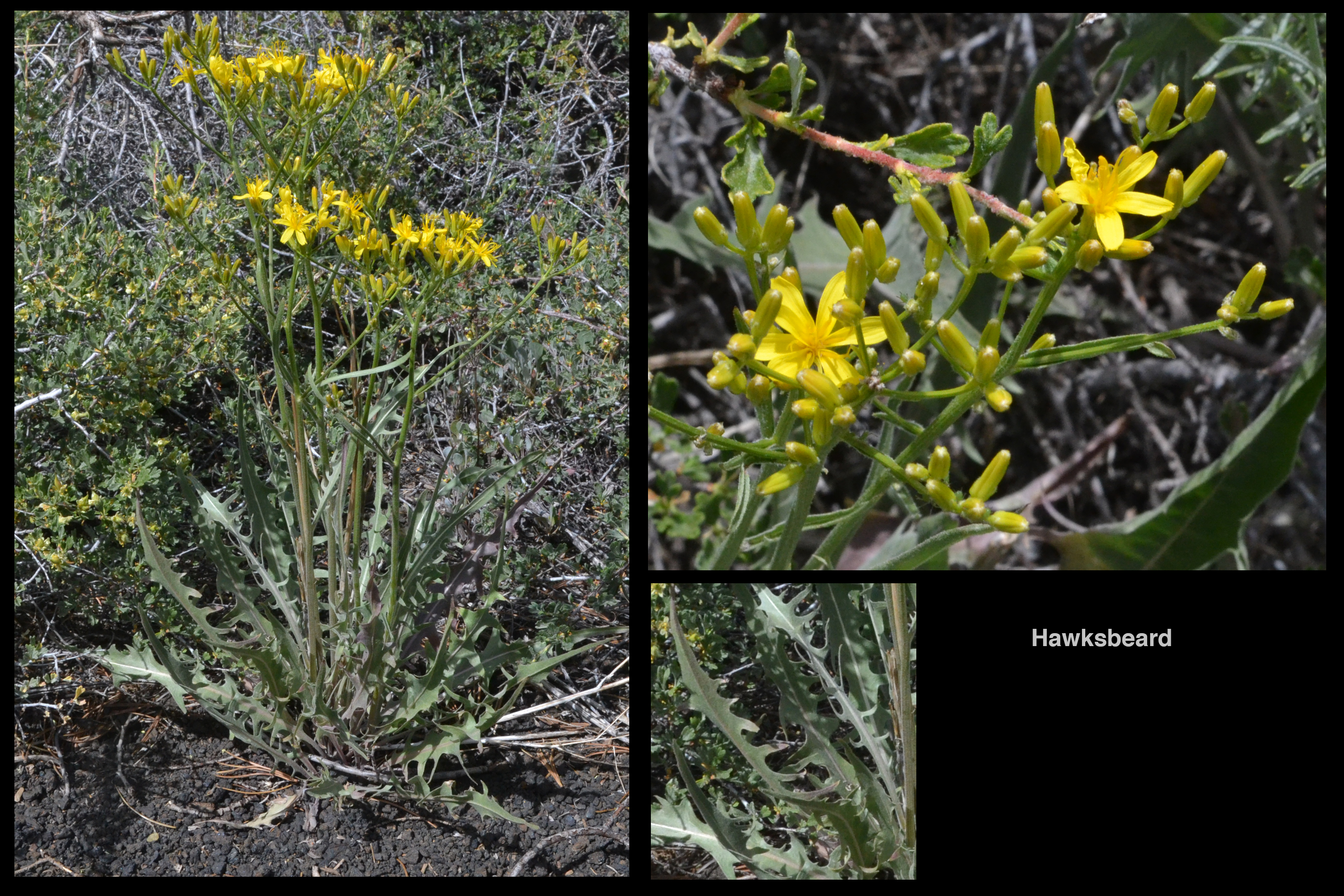
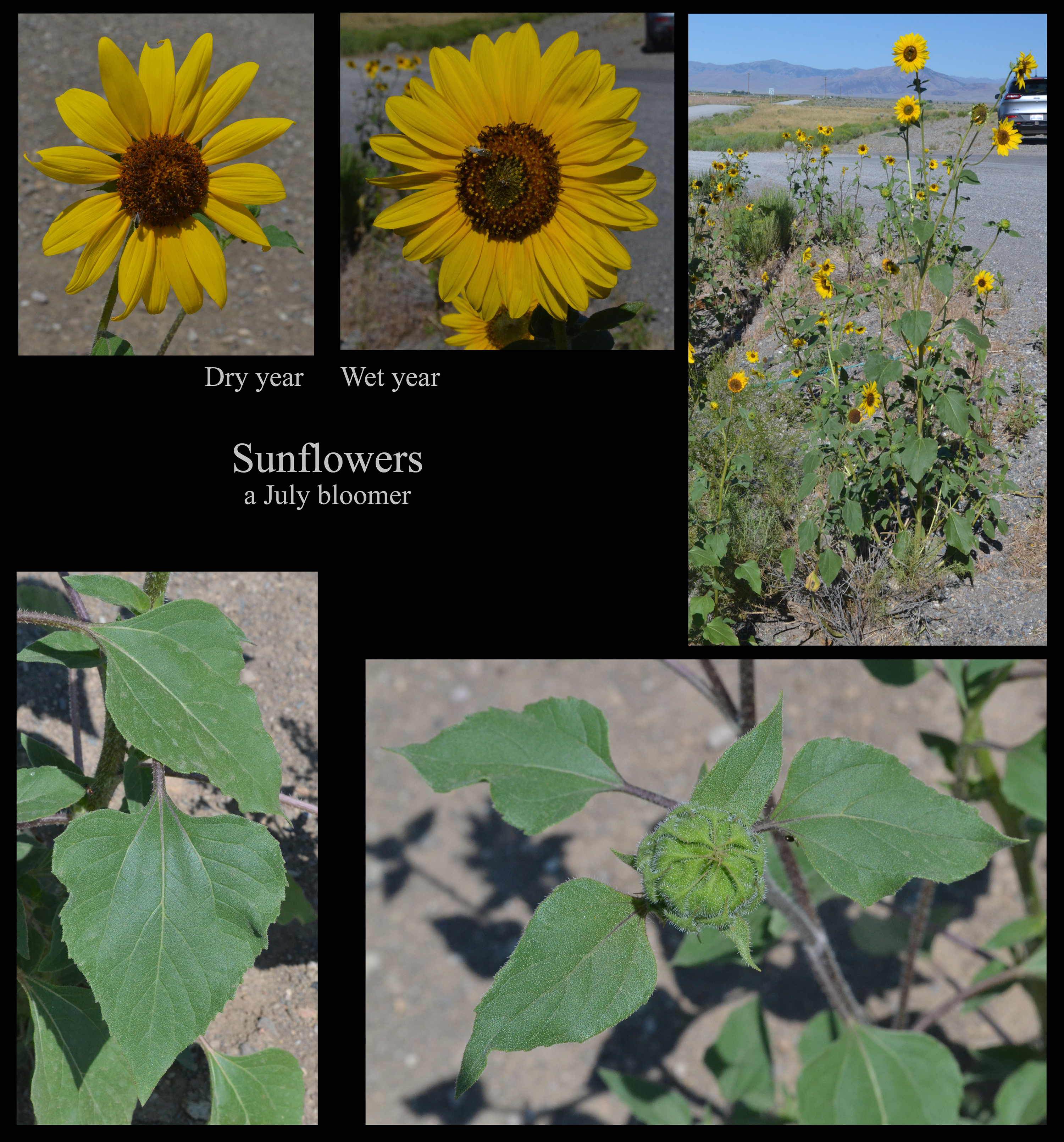
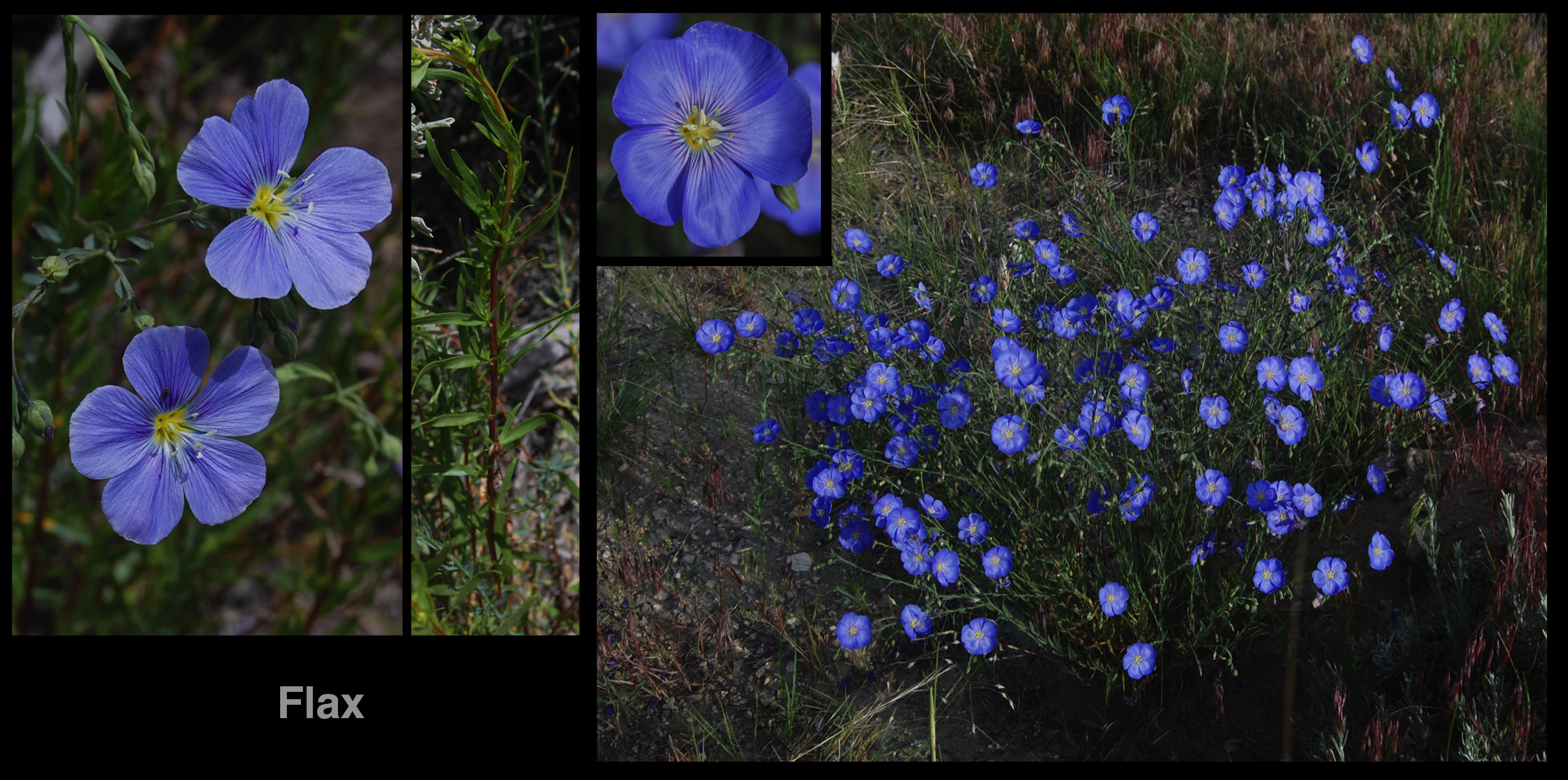
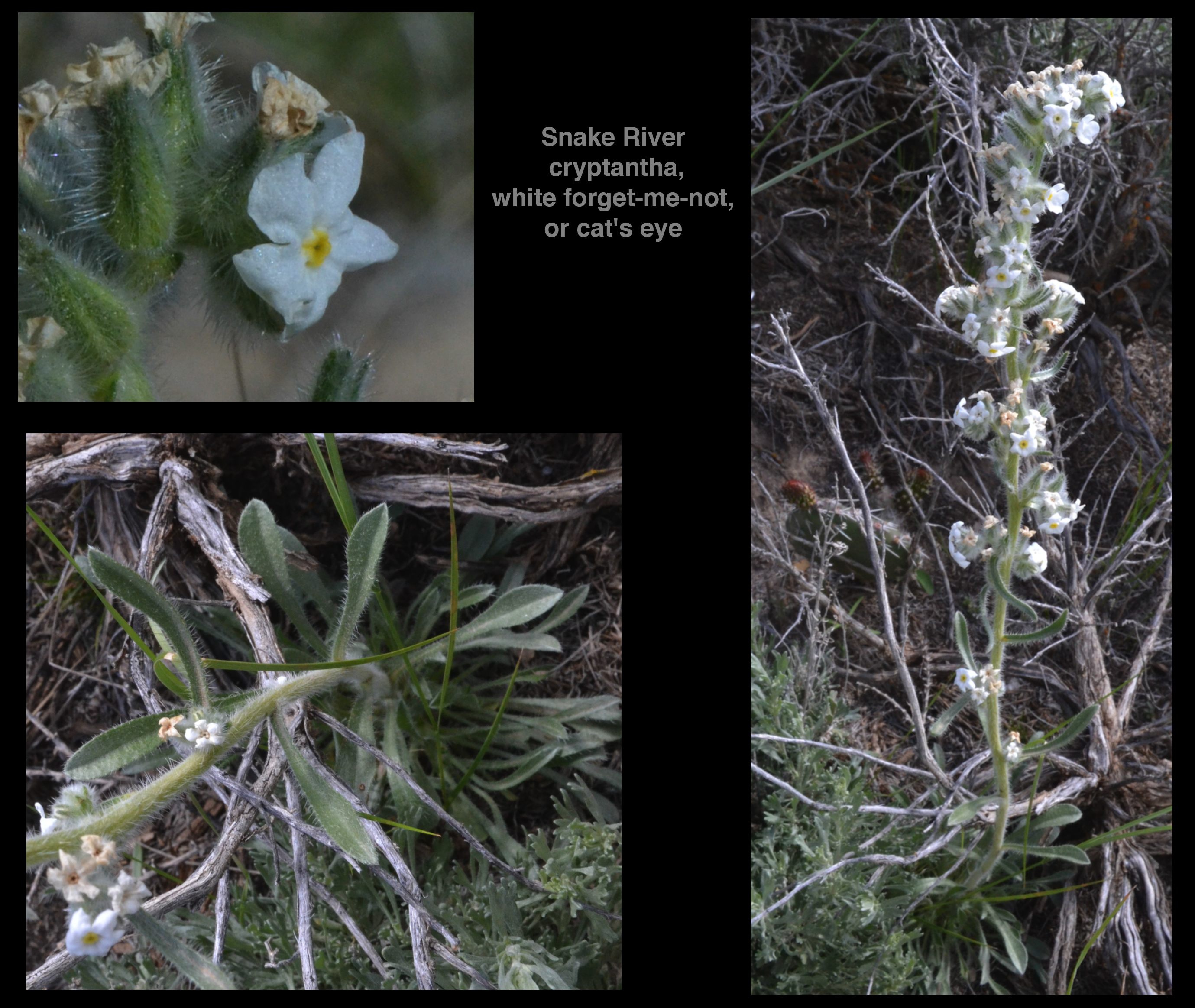
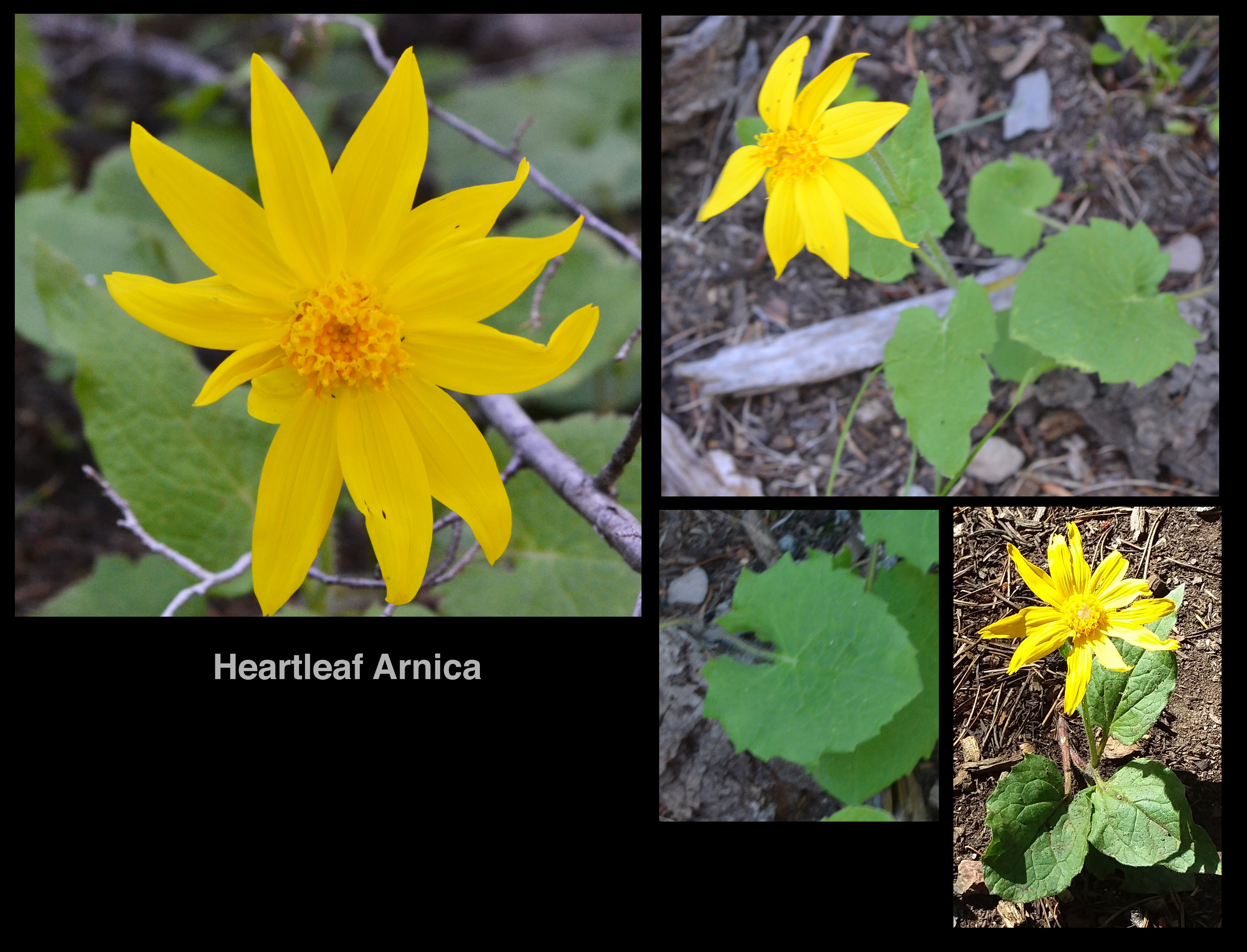
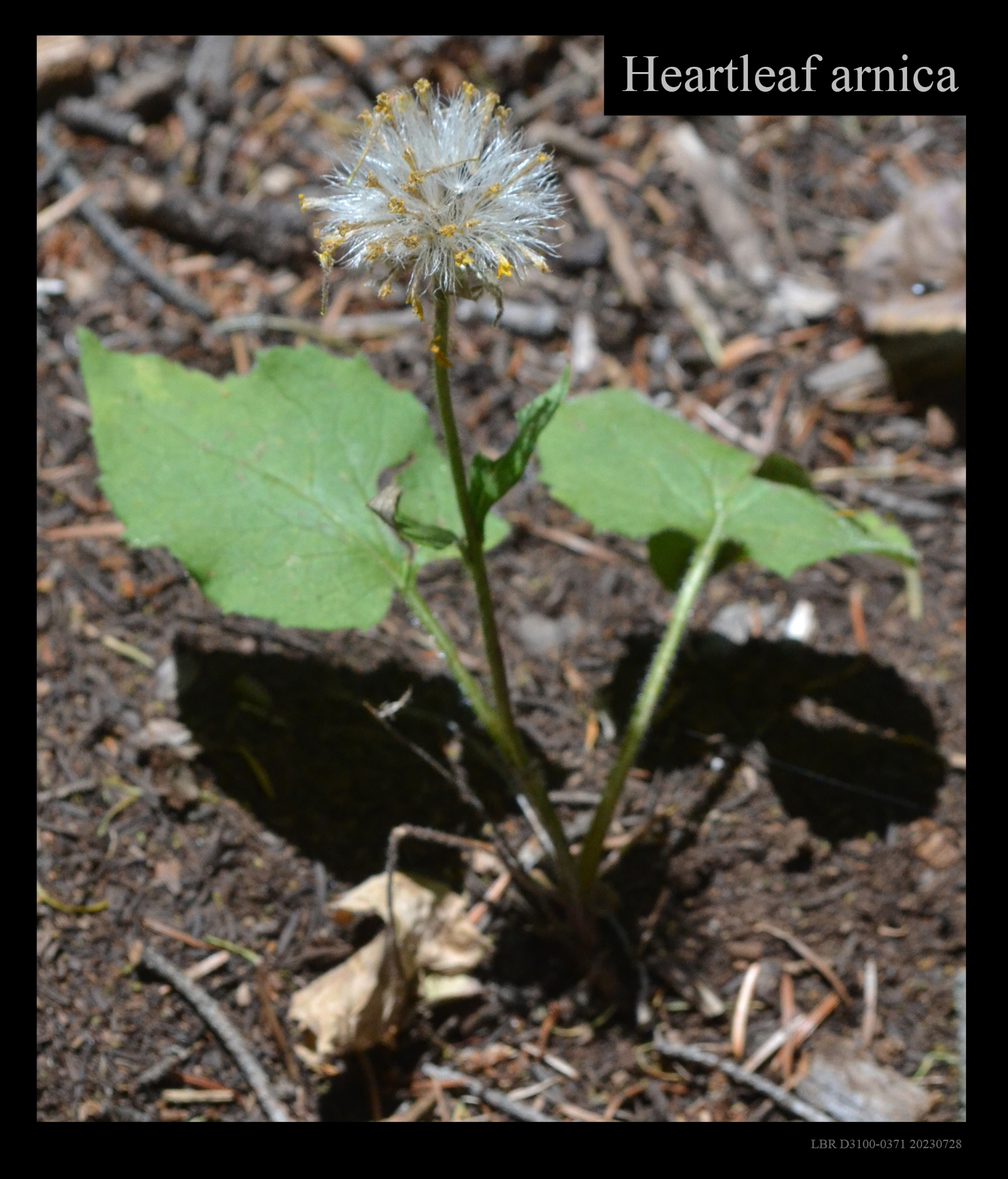
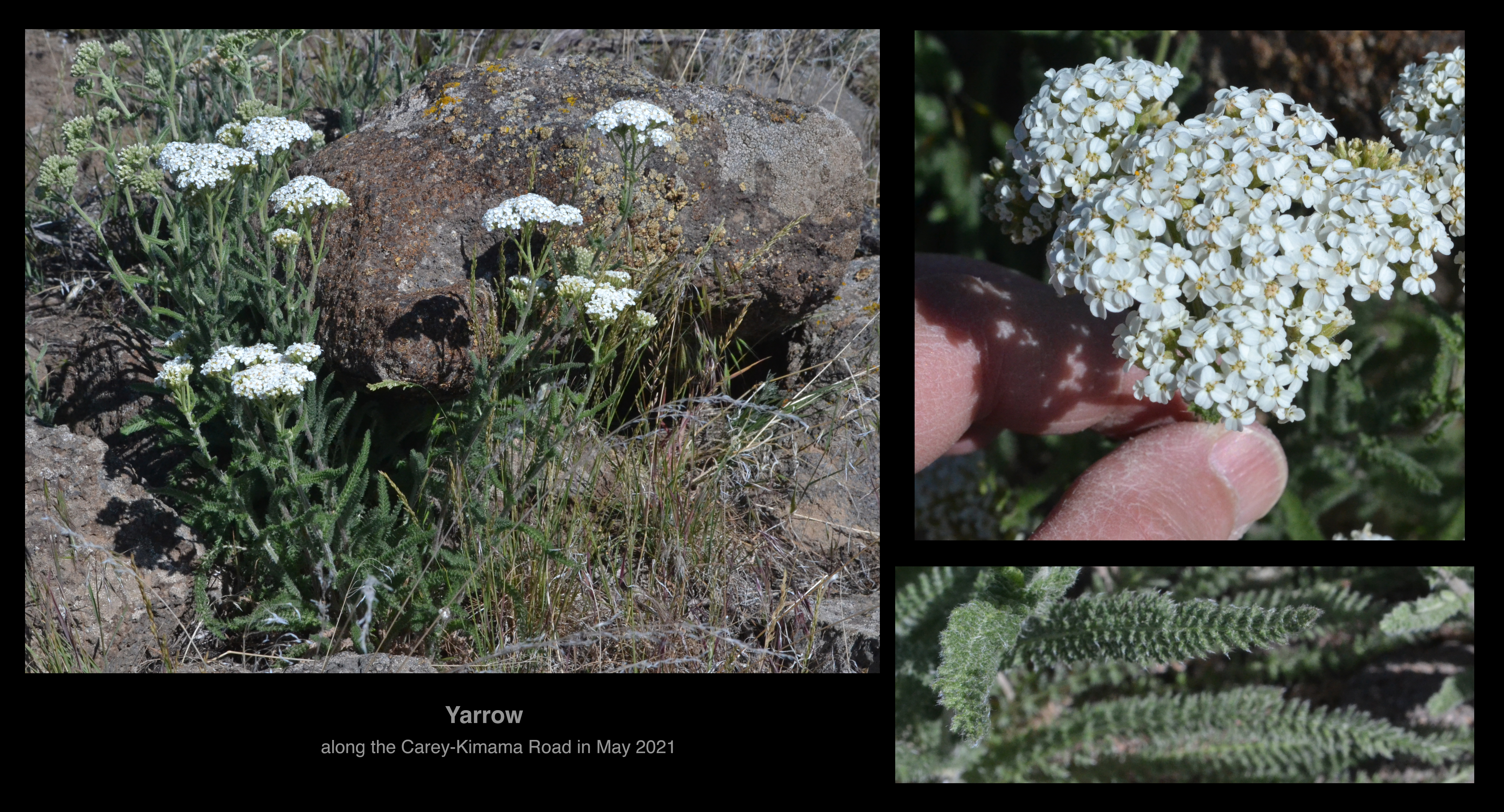
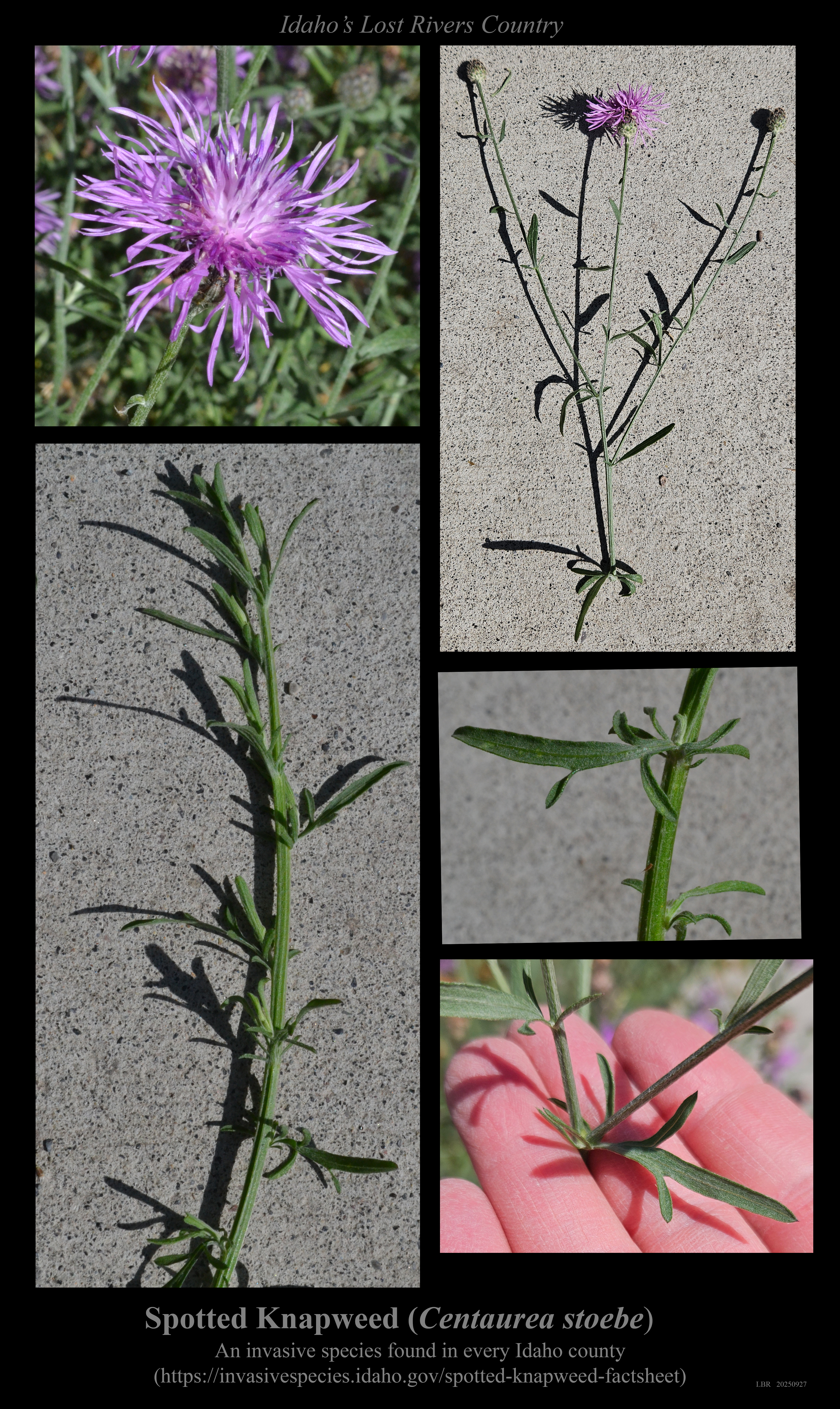
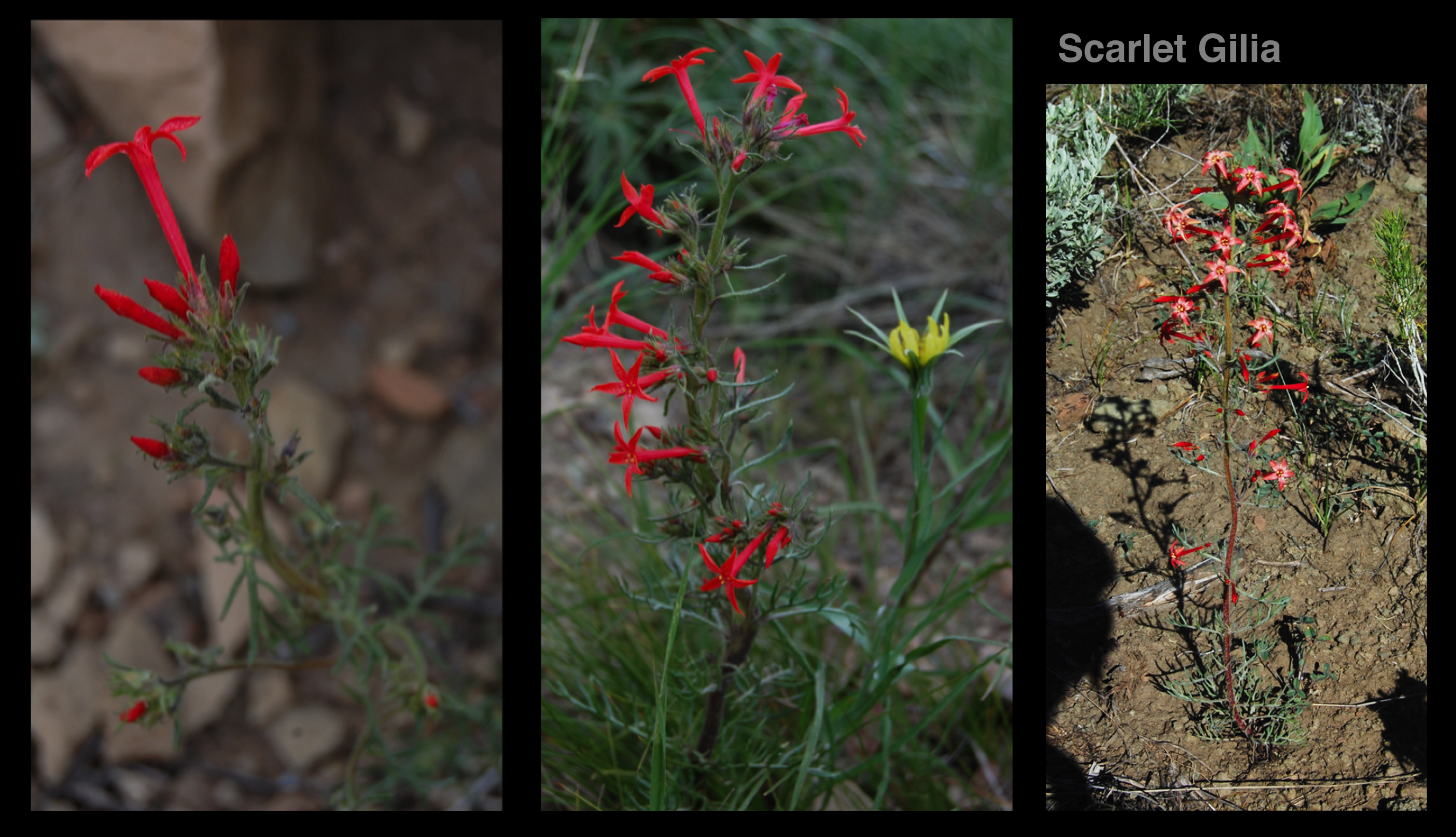
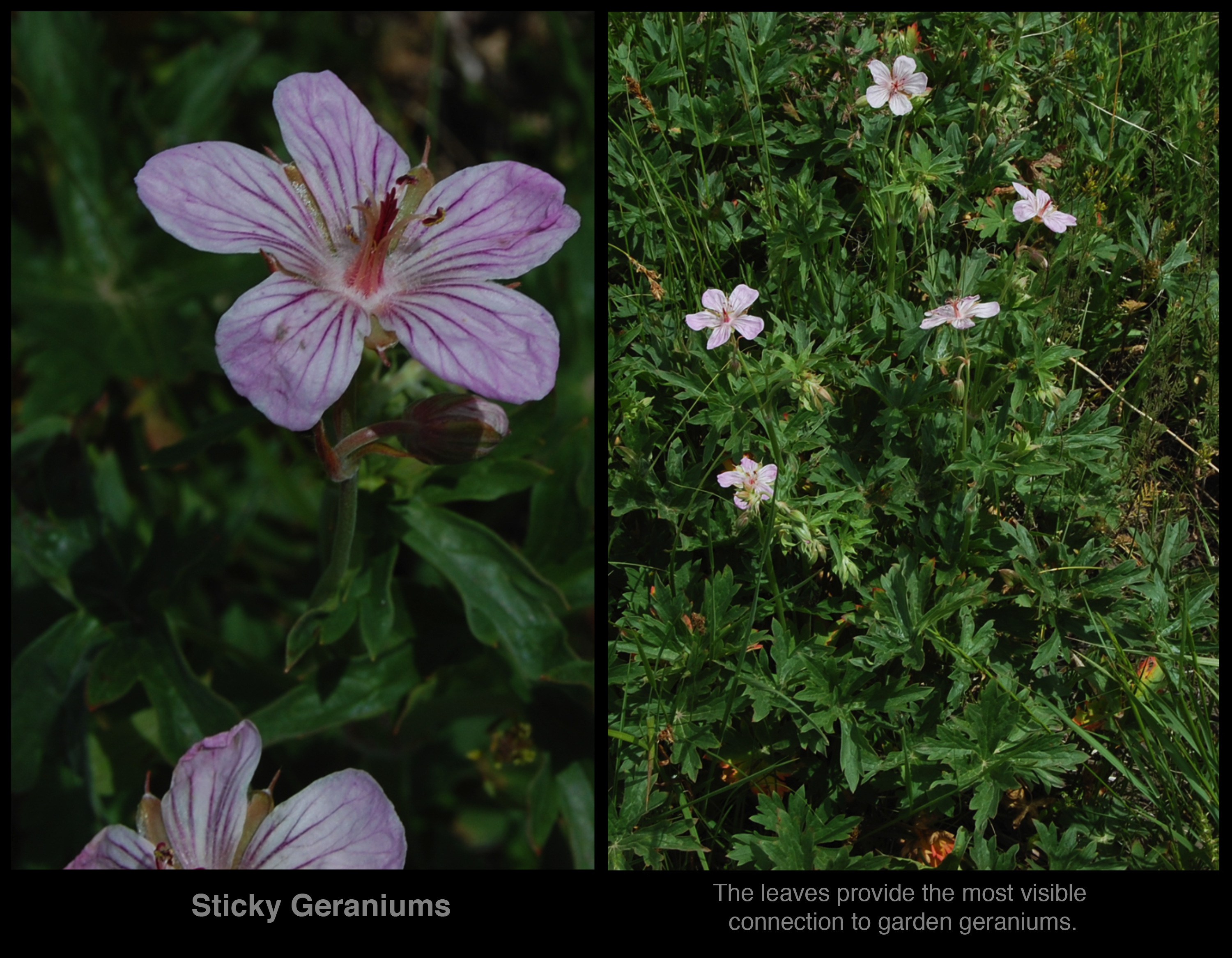
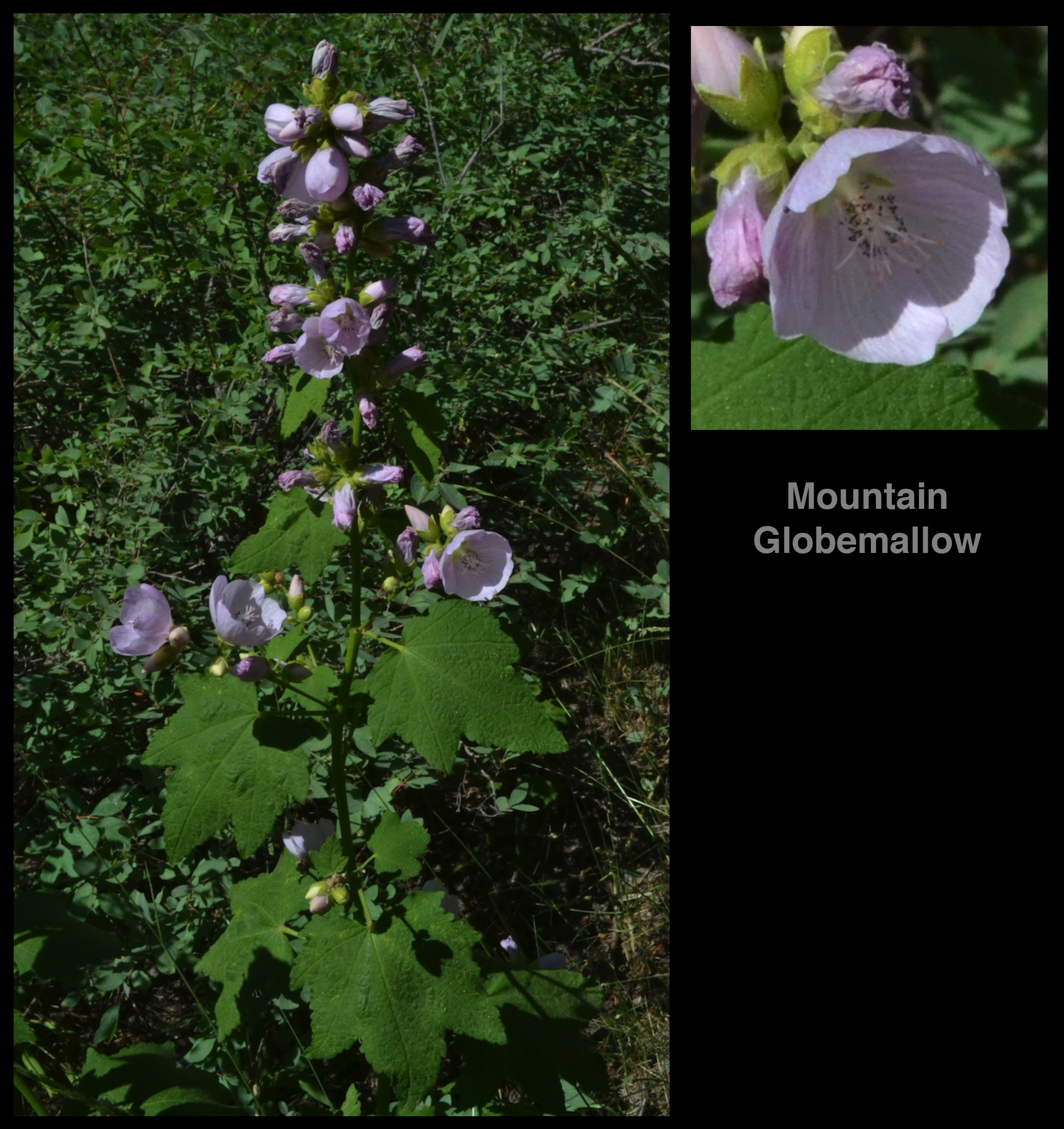
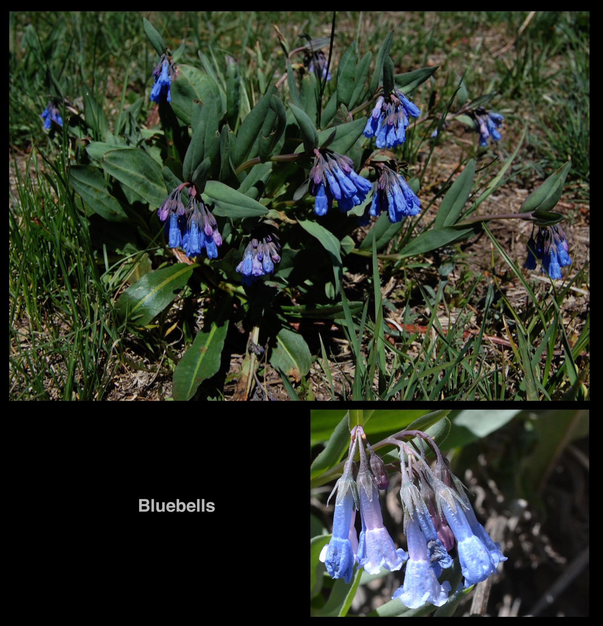
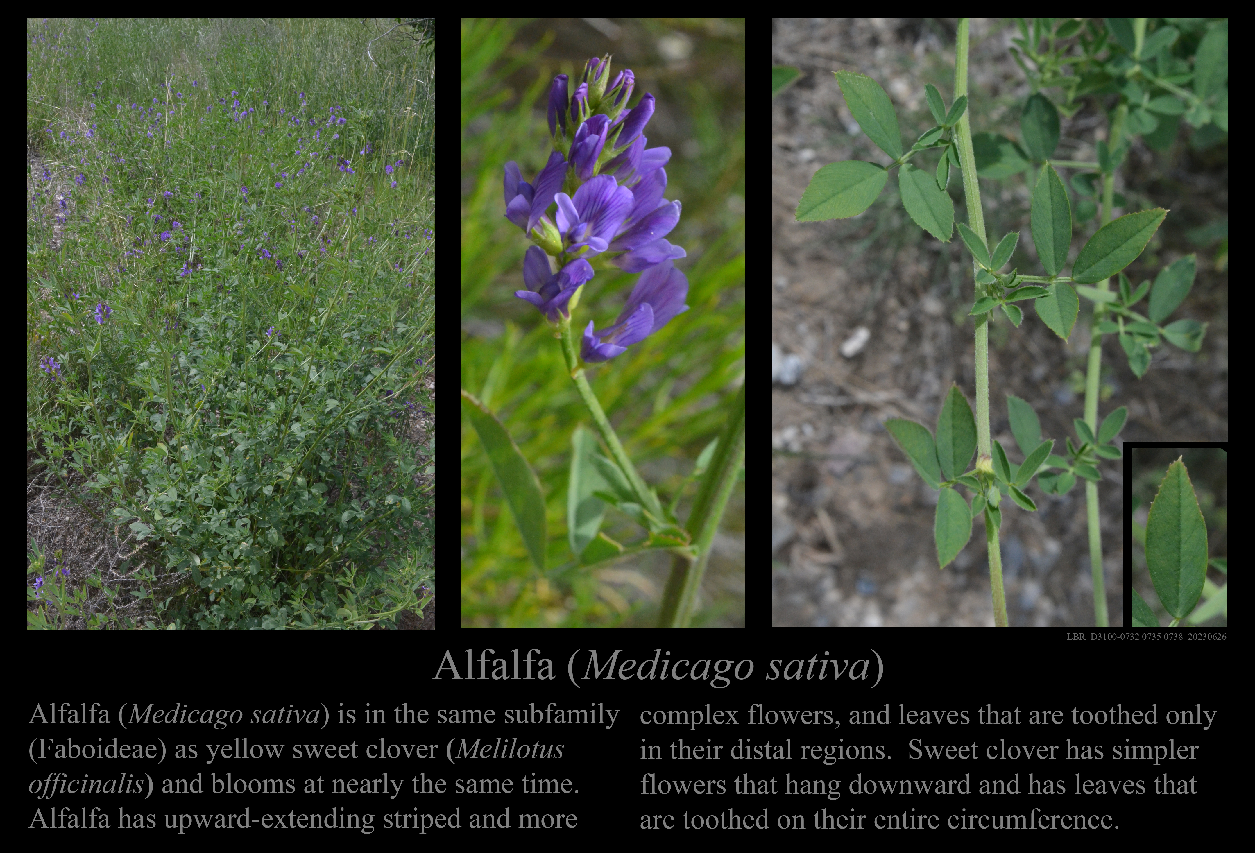
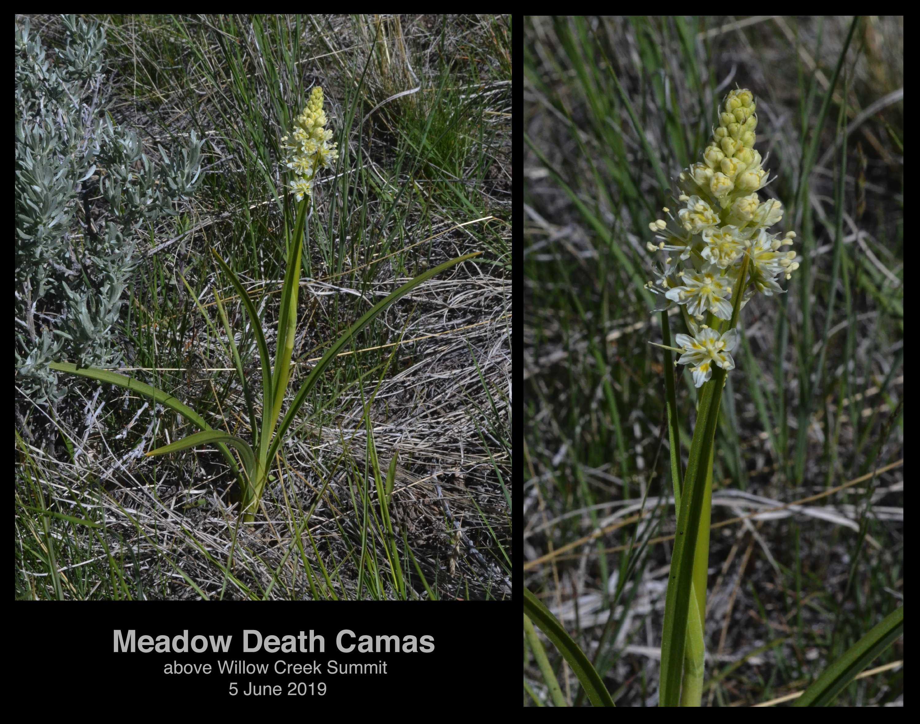
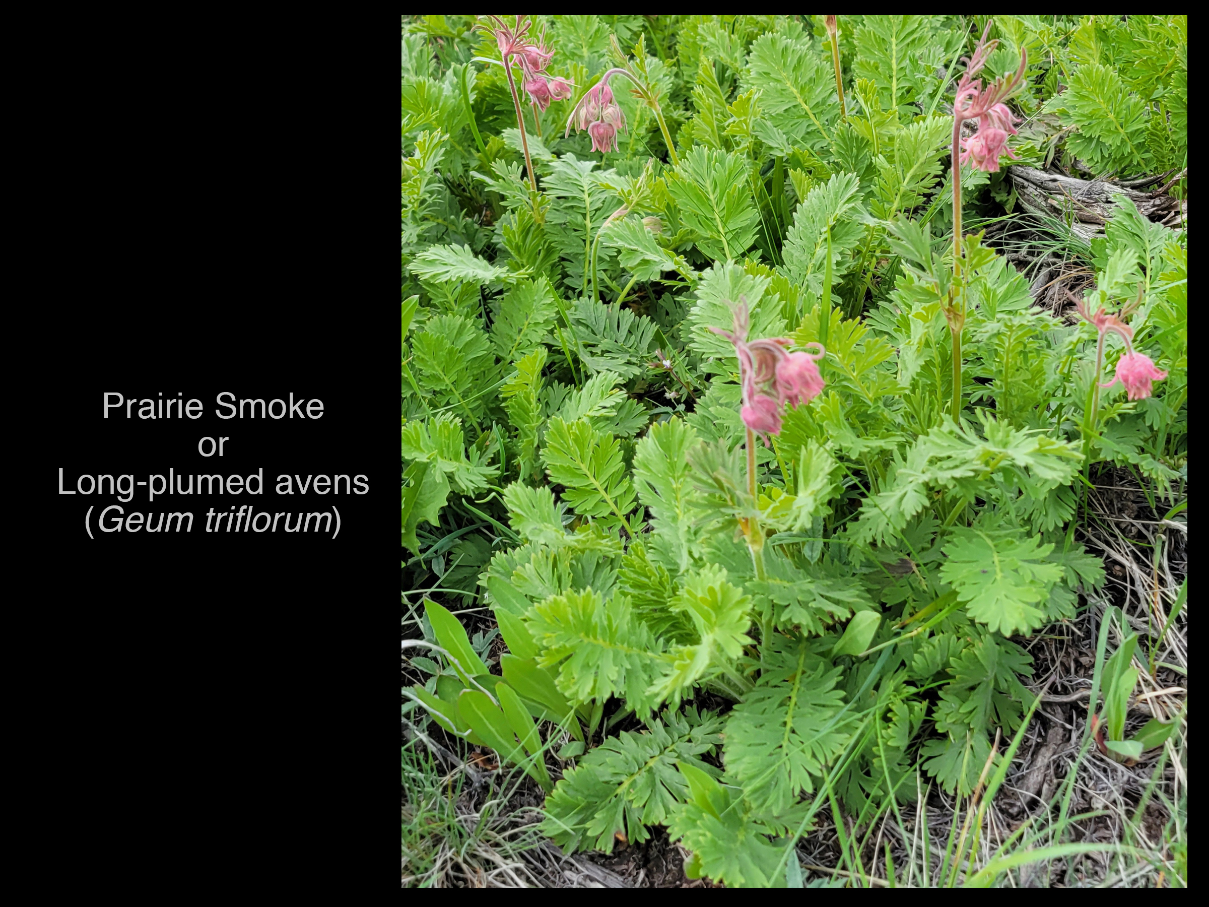
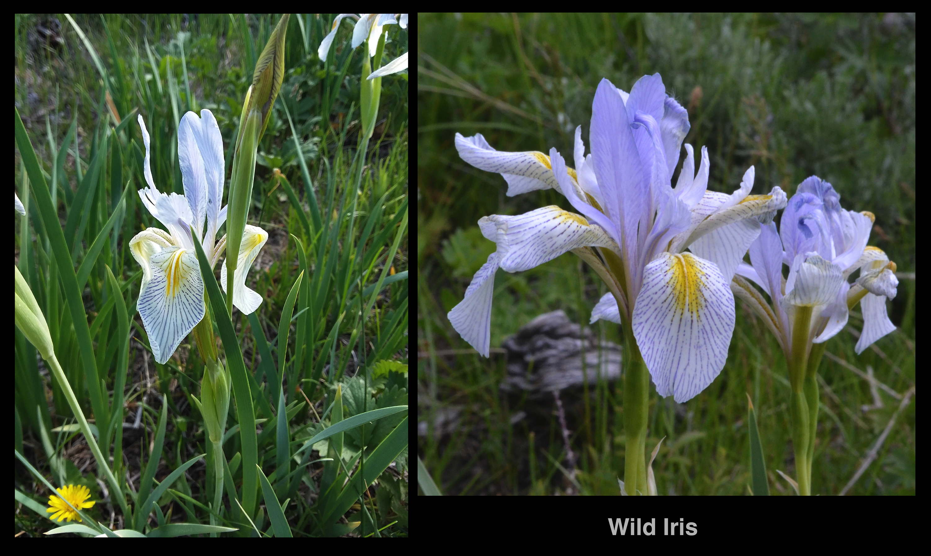
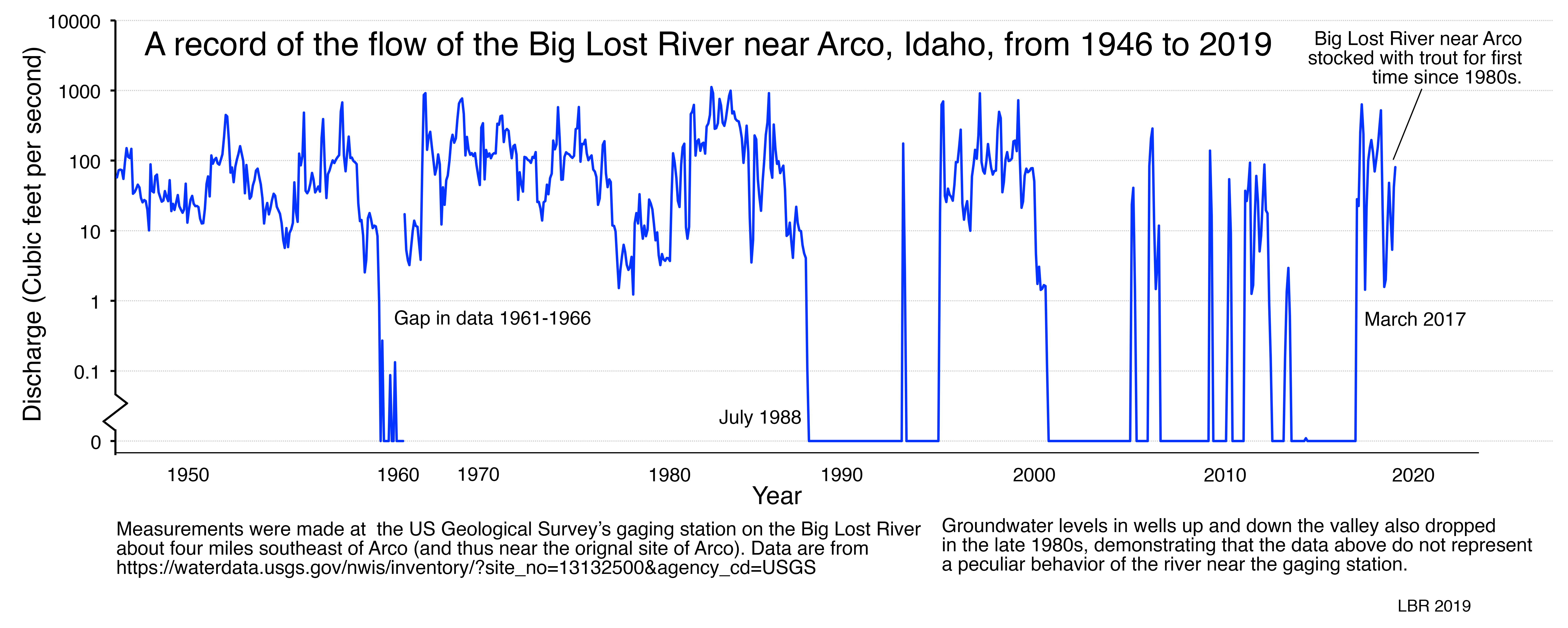
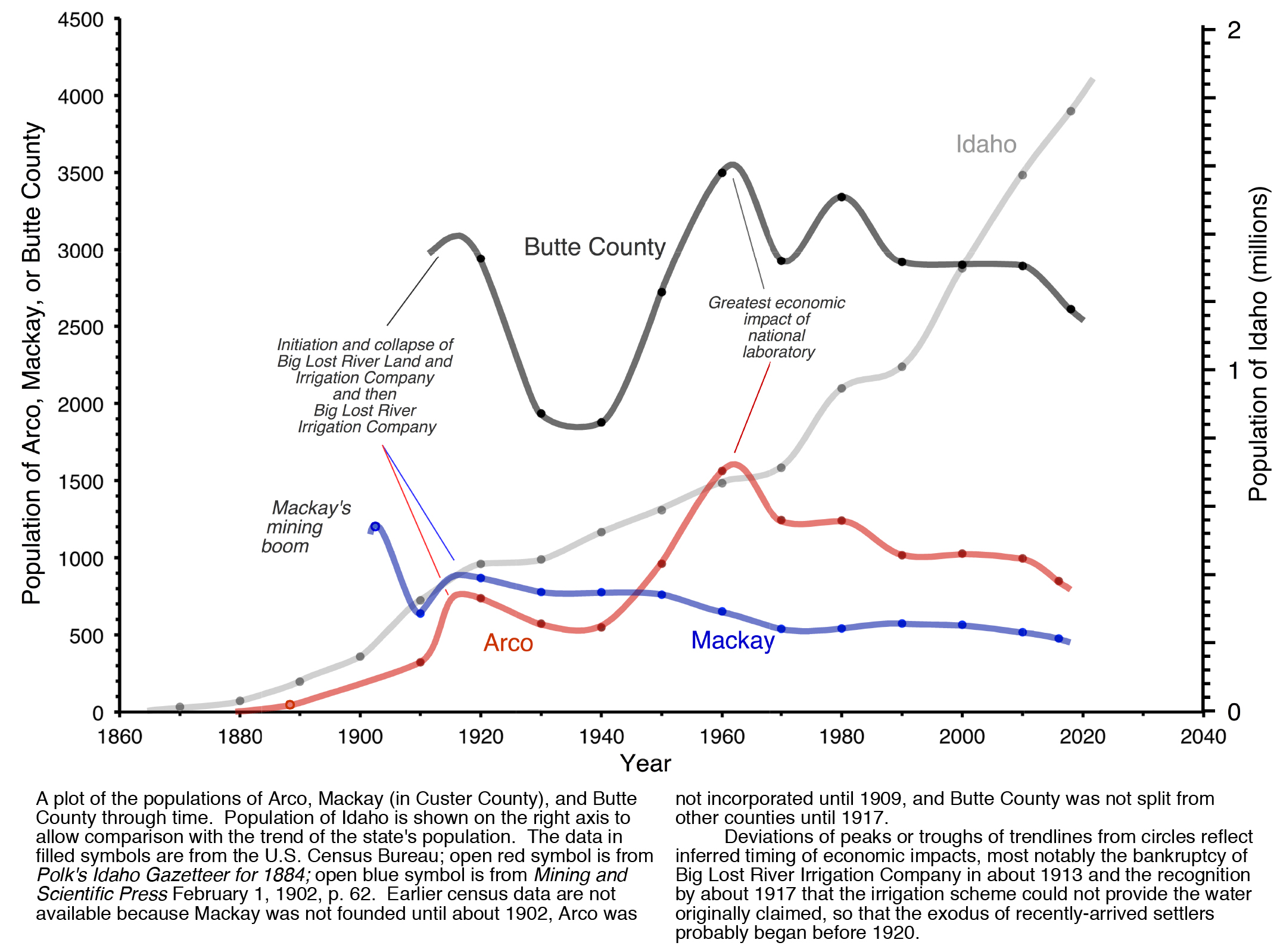
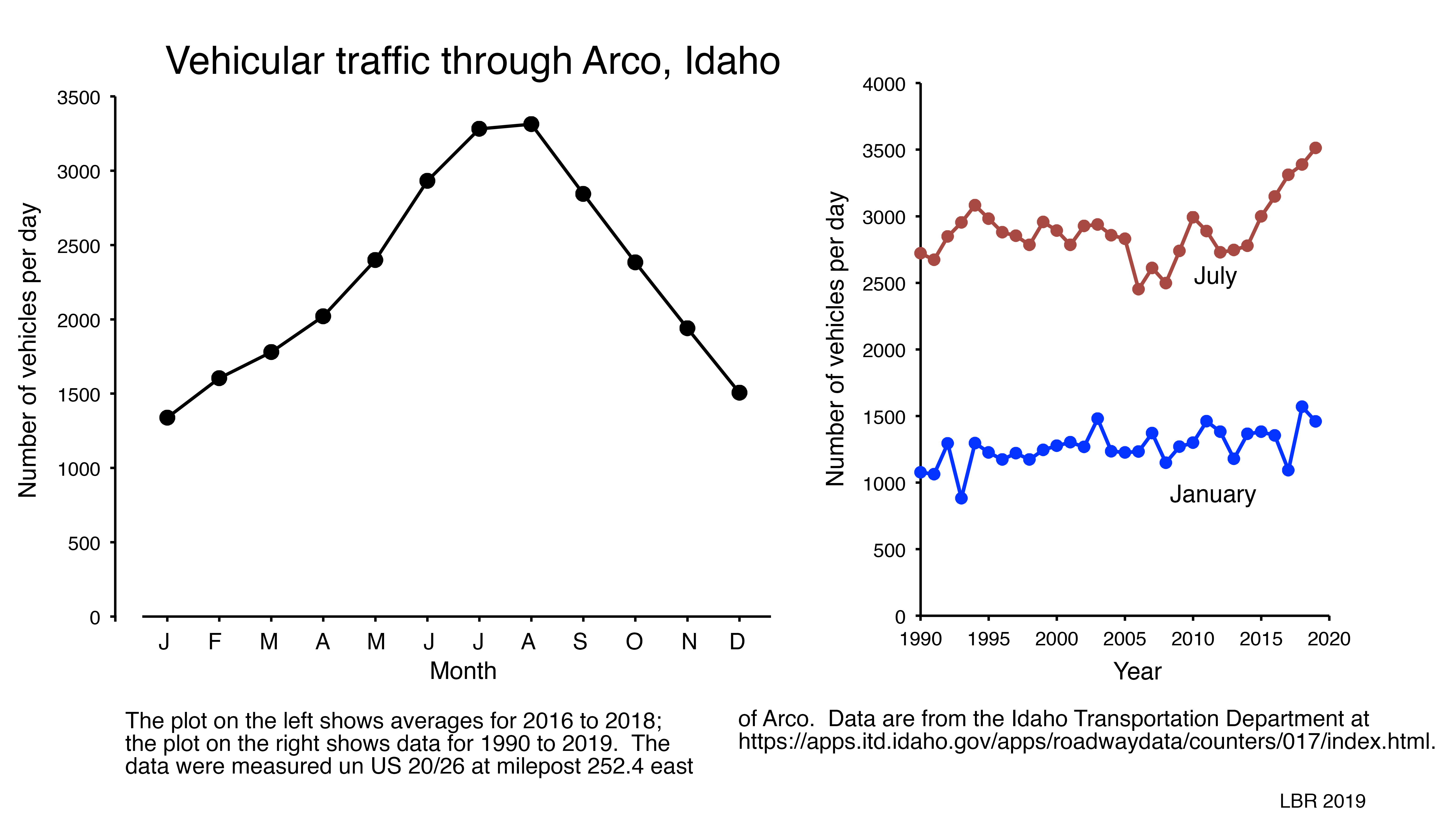
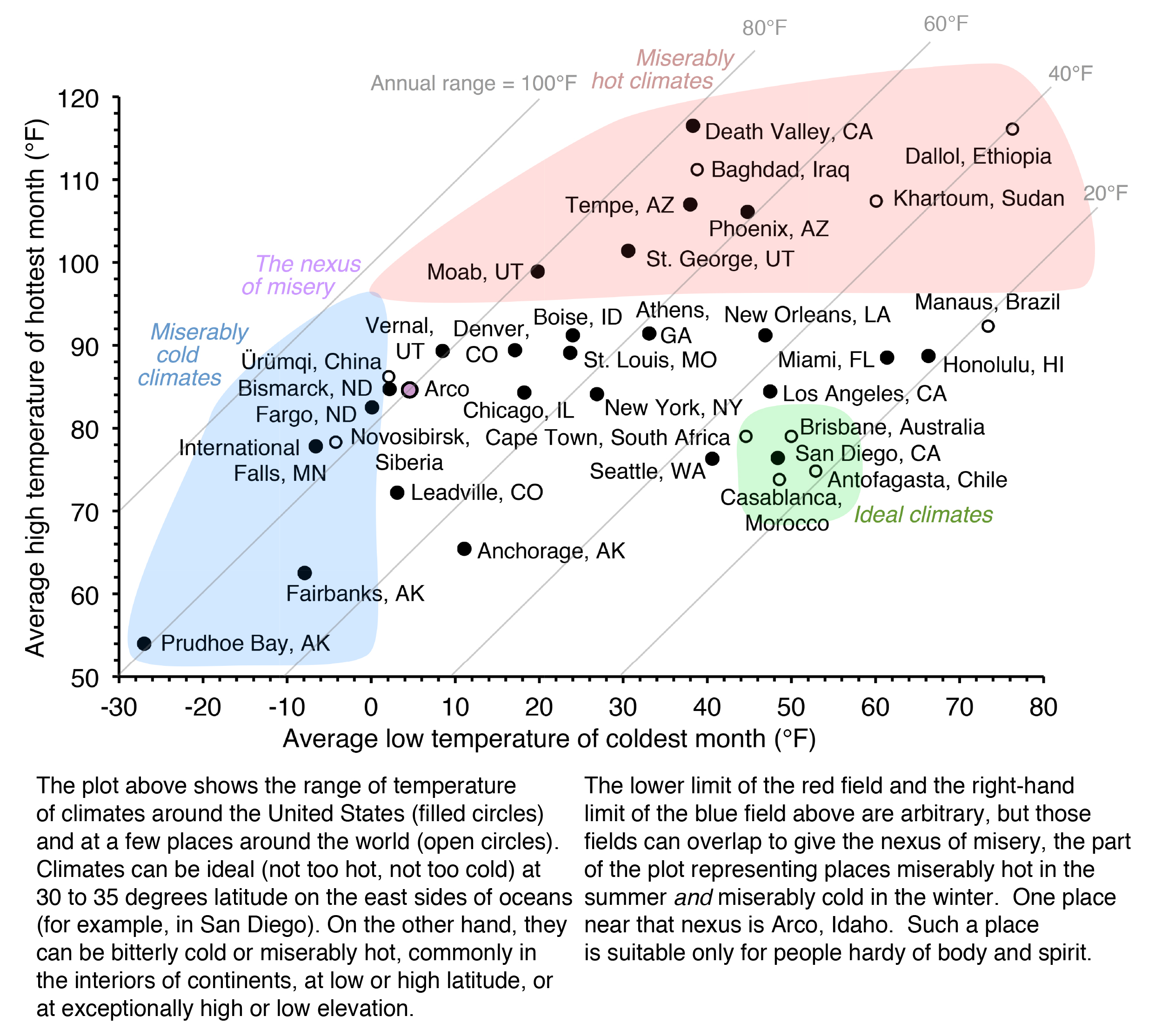
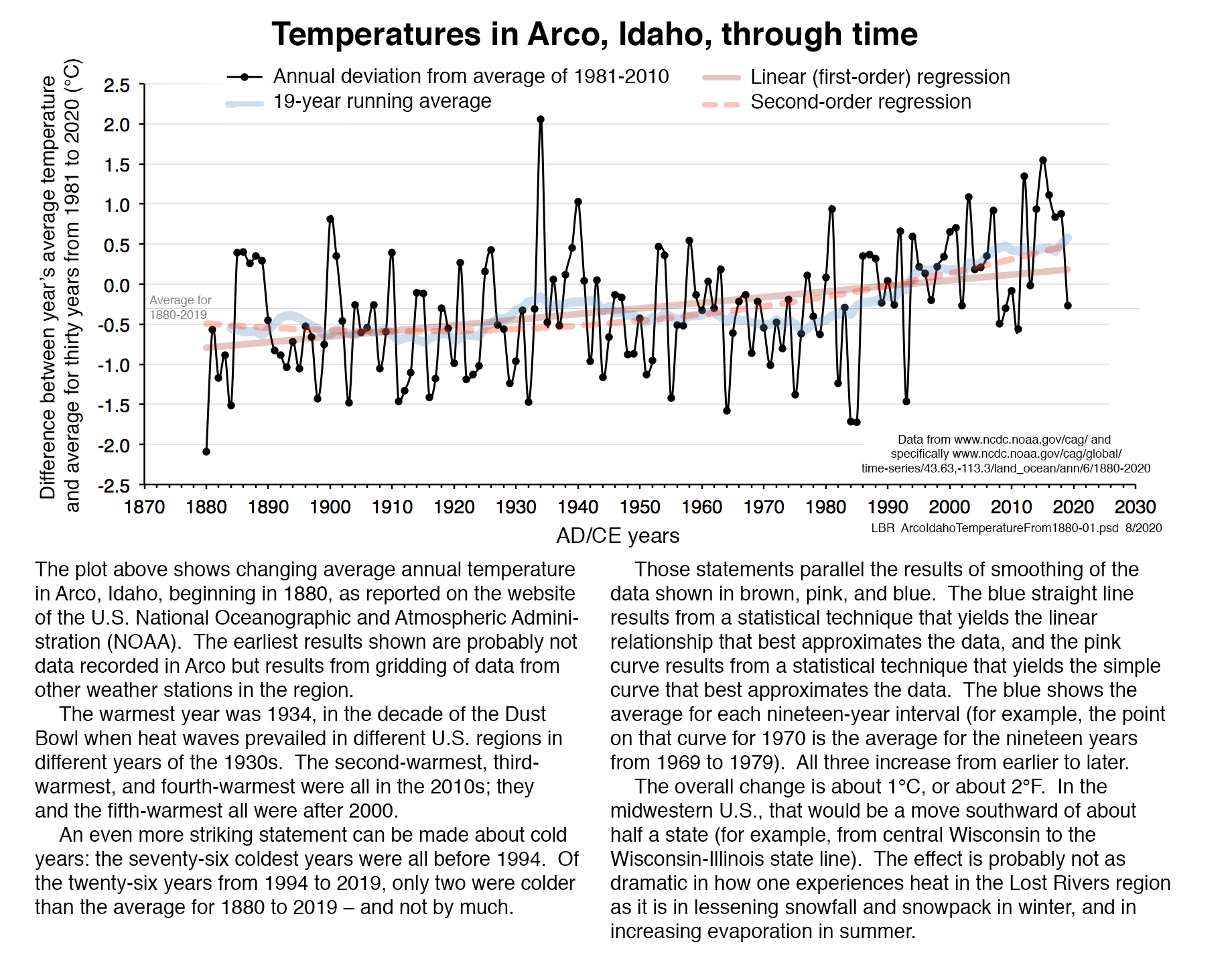
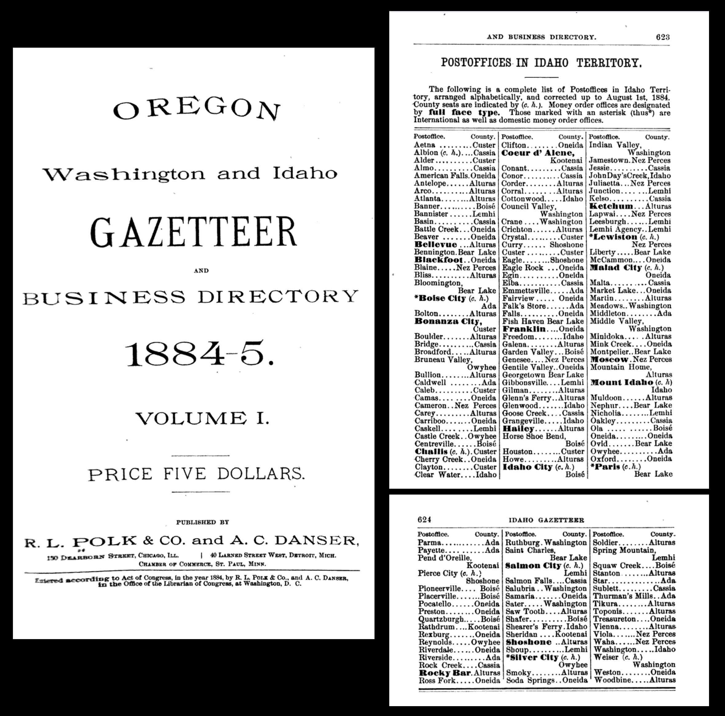
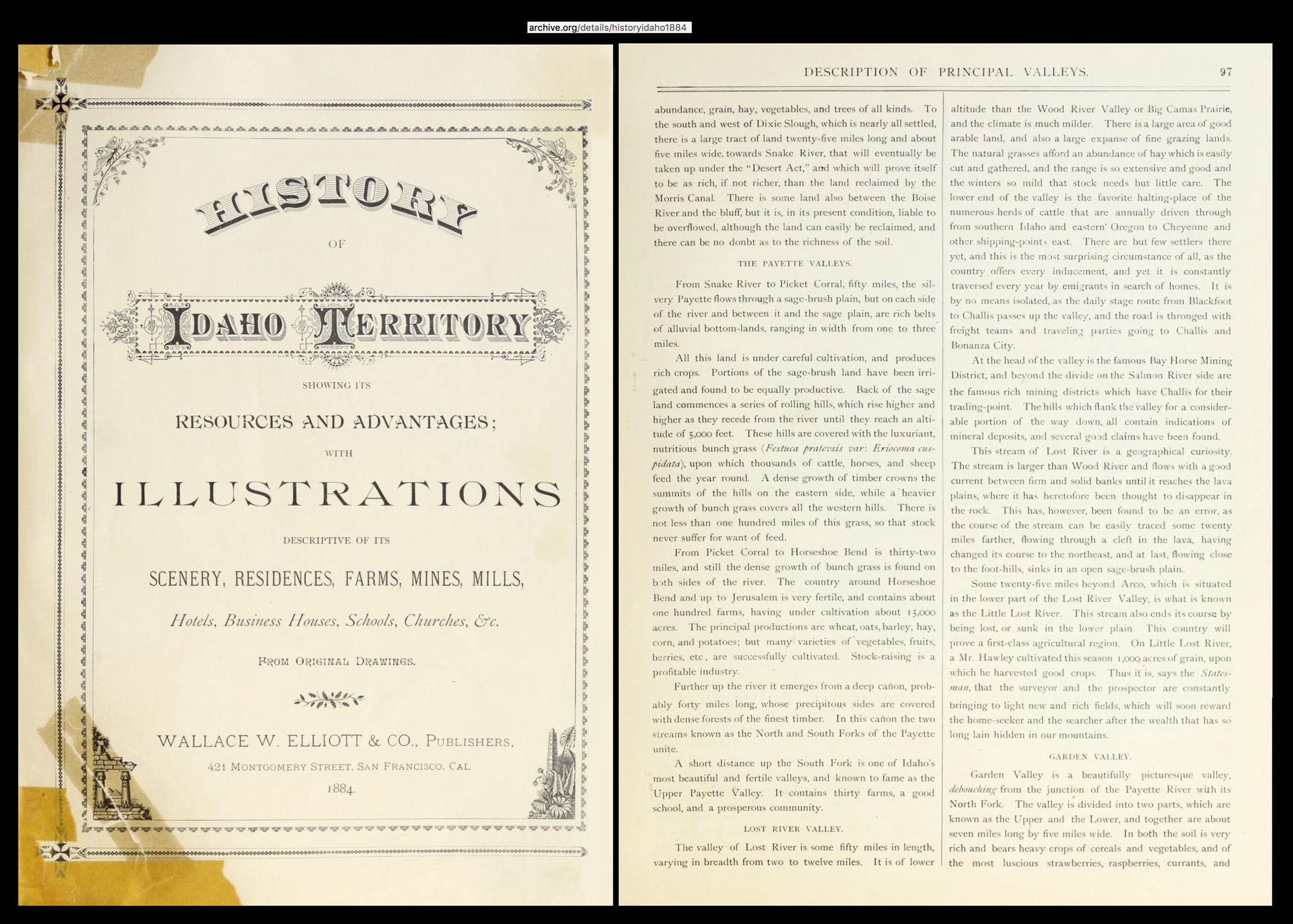
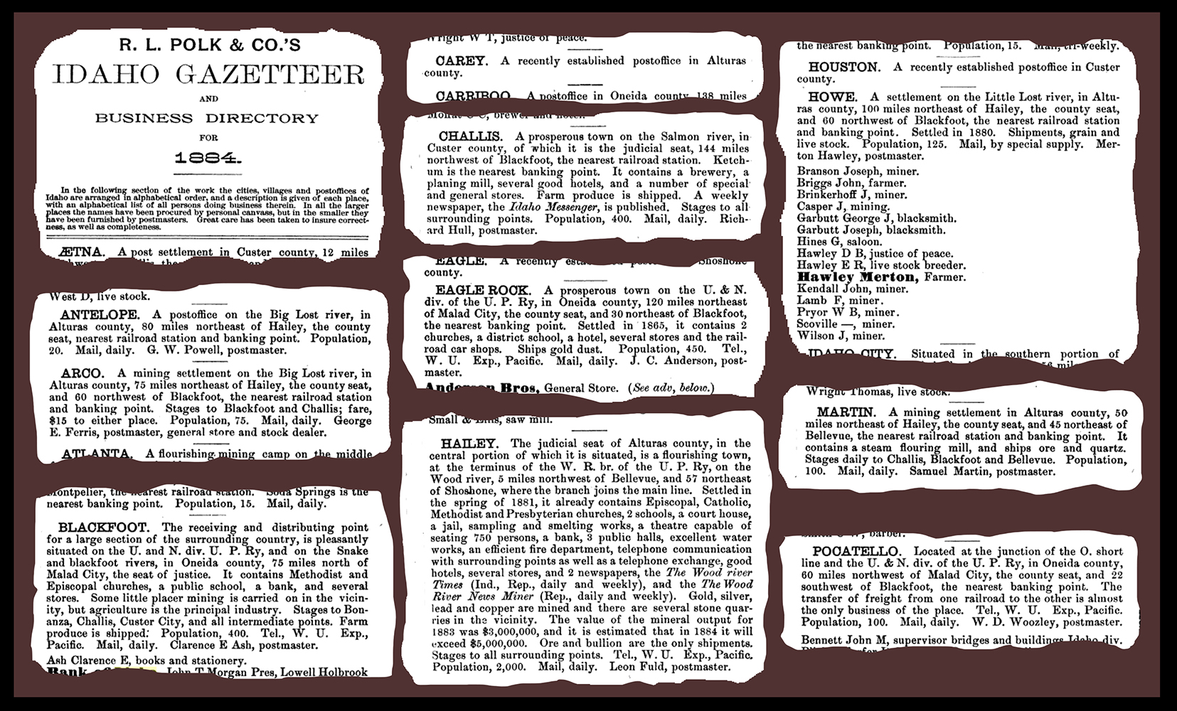
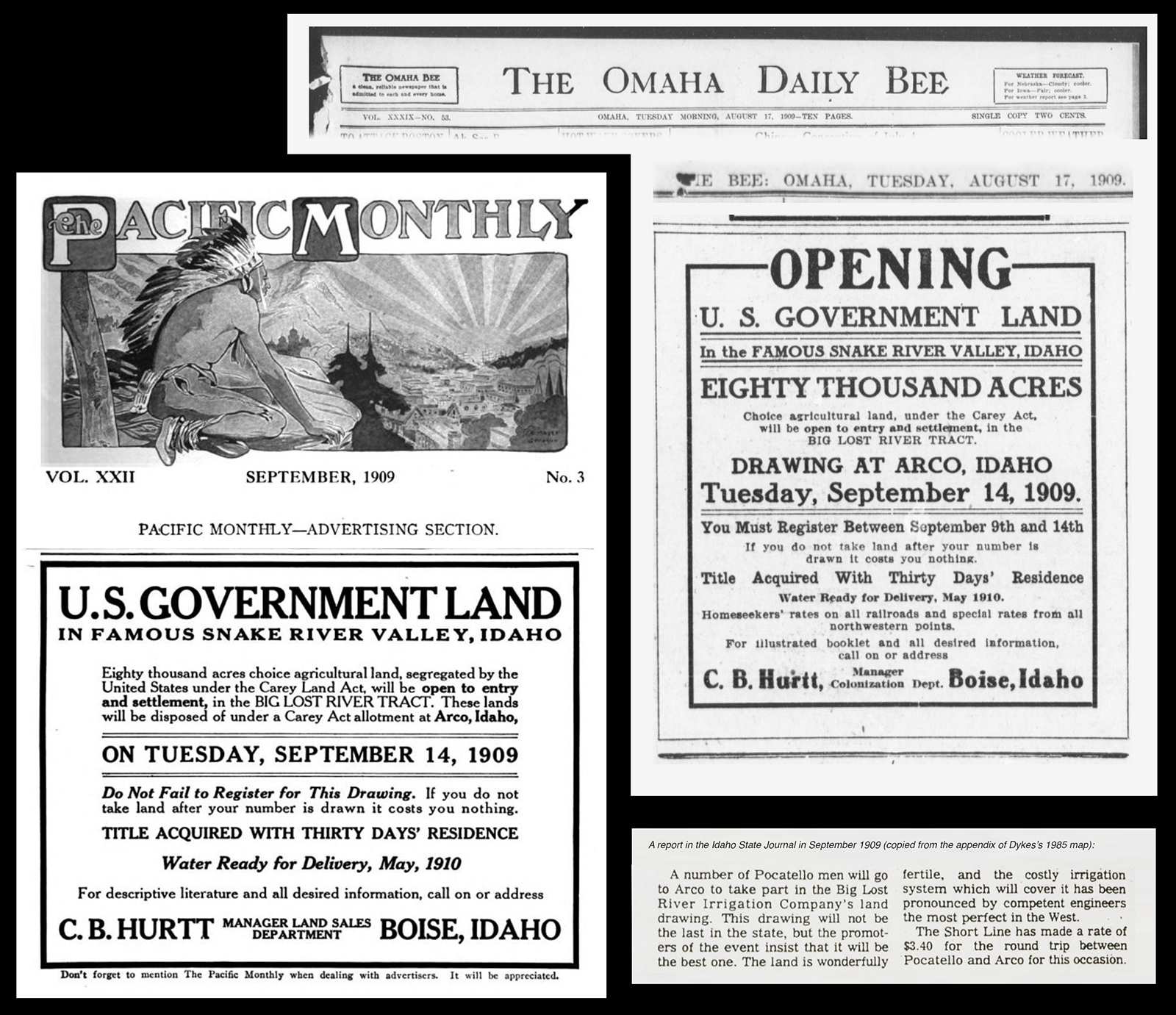
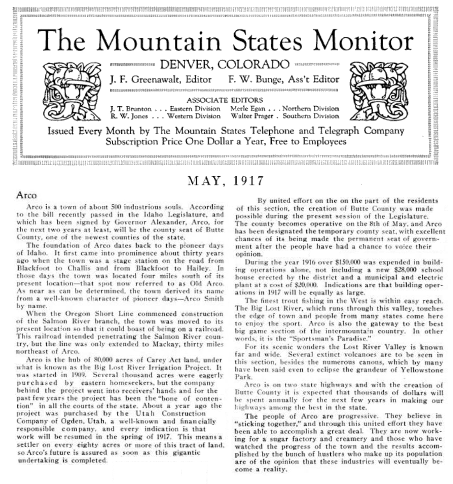
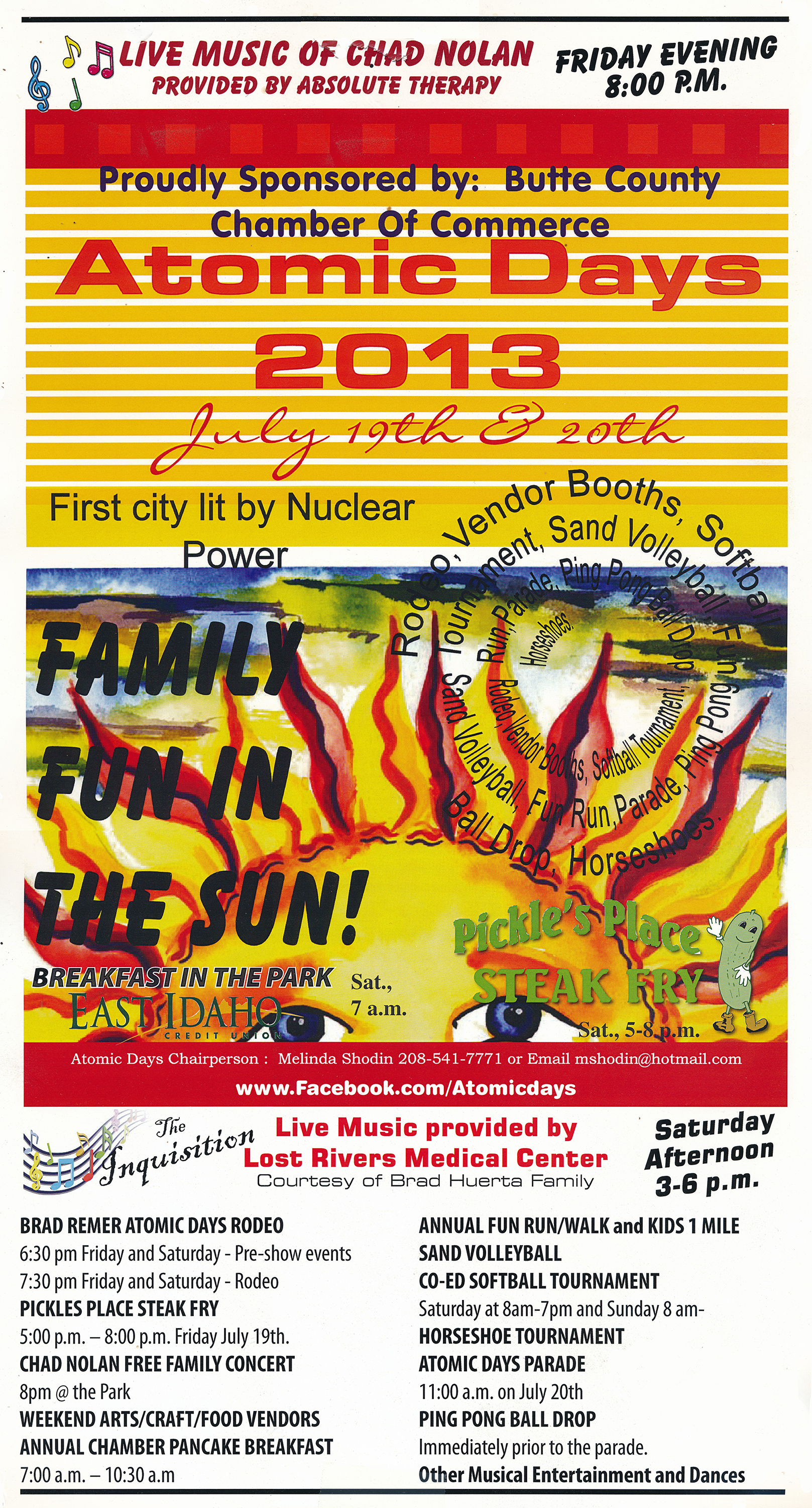
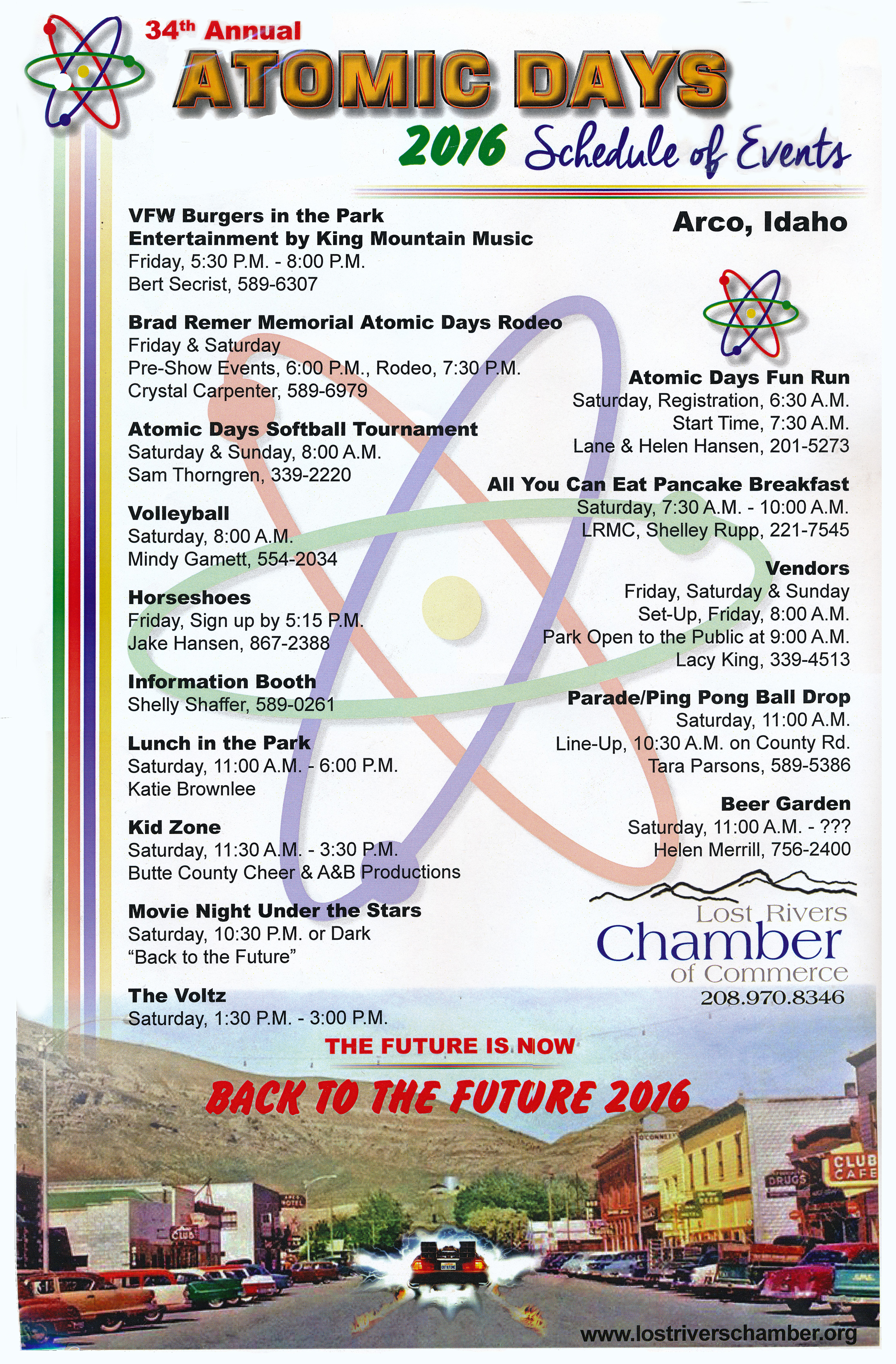
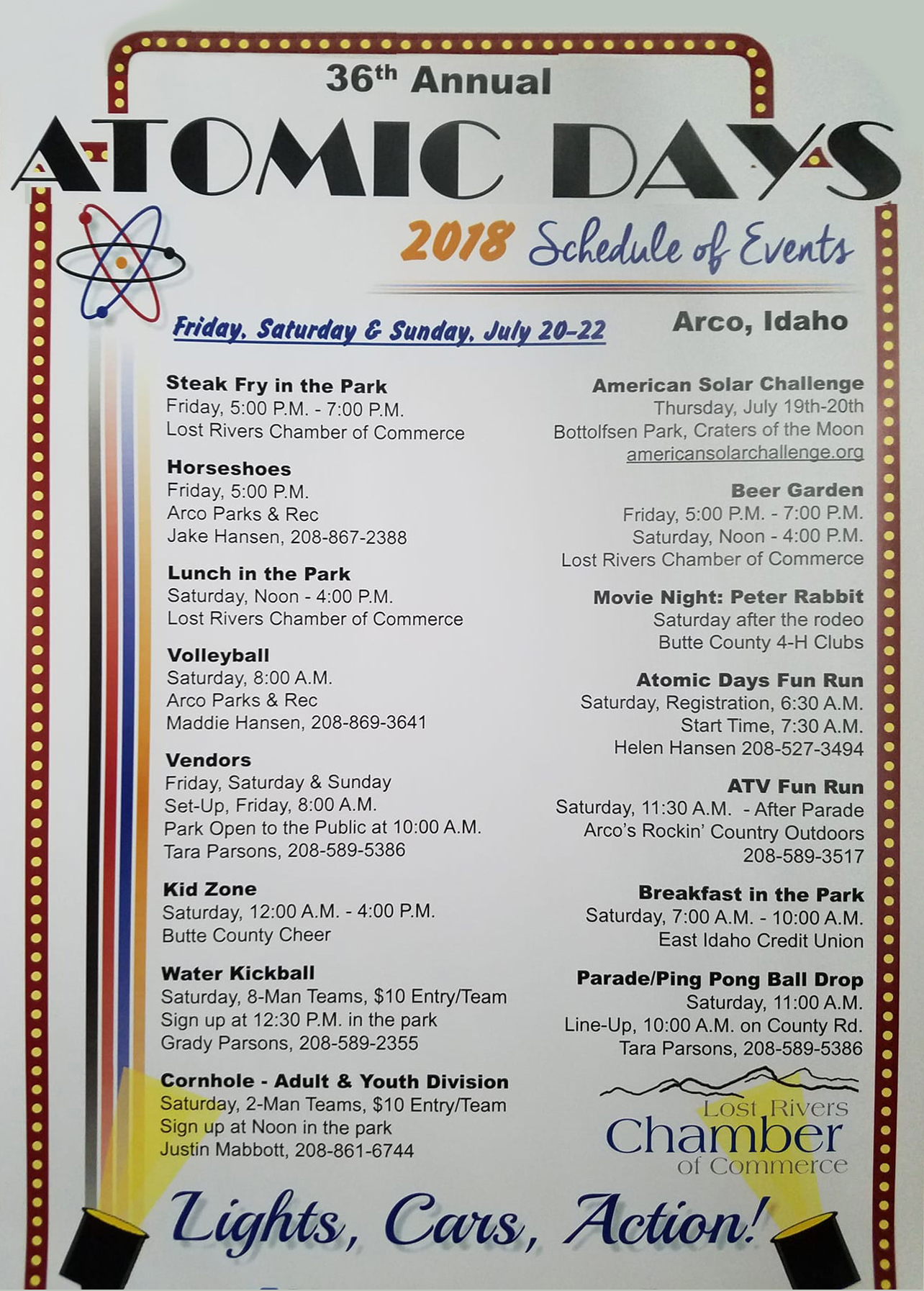
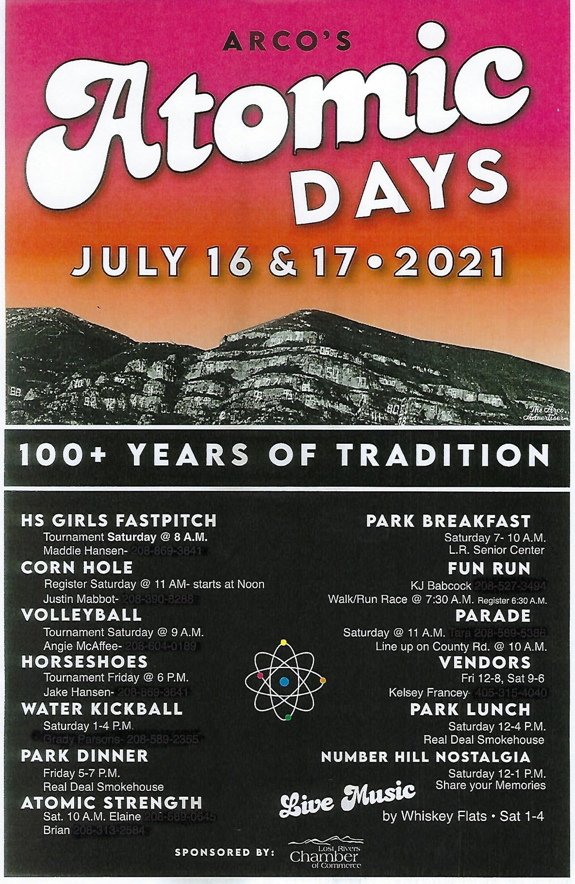
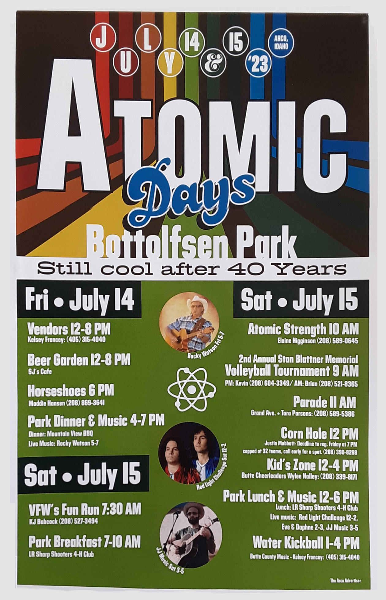
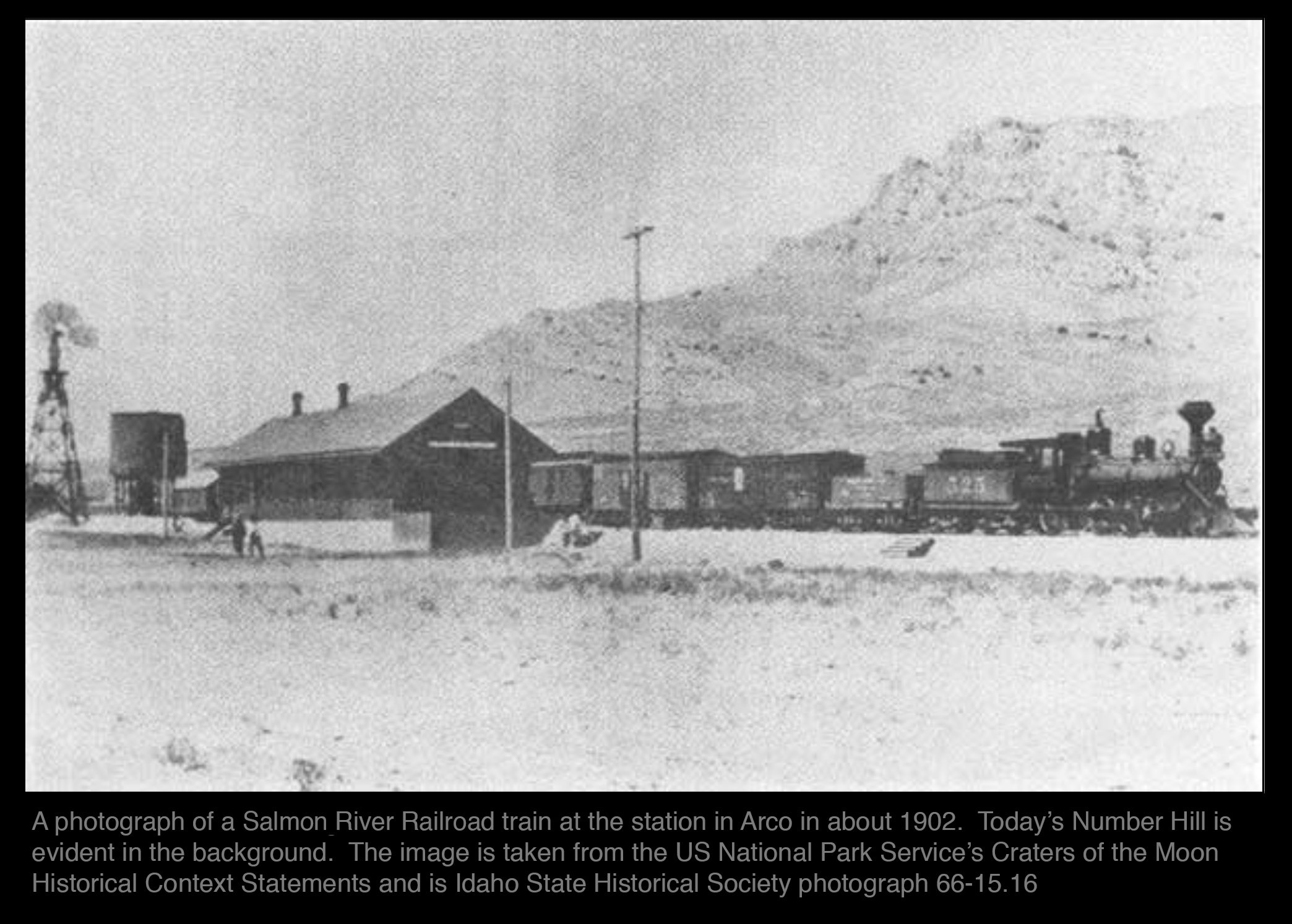
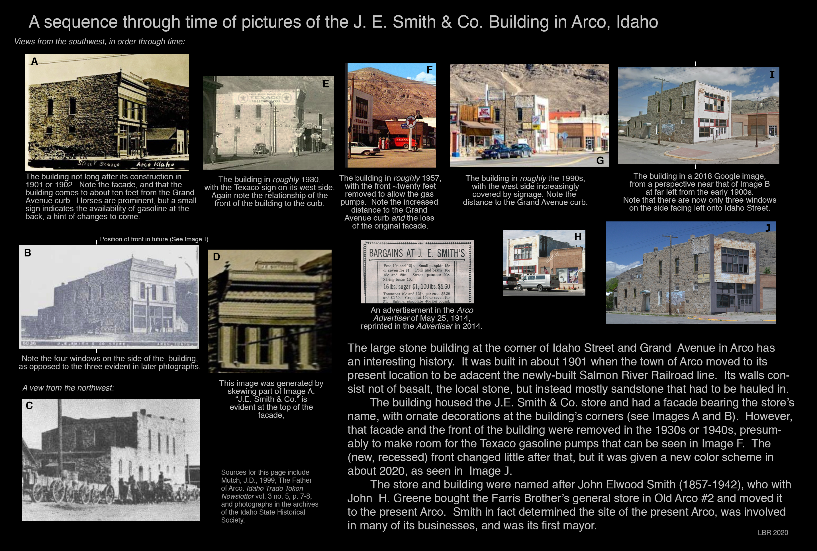
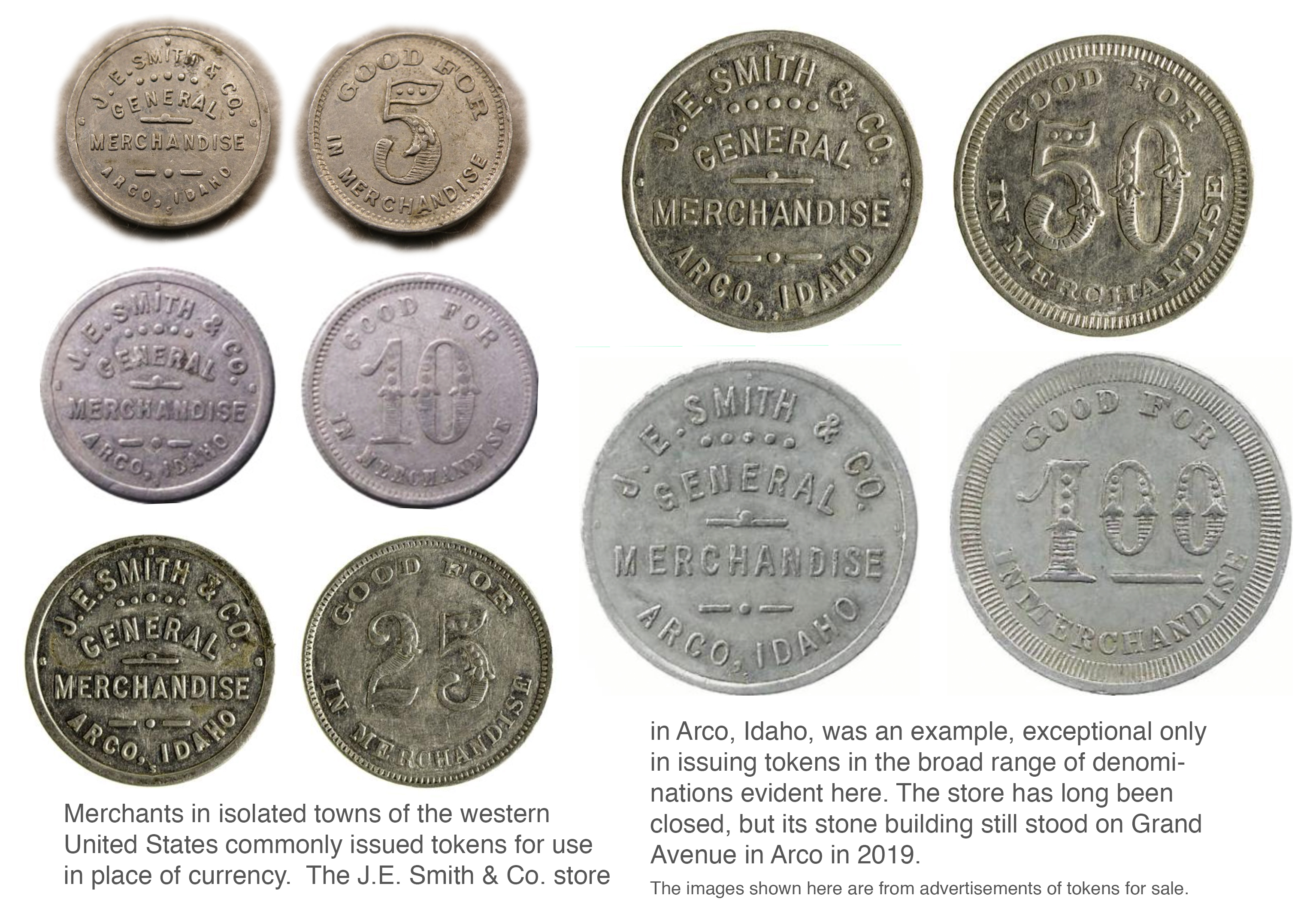
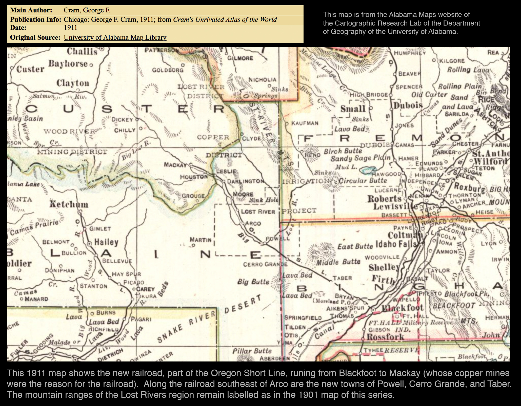
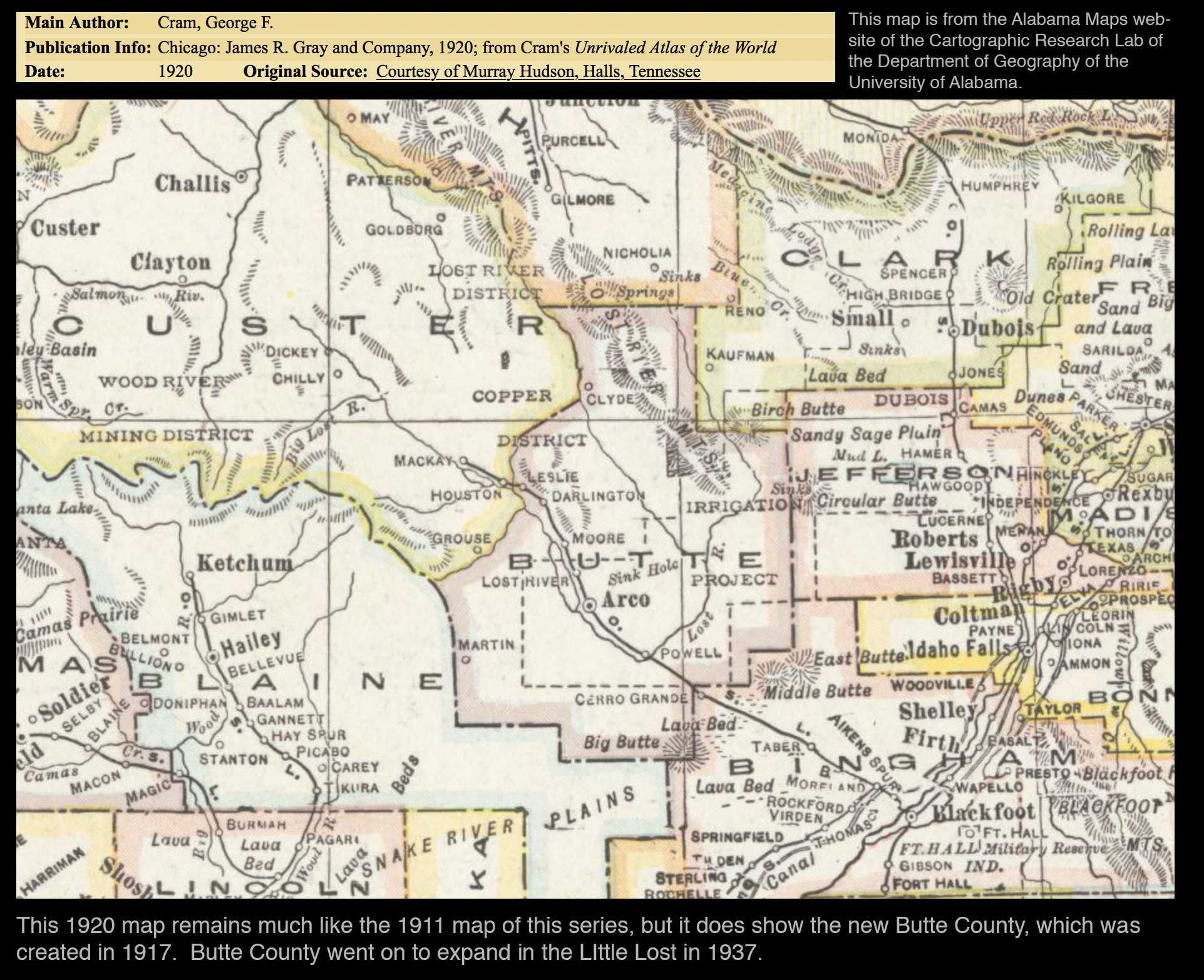
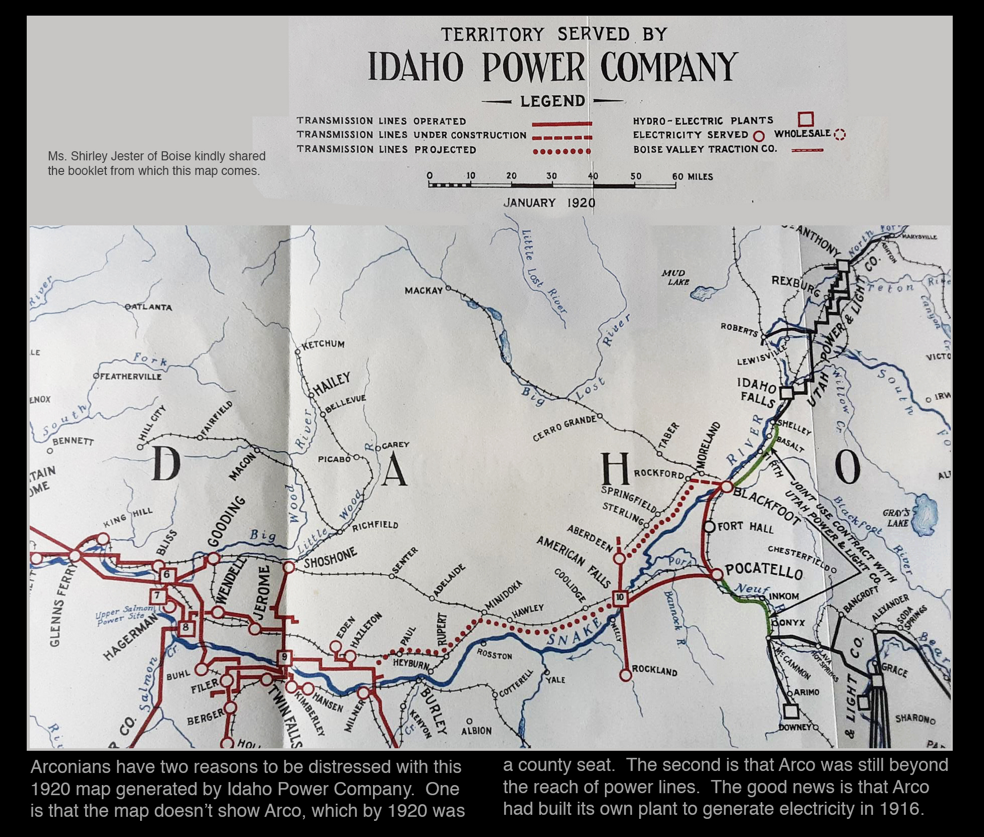
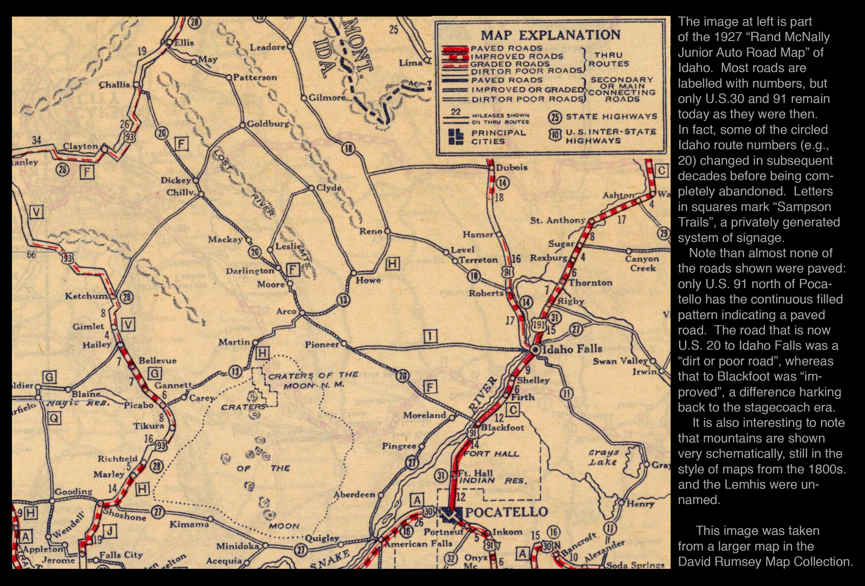
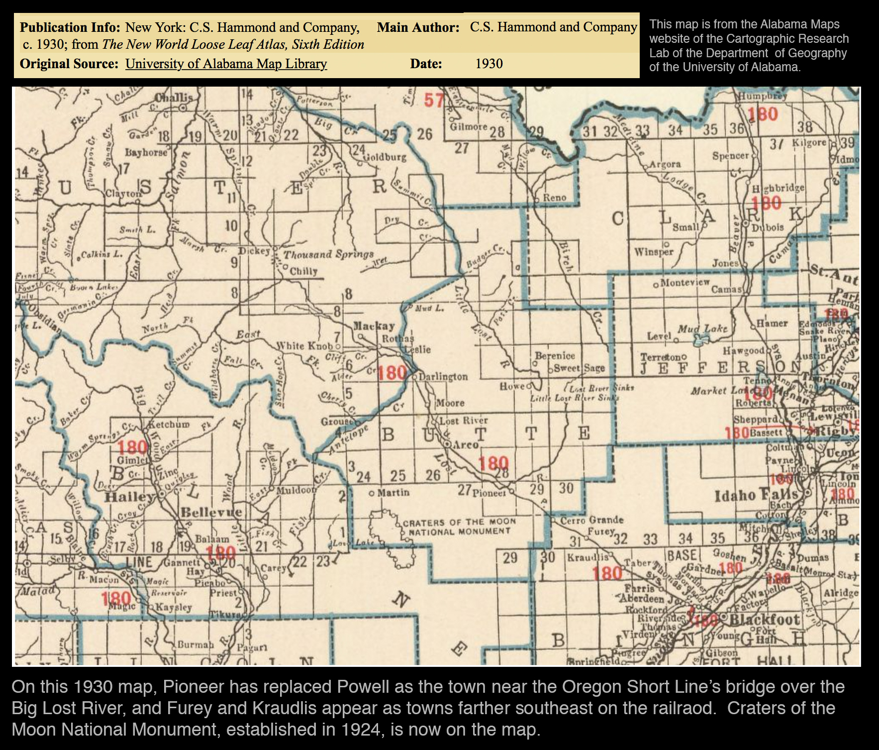
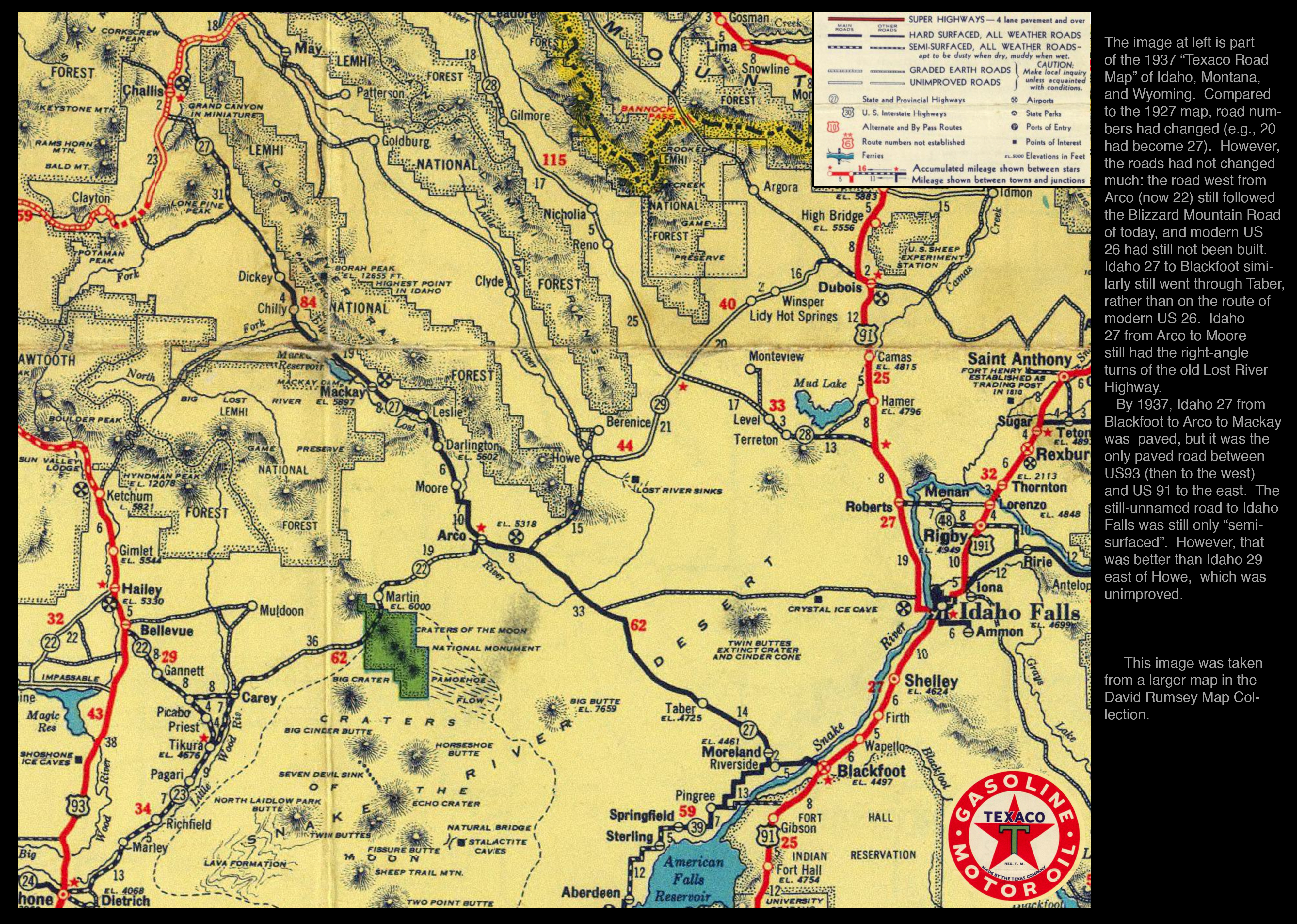
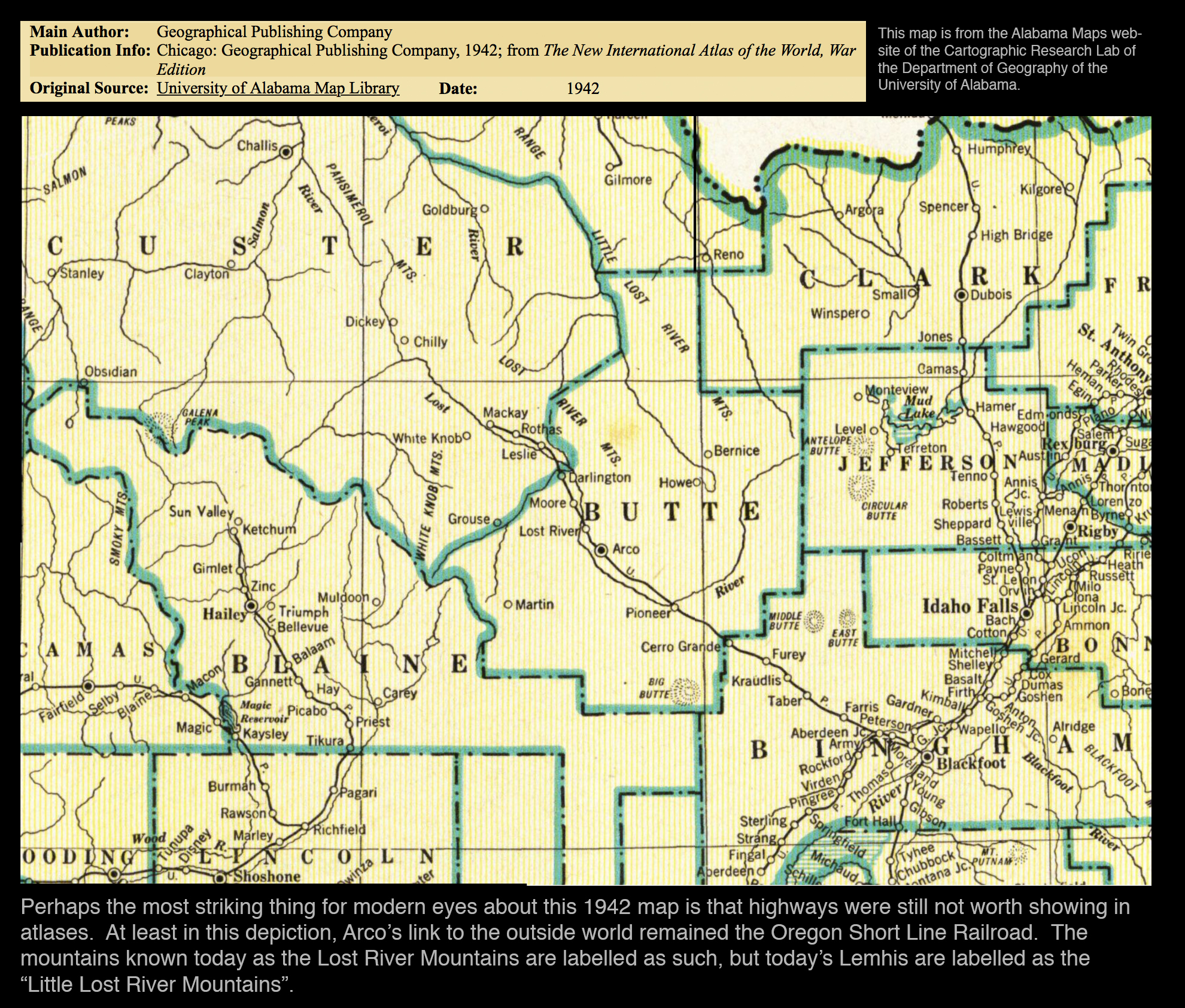
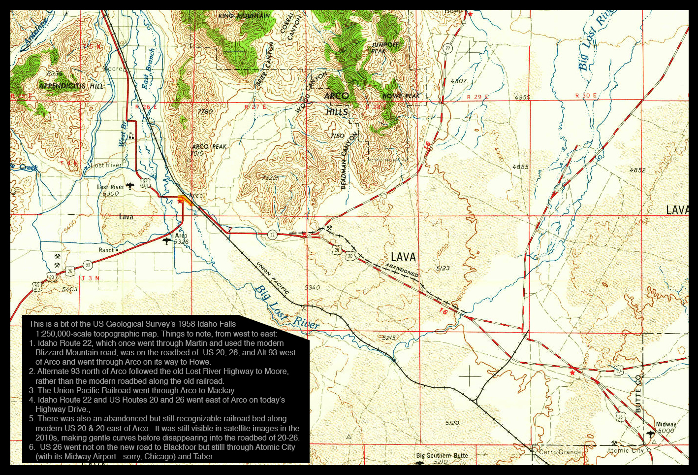
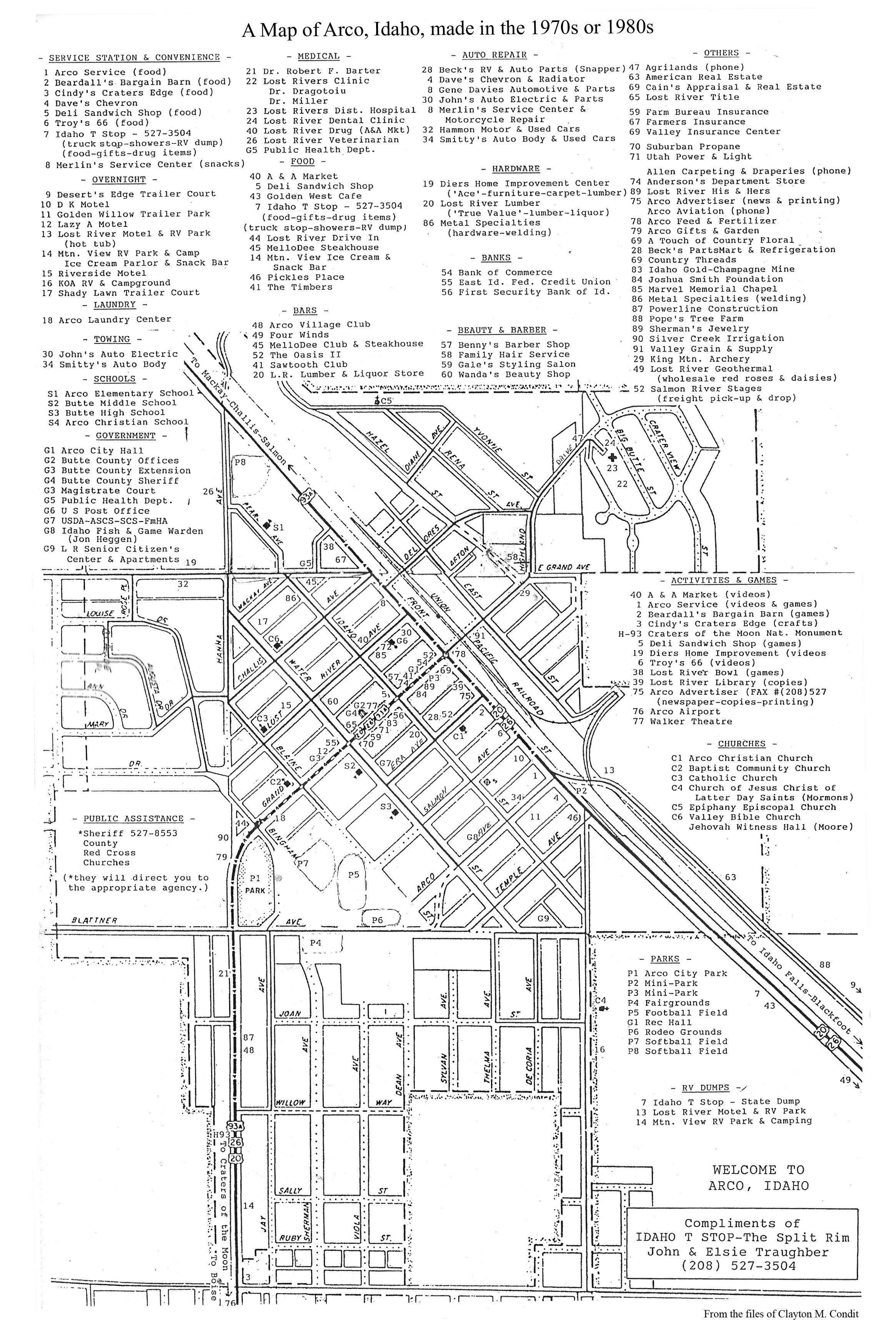
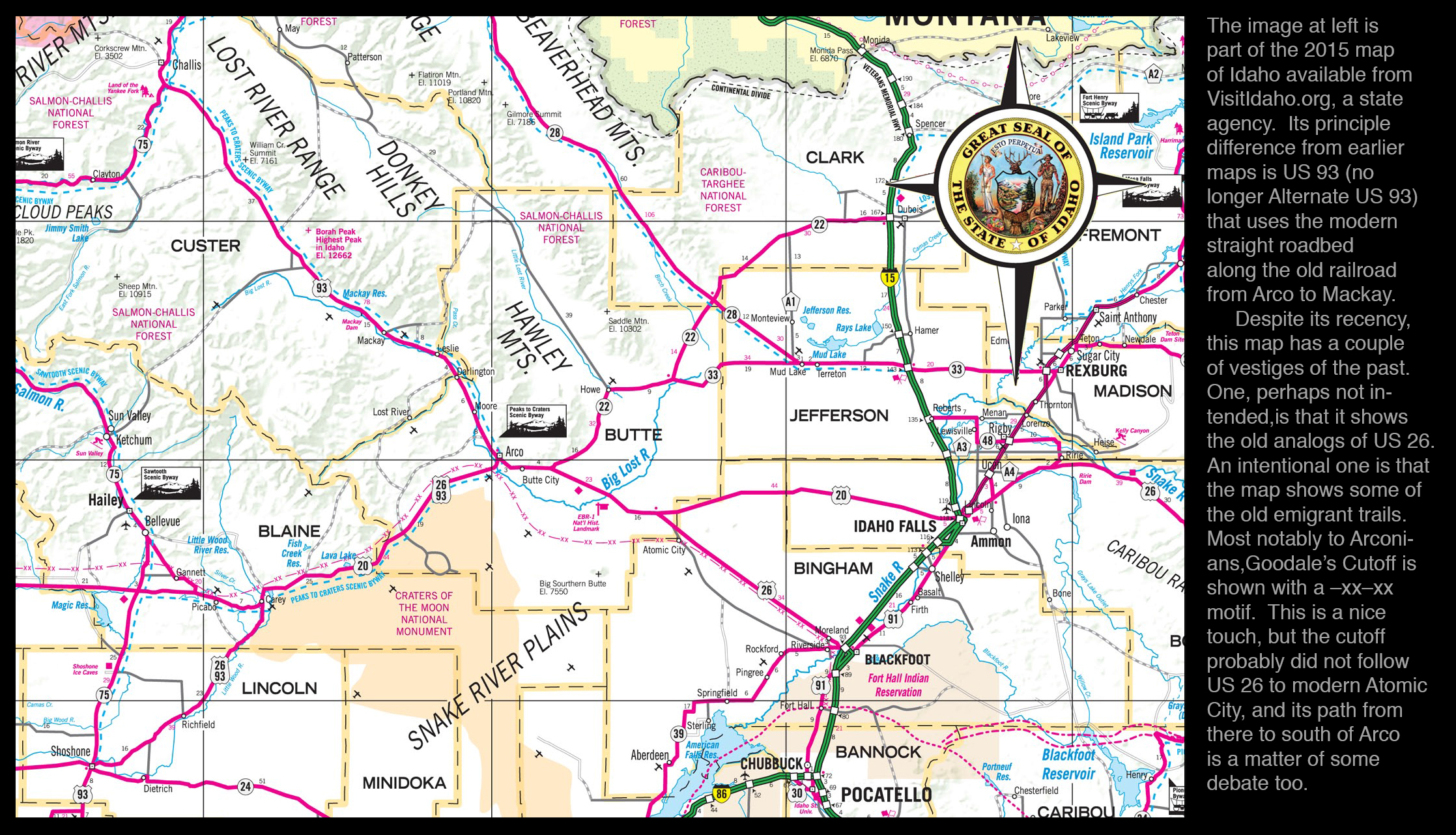
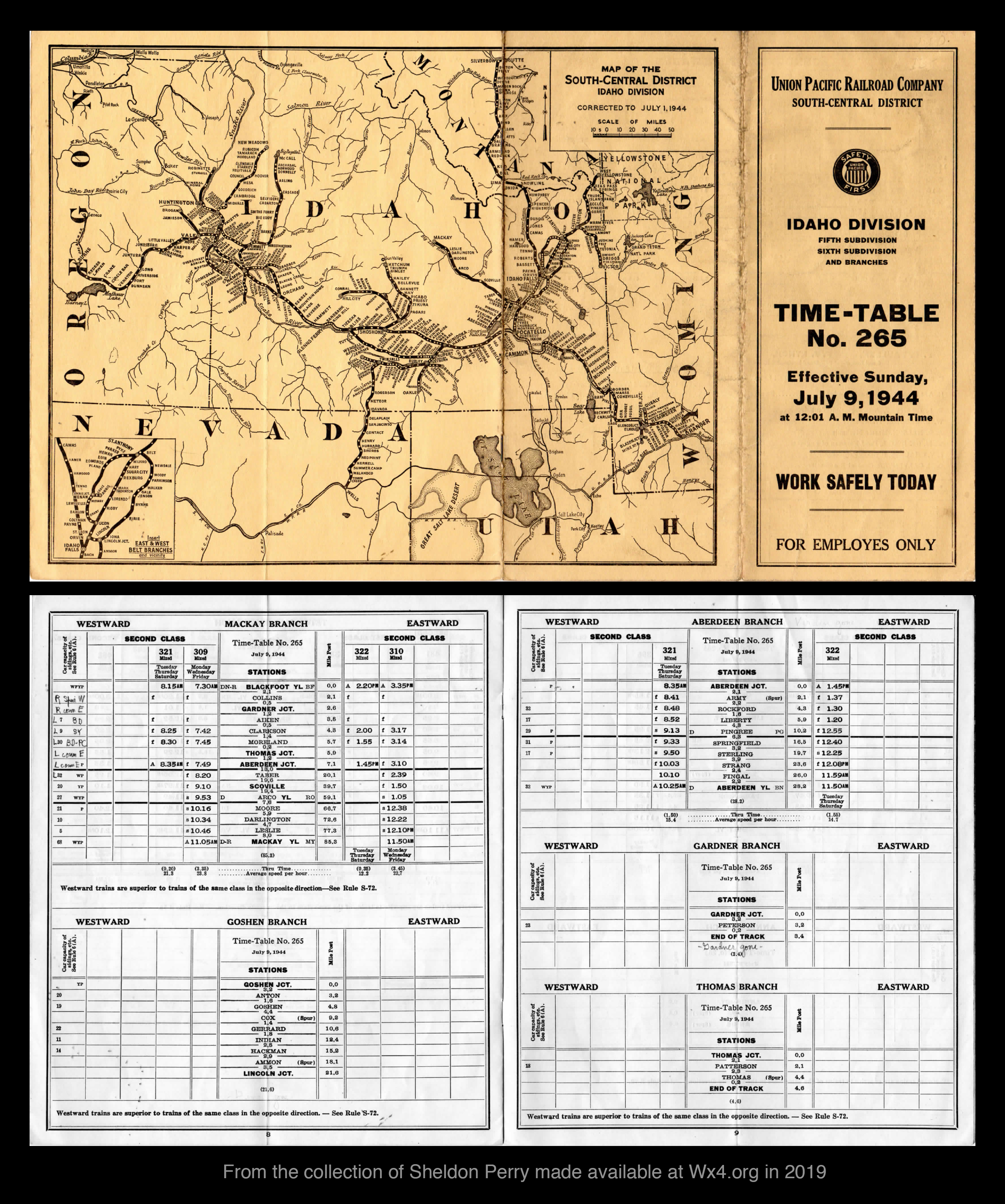
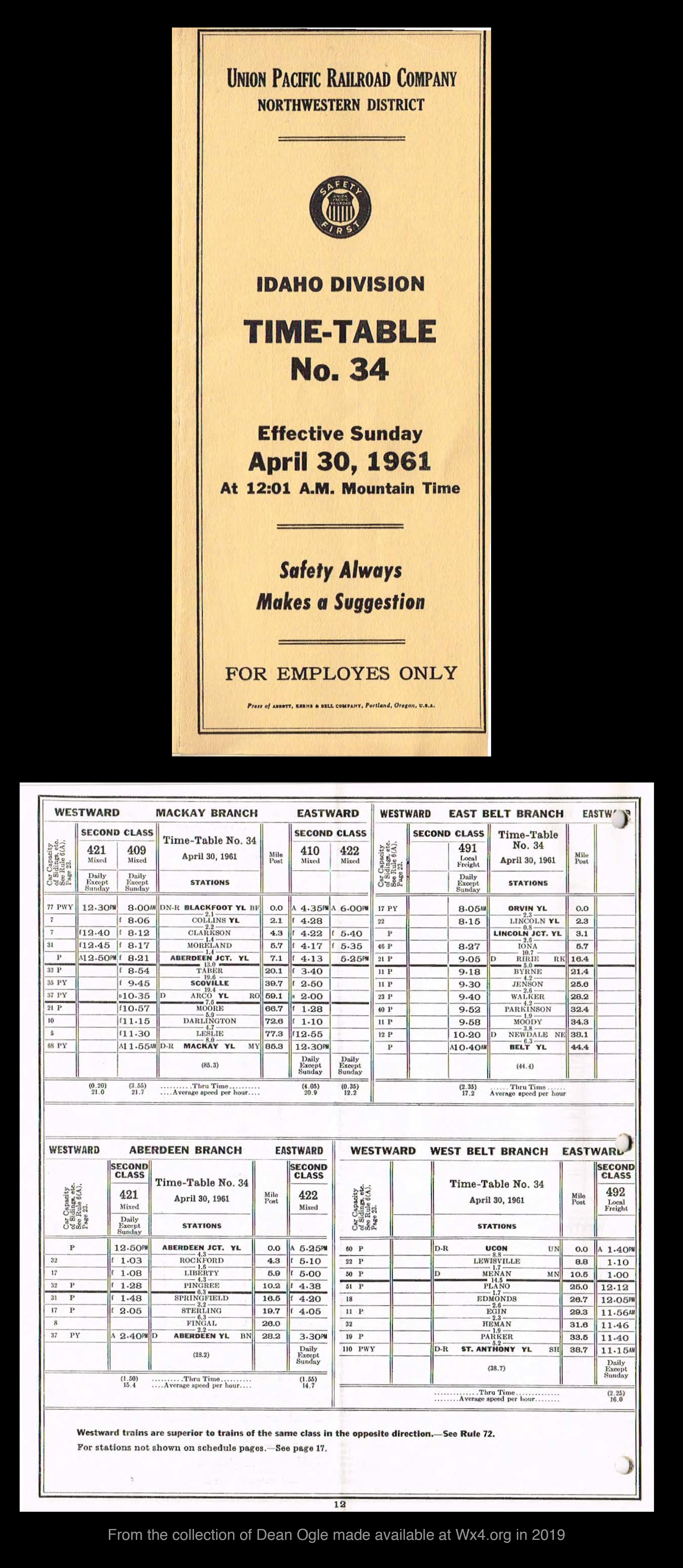
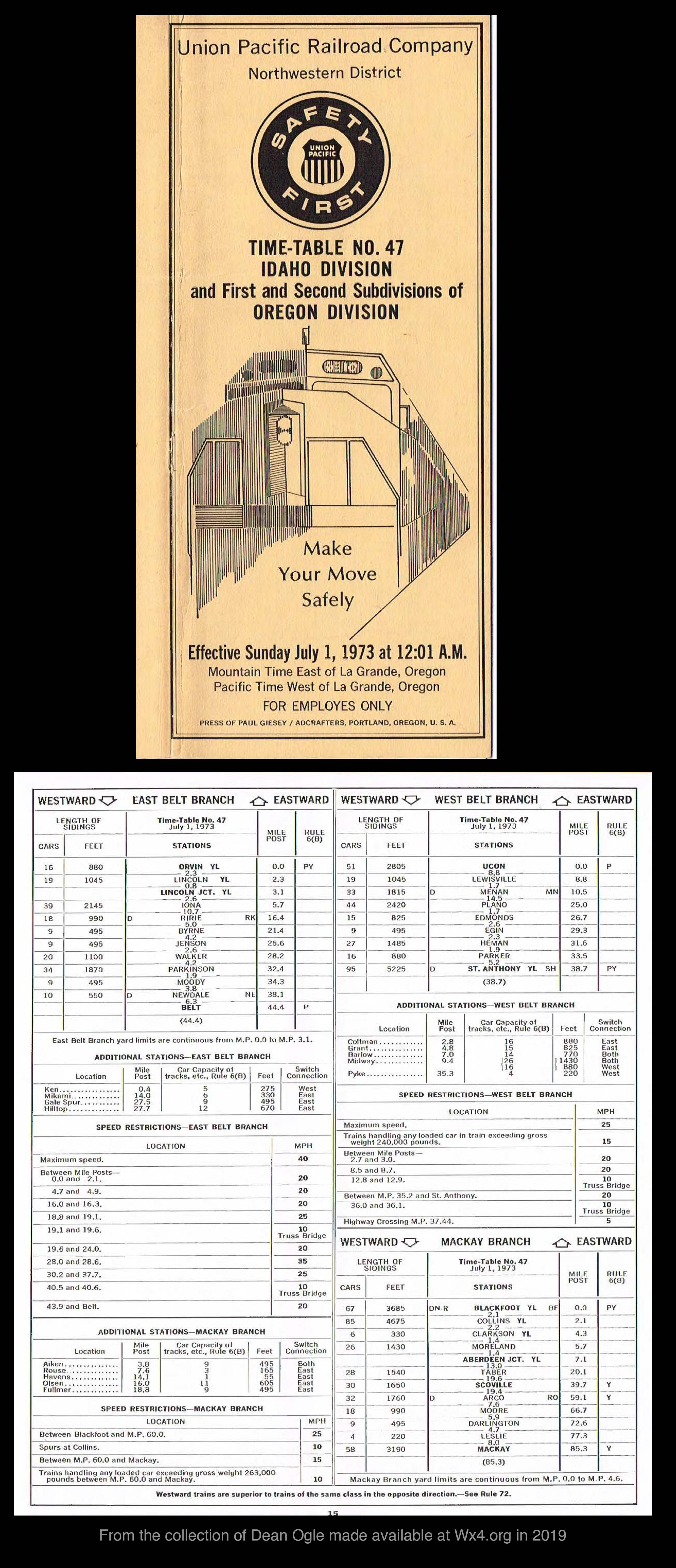
Stonecrop - clusters of five-petaled flowers on red stalks, in rocky settings. Scorpion Flower - purple-grey globular clusters of flower; a ground-hugger at high altitude. Hairy goldaster - multiple yellow flowers on low bushy plant in late summer to fall. Lupines - bushes of vertical stems with blue to white flowers and radiating clusters of leaves. Penstemons - stalked plants with flowers with three lobes below (think "pin-stay-mon") and two above. Broomrape - short plants of dull purple stems and flowers; easy to miss. Monkeyflowers - very small bright purple flowers with yellow on the three-lobed lower bloom. Sandwort - white five-petaled simple flowers on a light-green low bush. Thelypody - long white clusters on branches rising from long basal leaves. Blazing Star and another look - long narrow yellow petals below long yellow stamens(?) on a low bush. . Milkvetch (Astralagus) - purple and blue flowers on a low mat of gray-green leaves in spring. Golden currant - five petals with red centers on upright woody bushes. Coyote Tobacco - trumpet-like white flowers on vertical stems with long leaves at base. Arrowleaf Balsamroot - large yellow flowers and large arrow-shaped leaves in spring to early summer. Hawksbeard - ellow five-petaled flowers on long stems above very serrate leaves. Sunflowers and a bunch of them - many yellow petals around a large dark center of a large flower on a large plant in mid-summer. Flax - light-blue five petaled flowers in abundance on low bushes. Primrose - white, pink, or occasionally yellow large broad-petaled flowers on a creeping plant. Cryptantha - numerous small white five-petaled flowers on a fuzzy upright stalk. Heartleaf Arnica, the same again, and in seed - many-petaled yellow flower with broadly serrate leaves. Yarrow - broad clusters of small white flowers atop a stalk with fern-like leaves. Spotted Knapweed - purple cluster atop a spindly stalk one to three feet tall, in autumn. Scarlet Gilia -red trumpet-shaped flowers on an upright but not straight stalk. Sticky Geraniums - five light-purple veins petals and serrate leaves. Mountain globemallow - light purple or pink to nearly white cup-shaped flowers on an upright stalk. Bluebells - downward-hanging clusters of blue flowers on a low plant with elongate leaves. Alfalfa - blue flowers and leaves that are serrate at their ends in summer. Cinquefoil yellow five-petaled flowers on bushes with five-fingered leaves. Wild Iris - upright long-leaved plants with large white-to-light-purple flowers. Photographs and descriptions of invasive plants: The documents linked here come from the website of Invasive Species of Idaho and specifically from https://invasivespecies.idaho.gov/terrestrial-plants. These invasive species have been categorized by the state as Invasive plants reported from Butte and/or Custer Counties: Other invasive plants reported from counties adjacent to Butte and/or Custer Counties: Essays and documents made recently: A geologist's view of the region around Arco (11.4 MB pdf) Alexander Ross and Thyery Goddin in the Lost Rivers country in 1824 (98 KB pdf) Fur trappers in Idaho's Lost Rivers region in the early 1800s (32 MB pdf) A short history of Arco (477 KB) -- revised in 2025 Changing maps of Idaho's Lost Rivers region: 250 years (93 MB pdf) Changing flow of the Big Lost River (5 MB jpeg) A plot of the populations of Arco, Mackay, and Butte County through time (1 MB jpeg) Patterns in vehicular traffic through Arco (3 MB jpeg) Arco's climate compared to climates elsewhere (2 MB jpeg) Temperatures in Arco through time (1 MB jpeg) Historic documents: Text documents: John Work's journal of an 1832 fur-trapping expedition in the Big Lost River valley. 1881 list of Idaho Post Offices in the Official Register of the United States. 1884 list of Idaho post offices in Polk's Gazetteer. A section about the Lost River Valley(s) in an 1884 History of the Idaho Territory. Snippets about Arco, Howe, Martin, etc. in Polk's Idaho Gazetteer for 1884. A train in Arco in about 1902. 1909 ads for the Big Lost River irrigation project. a 1913 letter to the Governor about the Big Lost River irrigation project (a 23 MB pdf file). A 1970 report on the irrigation schemes of 1906-1918. A rosy 1917 article about Arco. A 1917 report about the region. A 1937 tour from Blackfoot to Arco to Mackay to Challis. The poster for the 2003 Arco Air Show. The poster for Atomic Days 2009. The poster for Atomic Days 2013. The poster for Atomic Days 2016. The poster for Atomic Days 2017. The poster for Atomic Days 2018. The poster for Atomic Days 2019. The poster for Atomic Days 2021. The poster for Atomic Days 2022. The poster for Atomic Days 2023. The poster for Atomic Days 2024. The poster for Atomic Days 2025. Photographs: An early photograph of a train in Arco. The evolving J.E. Smith & Co. building in Arco. Token currency issued by the J.E. Smith & Co. store in Arco. The Arco Airport in the 1980s. Four pictures of a parade in Arco in about 2000. The Galloping Goose and its hats. The Atomic Days ping-pong-ball-drop of 2014. The Fourth-of-July Cruze on Grand Avenue in 2020. The 2025 Fourth of July parade seen from above. Maps: The Astor Expedition's 1812 map of the region. William Kittson's map of the Snake River country from the 1820s (a 48 MB document). William Kittson's map of the Lost Rivers region from the 1820s (a bit of the above). Benjamin Bonneville's 1837 map of the region. An 1849 map of Benjamin Bonneville's travels in the region. An 1880 map of trails and railroads showing Wildcat Point. An 1881 map of trails and railroads. An 1884 map of trails and railroads. A 1920 map of railroads and power lines. A 1939 map of Idaho Route 22 through Martin. A 1958 map of railroads and highways. A map of Arco from the 1970s or 1980s. Railroad timetables: A 1902 timetable for the Oregon Short Line showing desert stops at Cerro Grande and Powell. A 1944 timetable for the Union Pacific showing a desert stop at Scoville. A 1961 timetable for the Union Pacific, the last timetable for passenger service to Arco. A 1973 timetable for the Union Pacific showing freight service to Arco. Errors and problems should be reported to rlsbk@uga.edu. Back to railsback.org
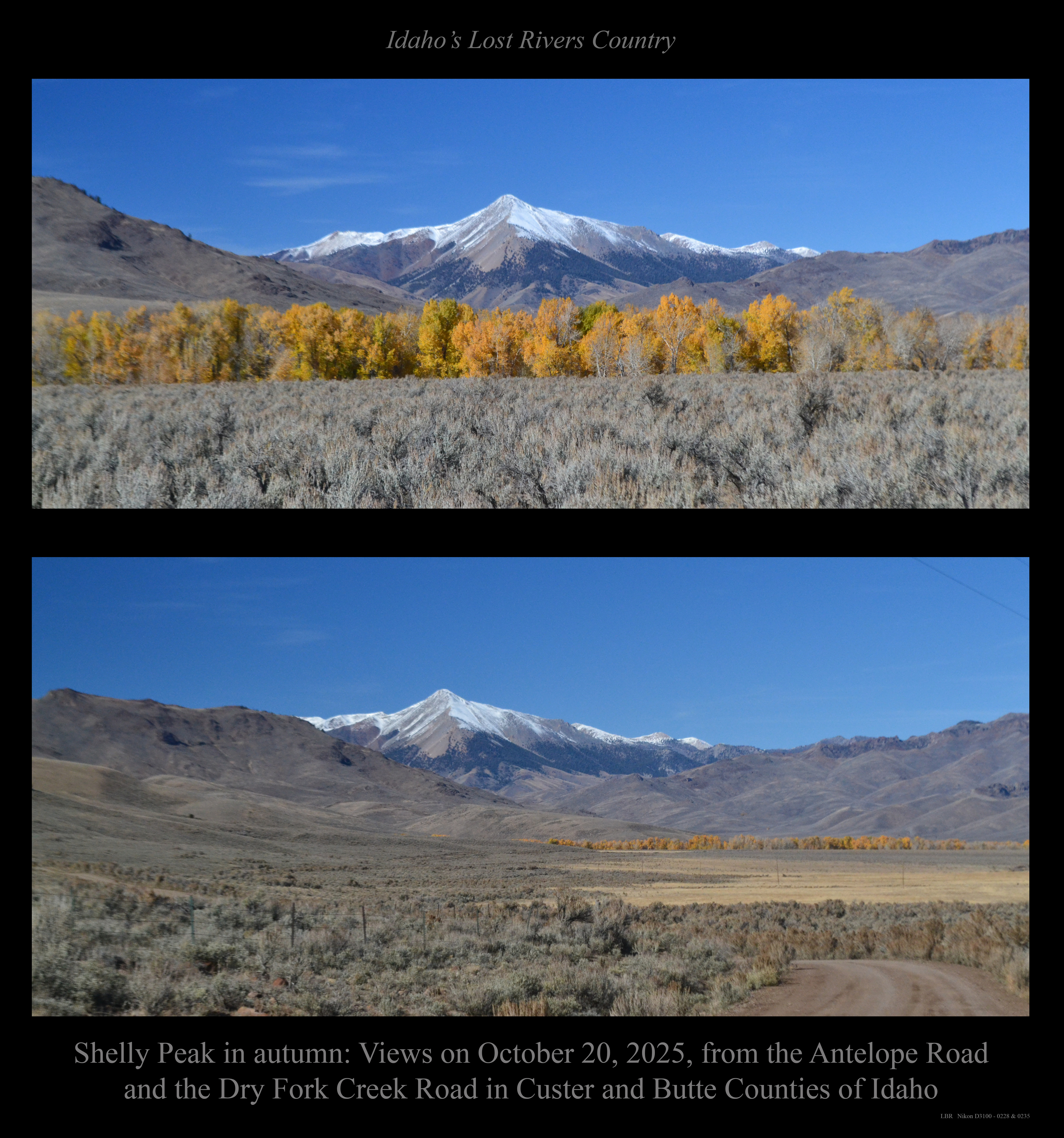
. . . and in the opposite direction (away from Shelly) a view up the canyon of the Dry Fork Creek of Antelope Valley.
(1) from the north,
(2) from the southeast, and
(3) from above Arco in July 2018.
In 2 and 3, note the Butte's left wing, which makes it identifiable from a distance.
from most recent highest in the list to oldest lowest in the list:
and of the Lost Rivers region.
a higher-resolution geologic map of southern Idaho from the Idaho Geological Survey.
and an alternate (probably better) view of the same pattern.
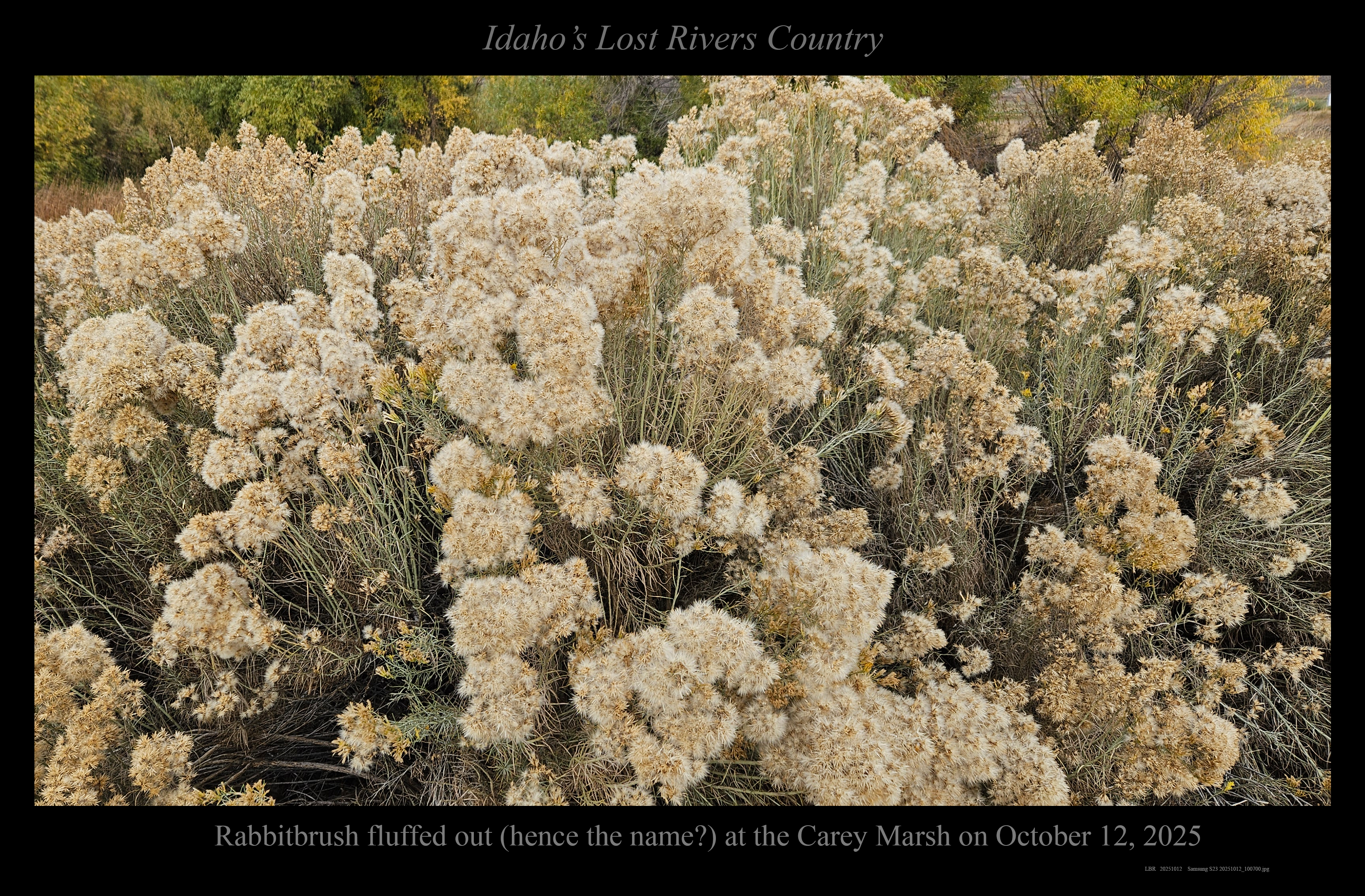
and rabbitbrush flowers and fluffed out in October.
. . . and a note about four-lobed sagebrush leaves
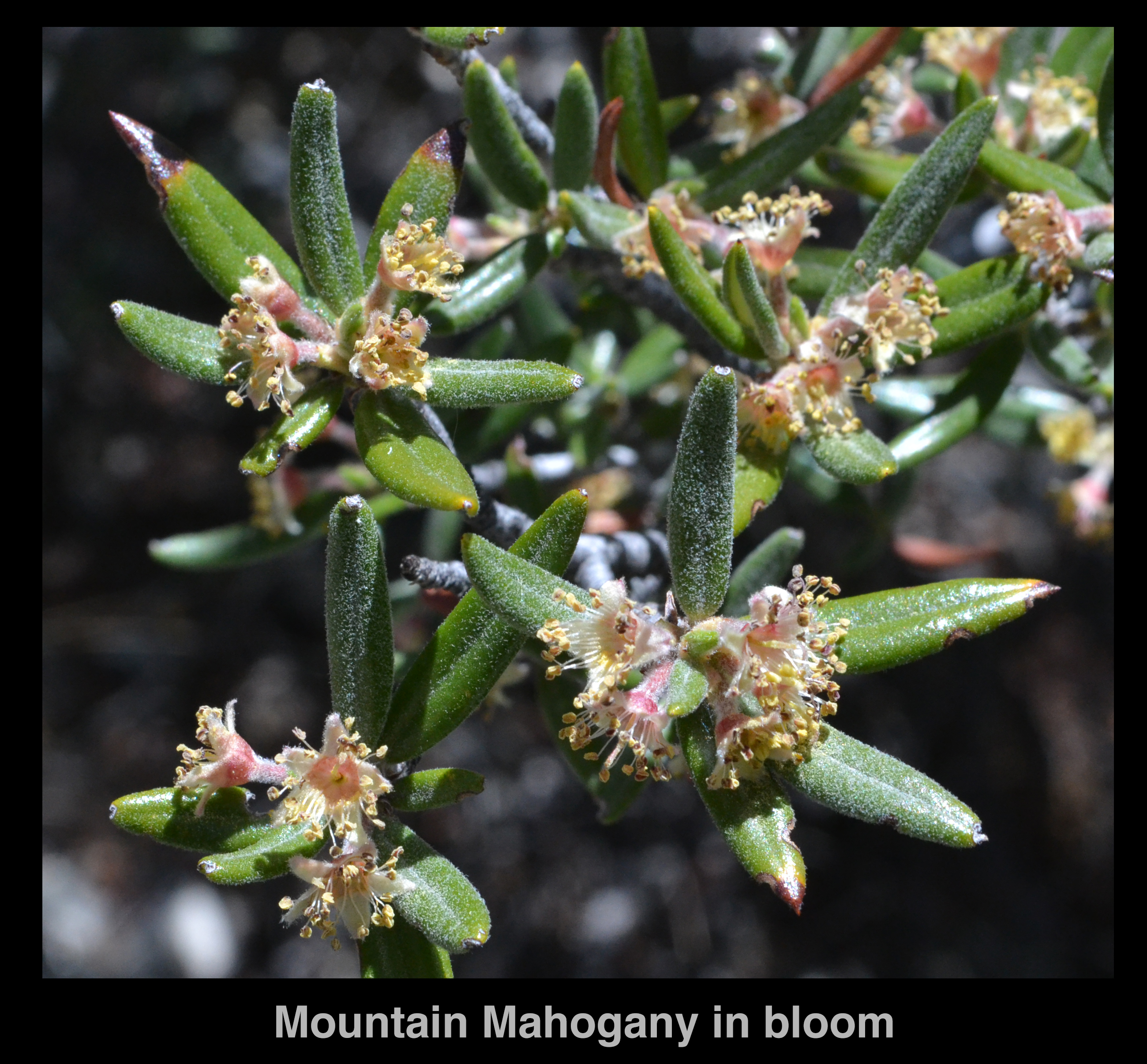
(and Mountain Mahogany in bloom).
(1) Weeds to be eradicated during the same growing season as the season in which they are identified (i.e., immediately);
(2) Weeds to be controlled or eradicated;
(3) Weeds to be contained to prevent new or expanding populations.
Black Henbane 2
Dyer's Woad 2
Japanese Knotweed 2
Matgrass 2
Perennial Sowthistle 2
Plumeless_Thistle 2
Russian Knapweed 2
Canada Thistle 3
Dalmatian Toadflax 3
Diffuse Knapweed 3
Field Bindweed 3
Hoary Alyssum 3
Houndstongue 3
Leafy Spurge 3
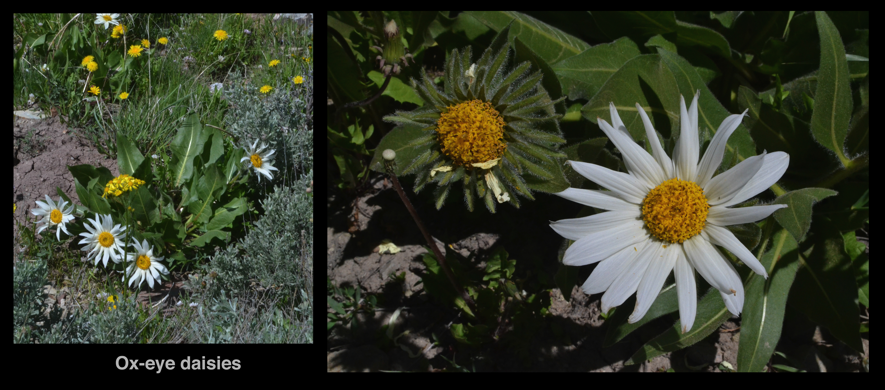
Oxeye Daisy 3
Perennial Pepperweed 3
Poison Hemlock 3
Puncturevine 3
Purple Loosestrife 3
Rush Skeletonweed 3
Saltcedar or Tamarisk 3
Scotch Thistle 3
Spotted Knapweed 3
Tansy Ragwort 3
White Bryony 3
Whitetop 3
Yellow Toadflax 3
Bohemian Knotweed 2
Buffalobur 2
Johnsongrass 2
Mediterranean Sage 2
Orange Hawkweed 2
Small Bugloss 2
Vipers Bugloss 2
Jointed Goatgrass 3
Yellow Starthistle 3
2022..jpg)